Interstate 96
Overview
Intrastate Interstate 96 traverses southern Michigan from Muskegon east to Detroit. The freeway begins at a cloverleaf interchange with U.S. 31 at Norton Shores. Angling southeast from there, I-96 heads to Crockery Township where it turns east to Coopersville and the north side of Grand Rapids.
Bypassing Furniture City to the north and east, Interstate 96 circles southward to Gerald R. Ford International Airport (GRR) and the east end of the M-6 freeway before resuming an eastward course to Portland. Southeast from there, the freeway parallels both the Looking Glass and Grand Rivers to combine with Interstate 69 to the west of Lansing.
East from Interstate 69, I-96 spans the Grand River ahead of south Lansing to Michigan State University and the freeway along U.S. 127. Interstate 496 loops through the city, serving both the state capitol complex and Downtown.
Becoming rural again, Interstate 96 leaves Lansing to pass by the villages of Webberville and Fowlerville and the small cities of Howell and Brighton. The Detroit suburbs ensue from U.S. 23 and Brighton east along I-96 to the interchange complex with Interstate 275, I-696 and M-5 at Novi. I-96 turns south there along side I-275 from Novi to Livonia.
The remainder of Interstate 96 east through Livonia and into Detroit is an urban freeway, with a dual roadway section between Exit 180 (Outer Drive) and Exit 186 B (Davison Street). Beyond the three-wye interchange with M-8, I-96 curves southeast along the Jeffries Freeway to meet I-94 and Interstate 75 (Fisher Freeway) before ending at the ramps to the Ambassador Bridge linking Michigan with Windsor, Ontario.
 Parallel U.S. Routes
Interstate 96 wholesale replaced the alignment of U.S. 16 through Michigan. The route used to cross Lake Michigan via a ferry from Milwaukee to Muskegon. It ran east to end in Downtown Detroit until 1962, when it was truncated west to Wisconsin.
History
Originally, Interstate 96 was to begin at the Michigan-Indiana state line cosigned with Interstate 94. Once at Benton Harbor, I-96 was to split from I-94, following current Interstate 196 all the way to Grand Rapids. Northward at Grand Rapids, Interstate 96 was to have turned onto its existing alignment toward Lansing and Detroit. Interstate 196 then was defined to include what is now I-96 between Muskegon and Grand Rapids. Changes were made in 19631 when I-96 and I-196 west from Grand Rapids traded places. The American Association of State Highway and Transportation Officials (AASHTO) approved the change on June 23, 1969.
The last section of Interstate 96 (between Eagle/Grand Ledge area and east of Howell) opened to traffic in 1962.3 This 59 mile long stretch of freeway replaced former U.S. 16, which subsequently was decommissioned.
Interstate 96 through the Novi and Wixom areas opened to traffic in 1957. Along this stretch are the first two Single Point Urban Interchanges (SPUI) built in Michigan. Upgrades to the previous diamond interchanges at Beck and Wixom Roads (Exits 159 and 160) were needed after traffic demands overwhelmed both. Rising land costs and a lack of available right-of-way necessitated the need for a new approach to improving the exits. Work began in 2004 on the $27.438 million interchange project at Beck Road with construction of a wider overpass for Beck Road. Ramp construction at Exit 160 followed in 2005. A similar process upgraded the Wixom Road interchange.2
Route Information
East End – Detroit, MI
West End – Muskegon, MI
Branch Routes – 4
Mileage – 192.06
- Cities – Muskegon, Grand Rapids, Lansing, Livonia, Detroit
Junctions –


Source: December 31, 2021 Interstate Route Log and Finders List

The designations of Interstates 96 and 196 were swapped west of Grand Rapids in 1963.1
Grand River Avenue, from the end of I-96 at Farmington southeast to U.S. 12 in Downtown Detroit, was posted as Business Spur I-96 from 1962 to 1977, when the Jeffries Freeway was completed.1
Within Detroit, Interstate 96 originally ended at Farmington along what later became Business Spur I-96 and is now M-5 (Brighton-Farmington Expressway). The freeway defaulted onto Grand River Avenue (historic U.S. 16) just west of Middlebelt Road in Farmington Hills, with the portion leading southeast to the Jeffries Freeway at West Chicago never constructed.
As part of the Gateway Project to improve the connection between I-75 and the Ambassador Bridge between Detroit and Windsor, Ontario, Interstate 96 was extended beyond the end at I-75 to the bridge into Canada. $230 million in construction began on February 25, 2008 and was completed in July 2009. Accelerated work was the result of entire shutdowns along the final mile of I-96 and a portion of I-75 as a new roadway was built to the Ambassador Bridge approach.
 Photo Guides
East End  (Fisher Freeway) – Detroit, Michigan
![]() East at
East at ![]()
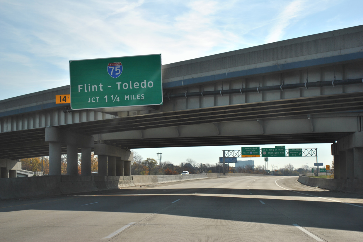
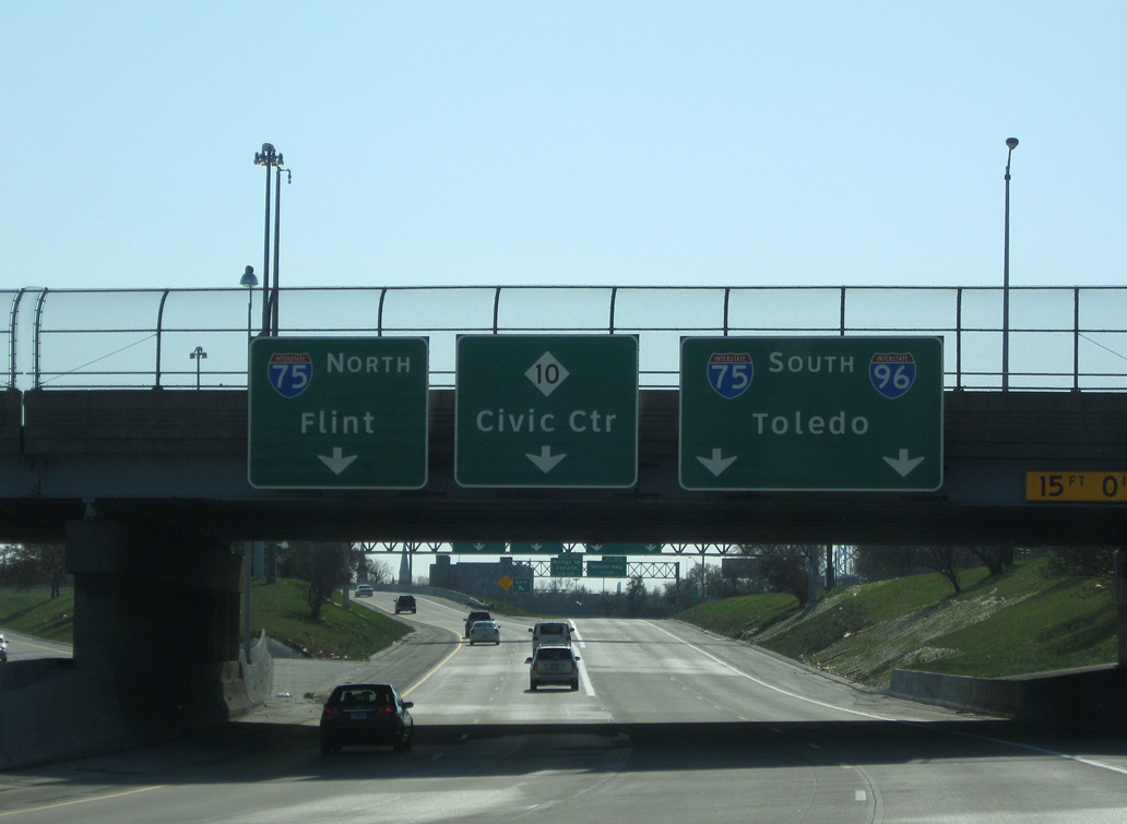
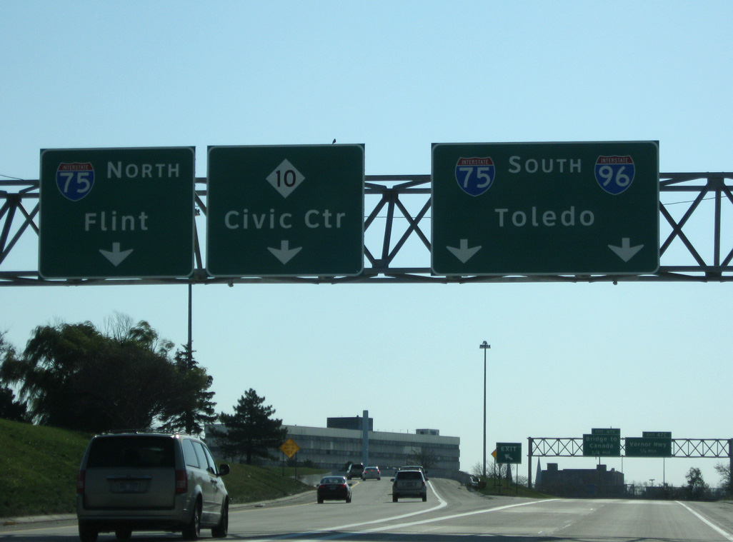
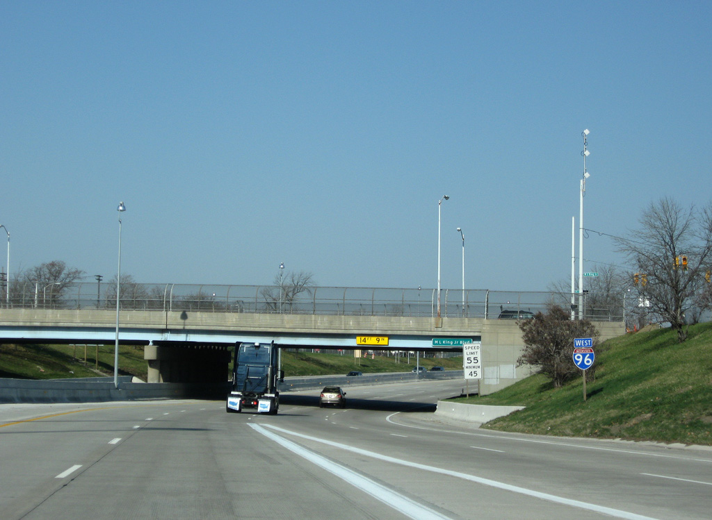
Interstate 96 continues 1.25 miles southeast from the systems interchange with I-94 (Edsel Ford Freeway) to the ramp separation for I-75 (Fisher Freeway). 11/06/11
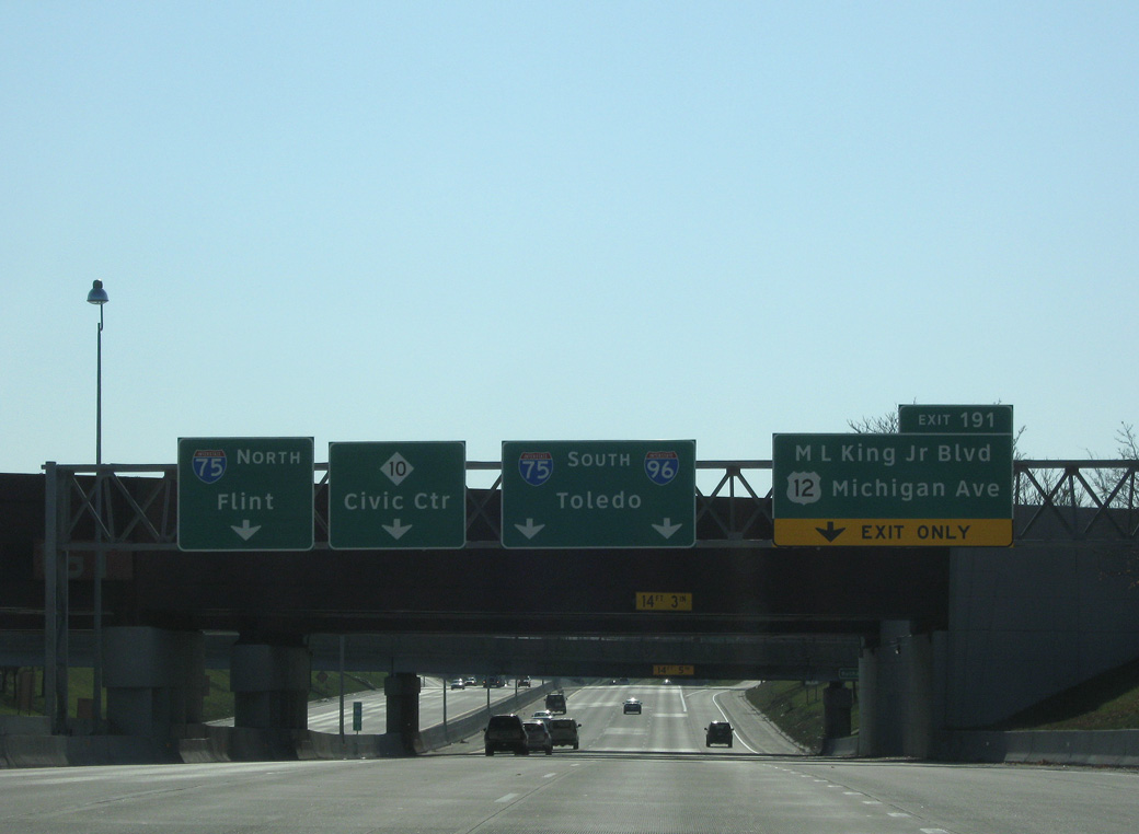
A half diamond interchange precedes I-75 along I-96 east with Martin Luther King, Jr. Boulevard. The west service road joins the exit ramp for U.S. 12 (Michigan Avenue), which passes through the exchange with the Fisher Freeway. 11/07/09
Traffic partitions into c/d roadways along both directions of I-75. The northbound roadway links with ramps to Rosa Parks Boulevard and M-10 (Lodge Freeway) south to Downtown Detroit. 11/07/09
The southbound c/d roadway from I-96 connects with Vernor Highway and the tolled Ambassador Bridge spanning the Detroit River to Windsor, Ontario. 11/07/09
An end shield previously stood at the exit to Porter Street from the southbound c/d roadway along Interstate 75. This ramp configuration changed with the Gateway Project. Photo by Dan Garnell (07/02).
![]() North at
North at ![]()
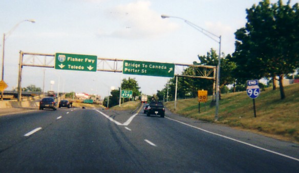
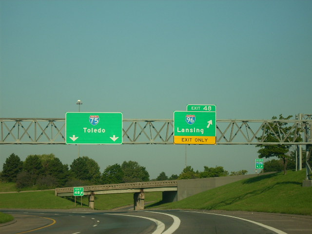
Paralleling M-85 (Fort Street), I-75 (Fisher Freeway) makes a northwesterly turn ahead of the Ambasssador Bridge and I-96 (Jeffries Freeway) west at Exit 48. I-96 links Detroit with Lansing 86 miles to the west while I-75 leads beyond Downtown to Flint. Photo by Jim Teresco / Rob Foulis (08/01/01).
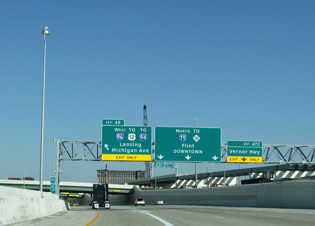
Ramps from the Ambasssador Bridge port of entry tie into the collector distributor roadway (Left Exit 48) for I-96 west at Vernor Highway. 11/07/09
![]() South at
South at ![]()
Leading away from the turbine interchange with M-10 (Lodge Freeway) outside Downtown Detroit, I-75 advances 0.75 miles west to Interstate 96. 11/07/09
Ramps from the Lodge Freeway to I-75 combine along a southbound distributor roadway. This roadway stays separate from the mainline to the exchange with Interstate 96. 11/07/09
A lane drop occurs along the I-75 southbound mainline at the three-wye interchange (Exit 48) with Interstate 96. 11/07/09
![]() West
West
The first confirming marker for Interstate 96 westbound stands ahead of the Martin Luther King, Jr. Boulevard just beyond I-75. 11/07/09
East End Throwback
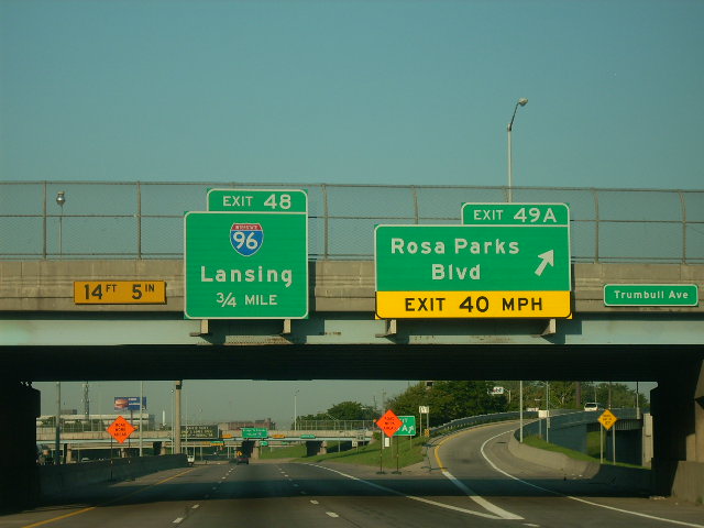
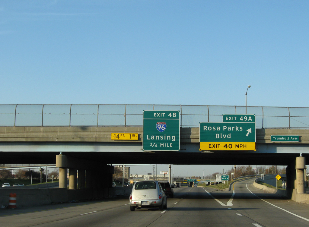
Replaced guide sign sides at Exit 49A along I-75 south. The Rosa Parks Boulevard off-ramp used to be the exit to old Tiger Stadium. Photo by Frank Gillon (09/03/07).
Southbound Interstate 75 at I-96 prior to the Gateway Project. Photo by Frank Gillon (09/03/07).
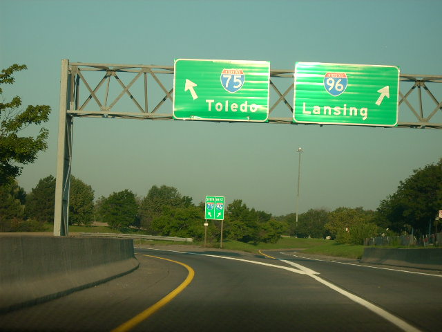
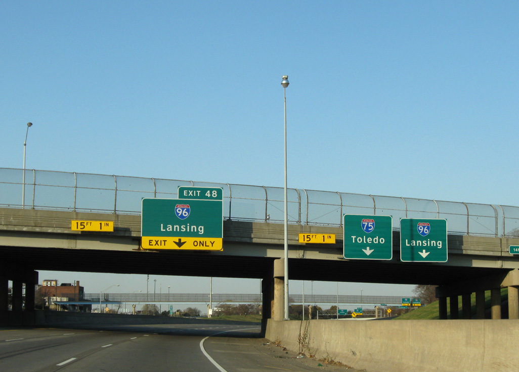
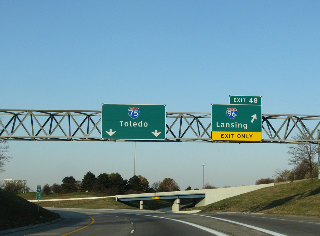
The distributor roadway from M-10 and the Rosa Parks Boulevard entrance ramp partitions into the connections for I-96 west and I-75 south toward Toledo, Ohio. Photo by Frank Gillon (09/03/07).
West End / Muskegon, Michigan
![]() West at
West at ![]()
![]()
Interstate 96 angles northwest along side Airline Highway (old U.S. 16) to U.S. 31 outside Muskegon. 11/05/09
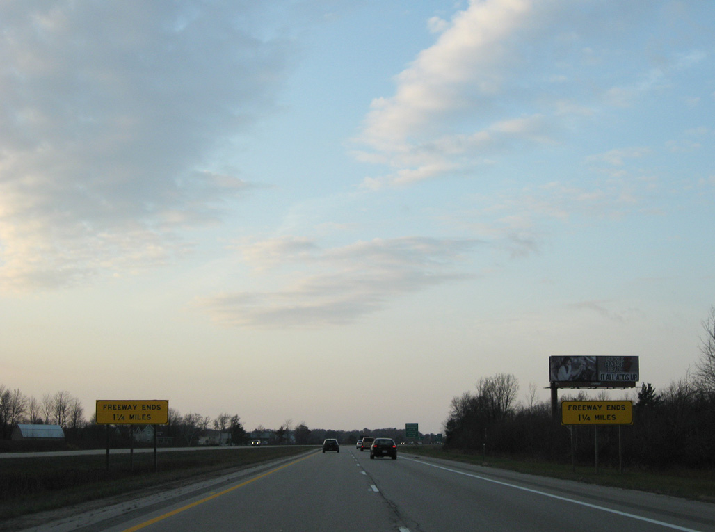
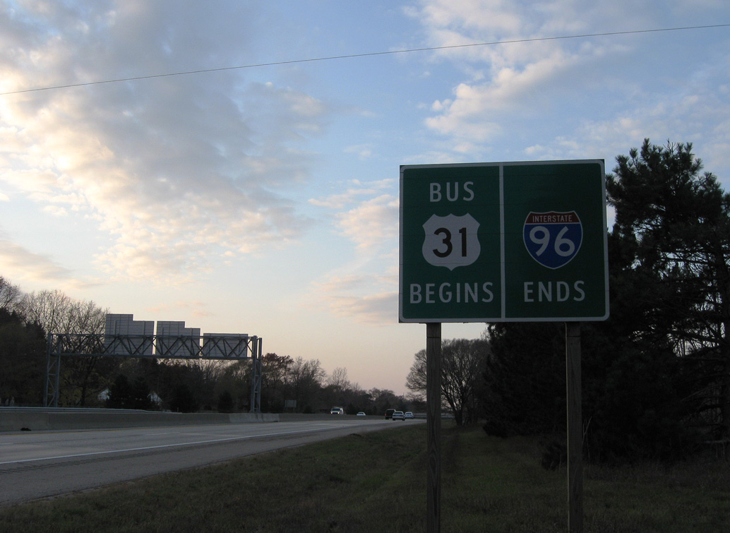
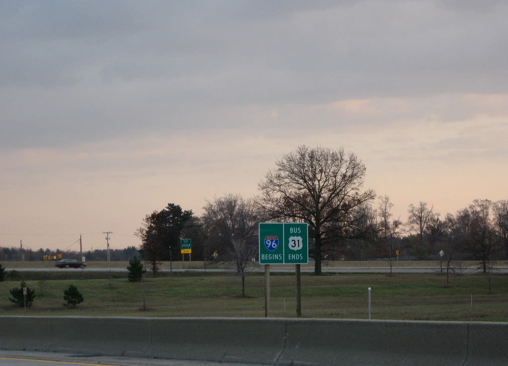
A pair of freeway ends signs precede the modified cloverleaf interchange (Exits 1B/A) with U.S. 31. 11/05/09
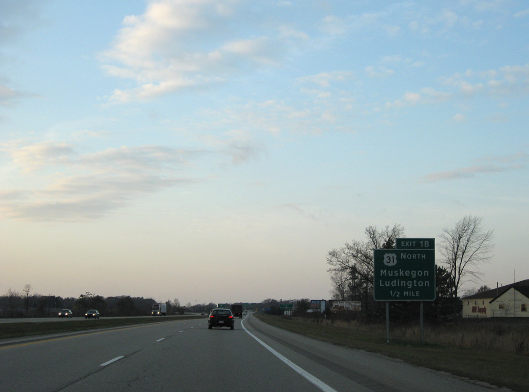
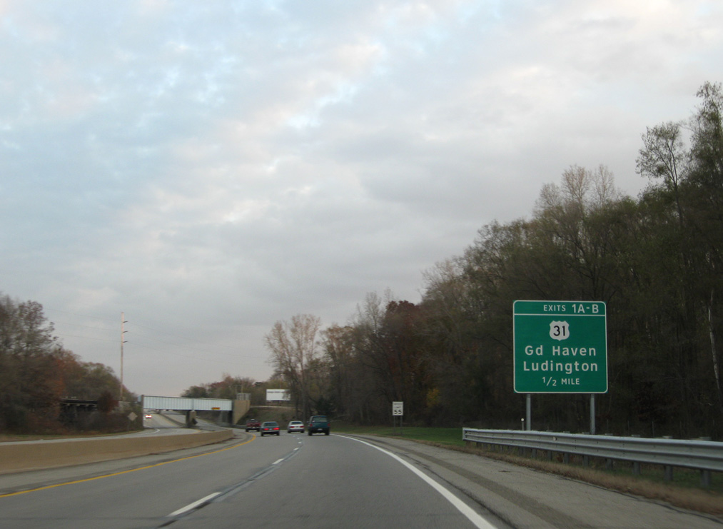
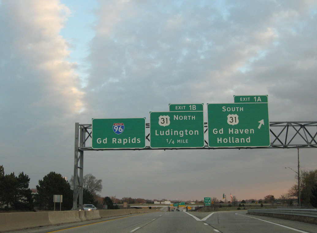
Exit 1B departs in a half mile for U.S. 31, which extends north along a freeway 60 miles to U.S. 10 at Ludington. 11/05/09
U.S. 31 travels along the east side of Muskegon toward Whitehall from the end of Interstate 96. 11/05/09
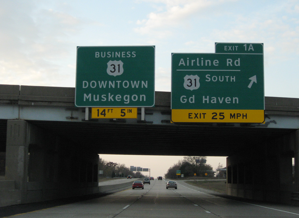
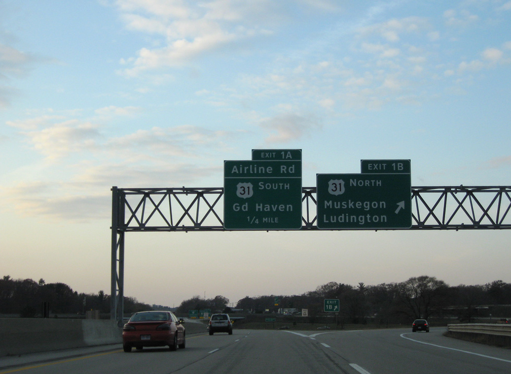
Exit 1A ties into adjacent Airline Highway (old U.S. 16) northwest to Muskegon Heights and south to the entrance ramp for U.S. 31 to Grand Haven and Holland. 11/05/09
Interstate 96 transitions into U.S. 31 Business, which extends the freeway another 0.75 miles to a wye intersection with Grand Haven Road (old U.S. 31). 11/05/09
![]() South at
South at ![]()
![]()
U.S. 31 Business (Seaway Drive) splits with Grand Haven Road (old U.S. 31) at a wye intersection and proceeds southeast along a freeway to Interstate 96 and U.S. 31 (Exits 1A/B). 11/05/09
Exit 1A departs U.S. 31 Business south beyond the Airport Road overpass for U.S. 31 south to Holland. 11/05/09
This sign formally marks the transition of U.S. 31 Business south to Interstate 96 east within the cloverleaf interchange (Exit 1) at U.S. 31. 11/05/09
![]() North at
North at ![]()
![]()
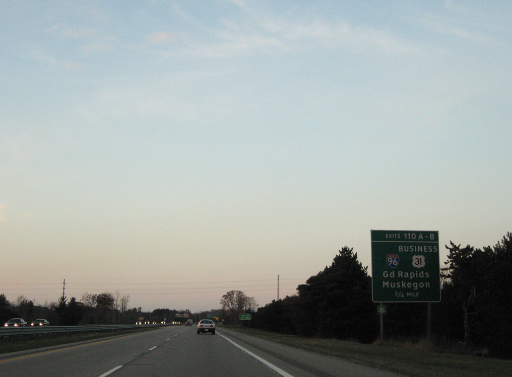
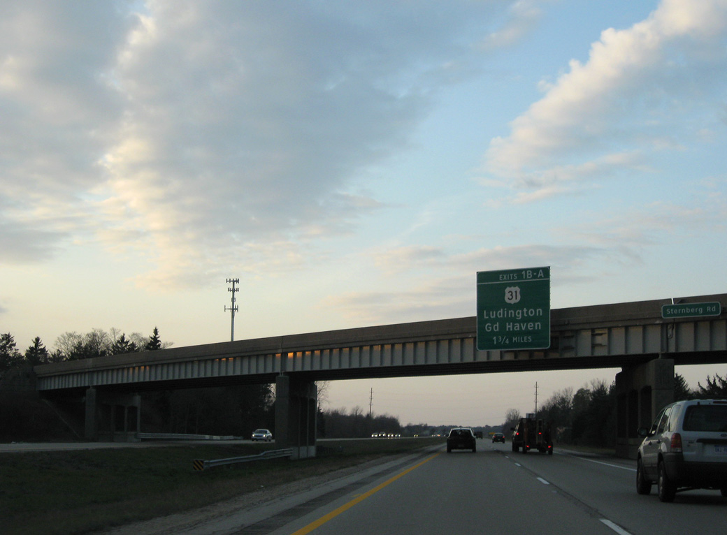
U.S. 31 advances 0.75 miles north from the commercialized interchange with Sternberg Road to Interstate 96 east and U.S. 31 Business north. 11/05/09
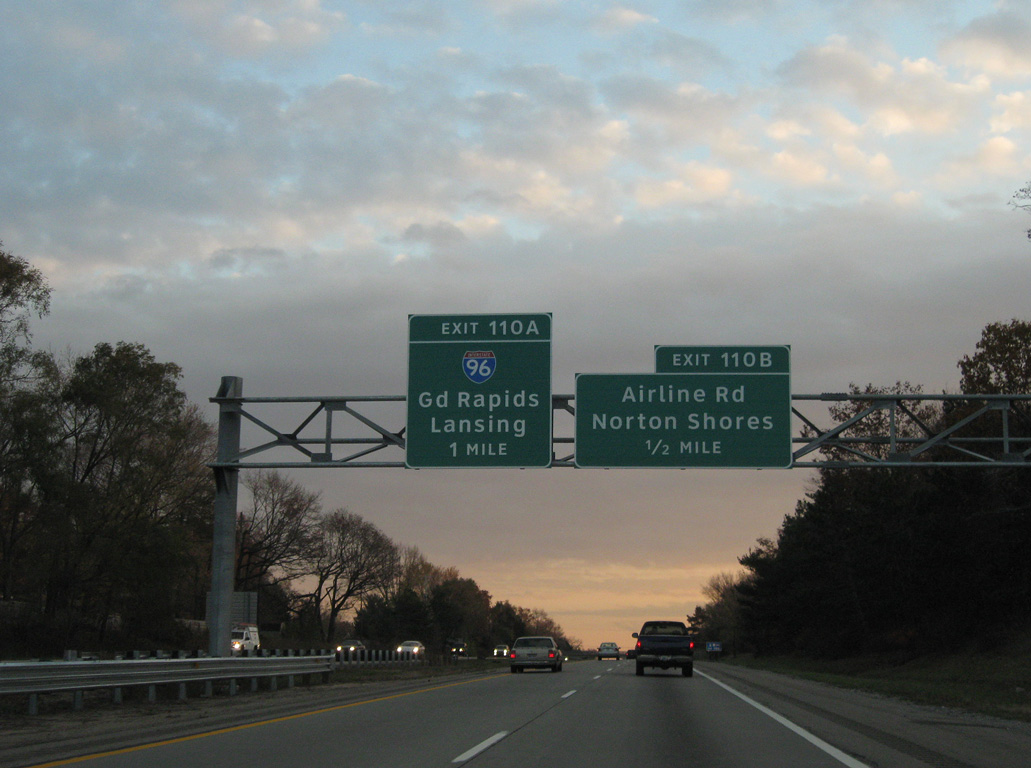
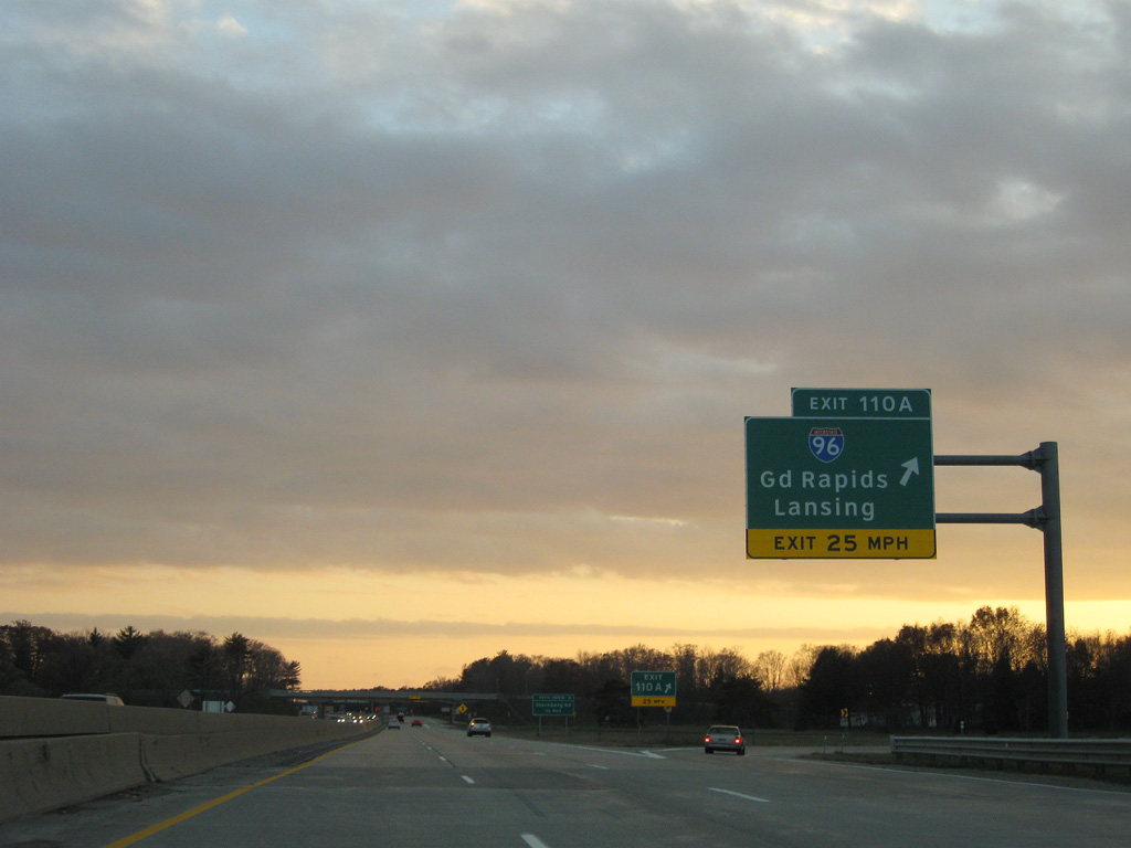
An auxiliary lane opens along U.S. 31 northbound for Exit 110A and Interstate 96 east. 11/05/09
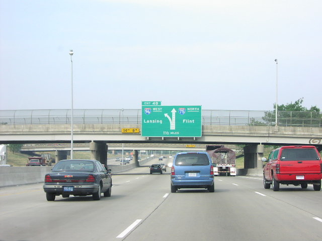
Motorists bound for Grand Rapids part ways from U.S. 31 northbound at Exit 110A. I-96 reaches the city in 30 miles. 11/05/09
![]() South at
South at ![]()
![]()
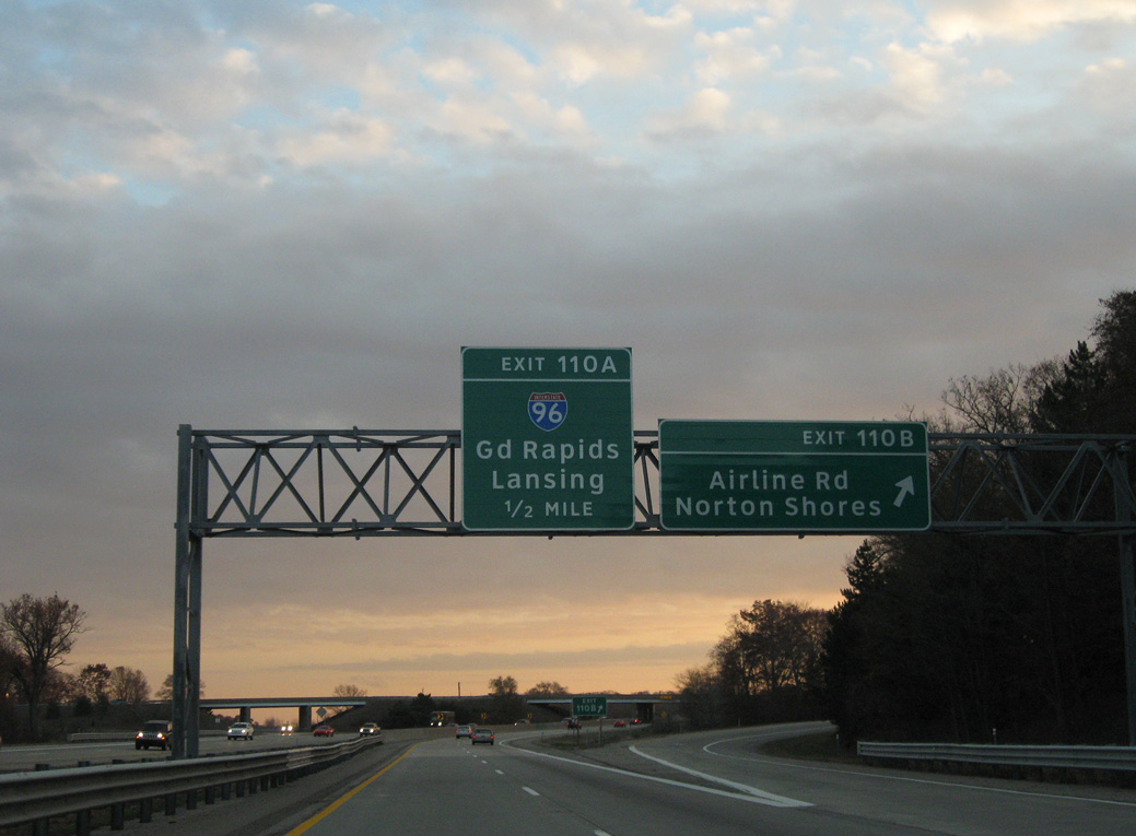
U.S. 31 traverses an area of wetlands associated with Black Creek on the one mile approach to Exit 110A with I-96 east. 11/05/09
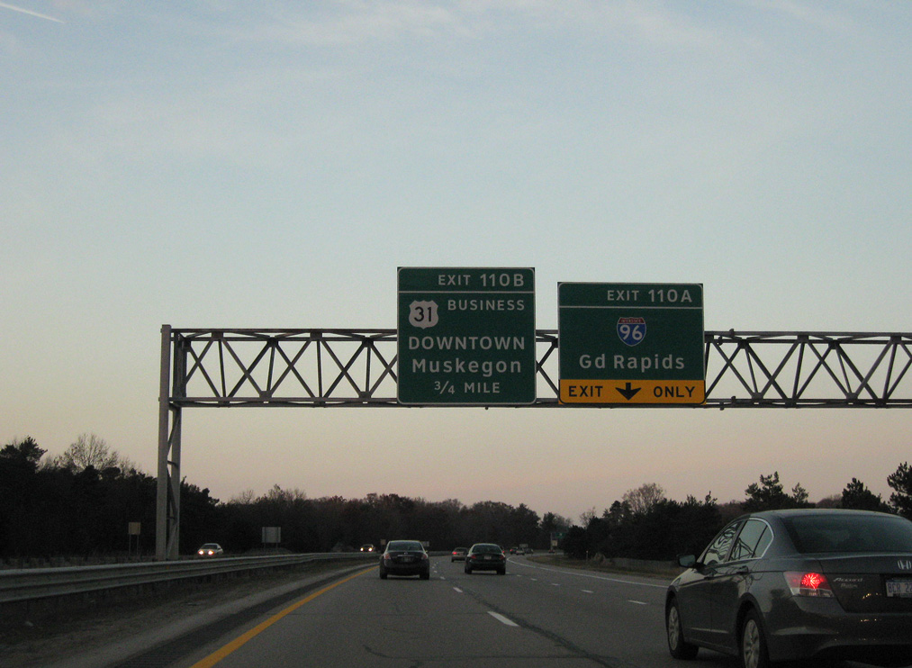
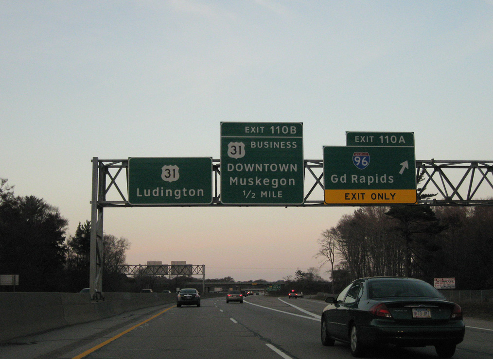
Exit 110B leaves U.S. 31 south for Airline Highway (old U.S. 16), which parallels U.S. 31 Business north to Airport Road and an on-ramp for Muskegon Heights. 11/05/09
A loop ramp (Exit 110A) joins Interstate 96 east from the ending U.S. 31 Business to Grand Rapids, Lansing and Detroit. 11/05/09
West End Throwback

Sign replacements at Exit 1A placed Airline Highway above U.S. 31. The ramp for U.S. 31 southbound uses a Breezewood connection via Airline Highway east. Photo by Dale Sanderson (2000).

The previous begin shield for I-96 stood ahead of Exit 1A for Grand Haven. Photo by Dale Sanderson (2000).
Sources:
- Michigan Highways: Highways 90 through 99.
- “Road engineers plan new kind of interchange for I-96.” The Oakland Press, October 12, 2003.
- “Interstate roads have shaped the future for many mid-Michigan communities.” Lansing State Journal, July 23, 2006.
- Ambassador Bridge Gateway Project
http://www.michigan.gov/gateway. MDOT project web site.
Page updated October 8, 2018