Interstate 95
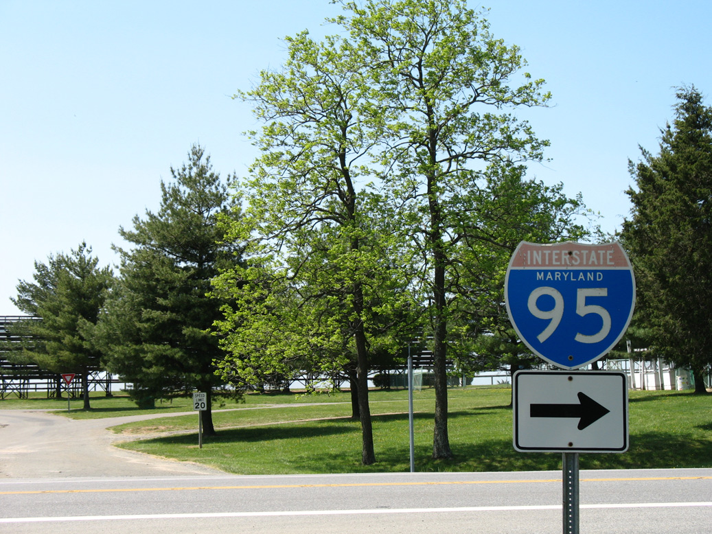
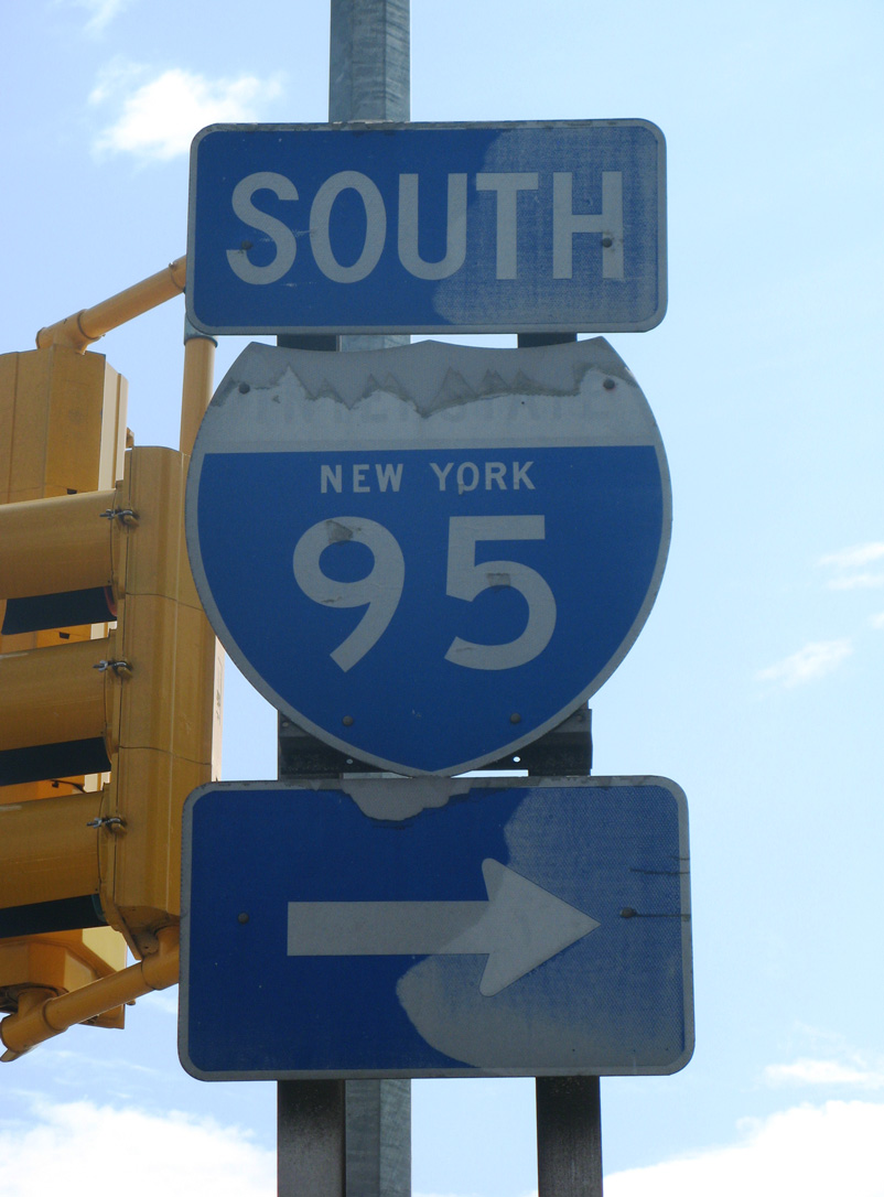
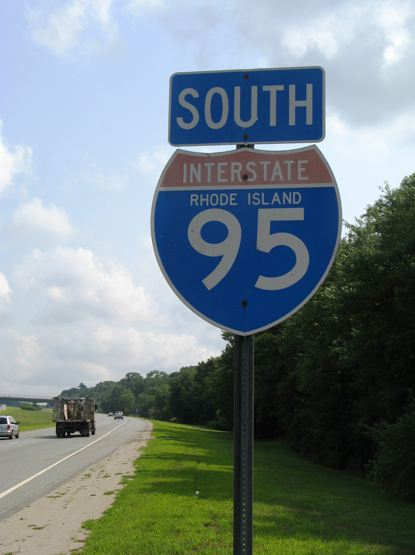
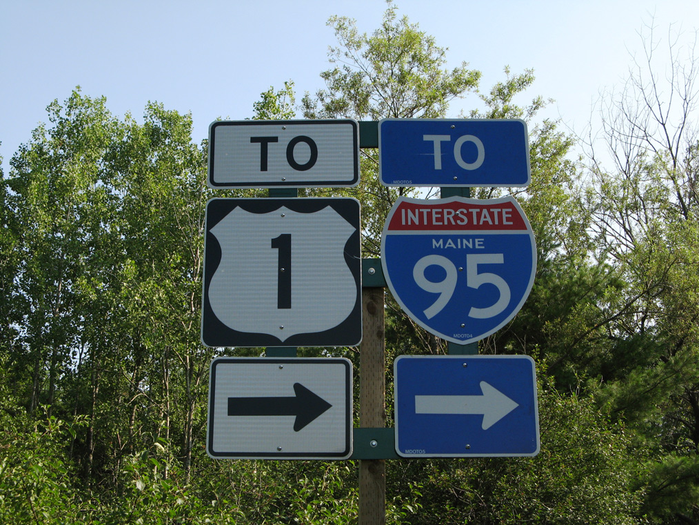
Overview
The East Coast’s Main Street, Interstate 95 serves the entire Northeast Megalopolis, while also serving southeastern cities of Jacksonville and Miami along Florida’s east coast. The highway is an important factor in commerce and tourism, linking scenic New England with subtropical South Florida. It passes through more states than any other Interstate highway.
Interstate 95 also has more branch routes than any other Interstate highway, and its spurs are generally much longer than those belonging to other routes:
- Interstate 195 – DC, FL, VA, MD, NJ, RI/MA, ME
- Interstate 295 – FL, NC, VA, MD/DC, DE/NJ/PA, NY, RI/MA
- Interstate 395 – FL, VA/DC, MD, CT/MA, ME
- Interstate 495 – VA/DC/MD, DE, NY, MA
- Interstate 595 – FL, MD
- Interstate 695 – MD, NJ, NY
- Interstate 795 – FL (Future Route), NC, MD
- Interstate 895 – MD
High Priority Corridor
Interstate 95 in Florida is part of High Priority Corridor 49: Atlantic Commerce Corridor. Through northern New Jersey, Interstate 95 is part of High Priority Corridor 63: Liberty Corridor. Within the Constitution State, I-95 is part of High Priority Corridor 65: Interstate 95 Connecticut. A short portion of Interstate 95 near Bangor, Maine is part of High Priority Corridor 50: East-West Corridor from Watertown to Calais.
 Parallel U.S. Routes
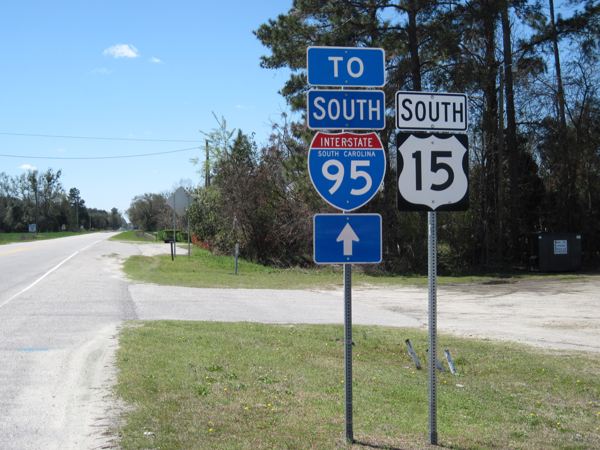
Overall, Interstate 95 follows U.S. 1, but it deviates from U.S. 1 in Georgia, the Carolinas, and Southern Virginia. Through those states, it follows U.S. 17 and U.S. 301, with a brief section that parallels U.S. 15 in South Carolina.
The Gap of Interstate 95 in New Jersey/Pennsylvania
Prior to 2018, Interstate 95 had a significant gap between the cities of Trenton and New Brunswick in New Jersey. This portion of I-95 was previously proposed along the Somerset Freeway. Community opposition to the roadway, and opposition from the New Jersey Turnpike Authority, which feared lost revenue due to the competition of a free highway to the west, ultimately canceled the portion of I-95 between Lawrenceville and New Brunswick/Edison in 1982. Ray Martin covers the “Interstate 95 Gap” in great detail on the History of the Interstate 95 “Missing Link” of central New Jersey webpage.
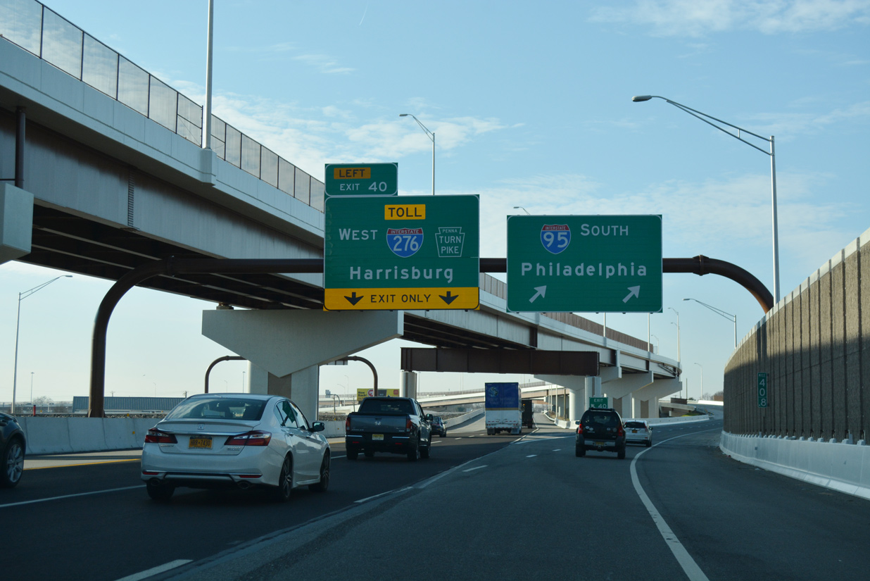
When I-95 was completed in Bucks County in 1969, the crossing with the PA Turnpike (Interstate 276) was not a direct connection. Instead a spur to PA 413 and a dogleg route of PA 413 south to U.S. 13 north was required to make the connection. Studies for the missing interchange commenced in 1975 and by 1982, the Federal Surface Transportation Assistance Act specified a complete route for Interstate 95 via a reroute of the Interstate east on the Pennsylvania Turnpike and PA Turnpike Extension from Bristol to the New Jersey Turnpike mainline near Bordentown, and northward on the NJ Turnpike to New Brunswick. A slow speed interchange was envisioned at the junction in the mid 1980s. The interchange was redesigned again in 1992 as a high speed exchange. An Environmental Impact Statement was conducted for the interchange during the 1990s, leading to a Record of Decision by 2003.29

Part of the proposal for the Somerset Freeway in New Jersey included a short connector numbered as Interstate 695. It was never built either.
Design work on the PA Turnpike / I-95 Interchange commenced in 2004 after federal funds were authorized. The Preliminary Design Phase for the interchange was completed in 2009.29 Construction on Stage 1 of the three stage project built the high speed connection between Interstate 95 and the Pennsylvania Turnpike and added a new main line toll plaza to the west. The new plaza shifted the ticketed system of the PA Turnpike mainline west of the I-95 connection. The Delaware River Turnpike Toll Bridge was subsequently converted to all electronic tolling (AET). The remainder of the PA Turnpike converted to AET in Fall 2021.
Stage 2 (Section D40) of the PA Turnpike / I-95 Interchange project adds the six remaining ramp movements between I-95 and I-276 and widens the Turnpike mainline. Work was previously anticipated to run between 2015 and late 2018. As of March 2023, planned construction for Section D40 remains on hold until funding is identified. Stage 3, previously forecast for 2025 or later, involves building a second span for I-95 across the Delaware River.29 Preliminary engineering for the Delaware River Bridge Reconstruction gets underway in 2024. Construction is anticipated to begin in 2030 or later.
Completion of the ramps linking I-95 north with I-276 (PA Turnpike) east and I-276 west with I-95 south took place on September 23, 2018. Sign changes started in January 2018 renumbered I-95 north from I-276 to U.S. 1 near Lawrenceville, New Jersey as an extension of Interstate 295 south and west. Previously signage for I-95 ended at U.S. 1 and did not resume until near East Brunswick on the New Jersey Turnpike, with the exception of some reassurance shields posted along the NJ Turnpike mainline in 2005 from Exit 6 northward. Trailblazers added in 2004 also directed I-95 mainline traffic to the N.J. Turnpike via I-295 south and I-195 east.
The numbering changes in the Trenton area and Bucks County, Pennsylvania for I-95 and I-295 were confirmed by the FHWA on May 20, 2015 with conditions. Until connections at the I-95 / PA Turnpike Interchange were made, I-95 between Bristol and Lawrenceville was to be referred as Future I-295 and the Pennsylvania Turnpike east into New Jersey as Future I-95.
A previous numbering plan for the relocation of I-95 between Bristol and Trenton in 2007 outlined extending Interstate 195 north over I-295 from Hamilton Township to Lawrenceville and west from U.S. 1 to Bristol, Pennsylvania over I-95. This was plan was amended in 2014 to renumber I-95 between Bristol and Lawrenceville as I-395 and leaving I-295 unchanged.
The two lane flyover for Interstate 95 south at I-276 (PA Turnpike) opened to traffic on September 23, 2018. 12/27/18
Phase 1 of sign changes were announced by the New Jersey Department of Transportation announced on December 21, 2017 along both I-95 and I-295 in Mercer County between January and March 2018. This included the renumbering of seven interchanges in New Jersey and four in Pennsylvania. Incorporated into the Scudder Falls Bridge project, Phase 2 sign changes followed in Spring 2018. These effected interchanges at Exits 49 and 51 for I-95 in Pennsylvania, and Exit 1 in New Jersey. Started in late Spring 2018, Phase 3 completed sign changes at the remaining interchanges in Pennsylvania leading southwest to the PA Turnpike at Bristol.34
Interchange renumbering along old I-95 in Mercer County, New Jersey continued the I-295 exit system. Exits in Bucks County, Pennsylvania count down from the Delaware River to milepost zero at the PA Turnpike Interchange at Bristol. Exit number changes were as follows:34
- U.S. 1 Business / PA 44: I-95 Old Exit 44 – new I-295 Exit 3
- U.S. 1: I-95 Old Exit 46 – new I-295 Exit 5
- PA 332: I-95 Old Exit 49 – new I-295 Exit 8
- New Hope / Yardley: I-95 Old Exit 51 – new I-295 Exit 10
- Route 29: I-95 Old Exit 1 – new I-295 Exit 76
- CR 579 – I-95 Old Exit 2 – new I-295 Exit 75
- Scotch Road: I-95 Old Exit 3 – new I-295 Exit 73
- Route 31: I-95 Old Exit 4 – new I-295 Exit 72
- Federal City Road: I-95 Old Exit 5 – new I-295 Exit 71
- U.S. 206: I-95 Old Exit 7 – new I-295 Exit 69
- CR 546 / 583: I-95 Old Exit 8 – new I-295 Exit 68
History
The following are key dates in the history of Interstate 95 in Florida:24
- 1959 – On the 1959 Shell (Gousha) Florida Map, Interstate 95 appeared as the “Jacksonville Expressway” from Beaver Street to the junction of U.S. 1 and U.S. 90 in South Jacksonville, the Fuller Warren Bridge (first segment to open).
- 1960 – Interstate 95 signed and built through downtown Jacksonville, up to Heckscher Drive.
- 1961 – Short section of Interstate 95 opened in Miami, including the link to I-195.
- 1963 – Interstate 95 opened from the Golden Glades interchange to Hallandale and was signed on the already constructed Sunshine State Parkway from West Palm Beach north to Fort Pierce. I-95 would remain signed on this section of the Sunshine State Parkway (later Florida’s Turnpike) until 1977.
- 1964 – Interstate 95 opened through the Golden Glades Interchange (SR 826/Palmetto Expressway, U.S. 441, and Sunshine State Parkway) and then north to SR 84 in Fort Lauderdale. In Jacksonville, I-95 was complete and opened between the South Jacksonville interchange and SR 104. I-95 under construction (1) at connection to Dixie Highway along South Bay Drive, (2) from Malabar to Mims, and (3) from Daytona Beach north to Jacksonville.
- 1965 – Interstate 95 opened (1) from Malabar to Eau Gallie and (2) from Daytona Beach to Bunnell.
- 1967 – Interstate 95 opened (1) from Eau Gallie to Scottsmoor and (2) from Bunnell to Jacksonville were opened. Interstate 95 under construction from Jacksonville north to Gross.
- 1968 – Interstate 95 (North-South Expressway) opened (1) from U.S. 1 north to Lummus Park and (2) from 20th Street to I-195. I-95 under construction: (1) at interchange with SR 836 (Dolphin East-West Expressway), (2) from SR 84 north to SR 82, (3) from West Palm Beach to Florida’s Turnpike, (4) from SR 60 north to Malabar, and (5) from Scottsmoor north to Daytona Beach.
- 1970 – Interstate 95 opened from SR 60 to Gross. I-95 under construction from Gross north to the Florida-Georgia State Line.
- 1971 – Interstate 95 opened from Gross to the Florida-Georgia State Line.
- 1972 – Interstate 95 was under construction from Fort Lauderdale north to West Palm Beach.
- 1977 – Interstate 95 opened from Fort Lauderdale north to West Palm Beach. Proposed route from West Palm Beach to
- Fort Pierce finalized. Interstate 95 shields removed from Florida’s Turnpike. Construction begins on section from Fort Pierce to SR 60.
- 1978 – Interstate 95 opened from Indrio to SR 60.
- 1979 – Interstate 95 opened Fort Pierce to Indrio.
- 1981 – Interstate 95 construction started from County Road 714 to Fort Pierce.
- 1984 – Interstate 95 opened from Port St. Lucie north to Fort Pierce. Gap existed between Port St, Lucie south to Palm Beach Gardens. The proposed connection between these two cities was still being determined, but the proposal shifted in 1984 to look more like the current alignment of I-95. The Miami Metro Rail (an elevated commuter rail service) begins service in May 1984.
- 1985 – Interstate 95 opened from County Road 714 north to Port St. Lucie.
- 1987 – Interstate 95 opened from Palm Beach Gardens north to County Road 714. I-95 is now complete from U.S. 1 in Miami north to the Georgia-Florida State Line, which is its original, planned route.
The last section of Interstate 95 opened in Georgia was the Turtle River bridge near Brunswick on December 20, 1977.30
Interstate 95 was fully complete through the Palmetto State on February 16, 1976, when a crowd of 150 gathered at the junction of I-95 and I-26 to open the final stretch. The freeway cost $186.8 million to construct. Initial corridors for the route in the 1940s included a path parallel to U.S. 15 from Bennettsville southwest to Society Hill and south from Sumter to U.S. 17A in Collecton County. The northern portion of the corridor eventually shifted eastward along U.S. 301 to match what North Carolina chose. The south end was also adjusted to tie into the Savannah area as mandated by the federal government.31
In Maine, the following are key dates in the history of Interstate 95:26
- 1947 – Maine Turnpike from Kittery to Portland opened
- 1955 – Maine Turnpike from Portland to Augusta opened
- 1955 – The Falmouth Spur segment of the Maine Turnpike opened (the Falmouth Spur was incorporated into Interstate 95 from 1956 until 2004; today it is unsigned Interstate 495 and acts as a connector between I-95 and I-295 north of Portland)
- 1960 – Section from Augusta to Fairfield opens
- 1960 – Section from Hammond Street (Exit 183) to Hogan Road (Exit 187) opens in Bangor
- 1961 – Section from Bangor to Orono opens
- 1963 – Section from Newport (SR 100) to Interstate 395/Bangor Industrial Spur opens
- 1964 – Section from Fairfield to Newport opens
- 1965 – Section from Orono to Howland opens, with certain sections built as Super Two
- 1966 – Sections from Howland to Medway and from Oakfield to Houlton open as Super Two
- 1967 – Final section of Interstate 95 completed from Bangor to Houlton with completion of bypasses of Medway and Oakfield
- 1972 – The Piscataqua River Bridge between Maine and New Hampshire opened; sections of Super Two are converted to four lane, divided freeway near Alton and Howland
- 1973 – Connector from Piscataqua River Bridge to Maine Turnpike is completed
- 1976 – More conversions of Super Two to four lane freeway occur on sections from Howland to Lincoln and from Lincoln and Medway
- 1977 – Interstate 95 from Smyrna to Houlton are converted from a two lane to a four lane freeway
- 1979 – Sections from Medway to Sherman, from Sherman to Island Falls, and from Island Falls to Oakfield are converted from a two to four lane freeway
- 1981 – Section from Oakfield to Smyrna are converted from two lane freeway
The section of Interstate 95 that crosses the Argyle Bog north of Bangor required special construction requirements due to the presence of unexploded ordnance. The U.S. Army used the area around Argyle Bog as a weapons testing/training area between World War I and World War II. Probes and other devices used for soil testing were not used in order to avoid setting off unexploded ordnance. Parade Magazine, the Sunday supplement to many national newspapers, rated Interstate 95 from Augusta to Fairfield as the nation’s most scenic highway in 1961. In 1965, the same competition rated the section from Bangor to Newport as an “honorable mention.”
Unconstructed Alignments of I-95 in Urban Areas
As if the Interstate 95 gap in New Jersey was not enough of obstacle in the path, many alignments in the older Northeastern cities came about after much deliberation politically and socially among community leaders and officials of each respective city. The through route for Interstate 95 through the downtowns of Washington, D.C., and Boston was not constructed; the Interstate instead follows the bypass route.
In Washington, D.C., Interstate 95 was originally planned to traverse the nation’s capital district, with a path northeast through the city, to the current I-95/495 junction. Interstate 395 represents the portion of I-95 that was built within the Capital Beltway. The most controversial section of the freeway included the “inner belt,” which included portions of unconstructed I-95, I-266, and I-295. This inner belt would have passed through lower income areas, causing a great deal of protestation for such a road to impact that group disproportionately.16 The right of way for Interstate 95 north of downtown, from the District of Columbia boundary north to the Capital Beltway is still reserved, but it is used for power lines rather than a freeway.
In Boston, Interstate 95 was intended to pass directly through the city, entering Boston from the southwest, then linking to a proposed but unconstructed Inner Belt Expressway (Interstate 695). From there, Interstate 95 would have followed the existing U.S. 1/Northeast Expressway, then travel north to the present I-95/Route 128 West of Peabody. Neither the southwestern nor northeastern sections were completed, and they were withdrawn from the Interstate Highway System on May 23, 1974.25 Sections that were built are today part of Interstate 93 through Downtown Boston and U.S. 1 northeast of Downtown.
Construction of Interstate 95 through Providence, Rhode Island in 1958 required the acquisition of hundreds and homes and businesses and two historic churches. The path through Philadelphia required special considerations in 1961 because of the historical nature of Penn’s Landing and the redevelopment at the time of Society Hill and Washington Square East. Within Jacksonville, I-95 traveled through minority neighborhoods from the downtown to the Trout River. In Miami, Interstate 95 cut through the Liberty City neighborhood, which was (and is), the poorest part of Miami. Unfortunately Interstate 95 often took the path of “least resistance”, meaning where the land values were low, even if it meant the displacement of poor communities.
In addition to the social cost of building infrastructure through established communities, there was an increased economic cost of building through urbanized regions. For example, in Philadelphia, the construction costs of Interstate 95 (Delaware Expressway) became more costly than any other project at that time. This was partially due to the fact that much of the freeway was constructed on an elevated viaduct directly adjacent to the Delaware Riverfront.16
Route Information
Mileage
Florida – 382.15
Cities – Miami, Hollywood, Fort Lauderdale, Boca Raton, West Palm Beach, Fort Pierce, Melbourne, Titusville, Daytona Beach, Jacksonville
- Junctions –


 Future
Georgia – 112.00
- Cities – Brunswick, Savannah
- Junctions –
South Carolina – 198.76
Cities – Walterboro, Florence, Dillon
- Junctions –
North Carolina – 181.36
- Cities – Lumberton, Smithfield, Fayetteville, Roanoke Rapids
- Junctions – Future Future Future Future
Virginia – 178.73
Cities – Emporia, Petersburg, Richmond, Fredericksburg, Alexandria, Arlington
Junctions –
District of Columbia – 0.11
Maryland – 110.01
Cities – Suitland, New Carollton, Greenbelt, Laurel, Baltimore, Aberdeen, Havre de Grace
Junctions –
Delaware – 23.43
Cities – Newark, Wilmington
Junctions –
Pennsylvania* – 51.00
Cities – Chester, Philadelphia
- Junctions –

New Jersey* – 97.76
Cities – New Brunswick, Elizabeth, Newark, North Bergen
Junctions –
New York – 23.50
Cities – New York City, New Rochelle
Junctions –

Connecticut – 111.57
Cities – Greenwich, Stamford, Norwalk, Bridgeport, New Haven, New London
- Junctions –
Rhode Island – 42.36
Cities – Warwick, Cranston, Providence, Pawtucket
Junctions –
Massachusetts – 91.95
Cities – Attleboro, Boston, Needham, Lexington, Woburn, Danvers
- Junctions –
New Hampshire – 16.11
Cities – Portsmouth
Junctions –

Maine – 303.10 (298.51#)
Cities – Kittery, Portland, Brunswick, Augusta, Waterville, Bangor, Houlton
Junctions –

Source: December 31, 2021 Interstate Route Log and Finders List
* the mileage for New Jersey and Pennsylvania still references the former route of I-95 north around Trenton to U.S. 1 and was not updated following the realignment of I-95 onto the easternmost section of the Pennsylvania Turnpike and Pearl Harbor Memorial Turnpike Extension in New Jersey.
# Maine mileage was not updated to incorporate mileage changes as a result of the realignment of Interstate 495 in Maine on January 5, 2004. The actual mileage is 303.10 (source: MaineDOT Map Viewer).
Interstate 595 is one of three spurs of I-95 in South Florida.
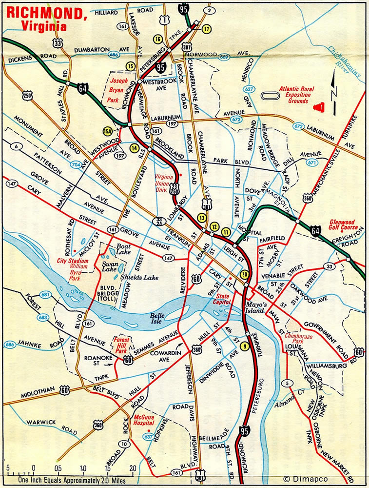
Interstate 95 overlaid the original Richmond-Petersburg Turnpike from the north end of I-85 to U.S. 301/SR 2 (Chamberlayne Avenue). Tolls were dropped on the Turnpike in 1992.
Early proposals for the Somerset Freeway took Interstate 95 east of U.S. 1 from Trenton directly to the New Jersey Turnpike near New Brunswick.

The I-95 corridor through New Jersey shifted westward to parallel U.S. 206 to Interstate 287. This alignment included the proposed I-695 near Manville.
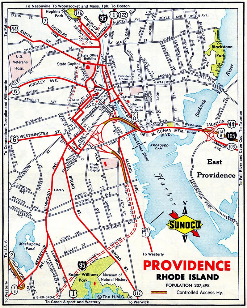
A short stretch of Interstate 95 was open south of Downtown Providence, Rhode Island in 1963. This connected with the then Providence River bridge of Interstate 195. The I-195 crossing was demolished after 2008 as part of the Iway project to relocate the freeway.
A $2.3-billion project between 2009 and 2014 rebuilt the New Jersey Turnpike from Exit 6 (Pennsylvania Turnpike Extension) to Exit 8A (Route 32). Construction extended the Inner/Outer Roadway configuration southward from South Brunswick Township to just below Exit 6. I-95 shift onto the Turnpike mainline from Bristol, Pennsylvania via Exit 6 in September 2018.
I-95 Annual Average Daily Traffic (AADT)
Source:
2019 AADT Florida Traffic Online
2017 AADT – GDOT Georgia Traffic Counts
2019 Traffic Data Virginia Department of Transportation (VDOT)
2018 AADT MDOT SHA Traffic Volume County Maps
2019 AADT Vehicle Volume Summary (Traffic Counts), DelDOT
2018 AADT PennDOT Traffic Volume Maps
2017 AADT NYS Traffic Data Viewer
2015 AADT Rhode Island Department of Transportation (RIDOT) Traffic Flow Map 2016
2019 AADT MassDOT Transportation Data Management System
2015 AADT NHDOT Traffic Volume Reports
2015/17 AADT State of Maine – Volume Counts
I-95 Toll Road History
A significant portion of Interstate 95 has been or remains a toll road, generally because efforts to construct the toll road predates the creation of the Interstate Highway System. Here is an overview of those segments of Interstate 95 that have been or are toll roads.
Florida
Through South Florida, Interstate 95 originally followed the Sunshine State Parkway (renamed Florida’s Turnpike in April 1968) in a temporary capacity from the Golden Glades Interchange north to near Fort Pierce. This 110 mile stretch opened to traffic in 1957. Additional sections of the turnpike extended the route north to Wildwood in 1964 and south to Homestead in 1974.17 Between the mid-1950s and 1980s, Interstate 95 was constructed as a non-tolled freeway, and the designation was shifted off of the tolled turnpike. The final section of Florida’s I-95, which bypassed Florida’s Turnpike between North Palm Beach and Fort Pierce, opened December 19, 1987. The $222 million project ended with then-Governor Bob Martinez driving a 1929 Ford Model A on the new roadway during the dedication ceremonies.13
Richmond-Petersburg Turnpike (Virginia)
Interstate 95 between I-85 in Petersburg and I-64 in Richmond, along with the northernmost section of I-85, comprise the Richmond-Petersburg Turnpike. This 36-mile facility commenced operations in 1958. The eventual plan for I-95 was to route the highway around both Petersburg and Richmond along what is today Interstate 295. The Turnpike was originally planned as a temporary route for Interstate 95, with I-95 transferred onto the new freeway once it was constructed. The Turnpike would subsequently become a state route no longer in the Interstate Highway System.
The connections between I-85, I-95, and the Richmond-Petersburg Turnpike would be afforded by three Interstate spur routes. The plans, which were approved in the mid-1970s, called for the following:18
- Interstate 85 would be transferred onto a new freeway that would travel east to meet the I-95/295 interchange (this was not constructed)
- The section of Interstate 85 from the new freeway northeast to the Richmond-Petersburg Turnpike would be renumbered as Interstate 385
- The section of Interstate 95 from today’s I-95/295 interchange north to the Richmond-Petersburg Turnpike would be renumbered as I-795
- The mainline Turnpike would carry an unspecified state route number
- Interstate 95 between the interchange with I-64 and I-195 north to the second interchange with I-295 would be numbered Interstate 195
- Today’s I-295 would be Interstate 95 from Petersburg to Richmond
- Interstate 295 would be the designation for the western half belt route of Richmond, which today is I-95 and (more or less) Virginia Route 288
However, as the new freeway was constructed in stages between 1984 and 1992, it was signed as Interstate 295, not I-95. In 1975, the turnpike bonds were paid off, but a subsequent expansion project to widen 22 miles of the Richmond-Petersburg Turnpike to six lanes and reconstruct certain interchanges resulted in another bond issuance. Those bonds were paid off by 1985, and other local projects funded by these tolls were completed by 1991. Tolls were eliminated on the Turnpike on July 1, 1992. Coincidentally, that was the same day that Interstate 295 to the east was opened to traffic.14 There are no plans to restore the tolls to the Turnpike.
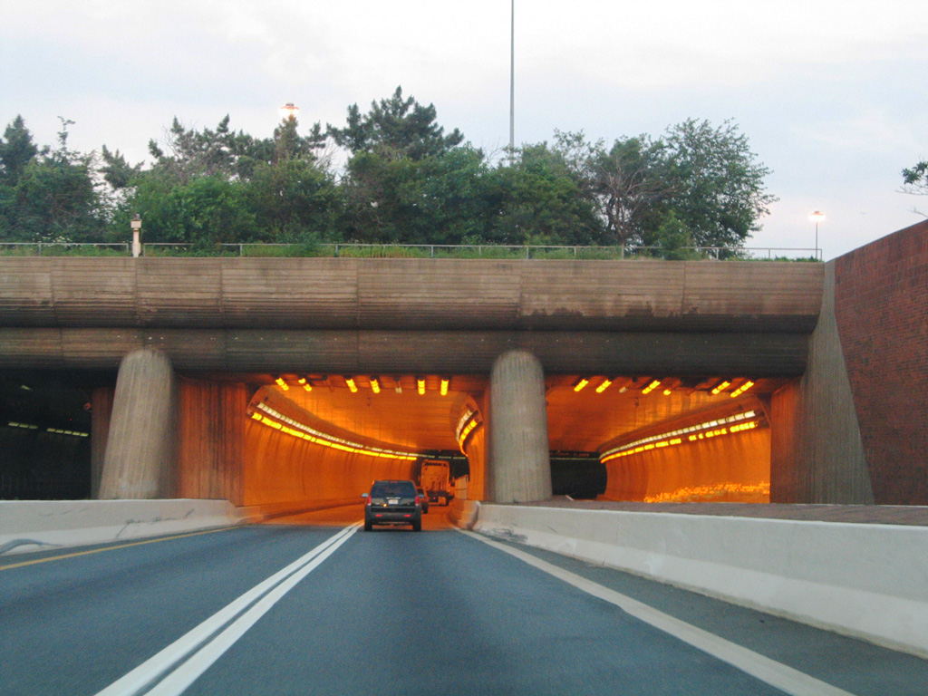
Fort McHenry Tunnel – Maryland
The Fort McHenry Tunnel in Baltimore opened to traffic on November 23, 1985, at a cost of $750 million. It is the world’s largest submerged tube-tunnel.25
Northbound Interstate 95 enters Fort McHenry Tunnel. 06/22/05
John F. Kennedy Memorial Highway – Maryland
Between Baltimore, Maryland, and the Delaware State Line, Interstate 95 uses the John F. Kennedy Memorial Highway (which is maintained as a tollway by the Maryland Transportation Authority). Planned as the “Northeastern Expressway,” the John F. Kennedy Memorial Highway carries Interstate 95 between Exit 67 (MD 43/White Marsh Boulevard) and the Maryland-Delaware state line. Built between January 1962 and November 1963, the opening of the memorial highway was the last public appearance by President John F. Kennedy on November 14, 1963; he was assassinated in Dallas on November 22, 1963. In 1964, the Northeastern Expressway was renamed in honor of President Kennedy.19
Delaware Turnpike
The Delaware Turnpike, which connects the John F. Kennedy Memorial Highway with the Delaware Memorial Bridge (Interstate 295), was also constructed during the early 1960s. Built in tandem with the John F. Kennedy Memorial Highway, construction began in January 1962, and the freeway was opened to traffic in November 1963. There were plans to connect the Delaware Turnpike with the Chesapeake Bay Bridge (U.S. 50-301) in Maryland via the U.S. 301 corridor, but this route remains a conventional two to four-lane highway and is not a freeway. Exit 2, which is missing on the Delaware Turnpike, was reserved for the future connection with the unconstructed U.S. 301 freeway. At the northeastern end of the Turnpike is the Delaware Memorial Bridge, which today connects I-95 to the southern end of the New Jersey Turnpike via Interstate 295. Interstate 95, however, continues north via the Delaware Expressway into Pennsylvania, where it enters the Philadelphia metropolitan area.
New Jersey Turnpike
Interstate 95 enters the Garden State east along the Pearl Harbor Memorial Extension to the New Jersey Turnpike mainline near Florence. Northward from that point (Exit 6 A), I-95 follows the Turnpike to Interstate 80 and the approach to the George Washington Bridge. The section of the NJ Turnpike south of Exit 6 A is designated as New Jersey Route 700 internally and is not part of the Interstate Highway System.
The New Jersey Turnpike was authorized by state legislators in 1948, and the mainline (excluding the connection to the Pennsylvania Turnpike) was constructed between January 1950 and January 1952 in the following order from south to north:20
- Deepwater (Exit 1) to Bordentown (Exit 7) (53 miles) – opened November 5, 1951
- Bordentown to Woodbridge (Exit 11) (40 miles) – opened November 30, 1951
- Woodbridge to Newark (Exit 14) (16 miles) – opened on December 13, 1951
- Newark to Ridgefield Park (9 miles) – opened on January 15, 1952
- Pearl Harbor Memorial (Pennsylvania Turnpike) Extension (6 miles) – opened on May 25, 1956
Interstate 95W (unsigned), which is the 12-mile “western spur” of the New Jersey Turnpike in the vicinity of Newark, was opened in September 1970. It provides the better through route to the George Washington Bridge. Additionally, the New Jersey Turnpike took over maintenance of I-95 from Interstate 80 in Ridgefield Park to the George Washington Bridge from the New Jersey Department of Transportation in July 1992, so that stretch is also part of the turnpike system.
An application establishing Interstate 695 along the Eastern Spur of the New Jersey Turnpike, between Ridgefield and Newark, was approved with condition by AASHTO at the Spring 2023 meeting.
George Washington Bridge
The George Washington Bridge, which carries Interstate 95 over the Hudson River, was built between October 1927 and October 1931; the bridge opened to traffic on October 25, 1931. A major increase to capacity was achieved when the lower level to the bridge was opened on August 29, 1962. As a result of this improvement, the bridge carries 14 lanes of traffic. Managed by the Port Authority of New York and New Jersey, the bridge has a sidewalk for pedestrians and bicyclists.
Entering the former New Rochelle toll plaza on Interstate 95 (New England section of the New York Thruway) northbound. New York Governor Andrew Cuomo announced the conversion of entire 570-mile Thruway system to all electronic toll collection (AET) in June 2018. The plaza at New Rochelle was one of three to be converted by the end of 2018. It was subsequently demolished in 2019. 08/29/05
New England Thruway
Through New York City, Interstate 95 follows the Trans-Manhattan Expressway and Cross-Bronx Expressway from the George Washington Bridge east to the Bruckner Interchange with I-278, I-678 and Hutchinsin River Parkway, then follows the Bruckner Expressway northeast until the Bronx-Pelham Parkway interchange. From the Bronx-Pelham Parkway interchange (Exit 8B-C) northeast to the Connecticut State Line via Westchester County, Interstate 95 follows the New England Thruway. This extant section of the New York Thruway was constructed in the early 1950s and opened to traffic in 1958.
Connecticut Turnpike
Through much of its route in Connecticut, Interstate 95 follows the original Connecticut Turnpike. Built in stages in the early 1950s, the turnpike incorporated some pre-existing bypasses of U.S. 1. The Connecticut Turnpike was approved as part of Interstate 95 by the Bureau of Public Roads on August 21, 1957. It was built at a cost of $464 million and opened to traffic on January 2, 1958.25 A bridge over the Mianus River collapsed on June 28, 1983, resulting in the death of three people. The use of federal funding to replace the bridge included a provision that required Connecticut to stop levying tolls after the bonds were paid off. Tolls on the Connecticut Turnpike section of Interstate 95 from the New York-Connecticut State Line northeast to the Interstate 395 interchange were subsequently removed on October 10, 1985.21, 25
Blue Star Turnpike – New Hampshire
The section of Interstate 95 through New Hampshire is part of the New Hampshire Turnpike System. The Blue Star Turnpike connects Interstate 95 at the Massachusetts-New Hampshire state line in Seabrook with the Portsmouth Traffic Circle in Portsmouth. The remaining section of Interstate 95 in New Hampshire is not part of the turnpike. Most of the turnpike was built in the 1950s.22
Maine Turnpike
The Maine Turnpike was built in stages between 1941 and 1955. The first section between Kittery and Portland was planned and constructed between 1941 and 1947; the freeway opened in December 1947. Between 1947 and 1955, the second section was planned and constructed, taking the turnpike from Portland north to Augusta, including a short spur to U.S. 1 in Falmouth. This second segment opened to traffic on December 13, 1955. The first segment was designated as Interstate 95; the second segment was initially not given an Interstate highway designation. That changed when the American Association of State Highway and Transportation Officials (AASHTO) Route Numbering Committee approved the Interstate 495 designation for the second segment on December 4, 1987.23
Between the mid 1950s and 2004, Interstate 95 followed the Maine Turnpike northward to metropolitan Portland, then departed the turnpike via the tolled Falmouth Spur. From the Falmouth Spur, I-95 traveled to the northern end of Interstate 295 and onto a toll free highway alignment between Falmouth and Gardiner. A proposal to change the designation of I-95, I-295 and I-495 was approved by AASHTO on October 11, 2002.
On January 5, 2004, in an effort to reduce confusion along the Interstate 95 alignment, the Maine Department of Transportation redesignated former I-495/Maine Turnpike as Interstate 95. As a result of this change, former I-95 was renumbered as a northerly extension of Interstate 295 between Falmouth and Gardiner. The short, Falmouth Spur became unsigned Interstate 495. Interstate 95 now follows the entire Maine Turnpike from Kittery to Augusta. As a result of this change, I-95 uses mileage based exit numbers rather than sequential based exit numbers. The redesignation process was undertaken within a week, as it was completed by January 10, 2004.15
Speed limits along the Maine Turnpike were increased on August 11, 2014. The section between mileposts 2.1 and 44.1 was increased from 65 to 70 miles per hour. The portion west of Portland and the Falmouth Spur increased from 55 to 60 miles per hour with the remainder of the Maine Turnpike north to milepost 109 upped to 70 miles per hour from 65.
Major Projects
Florida
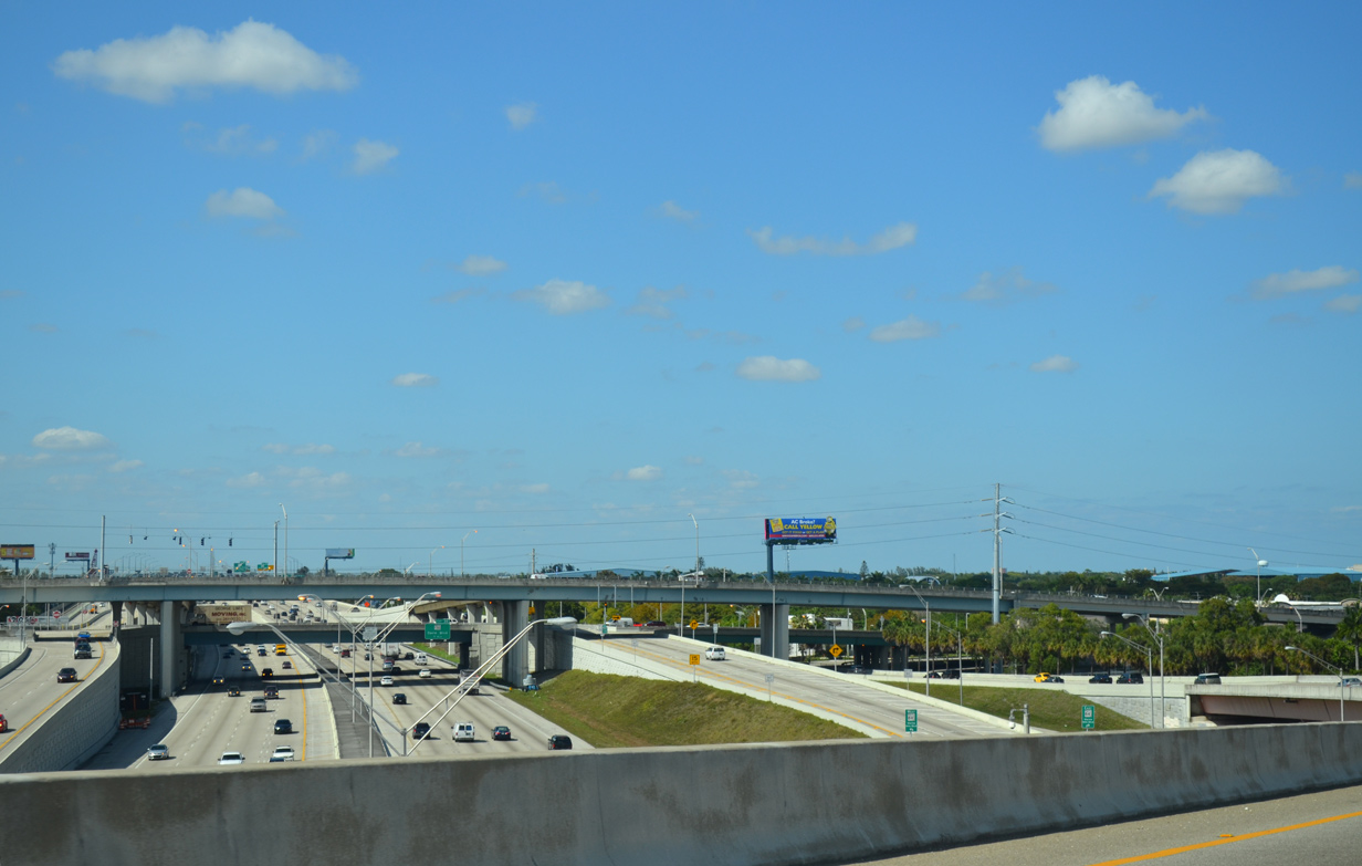
New toll lanes were added to Interstate 95 in Miami as part of the 95 Express Lanes project. These high occupancy toll (HOT) lanes allow registered carpools with three or more passengers to use the lanes free of charge; tolls will be charged for other users with a SunPass transponder. Phase 1A converted I-95 northbound with two toll lanes and four general purpose lanes separated by short orange poles between downtown Miami and the Golden Glades interchange (SR 826/Palmetto Expressway and Florida’s Turnpike); work was completed between February and December 2008. Phase 1B restriped I-95 southbound with two HOT lanes on the same stretch between Summer 2008 and January 2010. Phase 2 of the Express Lanes project, underway from November 2011 to April 2015, extended the HOT lanes northward to Broward Boulevard (SR 842) in Fort Lauderdale.27
South Carolina
Interstate 95 through the Palmetto State is mostly a four-lane freeway. One exception is the stretch between Interstate 20 and S.C. 327. The South Carolina Department of Transportation (SCDOT) reconstructed and widened Interstate 95 at Florence, expanding the freeway to six lanes of concrete separated by a barrier median. The project replaced or rehabilitated five spans over the freeway and improved several interchange ramps at U.S. 52. (Exit 164). Additionally the Interstate 95 bridges over an abandoned railroad north of U.S. 52 were removed and replaced with fill material. Construction began July of 2002 and was complete by August 31, 2004.1 The total cost of the project was $65 million.5
While the state of North Carolina has considered implementing tolls to help cover the costs associated with Interstate 95 reconstruction and widening, South Carolina initially had not, but later reconsidered adding them. Even with 34,500 vpd at the North Carolina line and 42,700 vpd at the Georgia state line, there remained no immediate plans to overhaul or widen the rest of Interstate 95 in South Carolina as of 2003.8
The South Carolina General Assembly voted to fund SCDOT $453 million in federal COVID-19 relief in March 2022. One of the projects to receive funding is the expansion of 33 miles along Interstate 95 from the Georgia state line northward. This project was deemed a high priority in 2018.35
Tolls on Interstate 95 in North Carolina
Interstate 95 through North Carolina was constructed between 1956 (as bypasses for U.S. 301) and 1980.11 The freeway remains with just four lanes statewide and traffic congestion is a growing concern.
An idea first discussed in 2001, tolling Interstate 95 in North Carolina to help pay for its improvement again arose in Fall 2003. In October 2003, state officials sought federal permission to implement a toll system on Interstate 95 to help cover a $3 billion price tag to overhaul the route. A consultant indicated to state officials that installing toll barriers at 30 mile intervals along the 182 stretch of highway at $3 a car would cover an expansion of Interstate 95 from four to eight lanes statewide. This would result in $2.4 billion in funds generated in a 30 year time frame. Governor Mike Easley in 2003 indicated that he did not support the idea of tolling Interstate 9512, and the tolling concept eventually fizzled.
Major construction eventually got underway in January 2020 on expansion of 16 miles along Interstate 95 between Exit 55 / Murphy Road and Exit 71 near Dunn. This first of several projects expanding Interstate 95 to six or eight lanes, with subsequent work underway from Exit 71 north to I-40 at Exit 81. Additional work widens I-95 south of Fayetteville at Lumberton.
Washington, D.C. Metropolitan Area
Two major construction projects along Interstate 95 in the Washington D.C. metropolitan area modernized the highway. The first of these projects upgraded the Springfield Interchange, the exchange between I-95, I-395 and I-495 in Northern Virginia. This $676 million project also upgrading I-95 south to Franconia and the interchanges with SSR 644, Old Keene Mill Road, and Franconia Road. Work ran between March 1999 and April 21, 2007.2
The Springfield Interchange Project phases:2
- I – Completed in August of 1996 was the addition of a fourth southbound lane to Interstate 95 between Springfield and Newington. Construction of an Exit 169 ramp of Interstate 95 north to Spring Mall Drive, coincides with the completion Franconia-Springfield Metro Center. The facility opened June 1998.
- II & III – Between March 1999 and November 2001, construction resulted in the rebuilding of the Interstate 95/SSR 644 interchange. A high rise overpass for Franconia Road between Interstate 95 to east of Frontier Drive was also built.
- IV – Road work that began November of 2000 constructed a direct bridge between the Capital Beltway west to Interstate 95 south and relocated the travel lanes of Interstate 495 eastbound through the same interchange. These aspects of the overall project were completed in late 2004.
- V – Work entails improvements to the Hemming Avenue junction with Interstate 495 and the ramp from Interstate 395 south to Interstate 495 west. Work began September 2001 and was completed by late 2003.
- VI & VII – Completion of the Interstate 95 northbound roadway alterations, including remaining local and through traffic ramps and HOV lanes. The Commonwealth Transportation Board awarded a $100 million contract for this phase on September 17, 2003.6 The project was completed in July 2007.
- VIII – HOV connections between Interstate 95 and 495. While the right-of-way was already acquired, VDOT removed this from the Springfield Interchange project and included it with the Capital Beltway Project. The work was completed on November 17, 2012 as part of the I-495 Express Lanes project.
A short distance to the east of the Springfield Interchange is the Woodrow Wilson Bridge spanning the Potomac River. The original Woodrow Wilson Bridge opened to traffic on December 28, 1961 with just four lanes and a capacity of 75,000 vpd. After just eight years, the crossing reached capacity. The growth of the area and increase in through-traffic resulted in chronic congestion and traffic counts up to 200,000 vpd.3 Based upon this increasing demand, improvements were considered from the 1980s onward, with prior expansion of the bridge to six overall lanes.
Construction on a replacement span for the Woodrow Wilson Bridge kicked off in 1999. Building of 17 pier supports for the bridge started May 2001 and was completed in July 2003. This $125 million project followed a $15 million dredging project completed February 2001. For the draw span, $186 million of work commenced in February 2003 on the twin bridges (Inner and Outer Loops). On the Maryland side, construction of the $191 million element of the project began June of 2003.4
The first span (serving the outer loop) opened to traffic on June 10, 2006; the second span (serving the inner loop) opened on May 15, 2008. Remaining construction of the bridge and approaches continued through 2009, with the Telegraph Road interchange redesign completed by early 2013.
The new Woodrow Wilson Bridge rises 20 feet higher than its predecessor. The 70-foot draw bridge results in 70% fewer bridge openings than the 1961-span, bringing the total traffic interruptions down from a previous 260 per year to 65 per year. The new bridge increased the Capital Beltway capacity from six to ten lanes across the Potomac River utilizing an Through/Local lane configuration. Further expansion utilizing the wide shoulders may be implemented with the possibility of HOV/Express Bus lanes or rail transit lines on the facility.3
Also a part of the Woodrow Wilson Bridge project was the improvement to Interstate 95 west and east of the Potomac and its surrounding interchanges. The exchange between Interstate 295 and the MD 210 connector was upgraded into a high-speed interchange. New overpasses for I-295/MD 210 were constructed and the “S-curve” ramps between the two routes were replaced with longer bridges to compensate for the wider beltway mainline. These projects began December 2001 and were complete by early 2004. $52 million in funding was involved.
Additional work at Interstate 295 and MD 210 was the creation of access ramps from the Outer Loop to/from the National Harbor development. This coincided with the widening of the Outer Loop roadway to accommodate the new bridge and interim alignment shifts related to construction. Costing $45 million, the project involved the creation of 11 new bridges and six retaining walls. Road work ran from December 2002 to mid 2006.
U.S. 1 interchange work added a new Washington Street overpass and beltway improvements in preparation for the new bridge to the east. Over $130 million in funds were allocated for this segment of the project. Another element to the overall work was the $1.5 million Intelligent Transportation Systems (ITS) contract. Began November 2002, this saw the installation of Variable Message Signs (VMS) throughout the project area to late 2003.4
South from Springfield, another project completed along Interstate 95 was the installation of HOT lanes. As part of Virginia’s Public-Private Transportation Act, the $1 billion project affected 29.4 miles of Interstate 95, from Garrisonville Road north to Duke Street in Alexandria. This included changes the existing reversible HOV-3 roadway from south of Exit 152 (SR 234) to the Springfield Interchange (I-395/495), where tolls were implemented during the process.
Groundbreaking took place on August 7, 201228. Broken into four segments, the portion between Prince William Parkway (SR 294) and Edsall Road (SR 648) (Segments 3 and 4) expanded from two to three lanes. Segment 2 extended the existing HOV roadway southward 0.5 miles beyond Dumfries Road. Segment 1 built two new reversible lanes for 8.3 miles to Garrisonville Road in Stafford County. The lanes opened to traffic on December 14, 2014 with a free trial period until tolling commenced on December 29, 2014. Find more details on the Express Lanes web site.
An earlier plan for HOT lane construction sought to extend the existing reversible HOV roadway southward to milepost 133 in Frederick, with a potential completion by March 2009.10
Maryland
Several increases by the Maryland Transportation Authority upped the rates at the Susquehanna River spans of Interstate 95 and U.S. 40 and the Baltimore Harbor crossings of I-95, I-695, and I-895 to generate $100 million a year for highway improvements along the I-95 corridor.9
Construction of the I-95 Express Toll Lanes from Baltimore east to MD 43 (White Marsh Boulevard) adds managed lanes to Interstate 95 from I-895 to just north of Exit 67. Work from 2006 to Spring 2015 upgraded the exchange with Interstate 695 into a high speed symmetrical stack interchange, eliminated the left-hand ramp for I-895 south at the wye with I-95 south, and redesigned the exit with White Marsh Boulevard to accommodate HOT lane ramps. Two new lanes were added for each direction of Interstate 95 between the general purpose lanes along this stretch. The I-95 Express Toll Lanes opened to traffic on December 6, 2014, with the first week as a toll free facility.
Connecticut
The $2 billion New Haven Harbor Crossing Corridor Improvement Program rebuilt and redesigned a 7.2 mile section of Interstate 95 between Exits 46 in New Haven and 54 in Branford. Constructed as part of the Connecticut Turnpike and opened to traffic in 1958, the overwhelmed stretch of freeway was expanded and modernized, with work starting in 2009. Included in the project was the replacement of the Q Bridge, a shoulder less six-lane span across the Quinnipiac River. It was replaced by a signature, extradosed bridge accommodating ten overall lanes of traffic. Named the Pearl Harbor Memorial Bridge, the new span opened partially on July 29, 2013, with two-way traffic on the eventual northbound span.
Construction progressed to the weekend of September 26-27, 2015, when southbound travelers along I-95 began using the new Pearl Harbor Memorial Bridge. All five lanes of the southbound span were opened to traffic by May 13, 2016. Work continued on the northbound span to August 22, 2016, when the fifth lane finally opened. The opening culminates a six year project to rebuild the adjacent Mixmaster Interchange with Interstate 91 and Route 34. Work at the junction replaced left side ramps and separated exit points while widening both connecting ramps and the freeway mainline. A milestone was reached at the Mixmaster Interchange on July 16, 2016, when the left side ramp (Exit 48) to Interstate 91 north was shifted to a new right side ramp.32
#letslighthisbridgeup pic.twitter.com/NeHzf4fIQw
— Q-Bridge (@QBridgeProgram) July 4, 2016
Traffic driving the new SB Pearl Harbor Memorial Bridge! pic.twitter.com/iuho4ngay8
— Q-Bridge (@QBridgeProgram) September 27, 2015
A lighting system was implemented along the Pearl Harbor Memorial Bridge, with the first official illumination taking place on Independence Day weekend in 2016.
Massachusetts
The Whittier Bridge/I-95 Improvement Project kicked off in Fall 2013 as part of the $3 billion Accelerated Bridge Program. The four year project replaced the 1951 spans across the Merrimack River with a new tied-arch bridge. The new Whittier Bridge accommodates eight overall lanes of traffic with breakdown lanes in each direction. Additionally a multi use path follows the northbound side of the crossing, linking with nearby trails.33
Associated work replaced overpasses for Interstate 95 and cross roads north from Route 113 to the I-95 Connector at Exit 60.33 All traffic on I-95 shifted onto the future northbound Whittier Bridge on December 4, 2015. This allowed crews to demolish the old spans and begin work on the eventual southbound tied arch bridge. Construction on the project extended through early Fall 2017.
Interstate 95 Northerly Extension
A grass roots organization in northern Maine advocated a northerly extension for the East Coast’s Main Street. During Summer of 2003, the group LEAD (Leaders Encouraging Aroostook Development) met with Maine Governor John E. Baldacci, members of the state legislature, and department of transportation Commissioner David Cole to discuss the freeway extension and other related issues. LEAD members strongly supported the idea, citing the economic vitality of Aroostook County as a major factor.7
North End –  / Canadian International Border – Houlton, Maine
![]() North at
North at ![]()

The final northbound Interstate 95 confirming marker stands along the three mile stretch between U.S. 1 and U.S. 2 at Houlton. The speed limit is 65 miles per hour here. Photo by Peter Johnson (09/27/19).

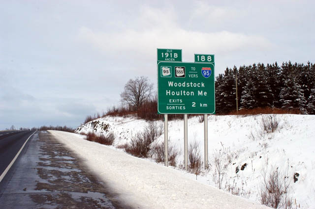
Beyond the final interchange northbound between Houlton and the International Border in Aroostook County, Maine, I-95 transitions into New Brunswick Route 95. Route 95 extends the freeway east to the Woodstock bypass of the Trans Canada Highway (Route 2). Photo by Peter Johnson (09/27/19).

U.S. 2 ties into Exit 305 north of Airport Road and Houlton International Airport (HUL) in two miles. The speed limit lowers to 40 miles per hour on the approach. Photo by Peter Johnson (09/27/19).

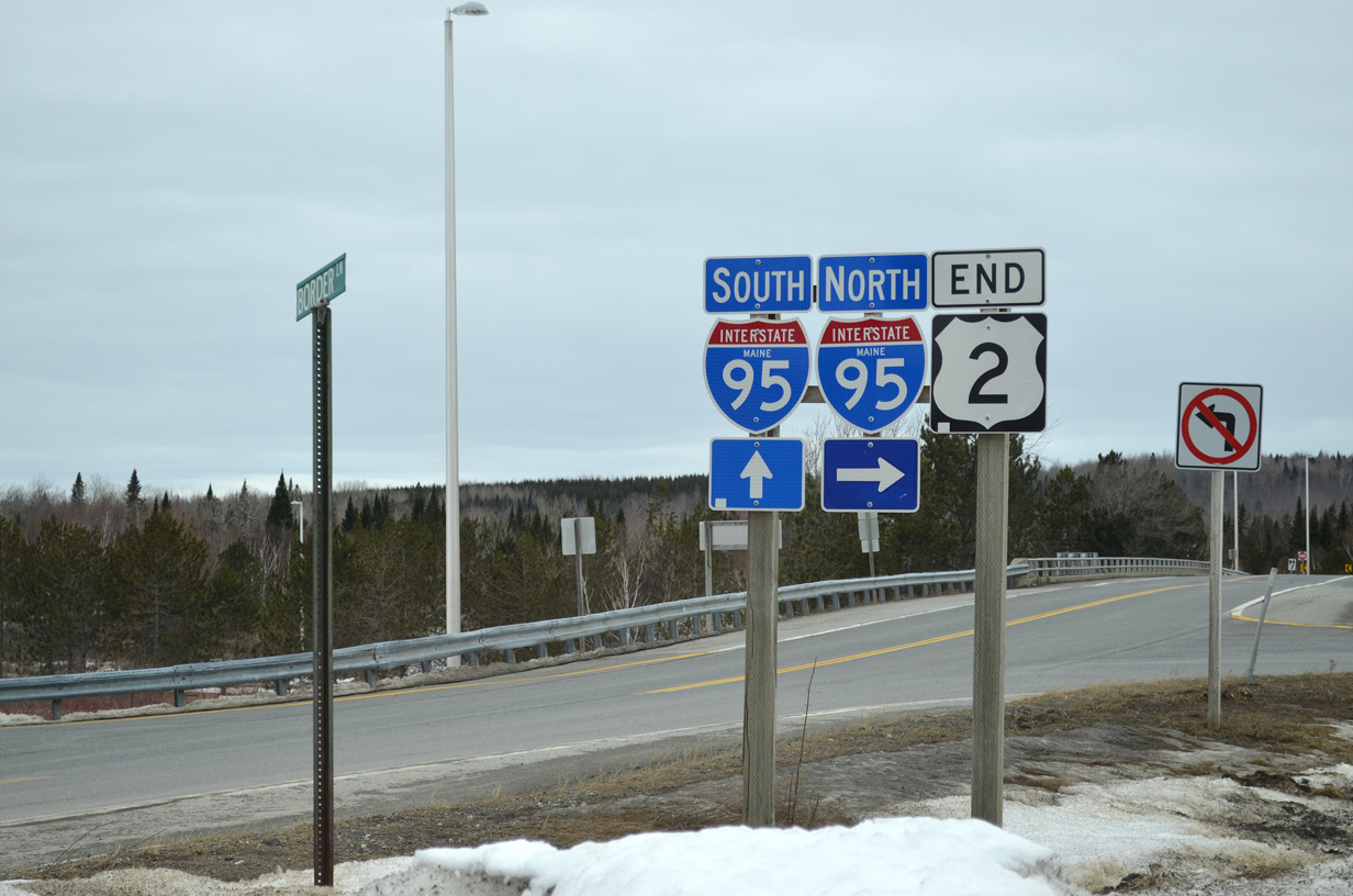
There is no U-turn ramp at the north end of I-95 at the Canada port of entry like there are at southern border crossings into Mexico. Instead the trumpet interchange (Exit 305) with U.S. 2 represents the final departure point for motorists on I-95 north. Photo by Peter Johnson (09/27/19).

Exit 305 departs I-95 northbound for the east end of U.S. 2 and Airport Road. U.S. 2 follows Military Street 2.5 miles west from Airport Road nearby into Downtown Houlton while Airport Road leads south to Houlton International Airport (HUL) and its Industrial Park. Photo by Peter Johnson (09/27/19).
The speed limit reduces to 25 miles per hour beyond the gore point for Exit 305. Photo by Peter Johnson (09/27/19).


An end shield for Interstate 95 appears just east of the U.S. 2 entrance ramp at the Canadian border. Motorists crossing the international border along I-95 north to Route 95 east also enter Atlantic Time Zone. Photos by Jeff Royston (12/02) and Peter Johnson (09/27/19).

New Brunswick Route 95 continues the freeway east nine miles to Woodstock and Route 2 / Trans Canada Highway (TCH). Photo by Peter Johnson (09/27/19).
![]() South at
South at ![]()
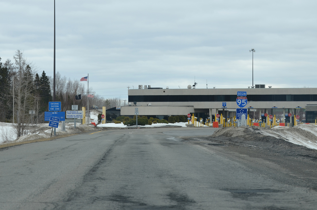
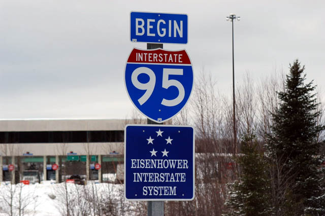
A begin Interstate 95 shield assembly stands at the international border, prior to the port of entry for passage into the United States. Photos by Ian Ligget (04/11/15) and Jeff Royston (12/02).
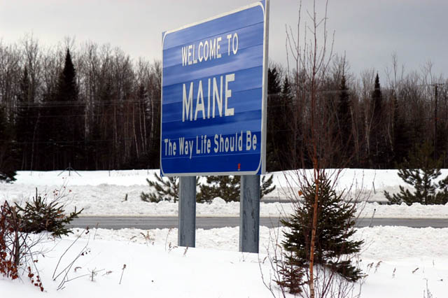
Welcome to Maine sign posted within the trumpet interchange (Exit 305) joining I-95 with U.S. 2. Photo by Jeff Royston (12/02).
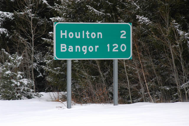
Leading away from New Brunswick, Canada, I-95 encircles Houlton on the 120 mile drive southwest to Bangor. Photo by Jeff Royston (12/02).
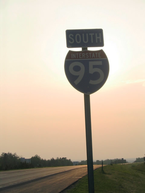
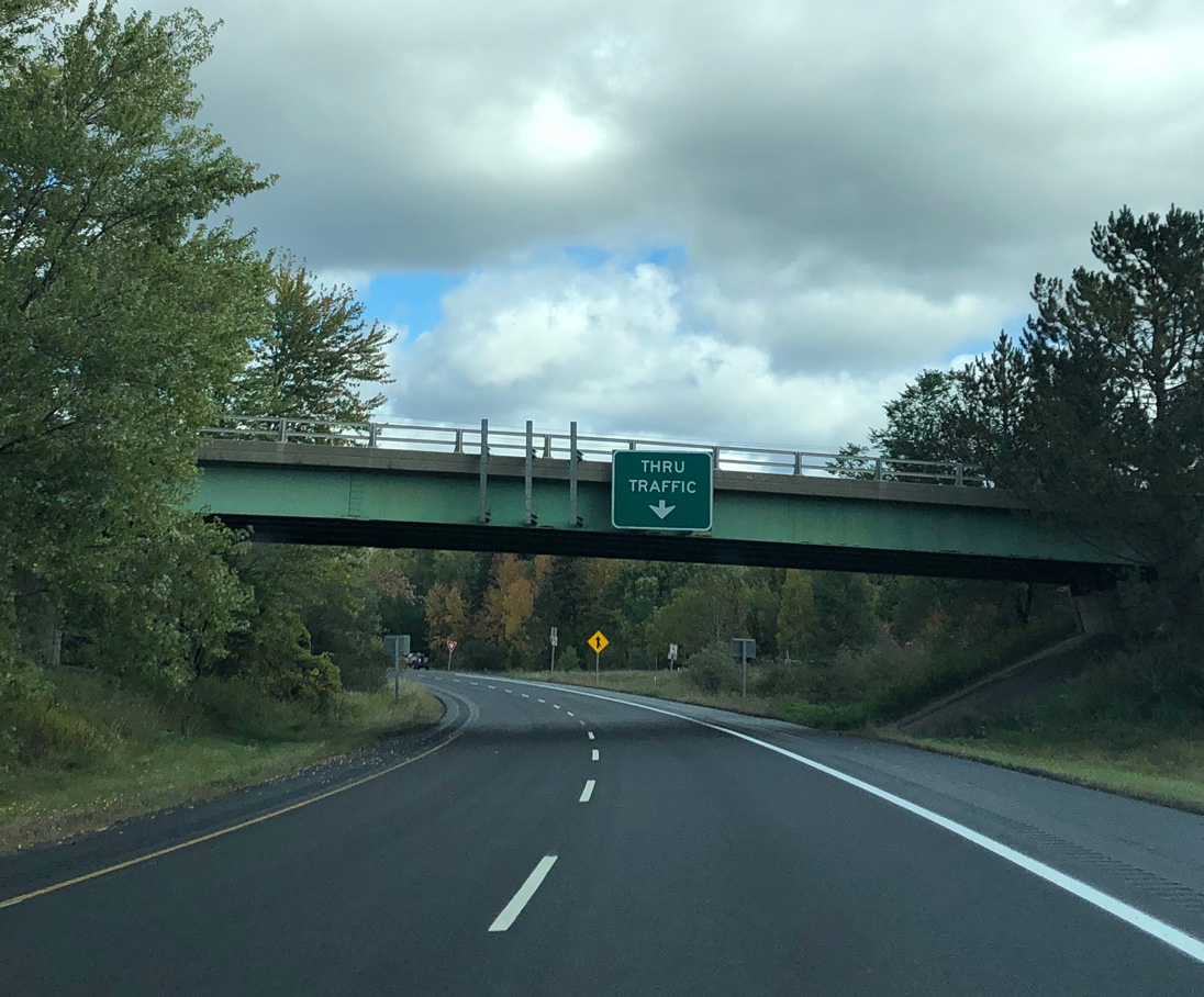
The first of many reassurance shields for Interstate 95 posted southbound from Houlton to Miami. The initial stretch of I-95 leading west from U.S. 2 is the least traveled along the 1,920-mile route. 06/27/05
![]() East at
East at ![]()

U.S. 2 leaves Houlton en route to Houlton International Airport (HUL) and its eastern terminus at Interstate 95. Border Lane, the original alignment of U.S. 2 prior to the construction of I-95, spurs east to dead end at the International line. Photos by Ian Ligget (04/11/15) and Peter Johnson (09/27/19).
Route 2 North at Route 95

New Brunswick Route 2 (Trans Canada Highway) west reaches the trumpet interchange (Exit 188) with Route 95 west to Interstate 95 at Houlton, Maine in Woodstock, New Brunswick. Route 95 was upgraded to a full freeway in 2007, with an interchange added at Route 540 / Richmond Corner. Photos by Jeff Royston (12/02).
South End – Miami, Florida
![]() South at
South at ![]() Dixie Highway
Dixie Highway
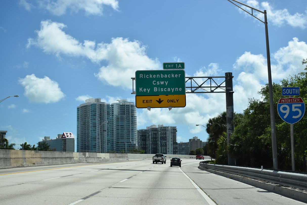
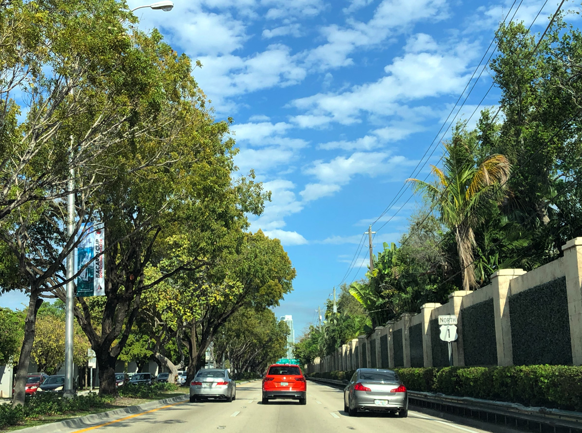
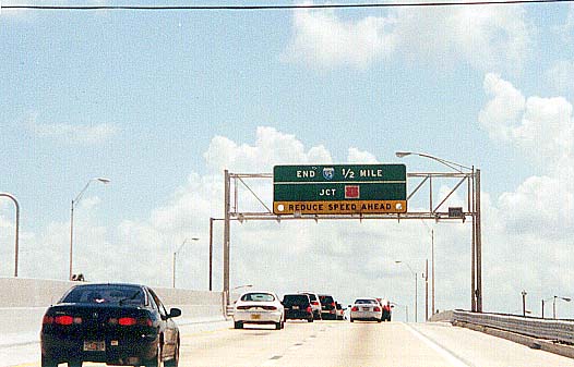
The final reassurance marker appears as Interstate 95 curves southwest at SW 19th Road to parallel SW 1st Avenue and a Metrorail. Exit 1A departs last for Rickenbacker Causeway (SR 913), a toll road east to Key Biscayne. 03/21/20
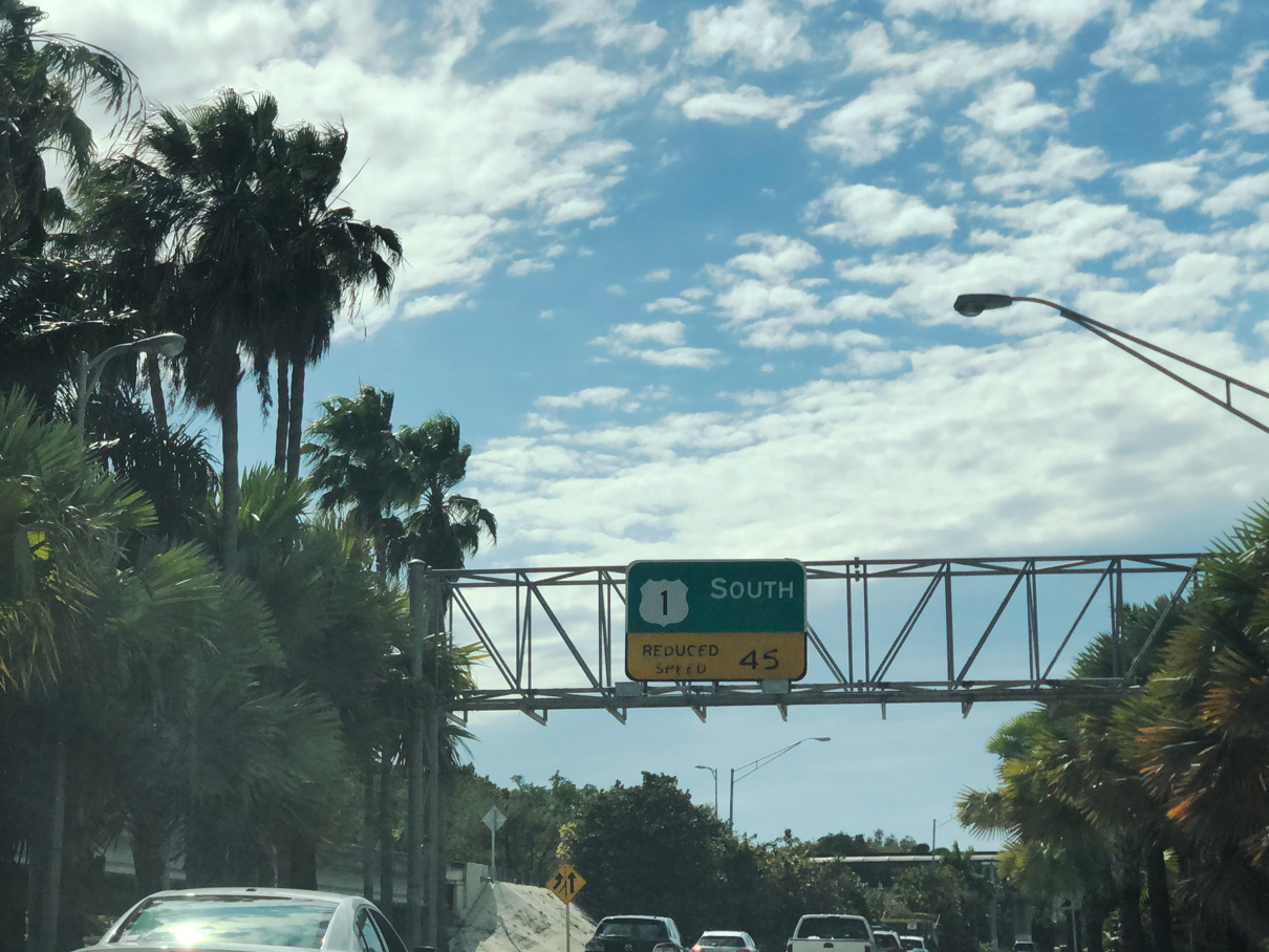
U.S. 1 was removed from Brickell Avenue east of Interstate 95 south between Downtown Miami and the freeway end in Winter 2014. Two lanes continue beyond Exit 1A directly to a wye interchange U.S. 1 along Dixie Highway south to Coral Gables. 03/21/20
Traffic slows as the freeway merges onto Dixie Highway from the south end of Interstate 95. U.S. 1 angles southwest through the Coconut Grove neighborhood of Miami to Coral Gables, South Miami and Pinecrest. Photo by Peter Johnson (02/27/20).
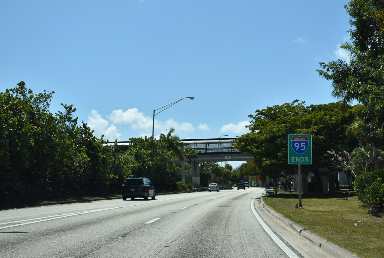
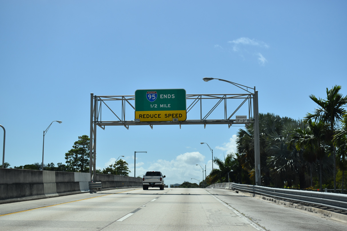
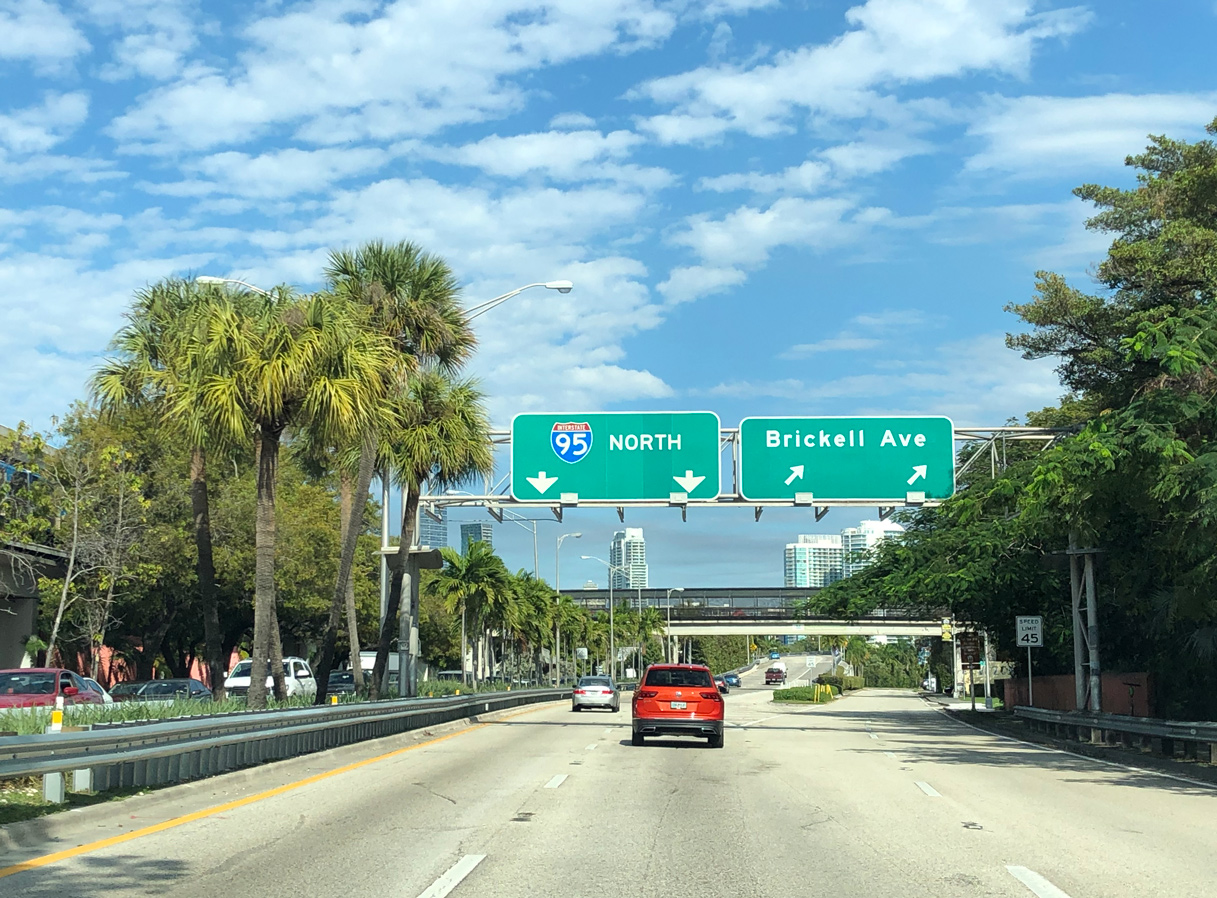
Interstate 95 ends sign posted at the merge with Brickell Avenue (former U.S. 1). U.S. 1 extends another 157 miles southward to Key West. 03/21/20
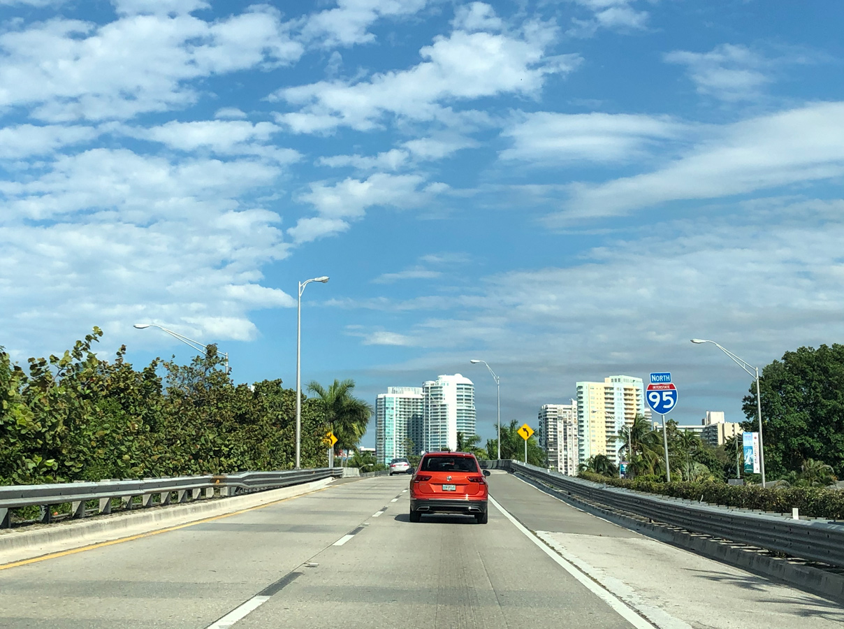
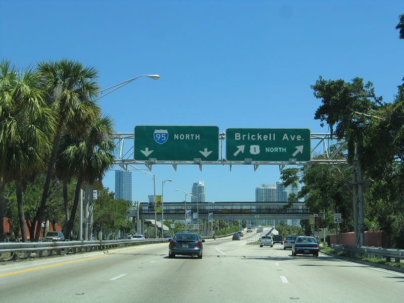
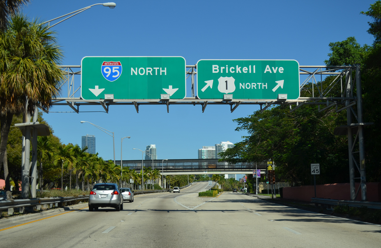
![]() North at
North at ![]()
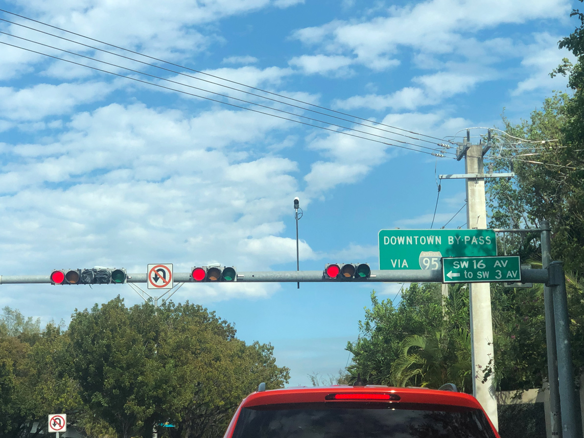
An older sign references Interstate 95 as the Downtown Bypass for U.S. 1. U.S. 1 followed Brickell Avenue along the west shore of Biscayne Bay toward Downtown until January 2014, when maintenance of Brickell was transferred from FDOT to the city of Miami. Bypassing the previous alignment, U.S. 1 overlaps with I-95 north to the Downtown Distributor (Exit 2A) east. Photo by Peter Johnson (02/27/20).
Interstate 95/U.S. 1 separate from Brickell Avenue (old U.S. 1) at a wye interchange. The freeway commences with two lanes initially to the entrance ramp from Rickenbacker Causeway (SR 913). Photo by Peter Johnson (02/27/20).
Eventual sign changes made here removed U.S. 1 from Brickell Avenue without adding it to the I-95 overhead. Photo by Peter Johnson (02/27/20).
![]() North
North
The first northbound shield assembly for Interstate 95 appears within the wye interchange at Brickell Avenue. Photo by Peter Johnson (02/27/20).

The Downtown Miami skyline comes into view on Interstate 95 north, one mile ahead U.S. 41 (Exit 1B). U.S. 41 ends to the east at Brickell Avenue (old U.S. 1) just south of Downtown. 03/04/14
South End Throwback
One half mile from the end of I-95 south. Previous overheads displayed U.S. 1 with a white on red shield, a remnant of Florida’s colored scheme for U.S. Highways. Photo by Gene Janczynskyi (08/00).
Another red U.S. 1 shield remained in service at the wye interchange joining I-95 south with U.S. 1 (Brickell Avenue) south until 2001. Photo by Gene Janczynskyi (08/00).
Older guide signs for the former split of Interstate 95 and U.S. 1 at Brickell Avenue were carbon copied after 2006. 03/26/06, 03/04/14
Sources:
- I-95 Widening.
http://www.dot.state.sc.us/Projects/I-95/default.htmlSouth Carolina Department of Transportation (SCDOT) web site. - “Springfield Interchange Improvement Project – Fact Sheet.” VDOT.
- The Woodrow Wilson Bridge Project.
http://www.wilsonbridge.com/Virginia Department of Transportation (VDOT) web site. - “Project Overview – Woodrow Wilson Project.” VDOT web site.
- Metts, Mitchell (SCDOT)
- Kozel, Scott. “Springfield Interchange Improvement Project – Final Phase to Begin.” Online posting, misc.transport.road, September 23, 2003.
- “LEAD to receive update on I-95 extension.” Bangor Daily News (ME), September 16, 2003.
- “Despite wear, state says I-95 toll not in works.” The Herald, South Carolina October 26, 2003.
- “Higher tolls get initial OK.” The Baltimore Sun (MD), September 30, 2003.
- “HOT plans for 95” The Free Lance-Star (Fredericksburg, VA) October 11, 2003.
- “Support for I-95 tolls in N.C. should increase.” Raleigh News & Observer (NC),November 6, 2003.
- “Easley, Tippett: Agree To Disagree?” WRAL-TV Raleigh (NC), November 18, 2003.
- Jason (gps_man2003). “Re: I-95 section from Ft Pierce to PGA BLVD,” Online posting, Yahoo! Groups FL Roads, November 13, 2003.
- Kozel, Scott. “Re: [seroads] VDOT criticizes I81 plans.” Online posting, Yahoo! Groups Southeast Roads and Transport , November 18, 2003.
- “Interstate I-95 Redesignation & Re-numbering Information,”
http://www.state.me.us/mdot/maines-transportation-systems/I-95-redesignation.phpMaine Department of Transportation. - Divided Highways: Building the Interstate Highways, Transforming American Life in 1997 by Tom Lewis, Viking Penguin/Penguin Books, page 197.
- Florida’s Turnpike: About Us – official site
- Kozel, Scott: “Re: Exit Letters,” Online posting to Misc.Transport.Road newsgroup, 12/12/04; see also Mr. Kozel’s outstanding Roads to the Future: Interstate 295 and Richmond-Petersburg Turnpike page
- John F. Kennedy Memorial Highway fact sheet.
http://www.mdta.state.md.us/mdta/Documents/jfk.pdf#search=’john%20f%20kennedy%20highwayMDTA web site. - New Jersey Turnpike Fact Book.
http://www.state.nj.us/turnpike/tpbook.pdfNew Jersey Turnpike web site. - Connecticut Turnpike (I-95). NYCRoads.com (Steve Anderson),
- Blue Star (New Hampshire) Turnpike – official site
- About the Maine Turnpike. official site.
- Florida’s Interstates: A Half-Century of Progress
http://www.fl-interstate.com(official Florida Department of Transportation site) - Celebrating the 50th Anniversary of the Eisenhower Interstate Highway System: Previous Interstate Facts of the Day by the Federal Highway Administration (FHWA).
- Maine’s Interstate System: An Investment in Safety, Mobility, and Prosperity<.
http://www.state.me.us/mdot/interstate/index.phpMaine Department of Transportation. - 95 Express Managed Toll Lanes in Miami Dade & Broward Counties (web site).
- “I-95 Express Lanes construction begins this week.” The Washington Post (DC), August 8, 2012.
- PA Turnpike / I-95 Interchange Project – Overview.
- “Completion near for interstate road systems,” Rome News-Tribune, November 14, 1977.
- “Blacktop And Greenbacks: I-95 Turns 25,” State, The (Columbia, SC), February 18, 2001.
- “New Haven Interstate 95-91 interchange to head in new direction for first time in 60 years.” New Haven Register (CT), July 10, 2016.
- Whittier Bridge/I-95 Improvement Project fact sheet.
http://www.massdot.state.ma.us/Portals/45/Docs/factSheet_Fall2013.pdfmassDOT, Fall 2013. - “I-95 in Mercer County to be renamed I-295 in early 2018, several exit numbers to change.” PlanetPrinceton, December 21, 2017.
- “Major SC interstates will be – widened with COVID cash.” State, The (Columbia, SC), March 7, 2022.
Page updated May 27, 2022.