Interstate 93
Overview
A New England intra-regional highway, Interstate 93 serves the Boston metropolitan area, northern Massachusetts through Lawrence, the state of New Hampshire, and the Northeast Kingdom of Vermont. The freeway provides a direct connection to Canada in conjunction with Interstate 91 north of St. Johnsbury, Vermont.
Built as part of the Big Dig project, the Thomas P. O’Neill, Jr. Tunnel carries 1.5 miles of Interstate 93 below central Boston. Opened in 2003, the tunnel runs between Kneeland and Causeway Streets, directly linking with the Leonard P. Zakim Bunker Hill Bridge.
Through the White Mountains and Franconia Notch in northern New Hampshire, Interstate 93 transitions into a parkway, with a reduced right-of-way and two or three lane sections. Nine miles long, Franconia Notch Parkway runs between Exit 33 (U.S. 3 north of Lincoln) and Exit 35 (NH 18 near Echo Lake). This exception to Interstate standards allows the freeway to intrude minimally on the sensitive areas of the Notch, including the former Old Man of the Mountain, which collapsed on May 3, 2003. Recreational areas are accessible along this stretch at Exits 34 A, 34 B and 34 C.
The Big Dig
Interstate 93 through Downtown Boston was reconstructed in one of the most expensive and dramatic projects in highway history. Known as “The Big Dig,” this megaproject resulted in the removal of the Fitzgerald Expressway, the elevated “green elephant” through Downtown (though part of the double deck in Charlestown remains). Traffic was relocated to a system of tunnels, as well as a new ten lane (six lanes northbound, four lanes southbound) cable-stayed Leonard P. Zakim Bridge over the Charles River, plus the four lane Leverett Circle Connector bridge. This new span replaced the original six lane double decker bridge.
No ceremonies were held as the last section of new freeway for Interstate 93 opened to traffic. The completion of the southbound lanes through the tunnel system on December 20, 2003 marked the end of the $14.6 billion project. Often controversial, the project was $4 billion over budget, and the source of bitterness among residents and politicians alike. With origins in 1987, the Big Dig even raised concerns of then President Ronald Reagan because of its overwhelming cost. Nonetheless, after years of construction, the two mile system of underground roadways built during the Big Dig resulted in the removal of a city eyesore and traffic nightmare.1
With the removal of the Fitzgerald Expressway, one and a half mile of green space was created within its former footprint. This resulted in eight acres of public park space and additional land made available for new housing, shops and cultural venues. Collectively 7.5 miles long, all in all 16 million cubic yards of dirt were excavated for the new tunnel system.1
Unfortunately, the Big Dig had a lasting legacy. Its underwater tunnels had a tendency to leak and the project managers (Bechtel and Parsons Brinckerhoff) were accused of making decisions that resulted in extraordinary costs for the project. Cost overruns led NBC News to refer to this project repeatedly on its “Fleecing of America” segment. The Boston Globe provides more detailed information on the Big Dig in the “Big Dig Report.”
The White Mountains
The northern portion of Interstate 93 in New Hampshire, from Plymouth to the Vermont state line, travels through the picturesque White Mountains. The section that runs along Franconia Notch Parkway is technically not a part of I-93, as it does not meet full Interstate standards. The parkway design was the result of a compromise between the park service and highway department. Maintained as a limited access highway, side access along the parkway is restricted to interchanges and designated parking areas.
When originally constructed, Franconia Notch Parkway used a separate exit numbering system from the rest of Interstate 93. According to Jeffrey Moss this changed in 2002 when Exits 1, 2 and 3 were renumbered to confirm with the rest of I-93. Aside from brown guide signs and the narrowing of the freeway, the transition to Franconia Notch Parkway along Interstate 93 is nearly invisible to the motoring public, so a separate exit number system made little sense.
 Parallel U.S. Routes
Interstate 93 primarily bypasses communities along U.S. 3 in Massachusetts and New Hampshire. Where the freeway turns westward toward Vermont at Littleton, it briefly parallels U.S. 302. U.S. 2 accompanies the northernmost reaches of the freeway corridor through the town of St. Johnsbury.
History
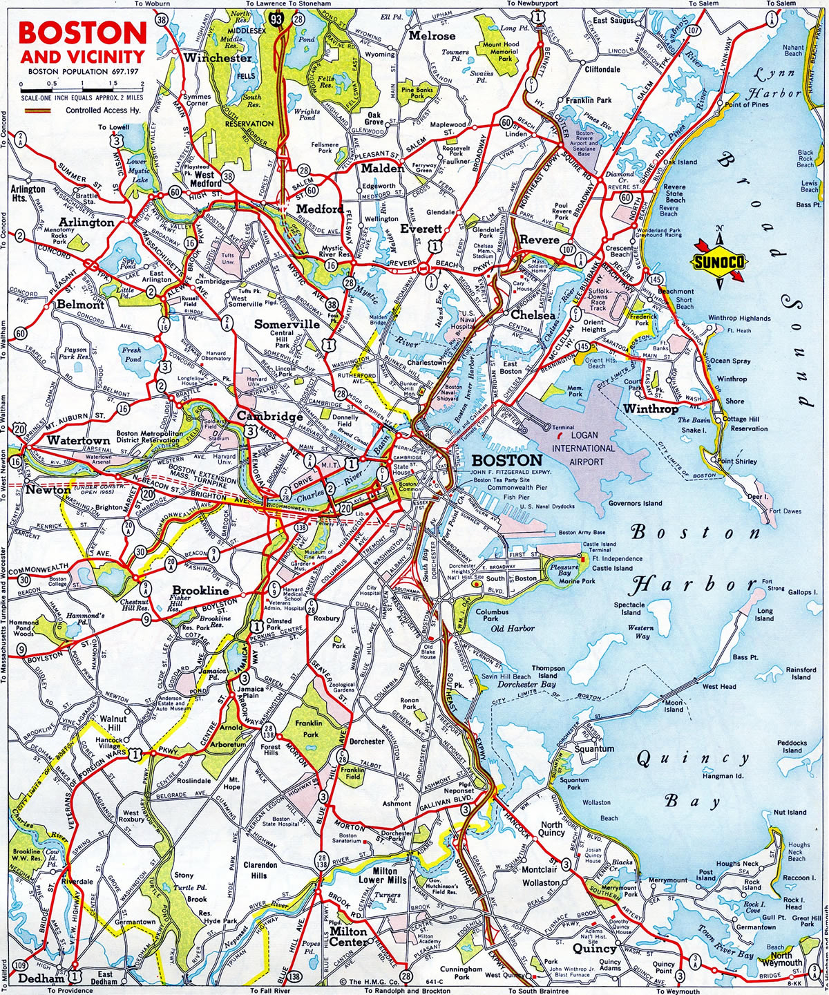
The first portion of Interstate 93 constructed in Massachusetts extended 24 miles north from Medford to the New Hampshire state line. Costing $47 million, work ran from 1956 to 1963. Delays ensued on the three mile link southward to the Northeast Expressway (then Interstate 95) due to the relocation of residents and businesses along the corridor. It eventually opened in 1973, around the same time that plans for I-95 within the Route 128 beltway (Yankee Division Highway) were dropped.5
The Massachusetts Department of Public Works requested a spate of changes to the Interstate Highway system in and around Boston in letters to the Federal Highway Administration (FHWA) sent on August 20 and September 10, 1974. These changes were previously incorporated in the comprehensive transportation proposals for the Greater Boston Region approved by the state on May 23, 1974. The revised route descriptions eliminated Interstate 695, the planned inner loop in Boston, realigned I-95 and extended I-93:
The 6.7 mile segment of State Route 128 from the junction of I-95 in Canton generally easterly to a junction with the Southeast Expressway (State Route 3) in Braintree was added as part of Route I-93 under the provisions of 23 U.S.C. 139(a). The 8.5 mile segment of the Southeast Expressway (State Route 3) northerly from Braintree to the Central Artery in Boston was added as part of I-93 under the provisions of 23 U.S.C. 103(e)(2).
The 36.9 mile segment of State Route 128 from a junction with existing I-95 and State Route 128 in Canton northwesterly, northerly, and easterly via Neeham, Waltham, and Burlington to a junction with existing I-95 in Peabody was added as part of Route I-95 under the provisions of 23 U.S.C. 139(a).
This resulted in an extension of Interstate 93 southward along both the John F. Fitzgerald and Southeast Expressways to Braintree and west along the Yankee Division Highway to I-95 at Canton. The American Association of State Highway and Transportation Officials (AASHTO) endorsed the extension south from the Boston/Somerville city limits to Route 128 in Braintree on June 17, 1975, and the extension west along Route 128 on November 15, 1975.
Route Information
Mileage
Massachusetts – 47.07
- Cities – Boston, Lawrence
Junctions –


New Hampshire – 131.78
- Cities – Manchester, Concord, Franklin, Plymouth, Littleton
Junctions –

Vermont – 11.10
Cities – St. Johnsbury
- Junctions –
Source: December 31, 2021 Interstate Route Log and Finders List
I-93 Annual Average Daily Traffic (AADT)
Source: Traffic Volume Reports 2014-15 AADT NHDOT
Interstate 93 was open from Medford north to the New Hampshire state line in 1963. The route southward was completed to the Northeast Expressway on February 1, 1973.5
Two portions of Interstate 93 were open north of New Hampton, New Hampshire in 1964: a short bypass of U.S. 3 between Plymouth and Campton and the northwestern alignment from U.S. 3 near Franconia Notch to Littleton. The freeway was completed north from New Hampton to Plymouth the following year.
Interstate 93 along the Everett Turnpike, from Manchester north to Concord in New Hampshire, opened to traffic in August 1957.2 Subsequent portions of I-93 through the Granite State opened between Salem and Manchester, and Bow and Tilton, by 1963.3 The route was completed in New Hampshire on June 2, 1988, when Franconia Notch Parkway was dedicated.3
Within Vermont, the 11 mile long stretch of Interstate 93 leading west to St. Johnsberry opened on October 29, 1982 after delays caused by agricultural lawsuits.4 I-93 would have been longer had I-91 been built further west toward Danville as originally envisioned. The planned corridor for Interstate 91 shifted eastward in 1963.
 Photo Guides
North End  – St. Johnsbury, Vermont
![]() North at
North at ![]()
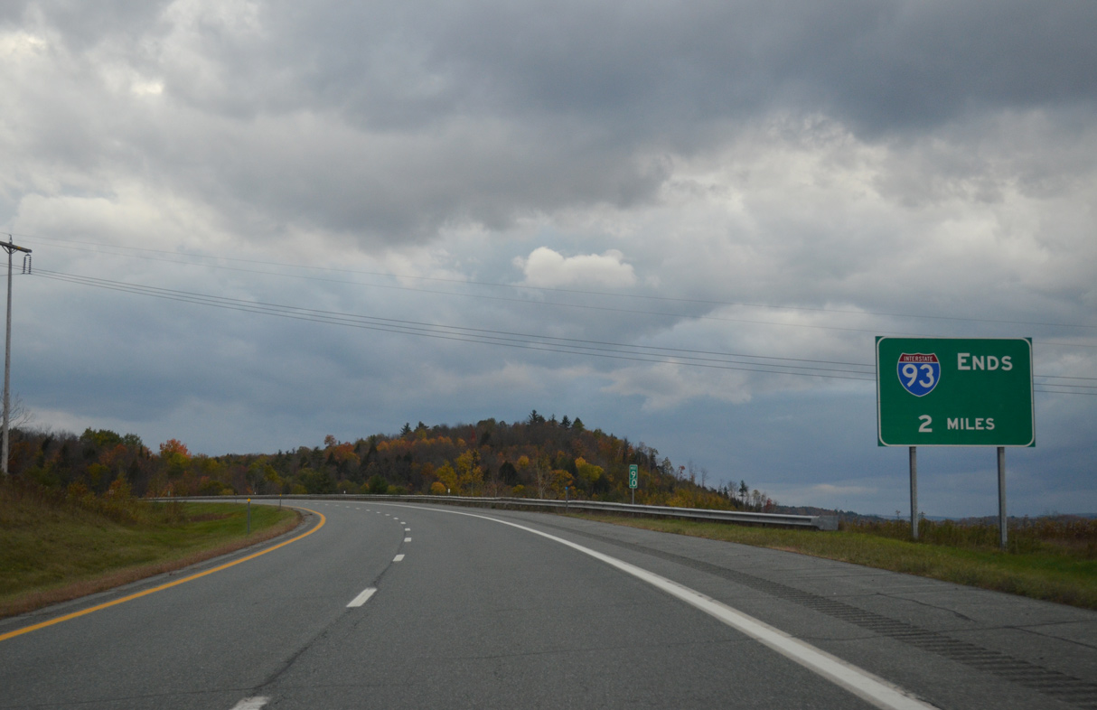
Interstate 93 straddles the northern slopes of Fairbanks Mountain southwest from VT 18. The route concludes two miles to the southwest along the St. Johnsbury and Waterford town line. 10/08/14
A wide forested median separates the roadways of I-93 leading into the directional T interchange with Interstate 93. 10/08/14
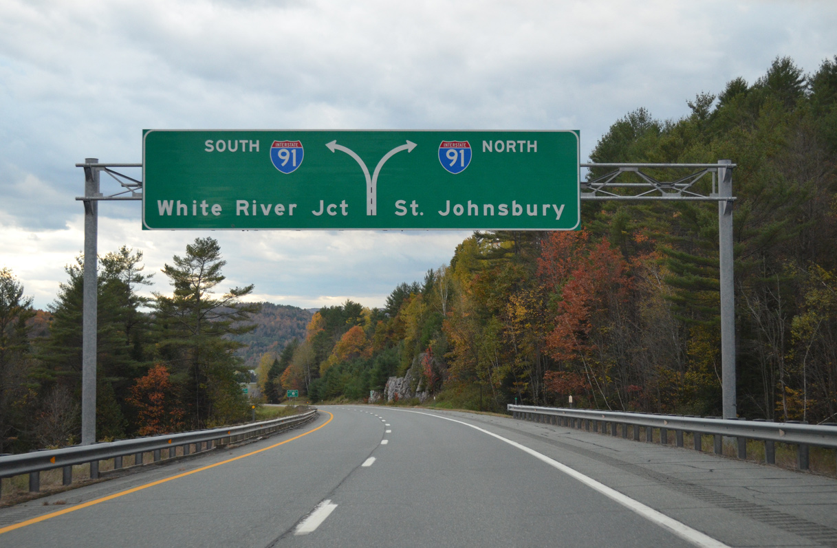
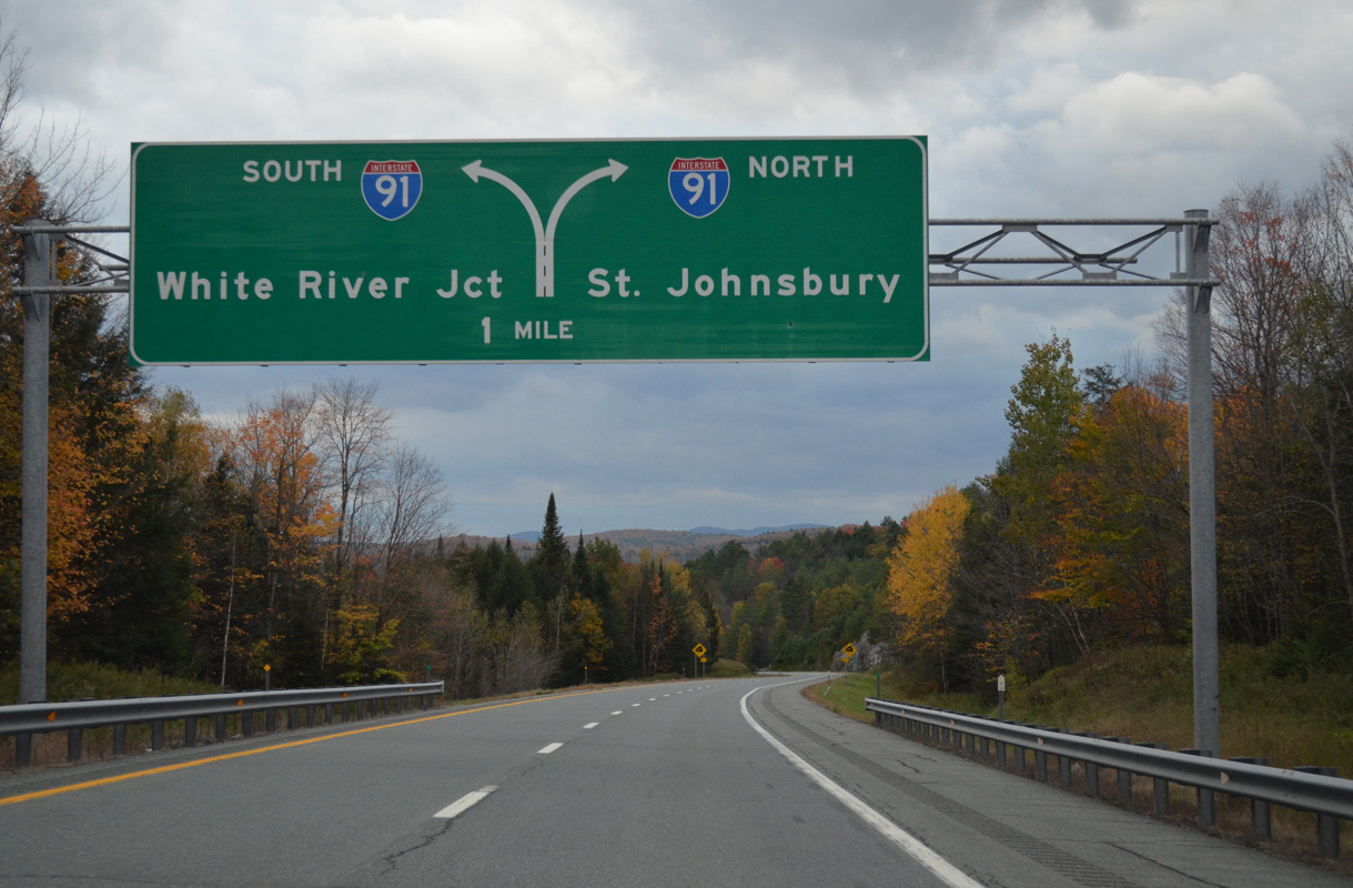
Interstate 91 crosses the Passumpsic River just north of I-93 into the town of St. Johnsberry. The freeway extends 49 miles north to the Canadian border at Derby Line. 10/08/14
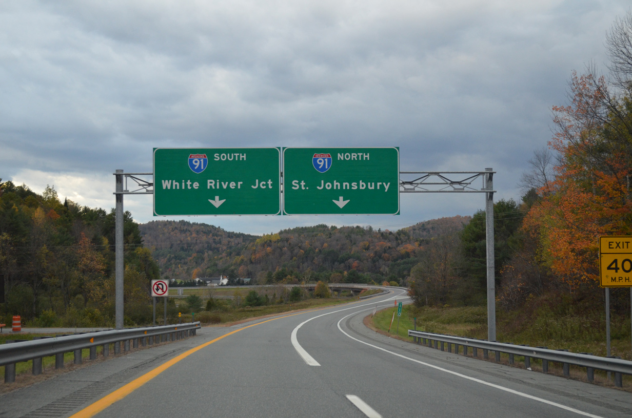
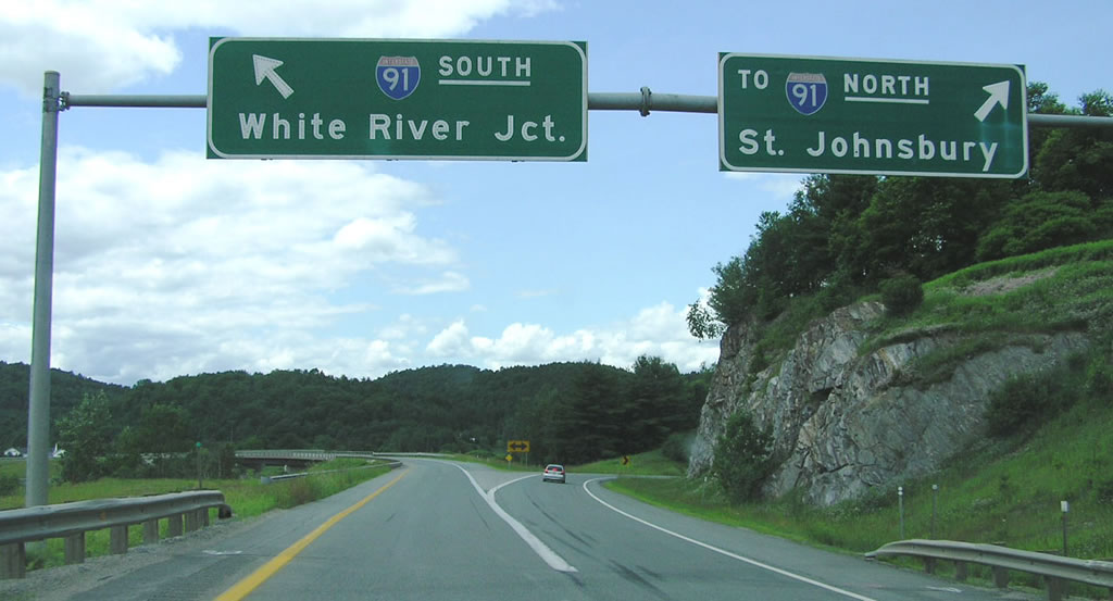
Single lane ramps separate at the north end of Interstate 93. Passing west of Silsby Mountain, I-91 travels south into the town of Barnet, where it converges with the Connecticut River. White River Junction, crossroads of I-89/91, lies 58 miles away. 10/08/14
![]() South at
South at ![]()
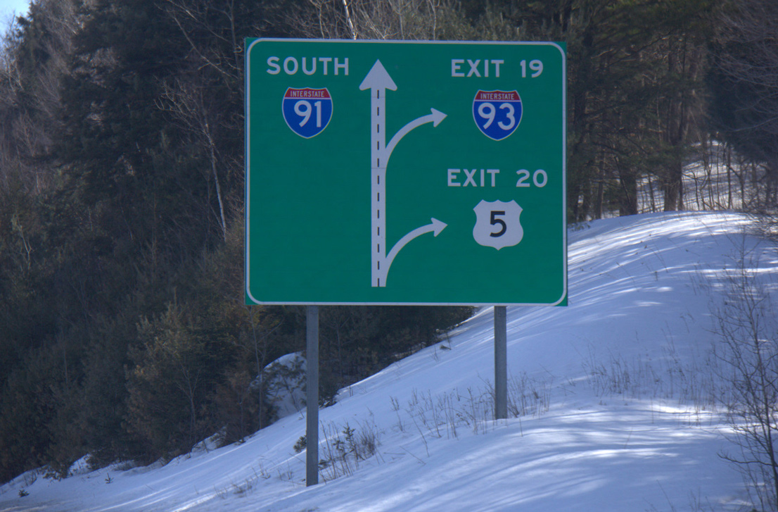
Approaching Interstate 93 south, I-91 runs along the west side of St. Johnsbury between U.S. 2 and U.S. 5. U.S. 2 connects I-93 and St. Johnsbury with Montpelier and I-89 to the west. Photo taken by Shaun Ganley (03/22/15).
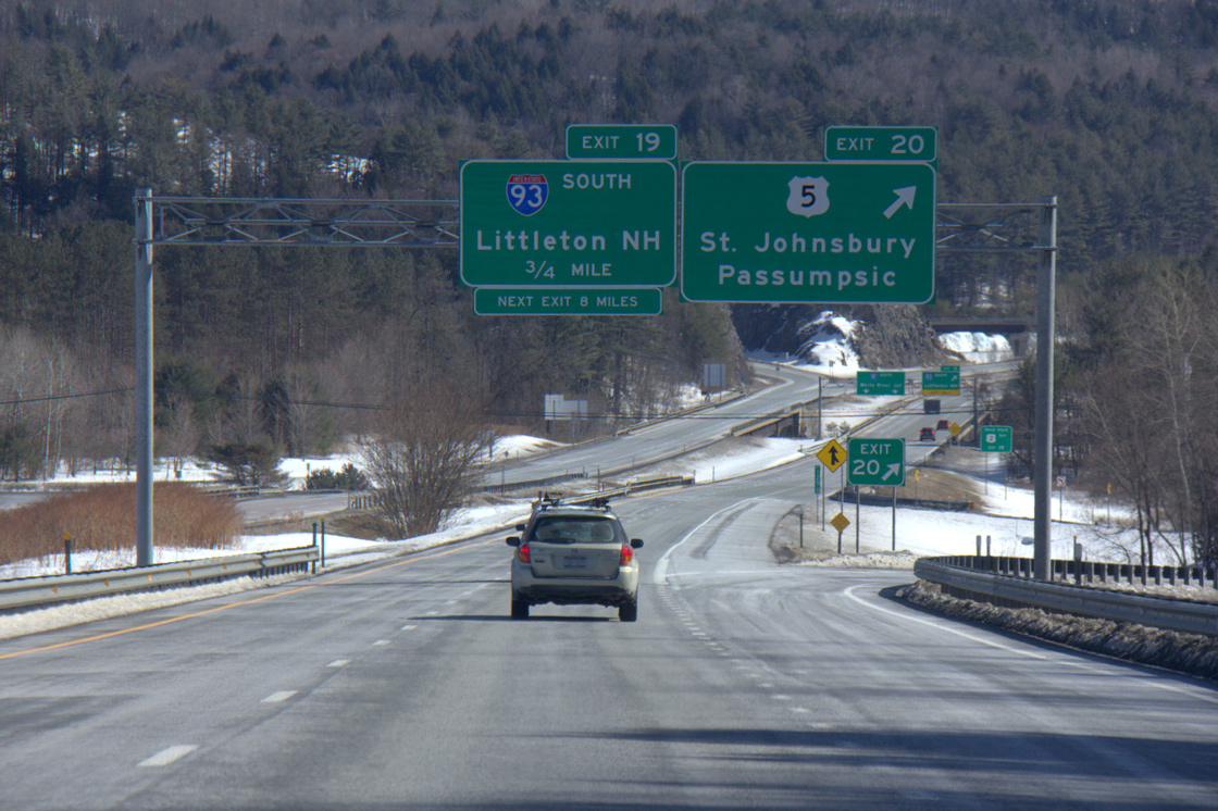
The Passumpsic River separates the exchange (Exit 20) at U.S. 5 from the nearby two-wye interchange (Exit 19) with I-93. Continuing south into the town of Waterford, U.S. 5 shifts to the west of I-91. Photo taken by Shaun Ganley (03/22/15).
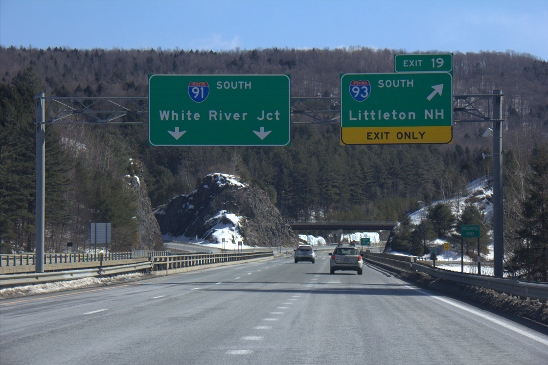
Interstate 93 arcs eastward around Fairbanks Mountain and Stiles Pond from I-91 before turning south across the Connecticut River toward Littleton, New Hampshire. Photo taken by Shaun Ganley (03/22/15).
North End Throwback
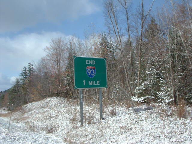
Former end sign for Interstate 93 north. Photo by Chris Jordan/Douglas Kerr (11/02/02).
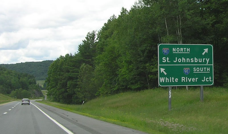
Older sign standards remained in use at Interstate 91 until 2007. Photos by Chris Elbert (07/06).
South End – Canton, Massachusetts
![]()
![]() South at
South at ![]()
I-93/U.S. 1 proceed two miles west from the Ponkapoag Trail overpass in the town of Milton to Exit 1 with Interstate 95. 10/06/14
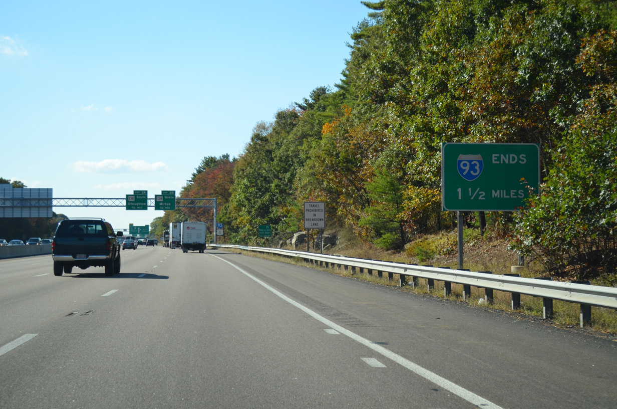
Crossing into the town of Canton, Interstate 93 advances west another 1.5 miles to conclude at a trumpet interchange with I-95. 10/06/14
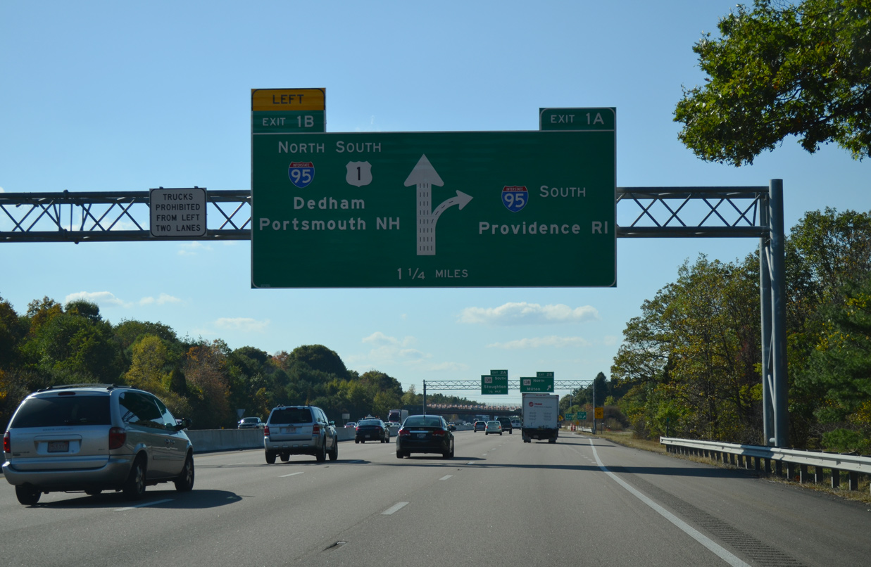
The mainline of I-93/U.S. 1 south defaults onto Interstate 95 north toward Dedham and Newton. U.S. 1 combines with I-95 north 2.6 miles to Boston Providence Highway through Westwood. 10/06/14
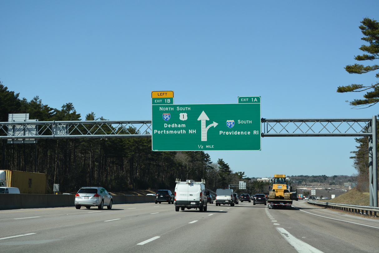
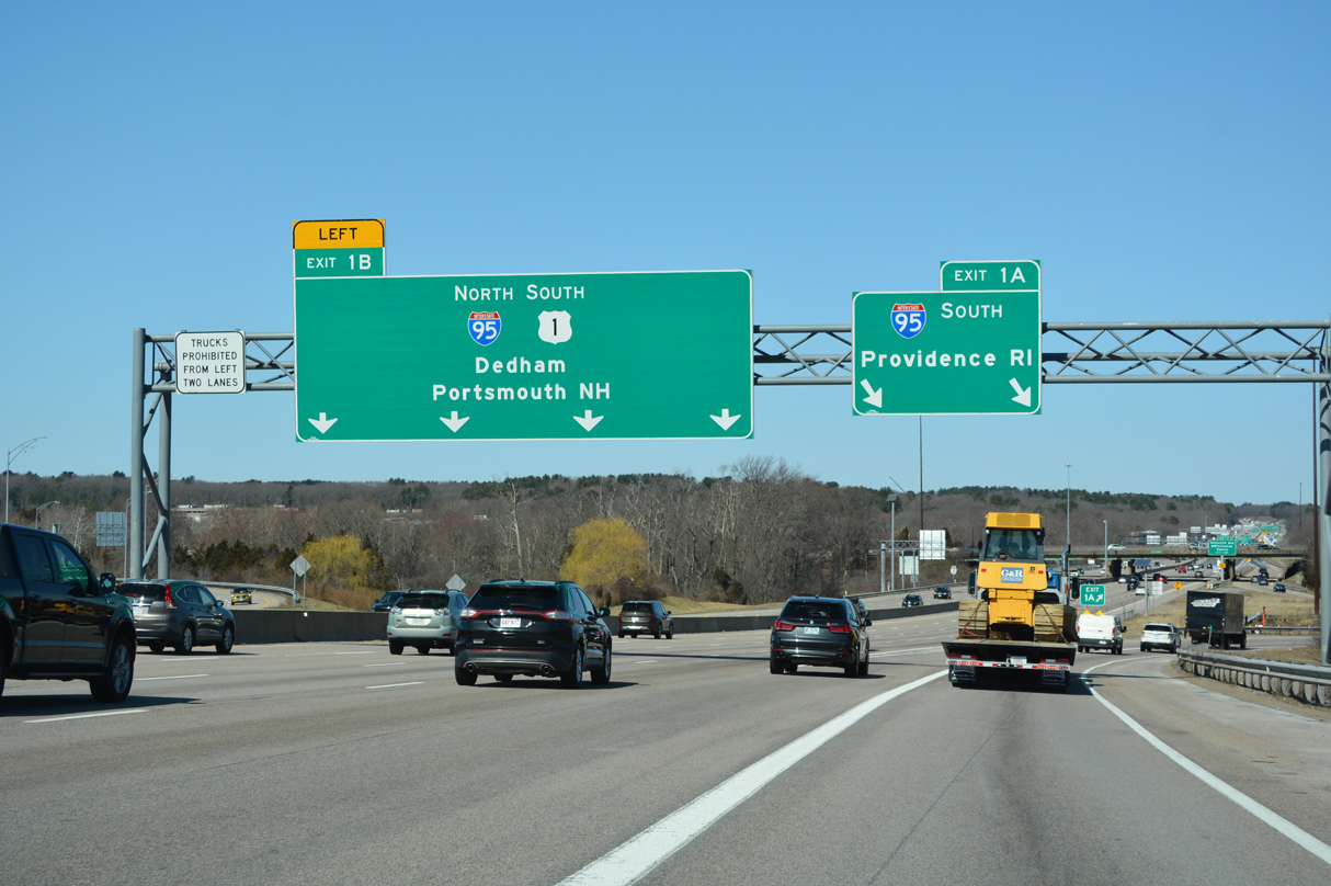
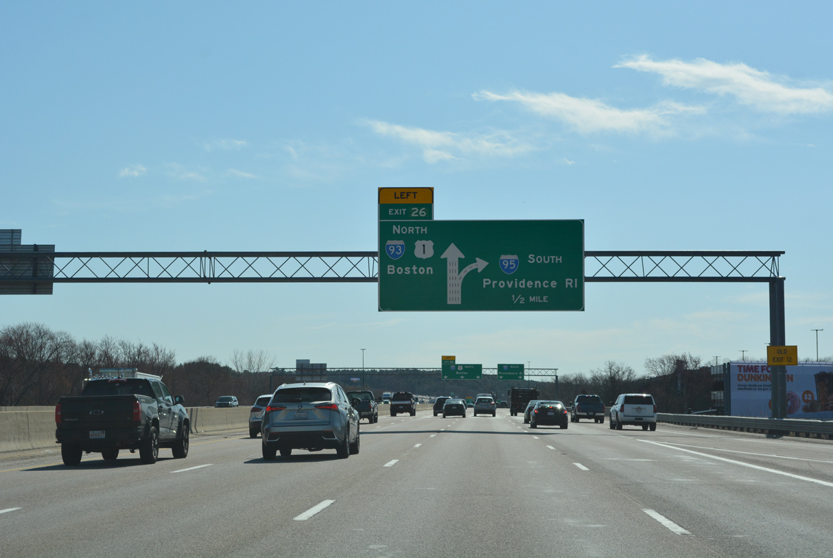
Two lanes separate from I-93/U.S. 1 south for Interstate 95 south toward Providence, Rhode Island in one half mile. 03/27/23
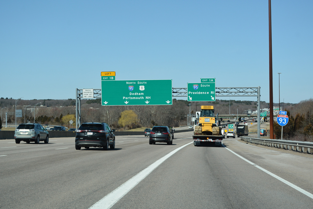
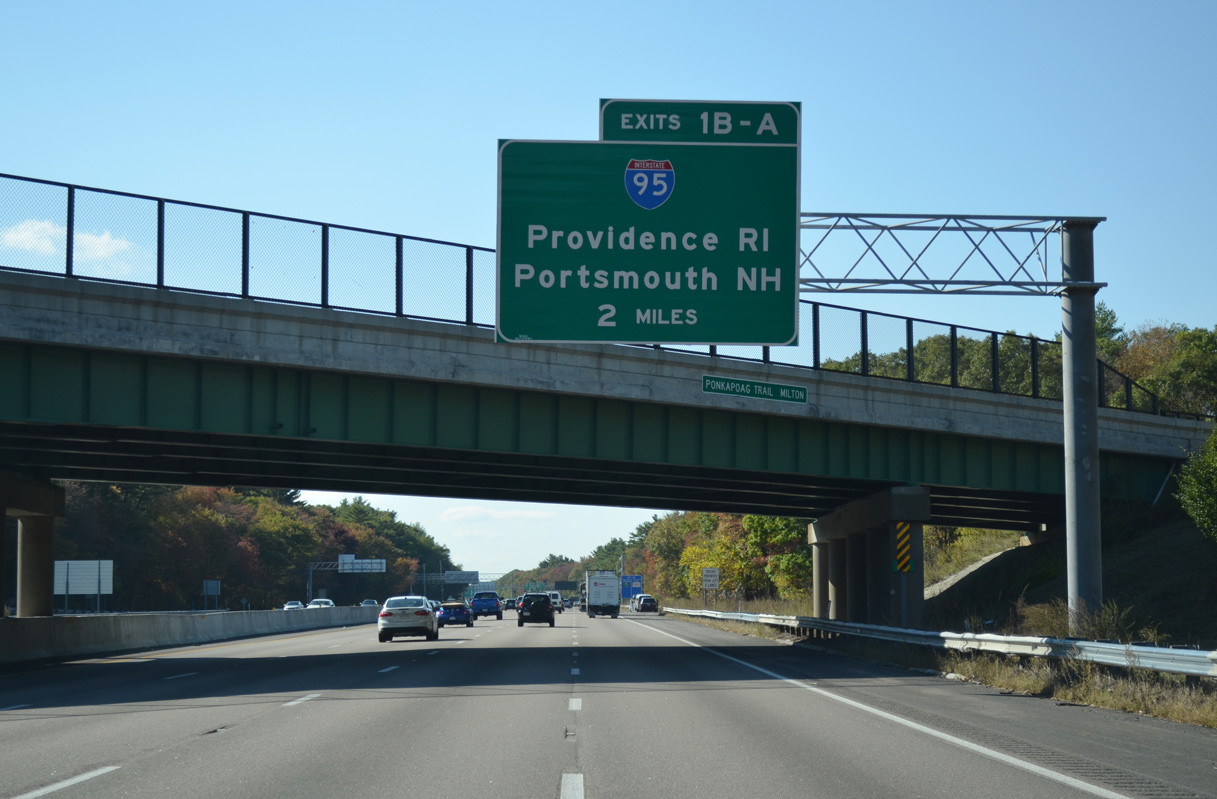
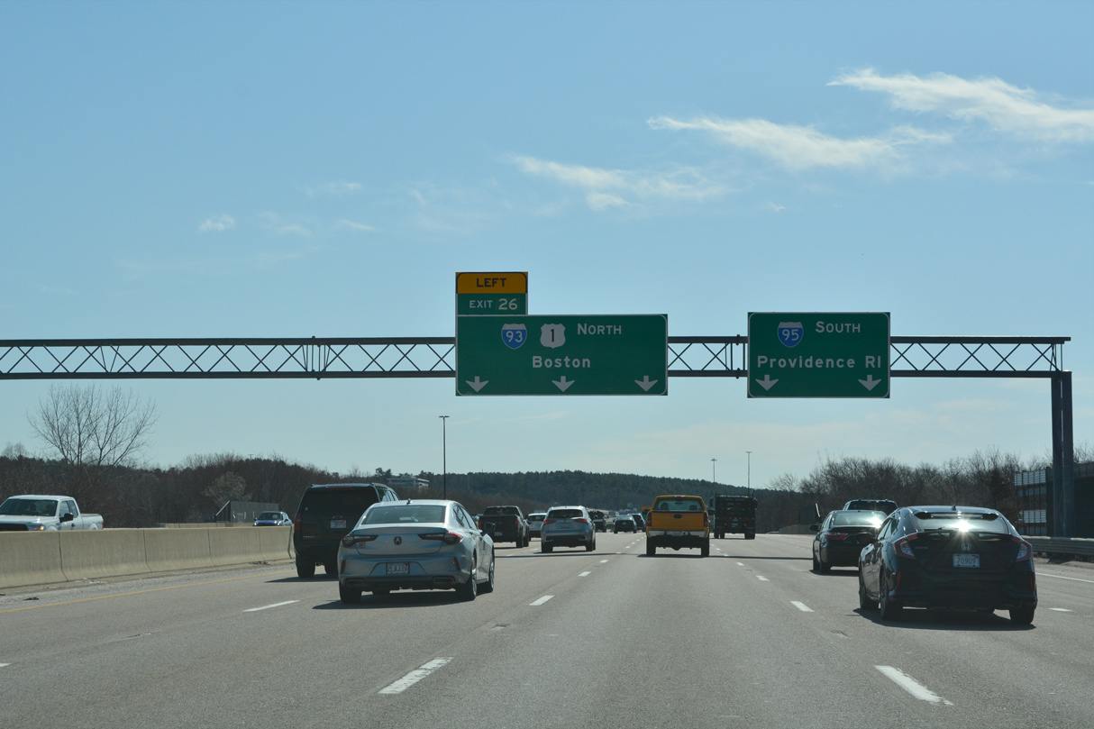
Interstate 93 ends with I-95 taking over the Route 128 beltway encircling Boston. I-95 heads south to Foxborough, Mansfield and Attleboro. 03/27/23
Interstate 95 circumvents Boston north to Waltham and Bedford and east to Wakefield and Peabody. The route was originally proposed to continue northward onto the old Fitzgerald Expressway through Downtown Boston and along the Northeast Expressway (U.S. 1) through Revere. 03/27/23
![]() North at
North at ![]()
![]()
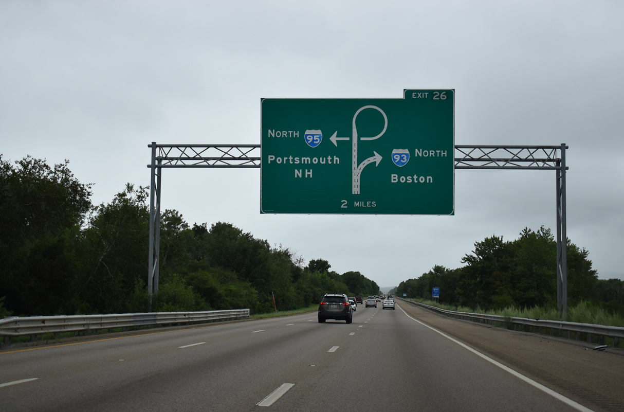
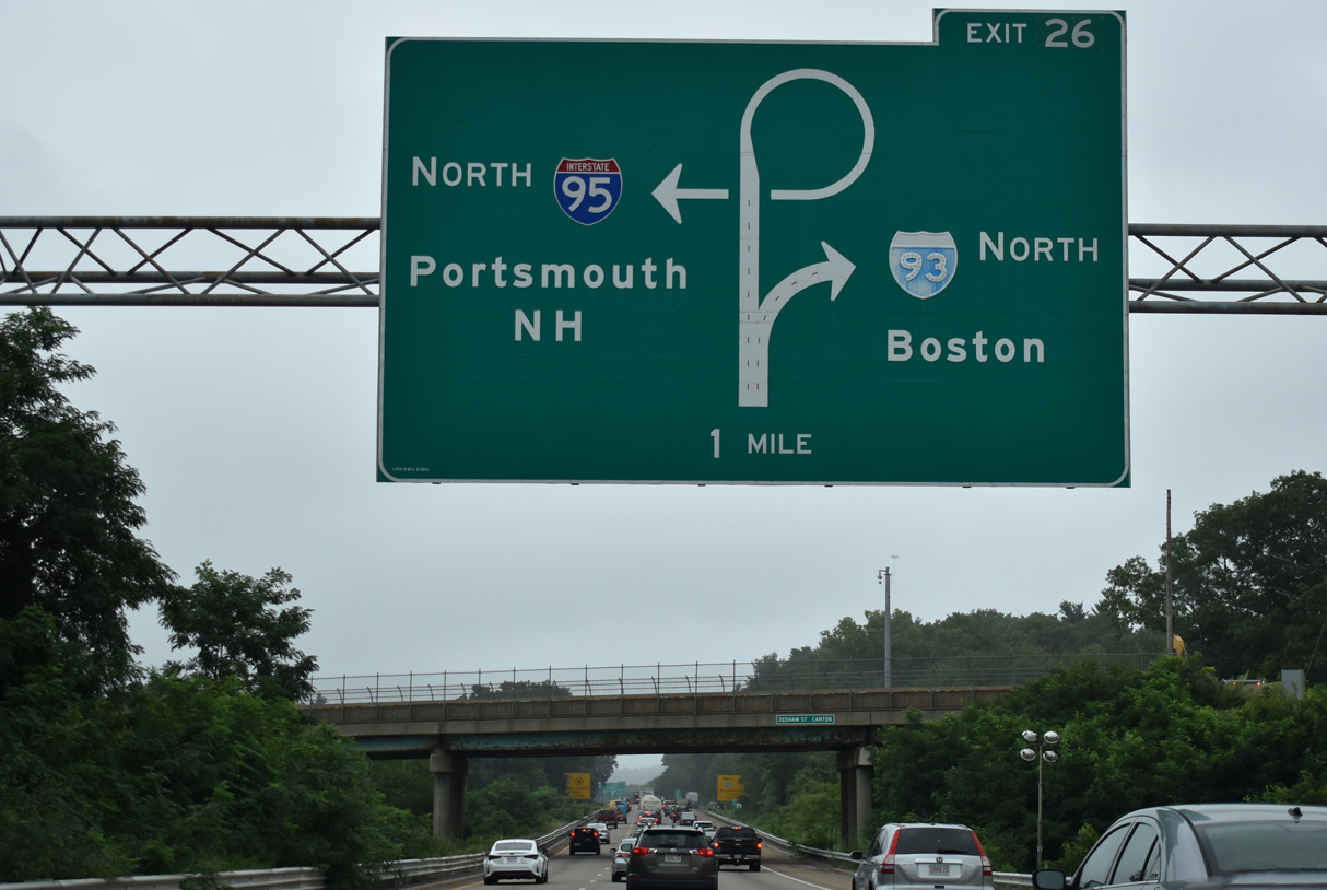
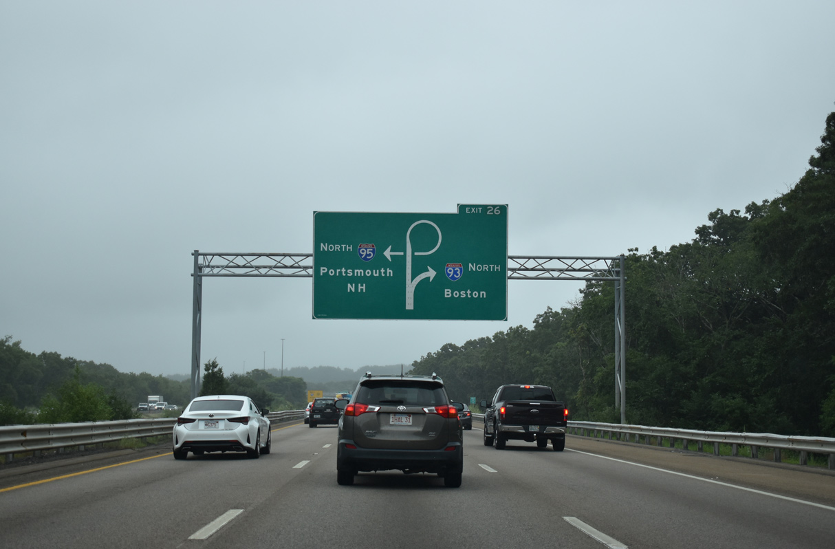
Diagrammatic overheads outline the forthcoming trumpet interchange (Exit 26) joining I-95 north with Interstate 93 and U.S. 1 in Canton. 08/20/21
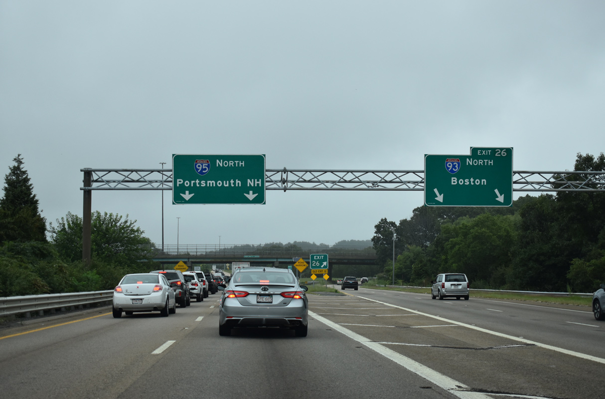
Interstate 93 circles east from I-95 to Route 3 at Braintree and north along side Route 3 to Quincy and Downtown Boston. 08/20/21
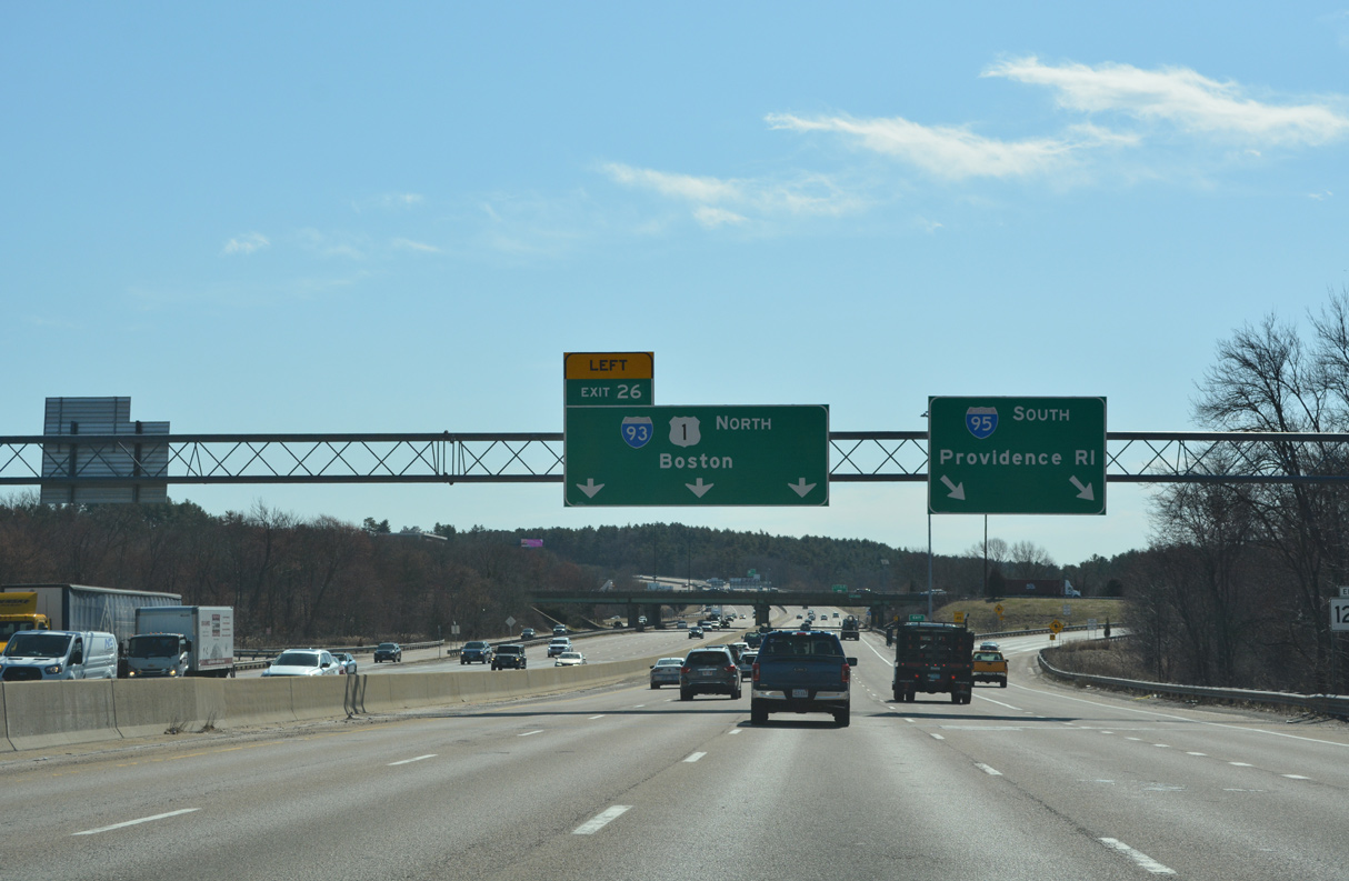
Interstate 95 reduces to a single lane on the loop ramp joining the end of I-93 and U.S. 1 south into the town of Dedham. 08/20/21
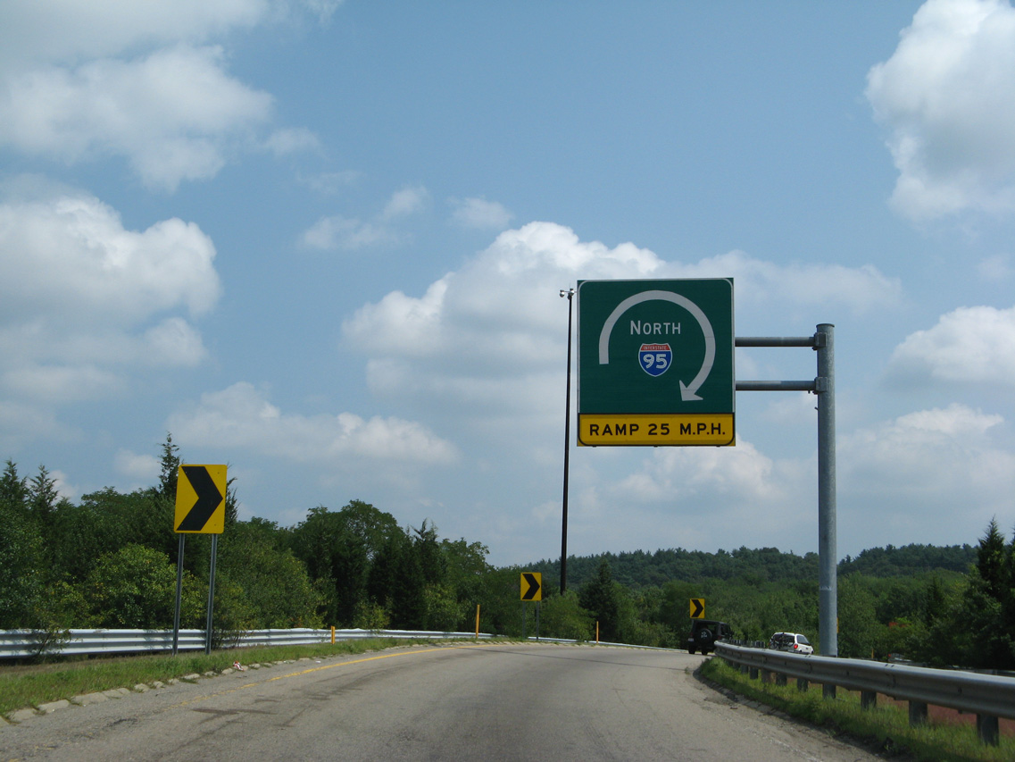
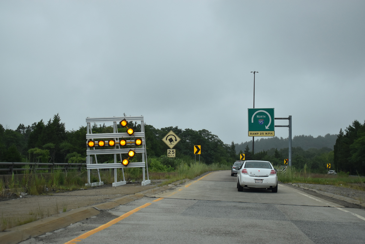
Unused ramps or grading for ones remain within the exchange at I-93 for the unconstructed alignment of I-95 northward into Boston. 07/29/07
![]() South
South ![]() North at
North at ![]()
U.S. 1 north combines with I-95 south ahead of East Street. U.S. 1 continues east along I-93 north into Boston. 03/27/23
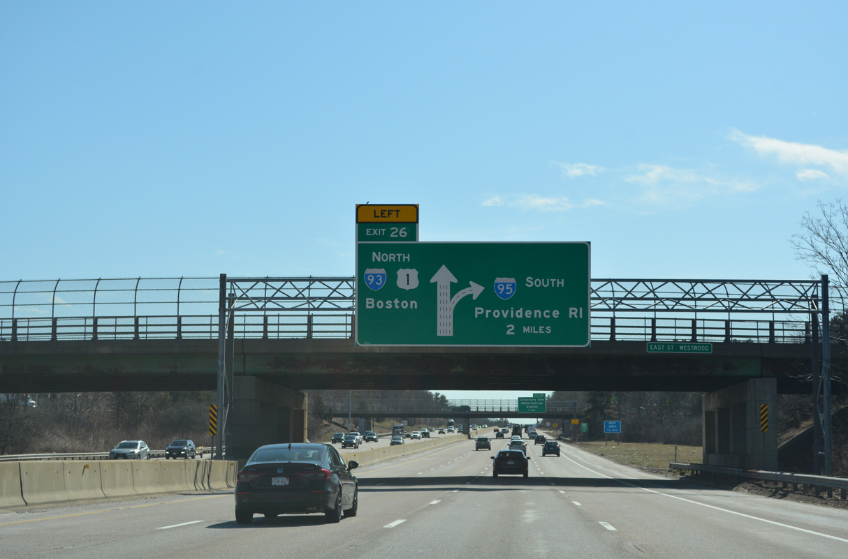
I-95/U.S. 1 straddle the Dedham and Westwood town line southeast to the Neponset River preceding the exchange with Interstate 93. 03/27/23
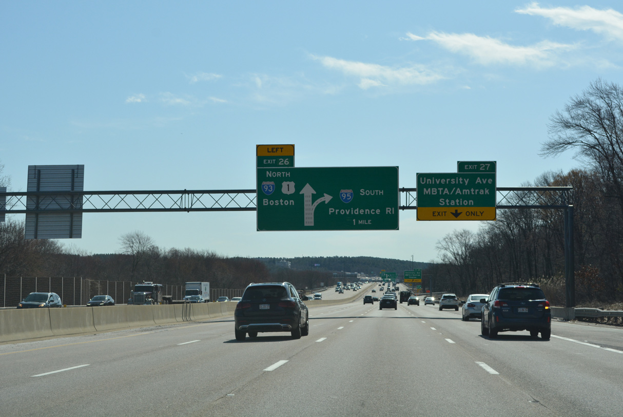
The entrance ramp from University Avenue adds a fifth lane to I-95 southbound ahead of Left Exit 26 for I-93/U.S. 1 north. 03/27/23
I-93 continues the Yankee Division Highway east from I-95 across Canton and Randolph. I-93/U.S. 1 turn north with Route 3 into Quincy. 03/27/23
The exchange between I-93 and I-95 was originally designed as a full cloverleaf interchange. It was later reconfigured once plans for the alignment taking I-95 northward into Boston were dropped. 03/27/23
![]() South
South ![]() North at
North at ![]()
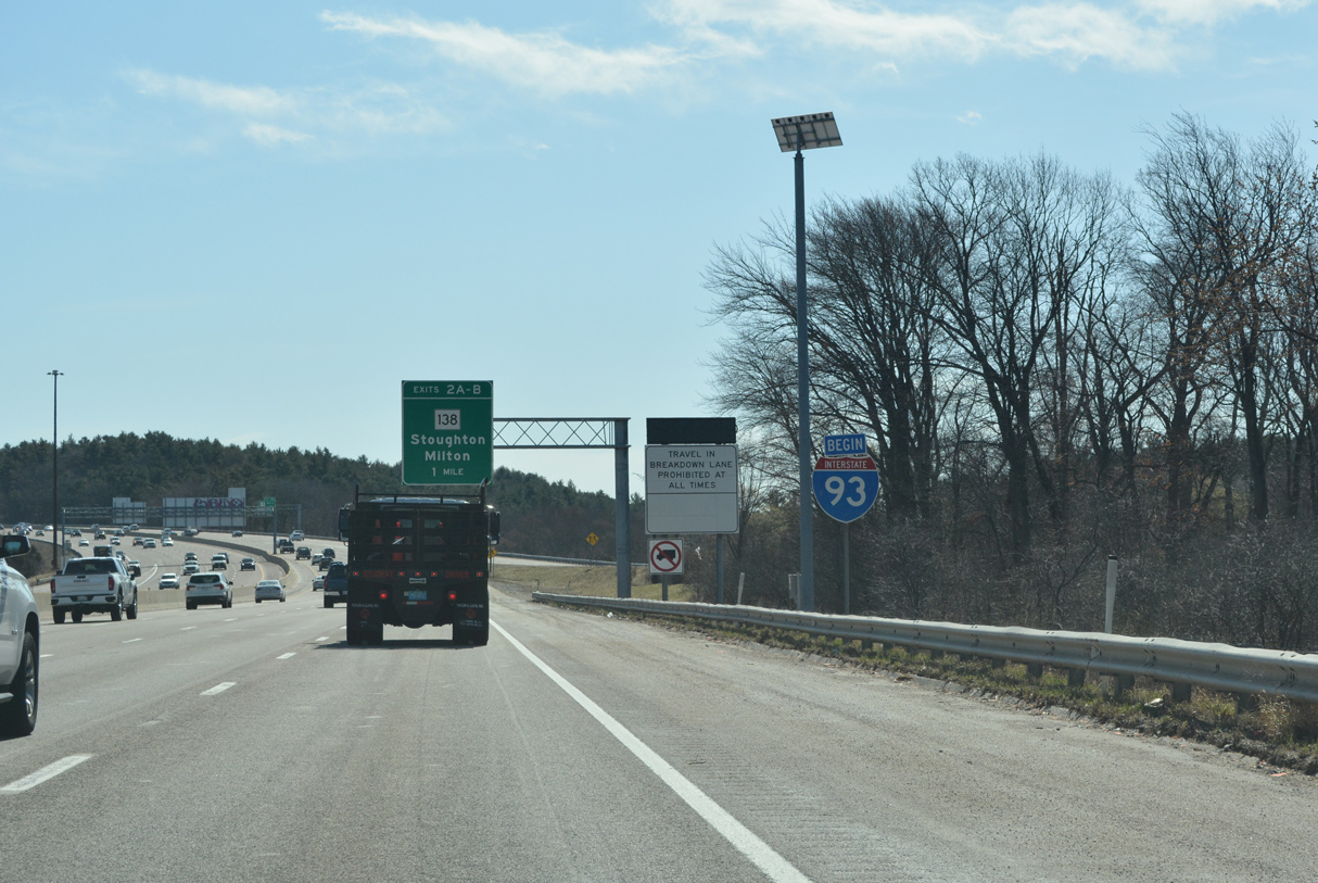
A begin shield for Interstate 93 stands within the trumpet interchange at I-95. 03/27/23
South End Throwback


Interstate 93 leading west to I-95 prior to the addition of a fourth southbound lane. Photos by Steve Timmons (02/04).
Sources:
- “$14.6 billion later, Boston’s Big Dig wraps up,” The Christian Science Monitor, December 19, 2003.
- Everett Turnpike (US 3, I-293, and I-93). BostonRoads.com.
- “NH Celebrates 50th Anniversary of Interstate Highway System.” New Hampshire DOT, press release, June 29, 2006.
- “Last stretch of I-93 will open Oct. 29.” The Nashua Telegraph (NH), October 19, 1982.
- Northern Expressway (I-93). BostonRoads.com.
Page updated April 3, 2023.