Interstate 90
Overview
The longest route within the Interstate Highway System, I-90 serves major northern cities such as Seattle, Chicago, Cleveland, Buffalo and Boston. Regional cities along the transcontinental route from the Pacific Northwest to the Rocky Mountains and Great Plains include include Spokane, Billings, Sheridan, Rapid City and Sioux Falls. The freeway traverses several mountain passes along the northern tier and can be closed during extreme storms during the Winter months.
I-94 overlaps with I-90 east across southern Wisconsin. Combining at a rural exchange outside the city of Tomah, I-90/94 lead 63 miles east to Wisconsin Dells and I-39 south of Portage. I-39 joins the two routes southeast 29 miles to the capital city of Madison, where Interstate 94 branches east toward Milwaukee. I-39/90 remain paired southward to Janesville and Rockford, Illinois.
East from Rockford, Illinois to Boston, Massachusetts the majority of Interstate 90 follows toll roads. Some sections of these toll roads predated the 1956 Interstate Highway Act. Tolled sections of I-90 in Illinois include the Jane Addams (Northwest) Tollway; between Beloit, Wisconsin and O’Hare International Airport (ORD) and the Chicago Skyway, between I-94 and the Indiana State Line. Interstate 90 combines with I-80 across northern Indiana along the Indiana East/West Tollway. This toll road connects the Chicago area with Hammond, Gary and South Bend.
Entering Ohio west of Toledo, I-80/90 continue east along the Ohio Turnpike to Elyria. They separate there with I-80 staying on the toll road south of Cleveland and I-90 winding northeast through Sheffield and Avon toward Downtown Cleveland. I-90 straddles the south shore of Lake Erie from Cleveland to Ashtabula and Erie, Pennsylvania.
Crossing into New York, I-90 transitions onto the Erie Section of the New York Thruway system. The toll road extends northeast to Buffalo, where I-90 becomes a toll free route through the urban area. East from I-290 and Buffalo, Interstate 90 follows the New York Thruway mainline by Rochester and to Syracuse, Utica and Schenectady.
I-90 loops east from the Thruway mainline through Albany, reconnecting with the toll road on the Berkshire Section linking I-87 with the Massachusetts State line. The remainder of I-90 lines the tolled Massachusetts Turnpike (Mass Pike) spanning the width of the Bay State. The Mass Pike connects Springfield, Worcester and Boston.
High Priority Corridor
Interstate 90 in the Seattle metropolitan area is part of High Priority Corridor 35: FAST Corridor.
 Parallel U.S. Routes
East from Seattle to Billings, Interstate 90 replaced U.S. 10. From Billings southeast to Buffalo, Wyoming, I-90 parallels U.S. 87, then follows U.S. 14 from Buffalo east to Wall, South Dakota. I-90 replaced U.S. 16 from Wall east all the way to Tomah, Wisconsin. From Tomah southeast to Chicago, Interstate 90 more or less follows U.S. 14 again, but it picks up U.S. 20 at Rockford. I-90 and U.S. 20 remain parallel to each other from Chicago east to Boston, with some proximity to U.S. 6 in Ohio.
Major Projects
Snoqualmie Pass
A partnership between the Washington State Department of Transportation (WSDOT) and several conservation groups to invest in wildlife corridors and protected habitats for species native to the Cascade Mountains resulted from the project to expand capacity along Interstate 90 between Hyak and Eaton. These wildlife structures allow for continuous range for a variety of animals that may migrate over the freeway. For more information on the wildlife overpasses, visit Interstate 90 Wildlife Bridges.10
Work on the three phase project commenced in Spring 2009 on Phase I, Hyak to Keechelus. Wrapping up in Fall 2018 2019, $453 million in construction involved adding a new lane per direction, bridge and culvert replacement, pavement replacement and improving sharp curves. Phase II ran between Summer 2015 and Fall 2018 2019 at a cost of $110 million. It improved a two mile stretch of I-90 from Keechelus Dam to the Stampede Pass interchange.
Work on Phase III, costing $335 million and scheduled for construction between Summer 2001 and Fall 2025 Summer 2022 to Fall 2028, improves the easternmost six miles of the project area with widening, pavement replacement and truck climbing lanes. Phase IV follows from Summer 2026 to Fall 2029. The $206 million project adds an additional lane per direction, replaces the concrete pavement, adds wildlife crossings and a chain-up area, and straightens portions of the roadway.
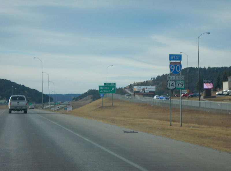
Rapid City Area
Several modifications were made to Interstate 90 from Rapid City east to Box Elder. Road work finished in 2009 realigned a portion of the freeway near Blackhawk, consolidating a split interchange with Sturgis Road (old U.S. 14/SD 79) and removing an S-curve along the mainline. Further southeast, the directional T interchange joining I-90 and I-190 was redesigned into a trumpet interchange, removing left exit ramps along westbound. Additionally the exchange provides enough separation from the adjacent SPUI (Exit 58) at Haines Avenue.
Further east at Exit 60, the wye interchange from I-90 west to U.S. 16 west was eliminated and replaced with a SPUI at Business Loop I-90 (E North Street). A third area SPUI replaced the diamond interchange at Exit 61 with U.S. 16 Truck and SD 79 south as well.
The parclo interchange at Exit 66 closed on October 1, 2003. This closure coincided with the Summer 2003 opening of a new parclo interchange at Exit 67 with nearby Liberty Boulevard. Liberty Boulevard, which links I-90 to the Ellsworth A.F.B. main gate, and the new exchange were constructed after successful lobbying by local officials. The move was made to address concerns about commercial development in the “accident-potential zone” to the south of the Ellsworth runway.2
Jane Addams (Northwest) Tollway
I-39 and I-90 combine along the Jane Addams Memorial [Northwest] Tollway between the Illinois-Wisconsin State Line and east side of Rockford. A portion of this stretch, from Rockton Road south to the split with I-39, was expanded to six overall lanes with advance work commencing in 2007. Widening was finished from Rockton Road / Exit 3 to the South Beloit Toll Plaza in 2008 and along eastbound from the toll plaza to U.S. 20 Business (State Street). Completion of the project by November 24, 2009 focused on the westbound lanes from the South Beloit Toll Plaza north to Rockton Road and along both roadways south from State Street to Newburg Road.21
The Cherry Valley Interchange project, which started in 2008, involved reconstructing the connection between Interstate 90 (Jane Addams Memorial Tollway) and I-39 in Rockford. The project was completed on November 13, 2010.20
This $89 million project was made possible as a result of Illinois Tollway’s $6.3 billion Congestion-Relief Program – Open Roads for a Faster Future announced in 2005. The work redesigned the interchange with new ramps, including a high speed connection from I-39 north to I-90 west. The original trumpet interchange at Cherry Valley opened in 1972 with the U.S. 20 bypass.20
Chicago Skyway
The Chicago Skyway, a toll facility operated by the City of Chicago, carries Interstate 90 over industrial areas and the South Side of Chicago. The elevated toll road connect with the Dan Ryan Expressway (Interstate 94) south of Downtown. 09/02/05
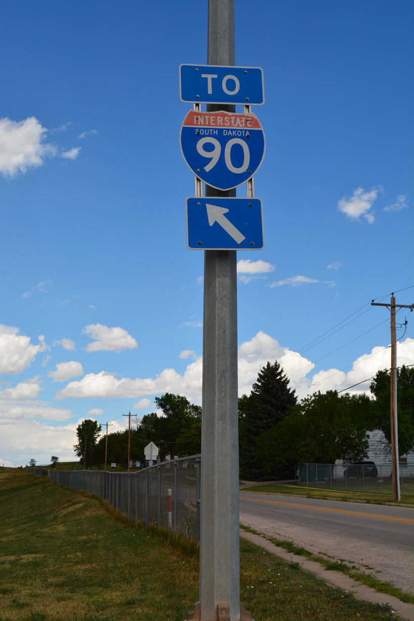
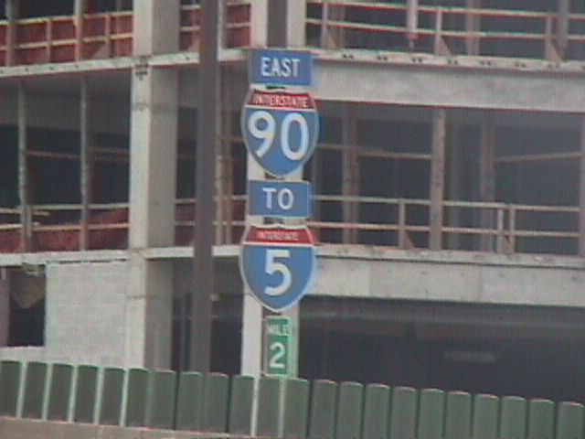
The Chicago Skyway is a steel cantilever bridge that connects the Dan Ryan Expressway (I-94) with the Indiana Toll Road (Interstate 90) in Illinois. Dominating the southeastern skyline of Chicago, the 7.8 mile long Skyway was constructed in the 1950s and opened in April 1958 to cross over steel mills, railroads, homes and the Calumet River. The bridge did not carry as much traffic as initially anticipated, but the growth of casinos in Northwestern Indiana increased traffic counts. In 1999, city of Chicago administrators determined that the Chicago Skyway was never officially incorporated into the Interstate Highway System.6 This may have been due to the fact that the Skyway was not up to current Interstate standards. As a result of this analysis, all Interstate 90 reassurance shields were amended to include a “TO” banner.
The elevated roadway underwent a reconstruction project between 1999 and November 2004.5 Prior to the completion of this project, the road was falling apart. With completion of the new Skyway deck, ramps, and three continuous lanes of travel, the Skyway was improved to meet Interstate standards.
Following reconstruction of the Chicago Skyway, the Chicago City Council voted to lease the bridge to a private company, the Skyway Concession Company, LLC (SCC). Infusing the city of Chicago with $1.83 billion from SCC, the 99 year agreement started in January 2005. In exchange, SCC collects toll proceeds and provides for administration, toll collection, maintenance and operations of the Skyway. The City of Chicago continues to provide police to patrol the freeway. This arrangement was the first of its kind in the country.
Indiana Toll Road
Through Indiana, Interstate 90 follows the Indiana Toll Road in its entirety. Authorized for construction in 1951, the Toll Road was constructed and fully open to traffic by 1956, the same year in which the Interstate Highway System was authorized by the federal government. The Toll Road was later added to the Interstate Highway System. In 2006, the state of Indiana approved leasing and privatizing the Indiana Toll Road. A bid for this lease came in at $3.85 billion by the same Spanish-Australian consortium that leased the Chicago Skyway from the city of Chicago. The project was awarded to ITR Concession Company LLC (ITRCC) for a term of 75 years.
Governor Mitch Daniels negotiated the lease, and the state House of Representatives approved the lease on February 1, 2006. The Senate approved the lease as part of the governor’s “Major Moves” program. By the middle of March 2006, Major Moves was law. ITRCC assumed operations on June 29, 2006. Funds generated by this lease were used for various transportation projects around the state12,13,14, including construction of new Interstate 69 between Evansville and Bloomington.
ITRR filed Chapter 11 bankruptcy on September 22, 2014 on more than $6 billion in debt. IFM Investors announced on March 11, 2015 they they entered a $5.725 billion purchase and sale agreement of ITRR and the remaining 66 years of the lease. The Australian based group closed on their purchase of ITRR on May 27, 2015. IFM planned on investing $260 million in capital improvements through 2020 for the Indiana Toll Road.11
Cleveland Innerbelt

The 1959-opened Innerbelt Freeway viaduct carrying Interstate 90 from Downtown to Tremont in Cleveland as seen from Jacobs Field (now Progressive Field), home of the MLB Cleveland Indians. This span was fully demolished on July 12, 2014. Photo by Jim Teresco (08/01).
Route Information
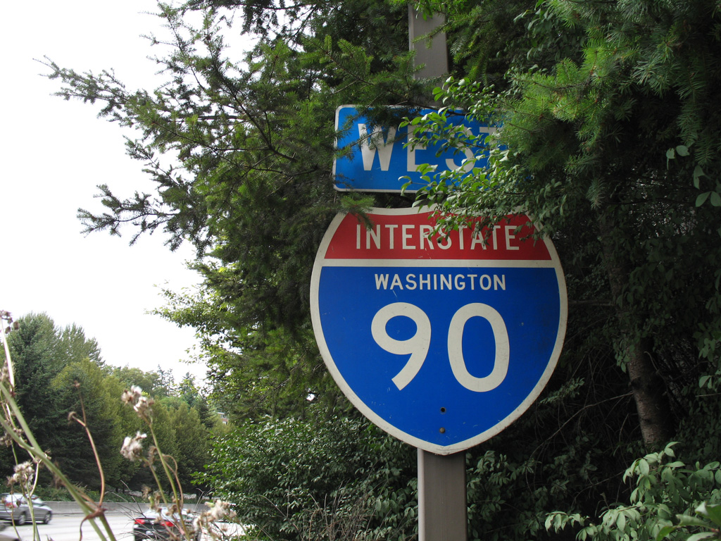
Washington – 296.92
Cities – Seattle, Bellevue, Ellensburg, Moses Lake, Spokane
Junctions –


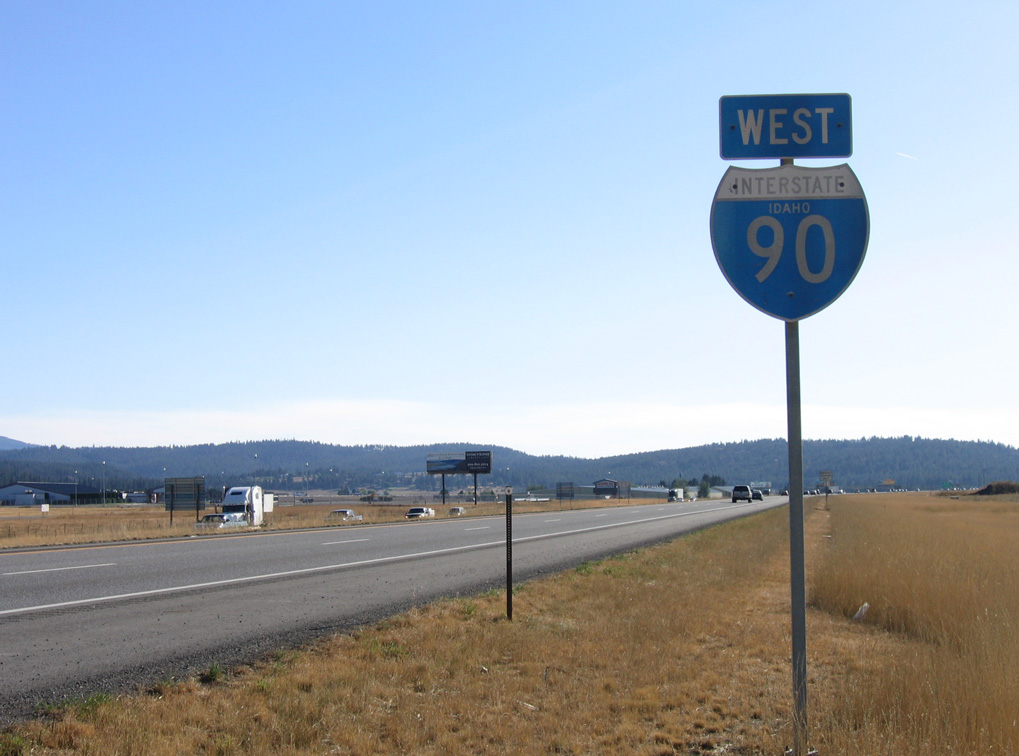
Idaho – 73.55
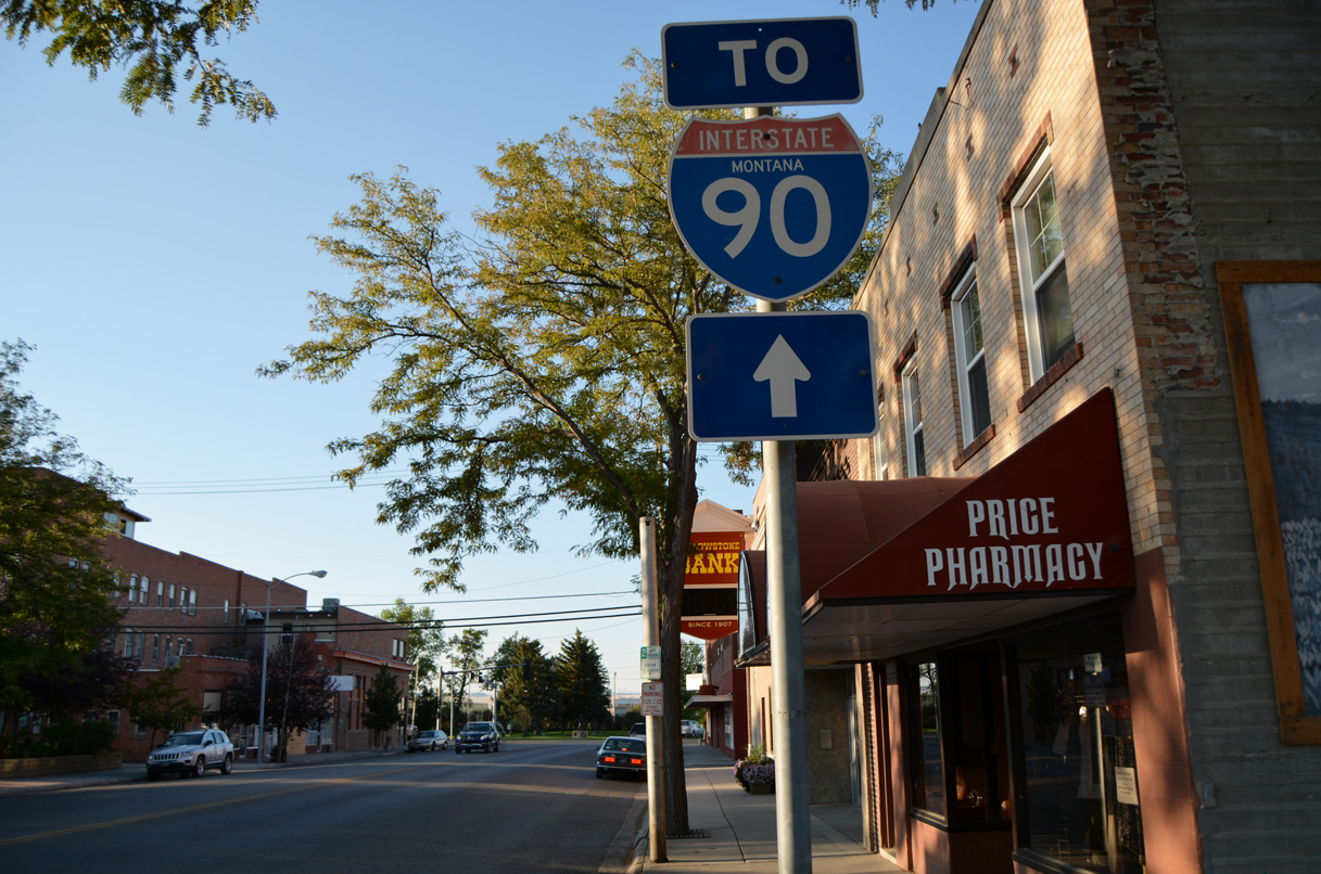
Montana – 552.46*
Cities – Missoula, Deer Lodge, Butte, Bozeman, Livingston, Laurel, Billings, Hardin
- Junctions –
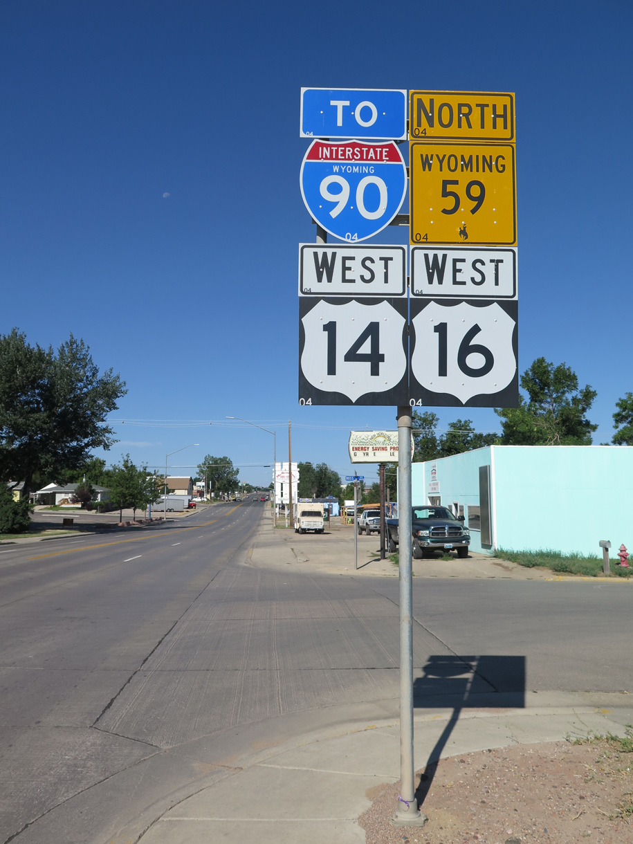
Wyoming – 208.80
Cities – Sheridan, Buffalo, Gillette
- Junctions –
South Dakota – 412.76
Cities – Spearfish, Sturgis, Rapid City, Chamberlain, Mitchell, Sioux Falls
- Junctions –
Minnesota – 275.70
Cities – Worthington, Fairmont, Albert Lea, Austin, Rochester
- Junctions –
Wisconsin – 108.61** (187)
Cities – La Crosse, Onalaska, Tomah, Madison, Beloit
- Junctions –
Illinois – 123.89***
Cities – Rockford, Elgin, Chicago
- Junctions –
Indiana – 156.28#
Cities – Hammond, Gary, South Bend, Elkhart
Junctions –
Ohio – 244.75##
Cities – Toledo, Elyria, Cleveland, Ashtabula, Conneaut
Junctions –
Pennsylvania – 46.30
Cities – Erie
- Junctions –
New York – 385.48
Cities – Dunkirk, Buffalo, Batavia, Rochester, Syracuse, Oneida, Utica, Amsterdam, Schenectady, Albany
Junctions –
Berkshire Connector
Massachusetts – 135.72 (137.6)###
Cities – Springfield, Holyoke, Worcester, Framingham, Boston
- Junctions –

Source: December 31, 2021 Interstate Route Log and Finders List
* – 7.65 miles on I-15
** – 91.76 miles on I-94, 108.61 of the 187 miles in Wisconsin are independent of I-39
*** – 15.39 miles on I-94
# – 135.60 miles on I-80
## – 142.80 miles on I-80
### – Prior to the opening of the Ted Williams Tunnel, Interstate 90 was 135.72 miles long.1
I-90 Annual Average Daily Traffic (AADT)
ITD AADT Map 2018 AADT
2002 Wyoming Vehicle Mile Book (WYDOT)
INDOT 2000 Annual Average Daily Traffic Volumes Map
Pennsylvania Traffic Volume Map 2017 (PennDOT)
NYS Traffic Data Viewer 2016 AADT
* – estimate 148,000 mainline and 2,600 reversible lanes
1987 Official Washington Highway Map showing the temporary west end of Interstate 90 at Rainier Avenue (former SR 900) in Seattle.
Throughout Montana, Interstate 90 directly overlaid or paralleled U.S. 10 closely. Portions of the freeway were open by 1968, including a lengthy stretch from Opportunity east through Butte to Cardwell. U.S. 10 remained signed between Missoula and West Fargo until 1987.
Interstate 90 combines with U.S. 14/SD 79 through Rapid City. Photo by Joseph Barnes (12/13/17).
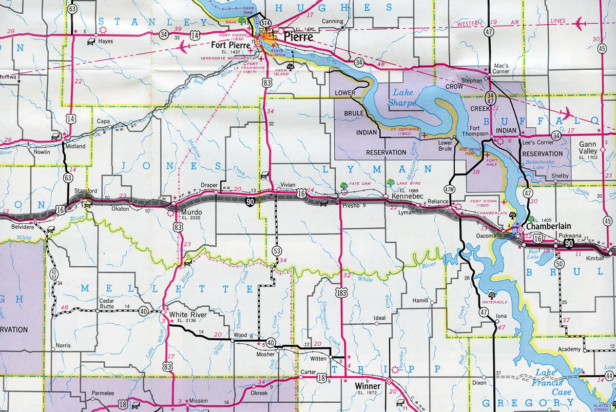
A short portion of I-90 was open to traffic between Chamberlain and Kimball, South Dakota in 1965. The freeway was completed across the state in 1976

This Downtown Boston inset shows the original layout of the Mass Pike east end at the Fitzgerald Expressway (Interstate 93). I-95 ran through Boston until 1973 and I-90 was not signed east of the Allston toll plaza.24
The Innerbelt Project replaced the Innerbelt Bridge built in 1959 across the Cuyahoga River and rebuilt I-90 from I-71 (Medina Freeway) north to I-77 (Willow Freeway). Named the George V. Voinovich Bridge, the new westbound bridge was constructed between May 2011 and November 2013 at a cost of $293 million. The $273 million project to replace the eastbound span was awarded to TGR and designer URS Corporation in the Fall of 2013. Construction culminated on September 24, 2016, when eastbound traffic shifted to the second span. Subsequent work opened all five westbound lanes for I-90 across the George V. Voinovich Bridge by mid October and the remaining eastbound lanes on October 24, 2016. Work on the weekend of October 28, 2016 restriped I-77 north at I-490 to three through lanes and the ramp from I-77 north to I-490 east to a single lane.29
Boston and the “Big Dig”
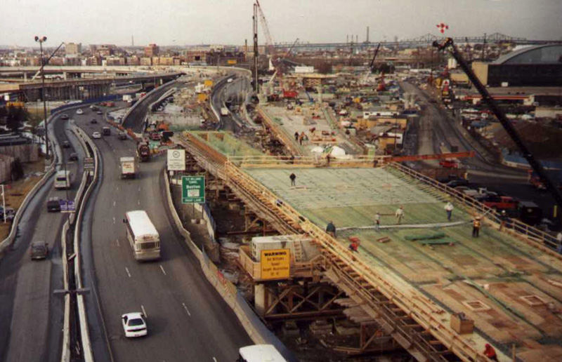
As part of the $24.3 billion “Big Dig” project in Boston, the Massachusetts Turnpike Extension lengthened Interstate 90 east 3.5 miles from the 1965 terminus at I-93 to Logan International Airport (BOS). Fully opened on January 18, 2003, the extension of I-90 shifted the end northeast to Route 1A in East Boston.
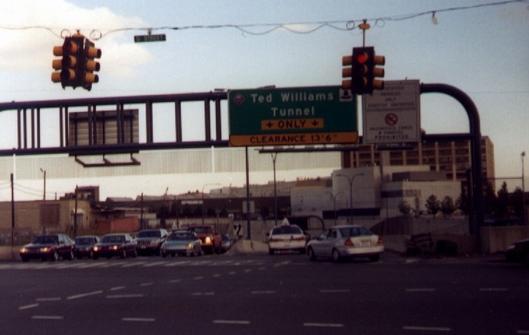
Built as part of the Turnpike Extension, the Ted Williams Tunnel below Boston Harbor arcs I-90 northeast between the Seaport District and the Airport Way loop to Logan Airport’s passenger terminal. The 8,500 foot long tunnel was constructed at a cost of $1.3 billion from December 1991 to December 15, 1995.22,23
West of the Ted Williams Tunnel and Seaport District is the Fort Point Channel Tunnel. The one mile long tunnel takes I-90 below Fort Point Channel between Interstate 93 (Central Artery and the Thomas P. O’Neill, Jr. Tunnel) and D Street by the Massachusetts Convention Center. The Fort Point Channel Tunnel opened to complete I-90 on January 18, 2003.
History
Idaho
Wallace, Idaho
One of the last sections of Interstate 90 to open to through traffic was the section bypassing the city of Wallace, Idaho. Wallace was also home to the final traffic signal to be bypassed by the transcontinental freeway. To avoid having the freeway pass directly through the town as originally planned, residents and city officials added Wallace to the National Register of Historic Places in 1976. As a result, the freeway was rerouted northward onto a viaduct parallel to the South Fork Coeur d’Alene River. Upon completion of the elevated roadway on September 12, 1991, old U.S. 10 through Wallace became Business Loop I-90 and the last traffic signal of I-90 was retired shortly thereafter.3,4
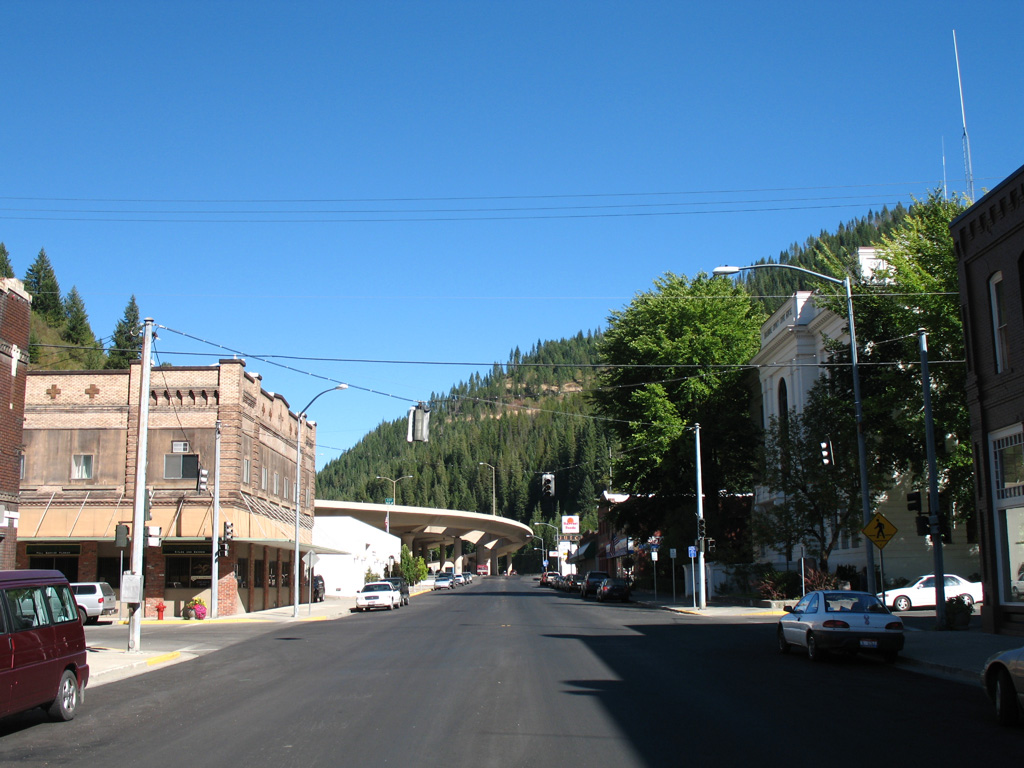
The final traffic light for I-90 was located in Downtown Wallace along old U.S. 10 (Bank Street) at 7th Street. The former at-grade route of I-90 through Wallace became Business Loop I-90. 09/01/06
Montana
Construction for Interstate 90 over Homestate Pass began in 1964 at a cost of $6.4 million. The route was complete between Whitehall and Butte in 1966 for $18.5 million.26 The final two lane segment of I-90 across the state was expanded to four lanes on May 13, 1987. The 20 mile long section, known as “Springdale West”, was rebuilt under a $12 million contract started in Fall 1985.27
Wyoming
For a history of the completion of I-90 in Wyoming, visit Interstate 90 @ AARoads.
Illinois
Chicago
In Illinois, the sections of Interstate 90 were built in the 1950s and 1960s. The Northwest Tollway, which brings Interstate 90 southeast from Wisconsin to Rockford, Elgin and Chicago near O’Hare International Airport (ORD) was constructed starting in 1956 and was completed by 1958.15 The construction of the 76 mile long Northwest Tollway and the other original tollways in Illinois was funded by a bond issuance in the amount of $415 million by the state tollway commission, which was created in 1953.18 The Northwest Tollway merges into the Kennedy Expressway near O’Hare International Airport.
The Kennedy Expressway, which connects O’Hare International Airport (ORD) with the Chicago Loop (Interstate 290 / Eisenhower Expressway), opened to traffic on November 5, 1960. Originally named the Northwest Expressway, it was renamed the John F. Kennedy Expressway on November 29, 1963, one week to the minute after the famous U.S. President was assassinated in Dallas, Texas. This 16 mile long expressway was constructed at a cost of $237 million.
The Kennedy Expressway from ORD Airport to the Northwest Tollway is designated as Interstate 190 and was formerly Illinois Route 594 until 1978. The Kennedy Expressway southeast from the Northwest Tollway to the Edens Expressway is a part of Interstate 90 and was designated as Illinois Route 194 prior to 1978.
The Kennedy Expressway southeast from the Edens Expressway (I-94) to the Jane Byrne Circle Interchange with I-290 (Eisenhower Expressway) was originally just I-94. I-90 was rerouted from the Eisenhower Expressway onto the Edens Expressway alongside I-94 in 1978. On February 1, 1970, new rapid transit rail service went into operation in the Kennedy Expressway median, shortly after commuter rail service began on the Dan Ryan Expressway segment of I-90/94.15, 16
The Dan Ryan Expressway, which continues the limited access route from I-290 (Eisenhower Expressway) south to Interstate 57, opened on December 15, 1962. It was designated as I-90/94 from Downtown to the Skyway and as I-90 from the Chicago Skyway to the split with I-57. However, I-90 and I-94 were swapped shortly thereafter, with I-94 following the entire length of the Dan Ryan and I-90 branching southeast along the Chicago Skyway.
Planned as the “South Expressway,” the expressway was named in memory of Dan Ryan, who was the president of the Cook County Board of Commissioners and had died in 1961, just before the road opened. Dan Ryan was a known expressway proponent in Chicagoland and was responsible for the construction of several urban freeways. The Dan Ryan Rapid Transit line follows the median of the Dan Ryan Expressway; the rail line opened to commuters on September 28, 1969. Similar rail lines have since been placed in median and other right of way locations along other urban freeways throughout the country, but Chicago is considered to be a pioneer in the implementation of this concept.15, 17
The Chicago Skyway opened in June 1958.15 It was not constructed using proceeds from the Illinois State Tollway Commission original bond issuance; it was instead funded by the city of Chicago separately.18
Interstate 90 followed the Eisenhower (Congress) Expressway and Eisenhower Extension rather than the Kennedy Expressway and Northwest Tollway from the 1960s until 1978. For more on this route, see Interstate 290 Illinois.
Ohio
Ohio Turnpike
Interstate 90 follows the Ohio Turnpike from the Indiana Toll Road east to Elyria near the Cleveland metropolitan area. The act that created the Ohio Turnpike Commission was passed in 1949, and construction began on the toll road in October 1952. The Turnpike was built in 38 months and the 241 mile long route fully opened on October 1, 1955. For more information, visit the official Ohio Turnpike History page.
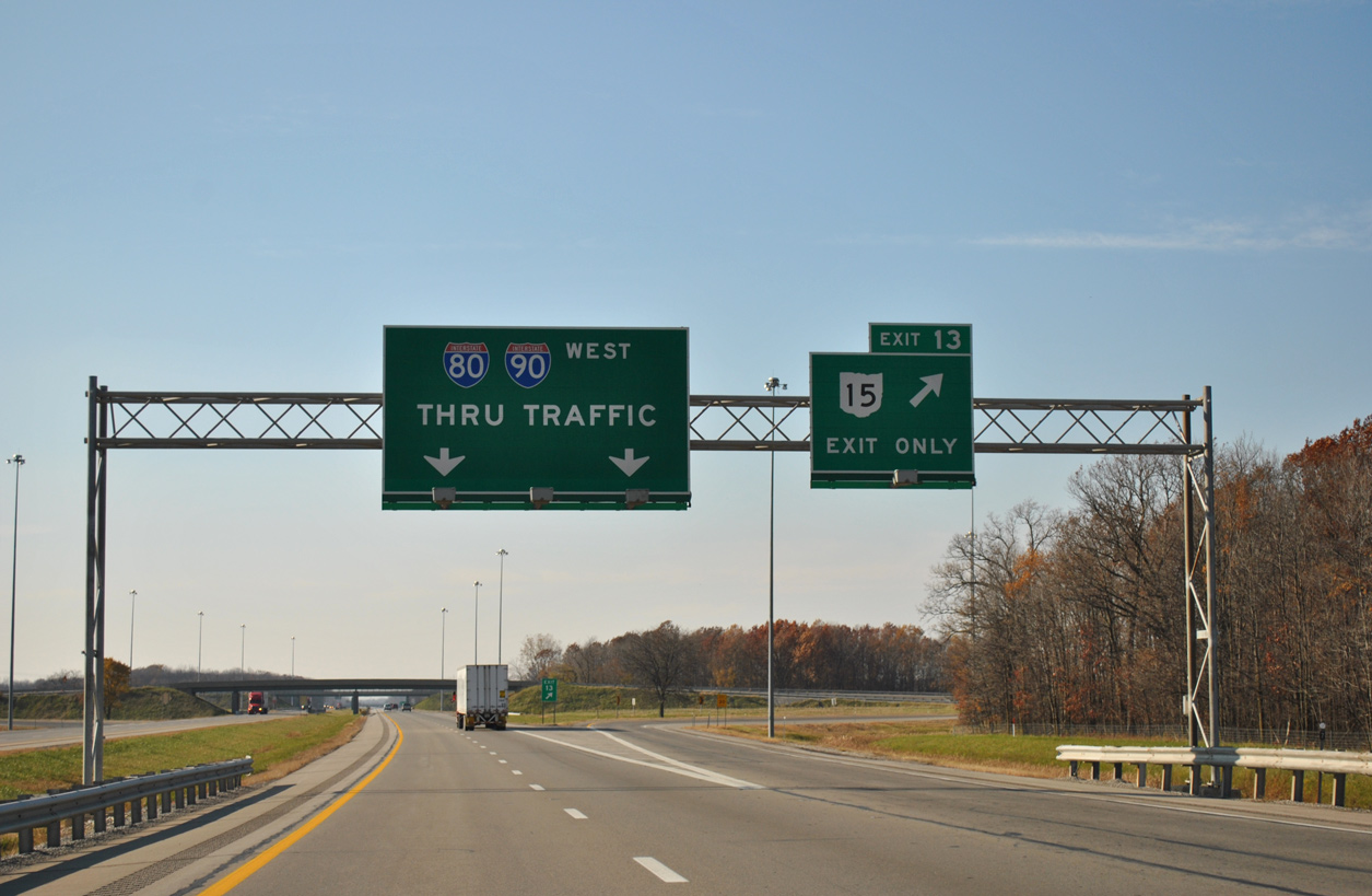
Several sections of Interstate 90 in the eastern United States uses toll roads. Together with I-80, I-90 follows the Ohio Turnpike westbound as it crosses Exit 13 with SR 15 at the village of Holiday City. 11/06/11
Cleveland
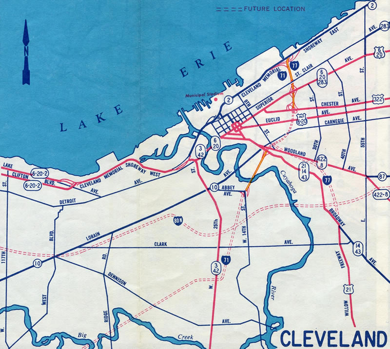
1950s Cleveland Freeway plans outlined a number of routes crisscrossing the city. Several of these were never built, including the Clark, Lee, Parma and Shaker Heights Freeways among others. Interstate 90 was routed along the Northwest Freeway east through Westlake, Rocky River and Lakewood into western reaches of the city. The route was to turn north at 65th Street onto the Parma Freeway to connect with Cleveland Memorial Shoreway (SR 2) at 49th Street. The Shoreway was then to continue I-90 east by Downtown to the north end of the Innerbelt Freeway. The remainder of the Northwest Freeway east to the Medina Freeway (I-71) and Innerbelt Freeway would have been a part of Interstate 80N. I-80N was proposed east along the Clark Freeway and south on the Bedford Freeway to Garfield Heights and the Outer Belt South Freeway (I-480).
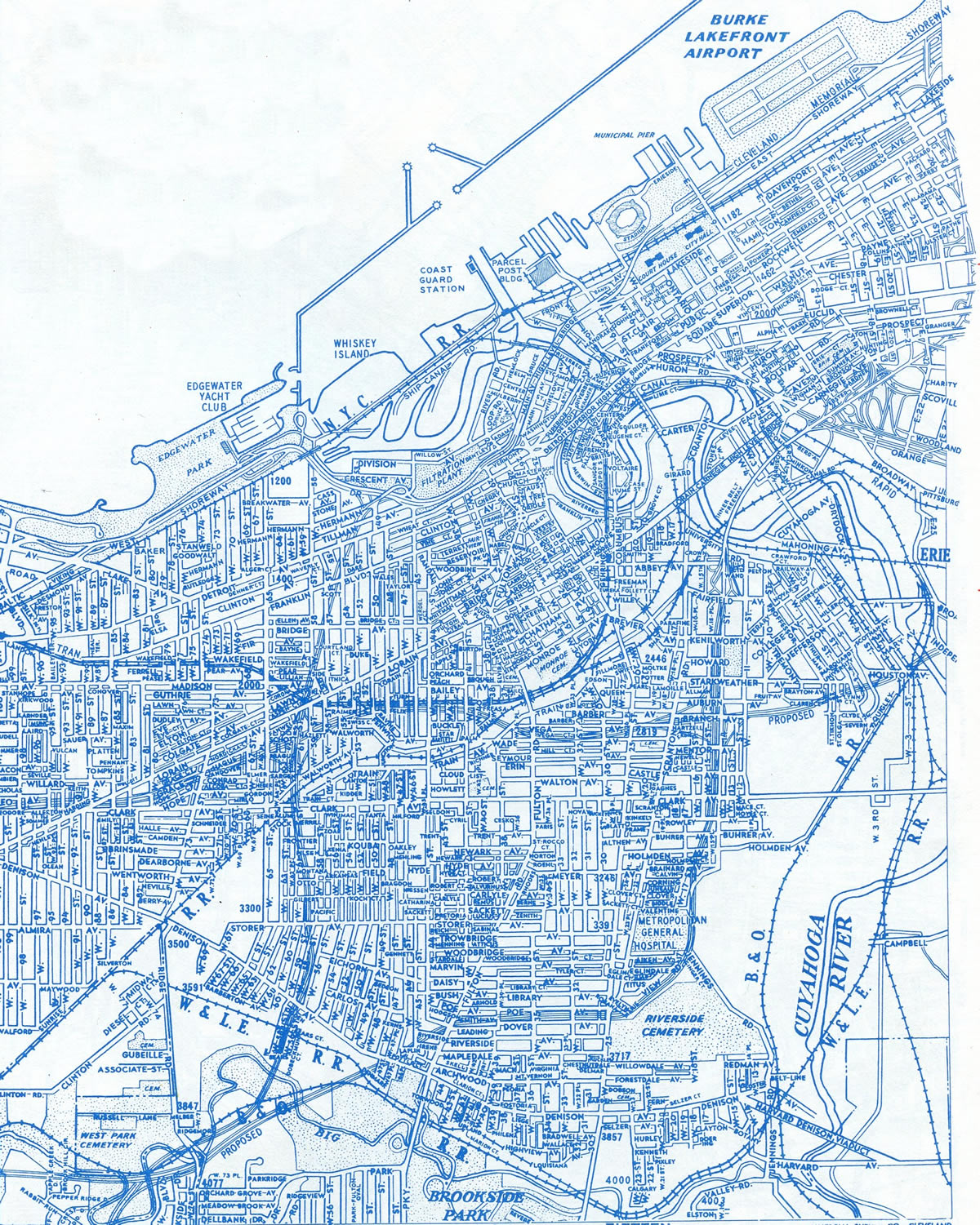
Commercial Survey Co. Street Guide, circa 1960, showing the proposed Parma Freeway extending north from the Northwest Freeway to Cleveland Memorial Shoreway.
The Innerbelt was proposed to carry I-71 north to the Shoreway, with some maps showing I-71/77 overlapped north to the Shoreway.
I-80N was later relocated onto the Outer Belt South Freeway, leaving the Clark Freeway as I-290 and later Interstate 490. The Parma Freeway was dropped by the mid 60s, leaving I-90 along the Innerbelt alone. A wide median at 65th Street along I-90 (Northwest Freeway) alludes to a potential interchange with the Parma Freeway, while the 49th Street interchange on Ohio Route 2 would have been incorporated into the I-90 mainline.
East of Downtown Cleveland and ahead of the south shore of Lake Erie, I-90 traverses the locally known Dead Man’s Curve. The freeway drops to 35 miles per hour as it abruptly turns from north to northeast and merges with SR 2 (Cleveland Memorial Shoreway). This curve is among the most substandard segments of Interstate 90.
Interstate 90 at Dead Man’s Curve and SR 2, east of Downtown Cleveland. Photo by Steve Hanudel (06/18/06).
I-90 along this stretch was built in 1959 and initially signed with a 50 mile per hour speed limit. When the Inner Belt was completed in 1962, problems became apparent with increased traffic counts, resulting at least one truck overturning at the curve per month. By 1965 speed limits were reduced to 35 miles per hour and warning signs installed. The curve was banked in 1969 and a new concrete barrier was added in place of the median guardrail. Despite these adjustments to the freeway, accidents remained a problem.19
New York
New York Thruway
The mainline of the New York Thruway was opened to traffic in stages between 1954 and 1957. Interstate 90 was designated on the Thruway at a later time, after the original opening date of the superhighway. Opening dates, from west to east, of the Thruway portion along I-90 is as follows:7
- Pennsylvania State Line to Silver Creek (41 miles) – August 21, 1957
- Silver Creek to Buffalo (29 miles) – December 14, 1957
- Buffalo to Rochester (63 miles) – August 25, 1954
- Rochester to Lowell (115 miles) – June 24, 1954 (first segment of Thruway ever opened)
- Lowell to Westmoreland (5 miles) – September 20, 1954
- Westmoreland to Albany (95 miles) – October 26, 1954
- Berkshire Spur (18 miles) – October 8, 1958
The remaining section of Interstate 90 in New York, between Albany and the Berkshire Spur of the Thruway, is maintained by the New York State Department of Transportation. It was completed in the mid 1970s as the new alignment of I-90. Prior to that, the entire length of the Berkshire Spur doubled as I-90. The 6.85 mile long section of the Spur west from I-90 is inventoried by NYSDOT as NY 912M, an unsigned designation.
1968 map showing construction for the toll free alignment of Interstate 90 across Albany, New York.
Discussion from the Thruway Authority, the State Department of Transportation and the Federal Highway Administration arose in 1999 to both redesignate the Berkshire Spur as I-90 and renumber the free portion of I-90 through Albany as an eastern extension of Interstate 88. This plan was never implemented.24
Massachusetts
Massachusetts Turnpike
138 miles in length, the Massachusetts Turnpike (Mass Pike) System comprises two sections:
- Original Mainline – from the New York state line to Exits 14-15 (I-95/Route 128) on the Weston and Newton town line
- Metropolitan Highway System (MHS) operates the Boston Extension from Exits 14-15 east to Massachusetts Route 1A near Logan International Airport (BOS). This section also includes the myriad tunnels and bridges that were built as part of the Big Dig project in and around Downtown Boston and the airport
Construction on the original mainline of the Mass Pike began in 1955 and was completed in 1957. The Massachusetts Turnpike ran east from the New York Thruway to Route 128 / Interstate 95 (Yankee Division Highway). In 1960, attention turned toward construction of the final 15 miles of the turnpike into the city center. It would prove to be a difficult stretch to construct, as it passed through areas already built out. Groundbreaking for the extension was in September 1962, and the turnpike was extended east to the Fitzgerald Expressway (then unsigned I-9525) by February 1965.7 An ancillary route, the Interstate 695 Inner Belt, was planned to connect the Turnpike with the Northeast and Southeast Expressways. However, that road was not constructed as a result of community opposition, including protests from students at the Massachusetts Institute of Technology (MIT).8
Interstate 90 ended at the Allston toll plaza until the mid 1970s. The end point referenced the original planned terminus where the cancelled I-695/Inner Belt would have crossed. The remainder of the Mass Pike east until that time was unnumbered.25
The Newton-Weston bridge replacement project addresses eight aging spans at the interchange complex joining I-90 (Mass Pike), I-95, Route 30 (South Avenue) and Park Road at Exit 123. Construction anticipated to run from 2023 to Summer 2027 replaces five of the spans, rehabilitates another and replaces the superstructure of the last two. The estimates $230 million design-build project includes the I-90 crossing of the Charles River.
The Massachusetts Department of Transportation switched toll collection on the MassPike to a cashless system on October 28, 2016. The transition aimed to both decrease traffic congestion and improve air quality, as vehicles would not longer idle or have to stop at toll plazas. All electronic tolling (AET) at 16 gantries collect fares by reading E-ZPass transponders or toll-by-plate methods where motorists are sent an invoice through the mail. Ensuing work through 2017 removed the mainline and ramp plazas located throughout the MassPike system.28

The Ted Williams Tunnel opened to limited operation prior to completion of Interstate 90 (Mass Pike) west across Fort Point Channel and north through Boston Logan International Airport (BOS) to Route 1A (East Boston Expressway). Photos by Dan Moraseski.
 Photo Guides
East End  – East Boston, Massachusetts
![]() East at
East at ![]()
Eastbound Interstate 90 emerges from the Tip O’Neill (Fort Point) Tunnel below grade at the Seaport District. The toll road proceeds northeast through the Ted Williams Tunnel to Boston Logan International Airport (BOS). 03/27/23
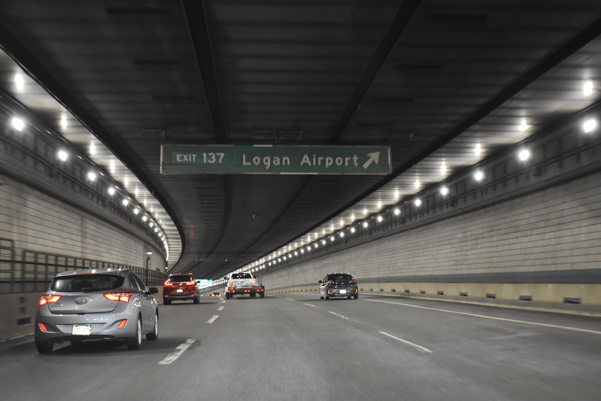
Passing below Boston Harbor, I-90 curves northward through the 1.6 mile long Ted Williams Tunnel. 03/27/23
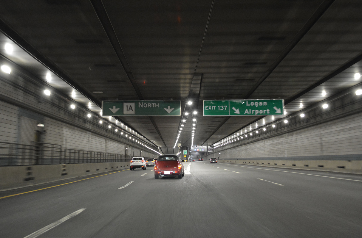
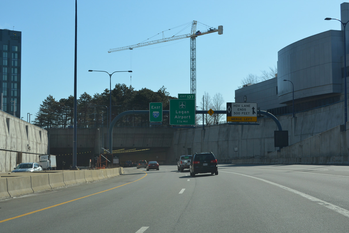
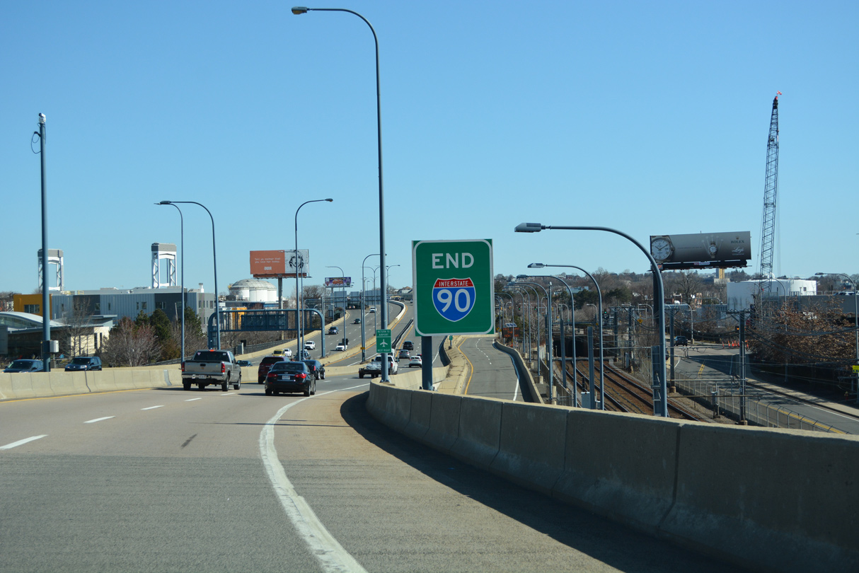
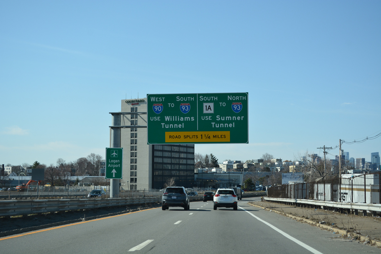
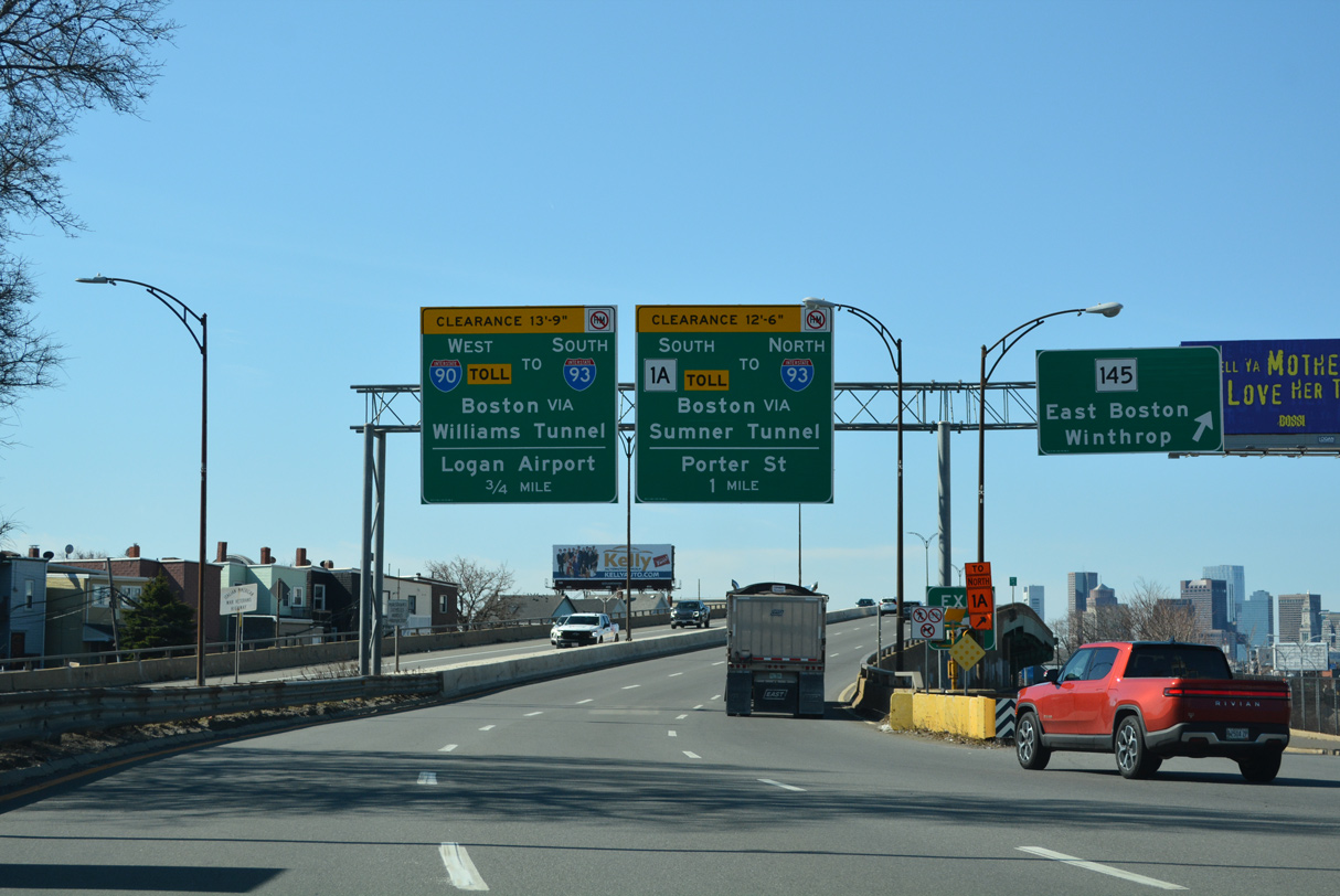
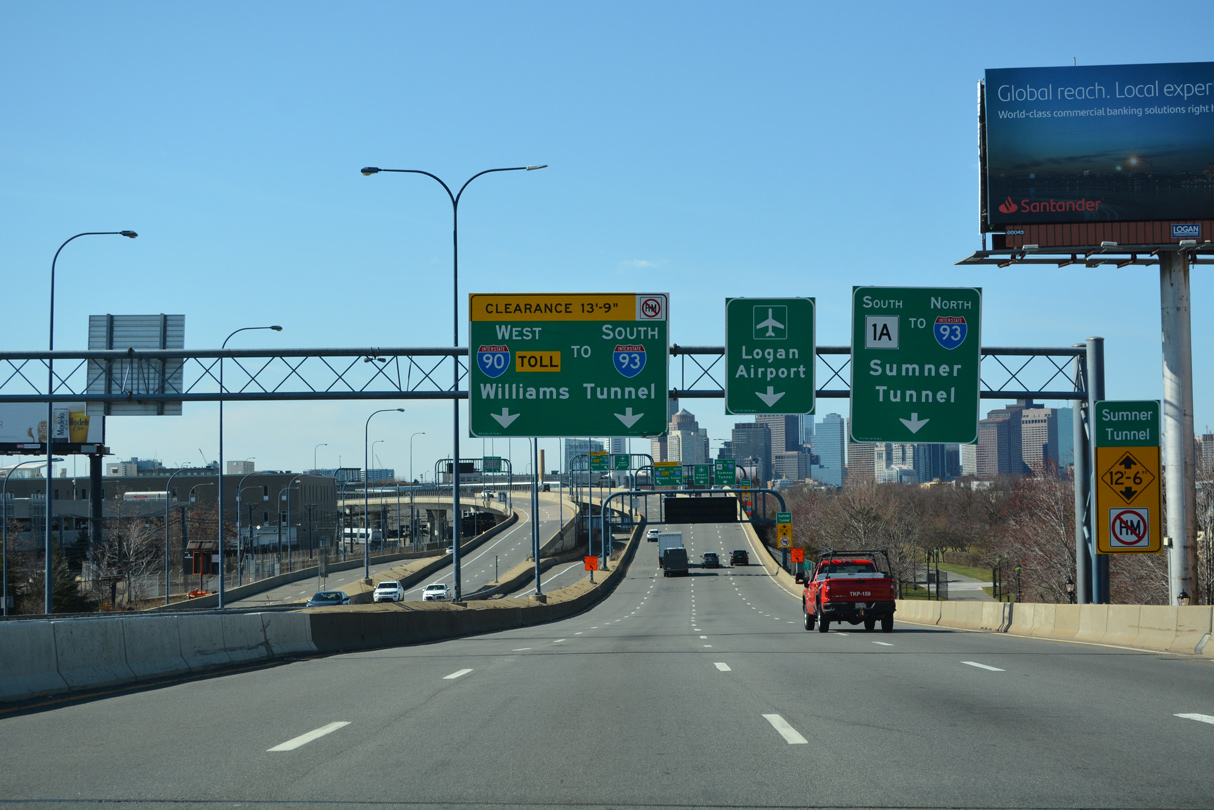
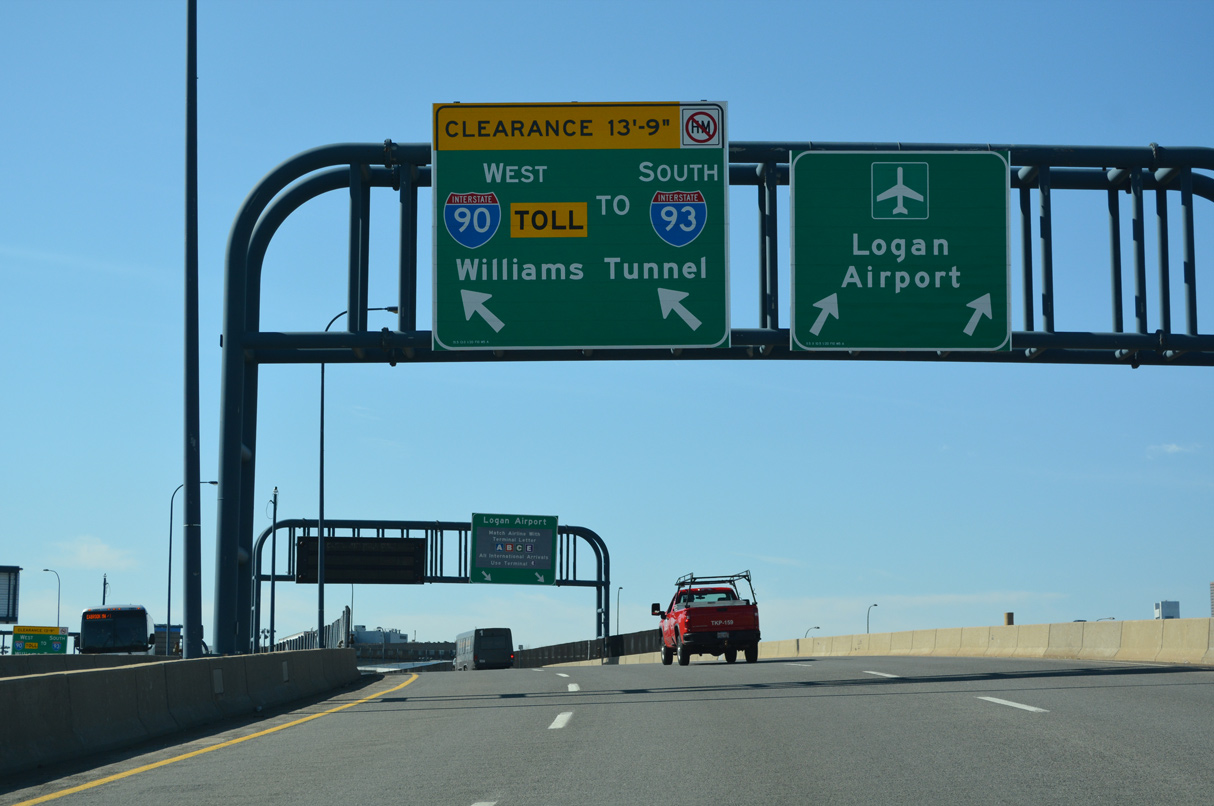
Exit 137 partitions from within Ted Williams Tunnel for the passenger terminals of Logan Airport (BOS). Prior to completion of the ramps with Route 1A, I-90 temporarily ended along surface roads through the airport area. 03/27/23
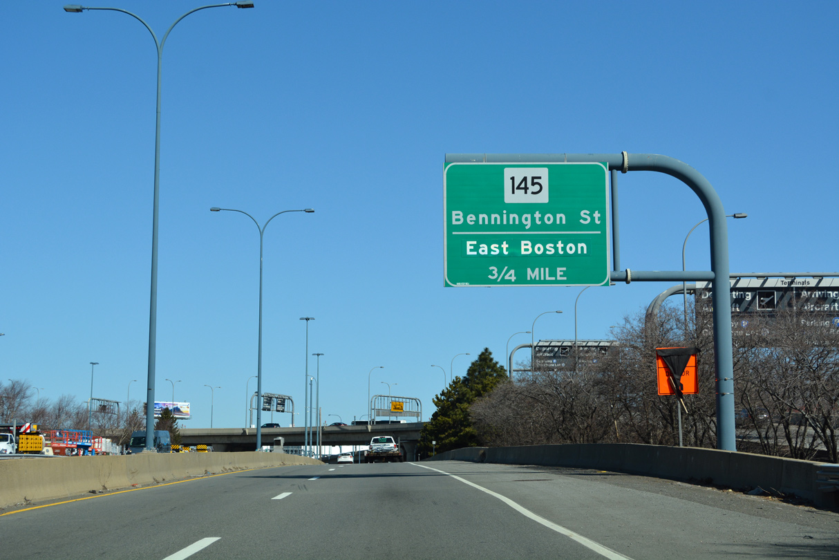
Interstate 90 east defaults onto Route 1A (William F. McClellan Highway) northbound just ahead of the exit for Route 145 (Bennington Street). The greenout for East Boston covers Chelsea. 03/27/23
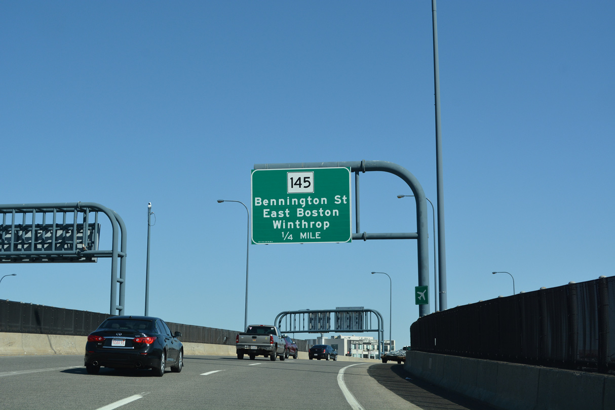
A left side entrance ramp joins I-90 east from Logan Airport (BOS) at the two-wye interchange with Route 1A (East Boston Expressway). Route 1A enters East Boston from the Callahan Tunnel and Downtown. The limited access portion of the state route extends just north of I-90 to Route 145 and Addison Street. 03/27/23
Flyovers connect Interstate 90 with the inside lanes of Route 1A (East Boston Expressway) beyond the end sign. 03/27/23
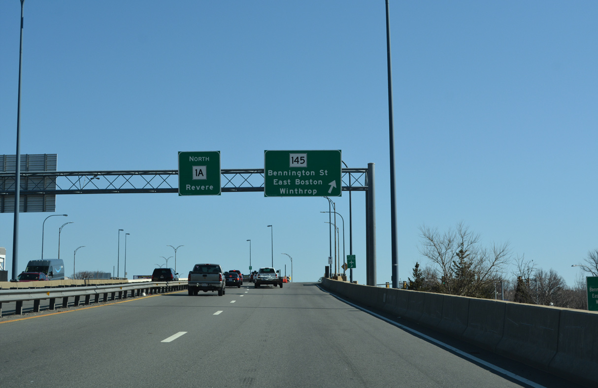
Route 1A (William F. McClellan Highway) northbound splits with the ramp for Route 145 (Bennington Street) just beyond the Interstate 90 east end. Route 145 loops east to Winthrop before turning back toward Route 1A in the city of Revere. Route 1A extends northeast from Revere to Lynn and Salem. 03/27/23
![]() South at
South at ![]()
Route 1A (William F. McClellan Highway) parallels the Chesea River southwest through East Boston to the westbound beginning of Interstate 90. 03/27/23
Route 1A elevates onto a viaduct (East Boston Expressway) at the ramp for Saratoga Street and Route 145 (Bennington Street). The expressway advances 0.75 miles south to Interstate 90 west at Boston Logan International Airport (BOS). 03/27/23
The Downtowns Boston skyline appears to the south on Route 1A just ahead of I-90 and Logan Airport (BOS). Route 1A travels through East Boston to the Sumner Tunnel and I-93 north at Downtown. The Massachusetts Turnpike begins from the left as I-90 arcs southward through the airport and Ted Williams Tunnel. 03/27/23

Entering the two-wye interchange with Interstate 90 (Mass Pike) west and Logan Airport (BOS) on Route 1A (East Boston Expressway). Interests to the Boston Government Center are directed south via Route 1A to New Chardon Street in Downtown. 03/27/23
As Interstate 90 westbound begins from Route 1A south, traffic partitions to a distributor roadway for Transportation Way and Airport Road to the passenger terminal of Boston Logan International Airport (BOS). 03/27/23
A flyover also joins the distributor roadway from I-90 (Mass Pike) west for Boston Logan International Airport (BOS) from Route 1A (East Boston Expressway) northbound. 03/27/23
![]() West
West
The first confirming marker for Interstate 90 west appears at the entrance to Ted Williams Tunnel. The 1.6 mile long tunnel crosses Boston Harbor to South Boston. 03/27/23
Historic East End – – Boston, Massachusetts
![]()
![]() East at
East at ![]()
![]()

Prior to completion of the Fort Point and Ted Williams Tunnels and the eastern extension of the Mass Pike to Boston Logan International Airport (BOS), I-90 concluded at Interstate 93 by South Boston. Photo by Dan Moraseski (10/00).

Exit 24 departed from I-90 (Mass Pike) east for Kneeland Street and Atlantic Avenue ahead of the ramps for I-93. The remainder of I-90 separated into ramps for I-93/Route 3 (John F. Fitzgerald Expressway). Photo by Dan Moraseski (10/00).
State named shield for I-93 on the button copy overhead for the northbound ramp to Downtown Boston and Logan Airport via Route 1A and the Callahan Tunnel. Photo by Dan Moraseski (10/00).

Older guide signs at the I-90 east end. Prior to the Big Dig, Interstate 93 followed the elevated John F. Fitzgerald Expressway along a winding course northward through Downtown Boston. Photo by Dan Moraseski (10/00).
Traffic split for the adjacent northbound lanes of I-93 north to Downtown and a sweeping ramp for I-93 south to Quincy below the Fitzgerald Expressway off-ramp to Kneeland Street. Photo by Dan Moraseski (10/00).
State named shield at the gore point between the I-93 ramps. Photo by Dan Moraseski (10/00).
![]()
![]() North at
North at ![]()
![]()

I-93, U.S. 1 and Route 3 overlap north from Quincy to Downtown Boston. This view looks ahead of I-90 during construction of the Big Dig. Photo by Douglas Kerr (09/01).
![]()
![]() South at
South at ![]()
![]()

Exit 20 overhead for I-90 (Mass Pike) on I-93/Route 3 southbound. The connection from the Fitzgerald Expressway to I-90 linked with an adjacent on-ramp from Kneeland Street and off-ramp to Albany Street. Photo by Dan Moraseski (10/00).

Guide sign for the Kneeland Street on-ramp to I-93/Route 3 (Fitzgerald Expressway) south and Interstate 90 (Massachusetts Turnpike) west at Chinatown, Boston. Photo by Dan Moraseski (10/00).
West End / 4th Avenue S / Edgar Martinez Drive S – Seattle, Washington
![]() West
West
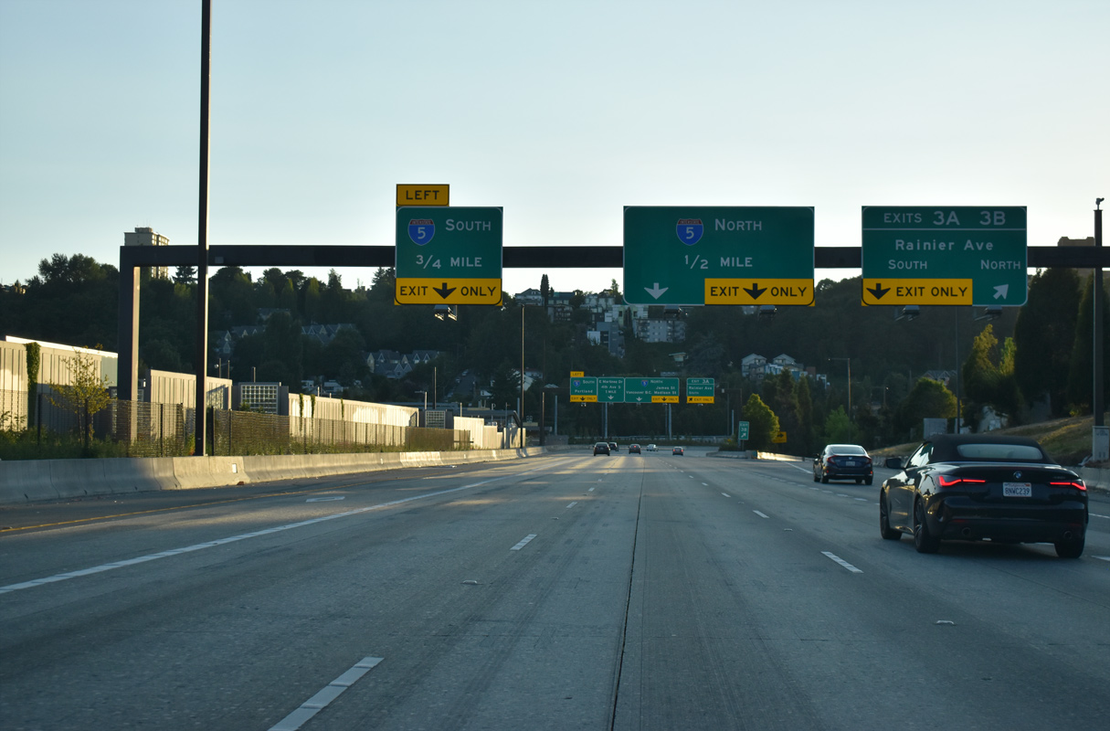
Exit 3 B departs Interstate 90 westbound for Ranier Avenue (former SR 900) in the Mt. Baker section of Seattle. 1.4 miles of the freeway remains, with the subsequent exits connecting to Interstate 5 at a systems interchange. 07/20/23
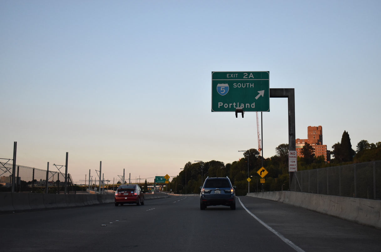
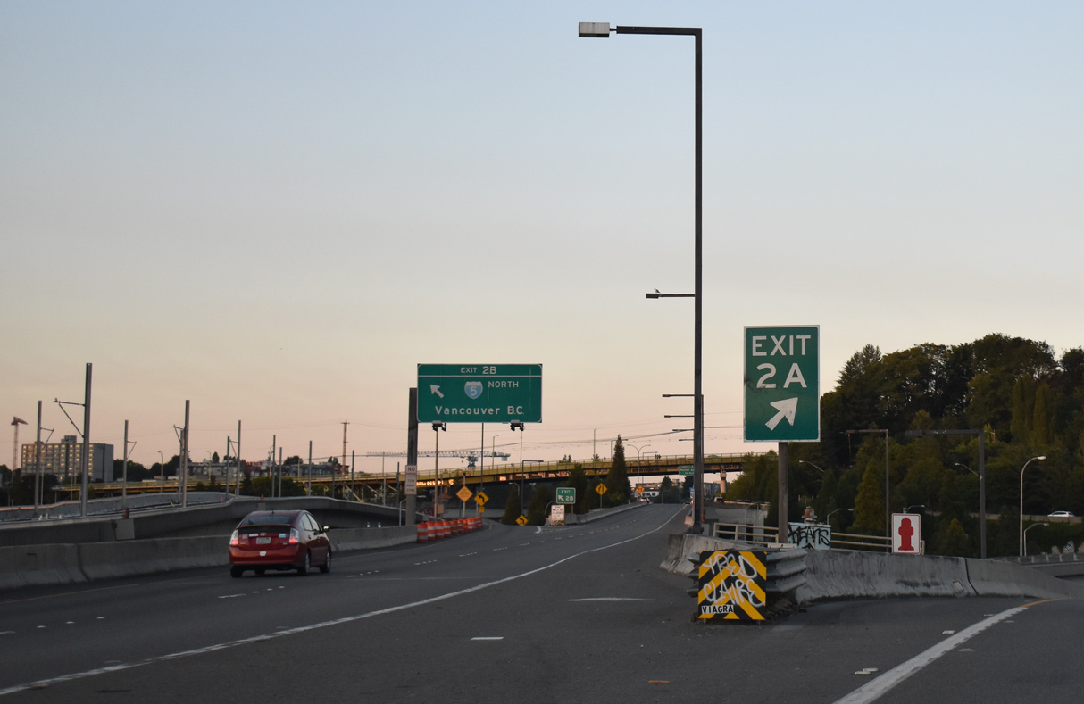
Advancing west with four lanes, Interstate 90 partitions into Exit 2 B for I-5 south to Tacoma, Olympia and Portland, Oregon and Exit 2 A for I-5 north to Everett, Mt. Vernon, Bellingham and Vancouver, British Columbia. 07/20/23

Exit 2 C departs from westbound I-90 for I-5 north to Everett and Vancouver, B.C. Interstate 90 transitions into a double decked freeway configuration ahead of Left Exit 2 B for I-5 south. 07/20/23
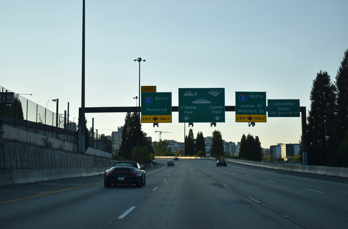
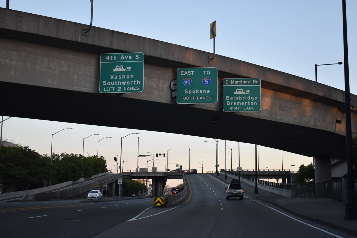
Continuing west from I-5, the westbound lanes of Interstate 90 travel below the eastbound roadway to the unnumbered exit for Edgar Martinez Drive (SR 519). 07/20/23
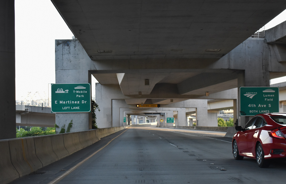
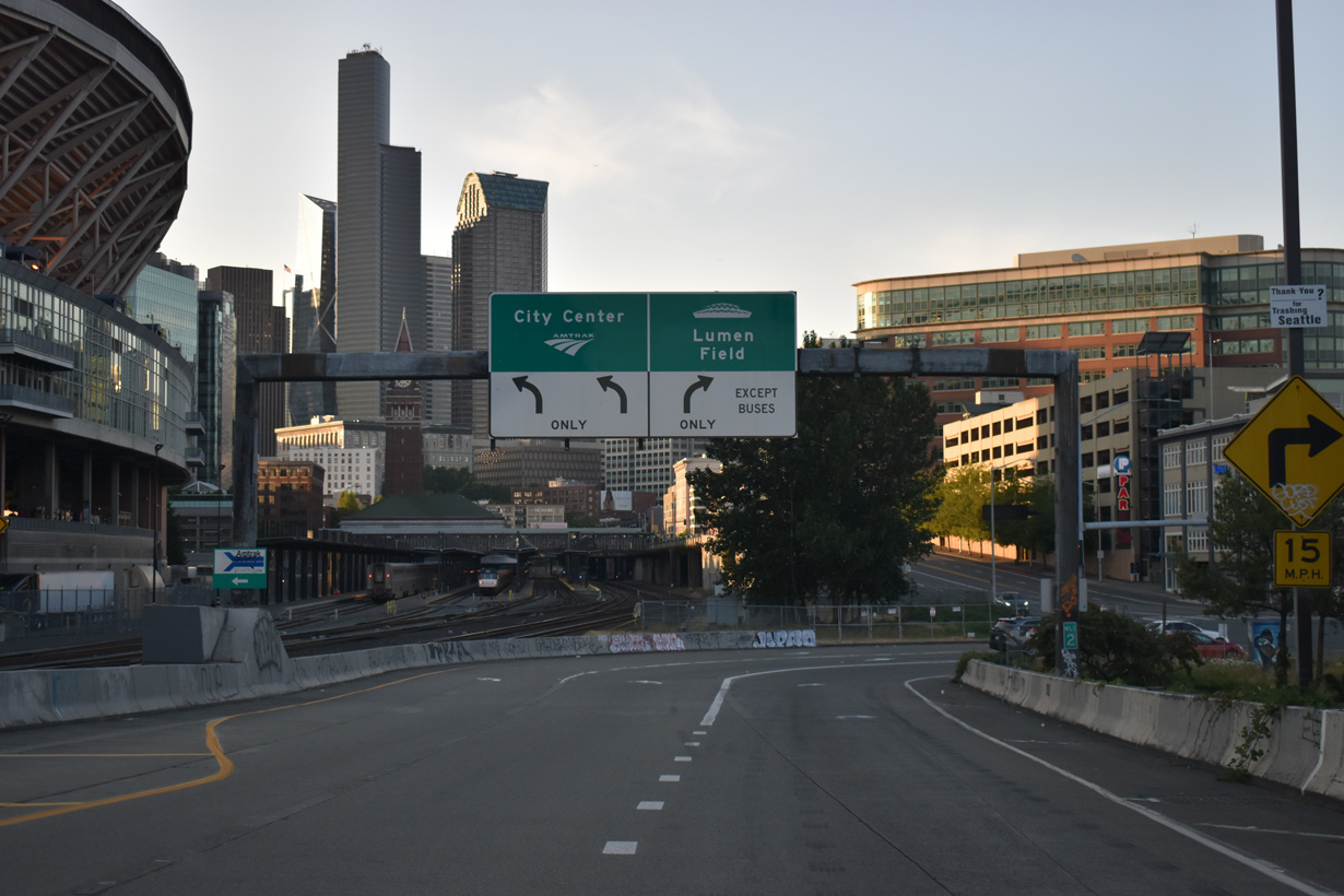
The left exit for Edgar Martinez Drive S (SR 519) leads to T-Mobile Park while the remainder of I-90 westbound hooks into 4th Avenue S adjacent to Lumen Field. 07/20/23
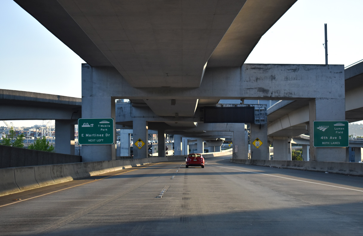
SR 519 lines Edgar Martinez Drive west from the ramps with I-90 at 4th Avenue S to 1st Avenue S north. The 1.14 mile long route links Interstate 90 with the Washington State Ferries. 07/20/23
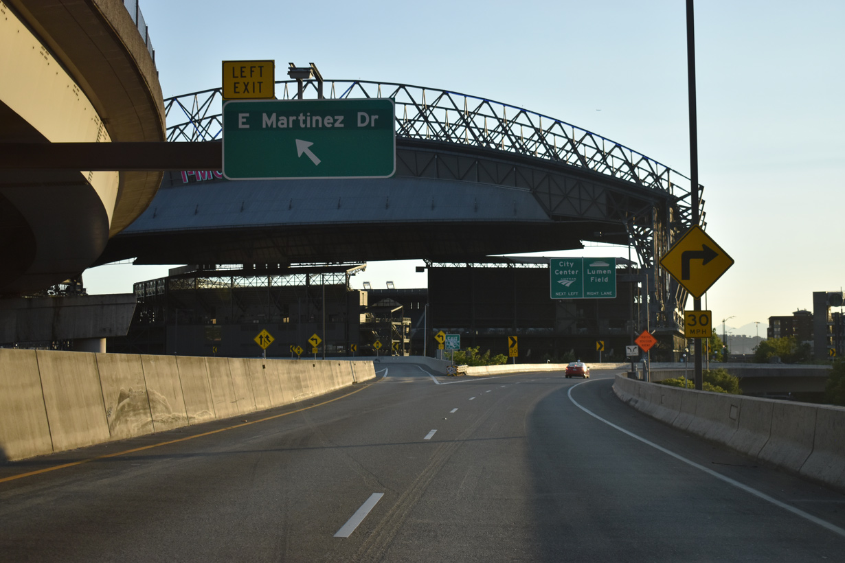
Interstate 90 west emerges from the double-decked viaduct ahead of T-Mobile Park, home of the Seattle Mariners. Eastbound I-90 begins along the flyover from Edgar Martinez Drive and 4th Avenue S. 07/20/23
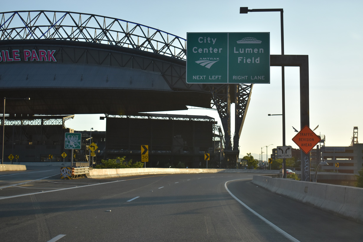
Interstate 90 westbound concludes with two lanes connecting to 4th Avenue S northbound to the Seattle central business district and two lanes for 4th Avenue S south to the adjacent stadiums. 07/20/23
4th Avenue S heads north to Downtown Seattle and south to the Industrial District. 07/20/23
Edgar Martinez Drive S east at ![]()
Edgar Martinez Drive S runs along the south side of T-Mobile Park between Dave Niehaus Way and ramps with 4th Avenue S and Interstate 90 east. Edgar Martinez played his entire career for the Seattle Mariners from 1987 to 2004. 06/26/15
Flyovers from I-90 west and to I-90 east tie into Edgar Martinez at the elevated intersection with the ramps from 4th Avenue S. 06/26/15
![]() East at
East at ![]()
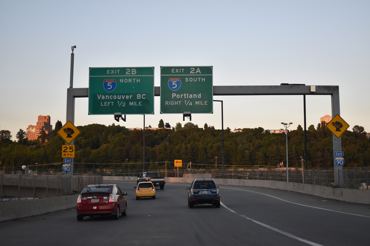
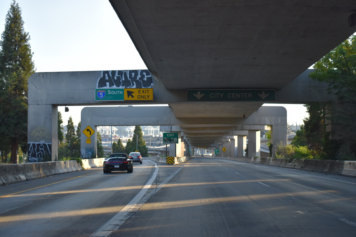
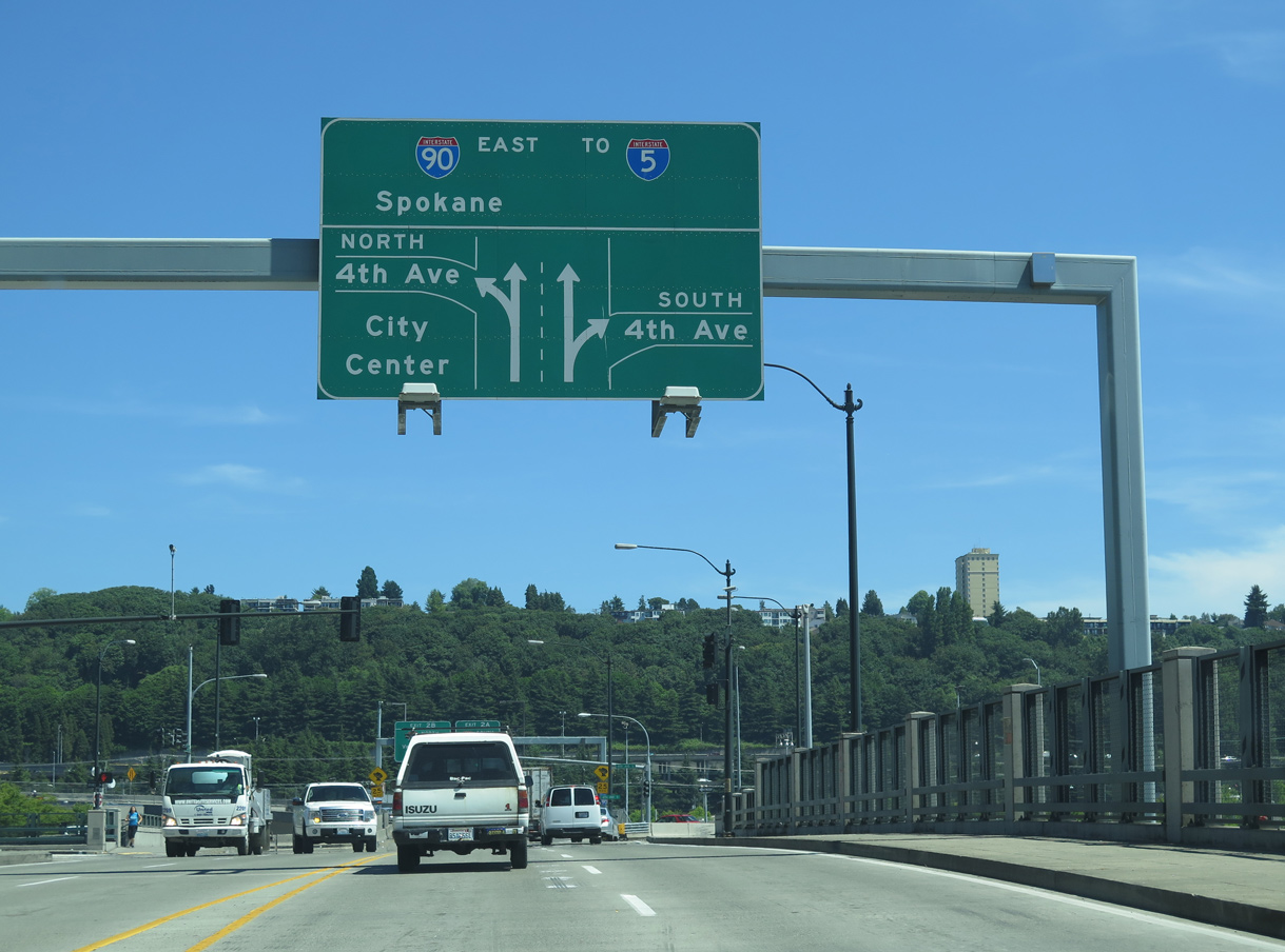
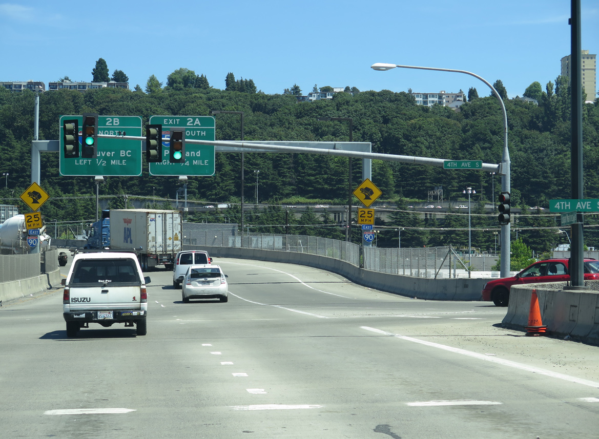
A pair of confirming markers appear at the eastbound beginning of I-90 from 4th Avenue S and Edgar Martinez Drive S (SR 519). The flyover curves northward over the King County Metro Ryerson Base bus yard to the double decked section through the systems interchange (Exits 2 A/B) with I-5. Greenouts here covered Everett for I-5 north and Tacoma for I-5 south. 07/20/23
Interstate 90 eastbound ascends onto the top deck of the multi level exchange with I-5 between the International District and North Beacon Hill. Departing next is Exit 2 A for I-5 south to Tacoma, Olympia and Portland, Oregon. 07/20/23
Left Exit 2 B connects I-90 east with Interstate 5 north to Everett, Mt. Vernon, Bellingham and Vancouver, British Columbia. 07/20/23
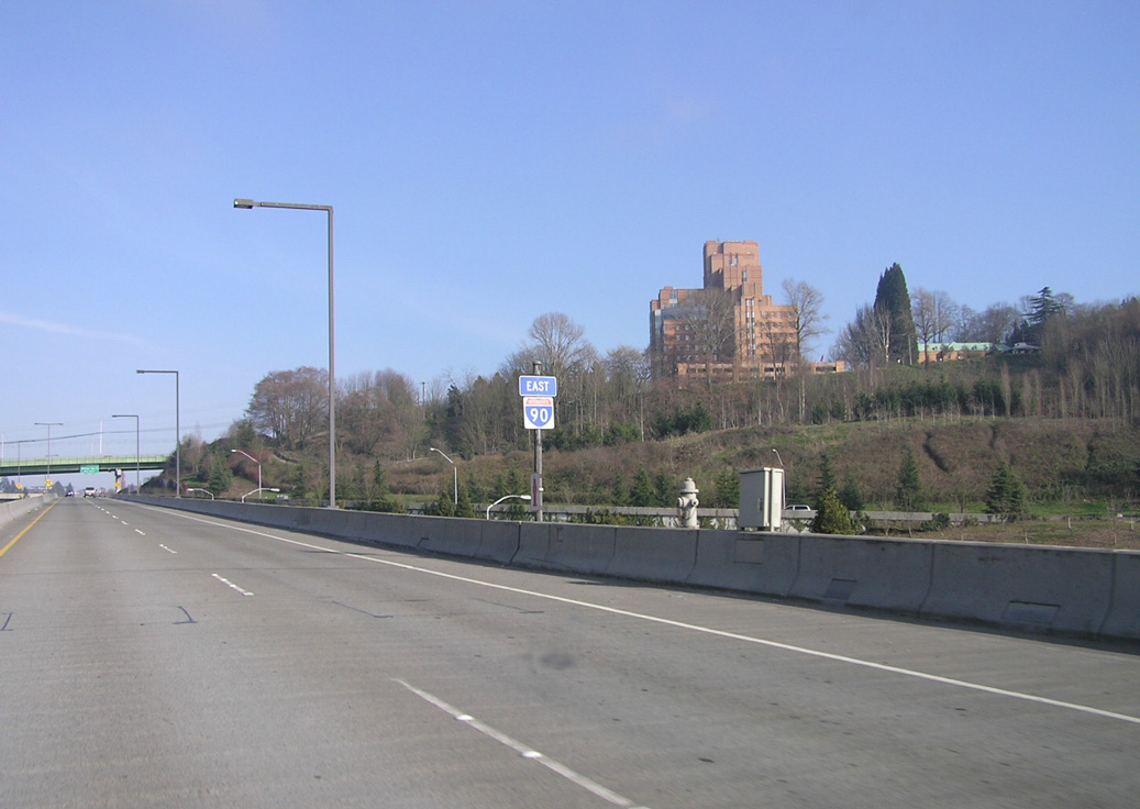
The second confirming marker for I-90 east precedes the 12th Avenue over crossing at the North Beacon Hill community. Completed in June 1989, the initial seven miles of I-90 between areas south of Downtown Seattle and Bellevue included upgrades to the Mount Baker Ridge Tunnel and the Lacey V. Murrow Memorial (Lake Washington Floating) Bridge. The Mount Baker Ridge Tunnel is the world’s largest diameter soft earth tunnel. Photo by Chris Elbert (02/26/05).
4th Avenue S south at ![]()

Southbound 4th Avenue S crosses a viaduct over the Amtrak lines and lowers to street level ahead of the west end of Interstate 90. Trailblazers for I-5/90 direct motorists southward along 4th Avenue S to the grade separated intersection with Edgar Martinez Drive S (SR 519). Photo by Chris Elbert (02/26/05).
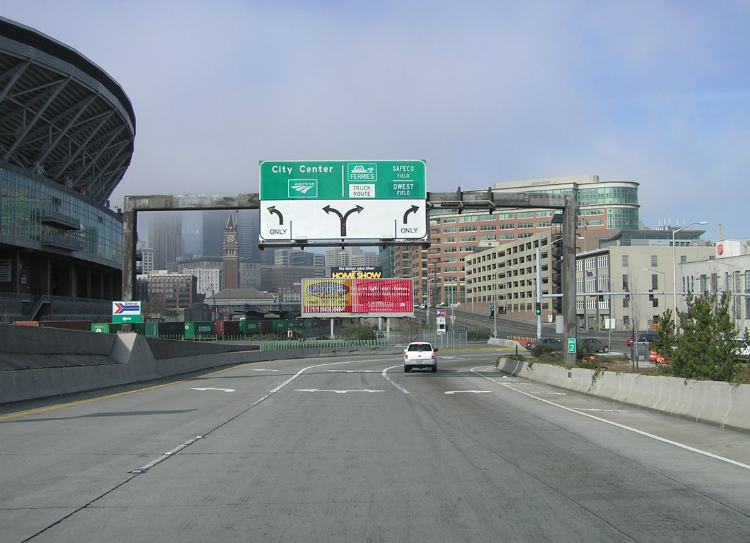
4th Avenue S (SR 519) intersects Royal Brougham Way below the westbound flyover. The ensuing ramp connects with Edgar Martinez Drive S (SR 519) at T-Mobile Park and I-90 eastbound. Redevelopment of this area for the Seattle sports venues included traffic pattern changes and a new connection to I-90. 08/29/06
SR 519 commences along Edgar Martinez Drive west from the grade separated intersection joining 4th Avenue S with the eastbound beginning of Interstate 90. 07/20/23

SR 519 extends 1.14 miles northwest from 4th Avenue S at Interstate 90 to the Seattle Ferry Terminal. Photo by Chris Elbert (02/26/05).
West End Throwback
Interstate 90 west at 4th Avenue S when it was part of SR 519 hooking west to Royal Brougham Way west and Alaskan Way to the Seattle Ferry Terminal. Photo by Chris Elbert (02/26/05).
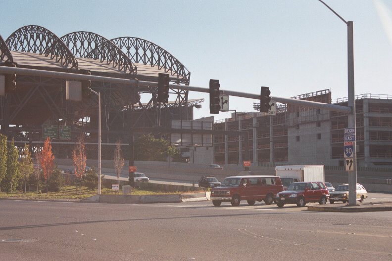
Interstate 90 formerly began from an intersection with 4th Avenue S. This connection closed permanently with construction of T-Mobile Park. Photo by Jeff Royston (09/99).
A begin shield was posted at the ramp to I-90 east from 4th Avenue S. The Lumen Field Parking Garage rises just west of the old ramp configuration adjacent to several railroad lines. Photo by Jim Teresco (07/29/99).
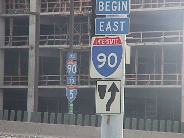
The previous first confirming marker for I-90 east stood along the connection from 4th Avenue S. Milepost 2 factored in SR 519, which links the Puget Sound Ferry Docks at Elliott Bay with Interstate 90. Photo by Jim Teresco (07/29/99).
Sources:
- Mileage update provided by Gary S. Peterson.
- “Exit 66 now road to nowhere.” The Rapid City Journal, October 2, 2003.
- “It’s Red Lights Out In Idaho Town.” Chicago Tribune, September 15, 1991.
- The Evolution of Interstate 90 between Seattle and Missoula, by Erick Johnson, Eastern Washington University
- “How a road changed everything: The skyway was a construction feat 50 years ago: ‘It was something to watch that road being built. Why, you would think the whole world was coming to an end.'” Chicago Tribune, November 24, 2004
- Chicago Skyway no longer an Interstate, post on Misc.Transport.Road, August 20, 1999, by Rich Carlson
- New York Thruway Factbook
http://www.thruway.state.ny.us/factbook/ - About the Massachusetts Turnpike, the Main Street of Massachusetts
http://www.massturnpike.com/aboutus/index.html - Divided Highways: Building the Interstate Highways, Transforming American Life in 1997 by Tom Lewis, Viking Penguin/Penguin Books, page 199.
- Personal Email from Jen Watkins, “Interstate 90 Info,” 03/10/05, and I-90 Wildlife Bridges Coalition
- “Lease sale closes on Indiana Toll Road for $5.72B” WLFI, May 28, 2015.
- “Toll Road plan clears senate: Chambers’ leaders say differences remain”. Indianapolis Star, by Theodore Kim, March 3, 2006.
- “Toll Road bill signed, Daniels moves quickly.” Indianapolis Star, by Theodore Kim, March 16, 2006.
- “A tale of 2 projects — and political implications.” Indianapolis Star, by John Ketzenberger, March 21, 2006.
- Encyclopedia of Chicago: Expressways by Dennis McClendon of the Chicago Historical Society
- Chicago Timeline: 1960 Northwest Expressway Completed; November 29, 1963 Renamed The John F. Kennedy Expressway
http://www.chipublib.org/004chicago/timeline/kennedyx.html, Chicago Public Library, updated August 1997 - Chicago Timeline: 1962 Dan Ryan Expressway Opened
http://www.chipublib.org/004chicago/timeline/danryanx.html, Chicago Public Library, updated March 2006 - Encyclopedia of Chicago: Tollways by David M. Young of the Chicago Historical Society
- “Dead Man’s Curve could be worse – in fact, it was” Cleveland Plain Dealer, April 22, 2001.
- “I-90/39 Ramp Project.” WIFR.com, July 23, 2010.
- “Jane Addams Memorial Tollway – Newburg Road to Rockton Road – Reconstruct & Widen>” Illinois Tollway, press release, November 24, 2009.
- Ted Williams Tunnel (I-90), BostonRoads.com.
- Tunnels & Bridges – The Big Dig – Highway Division, massDOT.
- “Thruway connector’s name spurs question“, Getting There (timesunion.com), March 25, 2010.
- “Re: Massachusetts” online posting by PHLBOS, AARoads Forum, February 18, 2016.
- “Timeline outlines Montana Department of Transportation history.” Montana Standard, June 16, 2013.
- “I-90 now four lanes all across Montana.” The Spokesman-Review, May 14, 1987.
- “State’s big move to all-electronic tolling begins Friday as toll plazas shut down.” MassLive, October 24, 2016.
- “Inner Belt Bridge is completely open today.” The Plain Dealer (Cleveland, OH), October 24, 2016.
Page updated February 1, 2024.