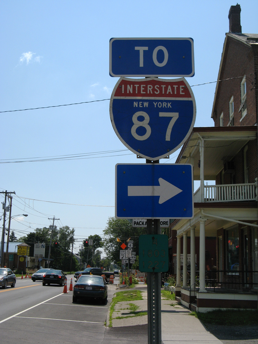
Interstate 87
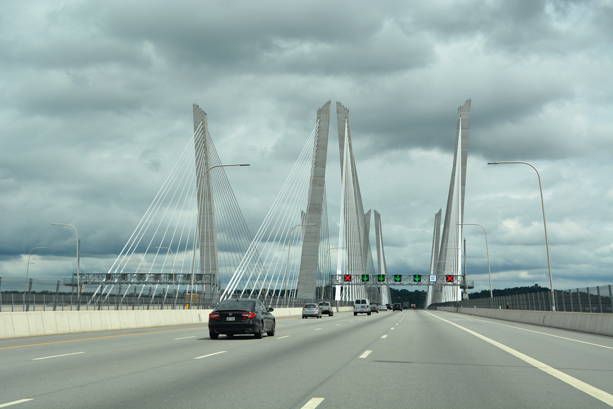
I-87 south / I-287 east crossing the Governor Mario M. Cuomo Bridge over the Hudson River. 08/19/21
Overview
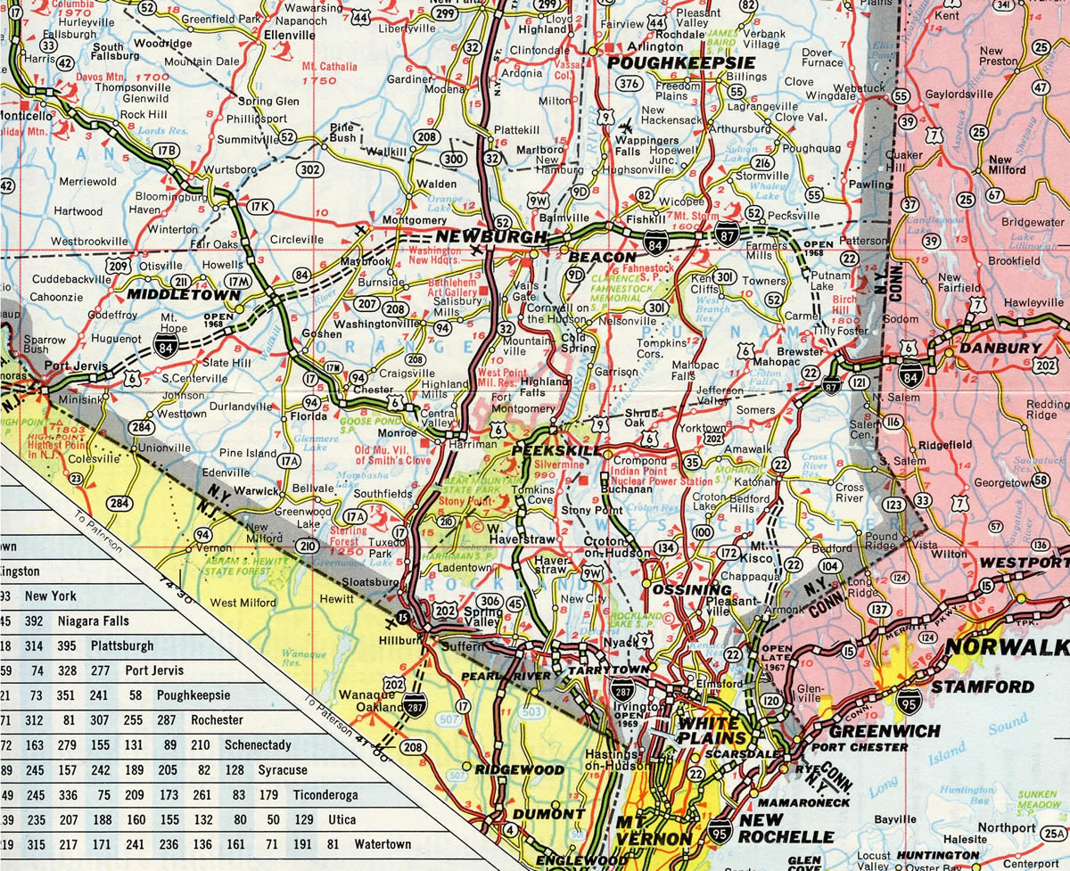
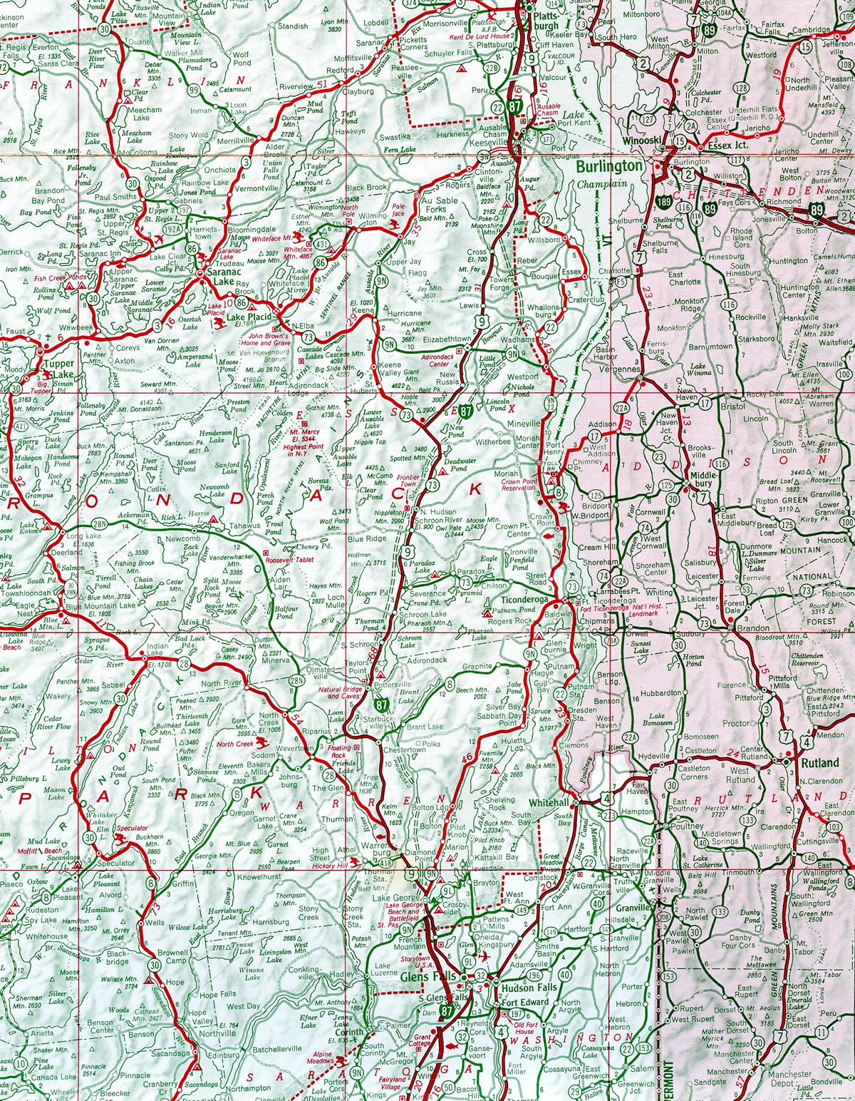
Interstate 87 runs nearly the height of the Empire State from New York City to the Canadian border at Rouses Point along three distinct sections. I-87 follows the Major Deegan Expressway from the Robert F. Kennedy (Triboro) Bridge in New York City northward to the Westchester County line. I-87 continues along the New York State Thruway from New York City to Albany and the Capital District, serving Newburgh, New Paltz, Kingston and Catskill along the way. Northward from Albany to the International Border, I-87 is the Adirondack Northway. The Northway serves Adirondack Park, the North Country and traffic bound for Montreal, Quebec via Autoroute 15.
Exit numbers along the three sections of Interstate 87 are sequential, each with its own numbering system:
- Major Deegan Expressway – Exit 1 (I-278) through 14 (McLean Avenue)
- New York Thruway – Exits 1 (Hall Place) through 24 (Northway and I-90 east)
- Adirondack Northway – Exits 1N/S (Western Avenue / I-87 North) through 43 (U.S. 9 / Champlain)
Branch routes from I-87 include I-287 from Suffern to Port Chester, I-587 into Kingston and I-787 from Albany to Troy. Preliminary numbers for the New York Interstate System included:
- Interstate 187 – the Westchester Expressway from the New York Thruway east to White Plains in 1958. Renumbered to I-487.8
- Interstate 387 – the New York Thruway from Elmsford west to Suffern in 1958. Renumbered as part of I-287.8
- Interstate 487 – designation for the Cross-West Chester Expressway. Renumbered as part of I-287 in 1961.
- Interstate 687 – unconstructed loop linking I-90 at Corporate Woods Boulevard with I-87 (Northway) near Albany International Airport (ALB).
High Priority Corridor
Interstate 87 in its entirety is part of High Priority Corridor 47: Interstate 87.
 Parallel U.S. Routes
With the exception of the South Bronx in New York City, Interstate 87 follows U.S. 9 for its entire length.
History
The mainline of the New York Thruway was opened to traffic in stages between 1954 and 1957. Opening dates of Interstate 87 from south to north:2
- New York City to Yonkers (3 miles) – August 31, 1956
- Yonkers to Suffern (27 miles) – December 15, 1955
- Suffern to Hillburn (1 mile) – July 1, 1955
- Hillburn to Harriman (14 miles) – May 27, 1955
- Harriman to Newburgh (15 miles) – December 22, 1954
- Newburgh to Albany (88 miles) – October 26, 1954
The Adirondack Northway, which is the toll free section of Interstate 87 from Albany north to the International Border with Quebec, Canada, began construction in 1957. A ten mile stretch opened on May 26, 1961 from U.S. 9 southwest of Glens Falls to Gurney Lane (Exit 20) to the north of Glens Falls. This portion joined the previously opened sections stretching 15 miles between Albany and Clifton Park and the nine mile bypass around Plattsburgh.4 The entire 176 mile long Northway opened to traffic on August 30, 1967. Completion of the route cost $208 million.3,5
Route Information
North End – Champlain, NY
South End – Bronx, New York City, NY
Branch Routes – 3
Mileage – 333.49
Cities – New York City, Newburgh, Kingston, Albany, Saratoga Springs, Glenn Falls, Plattsburgh
Junctions –

 Berkshire Connector
Source: December 31, 2021 Interstate Route Log and Finders List
Portions of I-84 and I-684 were opened to traffic by 1967 when both served as the mainline of I-87 between White Plains and Newburgh.
Interstate 87 was completed north from the Plattsburgh bypass to Canada and south from NY 9N near Lake George to Albany in 1963.
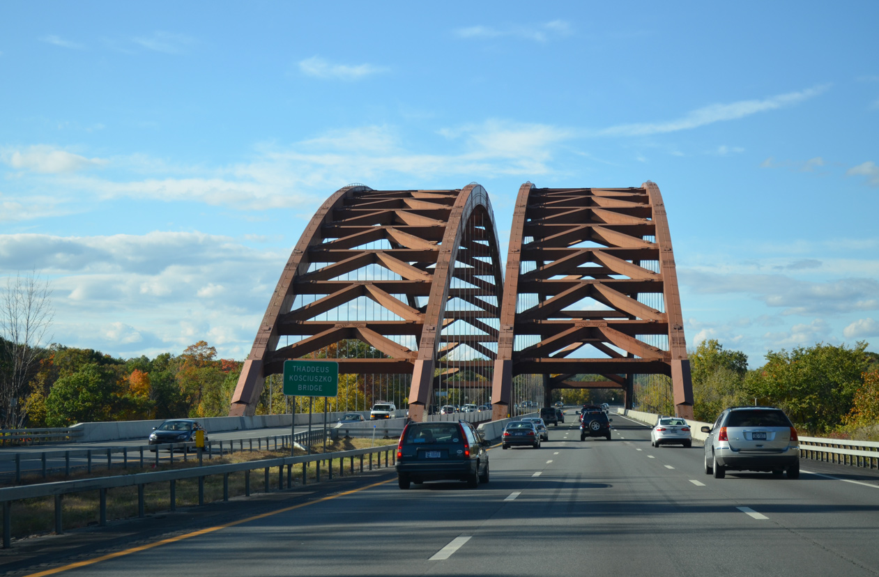
The Thaddeus Kosciuszko Bridge carries motorists along Interstate 87 north across the Mohawk River. The tied arch bridges were built in 1959. 10/05/14
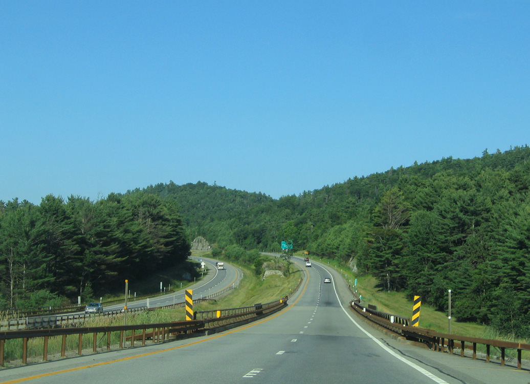
Interstate 87 along the Adirondack Northway north at the Black River in the town of Westport. 07/20/05
The path of the Northway was debated. Among other proposals, discussion included whether to route it east or west of Saratoga Springs, and whether to shift it east away from Adirondack Park toward the Vermont state line. Three possibilities made it into final consideration:5
- Routing I-87 northeastward from Albany to Whitehall and Ticonderoga and westward to the current Northway within the Town of Elizabethtown near New Russia. This alignment would have completely avoided Adirondack Park.
- Routing I-87 northward through the Schroon River Valley and along the west side of Schroon Lake.
- Routing I-87 north from Saratoga Springs to Lake George via the Town of Queensbury and then shifting slightly west to the west side of Schroon Lake.
The options through Adirondack Park spurned opposition and the formation of a citizens group, Citizens’ Northway Committee, in 1958, which advocated redirecting the Northway around the park. They supported an eastern route through the Champlain Valley, with I-87 staying east of its current route from Ticonderoga to Crown Point, Port Henry and Westport to Keeseville. Ultimately the path of I-87 was decided with public input and a state constitutional amendment passed in 1959.5
Interstate 87 did not follow the entire New York Thruway mainline, including the Tappan Zee Bridge, from Elmsford to Newburgh until 1969. The 1968 Highway Act included legislation that shifted I-87 west onto the New York Thruway. The Interstate was previously routed along the Cross Westchester Expressway (I-287) between Elmsford and White Plains, the present alignment of I-684 northward from White Plains to Brewster, and an overlap with I-84 west from Brewster to Newburgh. The Federal Highway Administration (FHWA) approved this relocation on September 11, 1969, followed by the American Association of State Highway Officials (AASHO) on October 26, 1969. Actions at the same AASHO meeting included the establishment of Interstate 684.
A $19.8 million project started in April 2014 replaced the U.S. 11 overpass at Exit 42 and reconstructed a nearly two mile section of Interstate 87 at Champlain in Clinton County. Construction also reconfigured the exchange into a dumbbell interchange. Work ran through late Fall 2015.10
Governor Mario M. Cuomo Bridge
Until 2017, I-87/287 crossed the Hudson River on the Governor Malcolm Wilson Tappan Zee Bridge. The cantilevered bridge between South Nyack and Tarrytown opened to traffic on December 15, 1955 as part of the New York Thruway mainline between Rockland and Westchester Counties. The crossing accommodated six overall lanes until the mid 1980s, when a narrow asphalt median was removed to allow for a seventh travel lane.6
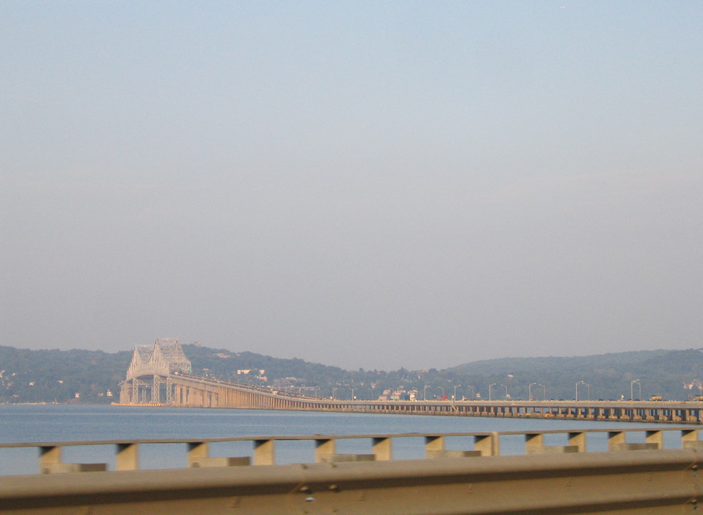
Looking east at the Tappan Zee Bridge from the northward curve of I-287 ahead of South Nyack. Construction commenced on the bridge in 1952 and the span cost $60 million to build.6 06/13/05
This river shot from main navigation channel shows our towers are already higher than existing, will rise to 419 ft pic.twitter.com/vgTbTbAkG0
— The New NY Bridge (@NewNYBridge) July 8, 2016
The concept of replacing the aging Tappan Zee Bridge arose in 2000 after a recommendation by a state task force. It would take another decade however for the replacement to gain backing, and it did by October 2011, leading to a $3.1 billion design and contractor selection by a state review panel and the Thruway Authority.6
The notice to proceed on the The New NY Bridge occurred in January 2013, with test piles erected starting in July 2013. Construction on the bridge approaches began in March 2014, with main superstructure work following in June 2014. The first of the 40 foot long girders were placed in early July 2016 over the four crossbeams which join together the eight towers on the new bridge. 192 cables support the girders and road deck over the main span. They tie into the 419 foot signature towers of the Governor Mario M. Cuomo Bridge. The towers top out at 100 feet higher than the former Tappan Zee Bridge.9
Dedicated to former New York Governor Mario N. Cuomo, the cabled stayed bridge opened to northbound traffic following a ribbon cutting ceremony held on August 24, 2017. Southbound traffic shifted to the new span on October 6, 2017. The westbound span accommodated two way traffic until the eastbound bridge opened to traffic on September 7, 2018. Total costs for the new bridge were $3.98 billion.7 web site.
 Photo Guides
North End – Canadian International Border – Champlain, New York
![]() North
North
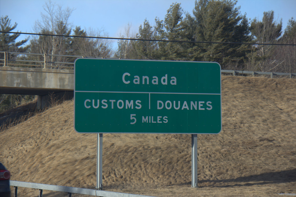
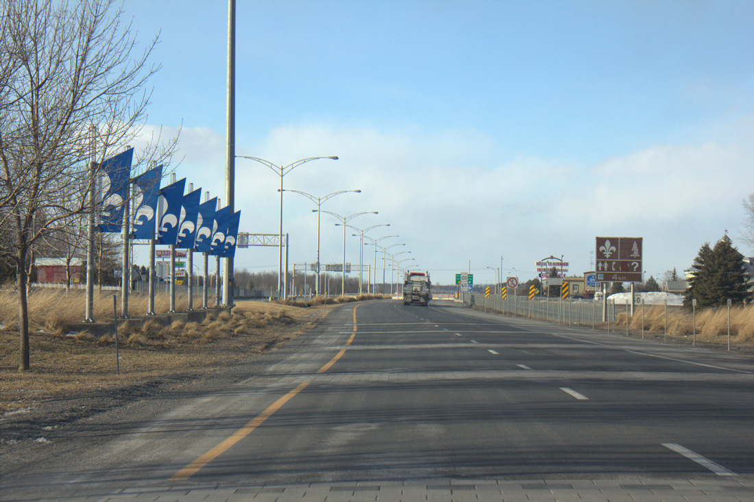
Five miles of Interstate 87 (Adirondack Northway) remain north of the Lavalley Road overpass to the Canadian customs station and Quebec Autoroute 15. Photo by Shaun Ganley (03/18/15).
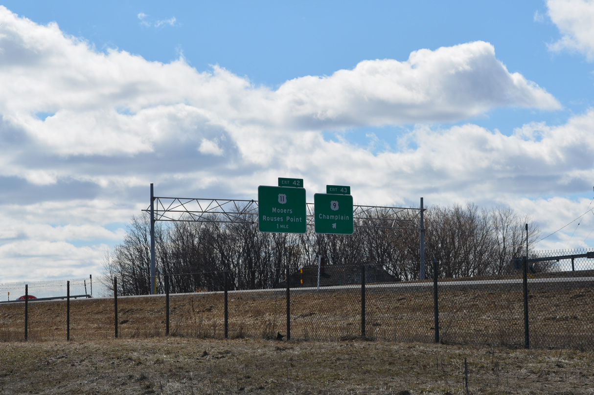
The penulimate exit from I-87 joins the Northway with U.S. 11 at the town of Champlain. U.S. 11 travels west across the northern tier of New York from the Canadian border north of Rouses Point to Watertown. Photo by Shaun Ganley (03/18/15).
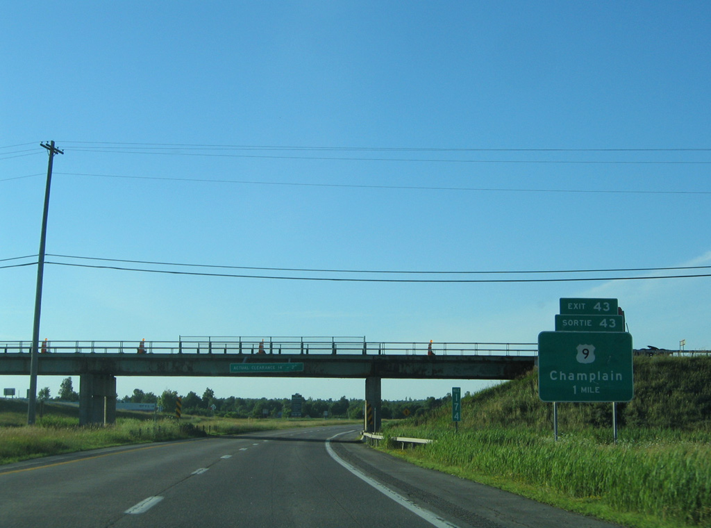
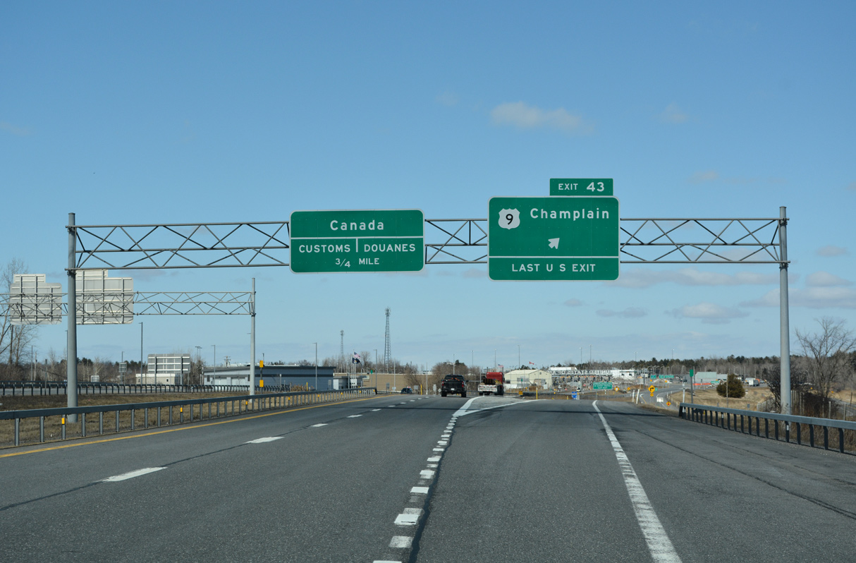
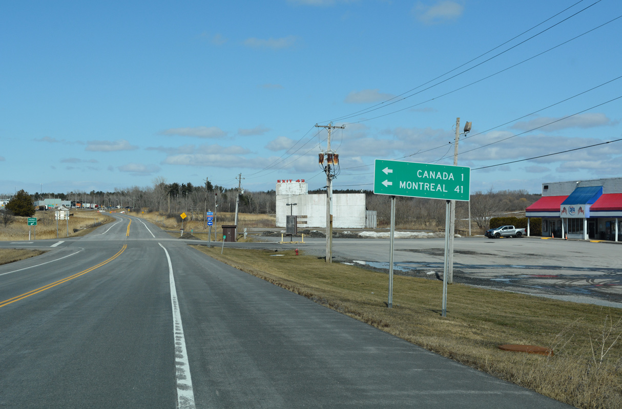
U.S. 9 angles northwest from Champlain along Main Street to conclude along the frontage road system of Interstate 87 at forthcoming Exit 43. 07/20/05
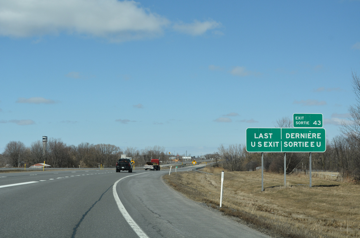
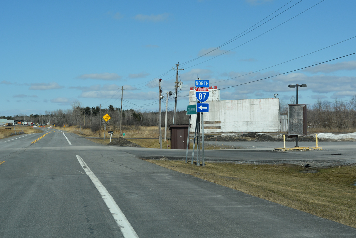
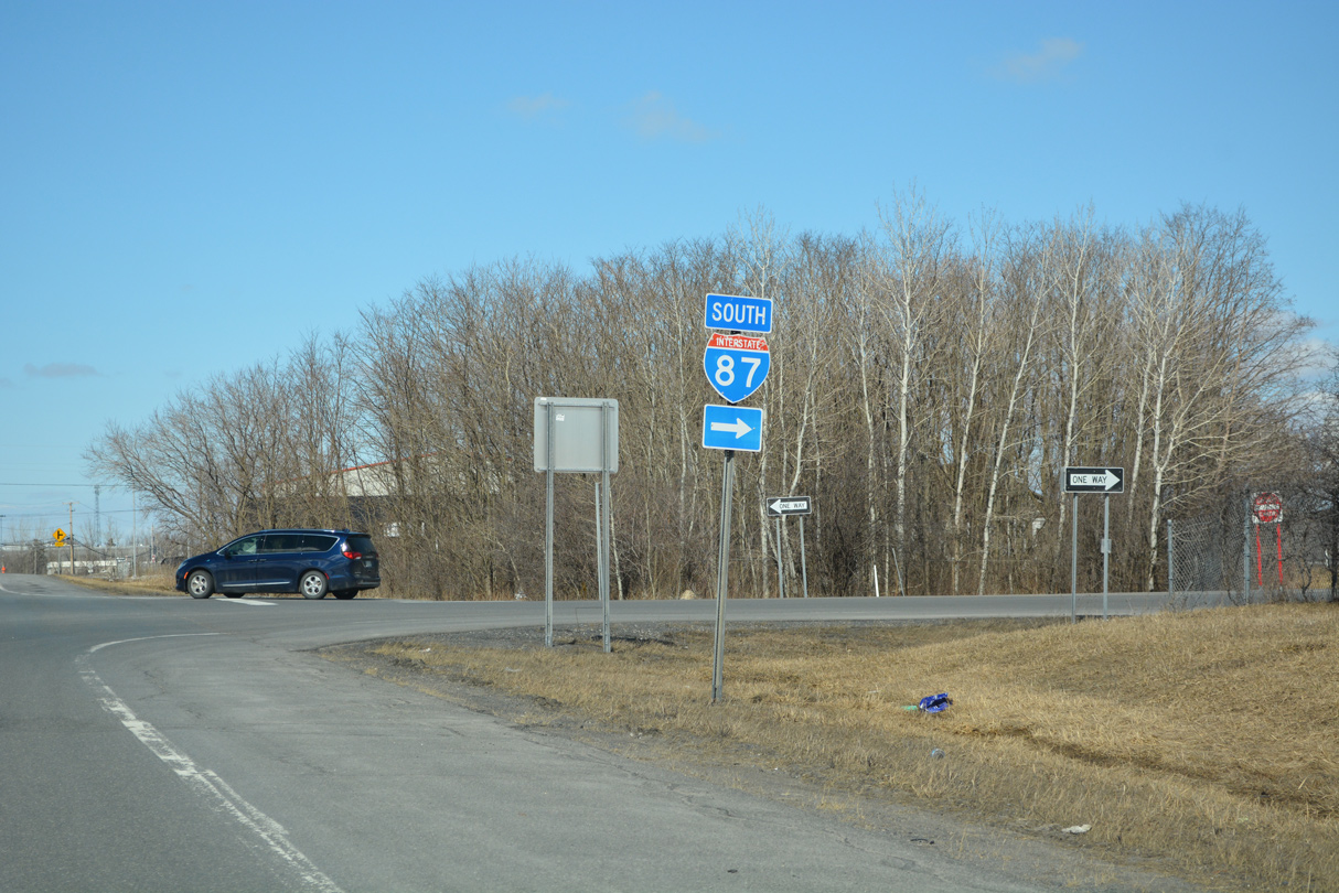
Exit 43 represents the final departure point along Interstate 87 north before the Northway enters the port of entry into Quebec, Canada. 03/24/23
I-87 crosses the Great Chazy River and Perry Mills Road ahead of the final confirming marker northbound. 03/24/23
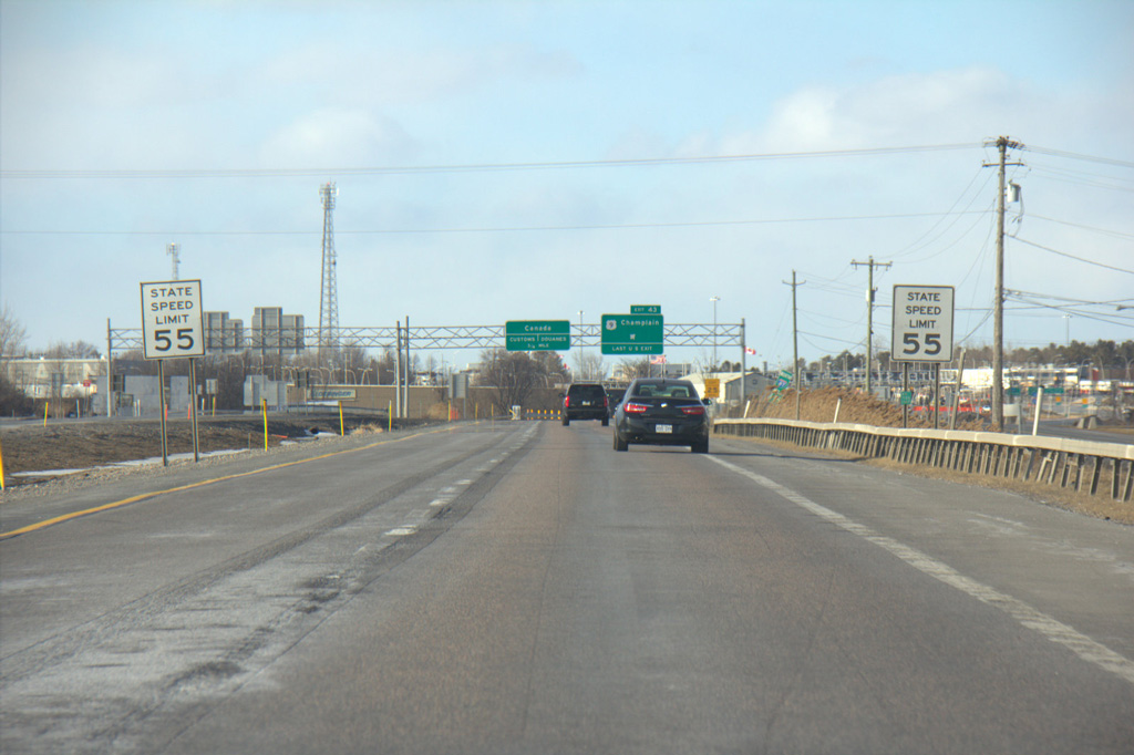
The speed limit reduces to 55 miles per hour as Interstate 87 north reaches the folded diamond interchange (Exit 43) with U.S. 9 and the Service Road system. Photo by Shaun Ganley (03/18/15).
Exit 43 separates from I-87 northbound to connect with the adjacent E Service Road. U.S. 9 leads back south into the town of Champlain and north a short distance to a cul-de-sac. 03/24/23
Prior to the building of Interstate 87, U.S. 9 continued north to the Canadian border. 03/24/23
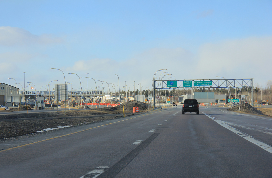
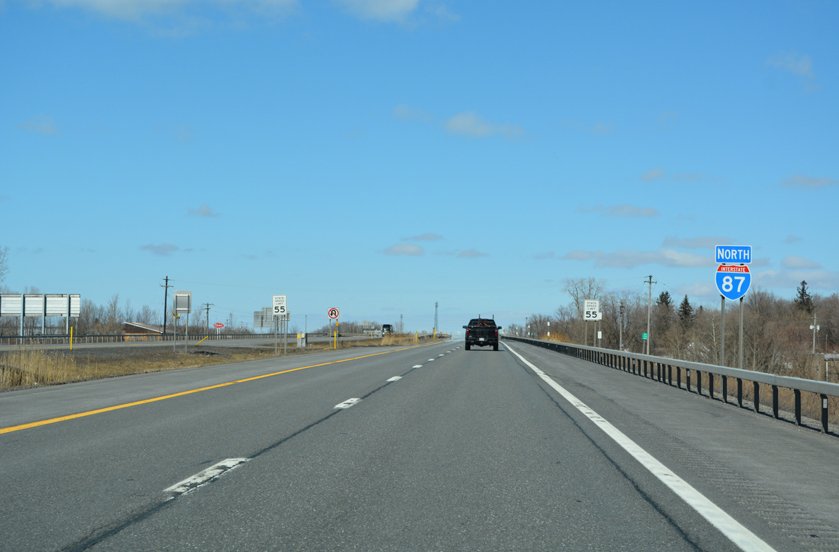
Interstate 87 concludes as traffic partitions into a truck ramp for export control and the customs station. There is no U-turn beyond Exit 43. Photo by Shaun Ganley (03/18/15).
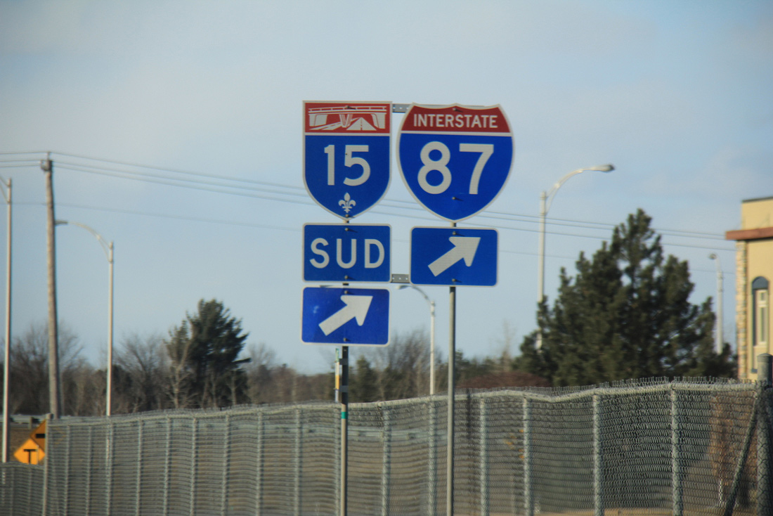
Leaving the Canadian port of entry, Autoroute 15 begins. Photo by Shaun Ganley (03/18/15).

Once a tolled facility, Autoroute 15 leads directly to Montreal from Upstate New York. The freeway advances 32 miles north to the Champlain Bridge across the Saint Lawrence River, where it combines with A-10 and A-20. Photo by Shaun Ganley (03/18/15).
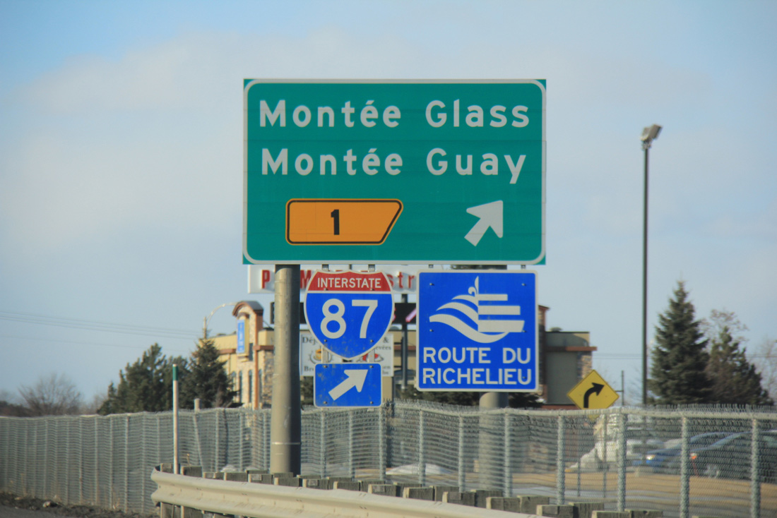
A folded diamond interchange (Exit 1) lies just north of the customs station with Montée Guay east and Montée Glass west. Photo by Shaun Ganley (03/18/15).
Trailblazers for Interstate 87 and Autoroute 15 reference the adjacent southbound entrance ramp from Montée Glass. Photo by Shaun Ganley (03/18/15).
![]() South
South
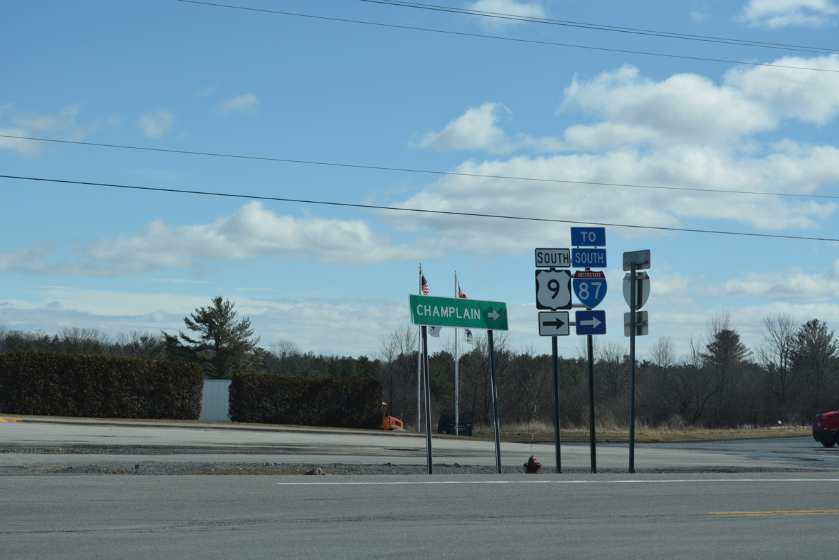
Traveling south from the U.S. Customs and Border Protection port of entry, Interstate 87 reaches Exit 43 to W Service Road and U.S. 9 south into the town of Champlain. U.S. 9 parallels the Adirondack Northway closely from Champlain southward to Plattsburgh. 03/23/23
Spanning the Great Chazy River, the speed limit increases along Interstate 87 south to 65 miles per hour. Beyond this assembly referencing the Metric to English conversion, bilingual signs are used along the northernmost stretch of the Northway. 03/23/23
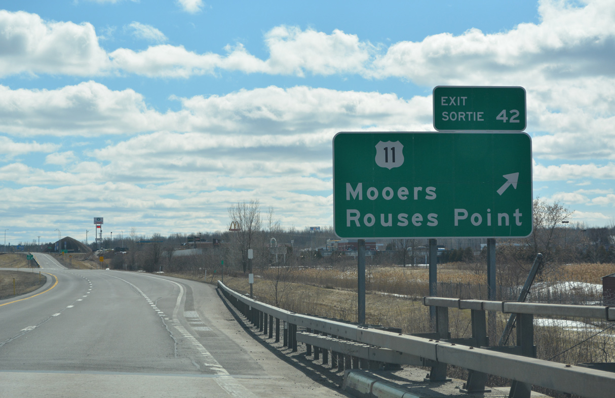
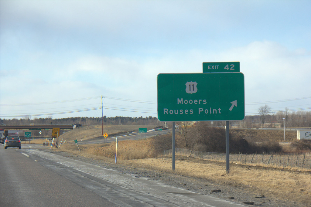
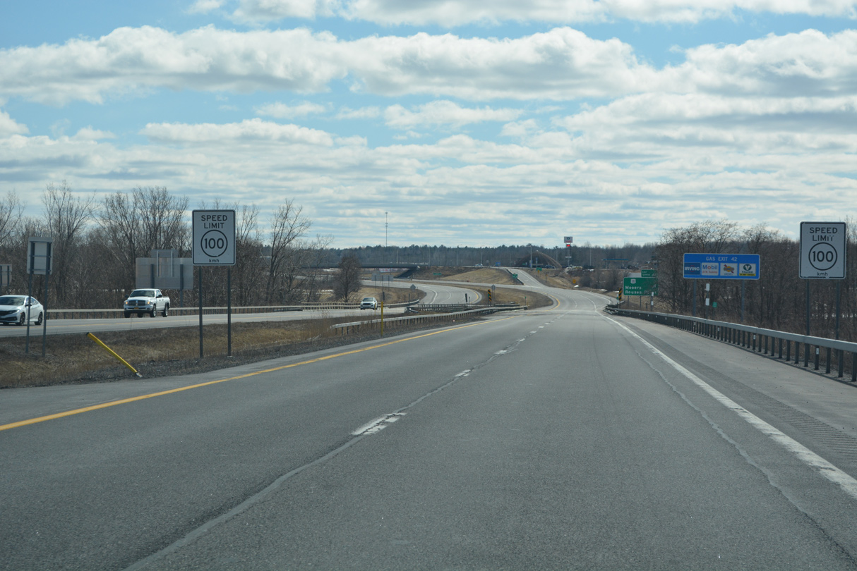
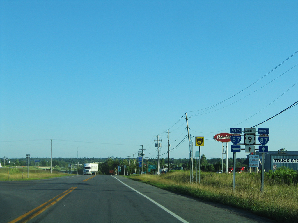
U.S. 11 converges with I-87 east of Mooers and west of Rouses Point at Exit 42. U.S. 11 also connects the Northway with U.S. 2 east across Lake Champlain into Vermont. South from Champlain, I-87 travels to Plattsburgh and through scenic Adirondack Park en route to Albany and New York City. 03/23/23
![]() at
at ![]()
U.S. 9 separates into the West and East Service Roads to connect with the respective directions of Interstate 87. The final entrance ramp for I-87 north departs from the East Service Road. 03/24/23
The East Service Road spurs north along the former alignment of U.S. 9 to a dead end. 03/24/23
The southbound entrance ramp to Interstate 87 from U.S. 9 along West Service Road. 03/24/23
West Service Road heads south from U.S. Customs and Border Protection facilities through an industrial park to become U.S. 9 south at the ramps with Interstate 87. 07/20/05
South End  – Bronx, New York City, New York
![]() South at
South at ![]()
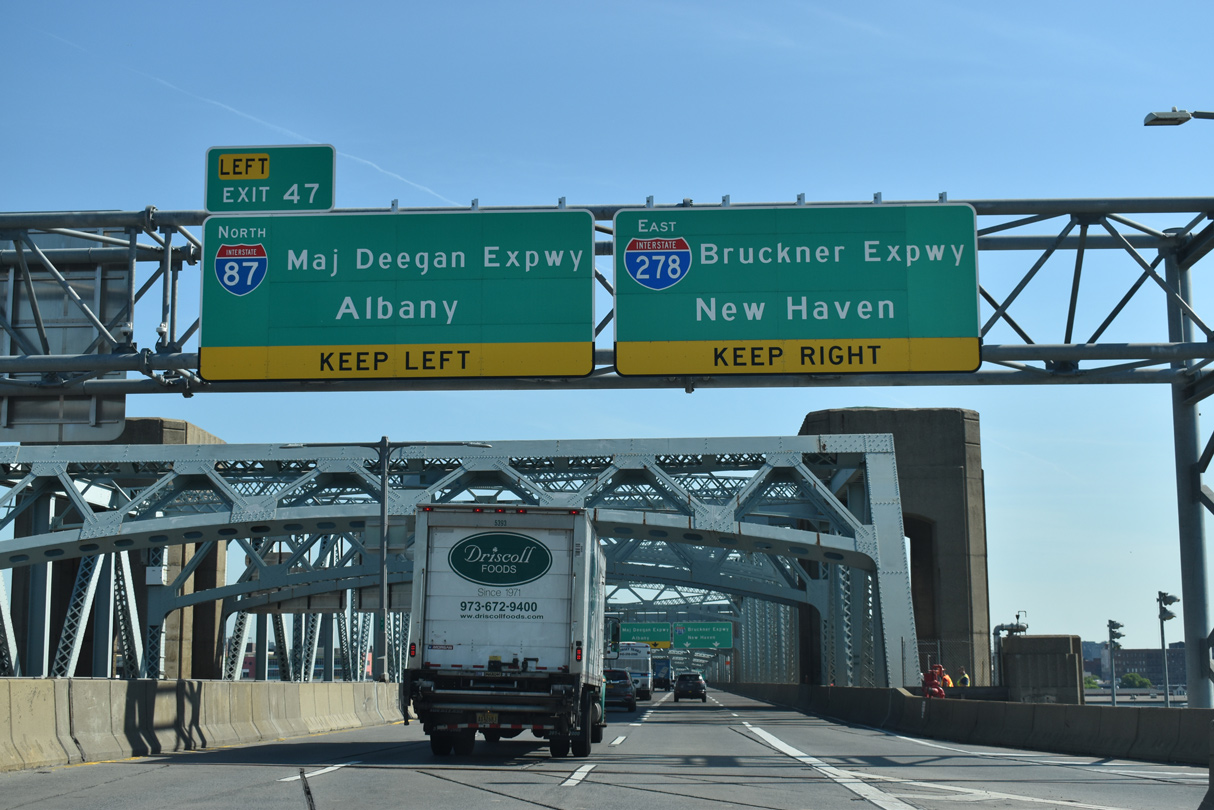
I-87 (Deegan Expressway) curves through the Mott Haven neighborhood, meeting Interstate 278 (Bruckner Expressway north of the Robert K. Kennedy Bridge. 03/28/23
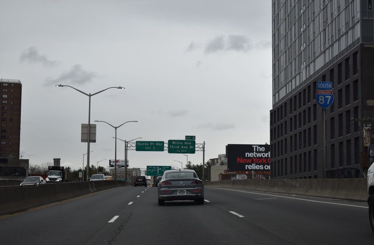
The final confirming marker for Interstate 87 south precedes Exit 2 onto E 134th Street at Willis Avenue. 03/28/23
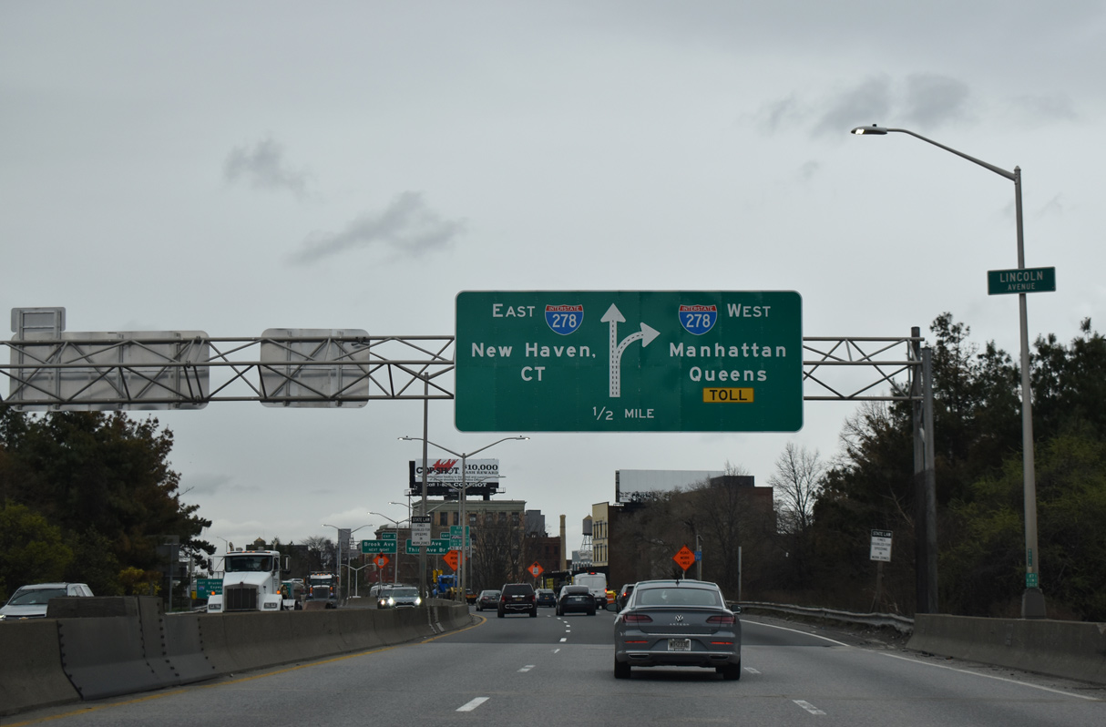
Spanning Lincoln Avenue, I-87 (Deegan Expressway) advances a half mile south to the three-wye interchange with the Bruckner Expressway at the RFK Bridge. 03/28/23
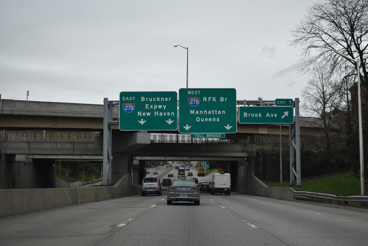
Exit 1 departs from the Major Deegan Expressway southbound below the Willis Avenue Bridge for Brook Avenue to Hunts Point Market. Three lanes continue to the nearby exchange with Interstate 278 (Bruckner Expressway). 03/28/23
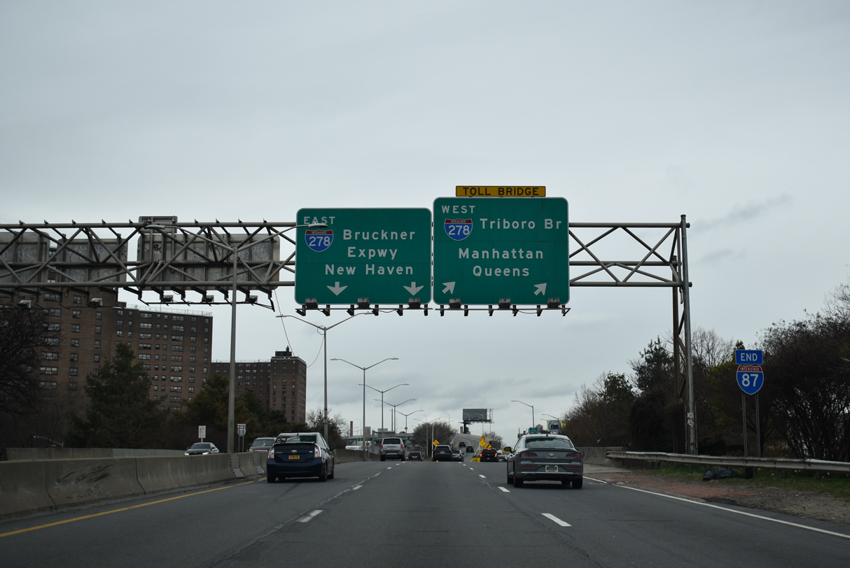
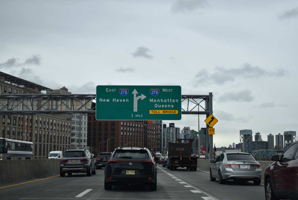
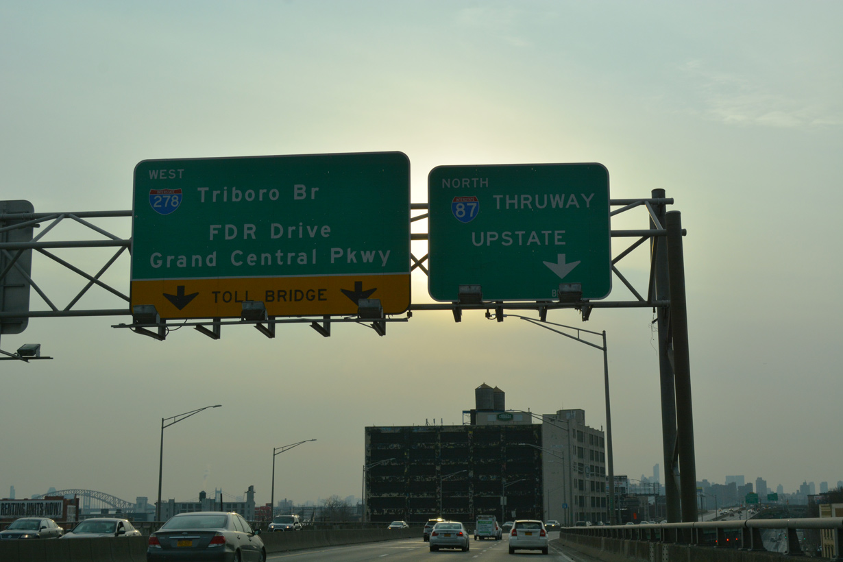
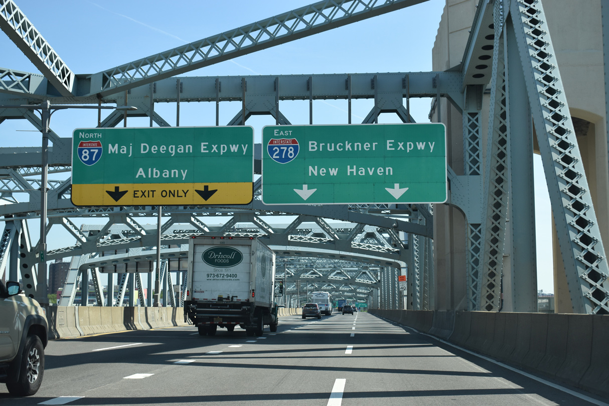
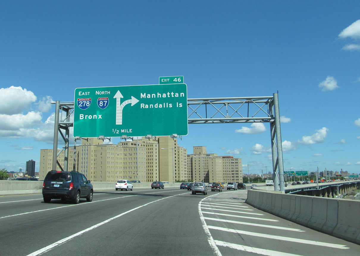
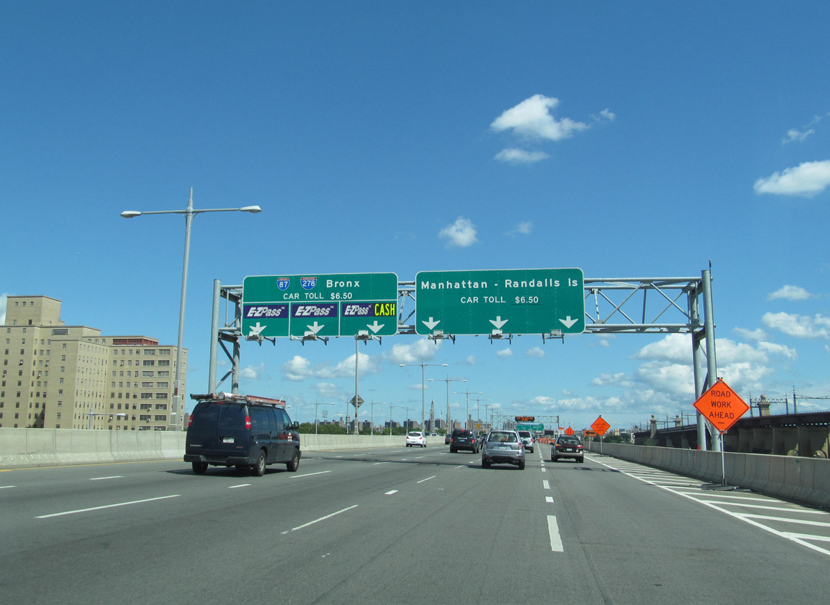
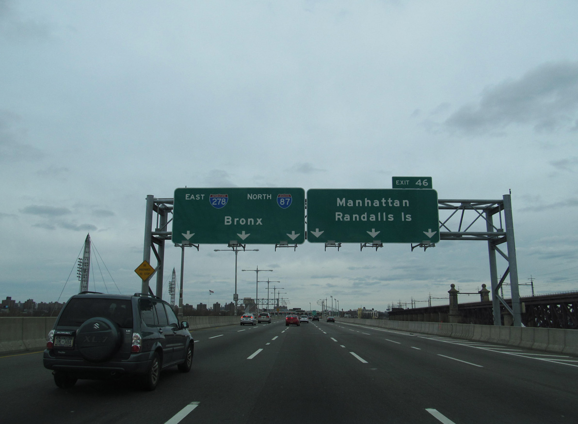
I-87 (Major Deegan Expressway) concludes with two lanes joining I-278 (Bruckner Expressway) east to I-95 for New Haven, Connecticut and two lanes for the RFK Bridge south to Queens. I-278 west spans Bronx Kill onto Randalls Island across the tolled RFK Bridge to connect with FDR Drive in Manhattan and Grand Central Parkway south to the Brooklyn-Queens Expressway (BQE). 03/28/23
![]() West at
West at ![]()
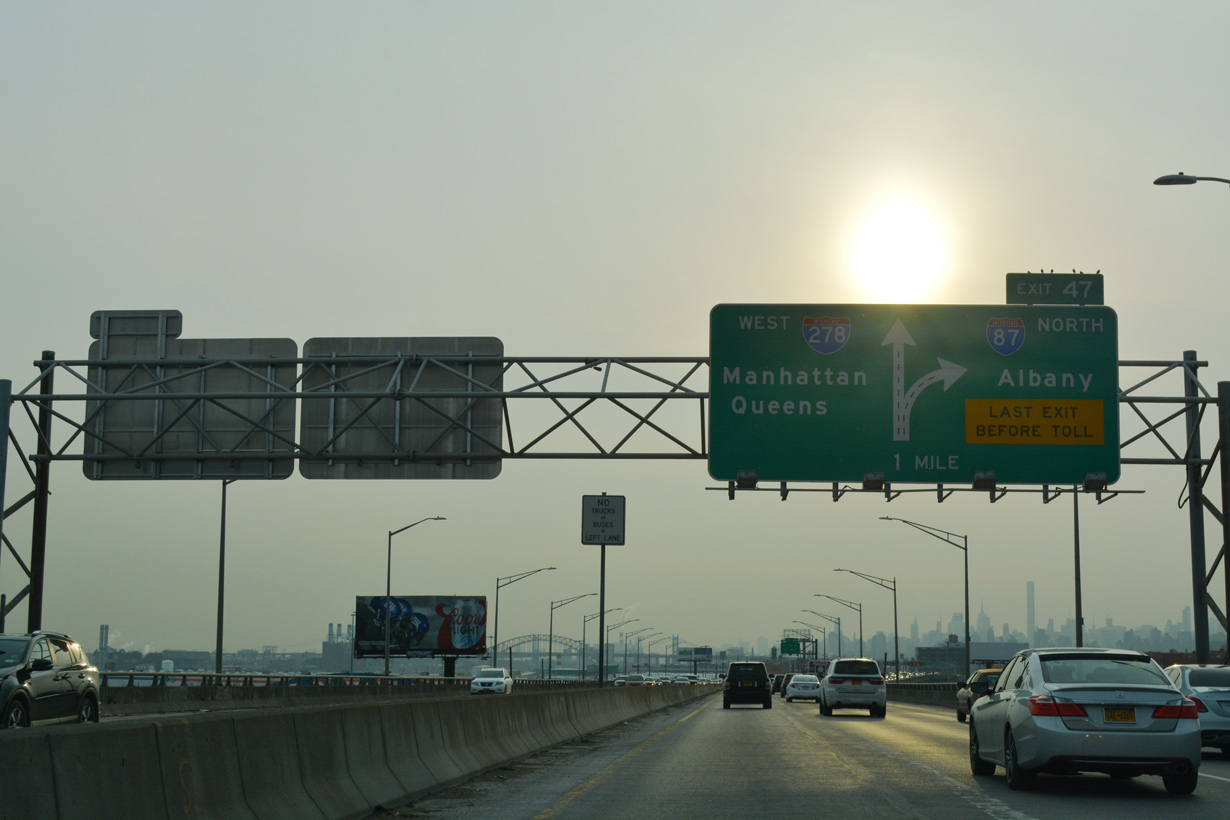
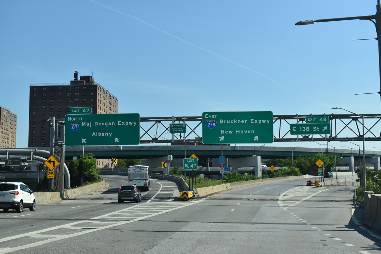
Traveling an elevated route adjacent to Bruckner Boulevard, I-278 progresses southwest with three lanes toward the three-wye interchange (Exit 47) with Interstate 87 (Major Deegan Expressway) north. 12/17/17
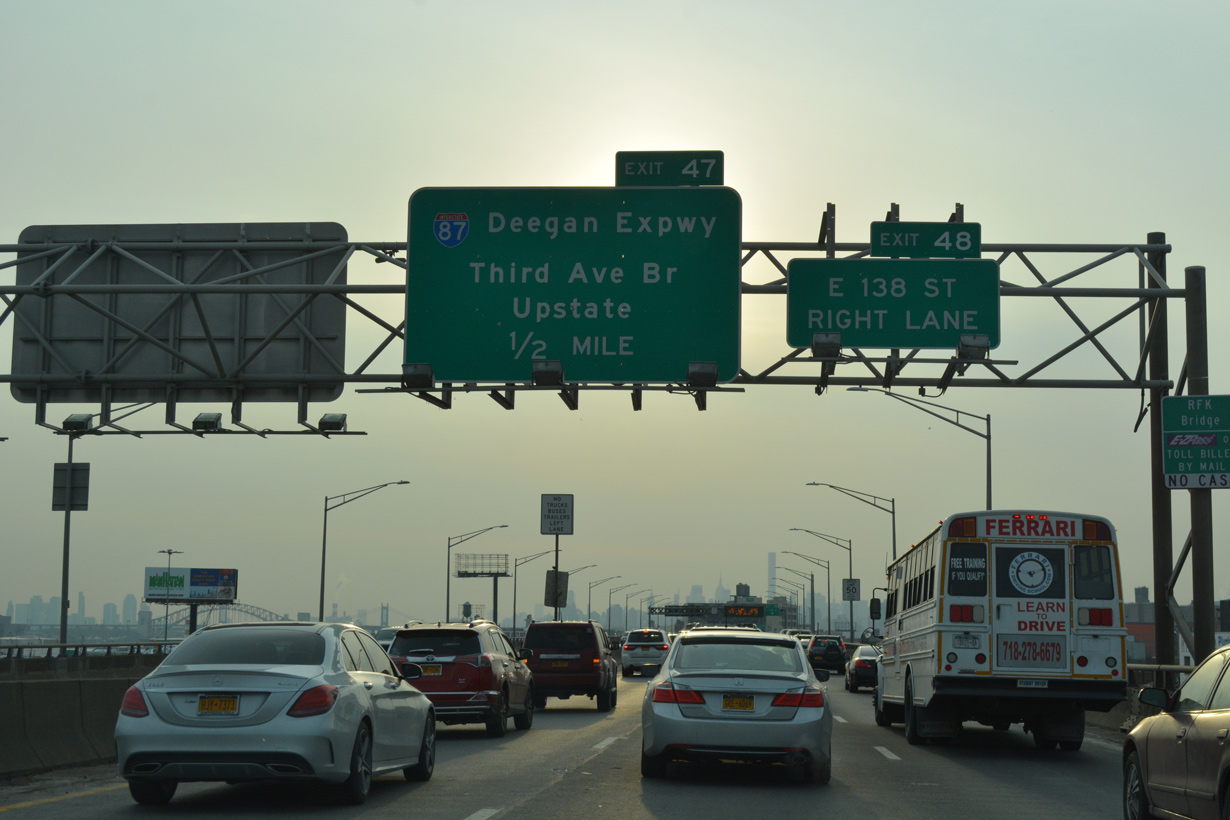
Exit 48 lowers from I-278 west onto Bruckner Boulevard ahead of E 138th Street at the Mott Haven community. I-87 connects with the Third Avenue Bridge linking Mott Haven with Harlem. 12/17/17
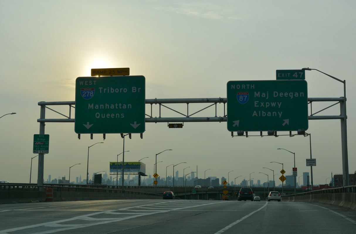
The Robert F. Kennedy Bridge links I-278 west with FDR Drive at East Harlem in Manhattan and Grand Central Parkway east from Astoria in Queens. I-87 continues north beyond New York City along the New York Thruway to Upstate New York. 12/17/17
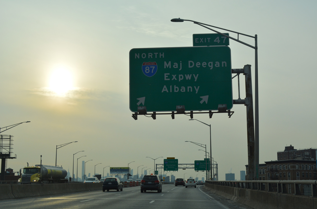
The Major Deegan Expressway separates from the Bruckner Expressway westbound just ahead of the tolled RFK Bridge onto Randalls Island. I-87 runs along the Harlem River north to Yankee Stadium, Highbridge and University Heights in Bronx, New York City. 12/17/17
A $205.9 million project reconstructed a half mile section of the Bruckner Expressway and five of six of the ramps at the exchange joining I-87/278. A contract for work was awarded on February 15, 2018 and the project was completed on October 21, 2020.11 12/17/17
![]() East at
East at ![]()
I-278 advances with four lanes across the RFK Bridge to Left Exit 47 for I-87 (Deegan Expressway) north to the George Washington Bridge (I-95) west to New Jersey and the New York Thruway. 05/30/22
I-278 shifts east from the RFK Bridge onto the Bruckner Expressway to I-95 (New England Thruway) north for New Haven, Connecticut. 05/30/22
Two lanes branch northward onto the Deegan Expressway toward Yankee Stadium and the New York Thruway to Albany. I-278 continues along the Bruckner Expressway east from Exit 48 to E 138th Street at Port Morris to I-95, I-295 and I-678 by Schuylerville. 05/30/22
![]() North
North
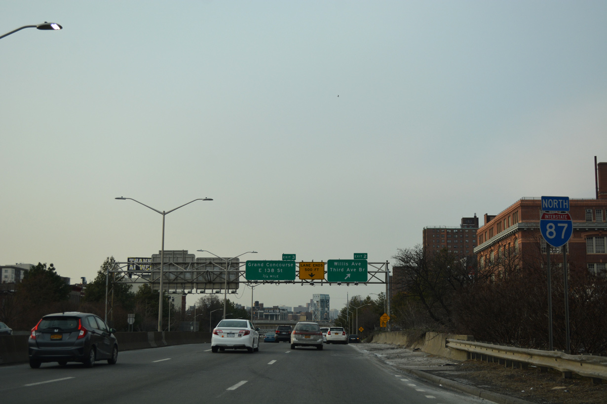
The first confirming marker for Interstate 87 (Major Deegan Expressway) stands by the Brook Avenue underpass at the Mott Haven neighborhood in Bronx, New York City. 12/17/17
 South End Throwback
North of the suspension portion of the RFK Bridge, Interstate 278 east enters a directional T interchange (Exit 46) with the Triboro Bridge west leg to Franklin Delano Roosevelt (FDR) Drive in Manhattan. Photo by Doug Kerr (09/09/12).
I-278 continues north to I-87 in Bronx, New York City. The west leg of the RFK Bridge includes local access to Randalls Island. Randalls Island is historically significant in the Robert Moses era of road and bridge building, as it was the location of the toll facility headquarters. Photo by Doug Kerr (09/09/12).
Traffic partitions for Randalls Island and FDR Drive to the west and the former toll plaza preceding the Bronx Kill bridge to the Bruckner Expressway at I-87. Wards Island falls within the borough of Manhattan (New York County).1 Photo by Doug Kerr (11/25/12).

Overheads preceding the south end of I-87 were formerly mounted on the Triborough Bridge superstructure. Photo by Doug Kerr (11/25/12).

Guide signs at the north end of the RFK Bridge were carbon copied. Photo by Doug Kerr (12/30/12).
Sources:
- Triboro information courtesy of Bill Mitchell.
- New York Thruway Factbook
http://www.thruway.state.ny.us/factbook - Celebrating the 50th Anniversary of the Eisenhower Interstate Highway System: Previous Interstate Facts of the Day by the Federal Highway Administration (FHWA).
- “Governor to Cut Ribbon on Northway Link.” The Warrensburg News, May 25, 1961.
- “A few facts, controversies, and quirks from the Northway’s history.” All Over Albany, May 27, 2015.
- Tappan Zee Bridge,
http://tappanzeebridge.lohud.com/The Journal News. - About the Project – The New NY Bridge, project web site.
- Interstate system route numbering web site
http://www.nwindianahwys.homestead.com/INTER_MAIN.HTML, Stephen Summers. - “Tappan Zee Bridge: Girders, road deck installed.” LOHUD.com, The Journal News, July 8, 2016.
- “NYSDOT Starts Work on US Route 11 Bridge Replacement.” New York State Department of Transportation (NYSDOT), press release. April 25, 2014.
- Reconstruction of Section of Bruckner Expressway and Six Ramps. New York State Department of Transportation (NYSDOT), project web site.
Page updated March 31, 2023.