Interstate 85
Overview
Comprising a major travel corridor between the Deep South and Mid Atlantic Regions, Interstate 85 traverses a good portion of the Appalachian piedmont. An increasingly busy trucking route, I-85 connects the major metropolitan areas of Atlanta and Charlotte. Additionally, I-85 links several smaller growing metropolitan areas including Greenville-Spartanburg, the Triad (Greensboro) and the Triangle (Durham).
Atlanta Bridge Collapse
A multiple alarm fire broke out around 6:30 p.m. on March 30, 2017 below an elevated stretch of Interstate 85 at Piedmont Road in northeast Atlanta. Fire damage compromised a 350 foot section of the northbound viaduct, leading to its collapse. Three arrests were made in connection to the fire, with the warrant for the main individual involved citing that “a chair set on top of a shopping cart” was set on fire. All three were believed to be homeless and witnessed at the site where the fire involving PVC products stored under the bridge started.29,31
BEFORE AND AFTER: Road crews are busy working just a day after a raging fire collapsed part of I-85 in Atlanta: https://t.co/Bo0pa2eG7d pic.twitter.com/LWALraU0Gb
— WSB-TV (@wsbtv) March 31, 2017
Both directions of Interstate 85 were closed north from the Brookwood Interchange (split with I-75 / Downtown Connector) to Georgia State Route 400 (Exit 86). The Georgia Department of Transportation (GDOT) indicated that the southbound span was compromised as well, requiring a full replacement.30 Northbound traffic was reopened on April 1 north from the I-75 split to Exit 86, where traffic shifted onto the adjacent Buford Spring Connector (SR 13). SR 13 parallels I-85 north to SR 400 and Sidney Marcus Boulevard, returning traffic to the Interstate 85 mainline via direct ramp ahead of Buford Highway.
Correction – all lanes on #I85Rebuild are now open. NB and now SB. https://t.co/vJAOj1XdwC
— Georgia DOT (@GADeptofTrans) May 13, 2017
Reopening of Interstate 85 to traffic was initially anticipated for June 15, 2017, then May 25. However around the clock efforts from contractor C.W. Mathews advanced progress on the repair work to 90 percent completion just 41 days after the collapse. Standing to earn over $3 million in incentives, C.W. Mathews crews reopened the northbound lanes of I-85 on May 12; the southbound lanes were reopened two days later.32
Interstate 85 Extension
The long planned Interstate 85 Extension was incorporated into the Interstate 14 Corridor stretching across the Deep South west from Augusta, Georgia into Texas. As a result, I-85 is no longer being pursued for extension west of Interstate 65.
The Fiscal Year 2002 Transportation Appropriations Act included funding for a feasibility study for extending Interstate 85 west from Montgomery, Alabama to I-20/59 near Meridian, Mississippi. During the Fall 2002, then-Governor Don Siegalman of Alabama advocated for the I-85 extension as well as reinforcing the desire for a Black Belt freeway corridor in Western Alabama between Mobile and Florence.
Funding for these projects was generally for preliminary planning, design and engineering, and additional funds were allocated to this project in 2005. The Safe, Accountable, Flexible, and Efficient Transportation Equity Act: A Legacy for Users (SAFETEA-LU) (enacted into law on August 10, 2005) appropriated $100 million toward the Interstate 85 Extension Project.
Initial work on the Montgomery Outer Loop (SR-108 / Future Interstate 85) commenced on September 28, 2011 for a $65.8 million project to build a 3.5 mile long connector between I-85 and SR 110.8 Work was a third complete as of November 2012, with pier supports and bridge girders visible along I-85 at the new interchange. Alabama Department of Transportation (ALDOT) officials originally scheduled a completion for the project in December 2014.9 Work however was halted on the project in 2014 when two workers fell 90 feet to their death at the construction site. Further delays due to weather pushed the completion date back further.16
The first phase of the Outer Loop opened finally following a ribbon cutting ceremony held on the morning of January 26, 2016. The freeway runs south from I-85 to an incomplete parclo interchange with Vaughn Road. Construction on the remaining three phases did not advance due to funding shortages.16

The Montgomery Outer Loop (SR 108) east ties into Interstate 85 at a systems interchange 14 miles east of I-65 in Montgomery. 06/07/17
Ultimate plans for the Montgomery Outer Loop outlined relocating Interstate 85 from the current alignment leading west to I-65 near Downtown Montgomery onto the southerly bypass. Upon completion, the former route of I-85 into the capital city was to be redesignated as Interstate 685. The American Association of State Highway and Transportation Officials (AASHTO) approved the I-685 designation pending Federal Highway Administration (FHWA) approval on October 30, 2010.
High Priority Corridor
The portion of what was the proposed Interstate 85 extension overlaying U.S. 80 west of Montgomery is part of High Priority Corridor 6: U.S. 80 from Meridian to Macon.
 Parallel U.S. Routes
Interstate 85 largely follows or overlaps with U.S. 80 from Montgomery east to Tuskegee. U.S. 29 joins the corridor from Tuskegee, Alabama northeast to Atlanta, Greenville, South Carolina, Charlotte and Greensboro, North Carolina. U.S. 70 ties into the corridor from Greensboro east to Durham. U.S. 15 accompanies I-85 from Durham north to Oxford, handing off to U.S. 1 for the remainder of the route northeast to Petersburg, Virginia.
Route Information
Mileage
Alabama – 80.00*
- Cities – Montgomery, Auburn, Opelika, Lanett
- Junctions –

Georgia – 179.90**
Cities – LaGrange, Newnan, Atlanta
Junctions –

South Carolina – 106.28
Cities – Anderson, Greenville, Spartanburg, Gaffney
Junctions –
North Carolina – 231.23***
Cities – Gastonia, Charlotte, Kannapolis, Salisbury, Lexington, High Point, Greensboro, Burlington, Durham, Henderson
Junctions –
Future
Virginia – 68.84
Cities – Petersburg
- Junctions –
Source: December 31, 2021 Interstate Route Log and Finders List
* – 14 miles on I-685
** – 8.00 miles on I-75, 1.21 miles on I-285
*** – 31.51 miles on I-40
I-85 Annual Average Daily Traffic (AADT)
| Location | Vehicles per day |
|---|---|
| Montgomery, AL | 101,383 |
| Opelika, AL | 51,887 |
| Huguley, AL | 30,549 |
| South Hill, VA | 20,000 |
| Petersburg, VA | 54,000 |
Sources: 2020 AADT – Alabama Traffic Data
12/31/2019 AADT – Virginia Department of Transportation (VDOT) Traffic Volume – 2020
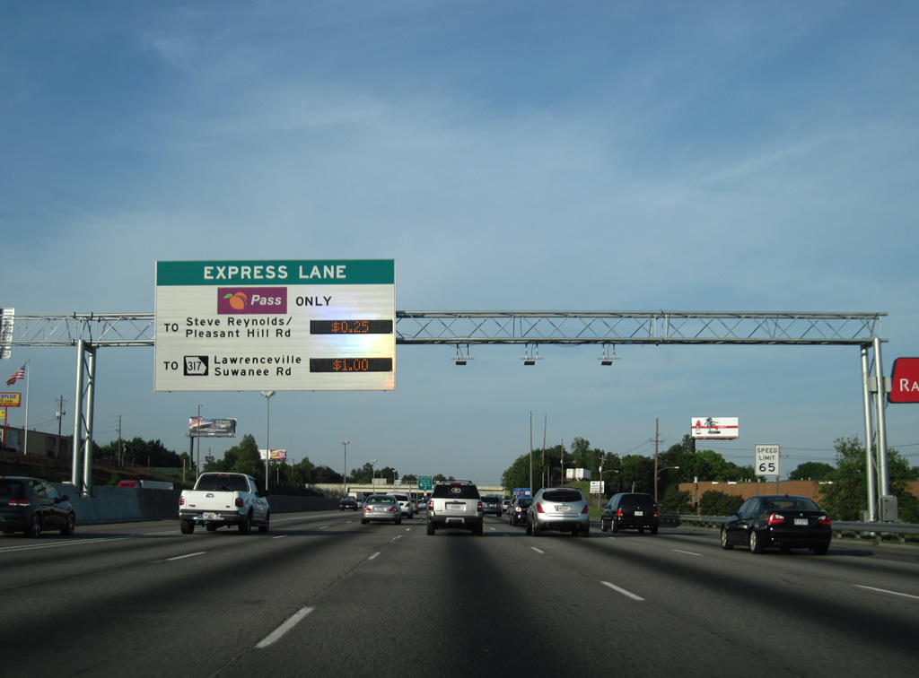
The HO/T lanes of I-85 in Georgia became operational on October 1, 2011 from Interstate 285 to Old Peachtree Road. Usage of the lanes requires an account with PeachPass.
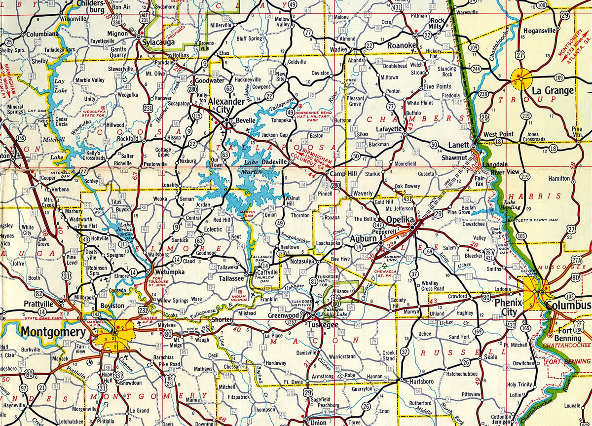
The Auburn-Opelika bypass was the first section of I-85 completed in Alabama. The freeway was extended north from there to Lanett in 1962 and also built between Mt. Meigs and Waugh the same year.
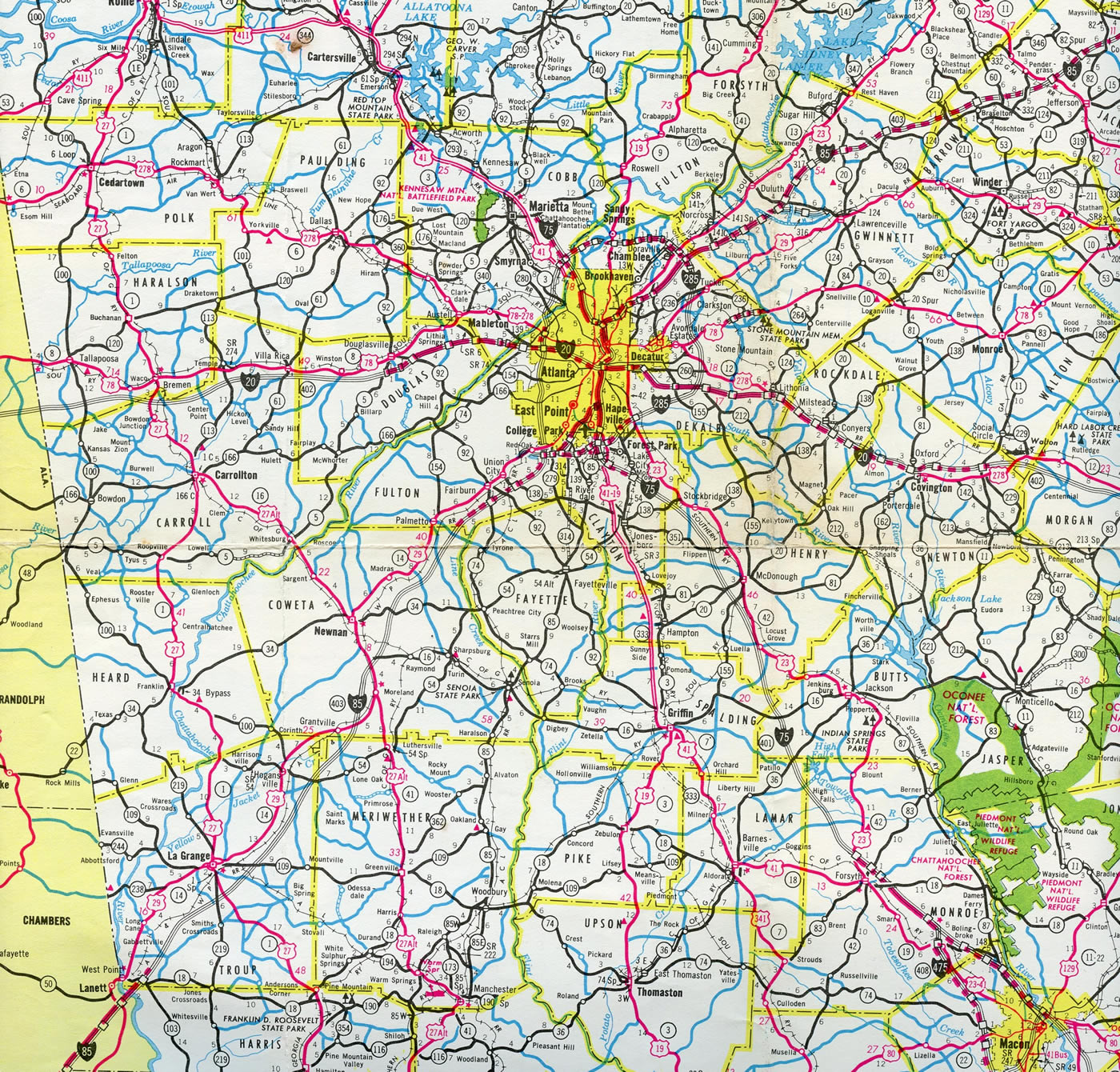
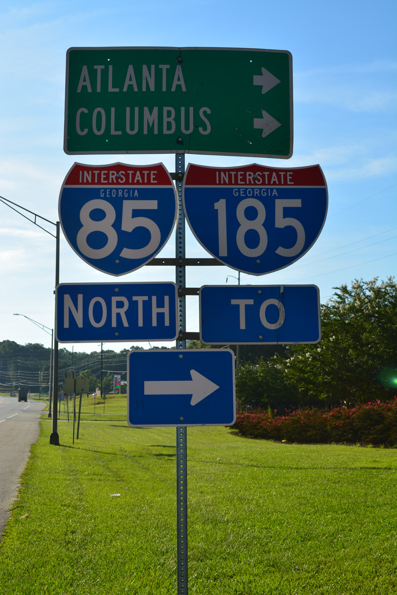
Interstate 85 was completed from College Park north through Atlanta to Suwanee in 1964. Construction was underway along the remainder through northeast Georgia and southward to the Coweta County line.
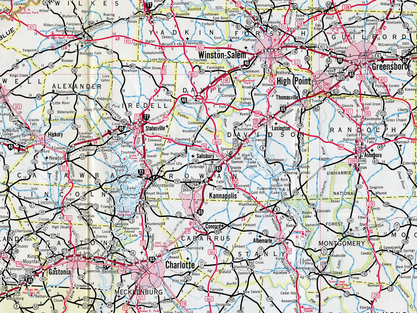
Interstate 85 north from the Yadkin River defaulted onto what is now Business Loop I-85 through Lexington, Thomasville and High Point. The expressway was built in the late 1950s and was signed as Interstate 85 Temp. The I-85 alignment to the east was finished in 1984.12
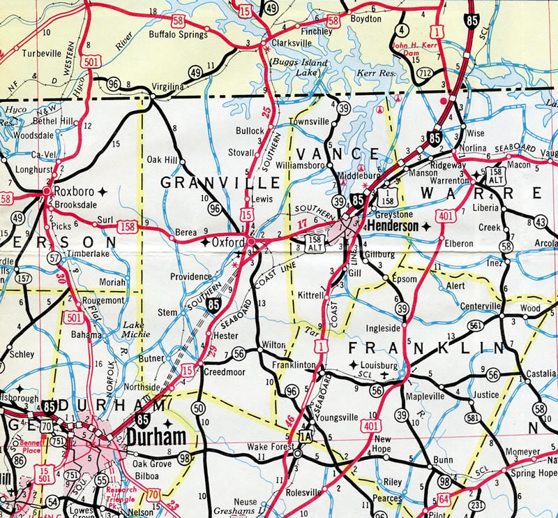
Interstate 85 was completed through Durham and from Henderson north into Virginia by 1970. U.S. 15 and U.S. 158 acted as the temporary route between the two stretches of freeway until I-85 opened in 1972.12
History
Georgia
Interstate 85 across north Georgia was constructed between September 1951 and December 1979.13 The section from LaGrange (Exit 13) to Grantville (Exit 35) opened on November 22, 1977.14
Planning for a new superhighway that would later become Interstate 85 through northeast Georgia outlined several possible routes per a state highway department report issued in July 1945. They included four alignments:15
- Buford to Gainesville to Toccoa
- Lawrenceville to Commerce to Lavonia
- Lawrenceville to Winder to Athens
- Stone Mountain to Monroe to Athens
The northerly alignment was the favored route by 1954. Referred to as the “upper route,” it paralleled the U.S. 23 corridor northeast to Buford, Gainesville and Cornelia and U.S. 123 to within ten miles of Toccoa. Officials from South Carolina concurred with the alignment according to reports, with overall benefits cited including the new Lake Lanier and economic prospects for growing Gainesville. This route was submitted to the U.S. Bureau of Public Roads in a February 1958 recommendation.15
Changes to Interstate 85 through northeastern Georgia followed in 1959 when Ernest Vandiver took the office of Georgia Governor. The Lavonia native advocated for a southward shift of I-85 along a course between Commerce and Lavonia, stating that it was a wiser choice versus having the freeway “meander through the mountains.” He subsequently withdrew the recommendation for the Gainesville route by July 1959, leading to the state highway department submitting the new “middle route.” The new alignment was touted to cost less to construct, provide a more direct route, and still serve the Gainesville and Athens areas peripherally.15
Some controversy ensued, with Vandiver referencing manipulations by the previous administration of Governor Marvin Griffin to endorse the upper route. There was also suggestions that Vandiver pushed for a more southerly route to include his home county of Franklin versus a route near Talmo, Maysville and Martin. A public hearing for the route was conducted on November 10, 1959, with the Commerce to Lavonia corridor laid out. Opposition was apparently muted and months later the decision was sealed.15
Construction eventually opened 67 miles of Interstate 85 between Suwanee and the South Carolina state line on November 5, 1965. This was the first Interstate segment to link Atlanta with an adjoining state. Associated work built the I-85 Connector, which opened in October 1969 as Georgia State Route 365.15 This was redesignated as Interstate 985 in 1984.
Though northeastern Atlanta, a relocation of Interstate 85 north from the Northeast Expressway between Interstate 75 (Downtown Connector) and Buford Highway was approved by AASHTO on April 19, 1996. The old alignment was redesignated as State Route 13. The “Freeing the Freeways” megaproject in the Atlanta metropolitan area included several projects involving I-85, with completion in 1987 and 1988:11
- The 1.6 mile overlap along I-85/285 by Hartsfield-Jackson International Airport (ATL) was reconstructed to split each route into separate roadways with 16 overall lanes.
- Eight lane expansion of I-85 between Peachtree City and the southwest junction with I-285, a distance of 16.2 miles.
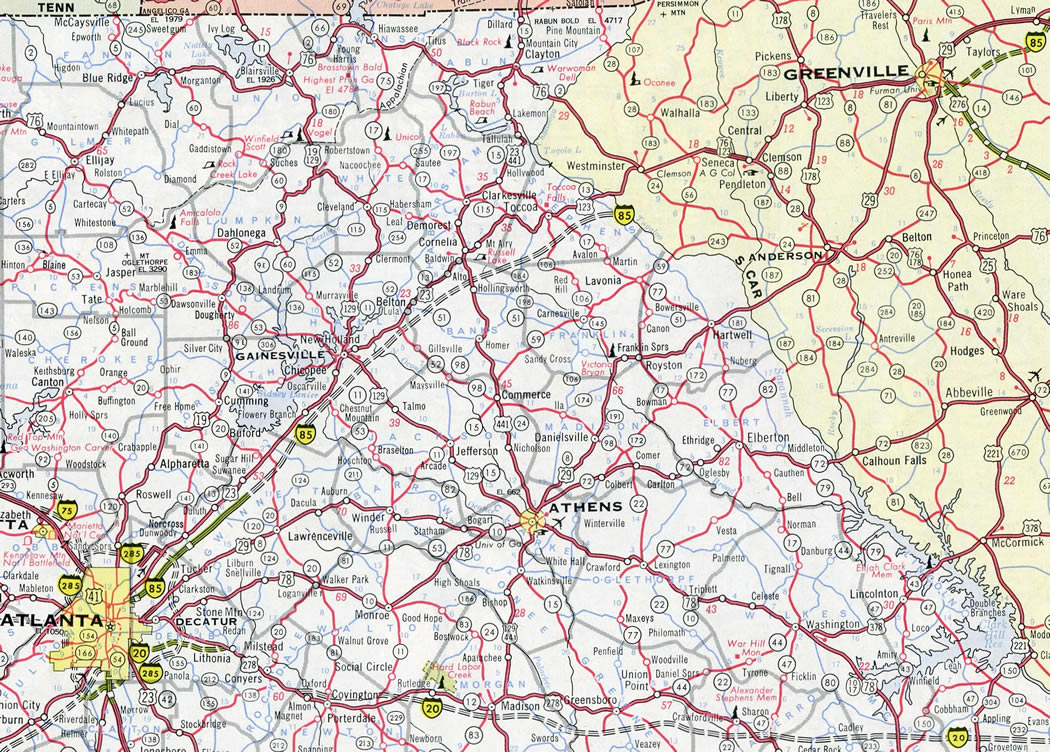
- Upgrading the cloverleaf interchange with Interstate 285 to the northeast of Atlanta into the multilevel Tom Moreland Interchange, locally known as “Spaghetti Junction”.
- Rebuilding the Downtown Connector with I-75 to widen the freeway and reconfigure the Capitol Hill Interchange with I-20.
Interstate 285 curves southeast from Doraville through “Spaghetti Junction” with I-85. 07/02/17
South Carolina
The first section of Interstate 85 to be awarded for a construction contract in South Carolina under the Federal-Aid Highway Act of 1956 was the bridge over the Broad River in Cherokee County on September 21, 1956.6 Construction underway in 1959 involved upgrading U.S. 29 from the Anderson County line north to North Carolina state border at Grover. The initial stretch opened in Spartanburg County.16 Opened in August 1964, a 14 mile long section in Anderson County was the last within the Palmetto State completed. Building I-85 in S.C. cost over $61 million.17
Increasing traffic counts up to 47,600 vehicles per day (vpd) and the substandard design of Interstate 85 through Spartanburg, which was originally built as a bypass for U.S. 29 in the 1950s, led to proposed improvements in 1983. Upgrades for I-85 were previously approved by the Federal Highway Administration in 1977. The South Carolina Department of Highways and Public Transportation plan involved improving a 9.6 mile long section of I-85, between South Carolina 129 and U.S. 221, that included expansion to six overall lanes and elimination of the Hearon Circle interchange. Estimated to cost $25 million and take four years, the project included the relocation of several businesses and one residence while widening the roadway using the existing median.18
While upgrading the existing freeway was discussed, two potential realignments for Interstate 85 were also under study in 1983. One option involved building a new roadway on the south side of the existing route while reducing the number of interchanges to two. The second option focused on a new alignment, 1.5 miles to the north, with a limited number of interchanges. The south option was abandoned due to costs and the needed severe dislocation of developed property. Benefits of the north bypass favored reduced congestion and costs estimates just four million dollars higher than widening the existing road ($53 million).19
The Spartanburg City Council opposed any relocation, citing economic impacts for having I-85 rerouted further from the city. A study contracted by the council with an engineer and planning firm presented three options to provide better access between the city and Interstate 85. They included improvements to interchanges at Hearon Circle and I-585/U.S. 176 (Pine Street), a $10 million new access route through the campus of Wofford College and a $4 million half cloverleaf interchange between U.S. 176 (Pine Street) and McCravy Drive. The consultants also suggested that the old route of I-85 be renumbered as Interstate 285 to remain within the system.20
The Federal Highway Administration (FHWA) approved plans for relocating Interstate 85 on December 7, 1983. The alignment included five interchanges, with U.S. 176 connecting the freeway with Interstate 585. An issue that arose was the connectivity of I-585 with I-85, as the relocation would disconnect it from the Interstate highway system. Herman Snyder, chief engineer for the South Carolina Highway Department in 1983, advocated for keeping the old alignment of I-85 in the system. He cited “The 585 system must connect with the interstate, either by a connector route or directly, or it will have to be taken out of the interstate system.”21
Construction finally broke ground on the new northern alignment for Interstate 85 in April 1988. Discussion however continued involving the number of the old route toward Spartanburg, with the state Highway Department formally requesting the designation of Interstate 285 in a February 5 letter to the Federal Highway Department.22 Section 139 of the Surface Transportation Assistance Act of 1982 specified that Interstate construction funds were made available on a costs to complete basis. Since I-85 was deemed woefully substandard by Spartanburg, it was considered incomplete. Section 139 called for relocation of an Interstate, and so the I-85 designation was reassigned to the new bypass, enabling 90% in federal funding.23 Proposals for I-285 were ultimately dropped and the route of I-585 unchanged.
Split into five phases totaling $96 million in costs, work on the new I-85 progressed through July 1994, with the bulk of the concrete roadway laid. The road was slated to open in November 1994,25 but delays due to frequent heavy rainfall pushed completion back to December 1994.24 Heavy rains throughout summer and fall 1994 combined with logistical problems related to congestion on the old I-85 further delayed completion until April 1995. Final costs were expected to top out around $122 million due to inflation and revision of the route from four to six lanes.25
AASHTO approved the relocation of I-85 on April 22, 1995, with the former route redesignated as Business Loop I-85. Relocated I-85 finally opened after additional further delay on August 31, 1995 without fanfare or a formal ceremony. Final construction at the end of the project continued until November 1995.10
Renumbering of the Business Loop I-85 freeway in Spartanburg County was suggested by the Spartanburg Hospitality Association in April 2000. The association approached Spartanburg Area Transportation Study (SPATS) seeking support to have the business route renumbered as Interstate 685. The South Carolina Department of Transportation (SCDOT) estimated that $150 million in improvements were needed to bring the route up to interstate standards. This included adding proper distancing of ramps and frontage roads, extending acceleration and deceleration lanes and improving ramp radii. SCDOT added further that these changes would likely cause more damages to area businesses than benefits due to the need for land acquisition. Ultimately, in an effort to bring more motorists onto the business route, sign changes were made at each end referencing it as a “Freeway Loop.”28
Completed in 2003, a $70 million project widened Interstate 85 to six lanes from Exit 19 / U.S. 76 northward to Exit 34 at Greenville. The 36 foot wide median was replaced with a concrete barrier along 11 of the 15 miles expanded. The remaining four miles retained a grassy median with guardrail protection. Traffic counts along this stretch ranged from 38,500 to 44,300 vehicles per day (vpd), with 35% of this volume comprised of trucks. SCDOT justified this project based upon 20 year traffic count projections that forecast 85,900 vpd using this same section of I-85. Additionally, various overpasses along the corridor were replaced or otherwise altered to increase the overall height to at least 16 feet.2
North Carolina
A seven mile segment of Interstate 85 opened to traffic on September 7, 1971 between the east end of the Oxford bypass and Henderson. Work continued to December 1971 on the freeway leading south 12.5 miles to the Neuse River. Upon completion, all of I-85 between Durham and Petersburg, Virginia was open to traffic.26
The final contract for constructing Interstate 85 across North Carolina was approved on May 14, 1982. The $8.5 million bid involved paving the freeway from Main Street (old U.S. 311) in Archdale northward to the preexisting section of I-85 south of Greensboro. Work ran in tandem with paving operations from Lexington north to Thomasville and Archdale. Completion occurred on October 15, 1983.27
I-85 widens to eight lanes where it overlaps with Interstate 40 between Greensboro and Durham in North Carolina. A realignment of I-85 around Greensboro shifted the freeway from a shared alignment with I-40 through the city onto the southeastern leg of the Greensboro Urban Loop around the city. Opened to traffic on February 22, 2004,4 the bypass for I-85 varies between six and eight lanes from near milepost 120 east to the exchange with I-40 and I-785/840. The highway was constructed as part of the overall planned Greensboro Urban Loop, a beltway encircling the city along portions of I-73 between Joseph M. Bryan Boulevard (I-73) near Piedmont Triad International Airport (PTI), I-840 to the north and I-785/840 to the east. AASHTO approved the relocation of I-85 on May 14, 2004.
Interstate 85 turns east onto the bypass of Greensboro while three lanes wind northward onto Business Loop I-85 toward Downtown. 06/01/12
The $160 million3 relocation of Interstate 85 was developed as a solution for the overwhelming and often congested “Death Valley” interchange where I-40 and I-85 previously came together. The nickname stemmed from a history of fatal accidents associated with the interchange. The wye interchange included a left exit ramp for I-85 south, narrow travel lanes and a weaving traffic pattern with the adjacent exit for Randleman Road. The North Carolina Department of Transportation (NCDOT) estimated 120,000 vehicles per day (vpd) traveled through Death Valley until the new bypass opened.
Old Interstate 85 through Greensboro was redesignated as an extension of Business Loop I-85 north from High Point. Exit numbers along the former I-85 were renumbered to reflect the business loop mile markers northward from Lexington. Business Loop I-85 extended east alongside I-40 from Death Valley to I-85 at the exchange with I-785/840.
Original plans shifted Interstate 40 onto the southern portion of the Greensboro Urban Loop upon its completion. This occurred when the southwestern beltway (Painter Boulevard) opened on February 21, 2008, The realignment lasted for a period of seven months, before NCDOT shifted I-40 back onto its in-city routing. NCDOT subsequently realigned U.S. 421 along the southwestern leg of the beltway, cosigning it with Interstate 73.
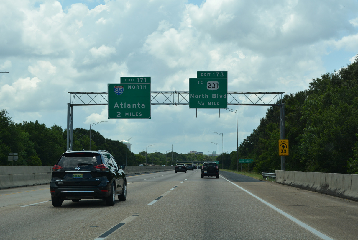
Within the Durham metropolitan area, major reconstruction was completed along Interstate 85 that transformed the substandard four lane parkway built in the 1960s into a modern eight lane urban freeway. Started in 1999, construction involved widening I-85 between Exits 173 and 179 to eight lanes, rebuilding narrow bridges, replacing shoulder mounted guide signs with overhead assemblies, installing variable message signs, and placing brick sound barriers among other safety improvements. With the inclusion of two lane collector distributor roadways, work expanded Interstate 85 to 12 lanes near the Duke and Gregson Street exits. Costing $175 million, the reconstruction project was divided into three stages with the following timeline:1
- Midland Terrace near U.S. 70 west to Camden Avenue by Fall 2004
- Camden Avenue west to Broad Street by Winter 2005
- Broad Street west to U.S. 15-501 by Winter 2007.
Work on the project continued until February 2008, with a final price tag of $210 million.7
Other portions of Interstate 85 in North Carolina underwent modernization and expansion as part of the I-85 Corridor Improvement Project. $201.5 million in road work focused on I-85 through Davidson and Rowan Counties between October 2010 and May 2013. This project followed widening of 8.3 miles of freeway between the U.S. 29 / NC 49 Connector (Exit 42) and Concord Mills Boulevard (Exit 49). That construction increased I-85 to eight overall lanes with a 22 foot wide median between Exit 42 and I-485, and seven lanes between I-485 and Exit 49. A left entrance ramp from the U.S. 29 / NC 49 connector was relocated to merge on the right as well. Construction was underway between December 2, 2002 and May 27, 2005.
Further north, the structurally deficient crossing of the Yadkin River was replaced as part of the I-85 Corridor Improvement Project. Work broke ground September 29, 2010 on a $136 million job to realign I-85 onto a new set of bridges east of the original Yadkin River spans. Construction also included expanding 3.5 miles of roadway and reconfiguring the wye interchanges with U.S. 29/70 and NC 150 to separate local traffic movements from I-85 with both a new service road and six-ramp parclo interchange. The new northbound bridge opened in May 2012, followed by completion of the southbound bridge in March 2013.
 Photo Guides
North End 
 – Petersburg, Virginia
![]() North
North ![]() East at
East at ![]()
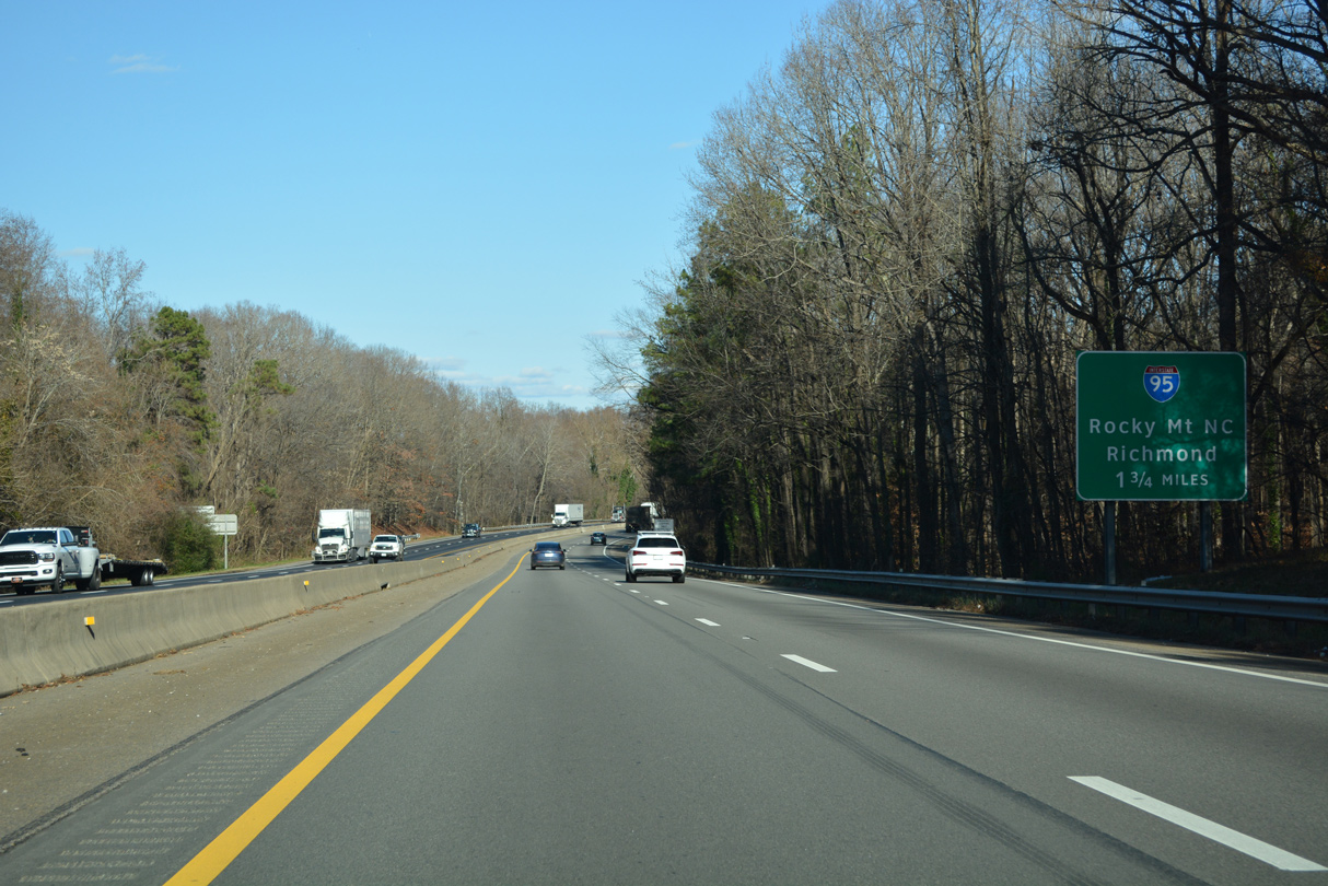
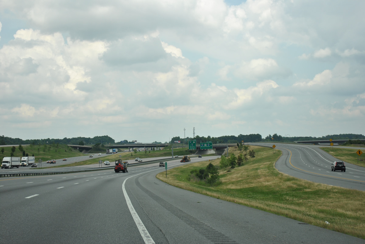
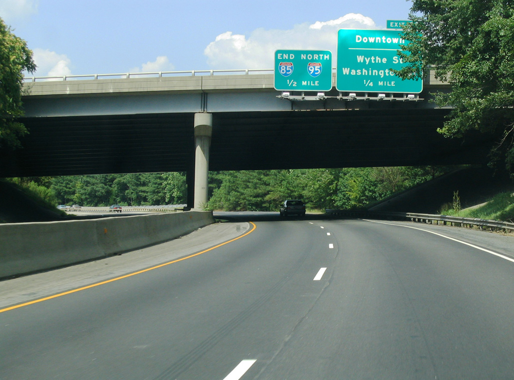
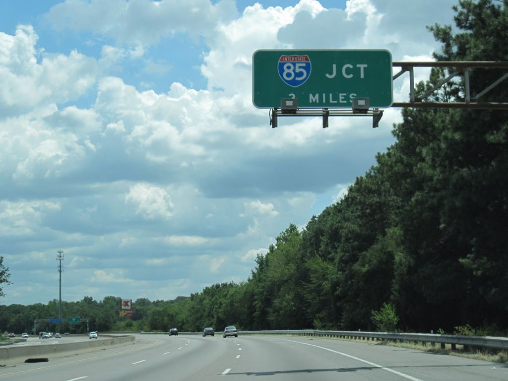
The first reference of Interstate 95 along I-85 north / U.S. 460 east appears 1.75 miles west of the trumpet interchange joining the three routes. 12/16/22
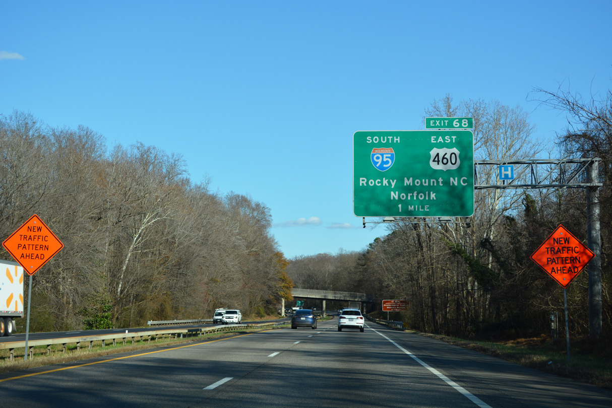
U.S. 460 briefly joins Interstate 95 south from Exit 68 to County Drive for its continuation east to Norfolk and Hampton Roads. 12/16/22
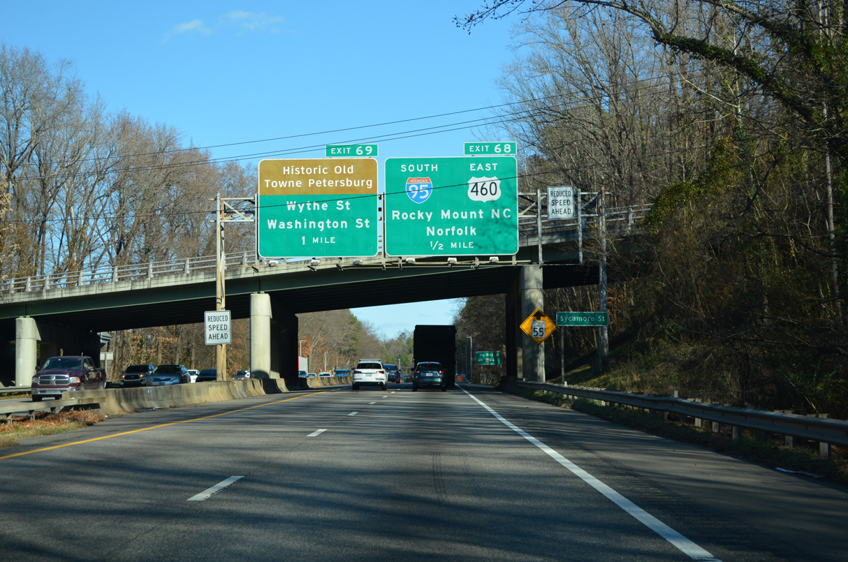
Traffic at the north end of Interstate 85 separates into ramps for Exit 68 for I-95 south / U.S. 460 east to U.S. 301; Exit 69 for the I-95 c/d roadway to Wythe and Washington Streets and Downtown Petersburg; and the direct transition onto northbound I-95. 12/16/22
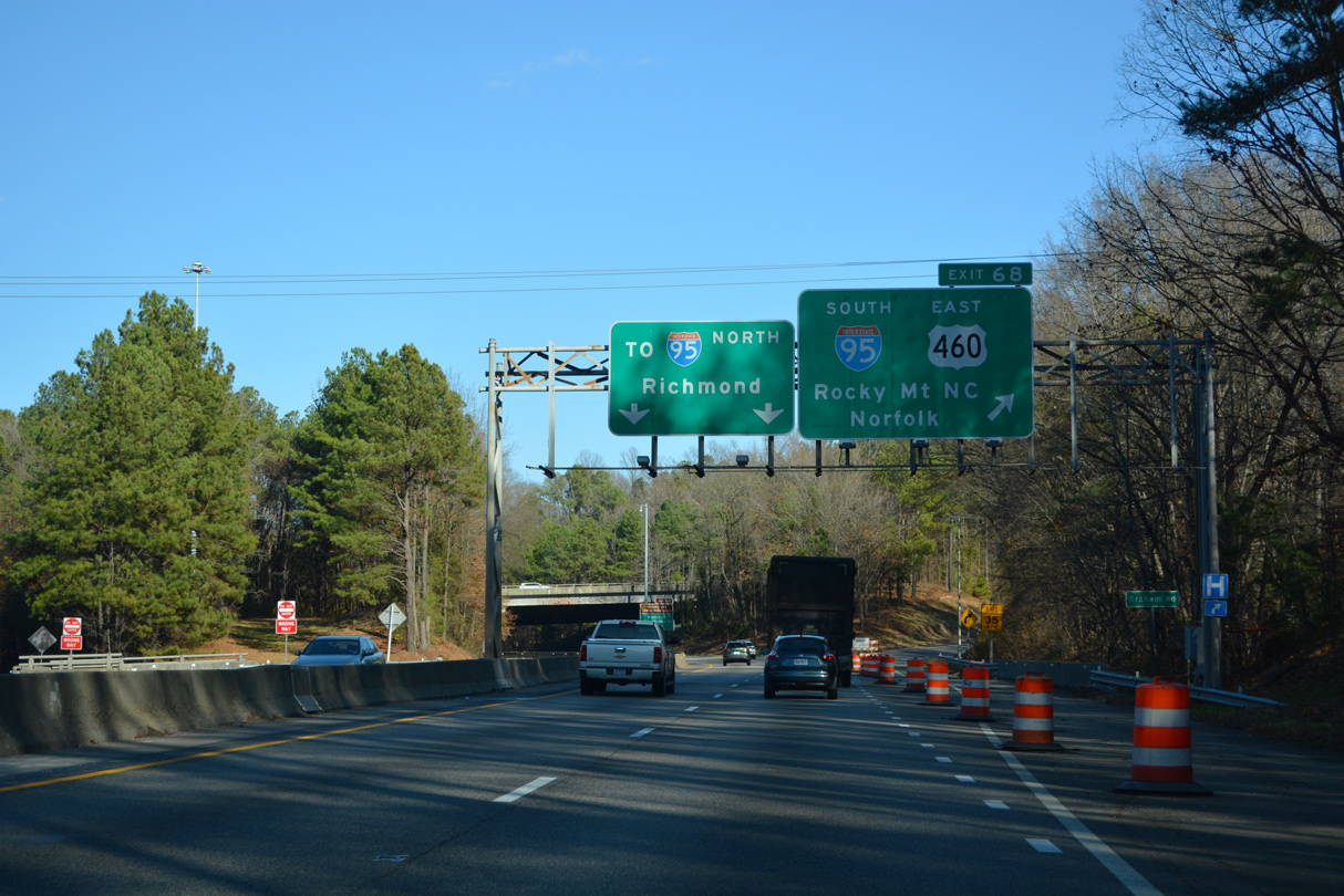
Exit 68 leaves I-85 north for I-95 south / U.S. 460 east. I-95 south connects I-85 with Interstate 295 around both Petersburg and Richmond. Posted with a 70 mile per hour speed limit, I-295 carries significantly less traffic than the Richmond-Petersburg Turnpike. 12/16/22
![]() South at
South at ![]()
![]()
The first sign for Interstate 85 (Exit 51) precedes Exit 54 to Virginia Route 144 (Temple Avenue) in Colonial Heights. 12/30/20
Entering the city of Petersburg, Interstate 95 spans the Appomattox River on the approach to I-85 and U.S. 460. 12/30/20
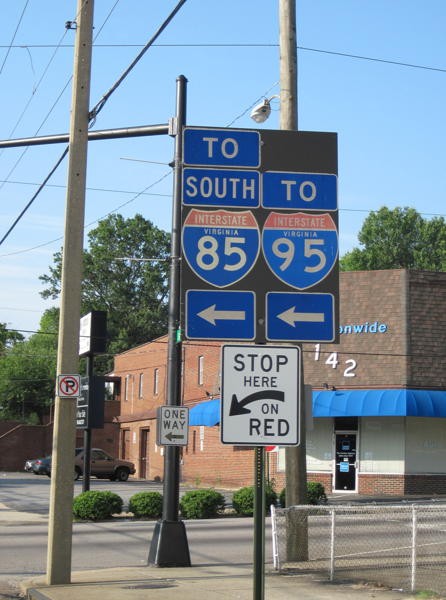
The forthcoming split is a major division between two southerly routes: I-95 follows the Atlantic Coastal Plain through the Carolinas and southeast Georgia into Florida, while I-85 angles southwesterly toward the Appalachian Piedmont en route to Durham, Charlotte, Atlanta and Montgomery. 12/30/20
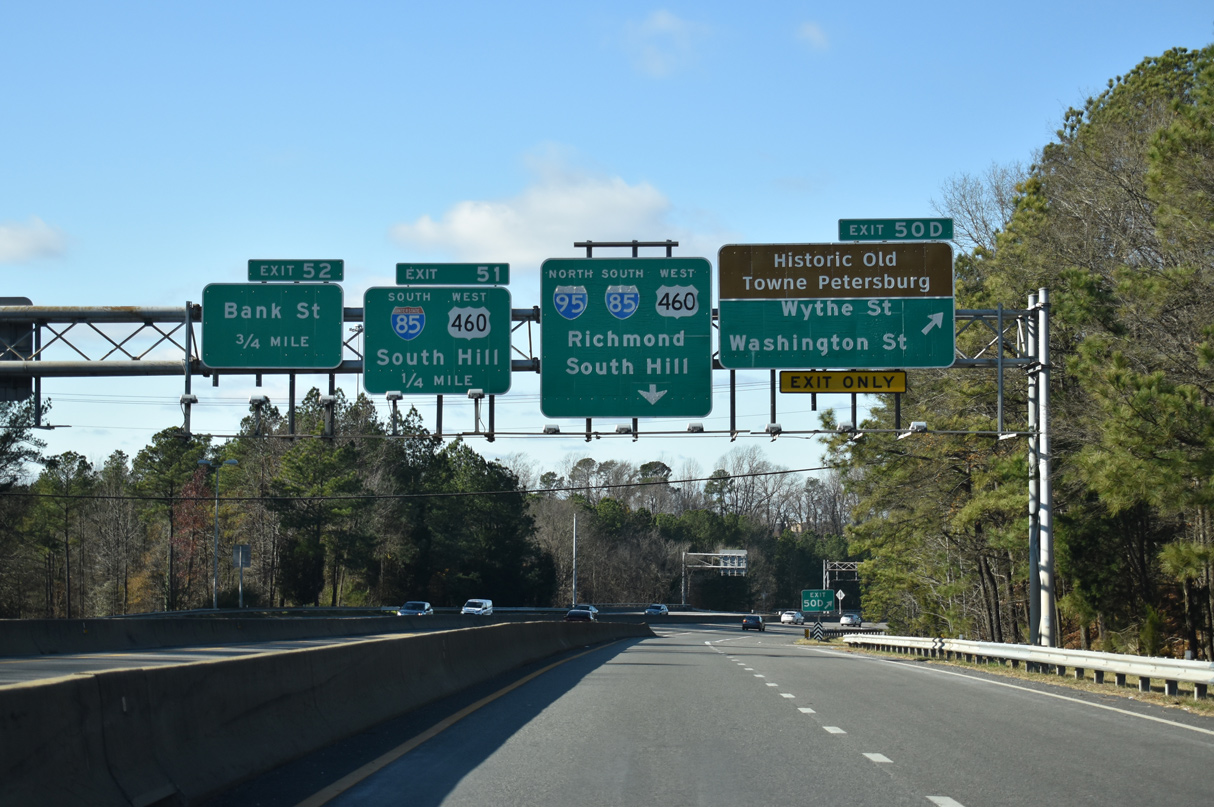
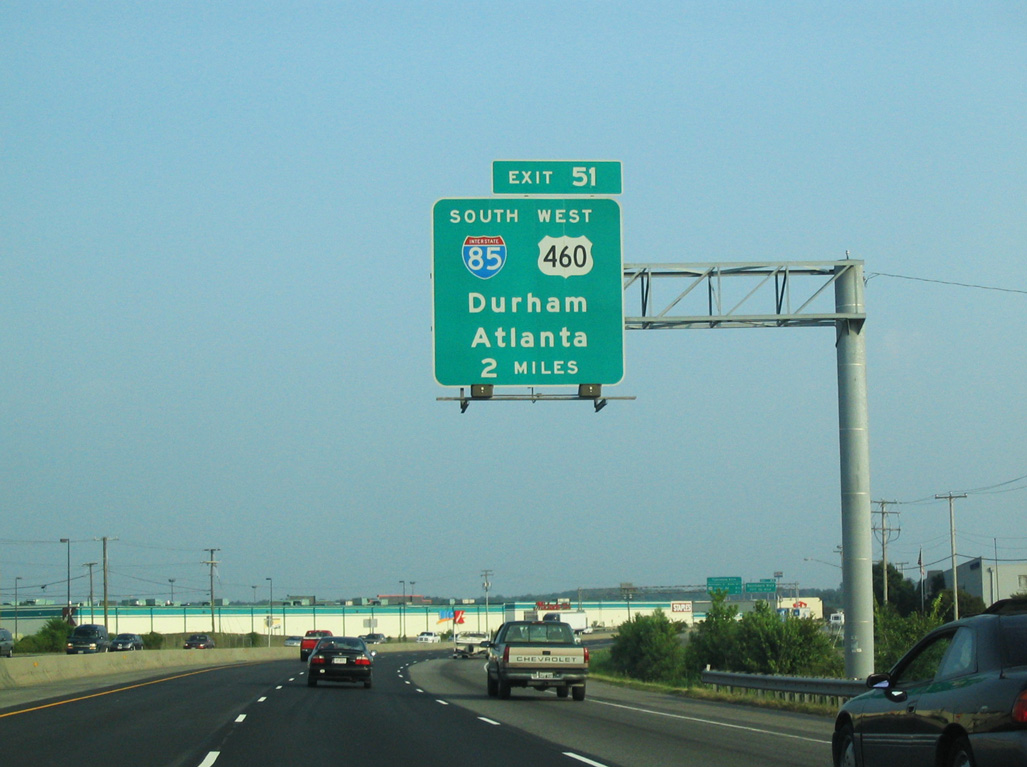
Interstate 95 south passes just east of Downtown Petersburg at the back to back ramps for Wythe and Washington Streets (U.S. 460 Business / SR 36). The mainline separates from the Richmond-Petersburg Turnpike in one mile at Exit 51. U.S. 460 bypasses Petersburg along I-85 south to Exit 61. 12/30/20
Arrow per lane (APL) signs for Exit 51 were installed along Interstate 95 south at the partition with I-85 (Richmond-Petersburg Turnpike) in 2015. I-85 turns west to U.S. 1 and the split with U.S. 460. The freeway follows a rural course southwest from Petersburg to Durham, North Carolina. 12/30/20
![]() North
North ![]() West at
West at ![]()
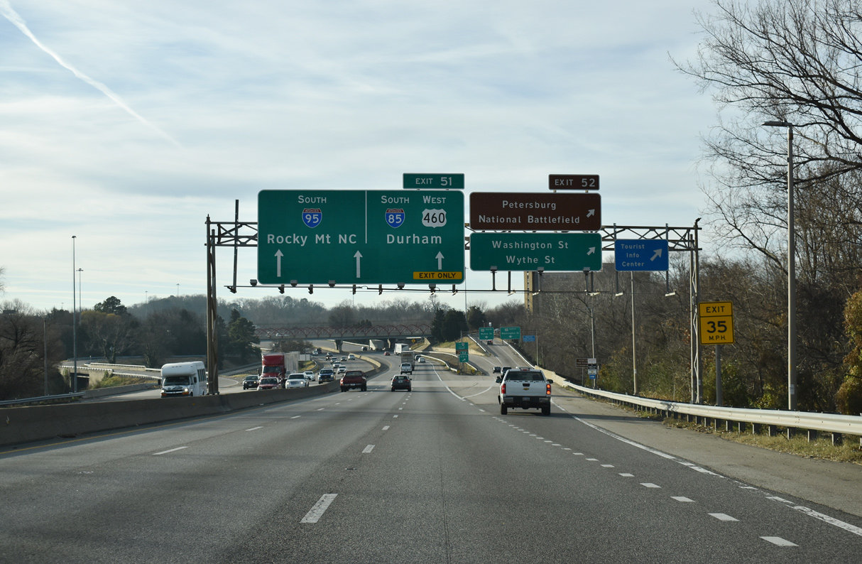
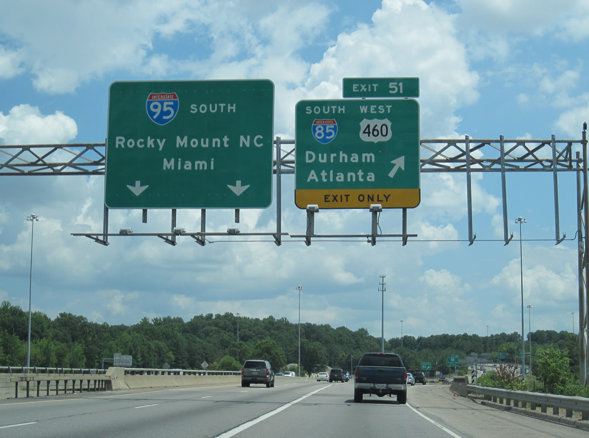
2.25 miles out from the trumpet interchange (Exit 51) joining I-95/U.S. 460 with Interstate 85 south. U.S. 460 overlaps with I-95 from Exit 50A to I-85 south. 12/17/20
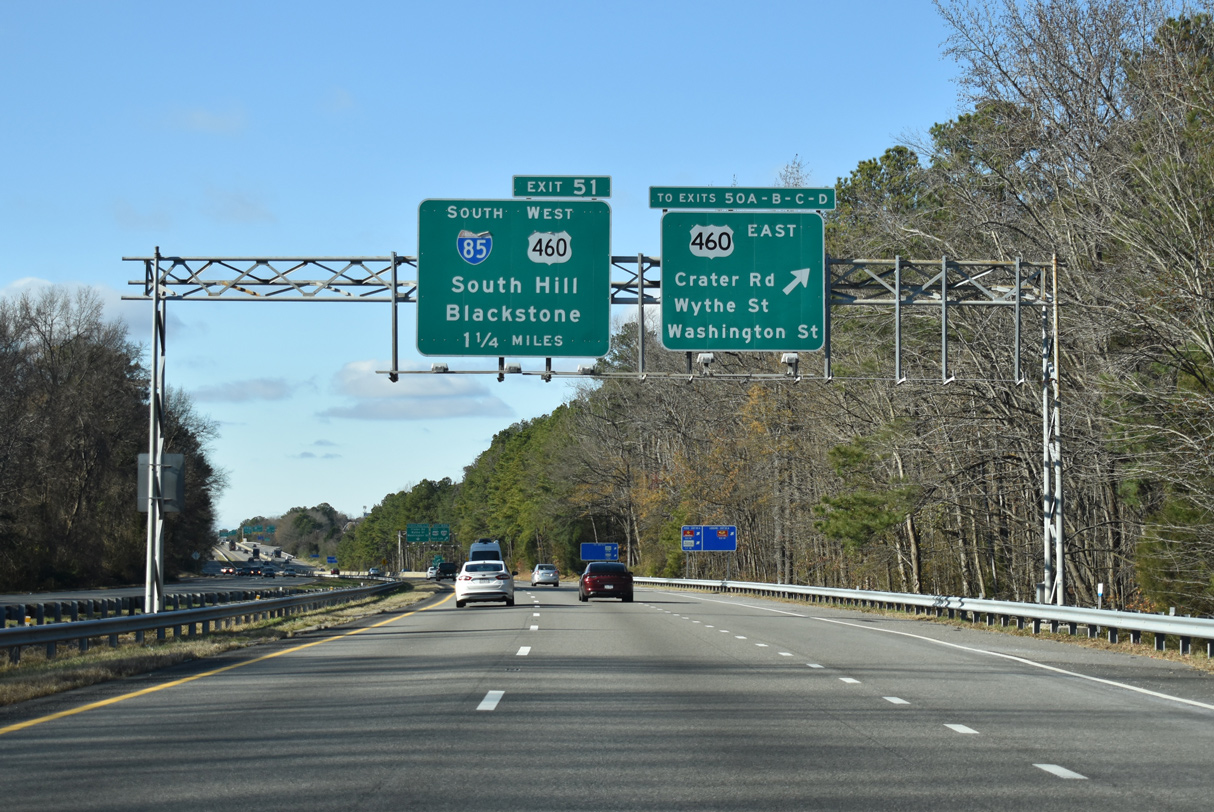
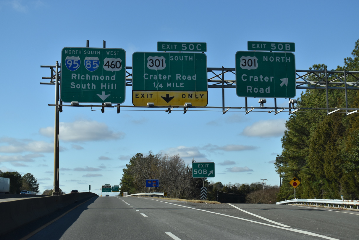
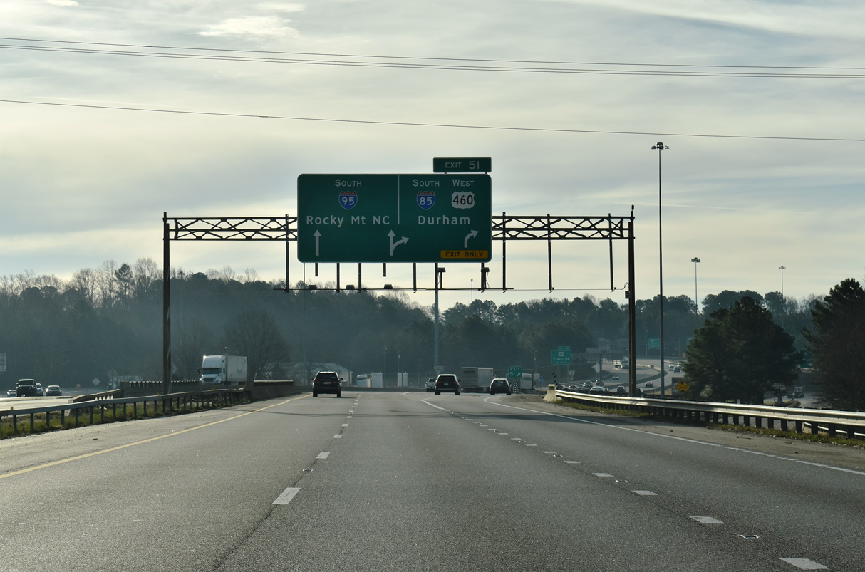
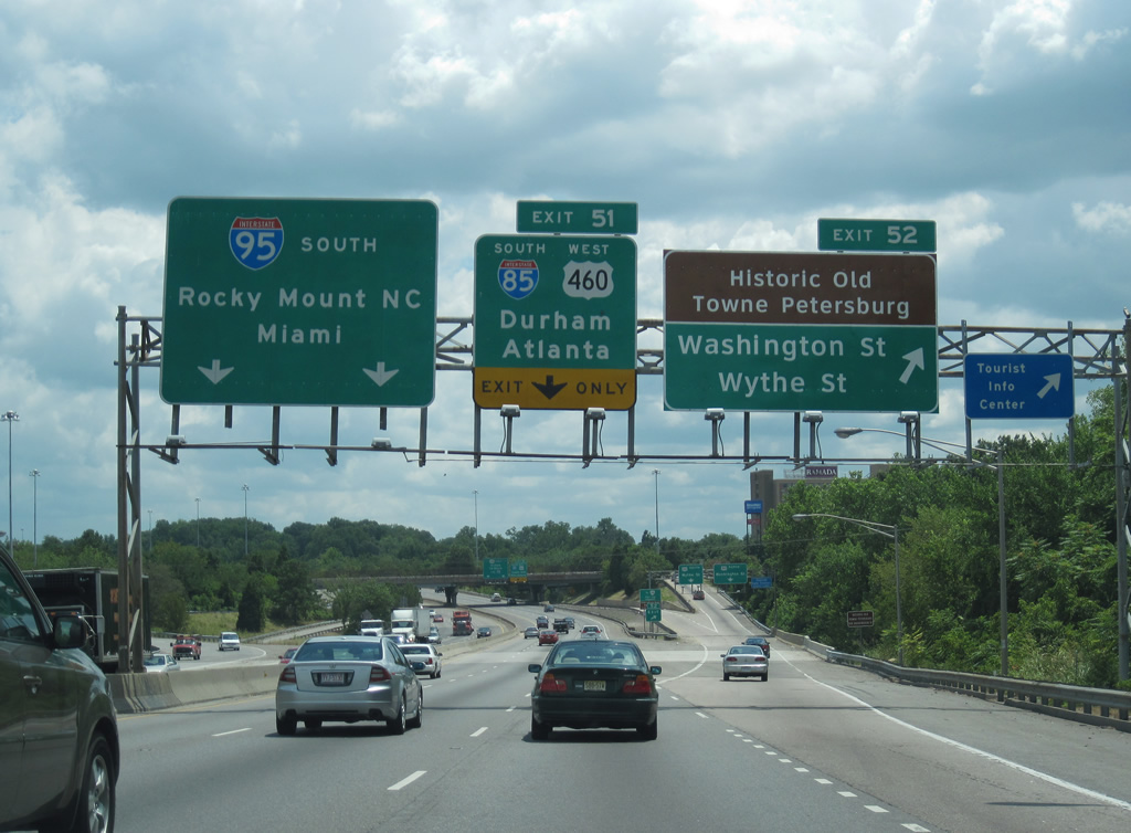
Connecting with U.S. 460 east, U.S. 301 (South Crater Road), and Downtown Petersburg, a collector distributor roadway (Exits 50A-D) separates from I-95 north. Mainline traffic continues unimpeded to Exit 51 for Interstate 85 south / U.S. 460 west. 12/17/20
Traffic along the Exit 50 c/d roadway splits with a slip ramp for the I-95 mainline to I-85 south (Exit 51) and a sweeping ramp for Wythe and Washington Streets (U.S. 460 Business / SR 36). A brief weaving traffic pattern ensues at Exit 51 on I-95. 12/17/20
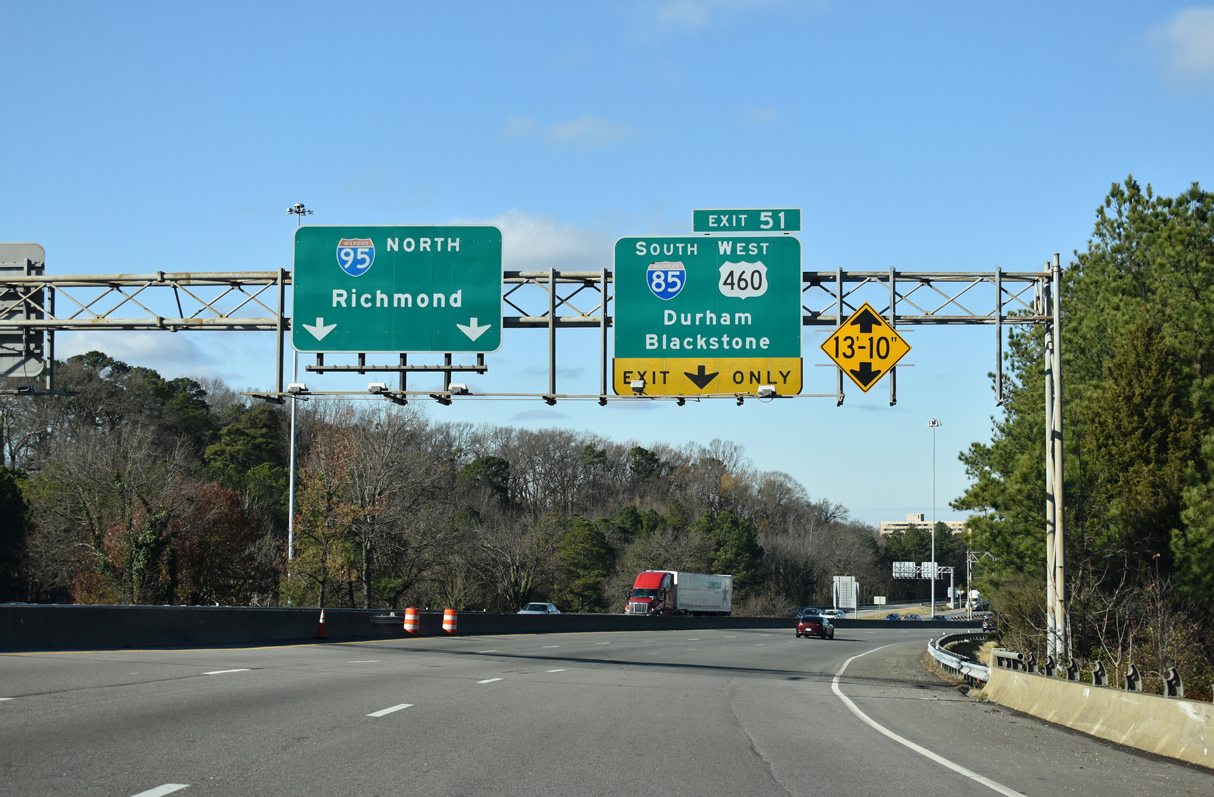
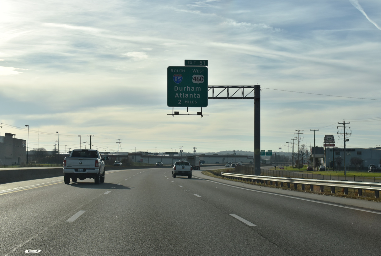
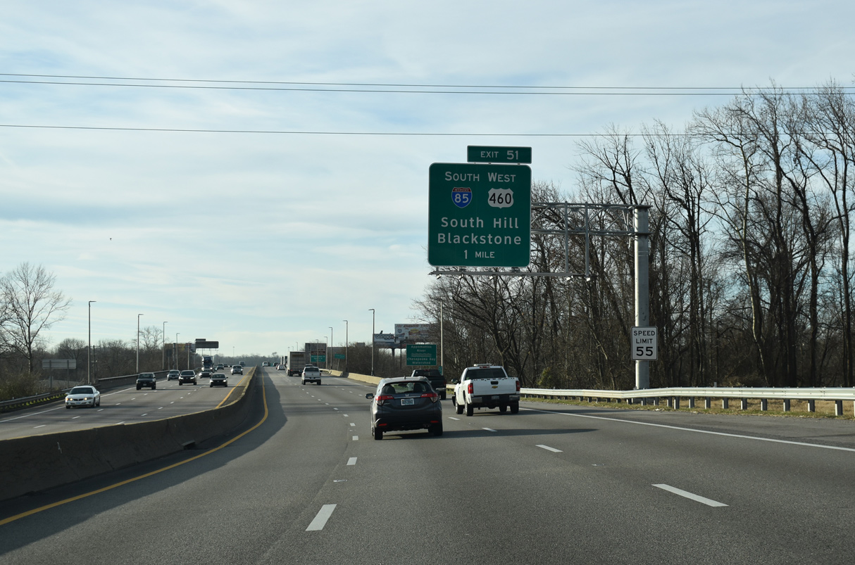
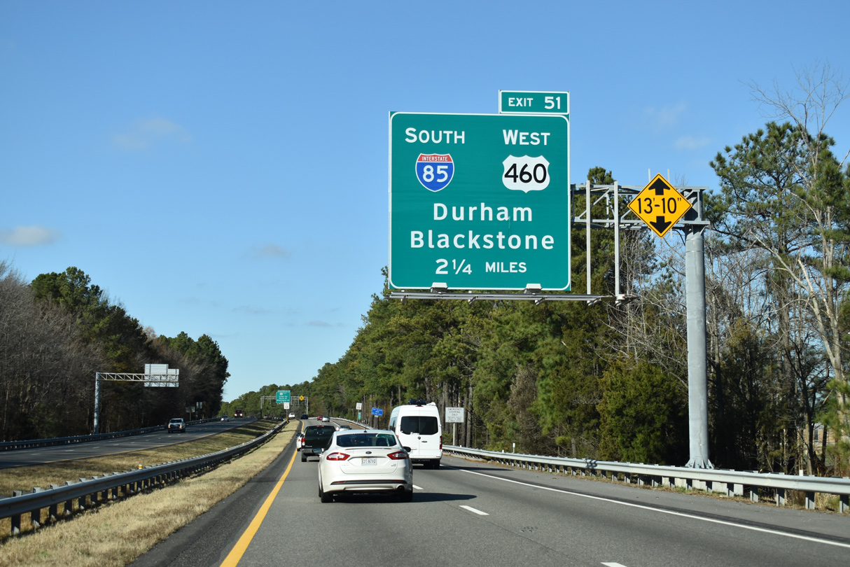
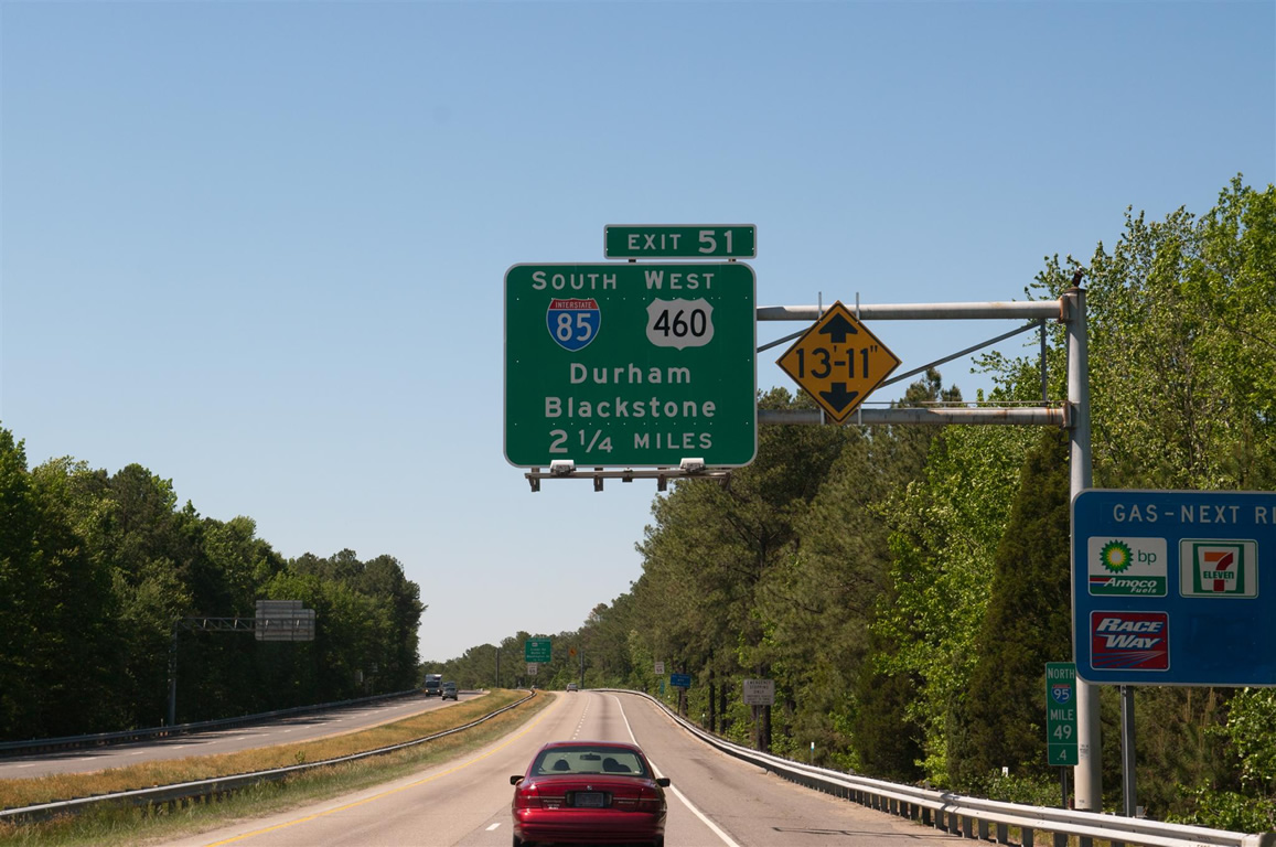
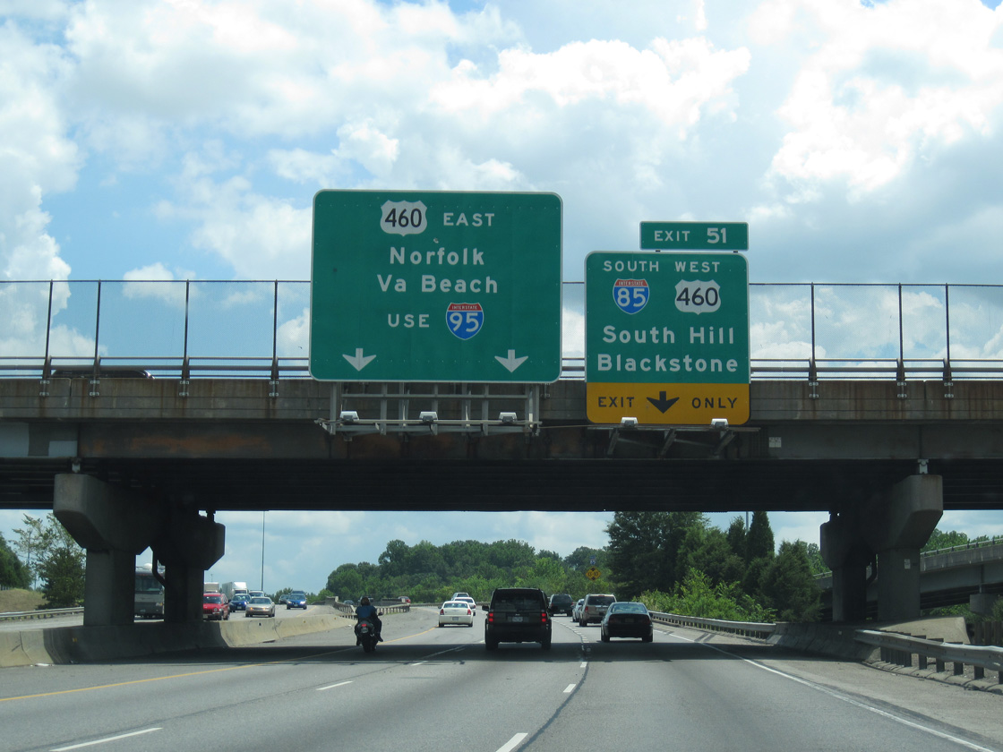
U.S. 460 joins the I-95 mainline just ahead of the loop ramp (Exit 51) onto Interstate 85 south. U.S. 460 overlaps with I-85 for seven miles before parting ways toward Blackstone. 12/17/20
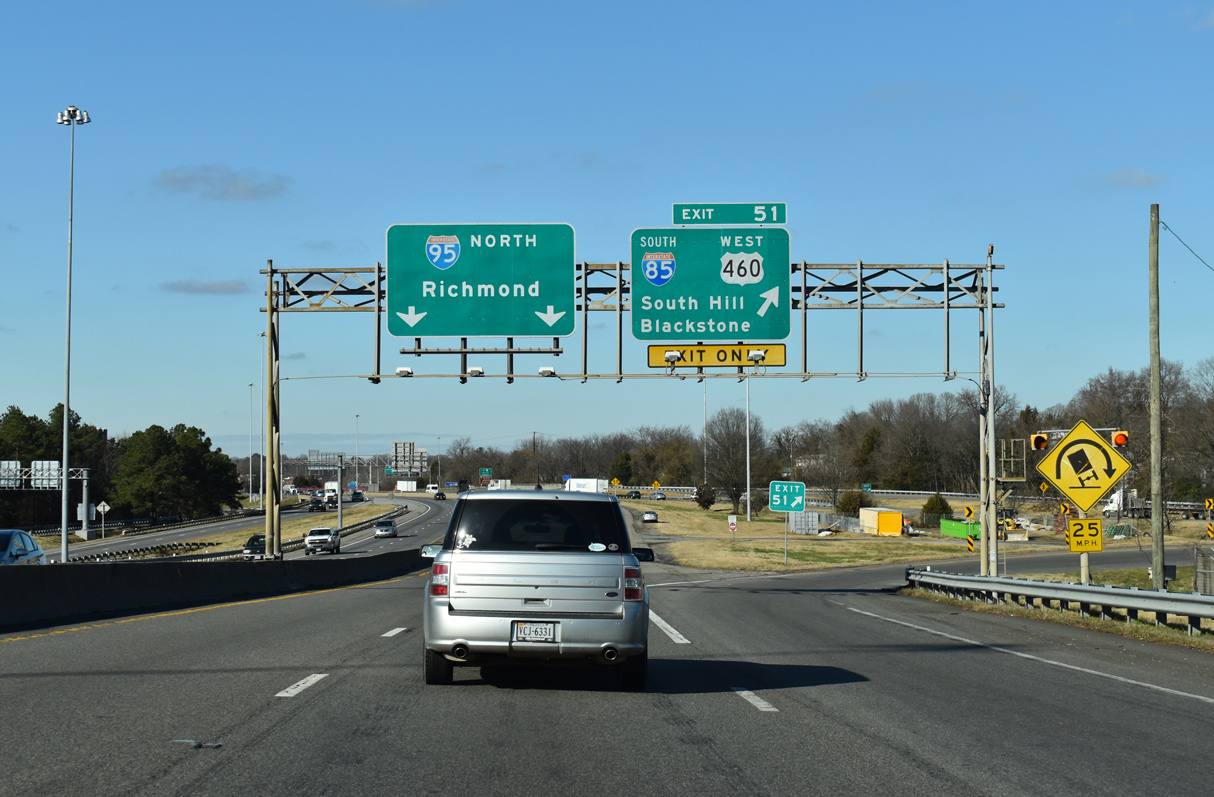
Exit 51 leaves Interstate 95 north for I-85 south / U.S. 460 west. Located where I-85 meets U.S. 58, South Hill is the main control city in Virginia. Durham, North Carolina lies 130 miles to the southwest. 12/17/20
North End Throwback
![]() North at
North at ![]()
Removed by 2012, an end sign was posted at the I-95 mainline overpass. Interstate 95 enters the capital city of Richmond in 18 miles. This connection was originally part of the tolled Richmond-Petersburg Turnpike. The turnpike began along Interstate 85 at U.S. 1 (Exit 63) and continued northward to the I-64 / I-95 overlap through central Richmond. Photo by Carter Buchanan (08/08/04).
![]() North at
North at ![]()
The initial overhead for I-85 south was replaced in kind by 2020. Photo by Will Weaver (05/08/10).
![]() South at
South at ![]()
The three mile sign for Interstate 85 on I-95 south was replaced by 2015. 07/09/10
The two-mile sign for I-85 south was replaced by 2015 to use Clearview font. Photo by Carter Buchanan (07/01/05).

The overhead for I-85 at the Appomattox River was replaced by 2020. 01/01/17
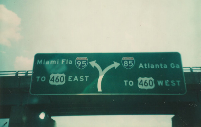
Popular in the road enthusiast community, a pair of sign bridges once referenced both Miami and Atlanta at the I-85/95 southbound split in Petersburg. APL signs displaying just Rocky Mount for I-95 and Durham for I-85 replaced both sets in 2015. 07/09/10
U.S. 460 combines with I-95 briefly from the end of I-85 before resuming an eastward course to Norfolk, Virginia Beach, and Hampton Roads at the succeeding interchange (Exit 50). These overheads were removed in 2018. 07/09/10
Exit 51 parts ways from Interstate 95 southbound at the St. Andrew Street underpass. Two lane expansion of the ramp for I-85 in July 2014 resulted in the replacement of these signs for Miami and Atlanta. 07/09/10
A diagrammatic sign outlined the upcoming split of Interstate 95 from the tolled Richmond-Petersburg Turnpike. The toll road extended another three miles west at the time along I-85 south. Because of the turnpike, U.S. 460 remained on its surface route due to the restriction on tolled US Routes. Photo by Michael Summa (1976).
South End – Montgomery, Alabama
![]() South at
South at ![]()
![]()
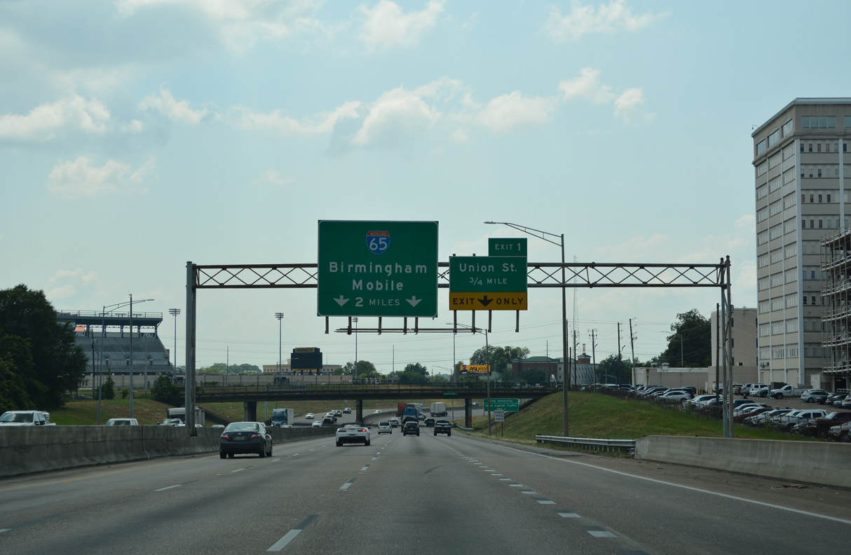
Advancing west from the Mulberry Street underpass, Interstate 85 concludes in two miles. The final exit departs for Union Street (former U.S. 331) to Downtown Montgomery in 0.75 miles. 06/16/22
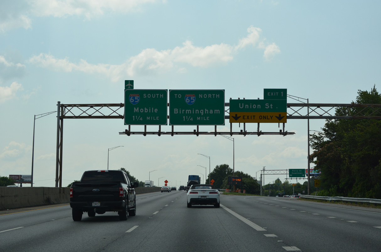
Interstate 85 southbound at Exit 1 for Union Street, Perry Street and the Alabama State Capitol. Three lanes continue 1.25 miles west to I-65/U.S. 82. 06/16/22
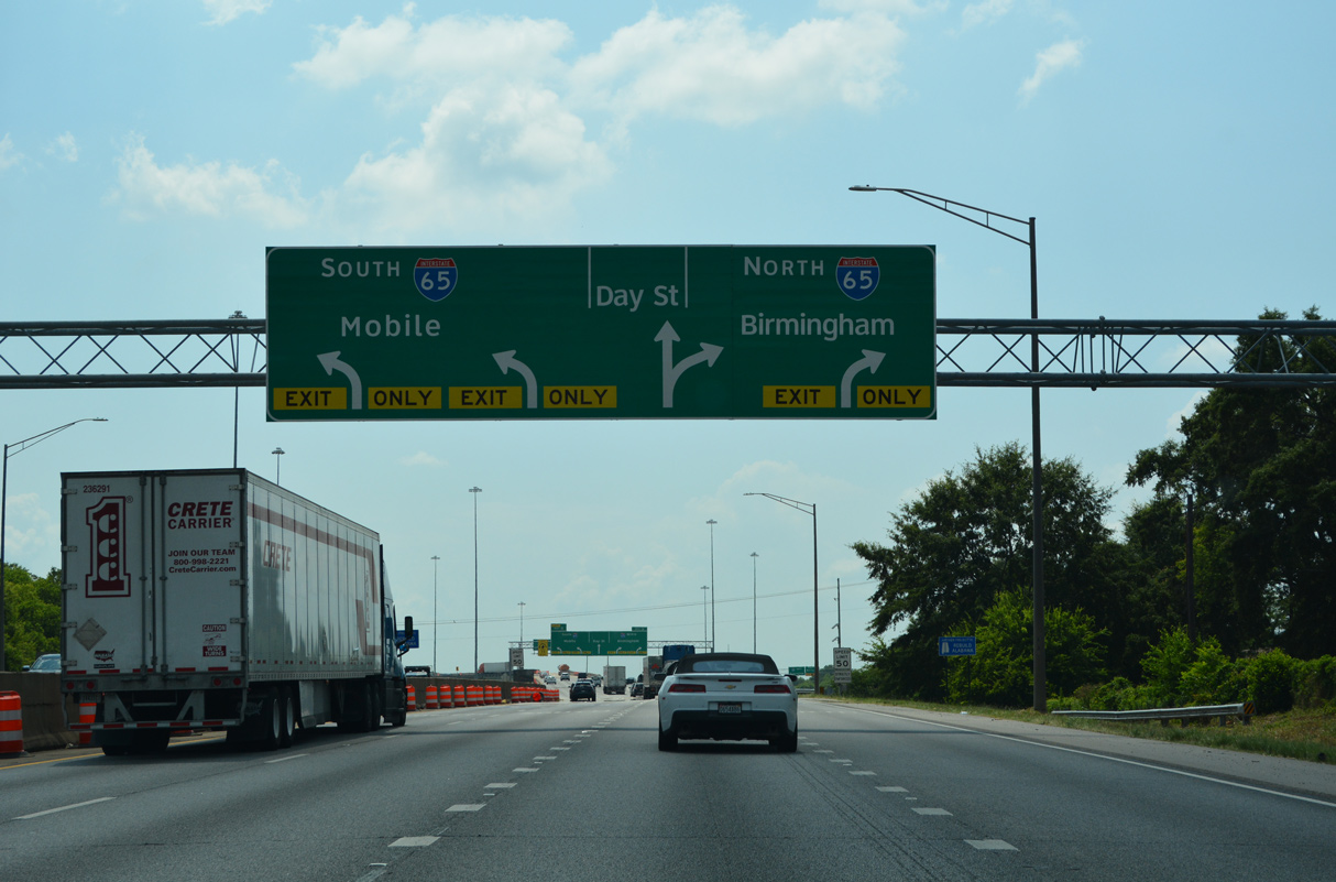
Two lanes are allocated for each ramp to I-65/U.S. 82 from I-85 southbound. A third ramp descends onto Day Street as well. Day Street extends west to Birmingham Highway (former U.S. 31/80) and Maxwell Air Force Base. 06/16/22

Removed by 2022, an end shield for I-85 appeared beyond the Rose L. Parks Avenue underpass. A signing project in 1995-96 replaced a state named version of this shield. 01/12/19
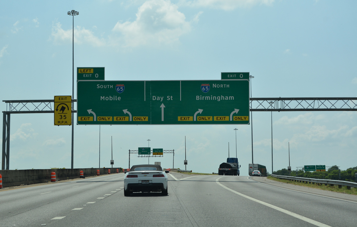
APL overheads added at the south end of I-65 in 2019 assigned Exit 0 to both ramps for Interstate 65. U.S. 82 remains omitted on guide signs, despite overlapping with I-65 since 2000. 06/16/22
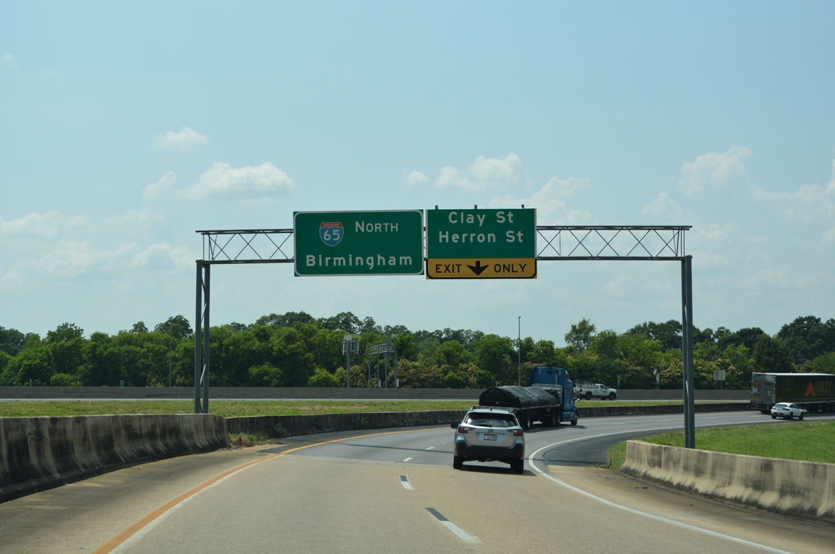
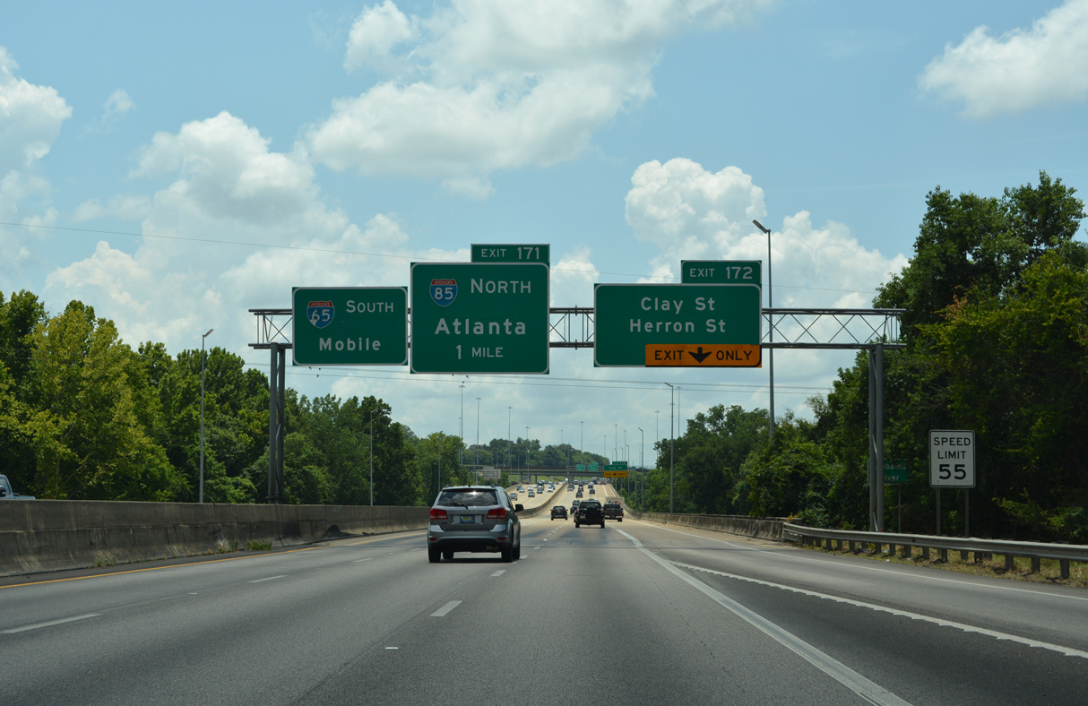
Traffic joining Interstate 65 north / U.S. 82 west merges onto the freeway mainline just ahead of the split diamond interchange (Exit 172) with Herron Street. 06/16/22

The ramp to I-65 south and U.S. 82 east curves sharply and immediately lowers to merge onto the freeway at a lane drop. Mobile lies 163 miles to the southwest. 01/21/13
![]() North
North ![]() West at
West at ![]()
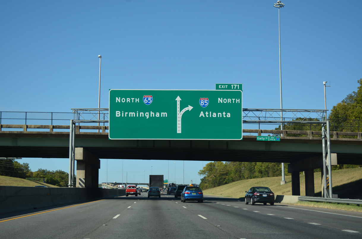
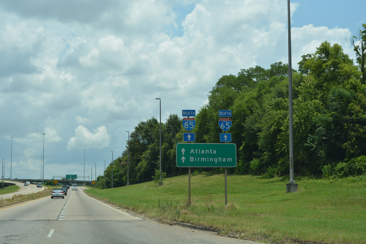
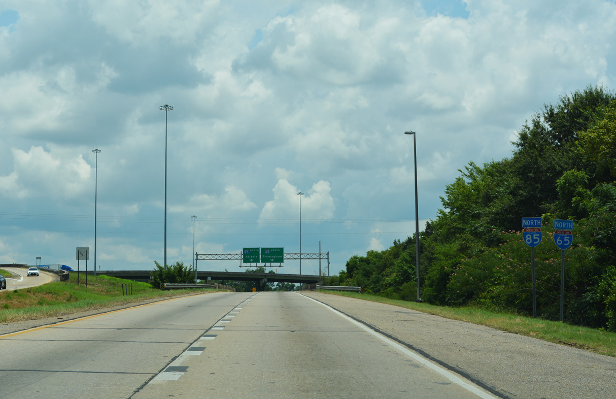
Two miles south of the I-65/85 northbound split at Exit 171. Interstate 65 was expanded to at least six overall lanes through Montgomery as part of a $110 million project between 2006 and December 21, 2010. 10/06/16
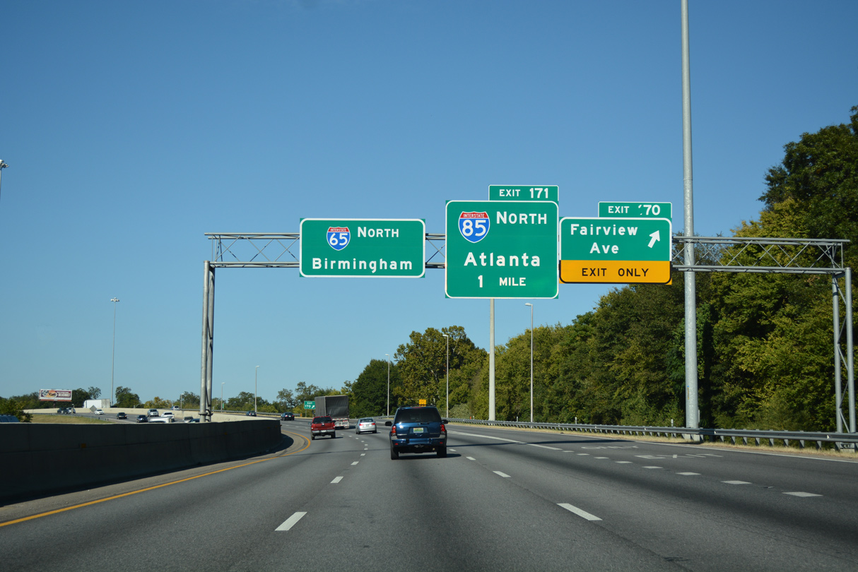
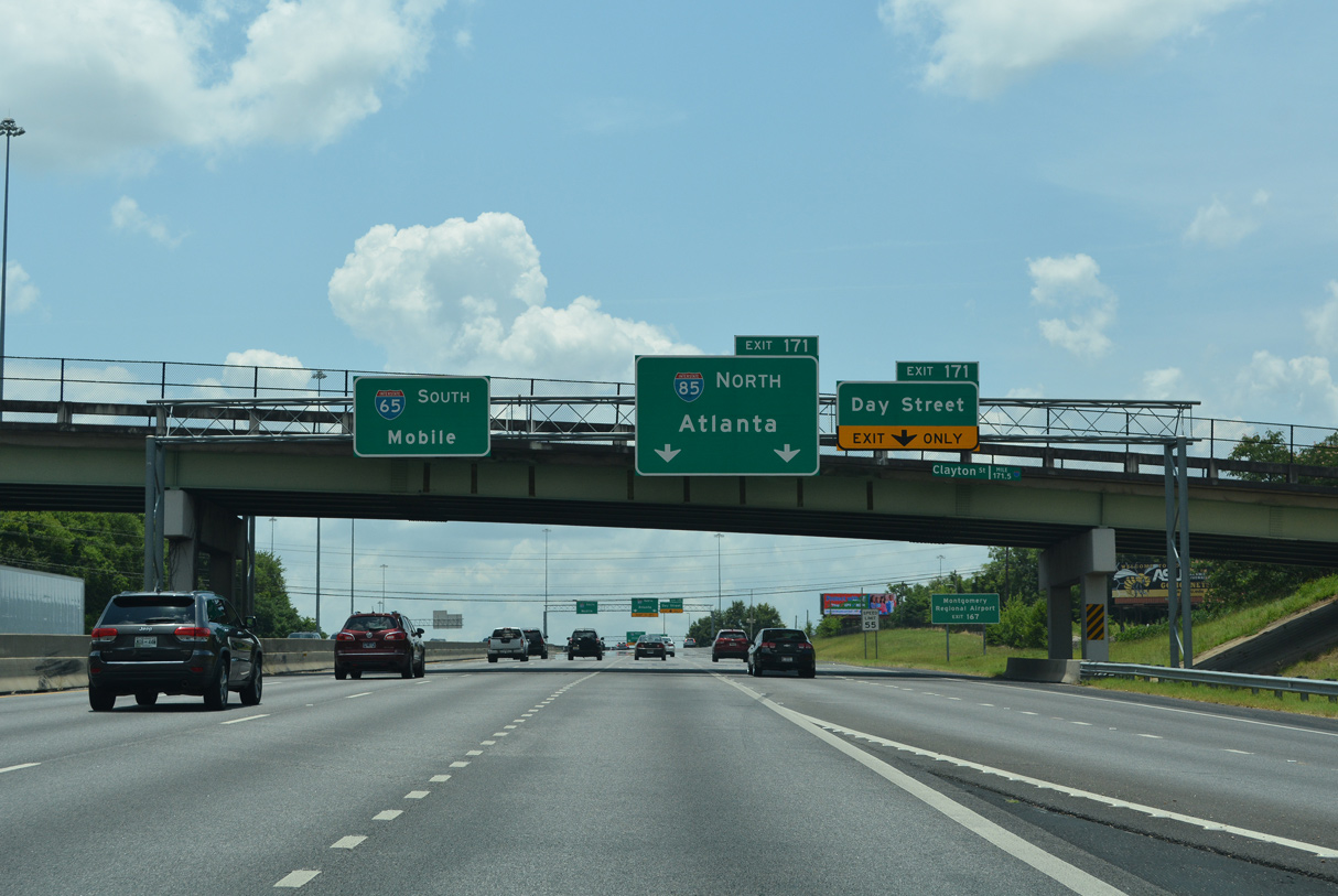
Exit 170 to Fairview Avenue, a former alignment of U.S. 80, departs Interstate 65 north / U.S. 82 west. The exchange with I-85 north follows in one mile. 10/06/16
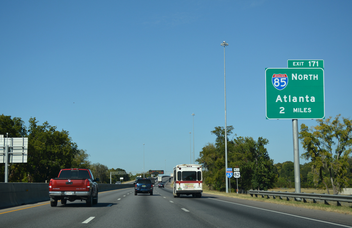
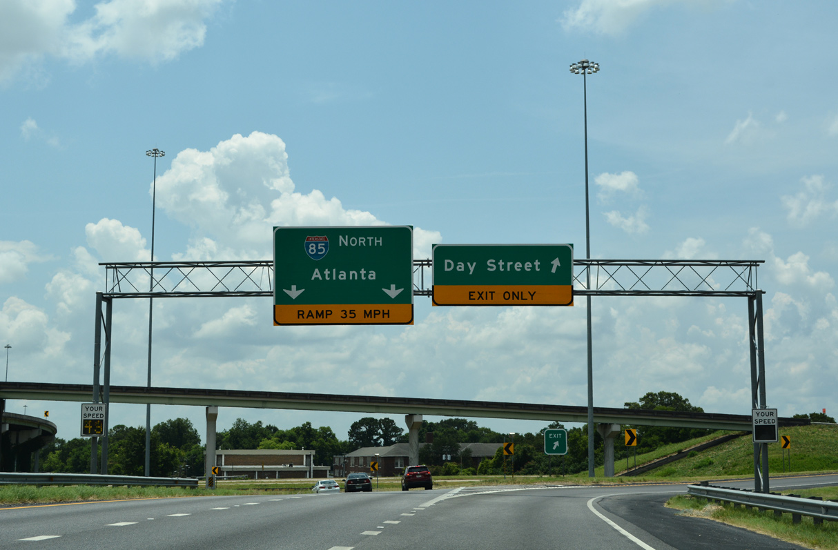
An optional lane and a dedicated lane depart northbound I-65/U.S. 82 beyond the Early Street overpass for Interstate 85 to Atlanta at Exit 171. 10/06/16
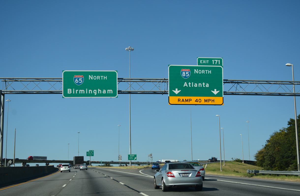
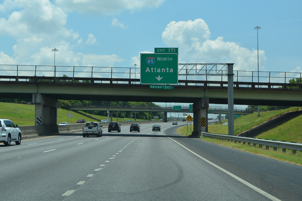
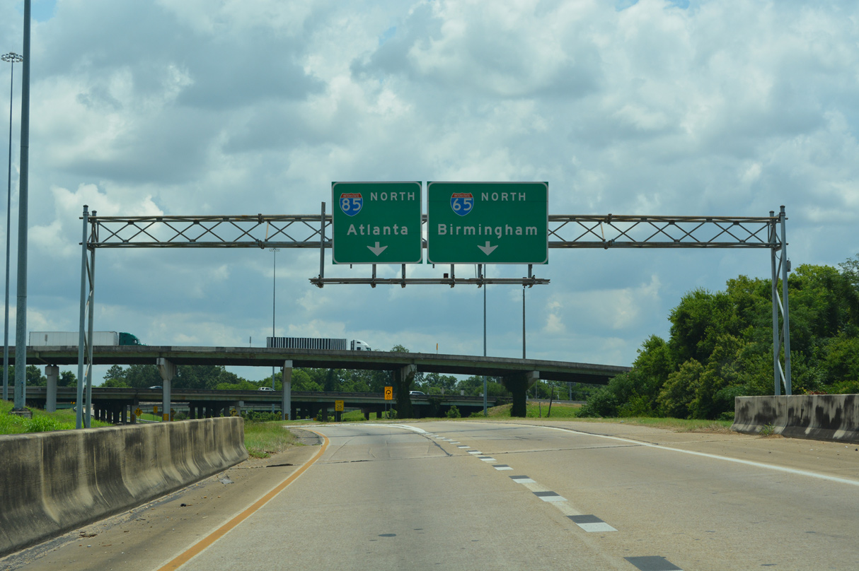
Exit 171 parts ways with I-65 north / U.S. 82 west for Interstate 85. I-85 initially heads east through Montgomery before turning northward from near Tuskegee to Auburn, Opelika and Atlanta, Georgia. 10/06/16
![]() South
South ![]() East at
East at ![]()
I-65 follows a causeway between a bend along the Alabama River to a trumpet interchange (Exit 173) with North Boulevard (Alabama Route 152). The freeway proceeds south another 1.25 miles to the exchange (Exit 171) with Interstate 85 north. 06/26/22
$110 million in improvements were undertaken along Interstate 65 between Exit 173 and Exit 168 through Montgomery between 2006 and December 21, 2010. This resulted in additonal lanes, expanded bridges and sign replacements throughout the stretch. 06/26/22
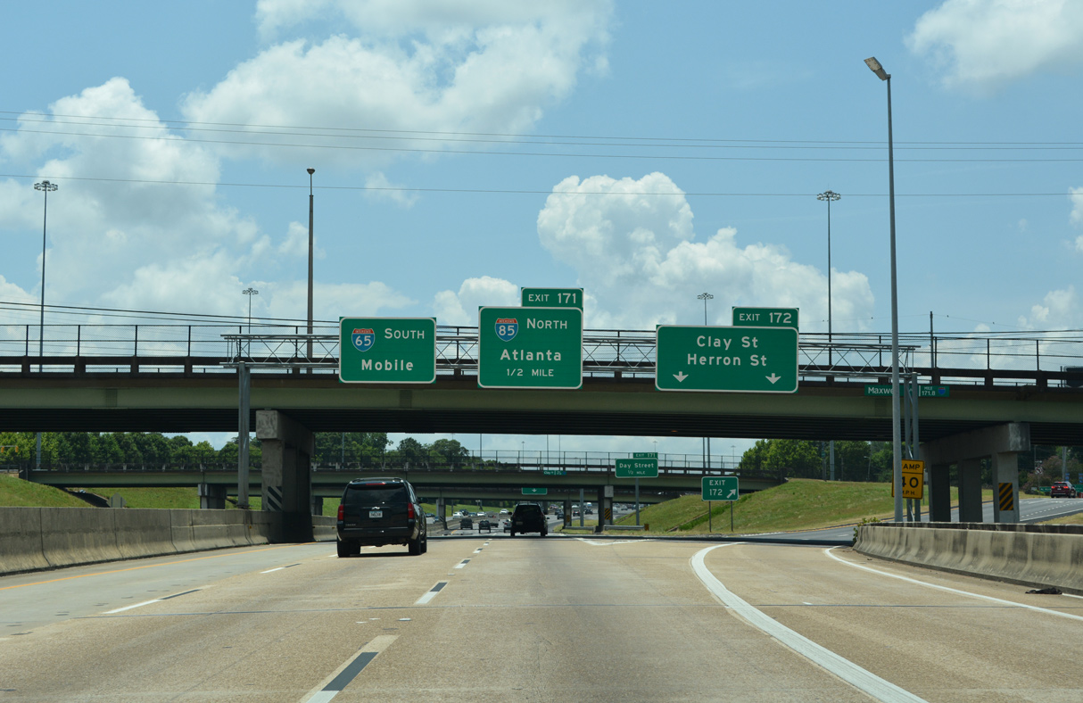
Exit 172 departs I-65 south / U.S. 82 east a half mile ahead of the three level interchange with Interstate 85. Clay and Herron Streets connect I-65 with the Montgomery central business district and Alabama State Capitol. 06/26/22
Aforementioned road work expanded I-65 south to four lanes leading to the northbound beginning of Interstate 85. Atlanta, Georgia lies 155 miles to the northeast along I-85. 06/26/22
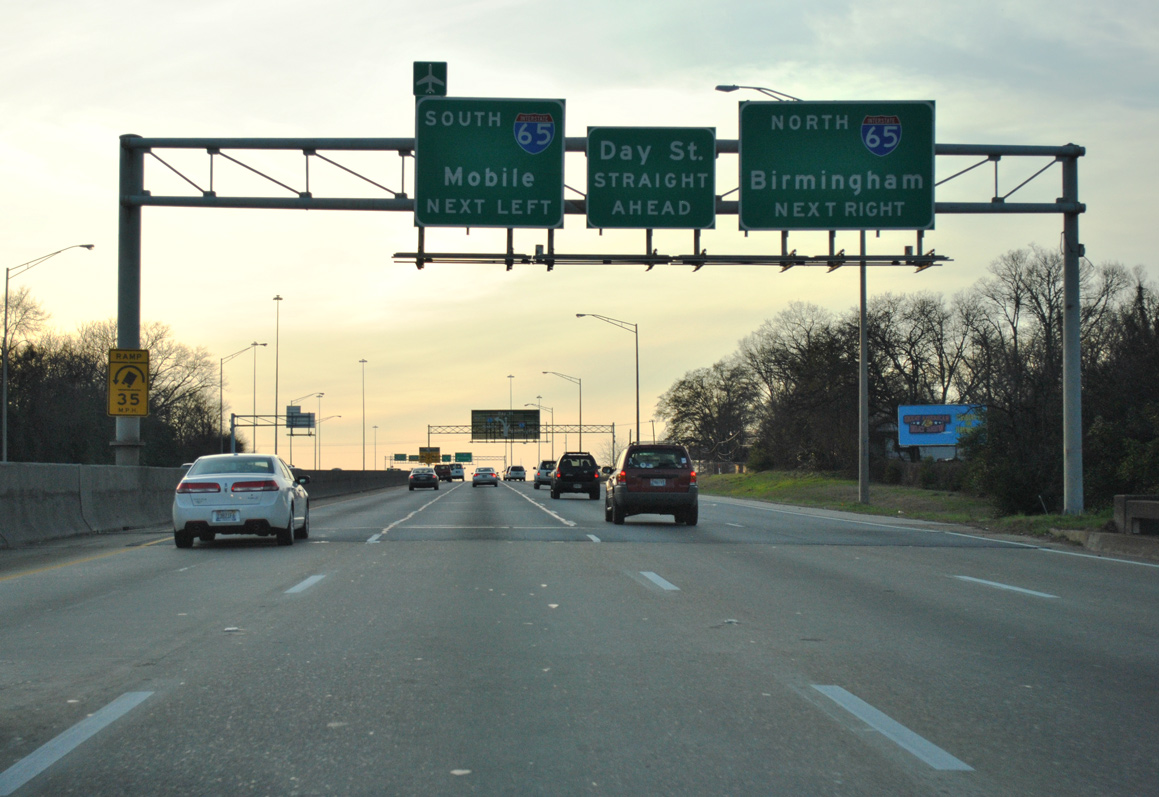
The Herron Street entrance ramp forms an auxiliary lane along I-65 south to Exit 171 for I-85 north and the Day Street Connector. I-65 south and U.S. 82 east continue with three overall lanes. 06/26/22
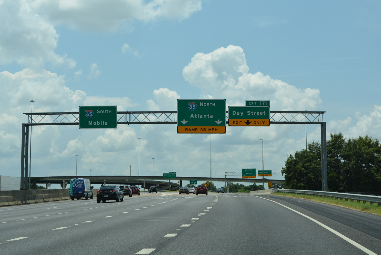
Three lanes leave Interstate 65 south / U.S. 82 east at Exit 171. The ramp for I-85 navigates along a sharp curve at grade level. The Day Street ramp spans adjacent Oak Street en route to Maxwell Air Force Base and Birmingham Highway (former U.S. 31/80). 06/26/22
East from I-65, Interstate 85 travels below grade across the Montgomery street grid between Downtown and the Garden District. 06/26/22
Day Street at ![]()
![]()
![]()
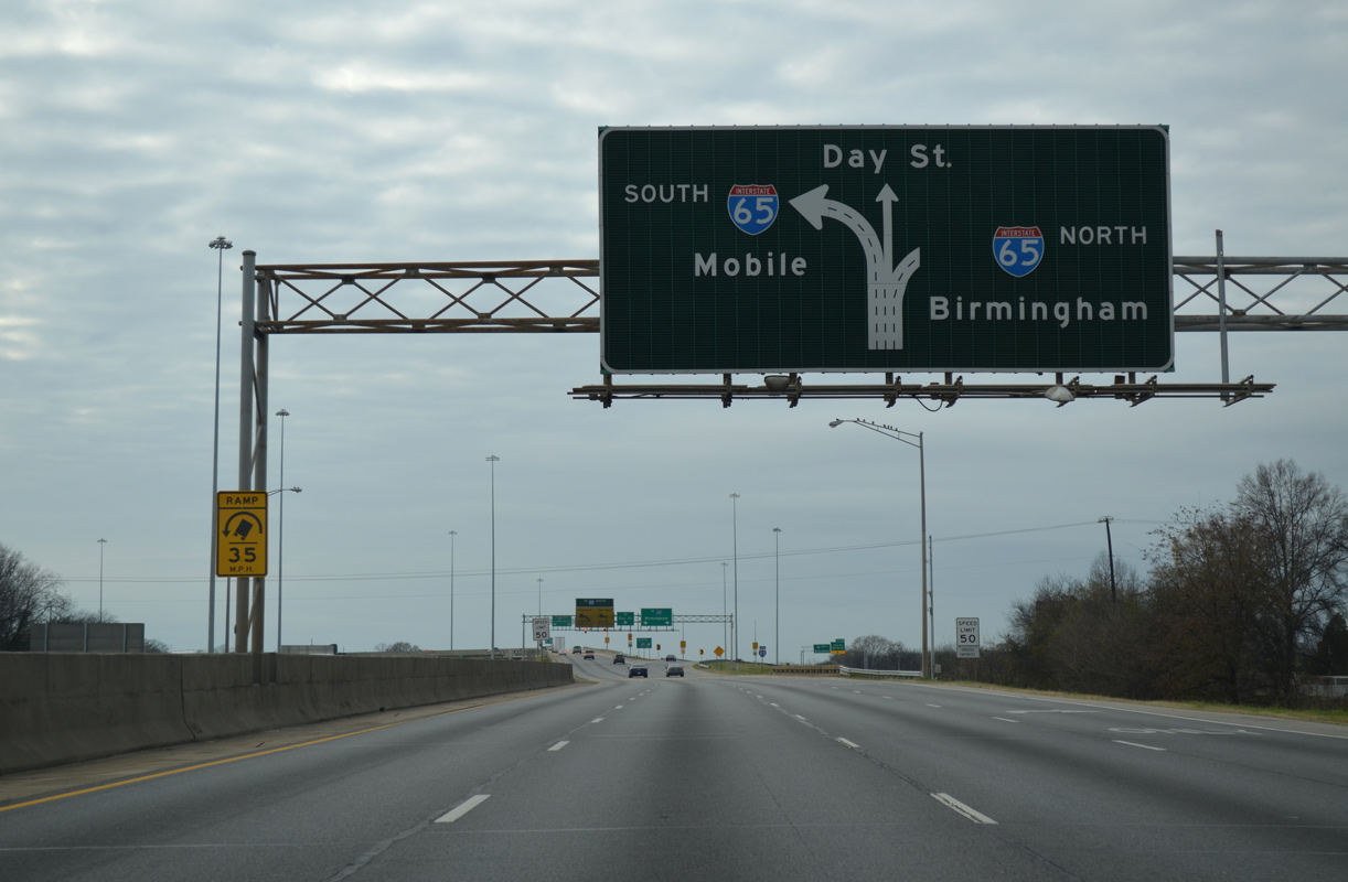
Day Street extends east from Birmingham Highway at Maxwell AFB to Hill Street, where the Day Street Connector links to I-65/U.S. 82 north and I-85 north. 06/26/22
The Day Street Connector partitions into ramps for I-65 north / U.S. 82 west and I-85 north at the Oak Street underpass. There is no access to I-65 south / U.S. 82 east. 06/26/22
I-65 north reaches the city limits of Birmingham in 86 miles while I-85 travels ten miles within the Montgomery city limits. 06/26/22
South End Throwback
Overheads at the Holcombe Street underpass were removed in 2019. A pair of regulatory signs for the sharp curve on the I-65 southbound flyover took their place. 01/21/13
12/31/12
01/21/13
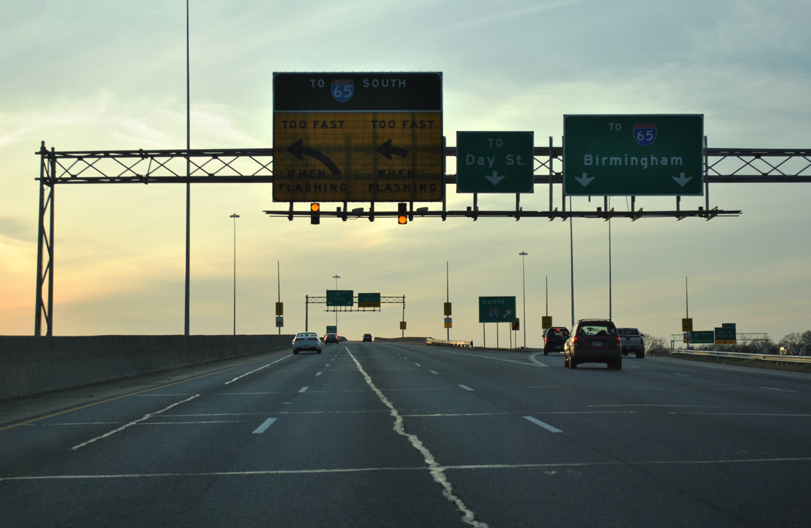
Slotted guide signs for Interstate 65 and Day Street were replaced with APL’s in 2019.
Sources:
- “I-85 to be 12 lanes near Northgate.” The Herald Sun, September 4, 2003.
- I-85 Widening (Anderson County)
http://www.dot.state.sc.us/Projects/I-85/default.html, SCDOT project web site. - “Drivers race to road around ‘Death Valley’.” Charlotte Observer, February 23, 2004.
- Aaron Porter, email: “New Section of I-85 Open” February 21, 2004.
- Jeff Absher, email: “Re: I-85,” May 25, 2004.
- Celebrating the 50th Anniversary of the Eisenhower Interstate Highway System: Previous Interstate Facts of the Day by the Federal Highway Administration (FHWA).
- “Overbudgeted I-85 Project Officially Opens.” WRAL, February 12, 2008.
- “Nation’s Top Highway Official Helps Break Ground on Montgomery Outer Loop.” FHWA Press Release, September 28, 2011.
- “Montgomery Outer Loop Project update.” WSFA, October 25, 2012.
- “Long-awaited section makes drivers happy.” Herald-Journal (Spartanburg, SC), September 1, 1995.
- “Light at end of the tunnel for Interstate 85 construction.” The Atlanta Journal and The Atlanta Constitution, September 17, 1987.
- NCRoads.com: I-85.
- “Happy Birthday to the open road.” Gwinnett Daily Post (Lawrenceville, GA), June 25, 2006.
- “Completion near for interstate road systems,” Rome News-Tribune, November 14, 1977.
- “Interstate 85 through Hall? It very nearly was Gov. Ernest Vandiver redirected highway plans in 1950s.” The Times (Gainesville, GA), April 13, 2005.
- “Nation’s Longest Interstate Route.” Herald-Journal (Spartanburg, SC), Novermber 11, 1959.
- “I-85, N.C. To Ga. To Open In August.” Star-News (Wilmington, NC), August 3, 1964.
- “I-85 Improvement Plan – Construction May Begin Sometime This Year.” Herald-Journal (Spartanburg, SC), January 13, 1983.
- “Controversy On Interstate 85.” Herald-Journal (Spartanburg, SC), August 7, 1983.
- “City Council Given Options On Road Improvements.” Herald-Journal (Spartanburg, SC), October 4, 1983.
- “Officials Concerned About Accessiblity To Re-Routed I-85.” Herald-Journal (Spartanburg, SC), December 15, 1983.
- “State, feds at odds over I-85 name.” Herald-Journal (Spartanburg, SC), May 4, 1988.
- I-85 The Boom Belt, South Carolina, FHWA web site.
- “New I-85 expected to open later this year.” Herald-Journal (Spartanburg, SC), July 27, 1994.
- “Rain delays grand opening of I-85 bypass until spring.” Herald-Journal (Spartanburg, SC), December 26, 1994.
- “State opens 19 more miles of Interstate.” Star-News (Wilmington, NC), September 2, 1971.
- “State Approves Final Interstate 85 Contract.” The Dispatch (Lexington, NC), May 15, 1982.
- “Road proposal ‘innovative” but expensive.” Herald-Journal (Spartanburg, SC), April 16, 2000.
- “I-85 collapses after massive fire: ‘The entire bridge is compromised’.” The Atlanta Journal-Constitution, March 31, 2017.
- “I-85 BRIDGE COLLAPSE: Both directions to be closed as crews work to make repairs.” WSB-TV 2 (Atlanta, GA), March 31, 2017.
- “Cleanup continues on I-85, DOT aims to reopen Piedmont Rd. by Tuesday.” Fox 5 Atlanta, April 3, 2017.
- “Final Countdown: Crews begin striping lanes of I-85.” WSB-TV 2 (Atlanta, GA), May 9, 2017.
Page updated April 7, 2023.