Interstate 84 (Western)


Looking east from the Vista House, Interstate 84 follows the Columbia River Highway toward Cascade Locks and Hood River. The freeway hugs the south bank of the massive river, much the same way as Washington State Route 14 hugs the north bank. As the main route east across Oregon, I-84 stays close to the river while the Historic Columbia River Highway (former U.S. 30) follows higher ground along a much more winding course. 08/27/06
Overview
The western Interstate 84 is the primary route linking the northwestern cities of Salt Lake City, Boise and Portland. This one of two instances of Interstate 84; the other runs east from Scranton, Pennsylvania to Sturbridge, Massachusetts via New York and Connecticut.
Interstate 84 in Portland is known as the Banfield Expressway; it is named after a former head of the Oregon Highway Commission. The stretch east from Portland through the Columbia River Gorge is one of the most scenic sections of Interstate Highway in the entire system.
 Parallel U.S. Routes
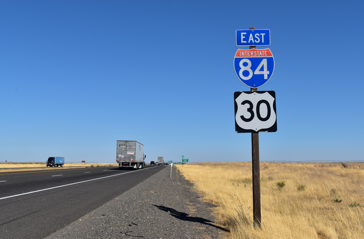
Interstate 84 largely follows U.S. 30 from Portland east to Rupert, Idaho. East of Rupert, U.S. 30 used to split into two branches: U.S. 30N and U.S. 30S. I-84 replaced U.S. 30S from Rupert southeast to Echo Junction via Ogden, Utah.
History
Idaho and Utah proposed the renumbering of Interstate 80N as Interstate 86, but the Oregon State Transportation Commission turned down the request on May 17, 1977. Reasons cited included costs, which were estimated at $100,000 to replace all of the signs, and also that businesses that were advertised as being along Interstate 80 North would be upset by the need to readvertise their location.1
Idaho also proposed renumbering Interstate 15W as I-84 between I-80N and Pocatello. That was conditionally approved by the American Association of State Highway Officials (AASHTO) as Interstate 86 on July 6, 1977, as Interstate 84 was instead applied to I-80N across Idaho, Oregon and Utah. A Utah Department of Transportation (UDOT) announcement followed on August 13, 1977, indicating that approval was granted by AASHTO to renumber the freeway as I-84. UDOT director Blaine J. Kay said renumbering the route would eliminate confusion between the I-80 mainline in Utah and the northwesterly I-80N, following the transportation officials effort to eliminate duplication of numbers which are modified by letter additions.2 The Idaho Department of Transportation followed with an announcement regarding the AASHTO approval in November 1977. Officials indicated that conversion to I-84 was to be completed prior to July 1, 1980.3
The freeway was completed within Oregon in 1975, but it still had several Super Two sections, including the segments from Boardman (Exit 164) to Stanfield Junction (Exit 188) and the Pendleton Bypass. These segments were upgraded to full Interstate standards with four lanes by 1980.
Within Oregon, Interstate 80N followed Columbia River Highway Number 2, which was also known as Oregon Highway 2. The Interstate was constructed in the Beaver State in stages commencing in 1963. One of the first segments of I-80N to be completed was the section between the city of Portland and The Dalles. This section was largely complete in 1963 but not finalized due to the narrow terrain until 1969. East of The Dalles, U.S. 30 was initially improved to expressway standards in the 1950s, but Interstate upgrades did not begin until after 1966 on this section. The freeway was considered fully constructed on July 3, 1980, with the completion of a segment of freeway near Baker City.4
Interstate 84 follows the Banfield Expressway through Portland. This freeway was constructed prior to the implementation of Interstate standards, and it would have required a costly retrofit to modernize the highway. As a result, a new route was suggested for Interstate 84. The proposed reroute of I-84 through eastern Portland between Interstate 5 and Interstate 205 would have followed the unbuilt “Mount Hood Freeway” instead of the Banfield Expressway. In the mid 1960s, various alternate alignments were considered for the Mount Hood Freeway, which would have been about five miles in length.
The alignment selected for this freeway was known as “Division-Powell” corridor because it was to have followed U.S. 26 (Powell Boulevard). To facilitate connecting the Mount Hood Freeway with existing Interstate 80N east of I-205, a 2.5 mile long overlap with Interstate 205 would be required. In 1968, the Oregon Department of Transportation tried to obtain approval for this proposed routing. As local communities became aware of the freeway’s proposed impact in established neighborhoods, a lawsuit was filed in 1972 in the U.S. District Court. The lawsuit demanded additional corridor studies and a full Environmental Impact Statement for this project.
Route Information
Mileage
Oregon – 375.17
- Cities – Portland, Hood River, The Dalles, Pendleton, La Grande, Baker, Ontario
- Junctions –


Idaho – 275.74
- Cities – Caldwell, Napa, Boise, Mountain Home, Jerome, Twin Falls, Burley
- Junctions –
Utah – 117.38*
- Cities – Brigham City, Ogden
- Junctions –
Source: December 31, 2021 Interstate Route Log and Finders List
* – 35.98 miles on I-15
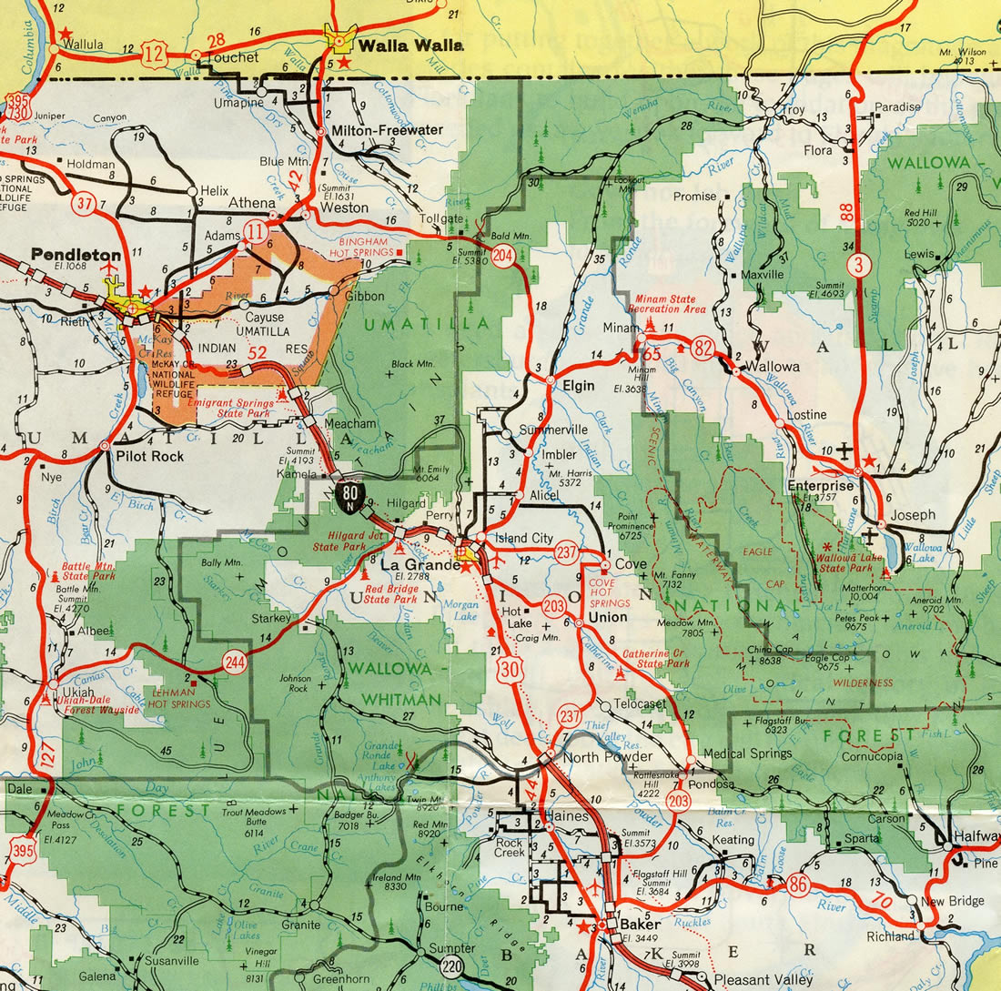
The last two sections of U.S. 30 to be upgraded to Interstate standards were stretches through Umatilla Indian Reservation and between La Grande and North Powder in eastern Oregon. Additionally a Super-Two portion of freeway ran south from U.S. 30N / OR 201 (Exit 356) to the Idaho state line.

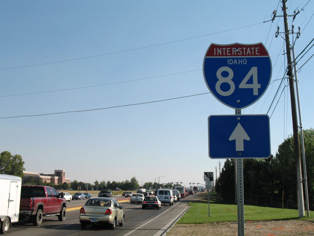
Interstate 80N stretched east from the Oregon state line to Boise and from South Federal Way near Exit 57 to Mountain Home in Idaho. The two sections were linked by late 1969.
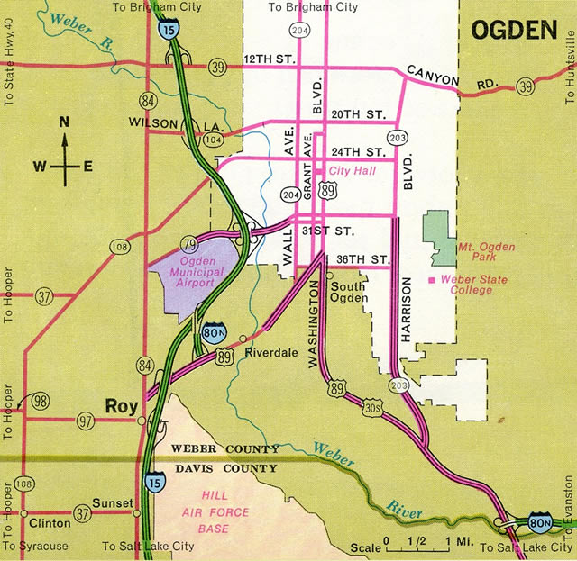
Interstate 80N was completed east from U.S. 89, south of Ogden, to Devils Slide by 1969. A stub of I-80N also connected I-15 with SR 26, shown here as U.S. 89 as well, at what is now a SPUI.
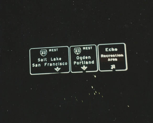
Button copy overheads posted ahead of the westbound split of I-80 and I-80N at Echo, Utah. Photo by Michael Summa, 1976.
As a result of this controversy coupled with the nationwide energy crisis at that time, the Portland City Council voted to withdraw its approval of the Mount Hood Freeway on July 25, 1974. By July 1975, the freeway was withdrawn by the department of transportation, and the Interstate funds were reallocated to other projects.4
Within Idaho, the final section of Interstate 84 built was the stretch through Caldwell. The route formerly took traffic through the middle of the city through what was regarded as an infamous traffic light. With construction of I-84 in the final stages through Caldwell in August 1983, the signal was removed from the corridor. Final paving of the main lanes for the last two mile stretch in Idaho commenced in September, with overall completion of the project in July 1984.5
The Utah stretch of Interstate 84 across Blue Creek Summit was the last to be built along the entire freeway. The 9.8 mile long segment was dedicated on September 25, 1986.6
East End  – Echo, Utah
![]() East at
East at ![]()
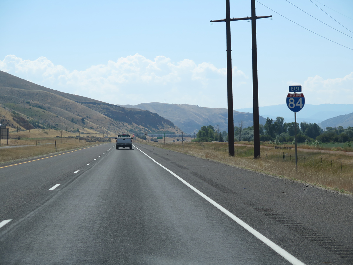
The final reassurance marker for Interstate 84 east appears beyond the Henefer town limits. 07/13/16
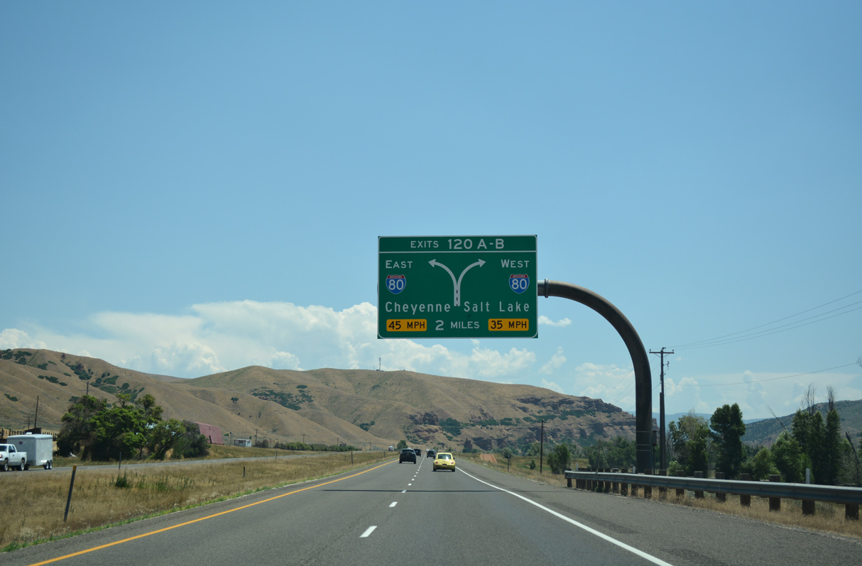
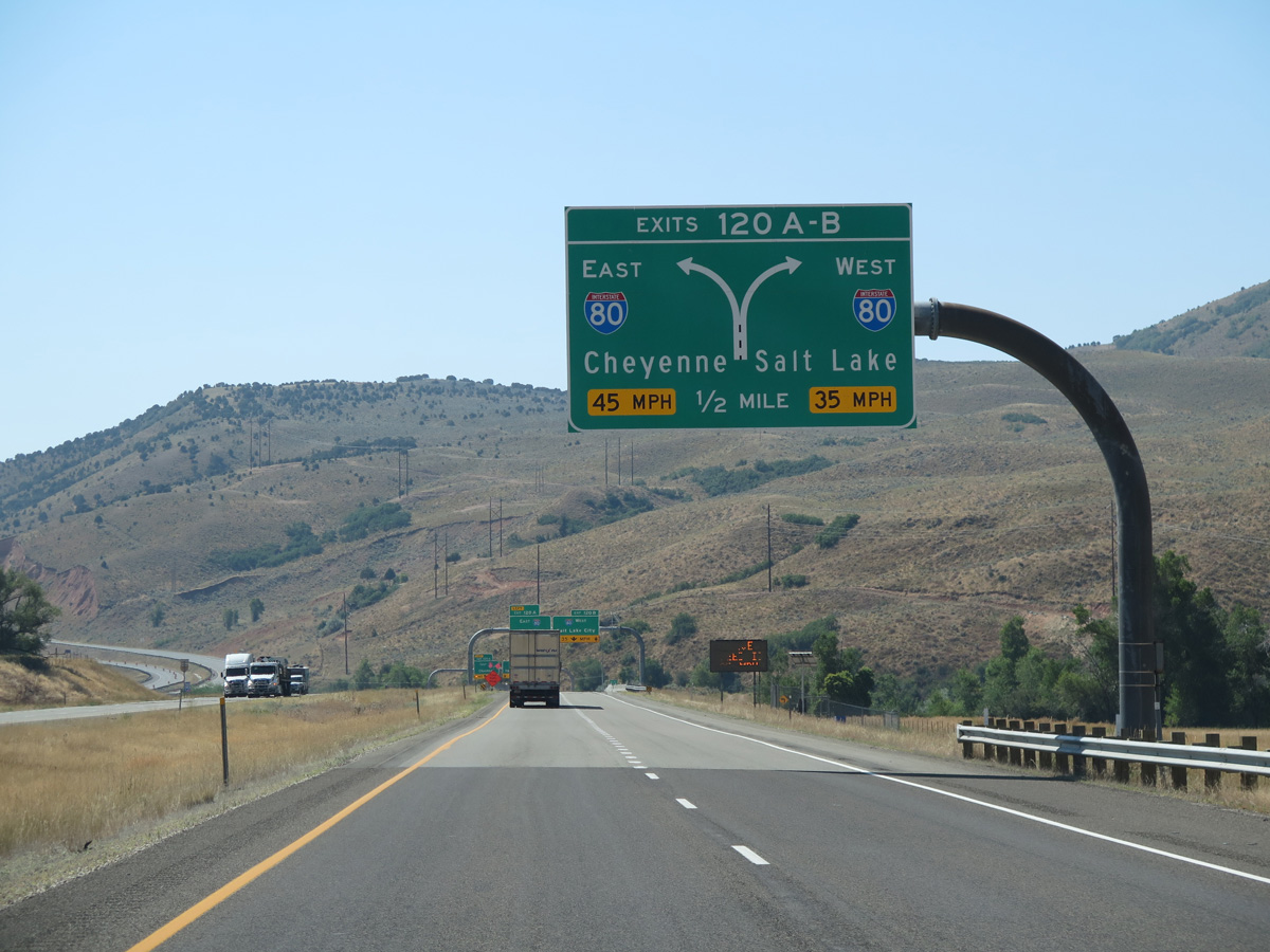
The first in a series of diagrammatic signs outlining the single lane ramps (Exits 120A/B) for Interstates 80 at Echo Junction. 07/16/17
Interstate 80 enters Echo Junction from Evanston, Wyoming, 33 miles to the east. The freeway turns south from I-84 to Coalville, Silver Creek Junction and Park City before resuming a westward heading through Parleys Canyon and Salt Lake Valley. 07/13/16
The agricultural areas of Henefer Valley give way to hills west of Echo Dam and south of Echo Canyon. I-80 traverses Echo Canyon along a remote stretch to the Wyoming state line. 07/13/16
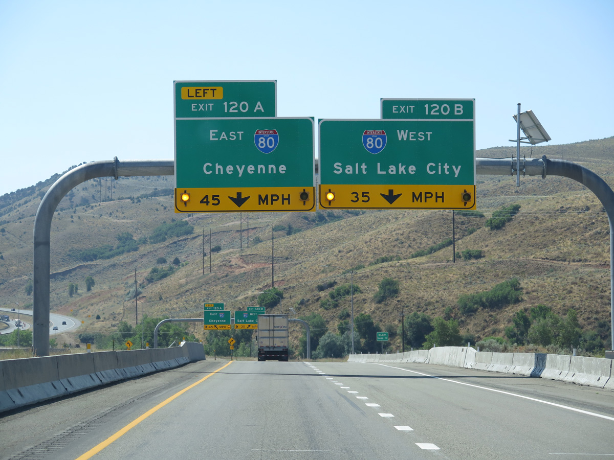
Sign changes made at the east end of I-84 assigned Exits 120A/B for the ramps to Interstate 80. Previously only the westbound ramp was assigned as Exit 120. 07/13/16
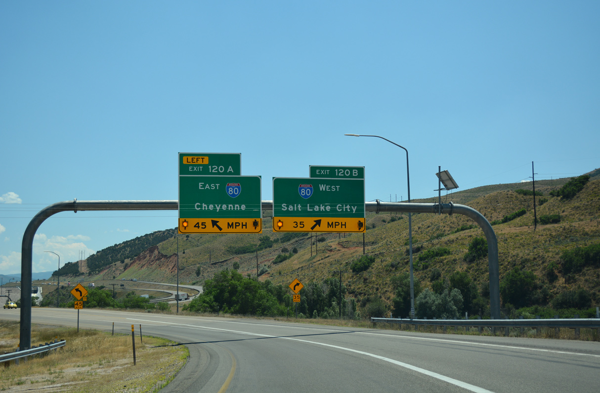
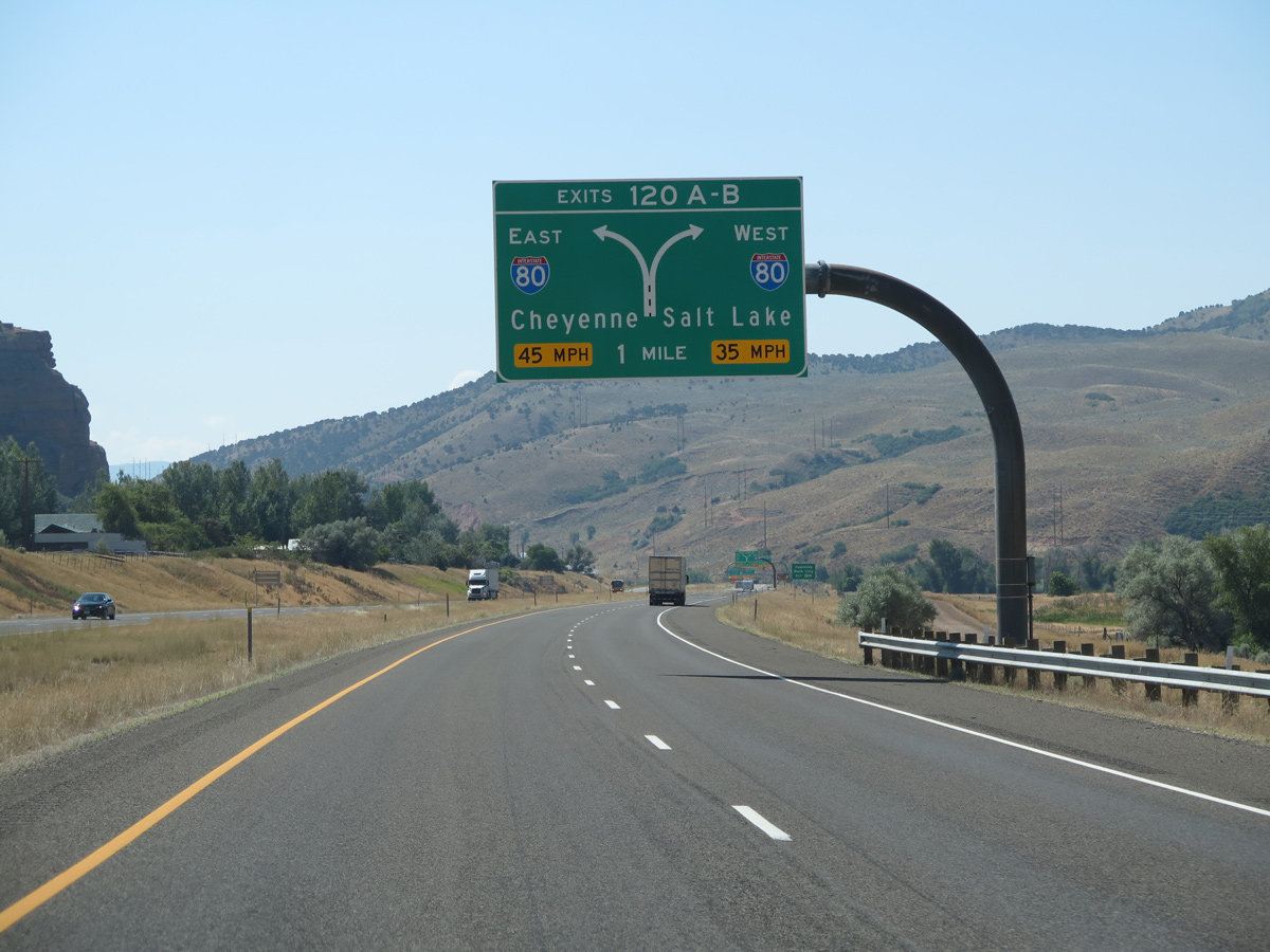
Interstate 84 ends as traffic partitions for I-80 east to Cheyenne, Wyoming and I-80 southwest to Salt Lake City. 07/16/17
![]() East
East ![]() North at
North at ![]()
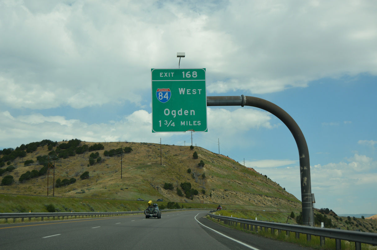
Interstate 80 continues north from the Echo Reservoir view area 1.75 miles to the east end of I-84. 07/05/16
Interstate 80 runs along the western periphery of Echo Reservoir from Coalville to Exit 168 with I-84 west. 07/05/16
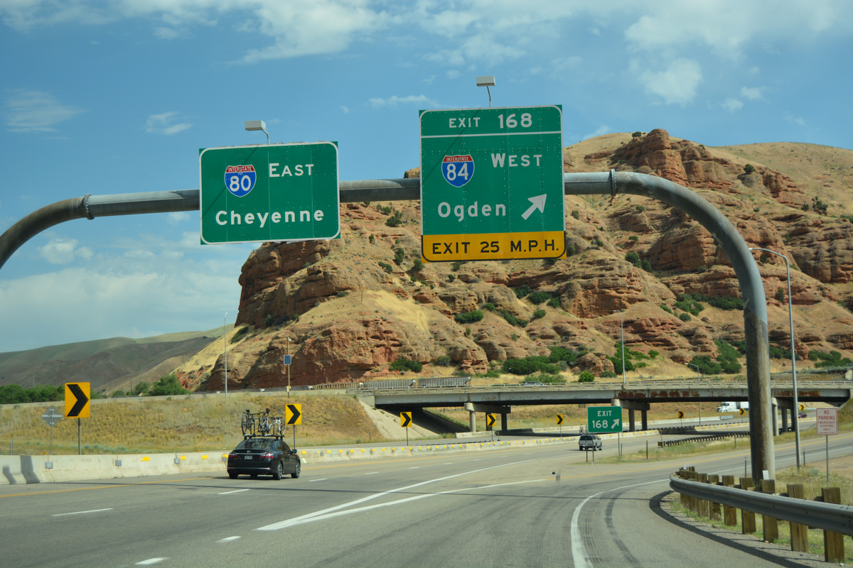
A directional T interchange (Exit 168) joins I-80 and I-84 at the mouth of Echo Canyon. 07/05/16
Exit 186 departs from Interstate 80 east for I-84 northwest through Henefer Valley and Devils Slide. Cheyenne, Wyoming is located 390 miles to the east. 07/05/16
![]() West
West ![]() South at
South at ![]()
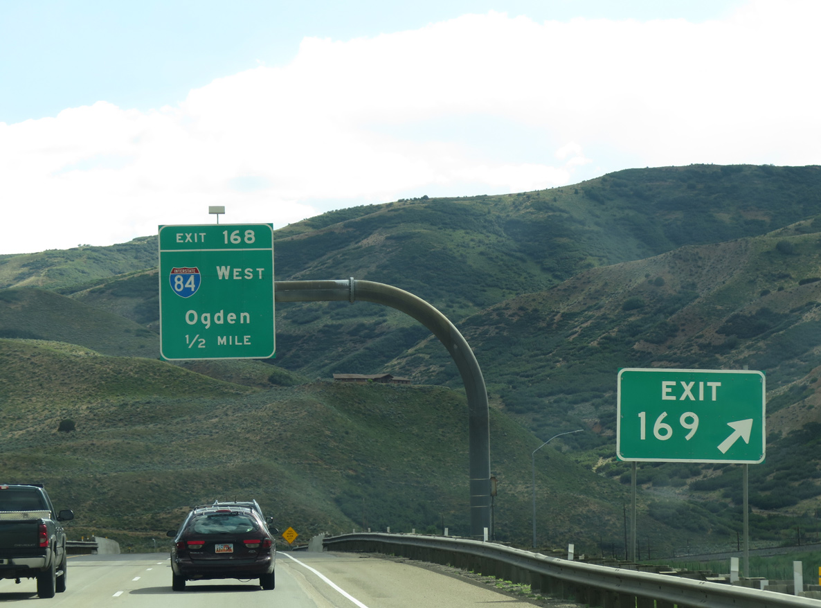
I-80 west and unmarked U.S. 189 south reach Exit 169 to Echo Dam Road just ahead of the split with Interstate 84. 07/11/15
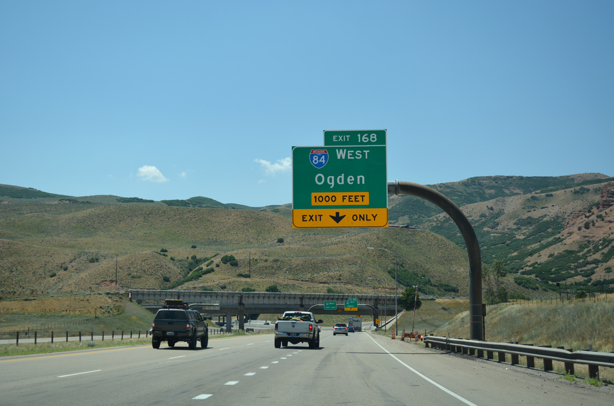
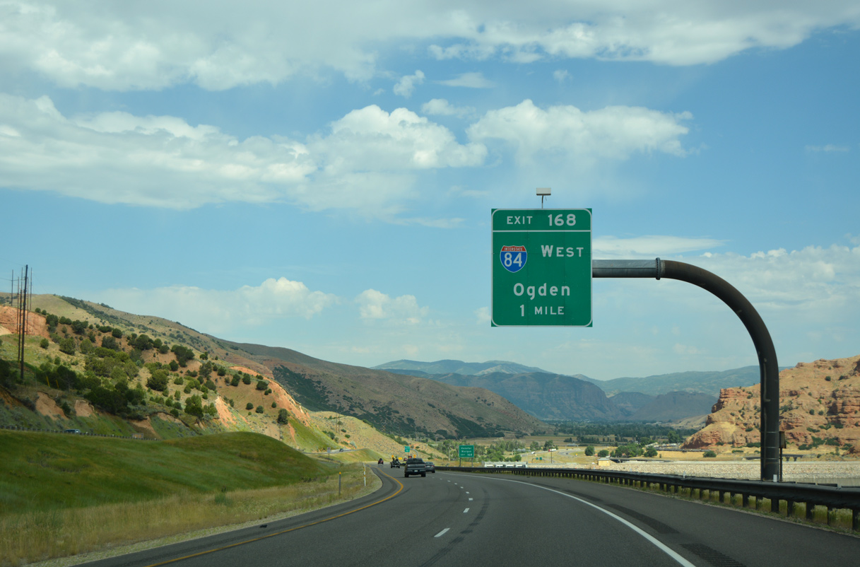
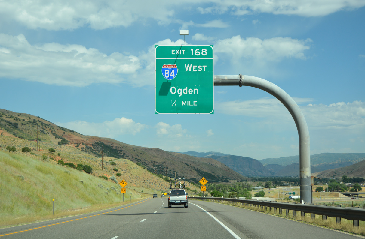
An auxiliary lane opens along I-80 west from Echo Canyon Road (old U.S. 30S) to Exit 168. Interstate 84 travels northwest from Echo Junction to Morgan, Ogden, Boise, and Portland among other communities in the northern Rockies and Pacific Northwestern states. 07/16/17
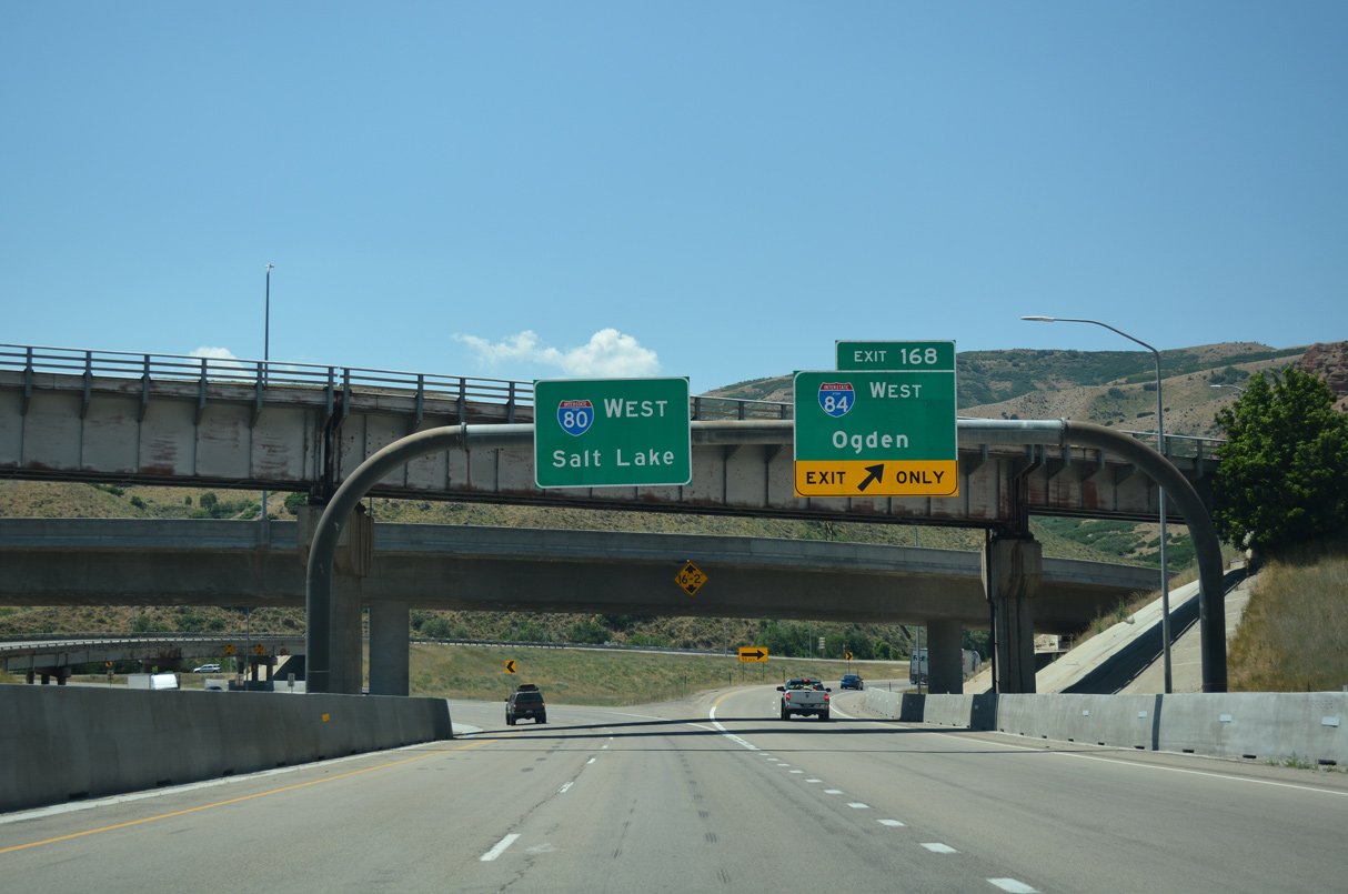
A Union Pacific Railroad line spans I-80 at Exit 168. I-80/U.S. 189 turn southward toward Coalville and Silver Creek Junction on the 40 miles to Salt Lake City. I-84 meanders northwest five miles to Henefer and 39 miles to combine with I-15 north in Ogden. 07/16/17
![]() West
West
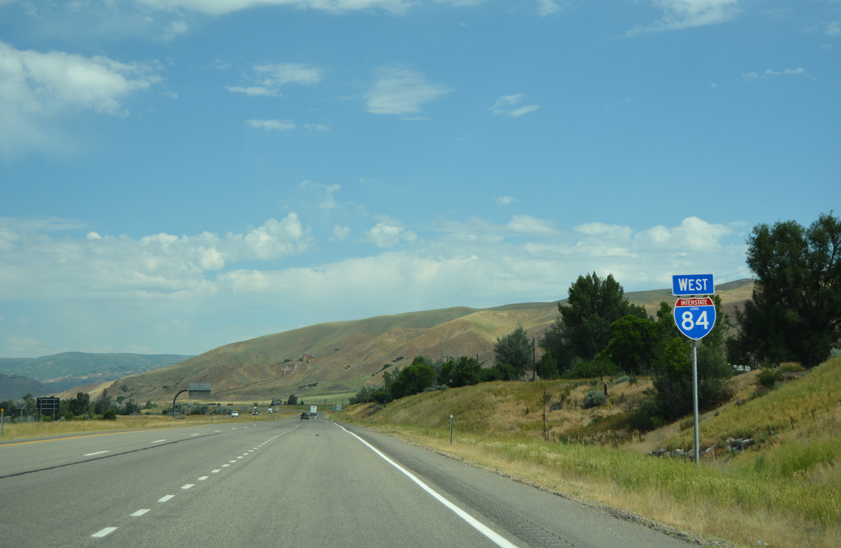
The first confirming marker for Interstate 84 west stands just north of I-80 in Henefer Valley. I-84 parallels the Weber River, a Union Pacific Railroad line and Echo Road (old U.S. 30S) to the town of Henefer. 07/05/16
West End – Portland, Oregon
![]()
![]() West at
West at ![]()
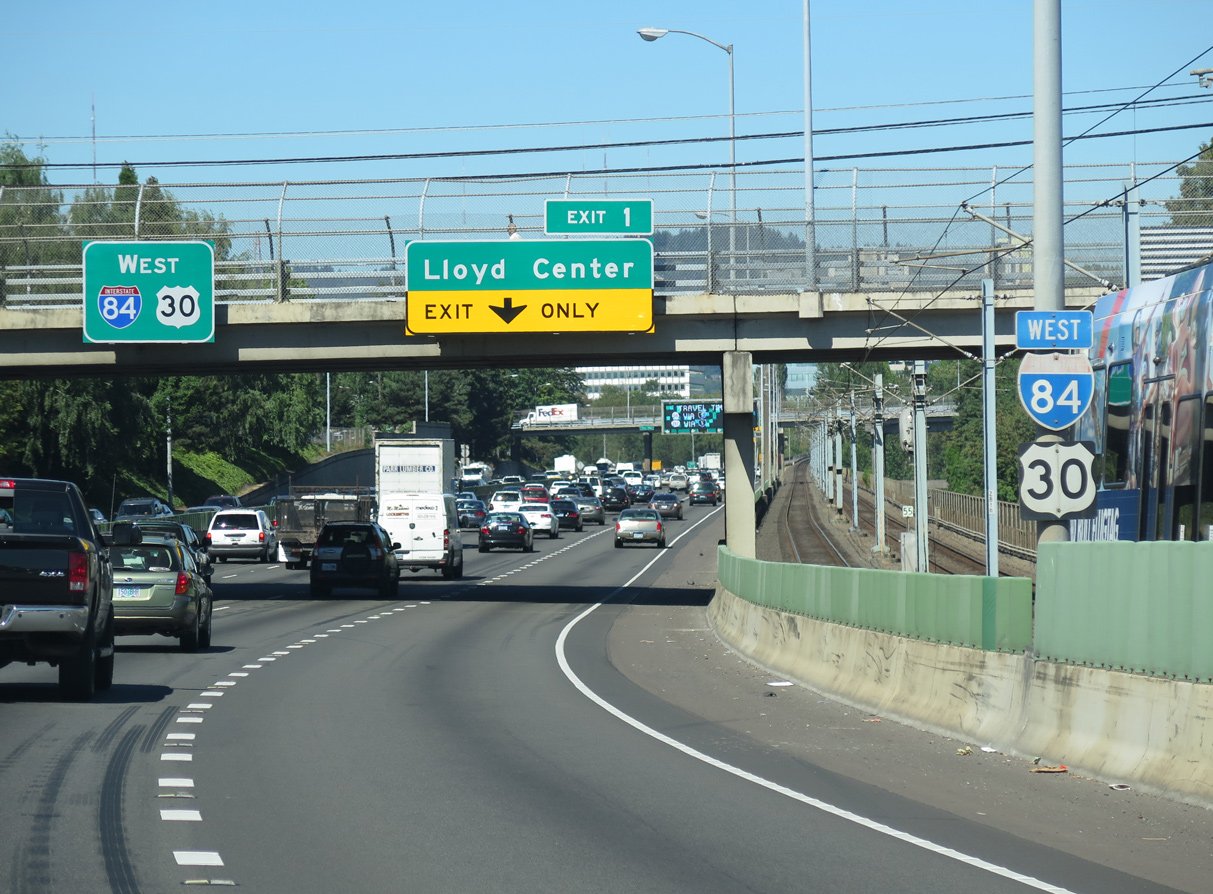
Most of I-84 along the Banfield Expressway runs along side the TRAX light rail system. The final reassurance shield assembly for westbound precedes Exit 1 to Lloyd Boulevard at NE 13th Avenue. 06/24/15
I-84/U.S. 30 pass between the Kerns and Sullivan’s Gulch communities one mile ahead of Interstate 5. 06/24/15
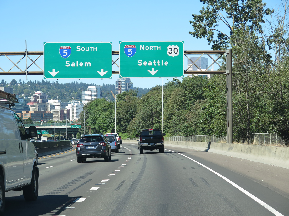
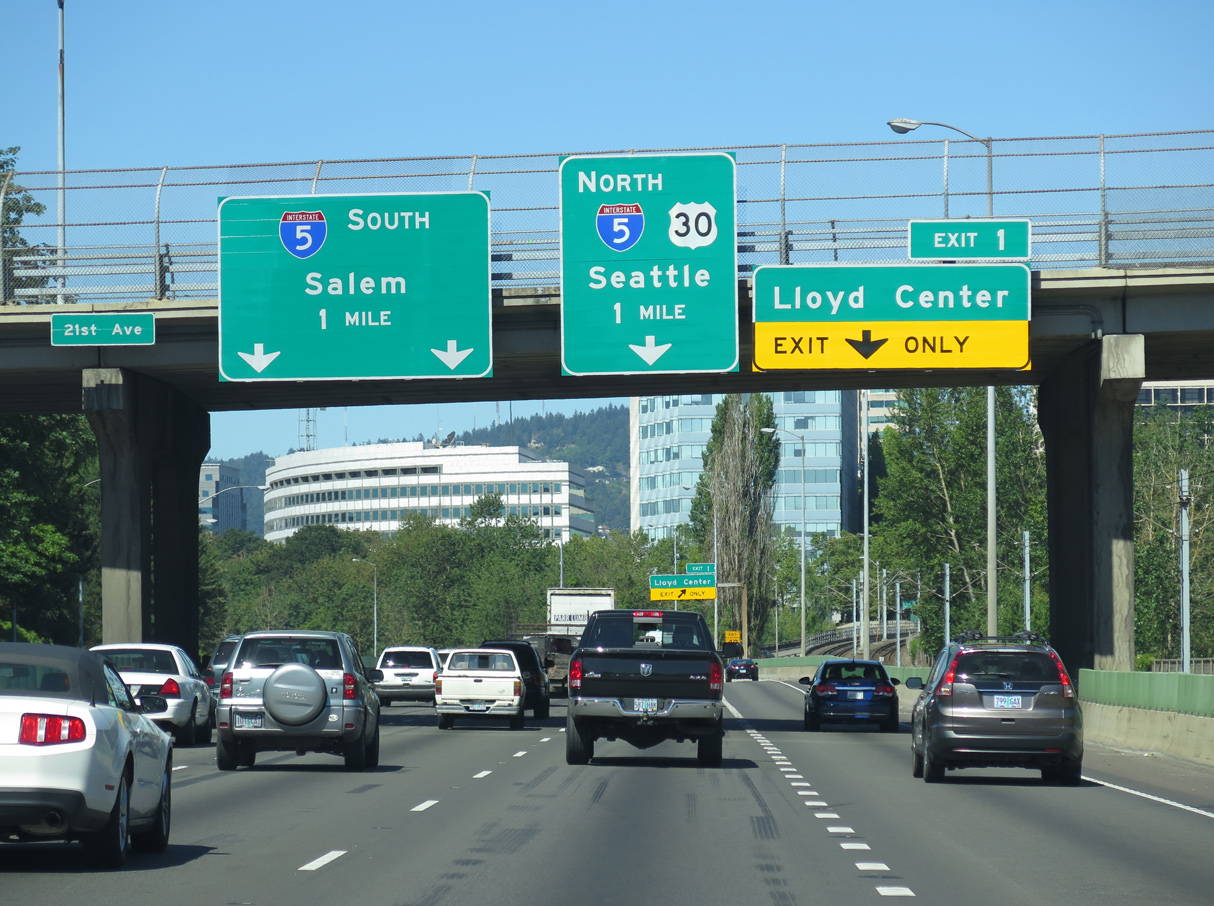
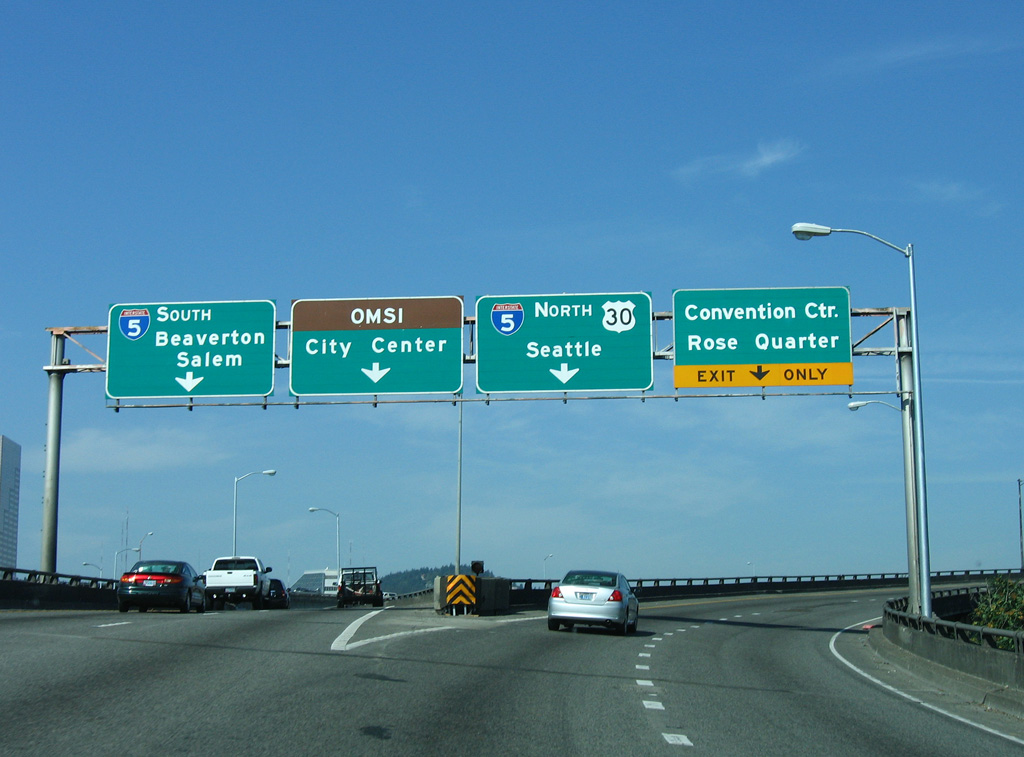
The Portland skyline comes into view as the Banfield Expressway turns southwesterly and lowers toward the Willamette River. Flyovers to I-5 follow for Beaverton and Salem to the south and Downtown Portland (via I-405 south) and Seattle, Washington to the north. 06/24/15
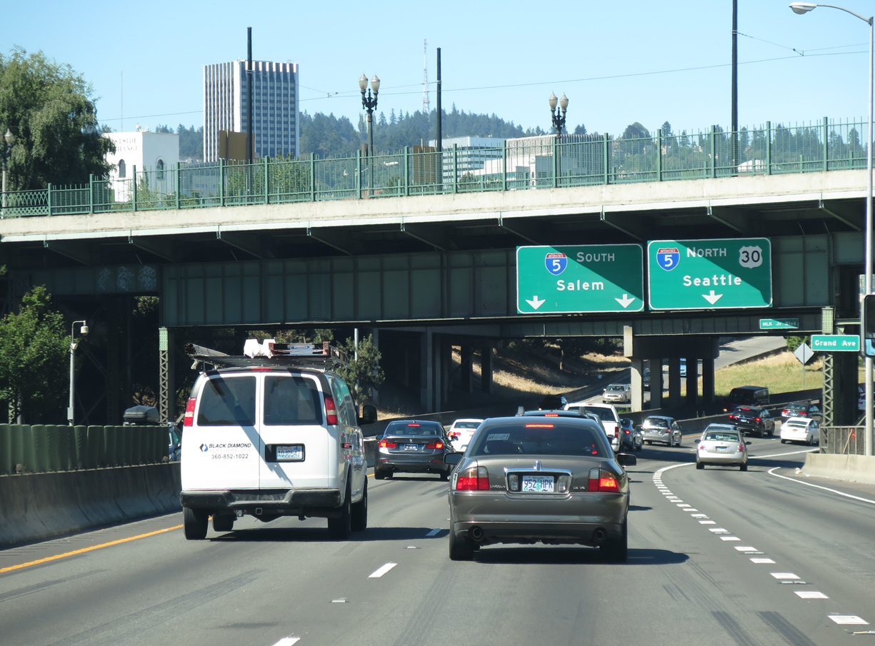
Oregon Route 99E (Grand Avenue) north spans the Banfield Expressway as Interstate 84 westbound ends. U.S. 30 joins I-5 north to the Fremont Bridge (I-405), where it continues west toward Astoria. 06/24/15

Ramps for Interstate 5 north and south include local connections. 06/24/15
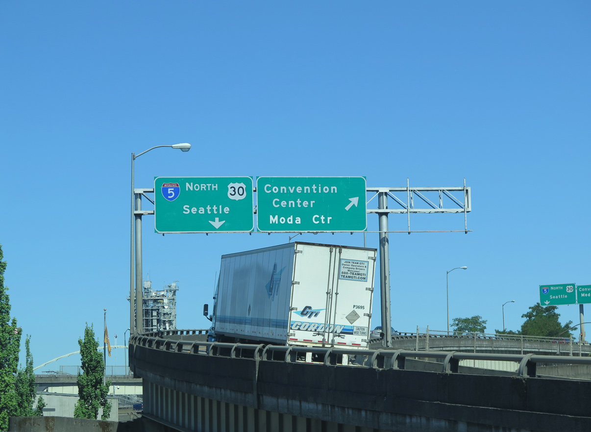
An off-ramp for the Rose Quarter, Steel Bridge and Oregon Convention Center lowers from the northbound I-5 flyover. 06/24/15
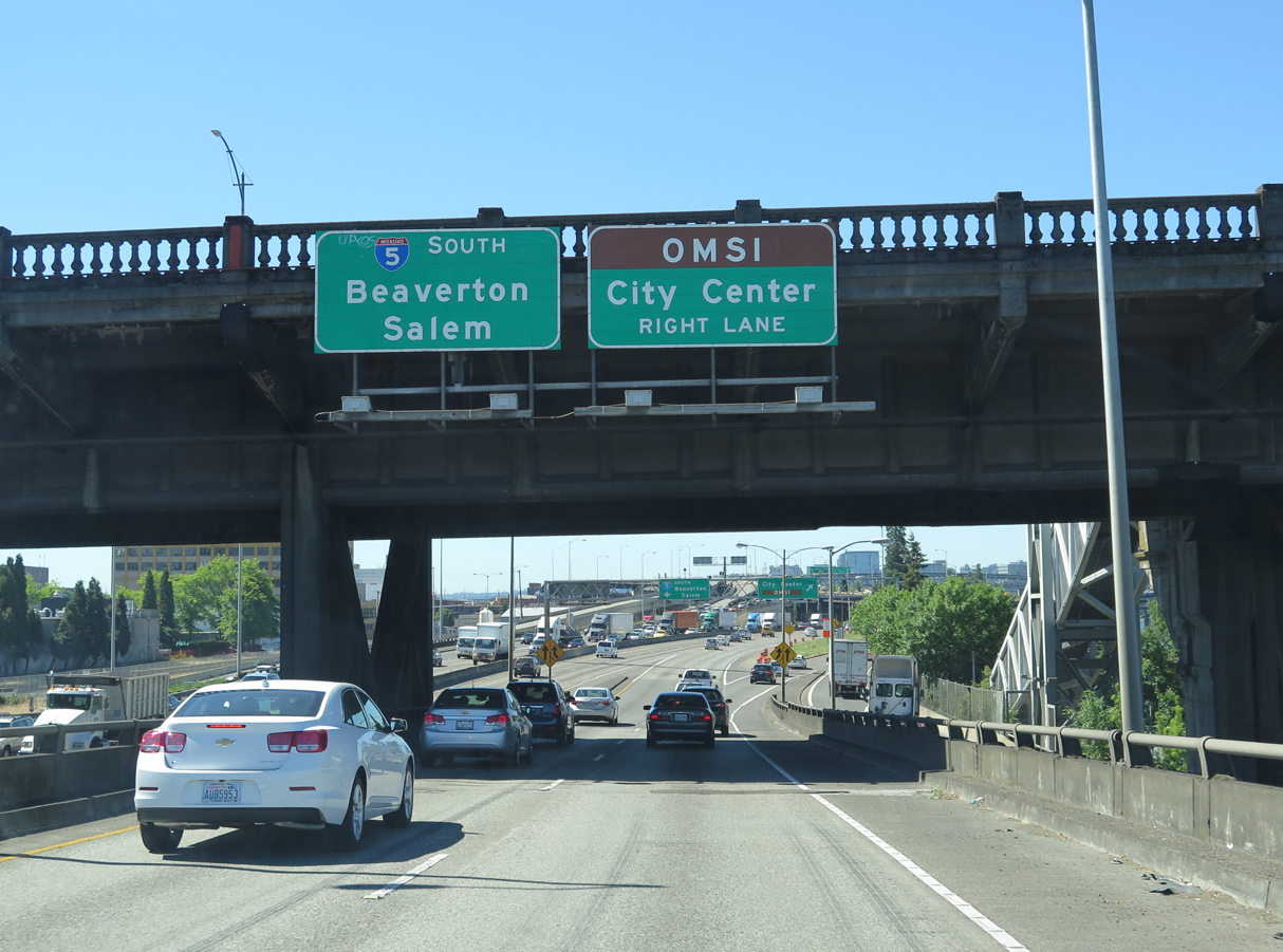
The southbound flyover ties into a distributor roadway (Exit 300B) for the Morrison Bridge west to Downtown and Belmont Street to Central Eastside Industrial District. 06/24/15
![]() South at
South at ![]()
![]()
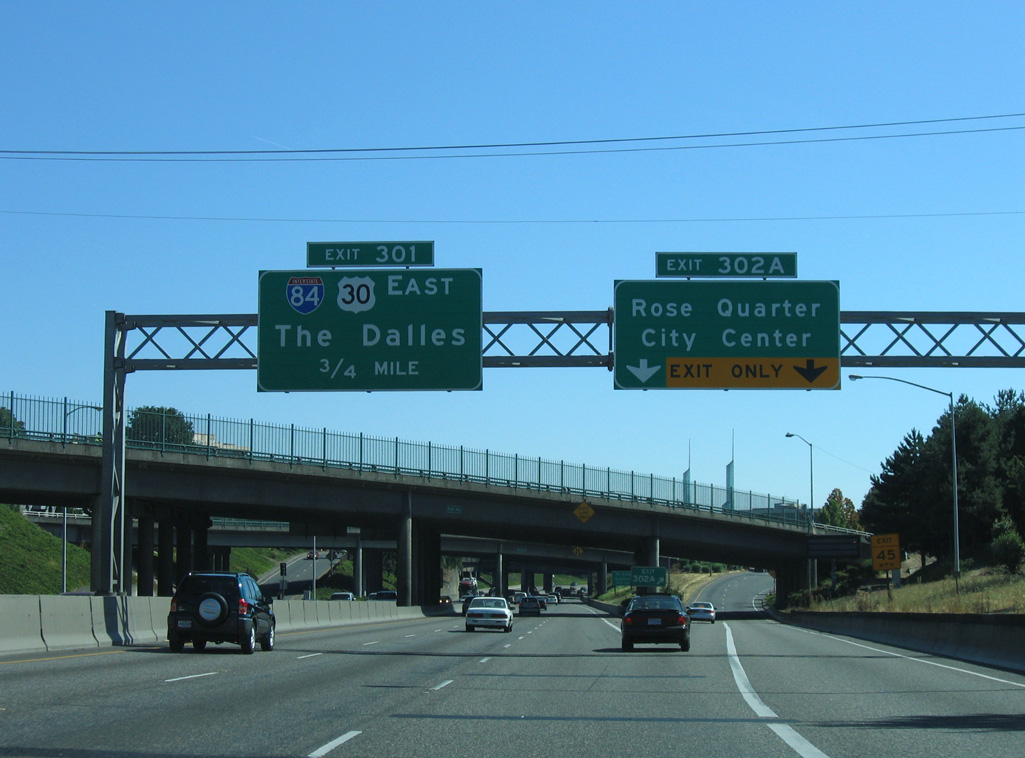
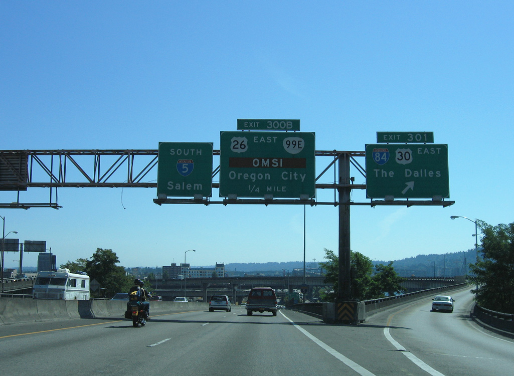
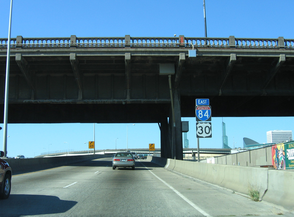
I-5/U.S. 30 curve southeast from the split with Interstate 405 to meet I-84 east at Exit 301, just south of the Rose Quarter. 08/27/06
The entrance ramp from Ramsay Way adds a third southbound lane to the directional T interchange (Exit 301) with Interstate 84 east. U.S. 30 shifts from I-5 south onto I-84 (Banfield Expressway) to the Columbia River Gorge, Hood River and The Dalles. 08/27/06
Interstate 5 straddles the eastern banks of the Willamette River from I-84 southward to the Marquam Bridge. I-84 comprises a busy commuter route east to Gresham, Fairview and Troutdale. Photo by Chris Elbert (04/24/05).
A high flyover (Exit 301) links I-5/U.S. 30 south with the Banfield Expressway. I-84/U.S. 30 weave east between the Sullivan’s Gulch, Kerns, Laurelhurst and Rose City Park neighborhoods through east Portland. 08/27/06
![]() North at
North at ![]()
![]()
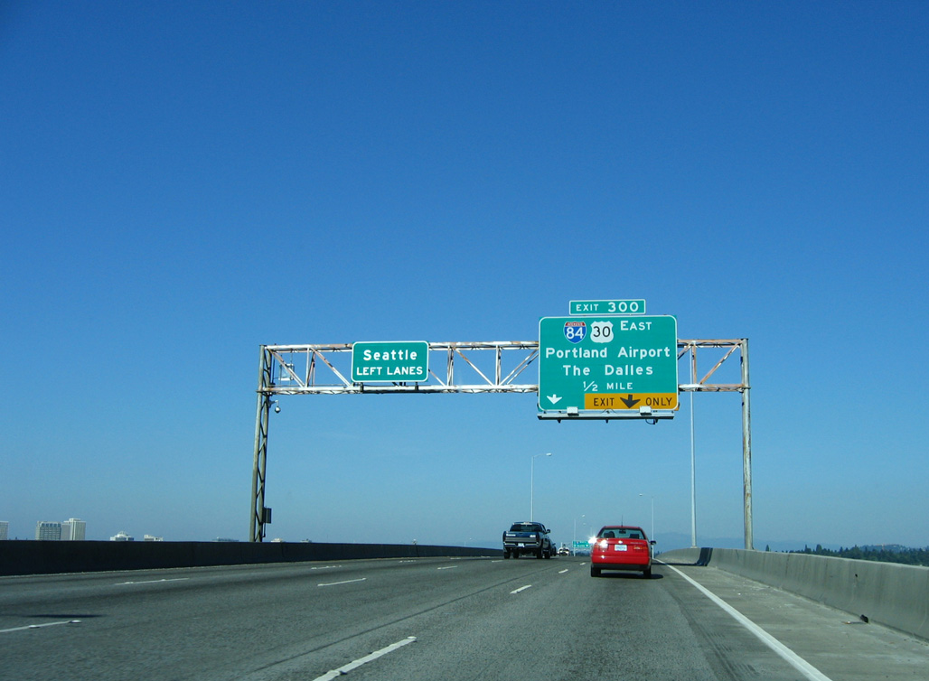
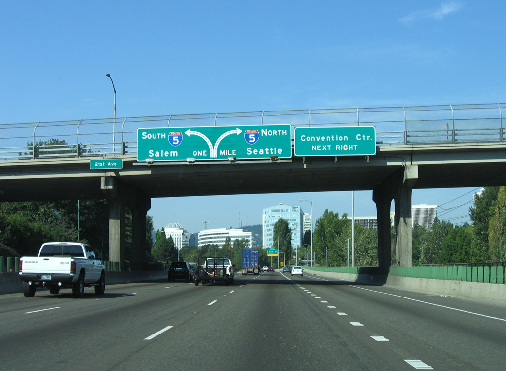
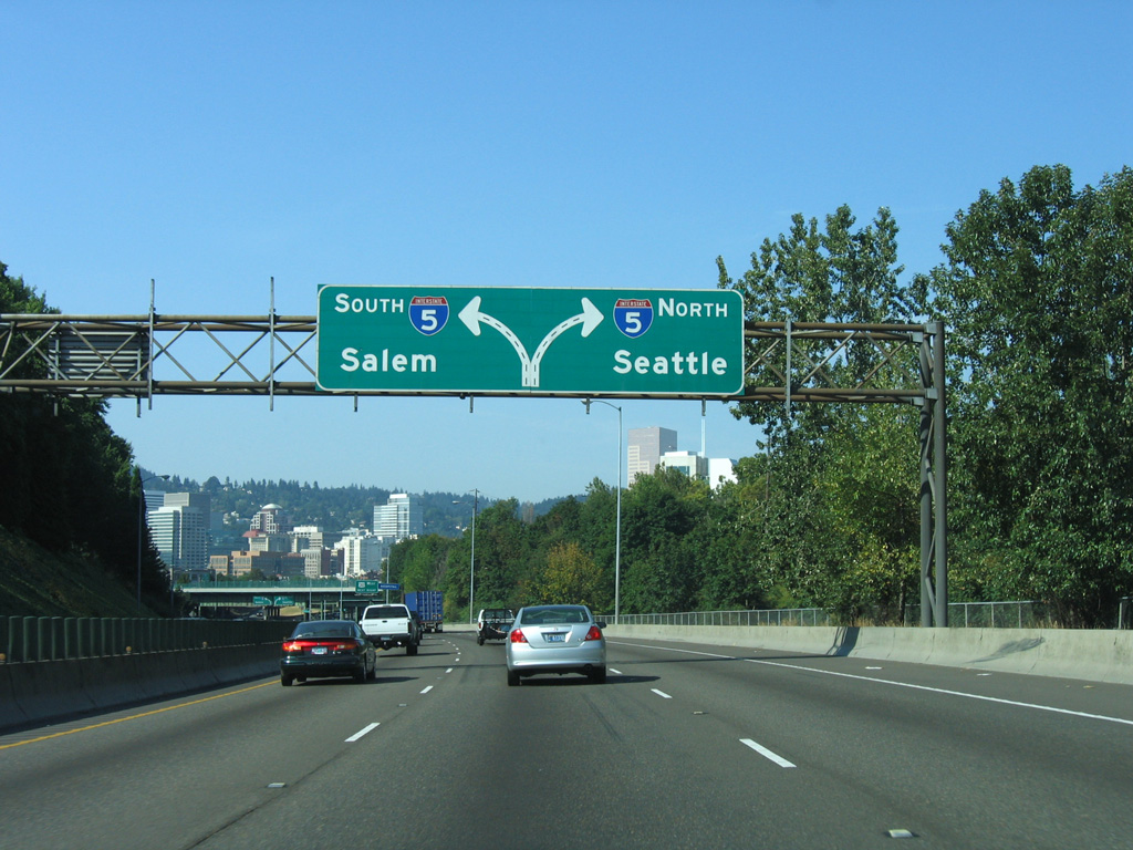
Interstate 5 travels high above the Willamette River across the 1966-built Marquam Bridge north from I-405. Forthcoming Exit 300 for the eastbound beginning of Interstate 84 departs well ahead of the directional T interchange between the two freeways. 08/27/06
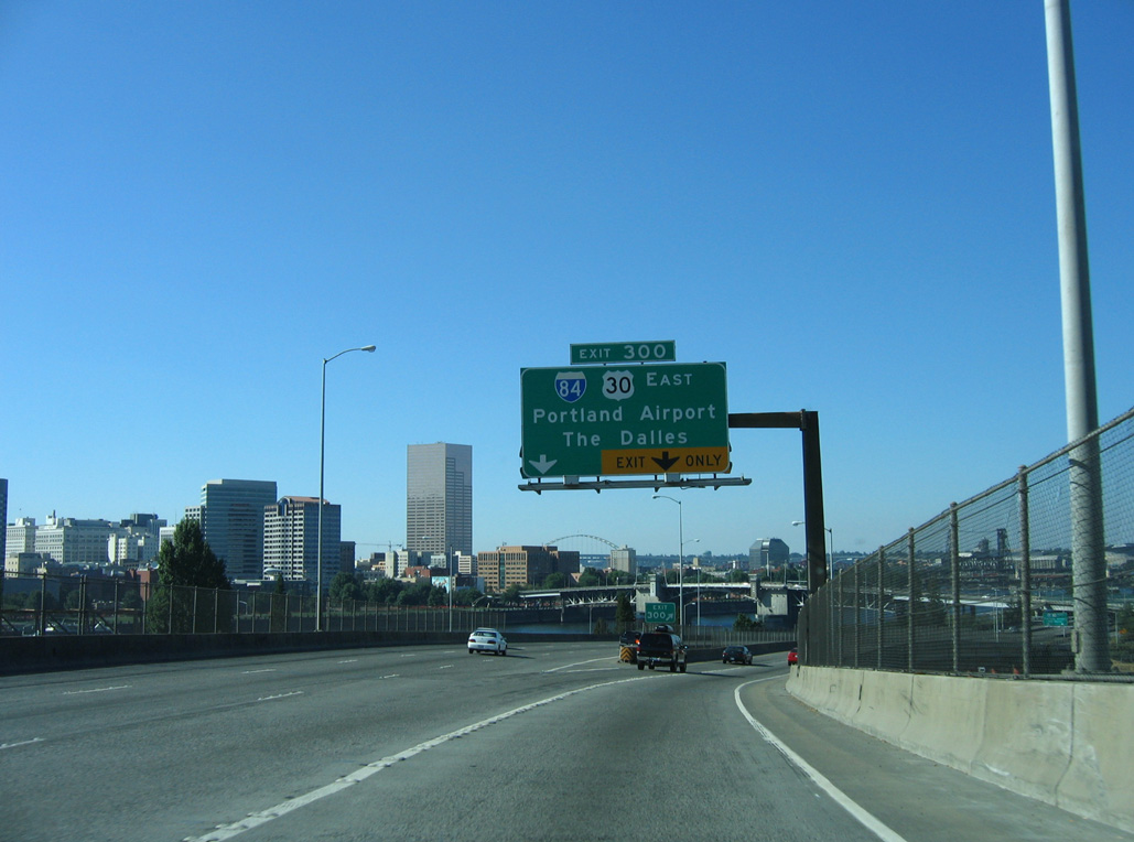
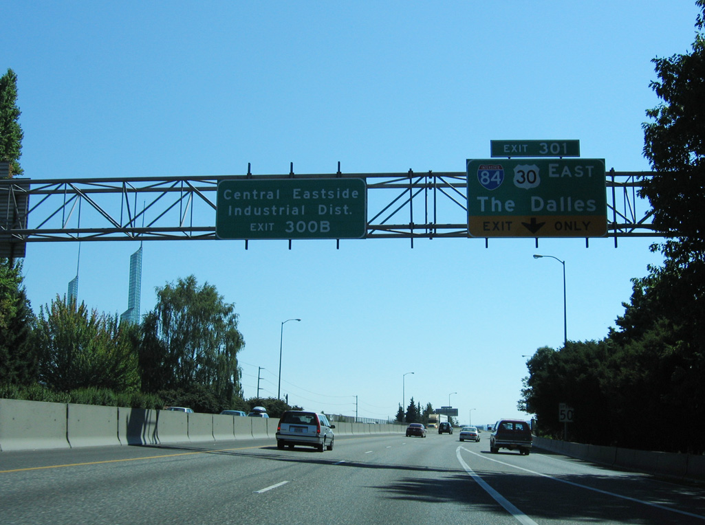
Exit 300 branches away from the I-5 mainline as a lengthly distributor roadway serving not only I-84/U.S. 30 east, but also the Central Eastside Industrial District. 08/27/06
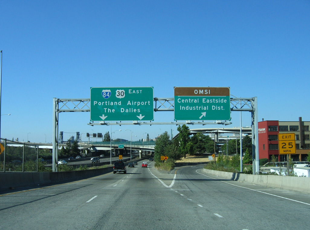
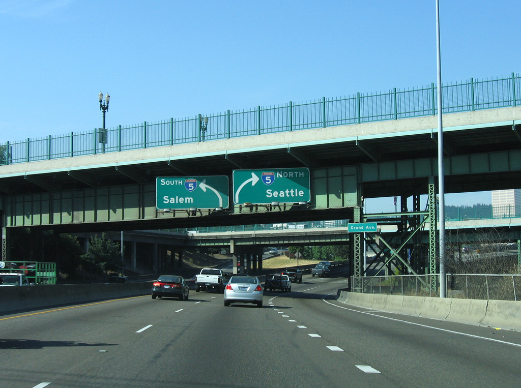
Exit 300 partitions into ramps for Yamhill Street east and I-84/U.S. 30 (Banfield Expressway) east. I-84/U.S. 30 overlap throughout most of Oregon including 83 miles between Portland and The Dalles. 08/27/06
![]()
![]() East
East
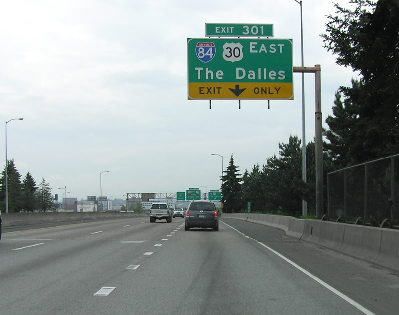
The eastbound beginning of I-84 from Interstate 5 north runs along side I-5 north for three quarters. The first confirming marker for I-84 east appears at the Burnside Bridge. U.S. 30 joins I-84 east from I-5 south. 08/27/06
West End Throwback
![]()
![]() West at
West at ![]()
21st Avenue spans Interstate 5 north from the Kerns neighborhood to Sullivan’s Gulch, one mile from Interstate 5. 09/02/06
I-84/U.S. 30 west parallel Lloyd Boulevard south of the Lloyd District to the exchange with Interstate 5. 09/02/06
Traffic partitioned for Interstate 5 below the one way couplet of OR 99E along Grand Avenue and Martin Luther King, Jr. Boulevard by the Oregon Convention Center. 09/02/06
U.S. 30 continues west onto I-5 north beyond the exit for 1st Avenue to the Rose Quarter. U.S. 30 extends through the Northwest Industrial area of Portland to St. Helens and west to U.S. 101 at Astoria. 09/02/06
Sources:
- “Interstate 80 will keep being Interstate 80.” Eugene Register-Guard, May 18, 1977.
- “Interstate 80 to become 84.” The Deseret News, August 13, 1977.
- “Road numbers to change.” The Spokesman-Review, November 3, 1977.
- Interstate 50th Anniversary: The Story of Oregon’s Interstates
- “Caldwell’s ‘claim to fame’ light is gone.” The Deseret News, August 21, 1983.
- “Officials dedicate the final stretch of I-84.” The Deseret News, September 26, 1986.
Page updated October 5, 2023.