Interstate 84 (Eastern)
Overview
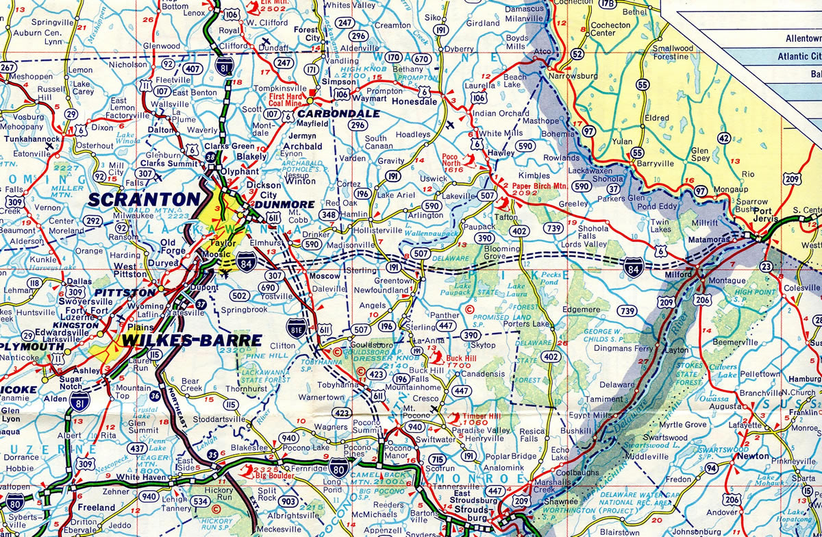
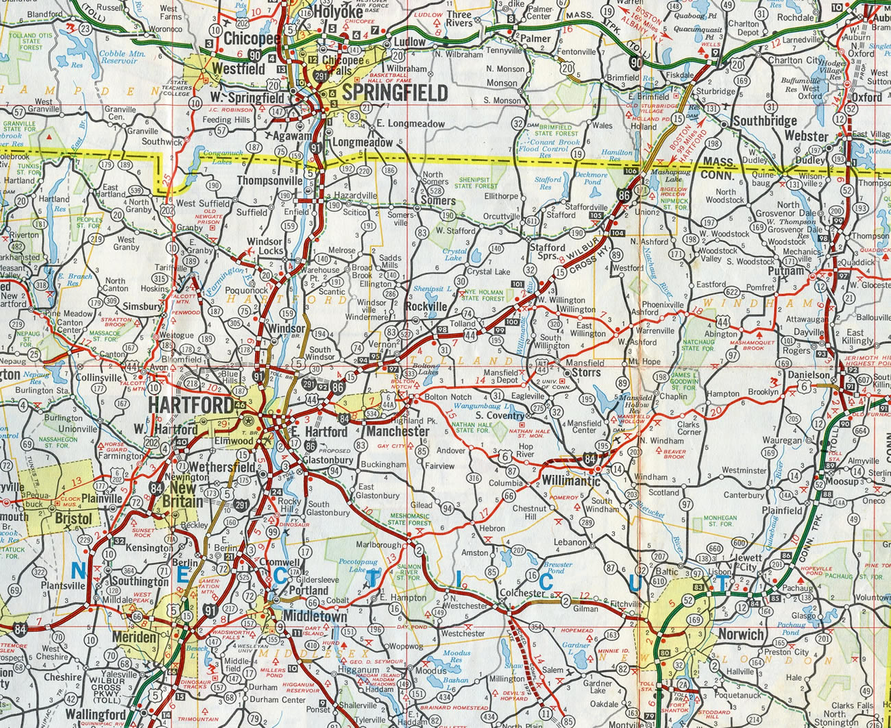
The Eastern Interstate 84 follows the U.S. 6 corridor between Scranton, Pennsylvania and Hartford, Connecticut and the Wilbur Cross Highway northeast from U.S. 6 to Interstate 90 (Mass Pike) at Sturbridge, Massachusetts. A well traveled freeway, I-84 serves as part of a long distance alternative between eastern Pennsylvania and New England.
I-84 begins at the exchange between I-81, I-380 and U.S. 6 in Dunmore, initially following I-380 before branching eastward to New York. The freeway enters the Empire State at Port Jervis on a northeast course to NY 17 at Middletown and I-87 (New York Thruway) at Newburgh. Beyond Shenandoah, I-84 dips southeast to meet I-684 at Brewster before turning back east into Connecticut. Interstate 684 extends south to White Plains and I-95.
I-84 enters Connecticut along the Yankee Expressway near Danbury, where U.S. 7 joins the freeway on a brief overlap. Beyond Newtown, Interstate 84 angles northeast to Waterbury and Interstate 691. I-691 branches eastward to Meriden as the Yankee Expressway reaches Southington. I-84 continues on a northeast course to the Hartford metro area, entering near West Hartford. The freeway arcs north of Downtown Hartford to meet Interstate 91 on the banks of the Connecticut River. As I-84 continues eastward from Hartford, it follows the Wilbur Cross Highway. I-384, the second branch of I-84, spokes east near Manchester as the Wilbur Cross Highway bends northeast toward Massachusetts. Interstate 84 passes through Sturbridge on its final stretch, ending at a trumpet interchange with Interstate 90 (Mass Turnpike) opposite Wells State Park.
Interstate 84 generally traverses a hilly course, including the Poconos in Pennsylvania, the historic Hudson Valley and the foothills of Connecticut. It also forms part of an outer loop of New York City via I-684 and I-287 and is a major thoroughfare for commuters based out of Connecticut.
 Parallel U.S. Routes
I-84/380 replaced U.S. 611 southeast from Dunmore to their split near Elmhurst. East from Milford, Pennsylvania, I-84 parallels or overlays U.S. 6 to Hartford, Connecticut. The freeway also intertwines with U.S. 202 between Brewster, New York and Danbury, Connecticut while briefly overlapping with U.S. 7. Further east U.S. 44 travels nearby between Downtown Hartford and Manchester.
Northeastern Pennsylvania – 1970
Interstate 84 opened initially in Pennsylvania as a short freeway spur from I-81 to Tigue Street in Dunmore in 1961. The next section to open was the Delaware River bridge in 1970.1
History
Interstate 84 combines with I-380 for 4.2 miles from their mutual beginning at Interstate 81 at Dunmore, Pennsylvania. Original plans called for I-84 to continue west across the Moosic Mountains to I-81 at the borough of Moosic. Cancellation of the freeway south of Lake Scranton due to engineering difficulties with traversing the mountains resulted in the realignment of I-84 westward along side I-380 to Dunmore.1
I-81E was redesignated as I-380 by the American Association of State Highway Officials (AASHO) on June 20, 1972. The same action also extended I-84 west along I-380 on an overlap to a shared end at Interstate 81 in Dunmore. Within the Keystone State, a section of I-84 opened in the Lake Region of the Poconos on November 21, 1973.2 Funds for construction of a 2.79 mile segment of I-84 between Mount Cobb and I-380 near Elmhurst were secured by presidential action of freeing Highway Trust Fund money in February 1975. This stretch included high level bridge spanning Roaring Brook gorge and the Erie-Lackawanna Railroad and the realignment of PA 435. Ongoing work at the time included I-84 from Newfoundland to Mount Cobb Road.3
Interstate 84 was two thirds complete in Pennsylvania by Summer 1975. The temporary west end was at the exchange with PA 191 in Sterling Township. Construction along seven miles west from PA 191 to Mount Cobb was anticipated for a late 1975 or Spring 1976 completion.4 The final link in Pennsylvania however was not completed until December 6, 1977, when a ribbon cutting ceremony took place.5
Within New York State, the final section of Interstate 84 opened to traffic on July 2, 1971. The last segment built was the 6.7 mile stretch from Newburgh to Maybrook.6
As originally designated in Connecticut, the easternmost segment of Interstate 84 ran from Hartford, Connecticut to Sturbridge, Massachusetts. With approval by AASHO on June 23, 1969, the course of I-84 shifted east to connect Hartford with Providence, Rhode Island, along the Manchester and Willimantic bypasses. Interstate 86 overtook the former routing of I-84 along the Wilbur Cross Highway to Massachusetts.
I-84 was planned to continue east along the U.S. 6 corridor from Hartford to Providence, connecting to either U.S. 6 (formerly Rhode Island Route 195) or Rhode Island Route 37 at Interstate 295 in the Ocean State. The Manchester bypass was completed in 1971 and the Willimantic bypass opened in 1973, with both signed as I-84. The remainder of the freeway was never built due to environmental concerns surrounding Nathan Hale State Forest in Connecticut and Scituate Reservoir in Rhode Island.7 This ultimately led to the cancellation of I-84 between the Willimantic Bypass and I-295 / Route 195 at Johnston.
Interstate 84 was eliminated in the state of Rhode Island by the American Association of State Highway and Transportation Officials (AASHTO) on October 1, 1983. Action taken by AASHTO on May 23, 1984 returned I-84 to its original alignment between Hartford and Sturbridge while I-86 was decommissioned. The same meeting also established Interstate 384 along the Manchester bypass to Bolton, while U.S. 6 was moved to the Willimantic bypass.
Route Information
Mileage
Pennsylvania – 54.87
- Cities – Scranton
- Junctions –


New York – 71.79
- Cities – Port Jervis, Middletown, Newburgh, Bacon
Junctions – Future
Connecticut – 97.90
- Cities – Danbury, Waterbury, Bristol, New Britain, Hartford, Manchester, Vernon
- Junctions –
Massachusetts – 8.15
Cities – Sturbridge
Junctions –

Source: December 31, 2021 Interstate Route Log and Finders List
I-84 Annual Average Daily Traffic (AADT)
| Location | Vehicles per day |
|---|---|
| Scranton, PA | 50,000 |
| Blooming Grove Twp, PA | 17,000 |
| Slate Hill, NY | 29,384 |
| Newburgh, NY | 72,519 |
| Brewster, NY | 76,633 |
| Sturbridge, MA | 63,785 |
Sources: Pennsylvania Traffic Volume Map 2017 (PennDOT)
NYS Traffic Data Viewer 2016 AADT
MassDOT Transportation Data Management System 2018 AADT
Interstate 84 was proposed to run east from Hartford to Providence between 1969 and 1984. The lone two portions of freeway built were the Manchester and Willimantic bypasses. The route was to also use the Connecticut Turnpike spur (Route 695) east from Route 52 to U.S. 6 at South Killingly.
Traveling south along the first mile of I-84/380. I-84 east splits three miles ahead for Port Jervis as I-380 continues south for the Pocono Mountains. Photo by Chris Elbert (07/06).
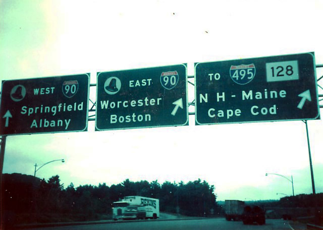
Historic look at button copy signage posted at the eastern end of I-84 (former I-86) with I-90 (Massachusetts Turnpike) near Sturbridge. Photo by Michael Summa (1976).
 Photo Guides
East End  – Sturbridge, Massachusetts
![]() East at
East at ![]()
![]()
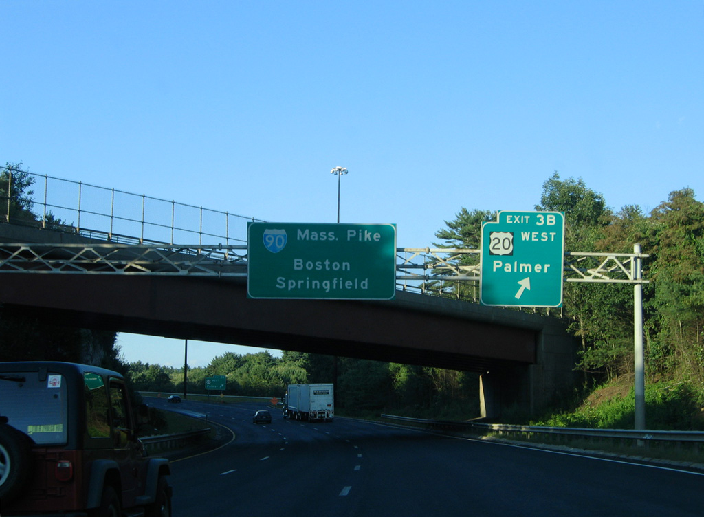
An end sign for Interstate 84 precedes the directional cloverleaf interchange (Exit 6) with U.S. 20 by the Sturbridge town center. 08/09/04
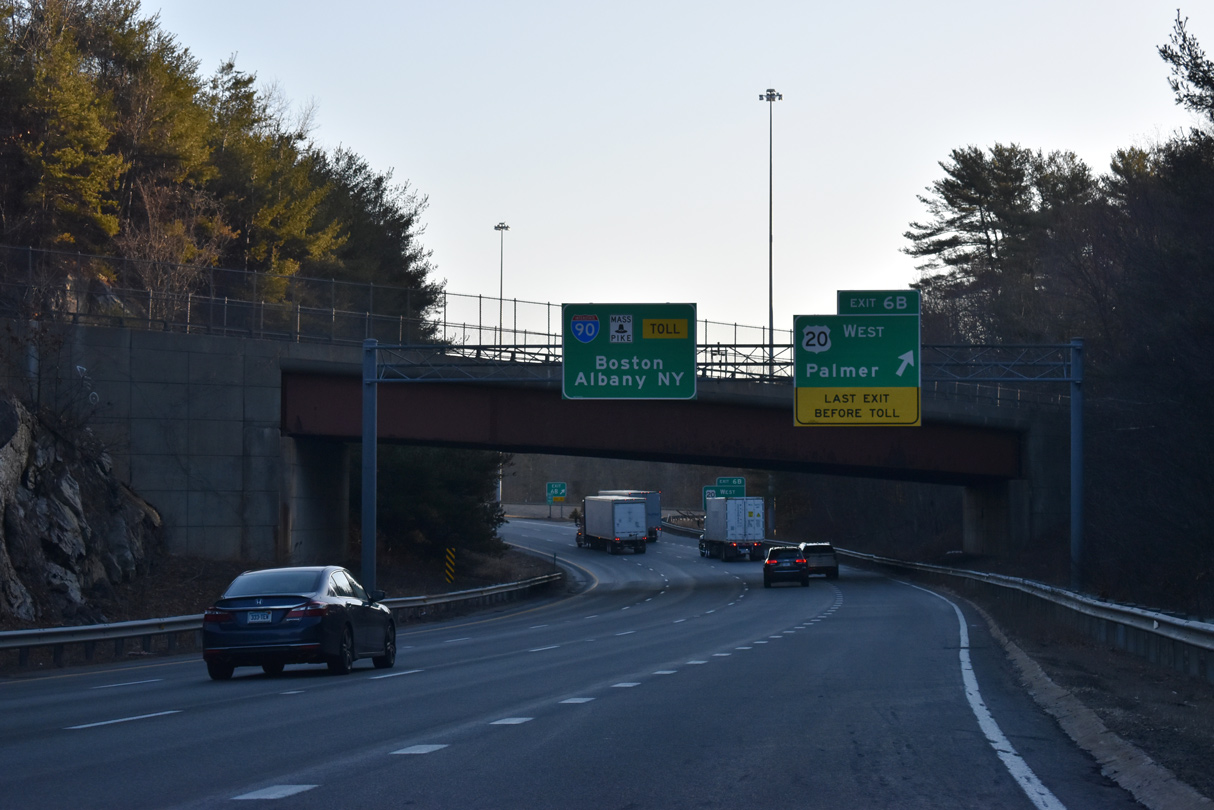
The final departure point from I-84 east ahead of the Mass Pike is the loop ramp (Exit 6 B) for U.S. 20 (Main Street) west in Sturbridge. 03/27/23
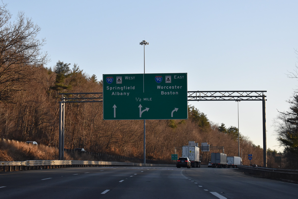
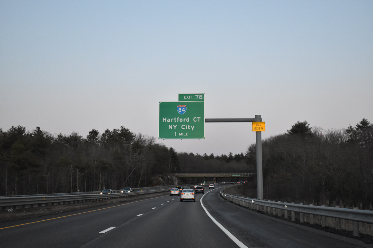
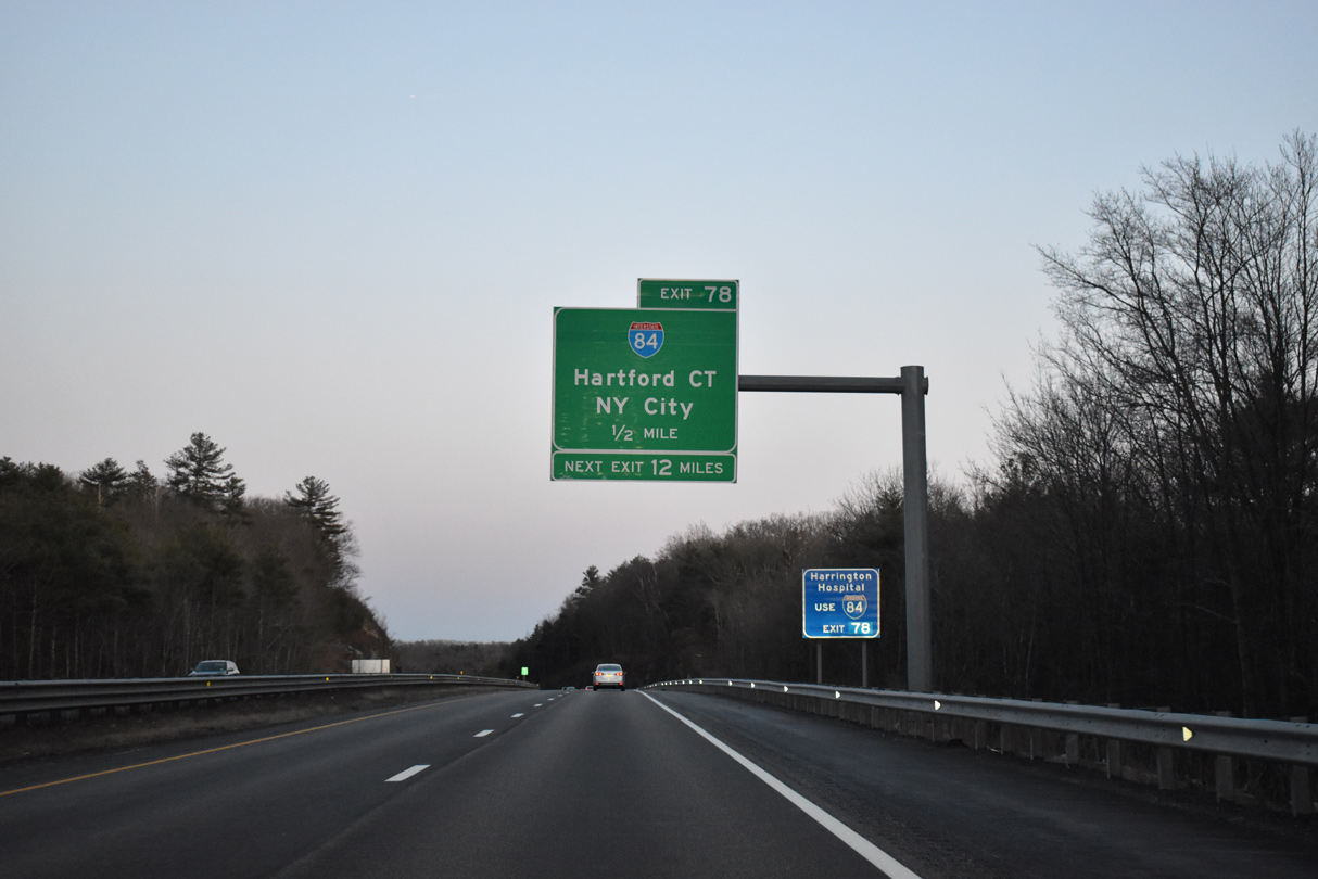
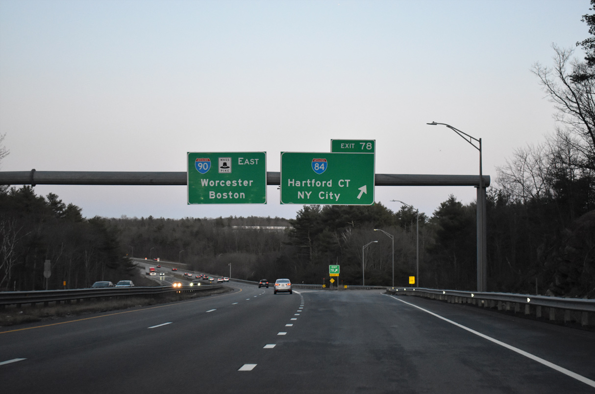
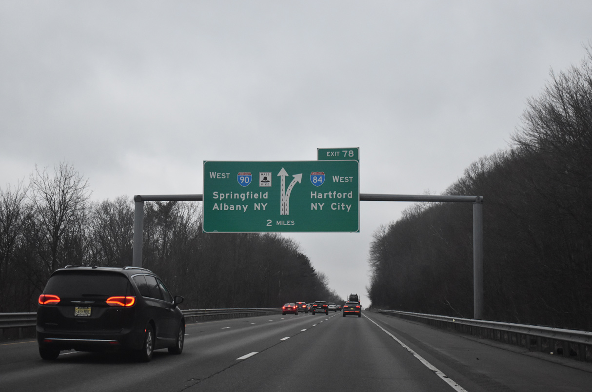
Interstate 84 partitions into ramps for the Mass Pike east to Worcester and Boston and I-90 west to Springfield and Albany, New York. 03/27/23
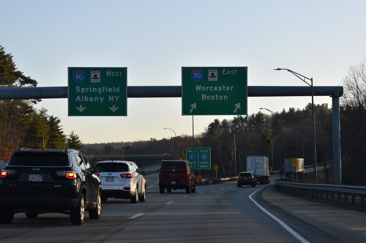
The Mass Pike east next meets I-290/395, 12 miles away near Worcester. 03/27/23
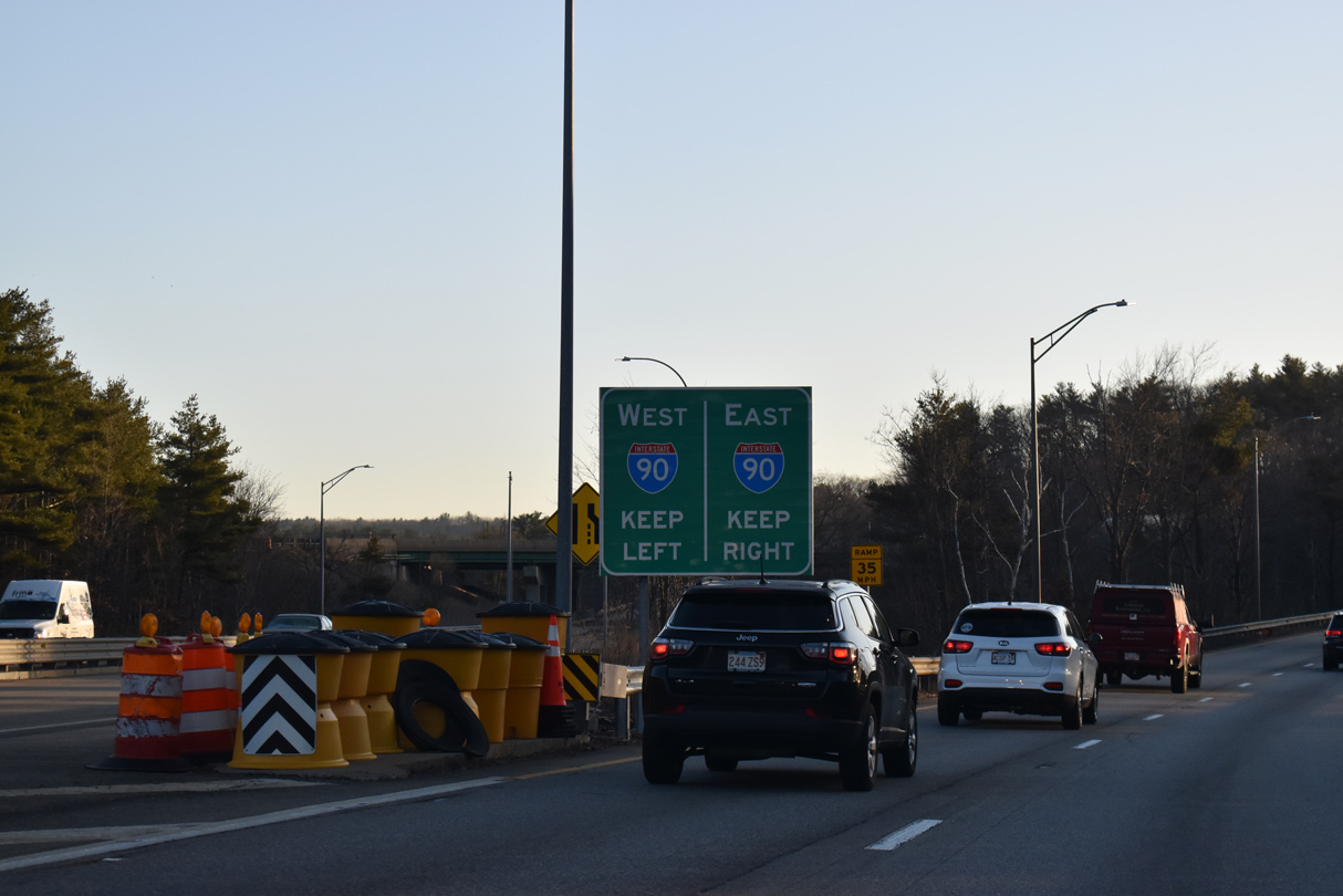
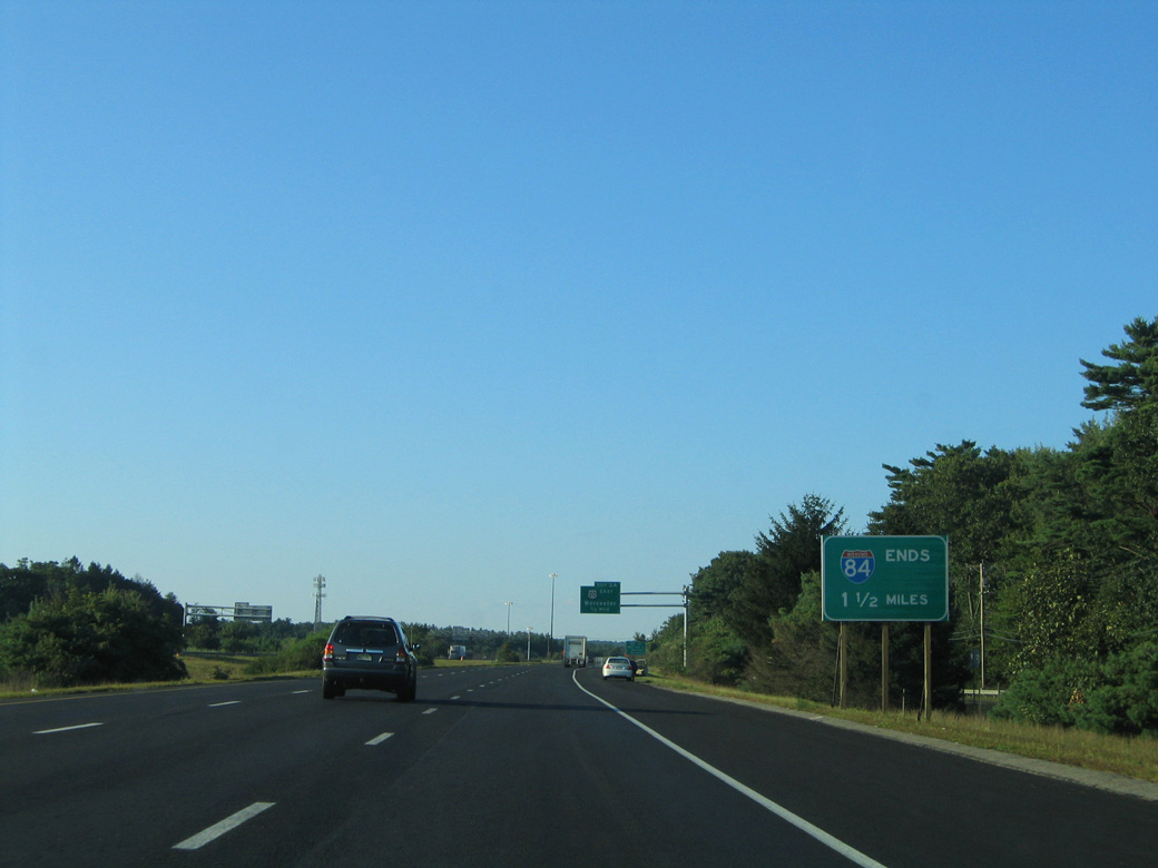
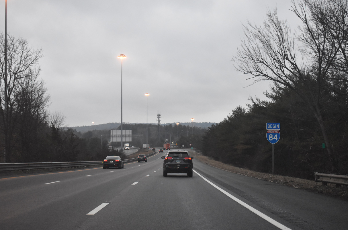
I-84 concludes at the trumpet interchange with Interstate 90 (Mass Pike). Springfield is a 30 minute drive to the west. 03/27/23
![]()
![]() East at
East at ![]()

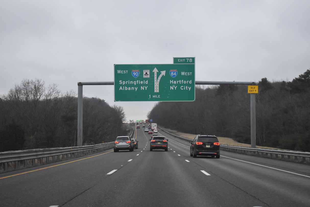
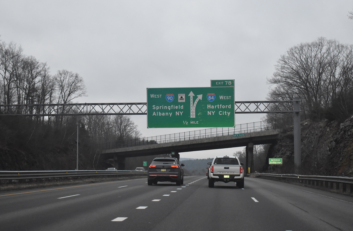
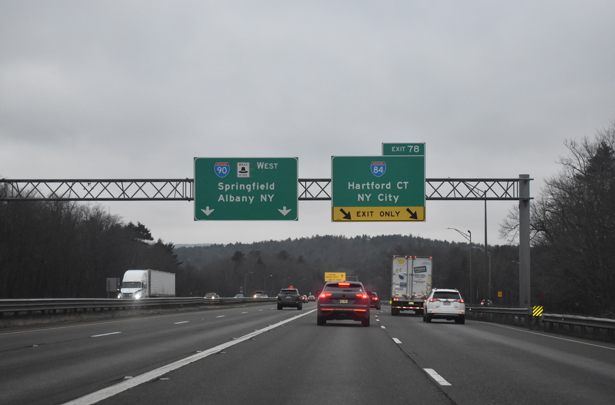
I-90/Mass Pike passes between Cedar Pond and Walker Pond on a rural stretching leading to Interstate 84 west at Exit 9. 03/26/23
Interstate 84 connects the Mass Pike with Sturbridge via U.S. 20 and Hartford, Connecticut. 03/26/23
![]()
![]() West at
West at ![]()
Advancing west from the town of Charlton, Interstate 90 (Massachusetts Turnpike) meets I-84 west toward New York City in two miles. 03/23/23
Meeting I-84 nearby between Charlton City and Fiskdale, U.S. 20 parallels Interstate 90 in Massachusetts from Boston west to Pittsfield. 03/23/23
Interstate 84 follows Wilbur Cross Highway southwest nine miles to the Connecticut state line. Hartford lies 35 miles further. 03/23/23
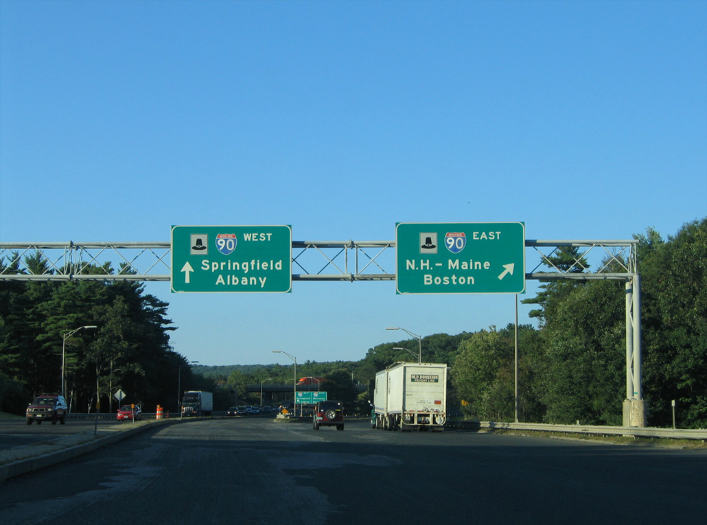
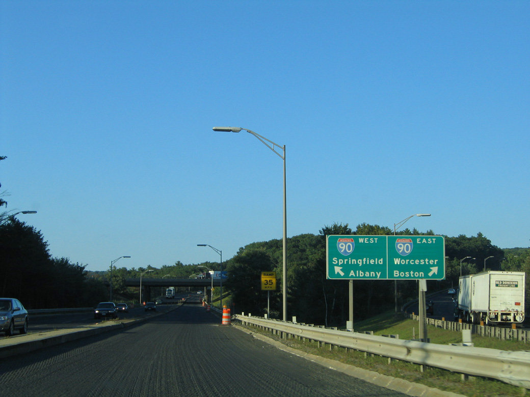
I-84 travels southwest across Connecticut to Waterbury and Danbury. I-90 continues 27 miles to I-291 at Chicopee near Springfield, and 110 miles to I-787 at Albany. 03/23/23
![]() West
West
A begin shield for Interstate 84 stands within the exchange for U.S. 20 in Sturbridge. 03/23/23
Throwback
![]()
![]() West at
West at ![]()
The first in a series of arrow-per-lane (APL) signs for Exit 78 to Interstate 84 replaced this previous ground level sign. Photo by Greg Goldman (07/29/05).
The Mass Pike continued west with three lanes leading into the trumpet interchange (Exit 9) with Interstate 84 west. Photo by Greg Goldman (07/29/05).
Route 49 crosses over Interstate 90 (Mass Pike) ahead of the split with I-84 west. Photo by Greg Goldman (07/29/05).
Two lanes depart the Mass Pike westbound at old Exit 9 for Interstate 84. Photo by Greg Goldman (07/29/05).
![]() East at
East at ![]()
![]()

Eastbound I-84 at Exit 6 A for U.S. 20 (Charlton Road) east. U.S. 20 provides an alternate route to Worcester in lieu of the Mass Pike. The US highway meets I-290/395 twelve miles to the east at Auburn. Interstate 290 heads north from there into the city of Worcester. 08/09/04
U.S. 20 meets Route 131 nearby in Sturbridge and travels two miles west to Route 148 at Fiskdale, five miles to Route 19 at Brimfield, and nine miles to Route 67 at Feltonville. 08/09/04
Previous guide signs for I-90/Mass Pike on I-84 east used N.H. – Maine. The state destinations were replaced with Worcester. 08/09/04
Interstate 90 follows the Massachusetts Turnpike for its entirely across the Bay State. 08/09/04
West End – Dunmore, Pennsylvania
![]() West
West ![]() North at
North at ![]()
![]()
I-84/380 combine ahead of the high level bridges spanning Roaring Brook gorge in the Moosic Mountains. Photo by Peter Johnson (06/14/21).

I-84/380 west lower from the Moosic Mountains northeast of Lake Scranton into the borough of Dunmore. 03/25/23
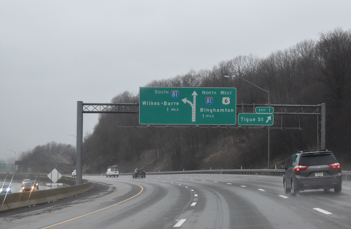
Exit 1 departs I-84 west for Tigue Street and Dunham Road one mile ahead of the exchange with Interstate 81. 03/25/23
A two-wye interchange connects I-84/380 west with the freeway taking U.S. 6 northeast to Carbondale. An adjacent three-way interchange ties both freeways in with Interstate 81. Photo by Peter Johnson (06/14/21).
Interstate 81 encircles Scranton east of Downtown and north with U.S. 6 along the Dickson City line. The city is home to the University of Scranton, Marywood University, and the Steamtown National Historic Site among other points of interest. Photo by Peter Johnson (06/14/21).

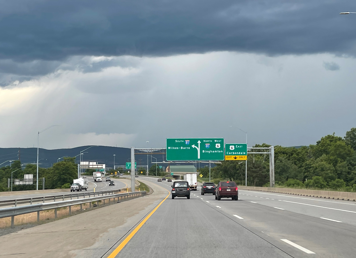
Two lanes partition from the end of I-84/380 for Interstate 81 south to Wilkes-Barre and Harrisburg and I-81 north and U.S. 6 west to Clarks Summit, Binghamton and Syracuse, New York. Photo by Peter Johnson (06/14/21).
![]() South
South ![]() East at
East at ![]()
![]()
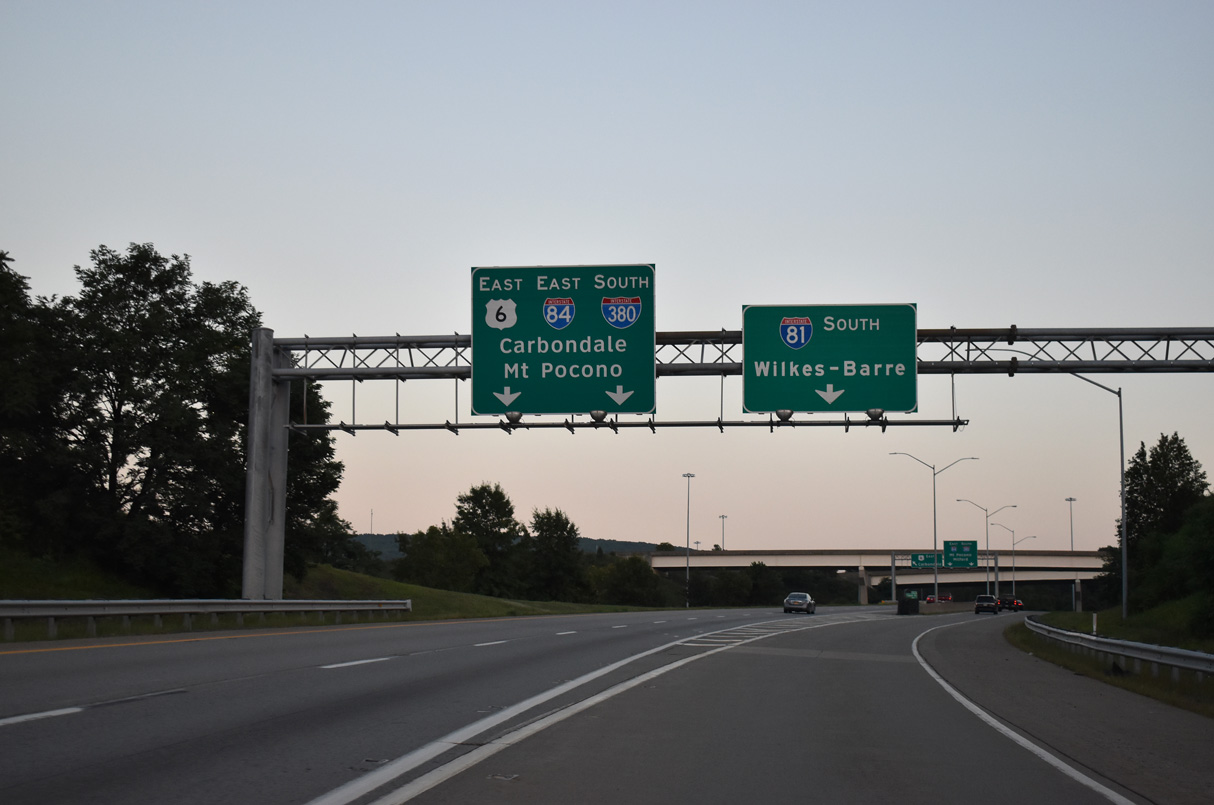
Interstate 81 south and U.S. 6 east two miles prior to the exchange with I-84 east and I-380 south. 08/24/21
Interstate 81/U.S. 6 enter the borough of Dunmore one mile ahead of I-84/380. 08/24/21
Entrance ramps from PA 347 (North Blakely Street) form a collector distributor roadway along I-81 south to I-84/380. The c/d roadways were added during reconstruction of Interstate 81 here in the early 2000s. 08/24/21
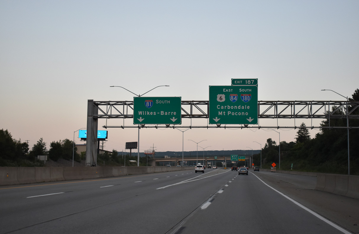
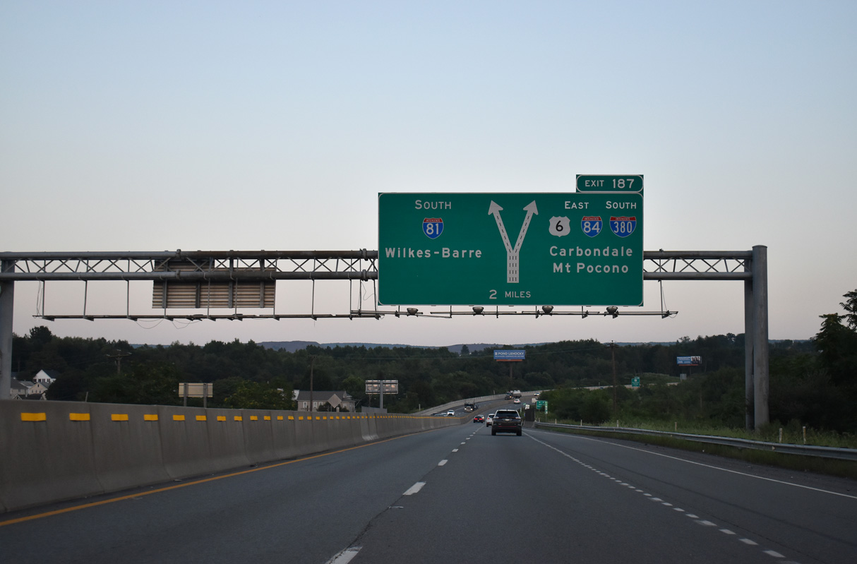
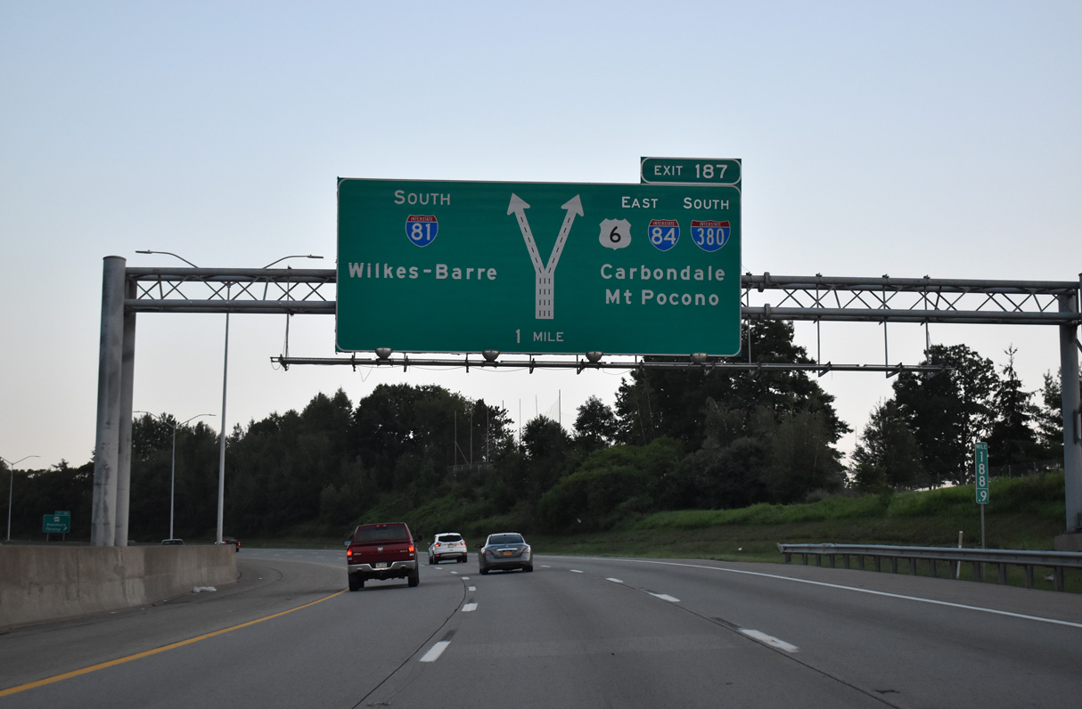
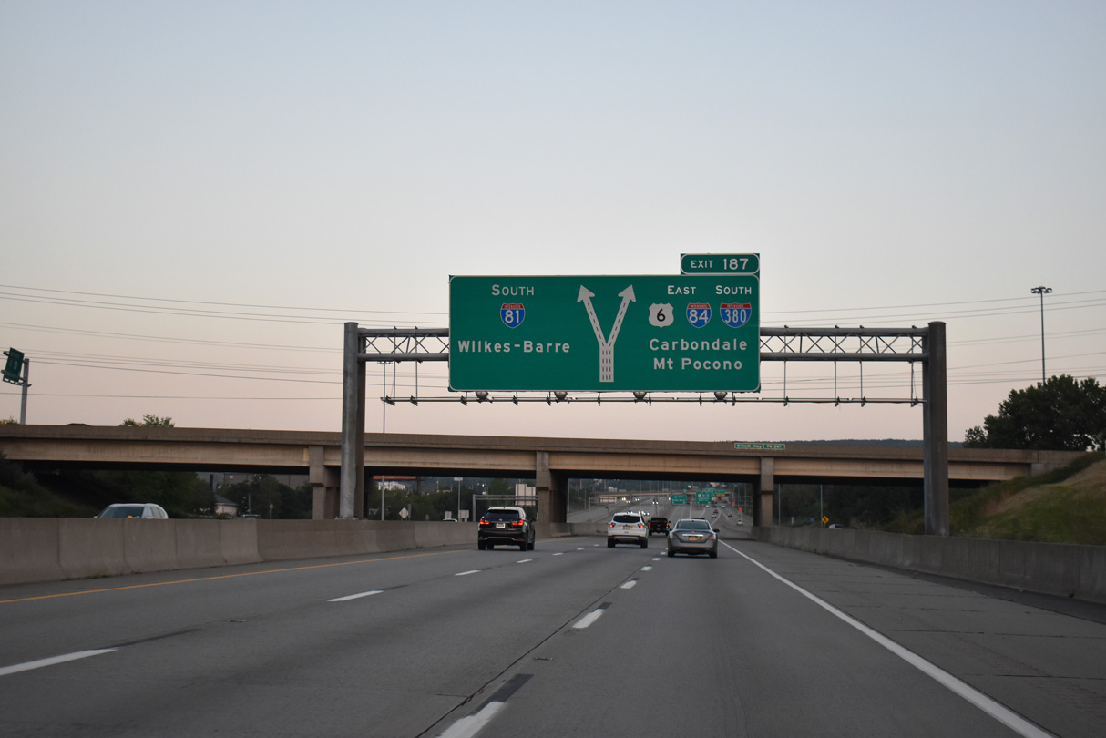
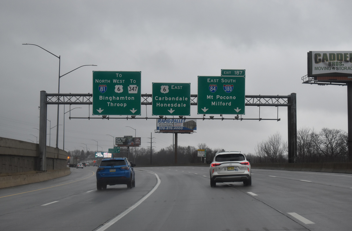
A two lane slip ramp (Exit 187) leaves I-81 south for U.S. 6 east and I-84/380. I-81 turns southwest at the forthcoming three-wye interchange for Wilkes-Barre, 17 miles ahead. 08/24/21
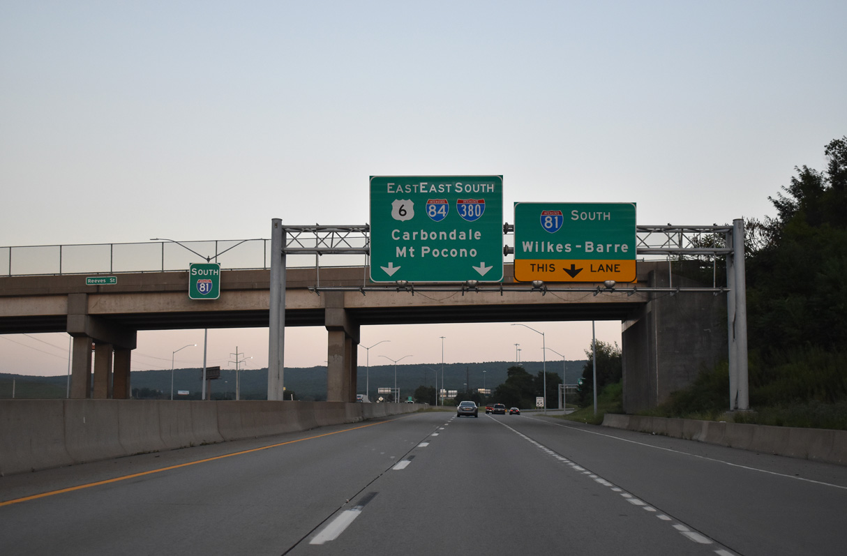
The c/d roadway along I-81 south passes under Reeves Street ahead of the separation for I-84 east to Hartford, Connecticut and I-380 south to Mt. Pocono. 08/24/21
The return ramp for I-81 south for PA 347 departs to the right, followed by a left exit for U.S. 6 northeast to Carbondale. 08/24/21
![]() North at
North at ![]()
![]()
![]()
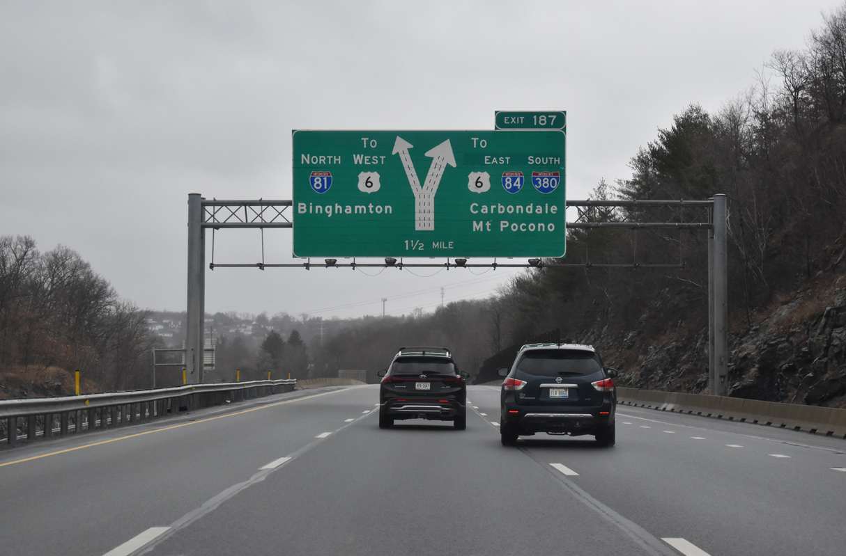
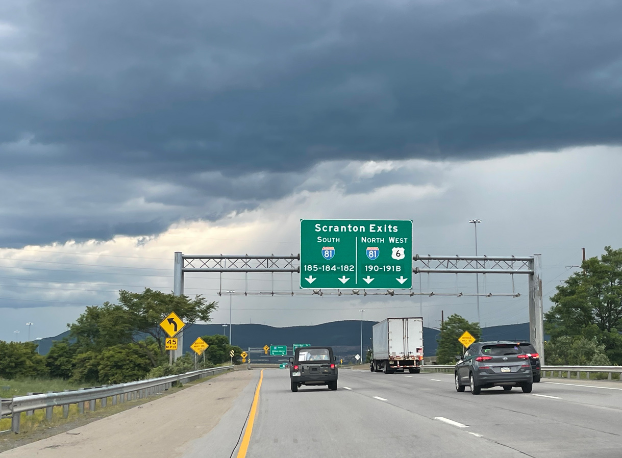
Interstate 81 advances north with three lanes to the systems interchange (Exit 187) with I-84/380 south and U.S. 6 east. 03/25/23

I-84 travels east from the Scranton area to Port Jervis at the New York border while I-380 travels southeast, connecting I-81 with I-80 near the Poconos. Photo by Chris Elbert (07/06).

Combining with U.S. 6, Interstate 81 curves northwest with two lanes through the exchange with I-84/380 to north Scranton. 03/25/23
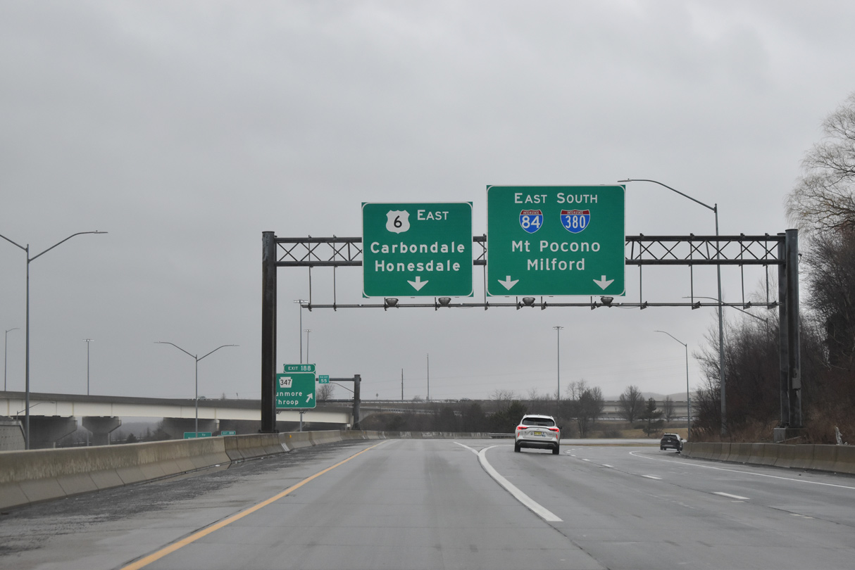
Interstate 81 continues north to Clarks Summit and Binghamton, New York. U.S. 6 weaves northeast through Throop, Olyphant and Jessup. I-84/380 split just north of Moscow. 03/25/23
Exit 187 separates with three lanes for U.S. 6 (Robert Casey Highway) to Carbondale and I-84/380 south to Roaring Brook Township. 03/25/23
Sources:
- Pennsylvania Highways: Interstate 84.
- “Section of I-84 to open.” The Pocono Record (Stroudsburg, PA), November 16, 1973.
- “More I-84 construction approved.” The Pocono Record (Stroudsburg, PA), February 17, 1975.
- “State may open I-80, 84 links by early next year.” The Pocono Record (Stroudsburg, PA), June 26, 1975.
- “Final I-84 link finished.” The Pocono Record (Stroudsburg, PA), December 3, 1977.
- “Boston, New England Travel Time Reduced.” Wilkes-Barre Times Leader (PA), July 3, 1971.
- Interstate 384 (Connecticut). NYCRoads.com.
Page updated March 30, 2023.