Interstate 70
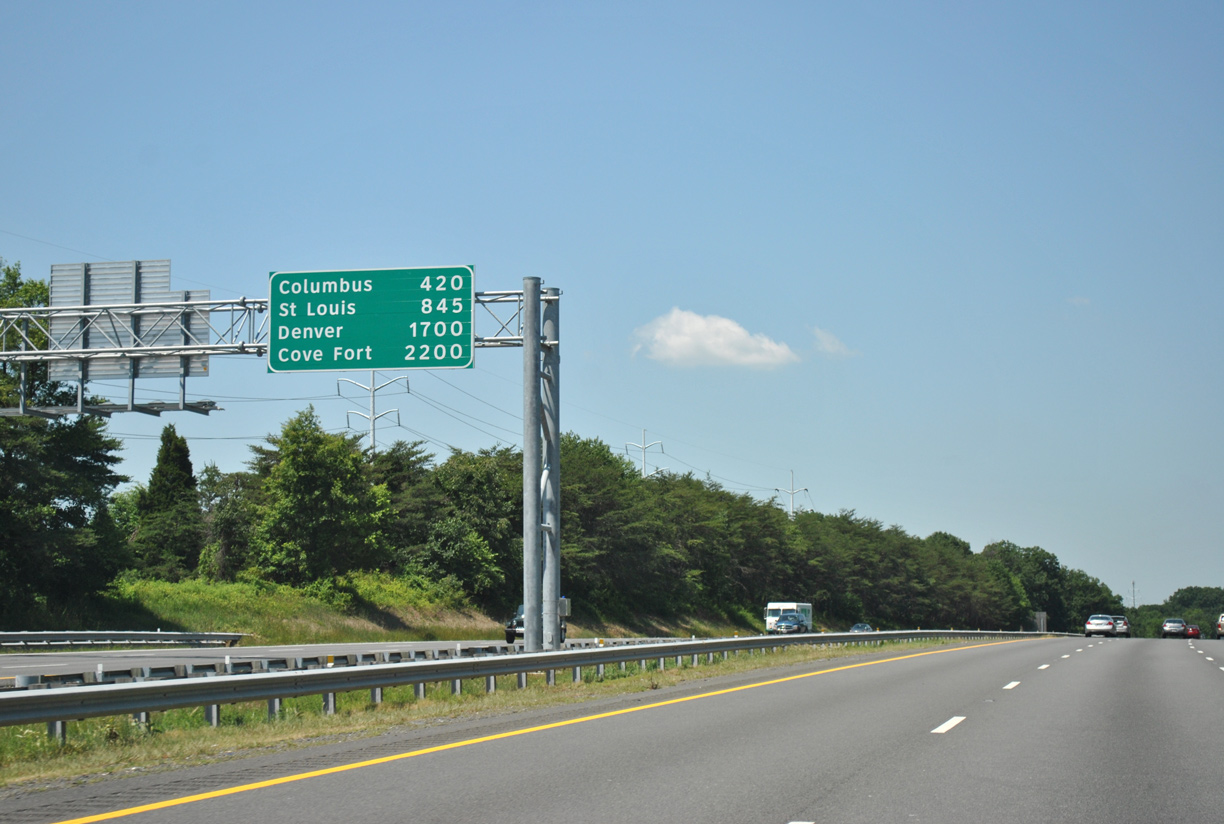
Interstate 70 commences a cross country route just west of Baltimore, Maryland. Posted just beyond I-695 is this distance sign with cities of Columbus, Ohio, St. Louis, Missouri and Denver, Colorado. Cove Fort, a small outpost in central Utah, is located at west end, where I-70 converges with I-15. This sign is a replacement of a ground level sign destroyed during a truck crash in 2010. 06/08/12
Overview
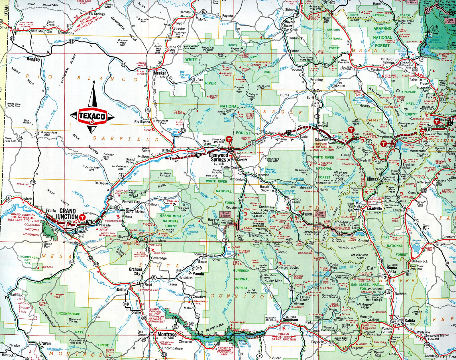
Traversing nearly the width of the United States, Interstate 70 serves major metropolitan areas such as Denver, Kansas City, St. Louis, Indianapolis, Columbus and Baltimore. The west end of the freeway connects with Interstate 15 at Cove Fort, Utah. There are no plans to extend I-70 west beyond that point, and most westbound traffic is funneled via I-15 to Southern California and via U.S. 50 to Northern California.
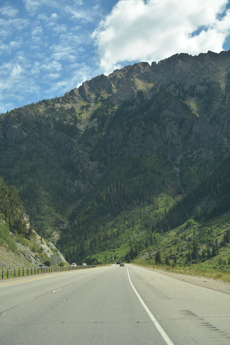
The bulk of the western extent of Interstate 70 passes through expansive high desert and the scenic Rocky Mountains. Until 1990, a section of I-70 remained with just two lanes across central Utah. The freeway across Colorado was also completed later, with the expensive section through Glenwood Canyon finished in 1992.

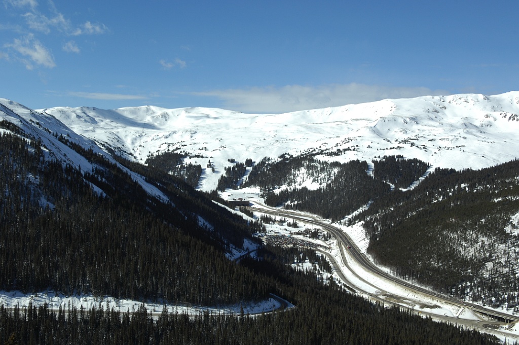
Interstate 70 at Silt, Colorado. The freeway straddles the Roan Cliffs west to Rifle. 08/11/16
Leaving the Denver metropolitan area, Interstate 70 traverses the Great Plains from Eastern Colorado into Kansas. The route through the Midwest crosses the width of Missouri, Illinois and Indiana. Several derivative routes for I-70 are designated in the larger cities of Kansas City and St. Louis. Notably, two branches of I-470 are located within 60 miles of each other.
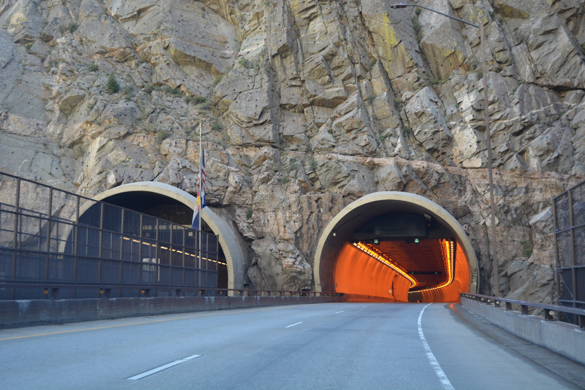
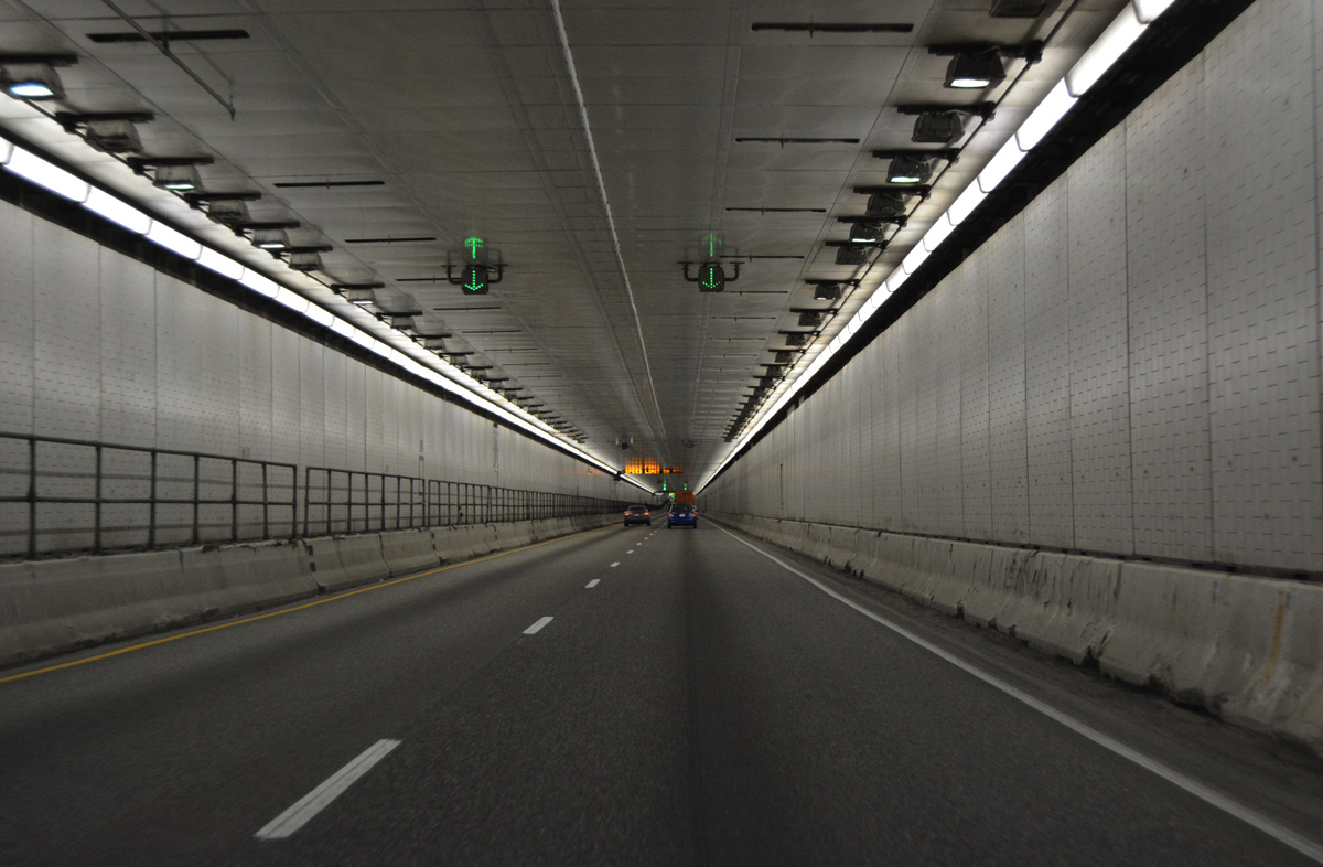
Interstate 70 passes through six tunnels between Grand Junction and Denver, Colorado. The Hanging Lake Tunnels here are located at Shoshone in Glenwood Canyon. 08/11/16
Through Ohio, Interstate 70 crosses Dayton and Columbus, then briefly enters West Virginia at Wheeling. Entering Pennsylvania, Interstate 70 combines I-79 at Washington and then with the Pennsylvania Turnpike (I-76) east from New Stanton to Breezewood. I-70 traffic must follow U.S. 30 through the business district in Breezewood to connect with the freeway leading south to Maryland from the PA Turnpike. There are no plans to create a direct connection between I-70 and I-76.
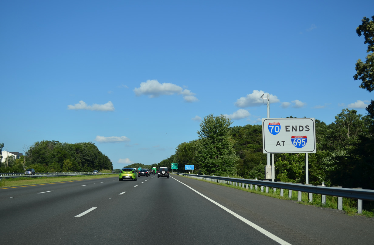
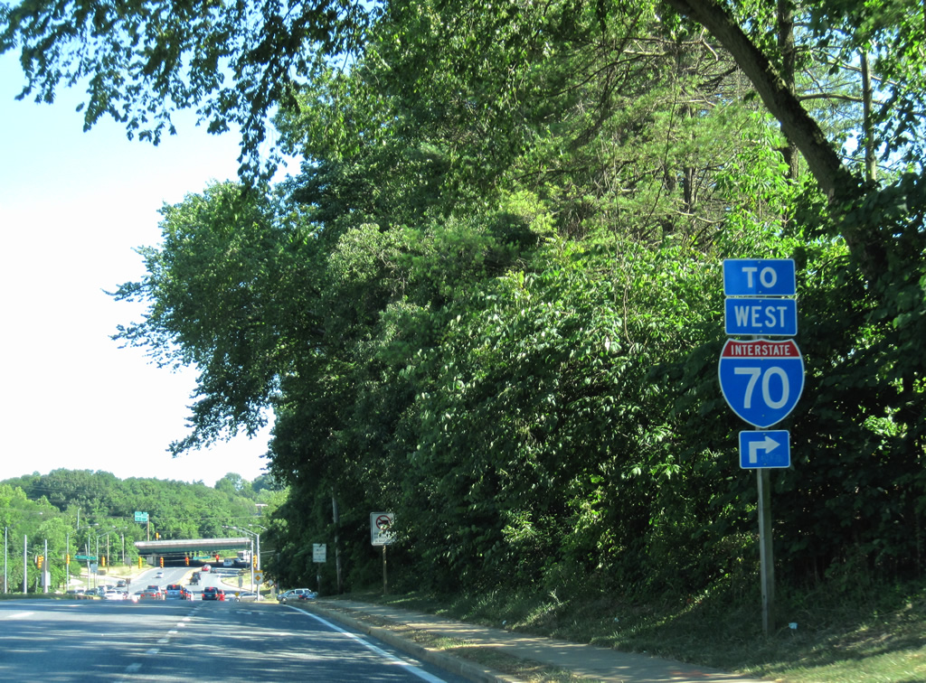
Interstate 70 ends rather ignobly at a Park and Ride at Baltimore, just east of the exchange with I-695. The continuation of the freeway to I-95 was removed from the city’s transportation plan and was never constructed.
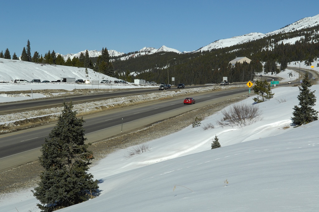
Looking west across Vail Pass (elevation 10,666 feet above sea level) in Colorado, Interstate 70 leaves Summit County and enters Eagle County. Even in autumn and spring, snow is a frequent occurrence here. Photo by Jeff Royston (11/18/06).
High Priority Corridor
Between Denver and Limon in Colorado, Interstate 70 is part of High Priority Corridor 38: Ports to Plains Corridor. In addition, the section of Interstate 70 through Missouri is part of High Priority Corridor 61: Missouri Corridors.
 Parallel U.S. Routes
From Cove Fort east to Green River, Interstate 70 largely follows U.S. 50, although prior to the construction of the freeway, U.S. 50 instead followed the route of U.S. 6 west to Delta. Between Green River and Grand Junction, Interstate 70 remains merged with U.S. 6-50. U.S. 50 splits south at Grand Junction, leaving I-70 to follow U.S. 6 from Grand East to Denver.
U.S. 40 meets Interstate 70 for the first time at Empire, and these two routes intertwine from there east to Baltimore. I-70 follows U.S. 40 out of Denver to Limon, where it combines with U.S. 24 east to Goodland and Colby, Kansas. Interstate 70 angles southeast from U.S. 24 at Colby to rejoin U.S. 40 at Oakley, Kansas. East from there, I-70 and U.S. 40 generally overlap to St. Louis, with a few exceptions. East of St. Louis, I-70 and U.S. 40 parallel each other closely, with a deviation from Washington, Pennsylvania, to Hancock, Maryland. However, once in Maryland, Interstate 70 again closely follows U.S. 40 all the way into Baltimore.
Major Projects
Baltimore, Maryland
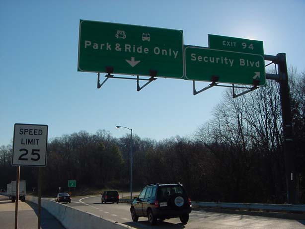
Not necessarily an improvement for the Interstate, but an improvement for Baltimore area commuters was the planned Maryland Transit Administration (MTA) Red Line along the 1.95-mile long I-70 spur within the Beltway (I-695). The proposed subway line was to utilize a portion of the I-70 right of way, with the existing six-lane freeway converted into a two-lane parkway. Additionally the interchange (Exit 94) between the I-70 east end at MD 122 (Security Boulevard) was slated for removal and replacement with an at-grade intersection. Cooks Boulevard, maintained by the Maryland State Highway Administration (MDSHA), would overtake former I-70 west to the four level interchange with I-695. Truncation of I-70 was approved by the the American Association of State Highway and Transportation Officials (AASHTO) U.S. Route Numbering Committee on May 29, 2014. However funding for the Red Line project was ultimately withdrawn.
Columbus, Ohio
Within Columbus, the Ohio Department of Transportation (ODOT) studied several options to deal with worsening congestion in Downtown in the early 2000s. Some of the options include converting portions of Interstate 70 into an at-grade boulevard, adding various collector distributor lanes parallel to the freeway, additional lanes, or doing nothing.
One option considered was to reroute Interstate 70 south of its current alignment between Exit 98/U.S. 42 and a point near Milepost 106. This plan would take I-70 onto a new alignment at Exit 98, connecting with Interstate 71 and SR 104 south of Downtown and continuing southeast of the former Cooper Stadium. East from there, I-70 would overtake SR 104, and a new connection would be constructed in the vicinity of U.S. 33 (Exit 105) linking the new route to the existing I-70. In exchange, the former route of Interstate 70 between Exits 98 and 105 A, including the notorious interchange with I-71, would be replaced with a 35 MPH boulevard.17
Another option presented by ODOT in November 2003, proposed separating through traffic on I-70/71 from Downtown-bound traffic, possibly through the use of collector distributor lanes. According to the Columbus Dispatch,
the plan would eliminate highway lane changes by dedicating three lanes of traffic to I-70, two lanes to I-71 and creating collector distributor streets above the highway for motorists getting to and from two sets of Downtown ramps.
As the study progressed between 2002 and 2004, various alternatives were considered, eliminated, or adopted for further consideration. According to the ODOT I-70/I-71 South Innerbelt Corridor Study, construction of one of three possible alternatives (involving the location and layout of the collector distributor lanes) would have begun in 2008 and ended in late 2010. Design of the project began in 2005.6
Columbus Crossroads
Rebranded as the I-70/I-71 Downtown Ramp Up, this $1.4 billion mega project addresses congestion along the I-70/71 overlap through central Columbus. The six phase project kicked off with a revamp of the I-71/670 interchange between 2011-2013. Phase 2 entailed redesigning the eastern junction of I-70/71 to eliminate left exit ramps and ultimately split the two routes into separate roadways. Construction underway in Summer 2017 added an additional lane along both directions of I-70/71. A new ramp was also constructed from I-70 east at Parsons Avenue to replace the exit at 18th Street. It opened to traffic on December 20, 2019. Costing $82 million, Phase 2E work wrapped up in Summer 2022.
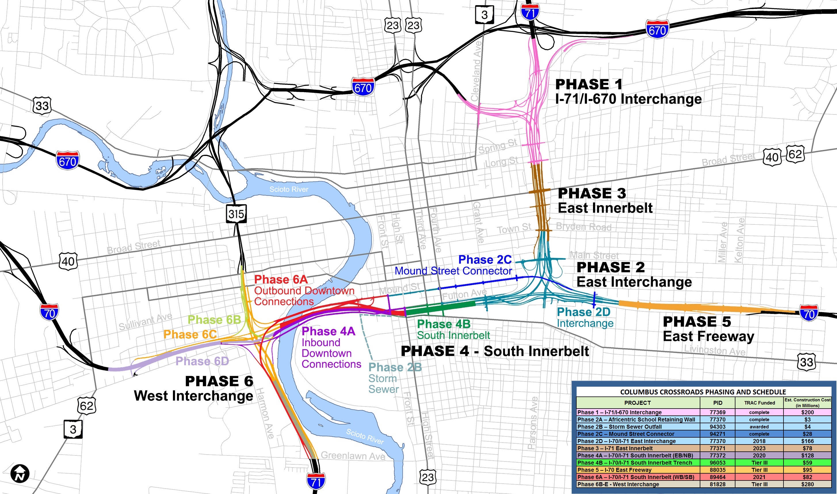
Columbus Crossroads Phases and Funding schedule as of March 2016.
Phase 3B – $41 million, work from Spring 2020 to Summer 2022 expanded I-71 from Broad Street to Long Street and replaced the Broad Street overpass.
Phase 4R/6R – $280 million, construction commenced in Spring 2022 and extends to Fall 2025. Phase 4R – Front Street Gateway adds a ramp from I-70 east to Fulton Street and replaces bridges for Fulton Street over I-70 and I-70 over Short Street. Phase 6R – West Interchange builds a new ramp from Mount Street to I-71 south and reconstructs the ramp from Mound Street to I-70 west among other improvements to Mound Street.
Phase 4B – $246 million, planned for Fall 2023 to Fall 2026. Reconstructs both roadways along I-70 between Front Street and Grant Avenue and I-70 east from I-71 to High Street. Reconstructs bridges on I-70 west over the Scioto River, SR 315 and Short Street.
Phase 5 is part of the I-70 Far East Freeway project, $433 million in construction started in Spring 2022. With work separated into four projects, construction rebuilds interchanges at I-270/Brice Road, U.S. 33/Petzinger Road, Hamilton Road and SR 256/Taylor Road. Project 1 at I-270 upgrades the exchange into a cloverstack, eliminating a weaving traffic pattern.
Route Information
Utah – 231.70
Cities – Cove Fort, Richfield, Green River
- Junctions –

Colorado – 450.18
Cities – Grand Junction, Denver, Limon
- Junctions –

Kansas – 424.15
Cities – Goodland, Hays, Russell, Salina, Abilene, Junction City, Topeka, Lawrence, Kansas City
Junctions –
Missouri – 250.16*
Cities – Kansas City, Boonville, Columbia, St. Louis
- Junctions –
Illinois – 157.33**
Cities – East St. Louis, Vandalia, Effingham
- Junctions –
Indiana – 156.60***
Cities – Terre Haute, Indianapolis, Richmond
Junctions –
Future
Ohio – 225.60#
Cities – Dayton, Springfield, Columbus, Zanesville, Cambridge
- Junctions –
West Virginia – 14.45
Cities – Wheeling
Junctions –
Pennsylvania – 167.92##
Cities – Washington, Nonessen-Charleroi, Breezewood
Junctions –

Maryland – 93.62
Cities – Hancock, Hagerstown, Frederick, Baltimore
- Junctions –
Source: December 31, 2021 Interstate Route Log and Finders List
* – 1.00 mile on I-35
** – 16.00 miles on I-55, 5.59 miles on I-57
*** – 2.13 miles on I-65
# – 1.74 miles on I-71
## – 3.55 miles on I-79, 87.22 miles on I-76
I-70 Annual Average Daily Traffic (AADT)
Source:
Utah Department of Transportation Traffic Statistics 2017 AADT
INDOT Traffic Count Database System (TCDS) 2018-19 AADT
Pennsylvania Traffic Volume Map 2017 (PennDOT)
Maryland Traffic Volume Maps 2018 (MDOT)
West of Denver in 1972, only four portions of Interstate 70 were open to traffic: Fruita to SH 65 east of Grand Junction (opened between 1964 and 1970), between New Castle and Glenwood Springs (1971), from Wolcott east to Vail (1970 and 1972) and Silver Plume east into Denver (1960 through 1968).13
The oldest sections of Interstate 70 in Colorado included the viaduct from Brighton Boulevard east to SH 2 (Colorado Boulevard) constructed from 1961 to September 12, 1964. The stretch east to Peoria Street was completed in 1965, and from there to U.S. 36-40-287 (Colfax Avenue) in 1966.19
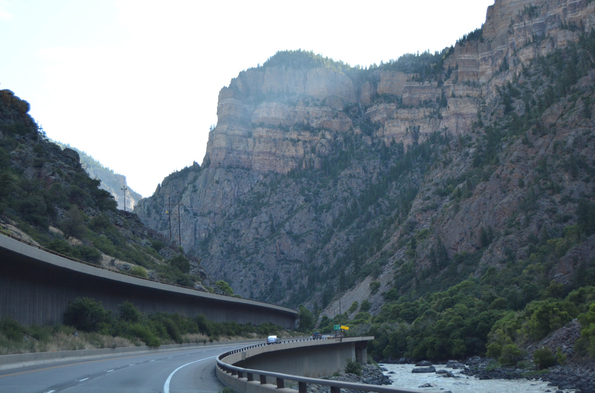
The scenic stretch through Glenwood Canyon in Colorado is an engineering marvel, with the freeway often partitioning with I-70 westbound traveling on elevated viaduct and I-70 eastbound staying closer to grade level over old U.S. 6. 08/11/16
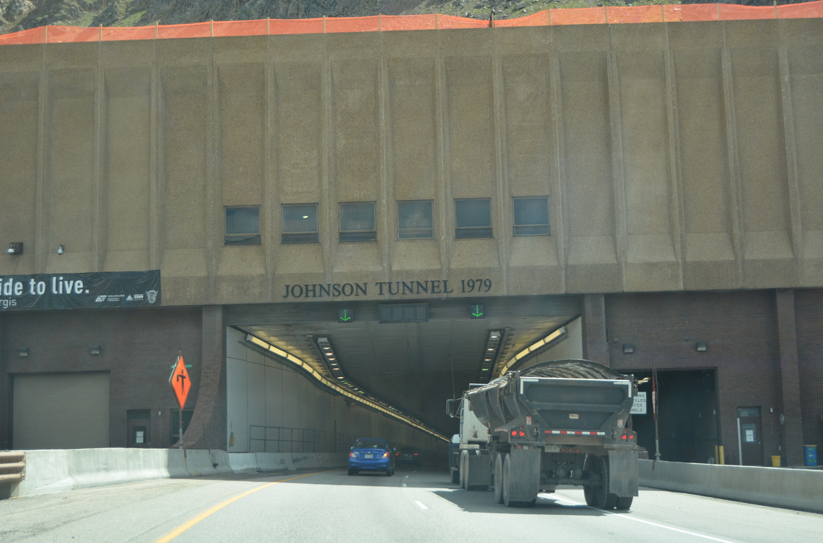
The Eisenhower Tunnel takes Interstate 70 across the Continental Divide between Silverthorne and Silver Plume in Colorado. The west portal of the 8,941 foot long bore sits at 11,158 feet above sea level. The tunnel represents the highest elevation on the Interstate Highway System.13 08/11/16

I-70 and U.S. 6-40 separate east of Idaho Springs. U.S. 6 traverses Clear Creek Canyon into Golden while I-70 and parallel U.S. 40 take a more southerly course across Flint Hill and through Mount Vernon Canyon to the Denver metropolitan area. 08/11/16
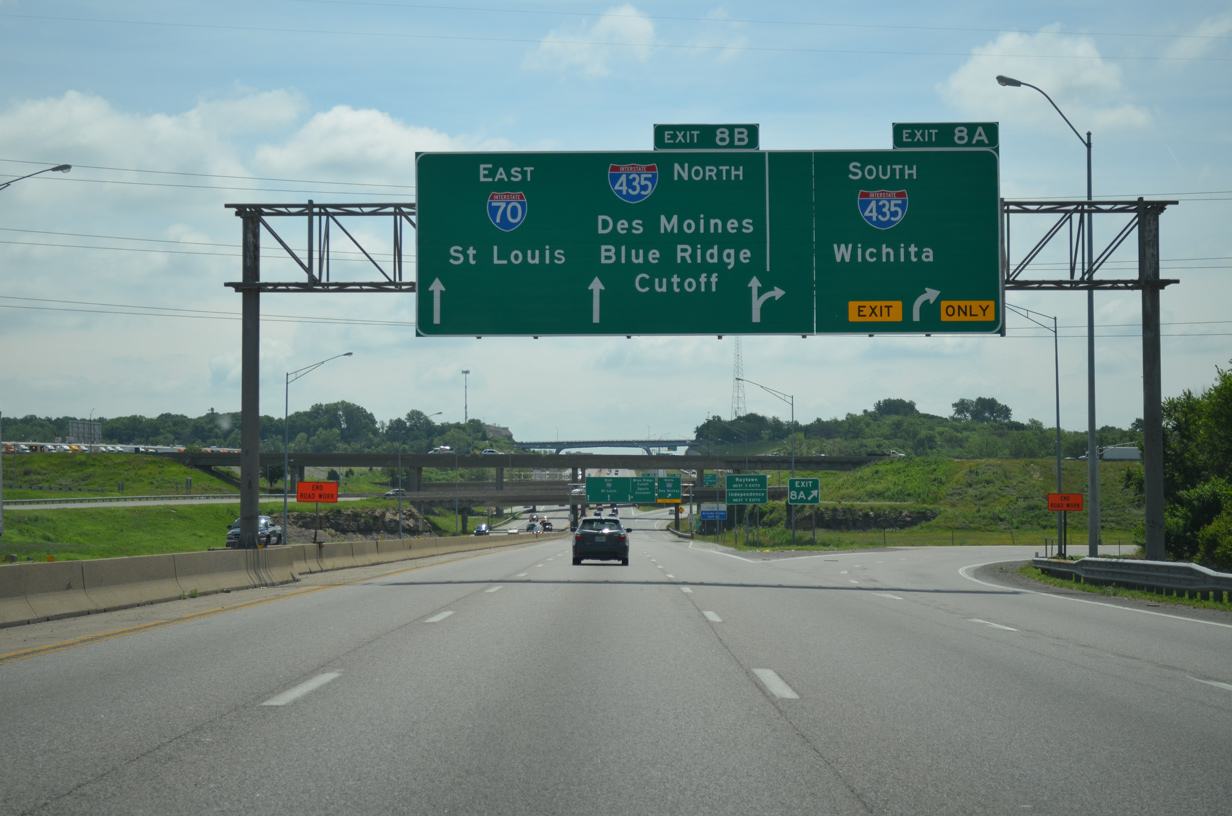
I-70 east at Interstate 435 in Kansas City, Missouri. The exchange joining the freeways northwest of Arrowhead and Kauffman Stadiums was reconfigured into a partial turbine during road work from Spring 2019 to October 2020. 06/19/15
Indianapolis, Indiana
A realigned section of I-70 between SR 267 and Interstate 465 opened south of Indianapolis International Airport (IND) on December 29, 2004. Costing $170 million, construction relocated a 4.5 mile long section of Interstate 70 southward onto a new footprint. This accommodated expansion of the airport’s runway system and new interchange ramps.4
St. Louis and East St. Louis
Within the St. Louis metropolitan area, Interstate 70 was realigned to cross the Mississippi River over the Stan Musial Veterans Memorial Bridge. Located north of both the Martin Luther King Bridge and the Poplar Street Bridge (I-55/64-U.S. 40), the new four lane wide, cable-stayed bridge stems east from an extended Interstate 44 at an interchange constructed with Tucker Boulevard to arc southward to East St. Louis, Illinois at the Tri-level interchange where I-55 and I-64 part ways.
Realignment onto the new freeway, which opened February 9, 2014, was approved by the American Association of State Highway and Transportation Officials (AASHTO) on October 21, 2013. This coincided with the redesignation of I-70 between the Poplar Street Bridge and Tucker Boulevard as an extension of Interstate 44. Approval for the $1.8 to $2.2 billion project by Illinois and Missouri occurred in 2001, though funding slowed progress and focus was directed on the $667 million bridge, new freeway south from the bridge to I-64 and I-55, and interchange upgrades at each end. Future work will add new roadway from the bridge’s east end to I-55/70 east of IL 203.12
Kansas Turnpike
A 12.69 mile long section of Interstate 70 along the Kansas Turnpike between Topeka and Lawrence was widened to six lanes. Costing $75 million and commencing in Spring 2005, the project included drainage improvements and a higher median barrier (51 inches). This project coupled with the replacement of the 3,000 foot long Kansas River bridge near Lawrence, which was estimated to cost $130 million and previously scheduled to begin in 2009.7 The new spans over the Kansas River opened in October 2009 and November 29, 2010 respectively.14

The Stan Musial Veterans Memorial Bridge accommodates four overall lanes with full outside shoulders. The span can be restriped for six lanes, but without shoulders. Photo by Chris Kalina (03/08/14).
Central 70 – Denver
Long term proposals to reconstruct, replace or realign Interstate 70 east through the Elyria and Swansea community in Denver continued beyond the 2006 completion of the T-REX reconstruction of the Mousetrap Interchange, where I-70 and I-25 meet at Globeville in Denver. The section of I-70 east of Brighton Boulevard (SH 265) followed an elevated roadway completed in 1964. Several options proposed for the freeway between Interstate 25 and Tower Road in Aurora, included:2
- Construct more general travel lanes to existing Interstate 70
- Construct four carpool lanes along existing Interstate 70
- Construct a four lane express toll facility along the center of the free lanes.
- Construct a new alignment for Interstate 70 between Washington Street and Quebec Street and add more free lanes to existing I-70 from Quebec Street to Tower Road
- Construct a new alignment of Interstate 70 between Washington Street and Quebec Street with four carpool lanes; extend the four carpool lanes along existing I-70 from Quebec Street to Tower Road
- Construct new alignment of Interstate 70 between Washington Street and Quebec Street with a four lane express toll facility; extend the toll facility down the center of the free lanes from Quebec Street to Tower Road
In Options 4, 5 and 6, the new alignment of Interstate 70 would extend from the Denver Coliseum east to Quebec Street (former SH 35) via industrial land in Commerce City. I-70 would depart its existing alignment at Washington Street, follow the BNSF Railroad tracks northeast to the defunct Rock Island Railroad right of way, then curve southeast back to I-70 near Quebec Street. These three options would have pushed the freeway through the home of the National Western Stock Show to a point nearly one mile north of the original alignment. Under these scenarios, former route of I-70 would revert to a surface street (E 46th Avenue).
These options were considered as part of an Environmental Impact Statement (EIS) jointly prepared by the Colorado Department of Transportation (CDOT), the Regional Transportation District (RTD) and the city of Denver. Preliminary estimates indicated that realigning Interstate 70 was the most cost effective option versus reconstructing the old freeway.2
Public hearings took place in September 2014 for the I-70 East Supplemental Draft Environmental Impact Statement. Estimated at $1.8 billion, the preferred alternative was the reconstruction of Interstate 70, calling for replacing the aging viaduct with a below grade freeway coupled with an express toll lane in each direction. Support for this option included the Denver Chamber of Commerce, the National Western Stock Show, and the Elyria-Swansea Business Association among other groups.19
The Federal Highway Administration (FHWA) approved the $1.2 billion reconstruction of Interstate 70 in January 2017. The approval allowed CDOT to move forward with design work on the five year Central 70 project. Construction started in 2018 rebuilt the ten mile long stretch of I-70 from I-25 at Globeville to Chambers Road in Aurora. The elevated lanes between SH 265 (Brighton Boulevard) and SH 2 (Colorado Boulevard) were lowered to travel 30 feet below grade. Toll lanes were added in each direction.20 The new freeway at Elyria and Swansea includes a lid supporting a four acre landscaped park by Swansea Elementary School.19 56 residences and 17 businesses were displaced by the project.21 Traffic shifted to the final configuration through the project area by late 2022, with landscaping and other side work completed in 2023.
I-70 Mountain Express Lanes
The I-70 Peak Period Shoulder Lane project upgraded 13 miles of Interstate 70 eastbound from the overlap with U.S. 40 at Empire to the split with U.S. 6 east of the Veterans Memorial (Twin) Tunnels in Clear Creek County. The expansion project added a full left shoulder for use as a third, optional lane during peak travel periods. When open to traffic, the Mountain Express Lane charges a tolls electronically through ExpressToll transponders or toll by plate. Congestion pricing is implemented to keep the toll lane moving at highway speeds, with rates adjusted upward during heavier traffic.
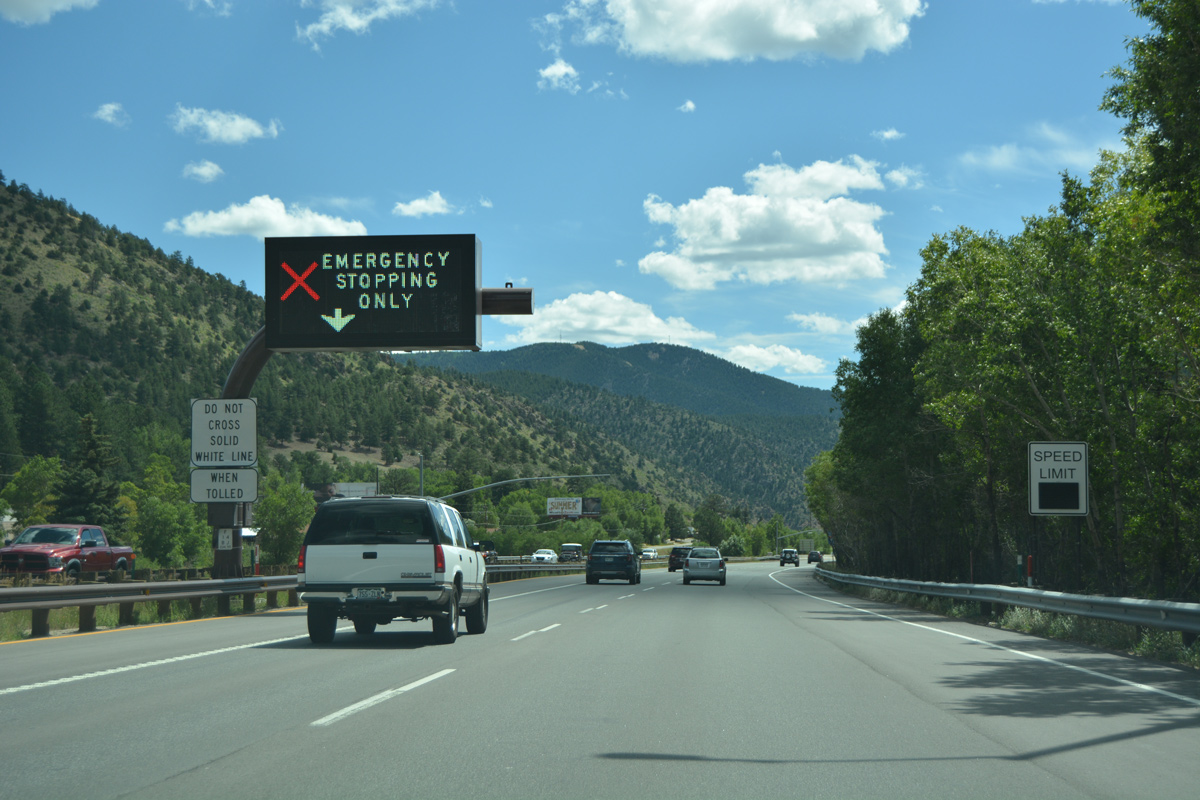
A dynamic message sign for the I-70 Mountain Express Lane on Interstate 70 eastbound at Dumont. 08/11/16
Associated work reconstructed interchanges at SH 103 and Colorado Boulevard (Exit 241) in Idaho Springs. Overpasses across I-70 at both exits were replaced as well. Further east at the Twin Tunnels, construction from late Fall 2012 to Summer 2014 expanded both bores to accommodate three lanes. Costing $72 million, work on the I-70 Peak Period Shoulder Lane ran from Summer 2014 to Fall 2015.18
Breezewood
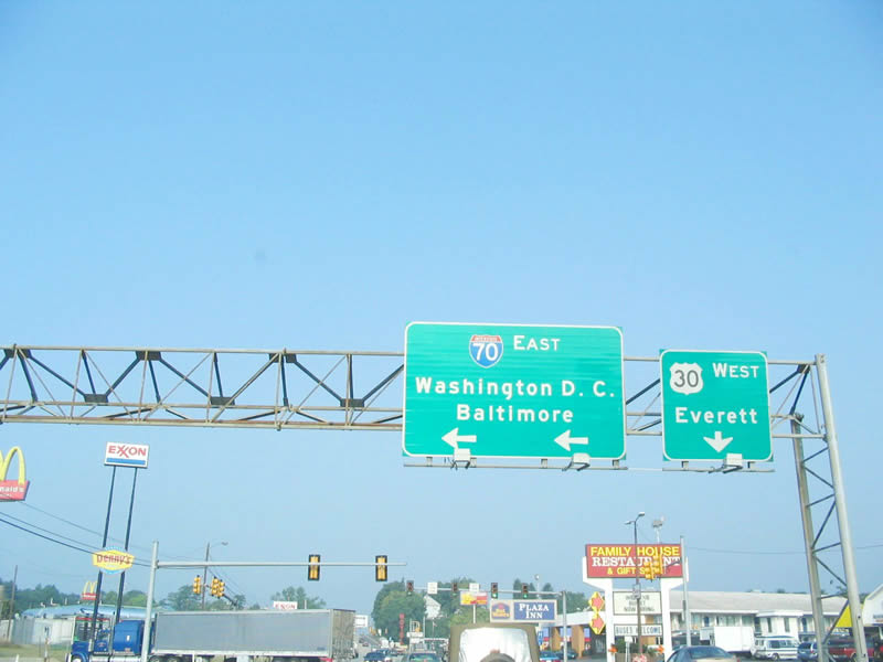
Interstate 70 is one of the few Interstate Highways that has traffic lights on its mainline. The series of signals is located on the connection between the Pennsylvania Turnpike (I-76) and I-70 through Breezewood, Pennsylvania via U.S. 30. The reason why this connection is not direct hearkens back to the requirements of the Federal-Aid Highway Act of 1956. Under Section 113(c), interchange connections between a toll road and the Interstate Highway System could be constructed with either Federal-Aid highway funds or toll revenue; however, if Federal-Aid funds were used, the tolling authority and state department of transportation would have to enter into an agreement with the Federal Highway Authority to cease collecting tolls upon retirement of the bonds.
Since the Pennsylvania Turnpike Commission (PTC) did not wish to stop collecting tolls after retiring bonds, the PTC decided against using the State of Pennsylvania’s Federal-Aid funds for the Interstate 70 connection. Additionally, the PTC decided not to use its own revenue for constructing other direct interchanges, such as I-81 in Carlisle and Interstate 99 in Bedford. There are no immediate plans to construct an Interstate 70 Breezewood bypass, so the strip of fast food, gas stations, and motels will remain a congested route for motorists continuing along I-70 for some time to come.3
U.S. 30 (Lincoln Highway) west at the overpass carrying I-70 along a spur ramp from the Pennsylvania Turnpike (I-76) mainline into Breezewood. I-70 east merges with U.S. 30 west for the next mile. Photo by Steve Hanudel (08/12/05).
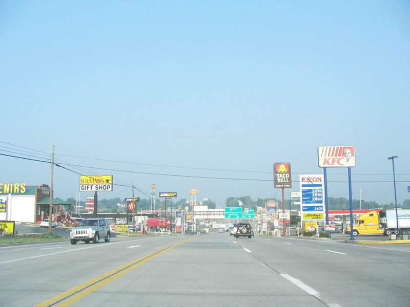
Beyond the Pennsylvania Turnpike spur linking I-70 east with U.S. 30, Lincoln Highway advances through Breezewood along a wide variety of motorist services including restaurants, gas stations and motels. Photo by Steve Hanudel (08/12/05).

The I-70 eastbound mainline makes a left turn from U.S. 30 west for the continuation southeast toward Baltimore, Maryland, and Washington, D.C.. Photo by Steve Hanudel (08/12/05).
I-70 resumes along a freeway leading south from U.S. 30 (Lincoln Highway). Photo by Steve Hanudel (08/12/05).
History
Interstate 70 was one of the first Interstate Highways to be built on many different levels, according to the Federal Highway Administration article “Three States Claim First Interstate Highway” by Richard F. Weingroff that appeared in Public Roads. Three sections of Interstate 70 in Pennsylvania, Missouri and Kansas could each claim to be the “first” section of Interstate Highway to be built.
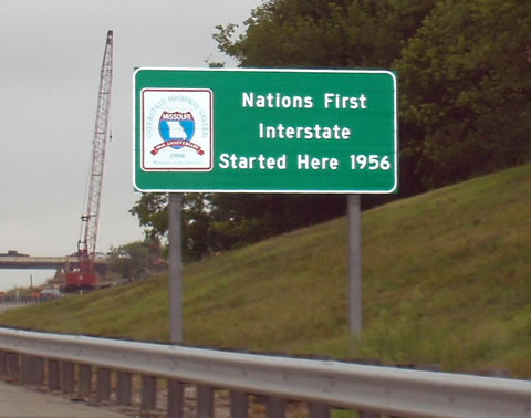
A sign in St. Charles County reminds motorists of Missouri’s claim of the “First Interstate Highway” with this sign posted on westbound Interstate 70 northwest of St. Louis. Photo by Joe Balsarotti (10/17/05).
The Pennsylvania Turnpike today incorporates portions of both I-70 and Interstate 76. The section between Irwin (Exit 67, near the U.S. 30 southeast of Pittsburgh) and Carlisle (Exit 226, near the junction with Interstate 81) opened to traffic on October 1, 1940. Although the Turnpike did not have I-70 shields on it when it opened, this portion of I-70/76 could be considered the first Interstate highway. However, this toll facility was not built with Interstate Highway Funds. The Interstate designation was added to the Turnpike well after the roadway opened.
The other two instances of “first Interstate highway” claims are directly related to the freeways built with Interstate Highway Funds. Within Missouri, the section of I-70 (Mark Twain Expressway) in St. Charles County was the first Interstate Highway project to be awarded and to start construction (contract awarded on August 2, 1956, and construction began on August 13, 1956). Within Kansas, a two lane section of I-70 (U.S. 40) several miles west of Topeka also could claim “first Interstate highway” because it was the first segment to be completed with federal Interstate Highway funds, even though construction had begun prior to that point. This section of Interstate 70 opened on November 14, 1956. Signs along the route at the time stated that this section of I-70 was the “first project in the United States completed under the provisions of the new Federal-Aid Highway Act of 1956.”
Utah

This view of Interstate 70 looks east through the San Rafael Swell toward Green River in central Utah from Ghost Rock Summit. The freeway occupies a narrow footprint as it ascends toward the top of the swell. Photo by Jeff Royston, 09/16/06.
Interstate 70 begins in sparsely populated central Utah from an exchange with I-15 near Cove Fort. I-70 follows former Utah State Route 4 between Interstate 15 and U.S. 89, then parallels old U.S. 89 from Sevier north to Salina via Richfield through the Sevier Valley. Originally, Interstate 70 was programmed to begin in Denver; however, a later addition, made public on October 18, 1957, extended the route west to Cove Fort to allow for greater access to Southern California.10 Some would have preferred that Interstate 70 turn northwest at Green River toward Spanish Fork, thus offering a freeway route to Salt Lake City; however, the federal plan preferred sending the route southwest to provide access to Southern California via I-15.
Interstate 70 leaves U.S. 89 at Salina, Utah and converges with U.S. 50. I-70/U.S. 50 cross 110 miles of sparsely populated land between Salina and Green River. U.S. 50 was rerouted onto Interstate 70 in 1976 from its former alignment it previously shared with U.S. 6 between Delta and Green River. East from Salina, the freeway ascends to Salina Canyon Summit/Emigrant Pass (elevation 7,923 feet) in Fishlake National Forest, then crosses the Wasatch Plateau. Beyond the exchange with SR 10, Interstate 70 enters the San Rafael Swell. I-70 through this scenic area was mostly built as a two lane freeway, and was the last section of nationally expanded to four lanes. Through the swell, freeway construction required removal of 3.5 million yards of excavation at Spotted Wolf Canyon and the construction of two steel arch bridges over deep Eagle Canyon (near Milepost 120) in 1965 (eastbound) and 1990 (westbound; constructed by OlsenBeal).11
The 70 mile long section of I-70 with two lanes opened to traffic on November 5, 1970, and it is still the longest section of Interstate Highway to open at one time.10 Four lane expansion was completed in stages, with the route completely up to Interstate standards following the opening of the second Eagle Canyon bridge on September 28, 1990. The freeway runs through such unpopulated territory that Interstate 70 still has no motorist services between Salina and Green River for 110 miles. I-70 was not preceded by any kind of two lane highway due to the rugged nature of the scenic San Rafael Swell in Emery County — neither U.S. 50 nor SR 4 were routed on the location of today’s freeway alignment.10 This segment cost $183.5 million to complete.
Interstate 70 proceeds east over the Green River and passes by the southern end of the Book Cliffs through the Grand Valley before entering Colorado. U.S. 6 combines with I-70/U.S. 6 east from the city of Green River into the Centennial State.
North from Copper Mountain, Colorado, Interstate 70 winds through a canyon along Tenmile Range through to the town of Frisco. 08/11/16
Interstate 70 traverses the Front Range of the Rocky Mountains via the Eisenhower and Johnson Tunnels, visible in this late autumn scene in the high country of Colorado. U.S. 6, which travels over Loveland Pass, follows the contours of the mountain to climb over the divide to provide an alternative to the tunnels. Photo by Jeff Royston (11/18/06).
Locally known as the “Mousetrap”, a $269 million project underway between May 1987 and December 2003 reconstructed the interchange joining I-70/25 in Denver, Colorado. Part of the T-Rex (Transportation Expansion Project) mega project along Interstate 25, work along I-70 reconstructed several segments of within the vicinity of I-25. The final section completed was work on the viaduct along I-70 from Brighton Boulevard west to I-25. Built in 1951 when Interstate 70 was known as E 46th Avenue, the Mousetrap expanded to connect with Interstate 70 in the mid 1960s and later became a source of traffic delays due to a design that was inadequate to handle traffic volumes in excess of 416,000 vehicles annually through the interchange.1
Kansas
Within Kansas, the following are highlights of the history of Interstate 70:7
- U.S. 24, U.S. 40, U.S. 69, U.S. 75 from Topeka to Nebraska, and U.S. 81 were first considered as potential Interstate routes by Kansas on June 5, 1945. A subsequent submission by the Kansas State Highway Commission on May 22, 1946, resulted in three primary routes to be considered by the federal government: Route 1 (today’s Interstate 70), Route 2 (today’s Interstate 35), and Route 3 (today’s K-66; Interstate 44 avoids the Sunflower State).
- The section of Interstate 70 that overlays the Kansas Turnpike was constructed in 1955 and 1956, with the entire turnpike opening on October 21, 1956.
- On November 29, 1956, proposed Interstate 70 was rerouted away from Ellsworth, thus allowing for a more direct path between Russell and Salina. The old road (U.S. 40) is partially designated as K-140 (Ellsworth to Salina) and the remainder (west of Ellsworth) is under local control.
- The portions of the Kansas Turnpike that carry I-35, I-70, and I-470 were approved as part of the Interstate Highway System by the Federal Highway Administration (FHWA) in 1957. Interstate 335 was designated for the remaining unnumbered section of the Kansas Turnpike in 1987.
- Interstate 70 was designated by the American Association of State Highway Officials (AASHO) on August 14, 1957, as an original Interstate Highway from Denver east to Baltimore.
- On April 22, 1958, the first “interstate” connection between two states (Kansas and Missouri) opened along I-70 in Kansas City.
- On October 9, 1959, Interstate 70 between Abilene and Junction City opened.
- During 1964, a large section of Interstate 70 through Ellsworth, Lincoln, and Saline Counties was under construction. Also during 1964, I-70 opened between Colby and Oakley.
- On November 16, 1966,15 Interstate 70 opened through Russell County, thus creating a continuous freeway from Colby east through Kansas City to St. Louis, Missouri.
- Interstate 70 was completed in Kansas on June 17, 1970 with the opening of the segment at Goodland.
- The completion of the 424 mile long stretch of I-70 in the Sunflower State was the longest continuous section of Interstate highway to be completed by any state as of 1970. Excluding the Kansas Turnpike, the 370 mile section of Interstate 70 in Kansas cost $155.6 million to construct.
- The East Topeka Interchange, where I-70, I-470, U.S. 40 and K-4 come together east of Topeka, was reconfigured, realigned and reconstructed between 1992 and August 2001.
Interstate 70 enters Kansas City, Missouri along a 1.3 mile long viaduct east from the Kansas River bridge to Quality Hill. This view looks west at the elevated roadway from the I-35 flyover ramp at the Alphabet Loop. 06/18/15
Missouri
Within Missouri, much of existing expressway along U.S. 40 was upgraded in the late 1950s and 1960s as part of the process to construct Interstate 70 across the Show Me State. Urban sections of I-70 were largely constructed through the 1960s and 1970s. The Poplar Street Bridge, which carries I-55, I-64 and formerly I-70 over the Mississippi River between St. Louis, Missouri, and East St. Louis, Illinois, opened on November 9, 1967. It consists of two, 2,165 foot long bridges, one for each direction of traffic. Excluding the bridge approaches, the main bridge cost $13.2 million. This span was the first orthotropic bridge, which is a type of plate-girder bridge.9
Illinois
The easternmost six and a half mile section of Interstate 70 in Illinois opened to traffic in stages during May and July 1969.23
Ohio
Interstate 70 across Ohio was completed and fully opened to traffic by 1976.5
 Photo Guides
East End  – Baltimore, Maryland
![]() East at
East at ![]()
An sign installed along I-70 east in 2000 references Interstate 695 (Baltimore Beltway) as the eastern terminus instead of the park and ride lot at MD 122 (Security Boulevard). I-70 was formally dropped east of the beltway in 2014, yet signage remains. 08/04/13
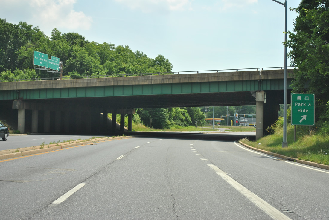
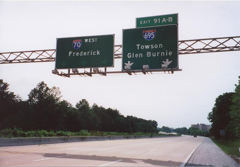
One mile ahead of the symmetrical stack interchange (Exit 91) with Interstate 695 on I-70 east. 08/04/13
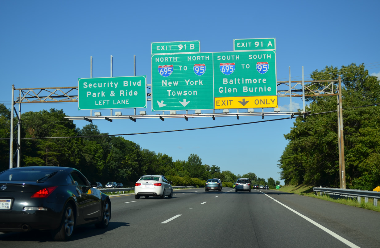
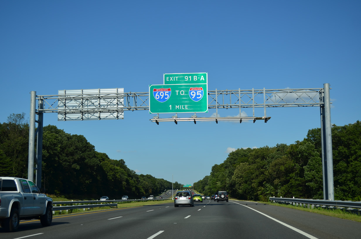
The right lanes of Interstate 70 default onto Exits 91A/B for the Baltimore Beltway. New York appears here for I-95 north along the JFK Memorial Highway. 08/04/13
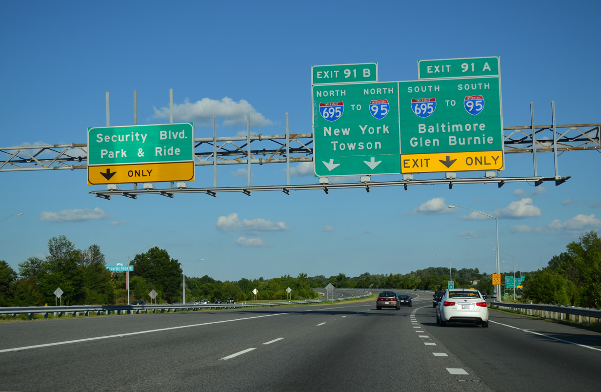
The mainline for I-70 reduces to a single lane for the final 1.95 miles leading to MD 122 (Security Boulevard) and the Park and Ride lot. 08/04/13
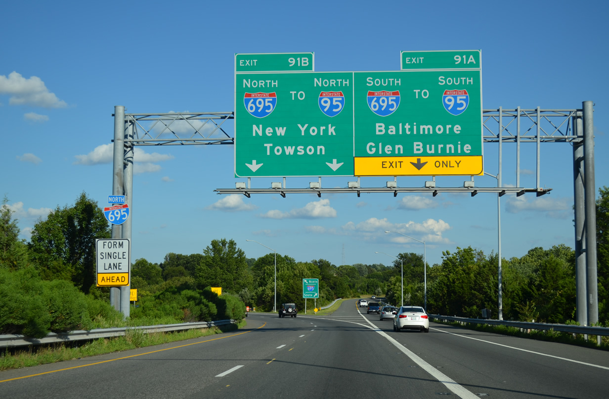
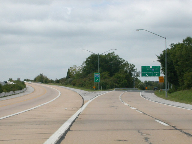
Exit 91 splits for I-695 north (inner) and south (outer) from Interstate 70 east. I-695 encircles the city of Baltimore through a myriad of suburbs including Towson, Pikesville, Essex, Glen Burnie and Dundalk. 08/04/13
![]() East at
East at ![]() / Park & Ride Lot
/ Park & Ride Lot
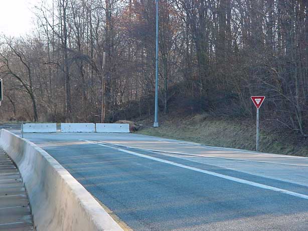
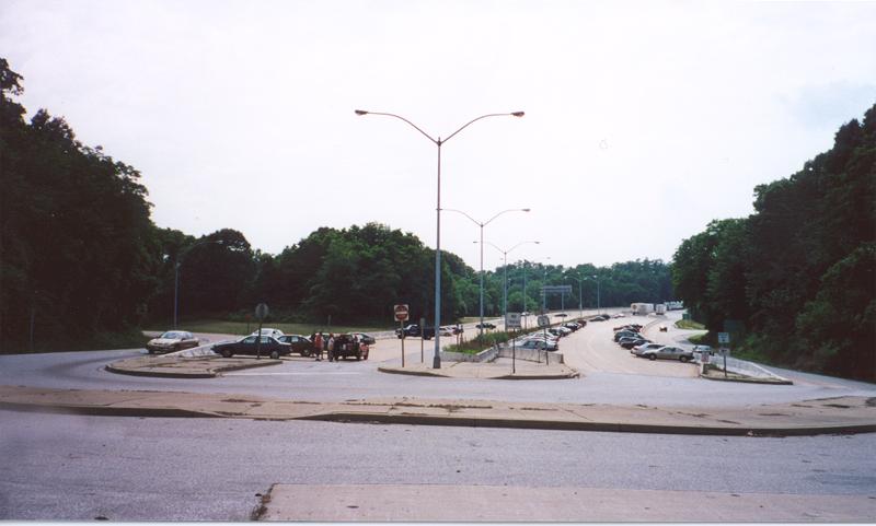
Interstate 70 extended 1.95 miles east of the Baltimore Beltway. Three eastbound lanes tapered down to two 1.25 miles from the freeway end. 06/01/04
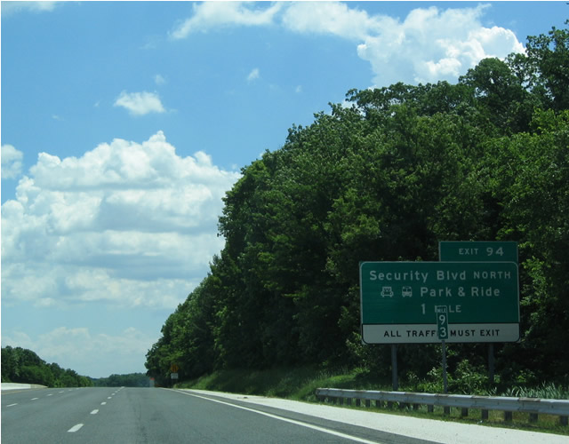
The final exit along eastbound Interstate 70 is Exit 94 for Security Boulevard (MD 122) west and Cooks Lane east to U.S. 40 (Edmondson Avenue). 06/01/04
A second end sign preceded the I-70 park and ride lot by one half mile. 06/01/04
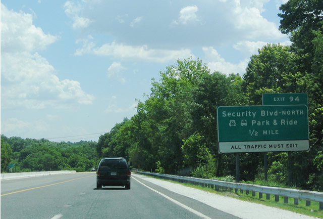
Traffic reduces to a single lane ahead of the loop ramp onto MD 122 (Security Boulevard) west. No ramp was built for Cooks Lane east into the city of Baltimore. 06/01/04
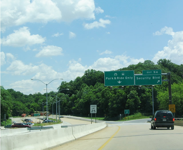
Gwynns Falls Park comes into view beyond the park and ride lot and departure of Exit 94 onto Security Boulevard north. 06/01/04
Beyond Exit 94, an access road loops through the park and ride area to the westbound beginning of Interstate 70. Photo by Tim Reichard (02/24/02).
A second loop was used for a bus stop. The roadway was later repurposed for the Gwynn Falls Trailhead. Photo by Tim Reichard (02/24/02).
06/17/00

Photo by Tim Reichard (02/24/02).
Concrete roadways built for Interstate 70 appear within the park and ride lot adjacent to Gwynns Falls Park.
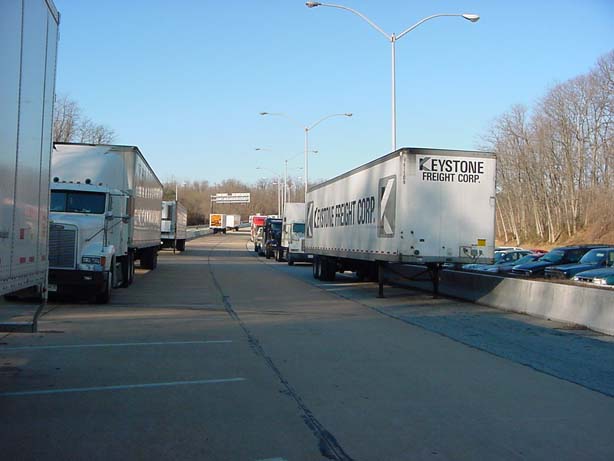
The park and ride lot occasionally doubles as a resting point for truckers and a storage area for trailers. Photo by Tim Reichard (02/24/02).
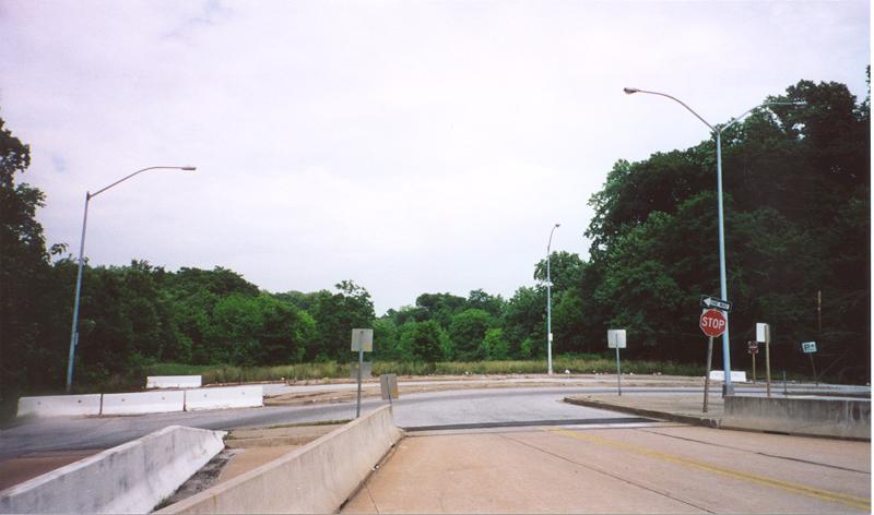
The planned mainline of I-70 was converted to a parking area while single lane collector distributor roadways served movements to and from MD 122 (Security Boulevard) and Ingleside Avenue. 06/17/00

A pair of shields directed motorists u-turning from the east end of the freeway onto I-70 west toward the Baltimore Beltway. 06/17/00
![]() Security Boulevard – East at
Security Boulevard – East at ![]()
Approaching Ingleside Avenue west and the parclo interchange with I-70 along MD 122 (Security Boulevard) east. 07/02/10
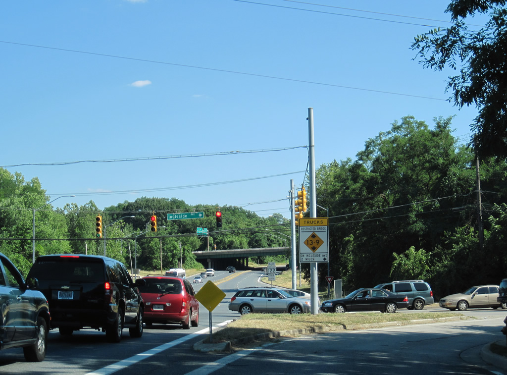
The westbound entrance ramp from MD 122 departs from Ingleside Avenue. Security Boulevard extends a short distance south to Forest Park Avenue west and Cooks Lane east to U.S. 40 in Baltimore. 07/02/10
A loop ramp provides access from MD 122 (Security Boulevard) east into the I-70 park and ride lot. 07/02/10
![]() West at
West at ![]()
Heading west from the Ingleside Avenue on-ramp, traffic partitions into two lanes for the Baltimore Beltway and a single through lane for Interstate 70. Originally three through lanes were striped here. 06/17/00
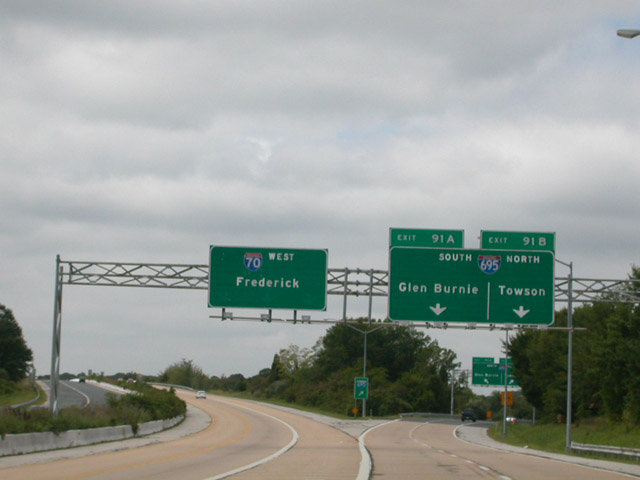
Replaced overhead signs for Interstate 695 at Exit 91. 48 miles separate the Beltway with the city of Frederick. Photo by Tim Reichard (09/01/02).
Leading away from Exit 91, I-70 runs across the top of the four-level interchange with Interstate 695. A three-lane entrance ramp follows from the Beltway. Photo by Tim Reichard (09/01/02).
Planned East End –  – southwest Baltimore, Maryland
The east end was originally intended connect with Interstate 95 in southwestern Baltimore. Adamant neighborhood opposition in the city resulted in the cancellation of the majority of I-70 through the city, resulting in the current stub end east of Interstate 695 and Security Blvd at a park and ride lot.
Eric from Baltimore writes:
Interstate 70 was supposed to run through Baltimore City and have it meet up with Interstate 95 just south of the Russell Street exit. This would be its ending point, thereby providing those of us living on the western end of the Baltimore Metro Area easy access to downtown. This would ease congestion on the western beltway along with The Jones Falls Expressway (JFX/Interstate 83) and Interstate 95. The plan was ultimately dropped because it would have cause so much destruction and would have caused immense amounts of horribly twisted local roads in Western Baltimore City.


A portion of the planned I-70 east to I-95 southbound flyover was constructed above Desoto Road along side Interstate 95. The northbound c/d roadway from Caton Avenue stays separated from the I-95 mainline to Washington Boulevard. The single lane viaduct includes an unused slip ramp to a stub built for unconstructed I-70 west from I-95 north. A second stub appears beside the off-ramp (Exit 51) to Washington Avenue. This section of roadway was leftover from the planned ramp between unbuilt I-70 east and I-95 north. 07/04/93; 10/14/01


West End – Cove Fort, Utah
![]() West at
West at ![]()
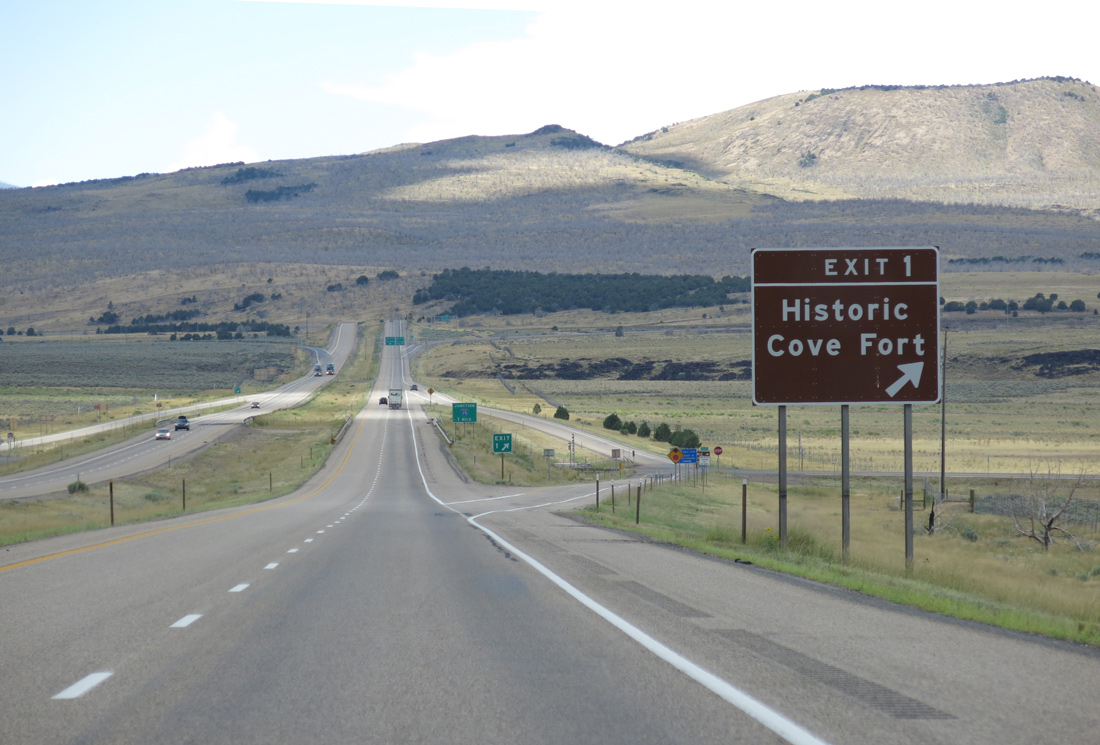
SR 161 links I-70 and Interstate 15 with historic Cove Fort. The state route follows old U.S. 91. The fort originated in 1867 as an outpost for weary pioneers traveling between Beaver and Fillmore. Created by Ira Hinckley at the request of Brigham Young, the settlement remained an attraction long after its duties came to an end. 08/17/13
I-15 meets Interstate 70 near the Millard and Beaver County line southwest of Cove Fort. The freeway replaced all of U.S. 91 from San Bernardino, California northward to Brigham City, Utah. The freeway joins Las Vegas with Salt Lake City along that stretch. 08/17/13
The final confirming marker for Interstate 70 westbound. 08/17/13
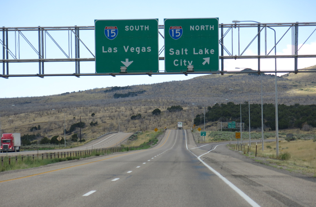
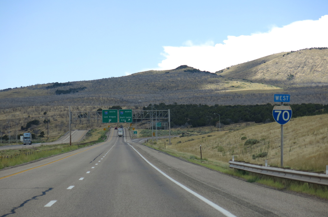
Entering the trumpet interchange with Interstate 15, an unnumbered ramp carries traffic north toward Provo and Salt Lake City, while the westbound mainline of I-70 defaults onto I-15 south. 08/17/13
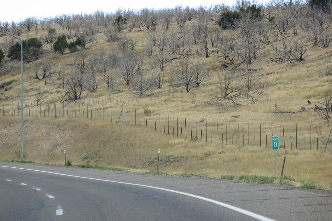
Milepost zero appears along the westbound ramp to Interstate 15 south. I-15 travels 19 miles southwest to Beaver, 73 miles to Cedar City and 124 miles to St. George. 08/17/13
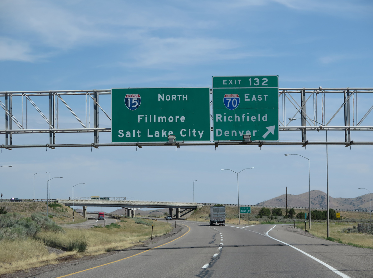
![]() North at
North at ![]()
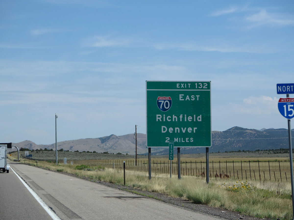
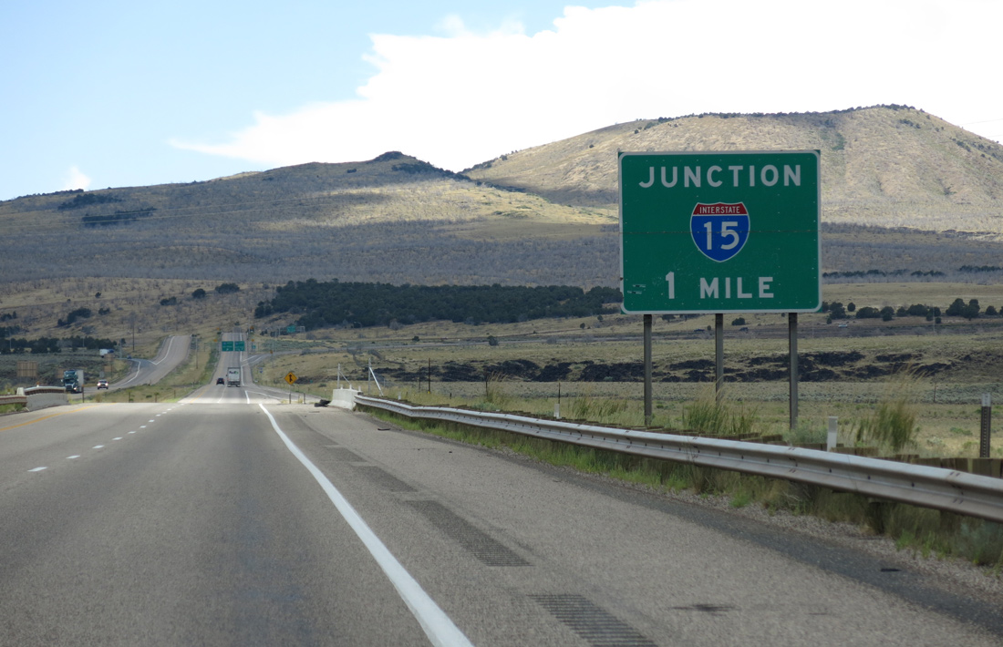
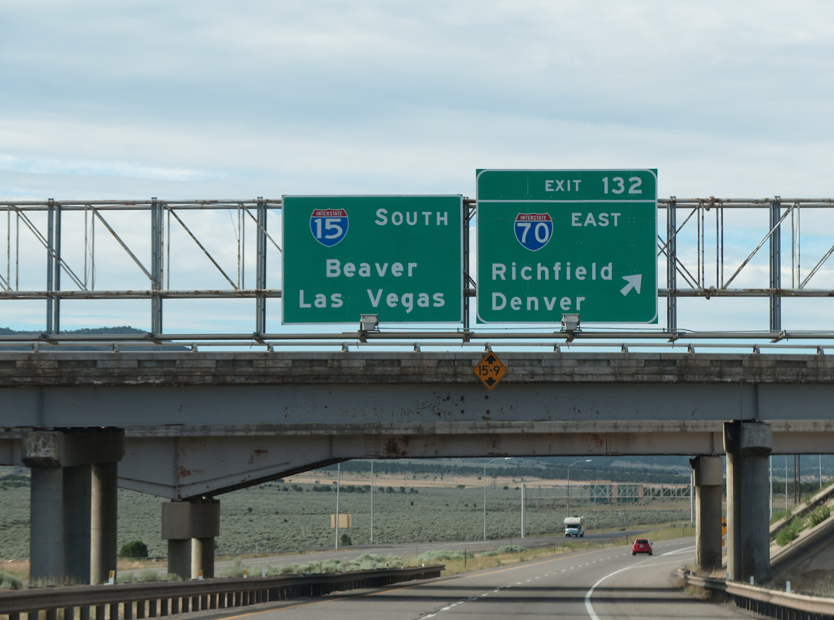
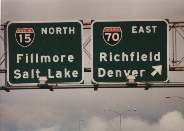
I-15 travels two miles north from Sulphurdale to Interstate 70 in southern Millard County. I-70 stems east from Exit 132 to Richfield, Salina, and Green River on its 232.15-mile course across the Beehive State. 08/09/14
One mile south of the trumpet interchange (Exit 132) with Interstate 70 east. I-70 provides the main connection from Southern California and Las Vegas to Denver, Colorado. The freeway reaches the Mile High City in 505 miles. 08/09/14
The exchange joining I-15 north with Interstate 70 east at Exit 132 was completed during the mid-1980s. 08/09/14
![]() South at
South at ![]()

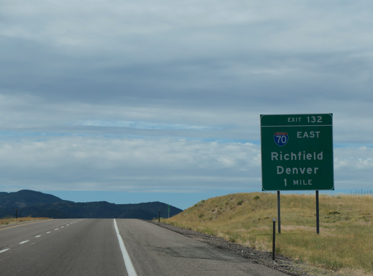
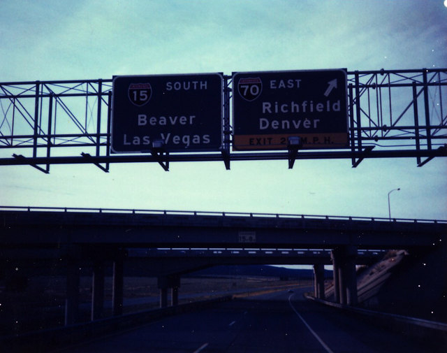
Two miles north of Interstate 70 east along I-15 south near Cove Fort. I-70 crosses the Pahvant Range nearby between Cove Fort and Sevier. The freeway then turns northeast toward Richfield and Salina before crossing the Fish Lake Mountains en route to Green River. 07/12/15
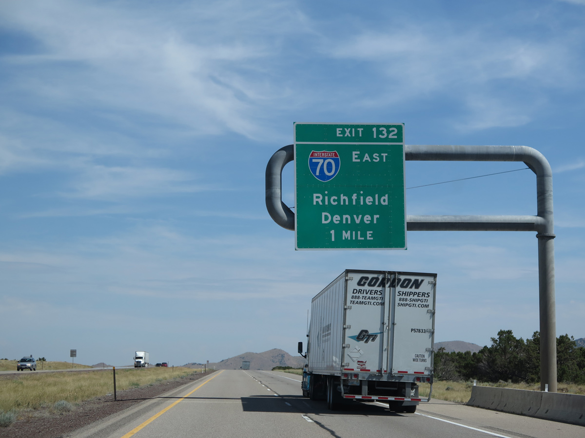
One mile out from the trumpet interchange (Exit 132) with I-70 east on I-15 south. Interstate 70 serves a vastly unpopulated swath of eastern Utah on the 257 mile drive to Grand Junction, Colorado. 07/12/15
Exit 132 loops away from I-15 south onto Interstate 70 east. I-70 follows U.S. 89 between Sevier and Richfield and U.S. 50 from Richfield to Grand Junction, Colorado. 07/12/15
![]() East
East

The zero milepost for Interstate 70 in Utah stands along the connecting ramp from northbound I-15. Photo by Chris Elbert (07/31/05).
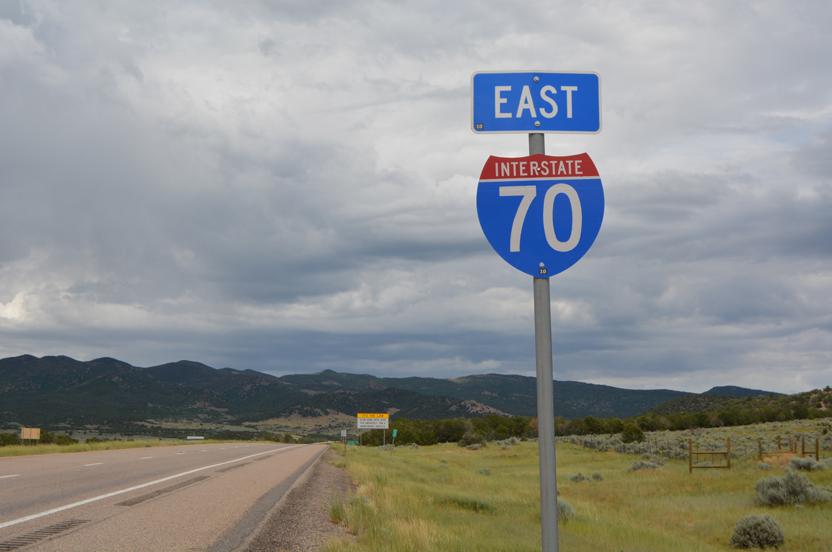
The first shield for Interstate 70 appears east of SR 161 and Cove Fort. I-70 traverses remote areas of Utah and the Great Basin en route to Grand Junction and Denver, Colorado. 07/03/16
West End Throwback
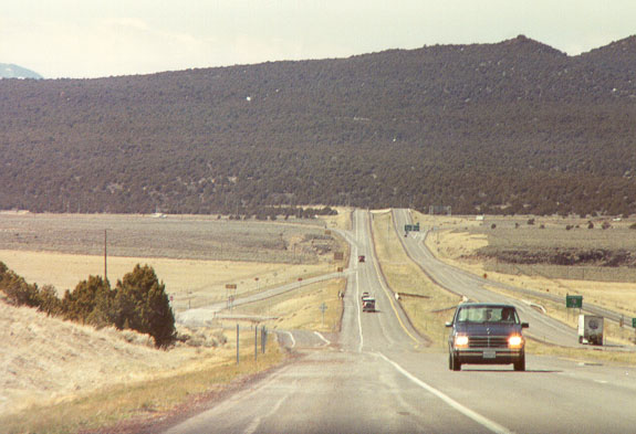
With the Mineral Mountains onlooking, the final mile of Interstate 70 as seen from the eastbound shoulder within the diamond interchange (Exit 1) at SR 161. Photo by Chris P (1990).
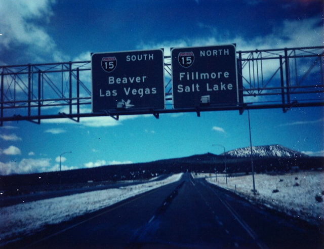
Vintage button copy overheads posted at the partition of I-70 west into ramps for Interstate 15. Local control points, the Millard County Seat of Fillmore to the north and the Beaver County Seat by the same name to the south, were used in addition to the regional destinations of Las Vegas and Salt Lake City. Photo by Michael Summa (1984).
Original signage along Interstate 15 north at I-70 east. Seat of Sevier County, the town of Richfield represents the first population center along Interstate 70, 40 miles away. Photo by Michael Summa (1986).
Original button copy signs posted at the unnumbered loop ramp to I-70 east from I-15 south. The pull-through panel, including the secondary control point of Beaver, remained in use until 2005. Photo by Michael Summa (1983).
Sources:
- “This Mousetrap wasn’t a snap, but after 17 years, project at I-70, I-25 has reached a close,” by Kevin Flynn, Rocky Mountain News, December 16, 2003.
- “I-70 shift gains support: Rerouting interstate hailed as efficient way to move traffic,” by Kevin Flynn, Rocky Mountain News, September 28, 2004.
- Why Does the Interstate Highway System Include Toll Facilities? from the official Federal Highway Administration web page.
- “Interstate Alignment Shifted To Allow Runway Expansion”,
http://www.enr.com/news/ transportation/archives/050103.aspEngineering News-Record, 01/03/2005. - Ohio Interstate Highway System Historical Timeline.
http://www.dot.state.oh.us/interstate50/OhioInterstateHistoryTimeline.htmOhio Department of Transportation (ODOT) Official Site - I-70/I-71 South Innerbelt Corridor Study.
http://www.dot.state.oh.us/7071study/official site - Kansas Interstate 50th Anniversary
- Missouri Interstate 50th Anniversary web page
- Celebrating the 50th Anniversary of the Eisenhower Interstate Highway System: Previous Interstate Facts of the Day by the Federal Highway Administration (FHWA).
- Ask the Rambler: Why Does I-70 End in Cove Fort, Utah?
- Eagle Canyon Bridge (EB). BridgeHunter.com.
- New Mississippi River Bridge Project home page.
http://newriverbridge.org/overview-intro.html - Colorado Highways: Interstate 70, Matthew E. Salek.
http://www.mesalek.com/colo/i70.html - Kansas Turnpike Bridges. Wikipedia.
- “1966 in Review – “A Look Back at Hays,” Oct.” The Hays Daily News (KS), October 1, 1999.
- “Last leg of Interstate 70 completed.” Sun Journal (Lewiston, ME), October 15, 1992.
- “Plan takes I-70 out of Downtown.” Columbus Dispatch (OH), February 7, 2004.
- EB I-70 Peak Period Shoulder Lane (PPSL) fact sheet. Colorado Department of Transportation.
- Interstate 70 – Construction Timeline. Colorado Department of Transportation, 50th Anniverary of the Interstate System web page.
- “I-70 tunnel plan in Denver open for public review this week.” The Denver Post (CO), September 22, 2014.
- “Federal Highway Administration Approves I-70 Project.” CBS 4 Denver (CO), January 19, 2017.
- “Feds sign off on $1.2B plan to lower, cover part of I-70 in Denver.” Denver7 ABC, January 19, 2017.
- “Illinois Schedules Its Largest Highway Building Program.” Chicago Tribune (IL), February 16, 1969.
Page updated June 3, 2022.