Interstate 68
Overview
Designated in October 1989 and fully opened in 1992, Interstate 68 replaced the second definition of U.S. 48 along the National Freeway in northeast West Virginia and across the panhandle of Maryland between I-79 and I-70. The route provides an alternative to I-70 for traffic headed between Baltimore and Washington, and southwestern Pennsylvania and Ohio.
The National Freeway was developed as part of the Appalachian Regional Development Act of 1965 to support economic growth. The route also enhances tourism and recreation opportunities for residents of the Baltimore-Washington metropolitan area.5
Western Extension
An extension of Interstate 68 west from Morgantown to Wheeling via Moundsville, West Virginia was discussed in September 2000. 26 alternative routes, including a north to south route along U.S. 250 from Hundred to Fairmont via Mannington, for I-68 were presented by the WV 2/Interstate 68 Authority, but no final routing was determined. The WV 2/Interstate 68 Authority was created by the West Virginia State Legislature in 1997 with two mandates: focus on widening WV 2 from Parkersburg to Chester and extend I-68 westward to the Ohio River.
Further developments in lengthening I-68 occurred with an announcement by West Virginia Governor Bob Wise on September 9, 2003 that the Federal Highway Administration (FHWA) approved the Interstate 68 extension for inclusion into the National Highway System (the addition was eventually applied to just U.S. 250). With origins dating back to 1986, the plan included a 73 mile long route between Morgantown and Moundsville. Including County Route 19/24, U.S. 19, WV 7 and U.S. 250, the roadway was reclassified as part of the State Principal Arterial System.2 Year 2000 forecasts listed the proposed cost at about $654 million, with later figures increasing to $1 billion. The I-68 Boosters, joining the WV 2/Interstate 68 Authority, obtained over 20,000 signatures on a petition stating support for the highway. Additionally public meetings were conducted in Marion, Marshall, Monongalia and Wetzel Counties during 2000 and 2001 to garner input and opinions on the highway.2
A meeting of northern West Virginia Panhandle area county commissioners, mayors and house of delegate members held on September 15, 2014 involved discussion of widening WV 2 along the Ohio River to four lanes and extending Interstate 68 west to Cameron and then Moundsville. Supporters of the upgrades cited possible new ventures for the oil and gas industry in the area. Costs were estimated at least $5 million per mile for new freeway construction.3
 Parallel U.S. Routes
Interstate 68 was originally constructed as U.S. 48, and U.S. 48 was decommissioned once the freeway was complete and accepted into the Interstate Highway System. A portion of I-68 east of Cumberland parallels U.S. 40.
History
The histories of both Interstate 68 and I-97 are tied together. Maryland originally applied to the American Association of State Highway and Transportation Officials (AASHTO) for adding the designation of Interstate 68 to the freeway along U.S. 50 (John Hanson Highway) east from the Capital Beltway (I-495) to a point west of Annapolis on November 15, 1975. AASHTO conditionally approved the western reaches of the route as Interstate 197 while approving the remainder east toward Annapolis and the eventual alignment of I-97 north to I-695 outside Baltimore as Interstate 97.
Route Information
West Virginia – 32.06
Cities – Morgantown
- Junctions –

Maryland – 81.09
Cities – Frostburg, Cumberland, Hancock
- Junctions –
Source: December 31, 2021 Interstate Route Log and Finders List
I-68 Annual Average Daily Traffic (AADT)
Source: Statewide Traffic Volume 2012-16 AADT (WVDOT)
MDOT SHA Traffic Volume County Maps 2018 AADT
U.S. 48 between Morgantown and Cumberland was the second entry of U.S. 48 posted across the U.S. The 1926-34 route joined the San Francisco Bay area in California with the Central Valley. The newest corridor was established in 2002 along Corridor H, an expressway route from Elkins, West Virginia to I-81 near Strasburg, Virginia.
The next change took place in 1981, with Maryland again opting to redesignate U.S. 50 between the Capital Beltway and the Annapolis area as Interstate 68. The request specified replacing the east to west leg of I-97 and the previously approved I-197 alignment along the John Hanson Highway with I-68. AASHTO withheld action on this request at their meeting on June 25th of that year. The request was altered with I-68 proposed to replace the east to west leg of I-97 and Interstate 168 over I-197. This was approved on October 3, 1981 but subjected to FHWA concurrence.
A third request went to AASHTO on June 7, 1989, with Maryland opting both to renumber I-68 along the U.S. 50 freeway as Interstate 595 and applying I-68 instead to the route of U.S. 48 between I-79 near Morgantown, West Virginia and I-70 at Hancock, Maryland. This too was subject to FHWA concurrence and ultimately approved.
The westernmost reaches of the National Freeway appeared on the 1966 Maryland Official Highway Map as the Appalachia Corridor east from the West Virginia state line to MD 53 outside Cumberland. The viaduct through Cumberland was already under construction at this time. The National Freeway from MD 658 (Exit 40) to Naves Cross Road (Exit 46) opened by 1972. The route was under construction from Keyers Ridge westward. The 1973 edition of the state map showed the National Freeway extended west from Exit 40 to MD 36 (Exit 34) at Frostburg.
U.S. 48 first appears along the National Freeway in 1974, with more of the route opened west to MD 546 at Exit 29. The 1976 state map showed U.S. 48 open west from U.S. 219 into West Virginia. All of the route west from Cumberland was completed the following year.
Work further east included completion of the 4.5 mile long Sideling Hill Cut segment, which opened initially on August 15, 1985 and fully (8.7 miles) by 1986.5 Signs for Interstate 68 replaced those for U.S. 48 after the August 2, 1991 opening of the 19 mile stretch of freeway from east of Cumberland to Green Ridge. This incorporated the stretch of U.S. 40 over Martin Mountain completed in 1957. Construction on the $182 million “missing link” started in May 1987 with a project divided into five sections.4
Included as Appalachian Corridor E, I-68 within the Mountaineer State was initially constructed between 1970 and 1976 at a cost of $113 million.1 The rest of the road was upgraded to Interstate standards by 1992.
 Photo Guides
East End 
 – Hancock, Maryland
![]()
![]() East at
East at ![]()
![]()
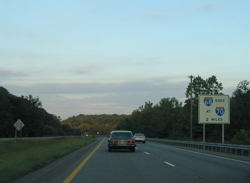
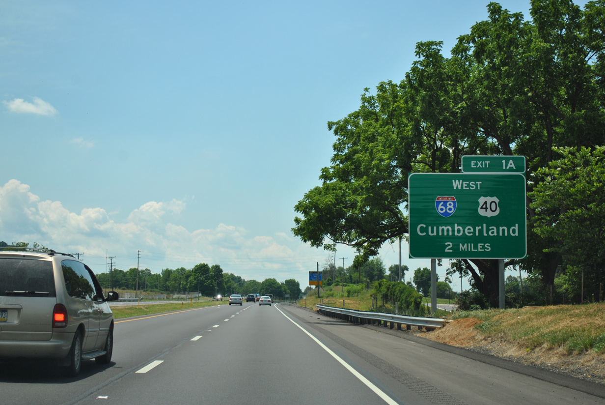
An end sign for Interstate 68 stands two miles ahead of the three-wye interchange with I-70. 08/07/04
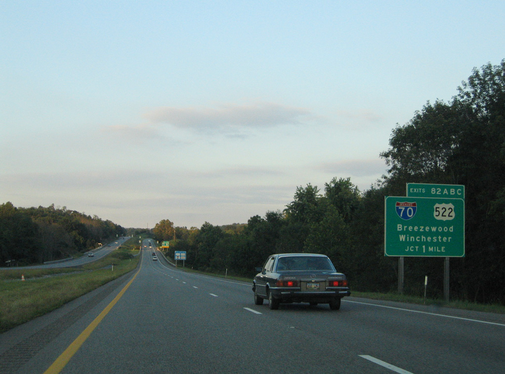
I-68/U.S. 40 cross over Creek Road just north of the Hancock town limits. Forthcoming U.S. 522 runs south from I-70/U.S. 40 by the Hancock business district to cross the Potomac River into West Virginia. 08/07/04
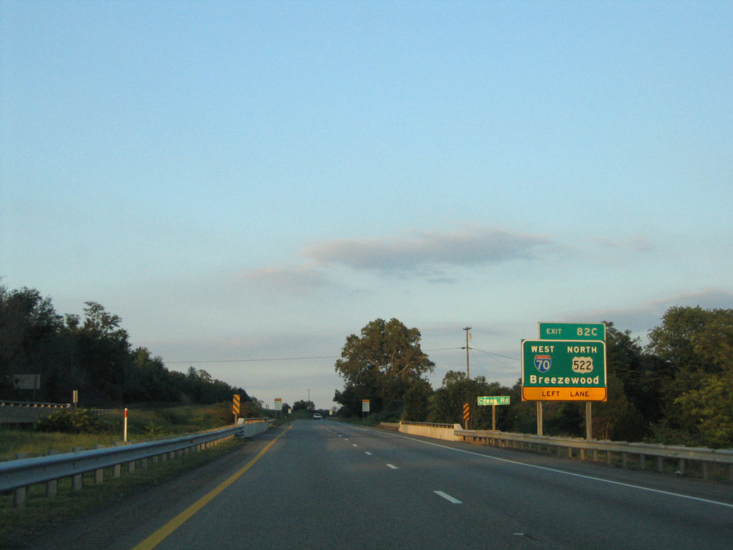
Left Exit 82C connects I-68/U.S. 40 east with I-70 west to Breezewood and U.S. 522 north to McConnellsburg, Pennsylvania. Breezewood, where I-70 joins the PA Turnpike (I-76), lies 25 miles away. 08/07/04
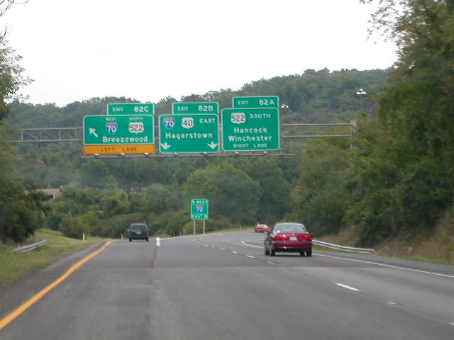
Two lanes continue east onto Interstate 70/U.S. 40 east toward Hagerstown (Exit 82B) as Exit 82C branches northward into Bethel Townhip, Pennsylvania. The city of Hagerstown and I-81 are 26 miles to the east. Photo taken by Tim Reichard (08/25/02).
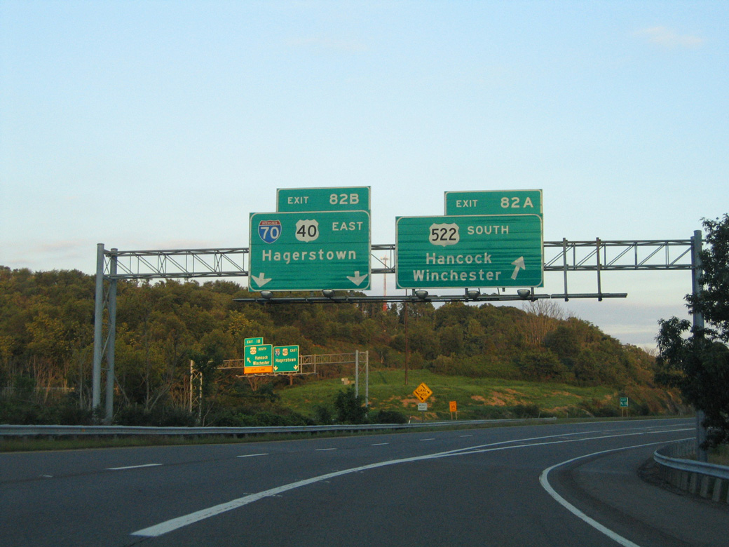
Exit 82A separates from the ramp to I-70 east for the adjacent departure of U.S. 522 south to Hancock and Berkeley Springs, West Virginia. 08/07/04
![]() East
East ![]() South at
South at ![]()
![]()
Heading south from Warfordsburg, Pennsylvania to the west of Cove Ridge, I-70 east and U.S. 522 advance two miles south to I-68/U.S. 40 west. Buck Valley Road parallels the freeway to the west along former U.S. 522. 06/24/12
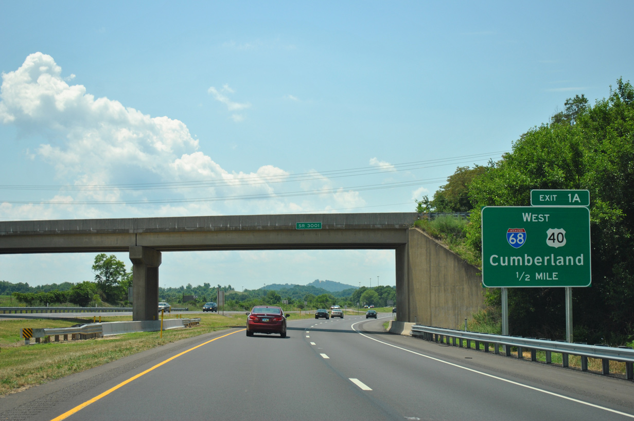
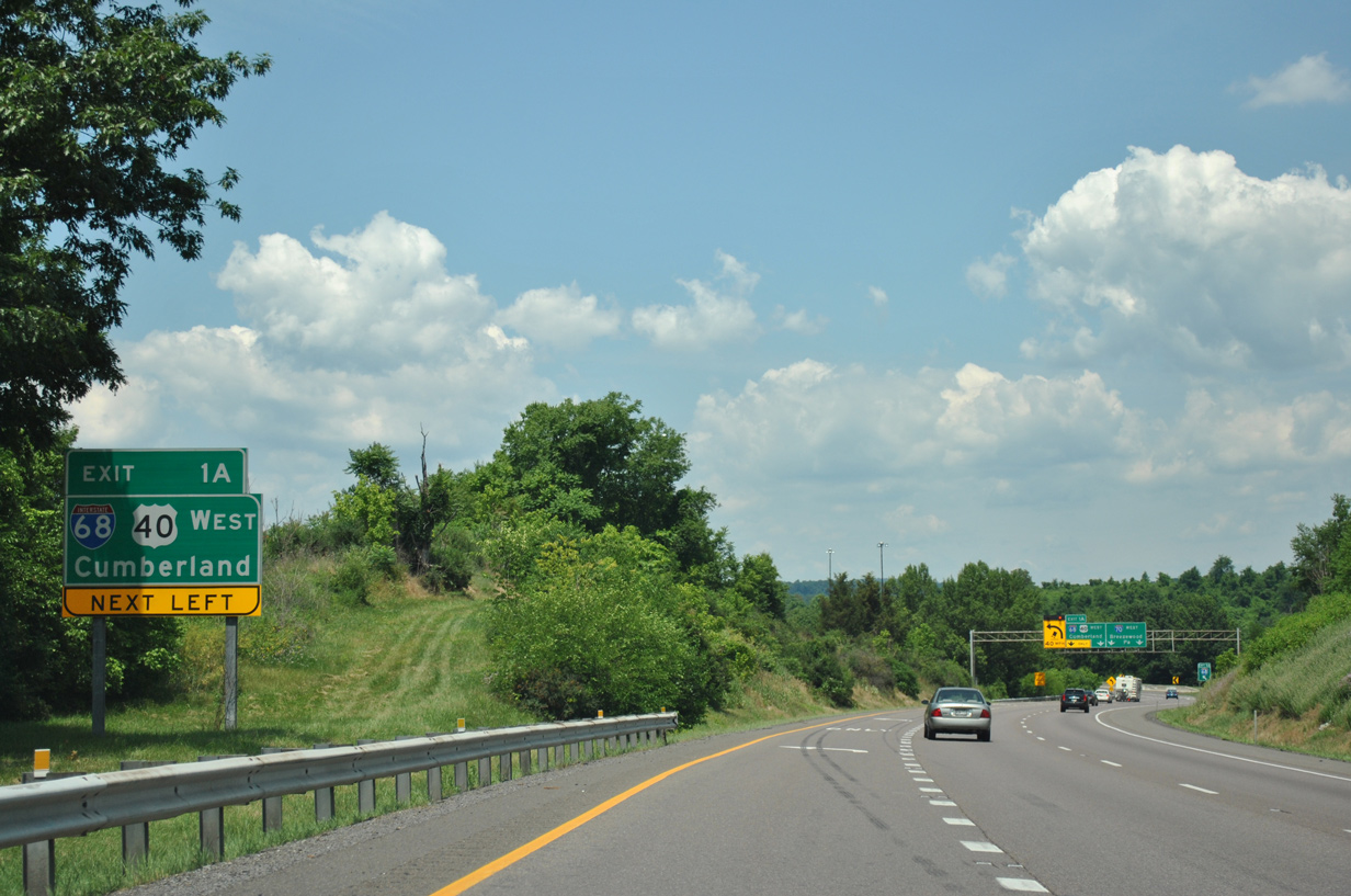
SR 3001 (old U.S. 522) passes over I-70 east / U.S. 522 south, one half mile north of the directional T interchange (Exit 1A) with Interstate 68/U.S. 40 west. 06/24/12
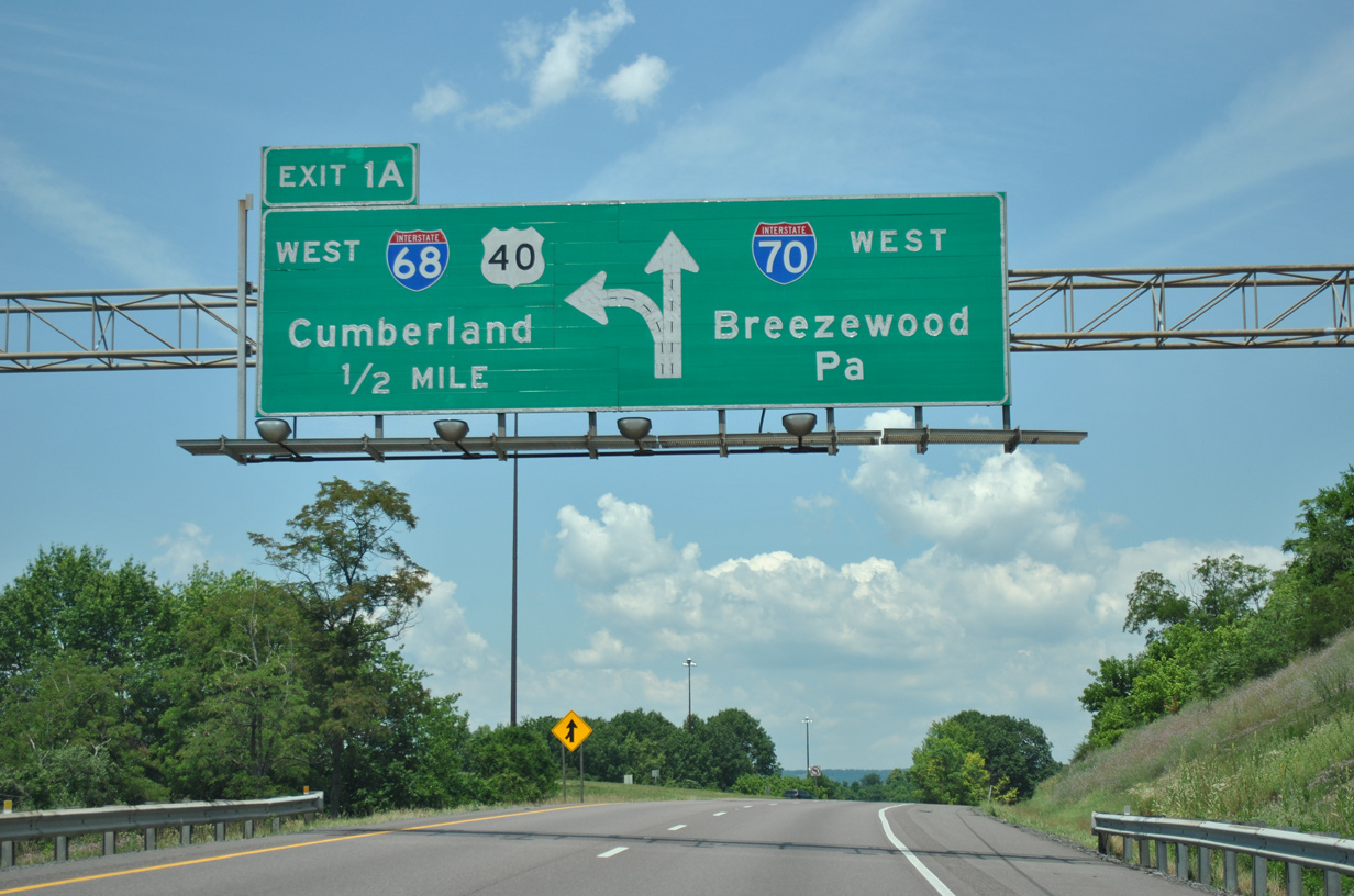
Exit 1A departs from I-70 east just beyond the Maryland state line. Interstate 68 winds west across Tonoloway Ridge and Sideling Hill over the next ten miles. The freeway passes through s a 340-foot deep rock cut across Sideling Hill.5 06/24/12
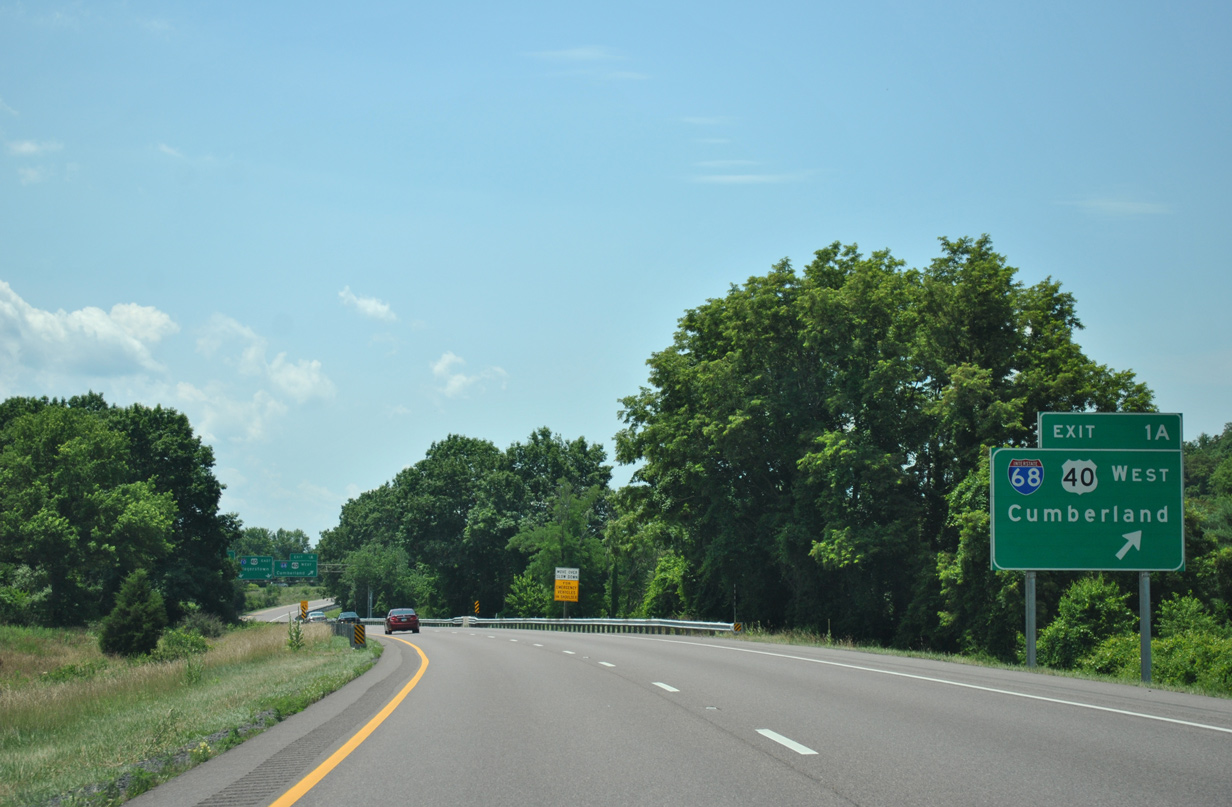
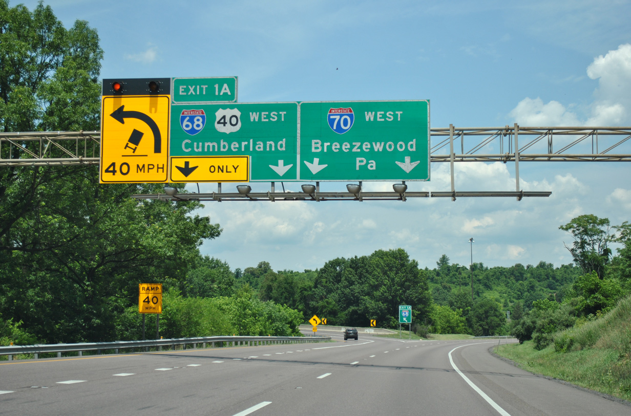
A single lane ramp leaves I-70 east and U.S. 522 south for I-68/U.S. 40 west at Exit 1A. U.S. 522 splits with I-70 to the immediate south via Left Exit 1B while U.S. 40 merges onto I-70 east to Exit 9 near Ernstville. 06/24/12
![]()
![]() West at
West at ![]()
![]()
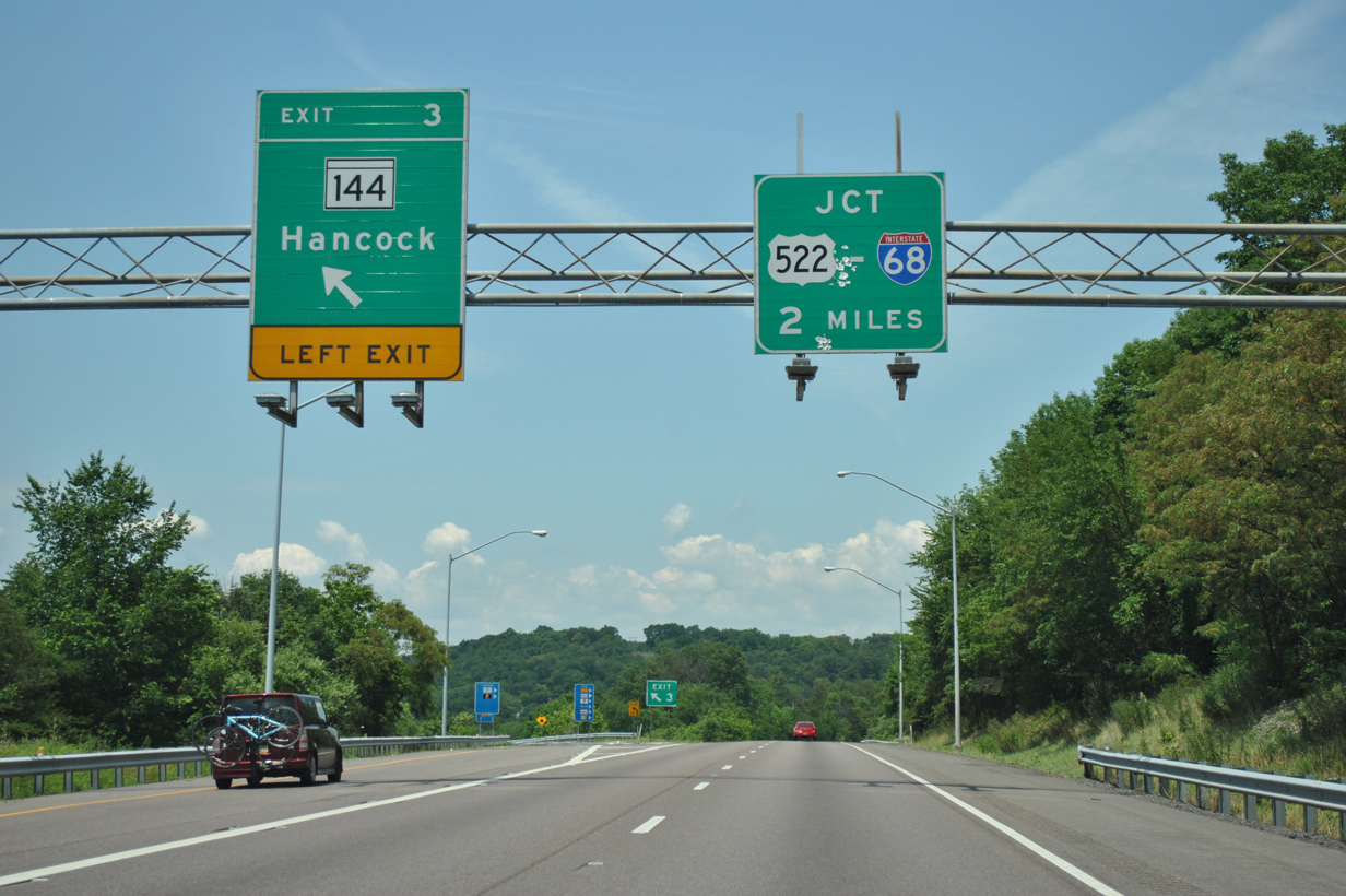
The first guide sign for Interstate 68 on I-70/US 40 west appears at Exit 3 for MD 144. MD 144 follows the original alignment of U.S. 40, which parallels I-68 for the first four miles. 06/24/12
A left side entrance ramp brings U.S. 522 north onto Interstate 70 west just ahead of the separation with I-68/U.S. 40 west at Exit 1A. U.S. 522 combines with I-70 for 3.4 miles to Warfordsburg, Pennsylvania (Exit 168). 06/24/12
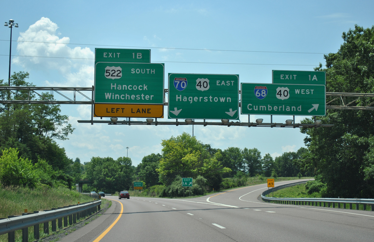
Interstate 68/U.S. 40 west depart with two lanes via Left Exit 1A immediately north of the directional T interchange with U.S. 522 at Hancock. 06/24/12
Interstate 68 travels 36 miles west from I-70/U.S. 522 to Cumberland and 107 miles to Morgantown, West Virginia. 06/24/12
![]()
![]() West
West
Tonoloway Ridge and Sideling Hill appear along the western horizon as Interstate 68 begins westbound. 06/24/12
East End Throwback
Replaced guide sign for I-68/U.S. 40 west, posted two miles north in Fulton County, Pennsylvania. Photo by Steve Hanudel (08/12/05).
This sign for I-68 was replaced after 2009. I-68 and U.S. 40 overlap along the National Freeway westward to Exit 14 near Keysers Ridge. Photo by Steve Hanudel (08/12/05).
West End – Morgantown, West Virginia
![]() West at
West at ![]()
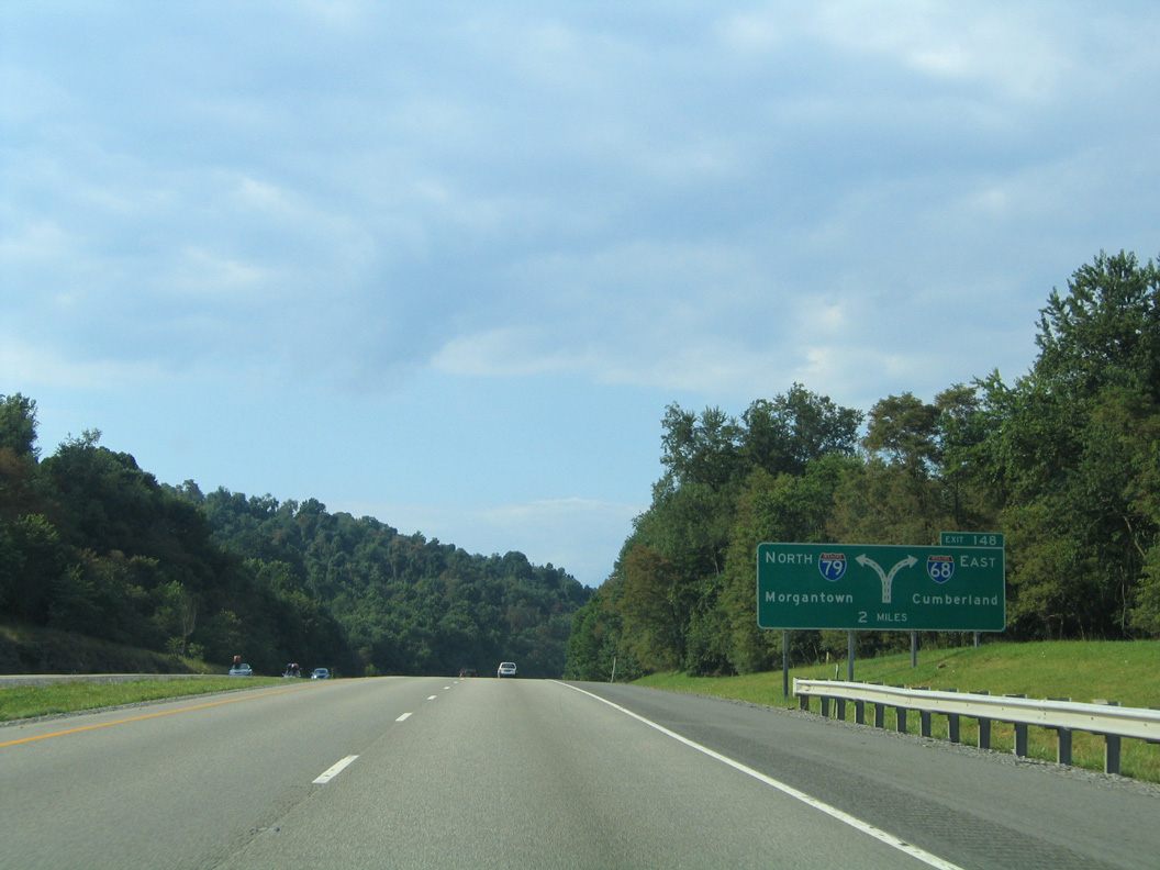
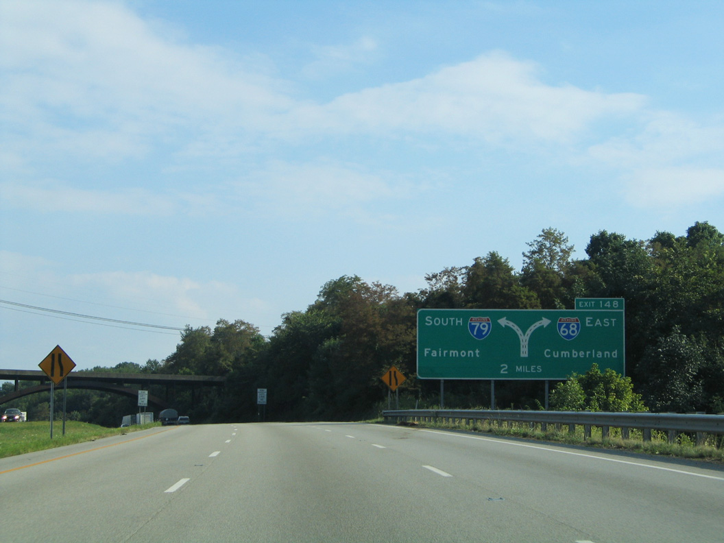
The initial sign for Interstate 79 appears along I-68 westbound across a valley fed by Cabun Creek, east of U.S. 119 (Exit 1). 06/24/12
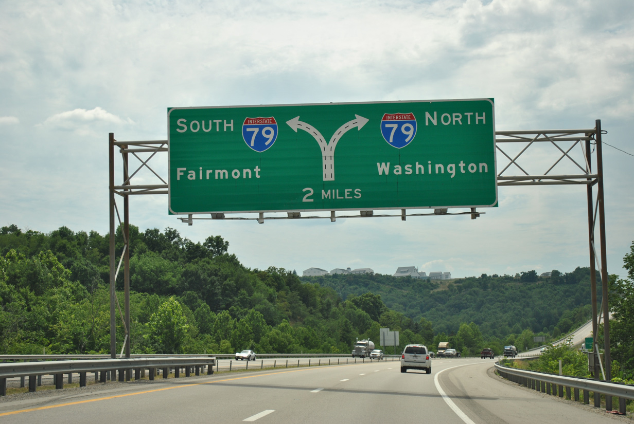
Interstate 68 meets U.S. 119 at a folded diamond interchange just one mile to the east of the directional T interchange with I-79. 06/24/12
A third westbound lane accompanies I-68 west from U.S. 119 to the end at I-79. Fairmont is nine miles to the south, with the capital city of Charleston another 140 miles further southwest. 06/24/12
An end shield for Interstate 68 was added at the ramp separation for I-79 after 2008. Washington, Pennsylvania, where I-79 converges with Interstate 70, is 46 miles to the north. 06/24/12
![]() North at
North at ![]()
Leading toward Interstate 68 east, I-79 makes a series of S-curves along a valley paralleling Booths Creek. 08/07/04
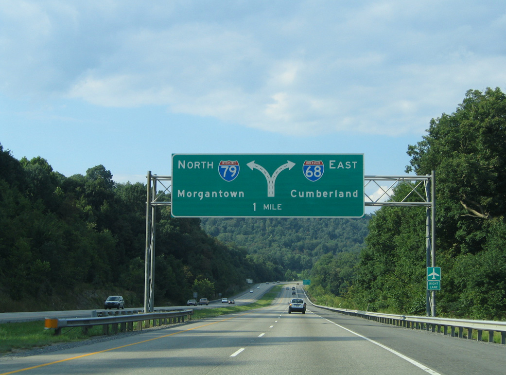
Interstate 68 branches northeast from I-79 in one mile to Brookhaven and Morgantown Municipal Airport (MGW). 08/07/04
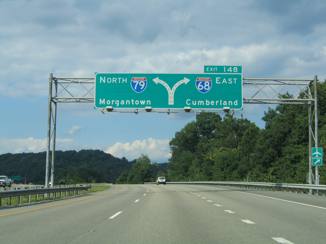
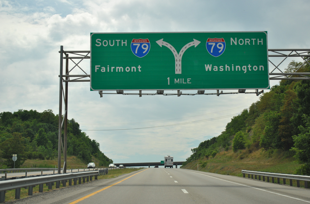
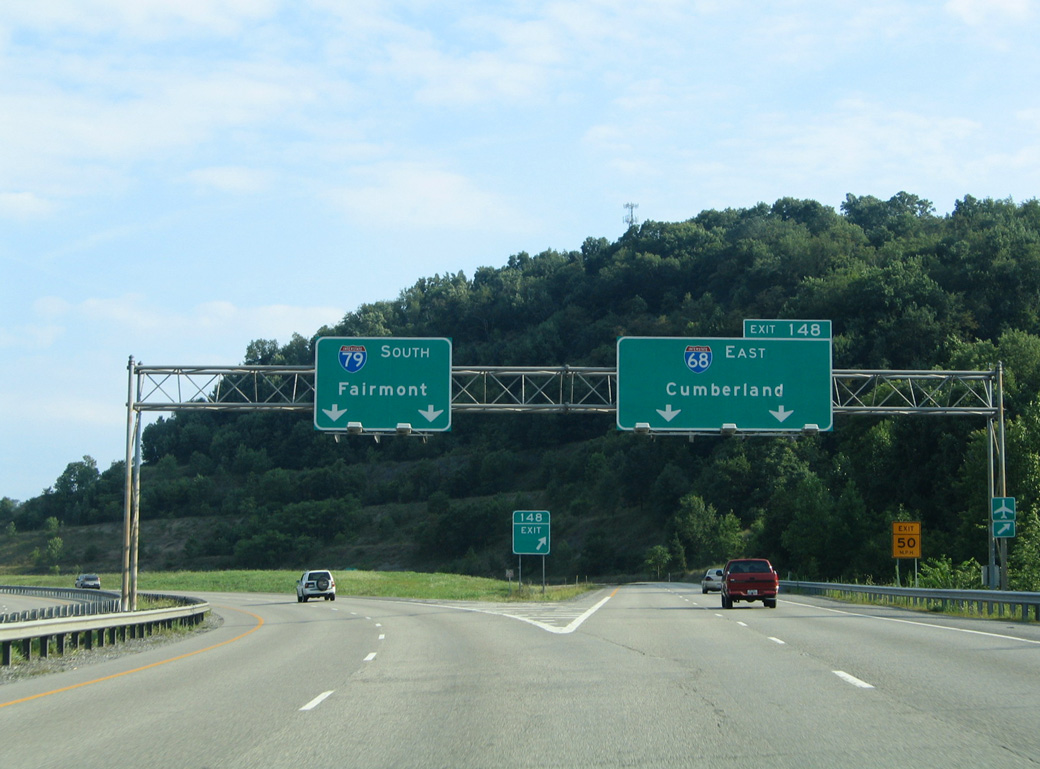
An additional lane opens along I-79 north to the two-lane off-ramp (Exit 148) for Interstate 68 east. I-68 reaches Cumberland, Maryland in 75 miles. 08/07/04
Interstate 79 north separates with I-68 east. Both freeways serve Morgantown over the next seven miles. 08/07/04
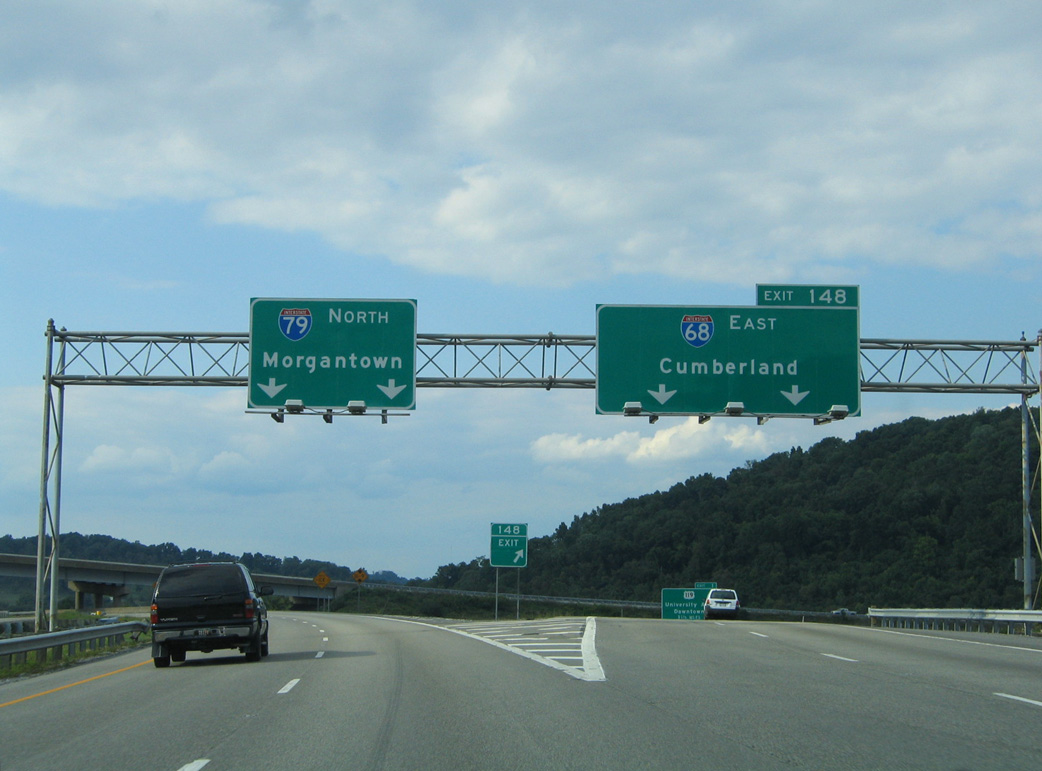
![]() South at
South at ![]()
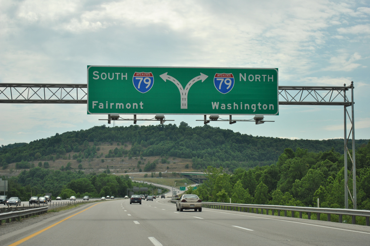
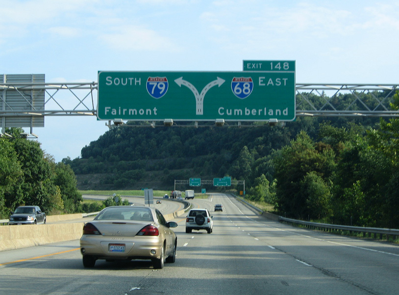
Passing through the Harmony Grove community, Interstate 79 shifts southeast on the two mile approach to I-68. 08/07/04
I-79 lowers to span the Monongahela River ahead of the two-lane ramp (Exit 148) for Interstate 68. 08/07/04
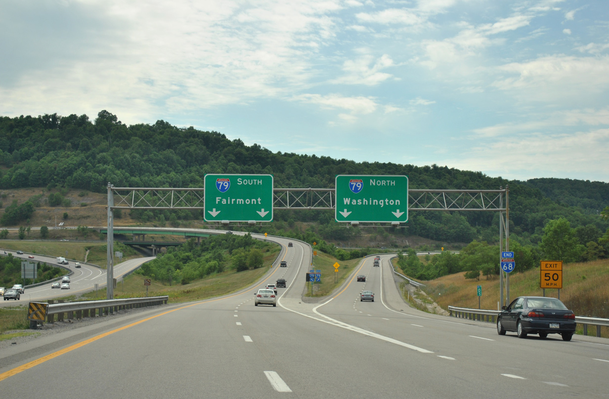
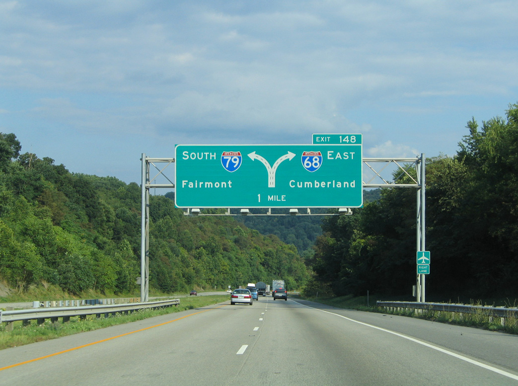
A third diagrammatic sign precedes the departure of Exit 148 for I-68 east. Interstate 68 encircles the south side of Morgantown to Cheat Lake, ten miles to the east. 08/07/04
Exit 148 takes travelers east onto Interstate 68 as part of a long distance route from Ohio and Southwestern Pennsylvania to Baltimore and Washington. 08/07/04
Sources:
- “I-68 Extension Gets Important Federal Endorsement.” WTOV-9 September 9, 2003.
- “Proposed I-68 Project Will Become Eligible for Federal Funding.” Wheeling News-Register (WV), September 10, 2003.
- “Plans Moving Forward for Moundsville-to-Morgantown Highway.” The State Journal, September 15, 2014.
- “Western Md. thumbs for a ride to prosperity along Interstate 68.” The Sun (Baltimore, MD), July 28, 1991.
- Economic Development History of Interstate 68 in Maryland, FWHA web site, Office of Planning, Environment, & Realty (HEP).
Page updated January 27, 2020.