Interstate 64
Overview
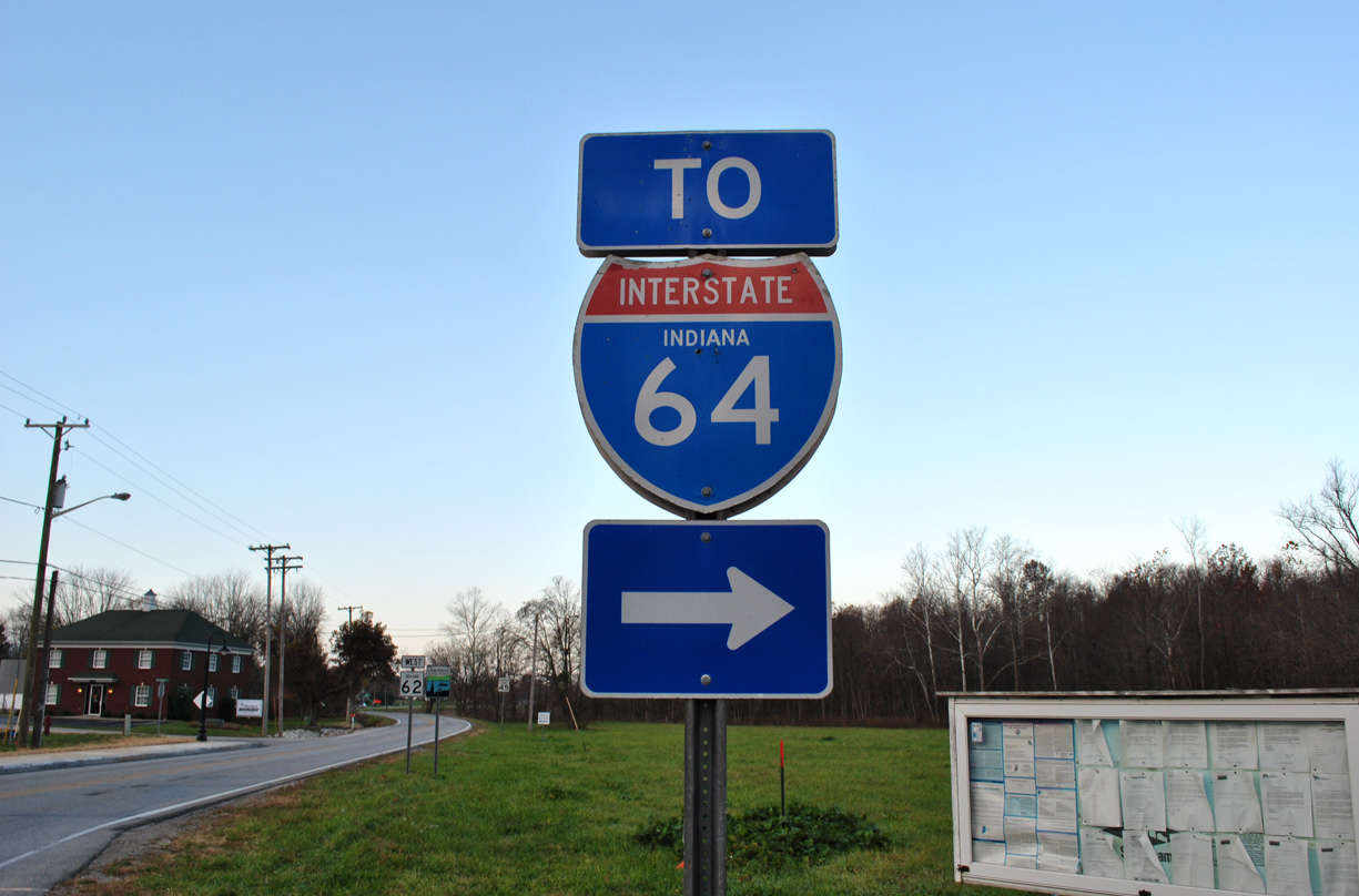
Interstate 64 travels east from the St. Louis metropolitan area in the Midwestern U.S. to Hampton Roads, Virginia along the East Coast. Along the corridor, I-64 joins Mount Vernon, Illinois with Evansville, Indiana; Louisville, Kentucky; Charleston, West Virginia and Richmond, Virginia.
Interstate 64 doubles as the southernmost extent of the Avenue of the Saints corridor between Wentzville and Lindbergh Boulevard (U.S. 61) at Ladue. Although the majority of the Avenue of the Saints corridor north of I-64 and I-70 consists of four lane, divided highway or expressway, it is not an Interstate route. The corridor extends from the St. Louis area to Hannibal, Iowa City, Iowa and ultimately St. Paul, Minnesota.
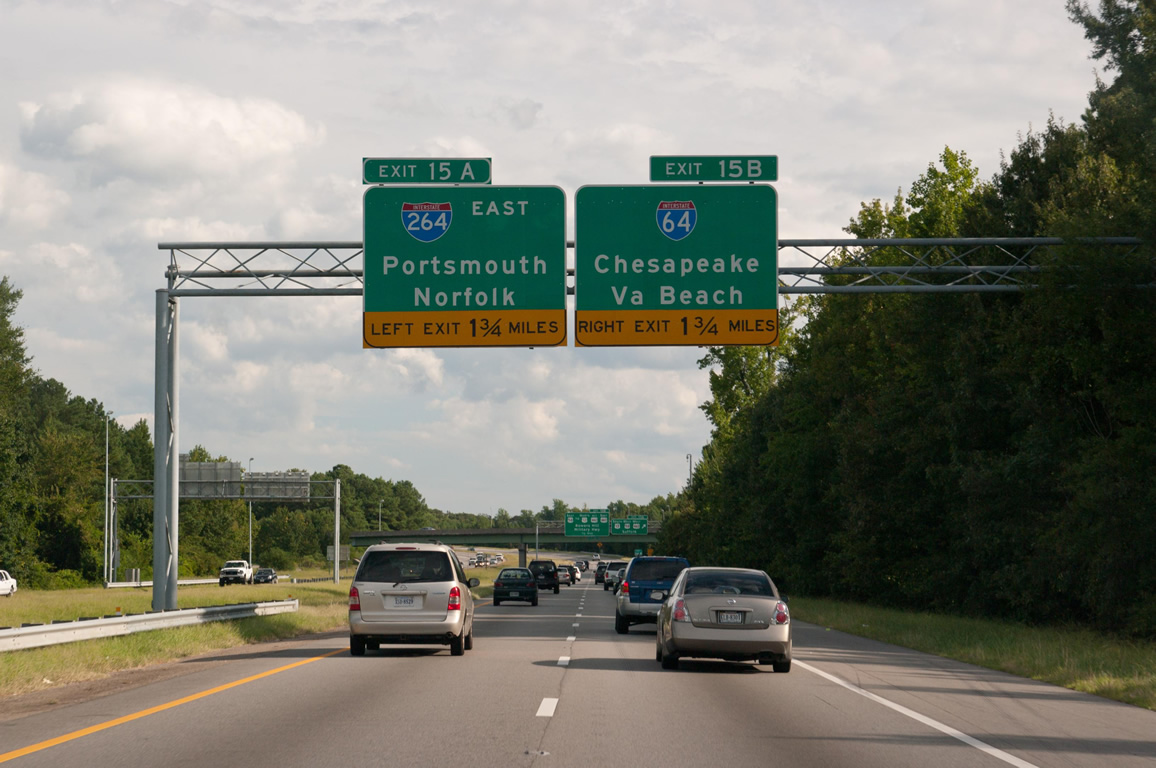
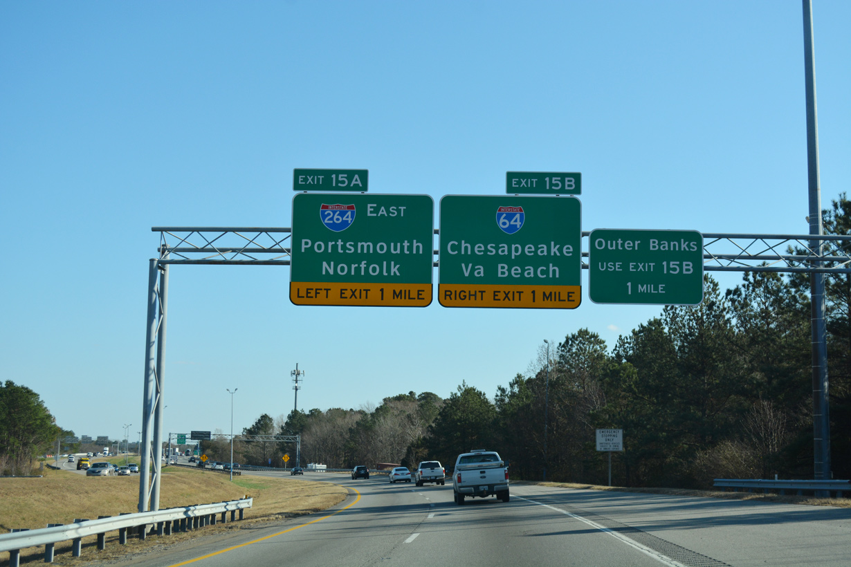
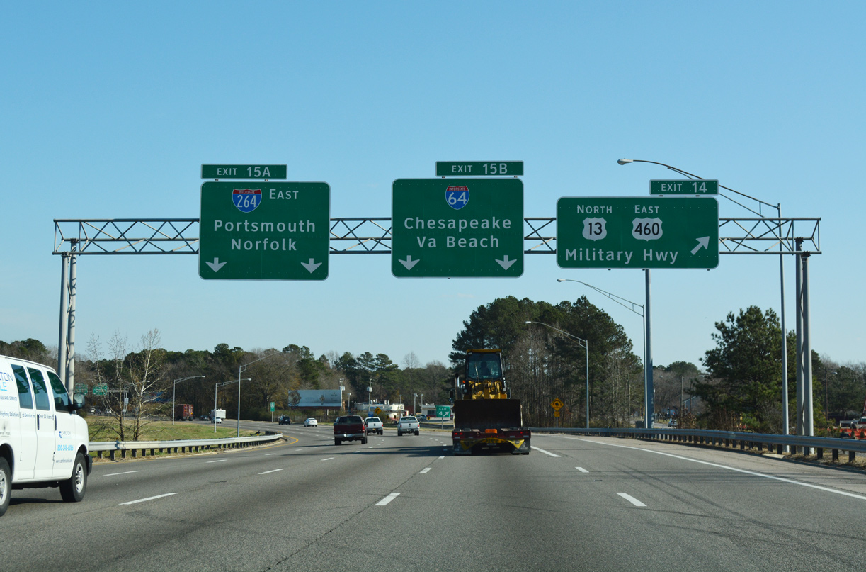
Within Tidewater, Virginia, Interstate 64 forms half of the Hampton Roads Beltway system, which results in I-64 curving south then westward, giving the eastbound direction a western orientation. The furthest east point along the route is located at the exchange with Interstate 264 in Virginia Beach.
Collectively the easternmost 35 miles of I-64 and all 20 miles of Interstate 664 constitute the Hampton Roads Beltway. Trailblazers for the Beltway utilize placards indicating inner or outer in lieu of cardinal directions. Markers for I-64 south of I-264/664 at Suffolk and I-264 at Virginia Beach do not include cardinal directions due to the orientation of the freeway.
 Parallel U.S. Routes
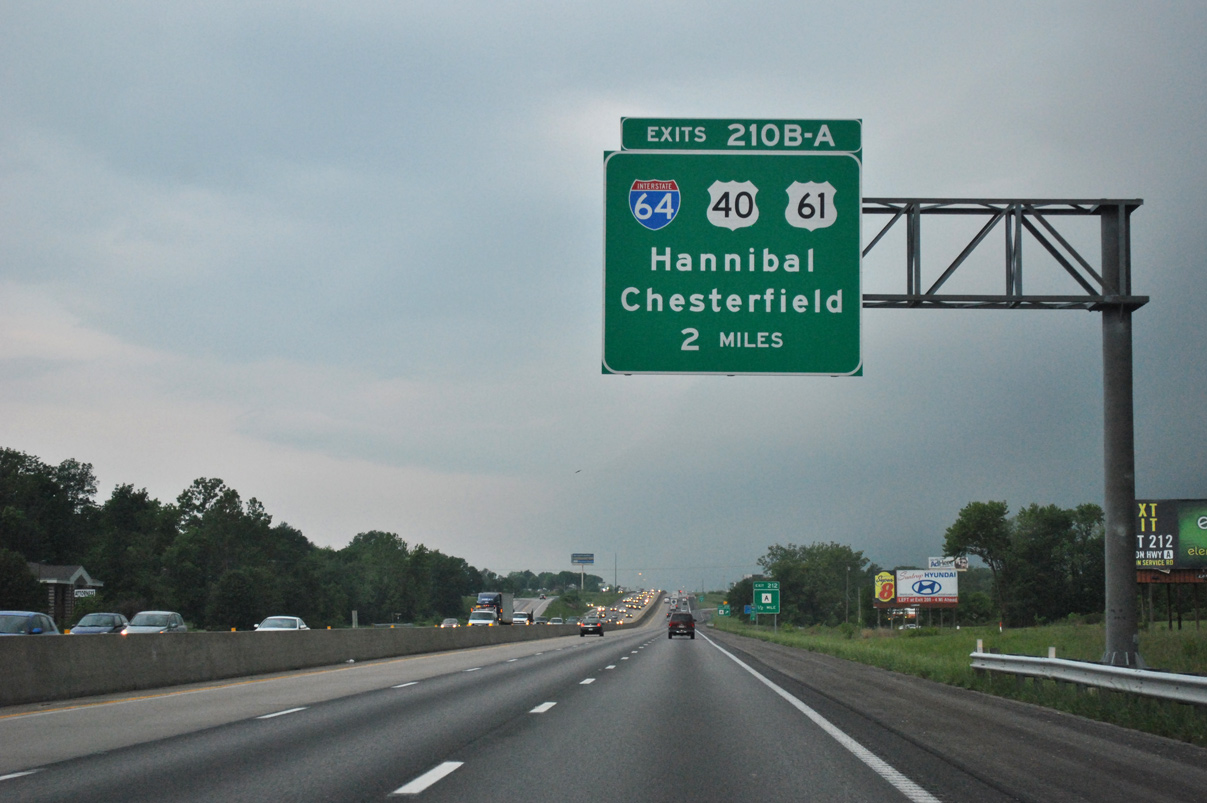
Interstate 64 and U.S. 40/61 overlap from the west end at Wentzville to Ladue, where U.S. 61 turns south along Lindbergh Boulevard. I-64 and U.S. 40 remain cosigned to St. Louis and the Poplar Street Bridge across the Mississippi River. I-64 and U.S. 40 part ways at the East St. Louis Interchange, with U.S. 40 taking I-55 and I-70. East of St. Louis, Interstate 64 replaced former U.S. 460, which used to follow portions of IL 15, IL 142 and IL 14 and Indiana State Road 66 and SR 62 en route to Louisville, Kentucky. The route also overlaps with U.S. 50 from Caseyville to O’Fallon, Missouri.
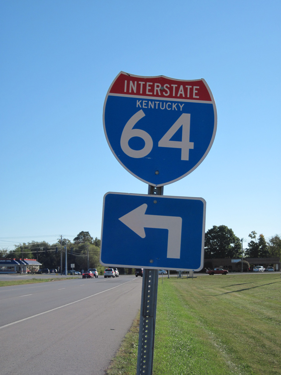
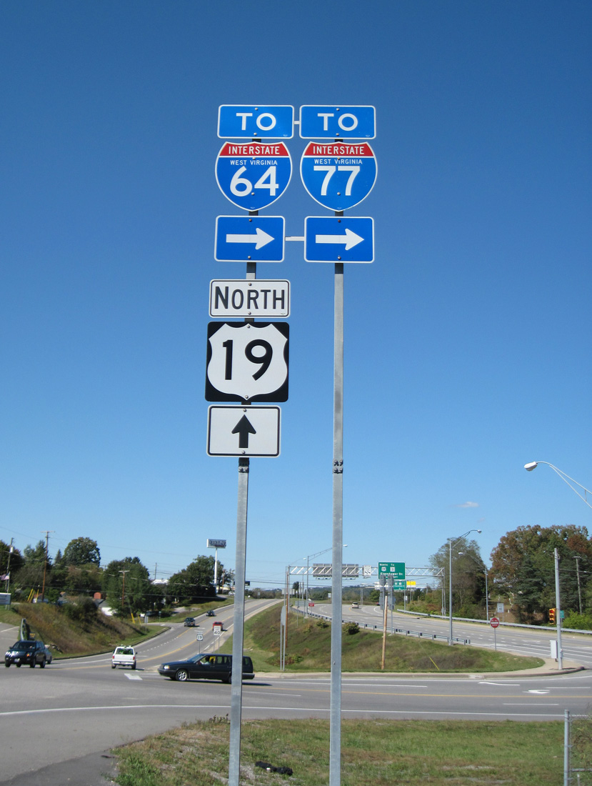
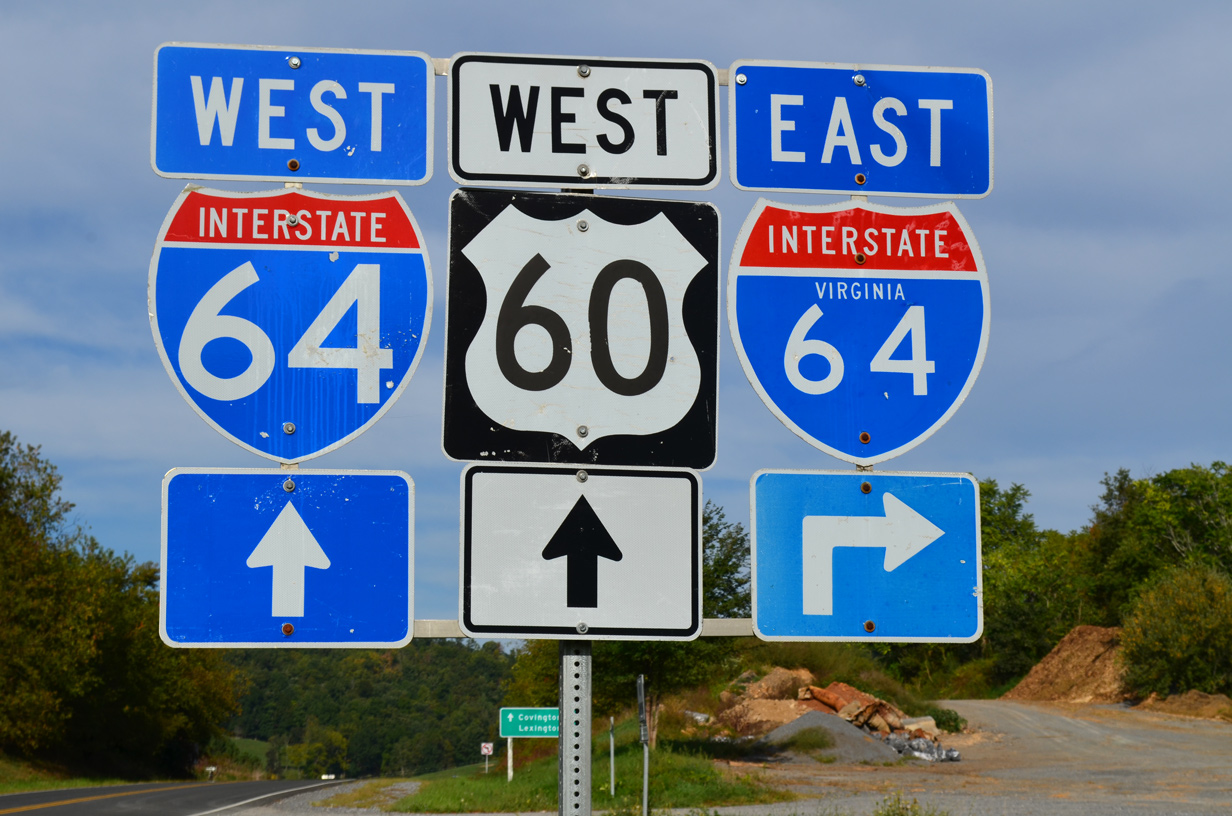
Once at Louisville, Interstate 64 parallels U.S. 60 more or less east to Virginia. Exceptions to this include the tolled West Virginia Turnpike where I-64 combines with Interstate 77, and between Staunton and Richmond, where it parallels U.S. 250.
Major Projects
Within Louisville, Kentucky, major improvements and upgrades were completed at the “Spaghetti Junction” (Kennedy Interchange) linking I-64 with I-65 and I-71 as part of the overall Ohio River Bridge Project. This project primarily focused on both the construction of the East End Bridge for I-265 and doubling capacity of the I-65 Downtown Crossing by constructing the parallel Abraham Lincoln Bridge for northbound traffic. Reconstruction of the Kennedy Interchange and surrounding roadways included a number of improvements:6
- Increased capacity for the ramp system
- A new interchange design at Mellwood Avenue and Interstate 64
- A new partial interchange at Interstate 71 and Frankfort Avenue/Ohio Street
- Relocation of Interstate 64 between I-65 and I-71 to the south of the existing alignment
- Extension of Witherspoon Street one mile to Frankfort Avenue/Ohio Street
Costs were estimated at $3.9 billion for the Ohio River Bridge Project in December 2006. The cost for two new Ohio River Bridges and the reconstruction of the Downtown “Spaghetti Junction” interchange surpassed the initial estimates by over 60%. Components of the major construction initiative were as follows in 2006:8
- Interstate 265 Connector/East End Bridge — Cost: $1.29 billion; Estimated Completion: 2013.
- Interstate 65 Downtown Louisville Bridge Replacement — Cost: $868.4 million; Estimated Completion: 2019. The Abraham Lincoln Bridge opened to traffic on December 6, 2015.
- I-64, I-65 and I-71: Reconstruct the Kennedy Interchange — Cost: $1.74 billion; Estimated Completion: 2024.
Funding was a major concern, and lack of money resulted in a delayed time table. Work finally started on the Kennedy Interchange project on July 15, 2013. Construction ran through the end of 2016.9
Route Information
Mileage
Missouri – 40.50*
Cities – Wentzville, Chesterfield, St. Louis
- Junctions –


Illinois – 128.12**
Cities – East St. Louis, Mt. Vernon
- Junctions –
Indiana – 123.33
Cities – Evansville, New Albany
- Junctions –
Kentucky – 185.20
Cities – Louisville, Frankfort, Lexington, Winchester, Mt. Sterling, Moreland
- Junctions –
West Virginia – 188.75***
Cities – Huntington, Charleston, Beckley, White Sulphur Springs
- Junctions –
Virginia – 297.62#
Cities – Covington, Clifton Forge, Lexington, Staunton, Waynesboro, Charlottesville, Richmond, Williamsburg, Newport News, Hampton, Norfolk
- Junctions –
Source: December 31, 2021 Interstate Route Log and Finders List
* – 0.40 miles on I-55
** – 2.70 miles on I-55, 4.14 miles on I-57
*** – 63.88 miles on I-77
# – 30.40 miles on I-81
I-64 Annual Average Daily Traffic (AADT)
History
Missouri
The original west end of I-64 was in Illinois at the Tri-Level Interchange with I-55 and I-70 at East St. Louis. Interstate 64 was extended westward in 1993 from East St. Louis through St. Louis to I-270 at Town and Country, Missouri via the Daniel Boone Expressway (U.S. 40). Further extension west into St. Charles County followed through a series of upgrades to the Daniel Boone Expressway (U.S. 40/61) to Interstate standards.
Interstate 64 ended in Chesterfield just ahead of the Daniel Boone Bridge spanning the Missouri River. Photo by Rich Piehl (11/00).
The west end of I-64 was located at the approach to the U.S. 40-61 bridge over the Missouri River until 2003. Upgrades continued westward to the Missouri Route 94 interchange, and then Highway K in 2004.2 The last section, which opened during a ceremony held at the new interchange at Prospect Road on October 14, 2009, extended Interstate 64 northwest to I-70 in Wentzville.
Interstate 64 underwent major improvements in the St. Louis area between 2000 and 2009 as part of the “The New I-64” construction project by MoDOT. I-64 between Ballas Road and Interstate 170 was closed for reconstruction between January 2, 2008 and December 31, 2008. The stretch east from I-170 to Kingshighway Boulevard faced a similar closure on December 15, 2008, as the western section reopened. The entire project was completed on December 7, 2009. The project redesigned the freeway built in the 1950s to modern standards, with new overpasses, redesigned interchanges and a high speed connection with I-170 in addition to landscaping and architectural improvements.
Illinois-Indiana13
The original corridor planned for Interstate 64 between St. Louis and Louisville followed the recognized major routing of U.S. 50 from St. Louis to Shoals and U.S. 150 from Shoals to Kentucky. The route between Louisville and Lexington was selected due to the introduction of Interstate 71 between Louisville and Cincinnati, and earlier stages of the Interstate system planning called for just a two lane route from St. Louis to Louisville.
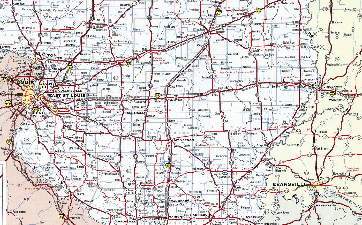
The initial proposed route of Interstate 64 along the U.S. 50 corridor across southern Illinois in 1960.
U.S. 50 was the main route between East St. Louis and Vincennes, and the state of Illinois planned to construct a four lane, divided highway along the corridor in the 1940s. World War II delayed construction and offset potential reconstruction of the route in Indiana, while U.S. 50 and U.S. 150 further deteriorated during the war as part of the strategic highway network. The corridor became a part of the Interstate System in 1947, with Indiana calling for a new route from Vincennes to Cincinnati for U.S. 50. The Indiana state Highway Commission submitted strip maps of the U.S. 50-150 corridor from Vincennes to New Albany as the proposed alignment for Interstate 64 because of the necessity to meet the Bureau of Public Roads deadline of January 1, 1957 for all general Interstate route alignments.
Construction to expand U.S. 50 to four lanes from Vincennes to Lawrenceville was incorporated into Interstate 64. Contracts for this work were let in 1956 and 1957. Illinois and Indiana also submitted an agreement to the Bureau of Public Roads to construct the I-64 bridge across the Wabash River, north of Vincennes, on April 7, 1958. This was approved on June 12, 1958, with work commencing soon thereafter.
The date of formal approval for all Interstate system routes set by the Bureau of Public Roads was June 30, 1957. Indiana followed this deadline with comparative studies on a more direct alignment between Vincennes and New Albany, including a straight line running about ten miles south of Washington. The consideration of several alternatives, including more southern routes, attracted the attention of local interests. Local Chambers of Commerce and civic groups formed two major factions, with one favoring the original northern route through Vincennes and another supporting a southern alignment closer to Evansville. The formation of Southern Illinois Incorporated, an association of community development groups, in 1957 led to the announcement of Indiana Governor Handley that both Illinois and Indiana were considering shifting the I-64 corridor southward to serve a greater population base. Despite efforts of the northern proponent group, the St. Louis – Vincennes – Louisville Interstate Highway Committee, which were slower to organize than those to the south, Governor Handley formally announced on February 12, 1958 that I-64 would take the southern course toward Evansville.
The St. Louis – Vincennes – Louisville Interstate Highway Committee continued to lobby for the northern alignment of I-64 after the 1958 announcement, garnering support from Chicago newspapers as well. However Illinois Governor Stratton and the Chairman of the Indiana State Highway Commission sent a formal recommendation to the Regional Office of the Bureau of Public Roads recommending the southern corridor on May 19, 1959. This was based upon documentation on the original and southern corridor comparisons made by the Illinois and Indiana State Highway Departments. Subsequent actions by the Chief Highway Engineer of Illinois and the Chairman of the Indiana State Highway Commission reaffirmed the southern route with separate requests to the Bureau of Public Roads on February 4, 1960. After three days of public hearings involving the two major factions, the Bureau of Public Roads ultimately approved the southern alignment due to the two states agreement in late 1960.
Governor Stratton maintained that Illinois would continue to upgrade U.S. 50 to a four lane, limited access route in September 1960. Indiana started construction on the U.S. 50 Vincennes bypass by 1963 and four laning of the route west from Aurora. Efforts by the northern alignment group continued unsuccessfully to the Bureau of Public Roads hearing held on July 26, 1961 and location approval of the Evansville area route.
Kentucky
Connecting Indiana with Kentucky, the double decked Sherman Minton Bridge, a dual suspended arch bridge, carries Interstate 64 over the Ohio River. It was completed and opened to traffic in 1961.7 The span was closed between September 9, 2011 and February 17, 2012 for emergency repair work when cracks were discovered in two supporting bridge members.
In November 2005, Tyler Allen, owner and president of USA Image Technologies in Louisville3, and J.C. Stites, founder and CEO of Autodemo LLC4 created the 86-64 grassroots organization that called for the removal of a portion of Interstate 64 adjacent to Downtown Louisville along the Ohio River. Under their plan, I-64 would be realigned onto Interstate 265 in Indiana and I-265 in Kentucky via the East End Bridge, which connected the two sections of I-265 in 2017. With this bypass in place, the remaining sections of I-64 east of I-65 and west of an area near Roy Wilkins Avenue would be renumbered as Interstate 364. A surface boulevard along the southern riverfront would allow for access through the restored waterfront area where Interstate 64 used to be. On their web page, Allen and Stites cited benefits including reduced cost of the proposed improvements to the I-64-65-71 interchange (Kennedy Interchange) and increased access to the Ohio River, making Downtown Louisville more vibrant and enhancing the regional economy.5
With upgrades at the Kennedy Interchange completed as part of the Downtown Crossing project, the idea of removing I-64 from the Ohio River waterfront is very unlikely.
West Virginia
The West Virginia Turnpike opened to traffic with two lanes on November 8, 1954. The toll road was later added both to the mileage of Interstate 77 and to I-64 between Beckley and Charleston. The project upgrading the turnpike to four lanes was completed on September 2, 1987.7
Virginia
Competing state interests contested over the planned route of I-64 from Interstate 81 east to Richmond. One faction favored the current route from Staunton east through Charlottesville. The second group, including Governor J. Lindsay Almond, Jr. and several members of the highway commission, advocated a southerly route from Roanoke to Lynchburg and Farmville. The route was debated for three years before the 1961 mandate by U.S. Secretary of Commerce Luther Hodges for the northern route parallel to U.S. 250.14
Spanning the waters of Hampton Roads in southeastern Virginia along Interstate 64 is the four lane Hampton Roads Bridge-Tunnel. This formerly tolled facility connects Norfolk near the Willoughby Spit community with the city of Hampton at Phoebus. The bridge-tunnel system includes a four lane viaduct over the mouth of James River and a four lane tunnel. Opened in 1957, the bridge tunnel carried only two lanes originally. Revenue bonds for the crossing were paid off by 1976 and tolls were removed. Coinciding with the toll removal was the opening of the parallel two lane span, bringing the crossing up to its current capacity. Since this aspect of Interstate 64 was 90% covered by Federal Highway Administration (FHWA) Interstate funds, toll collection was not extended. Tolls were removed from the bridge taking U.S. 17 across the James River bridge to the west on the same day in 1976.1
One of four plans never acted upon by the Virginia Commonwealth Transportation Board (CTB) in May 1996 outlined renumbering the Hampton Roads Interstate system. One proposal realigned I-64 southward over Interstate 664 to Suffolk, where it would join its route eastward through Chesapeake to I-264 at Virginia Beach. I-64 would then overtake Virginia State Route 44 into Virginia Beach. Coinciding with this concept was establishment of Interstate 864 over former I-64 from Hampton southeast to Norfolk. SR 44 later became an extension of I-264 in August 1997.12
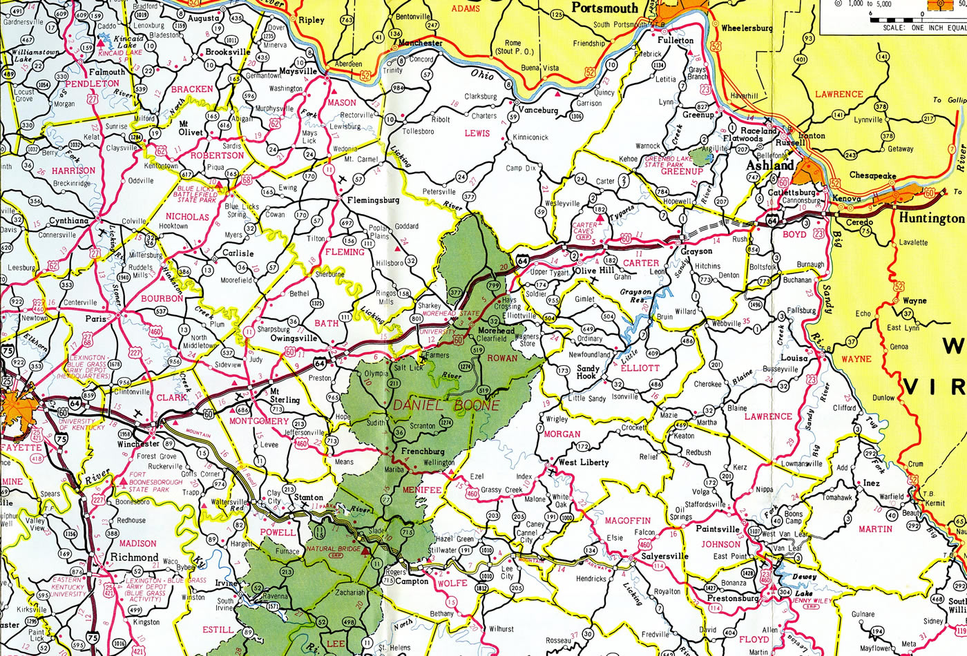
A short segment of I-64 was incomplete by 1970. This stretch ran east from Grayson to U.S. 60 in western Boyd County. The interstate was finished across the Bluegrass State in 1976.10
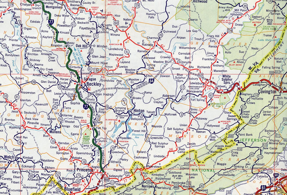
Interstate 64 was initially completed east of Beckley, West Virginia in the White Sulphur Springs vicinity. The route was finished in West Virginia by 1988.
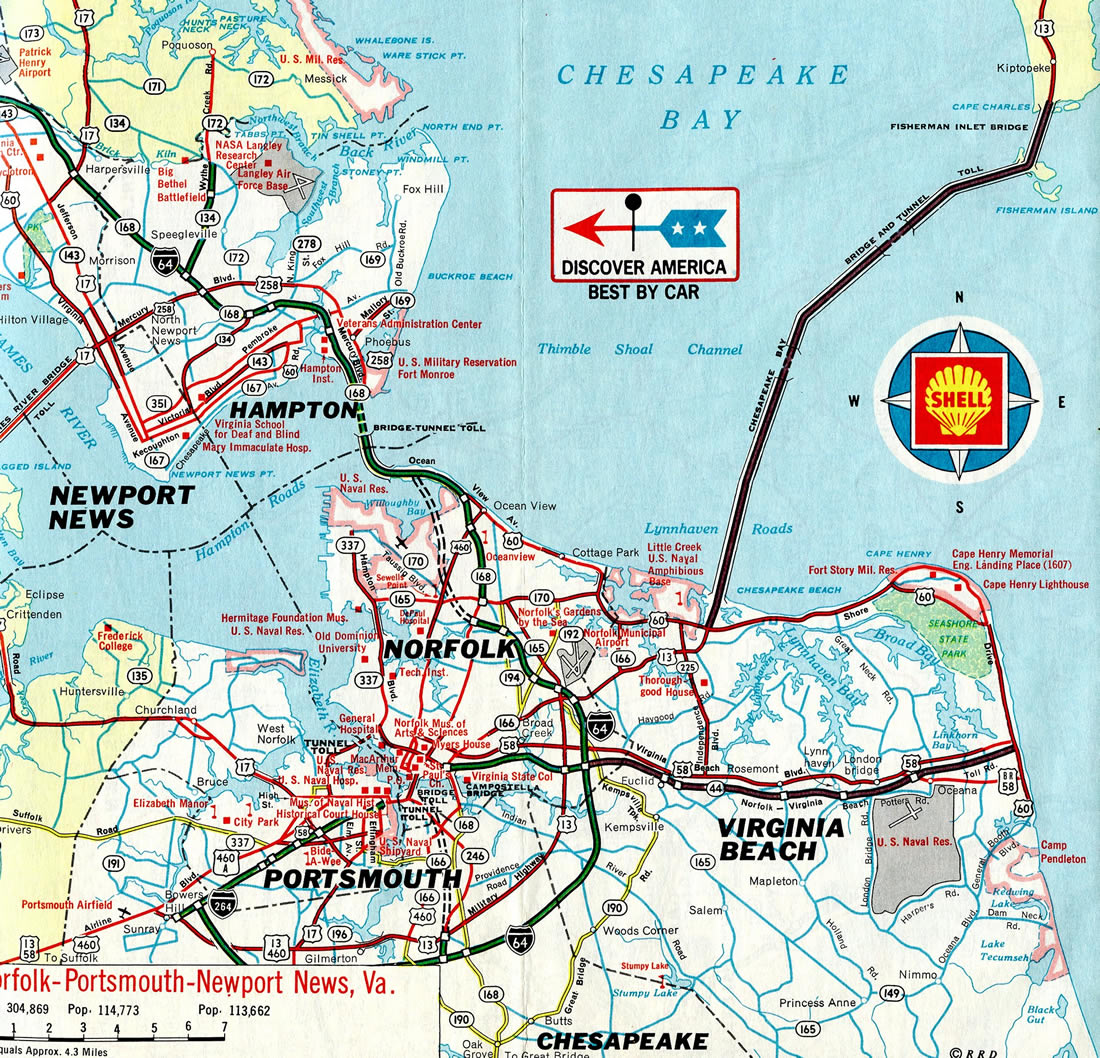
Interstate 64 utilized a portion of SR 168 as part of the through route southward from the Hampton Roads Bridge-Tunnel until 1976, when the route was completed through Norfolk.11
East End 

 – Chesapeake, Virginia
![]() Inner Loop at
Inner Loop at ![]()
![]()
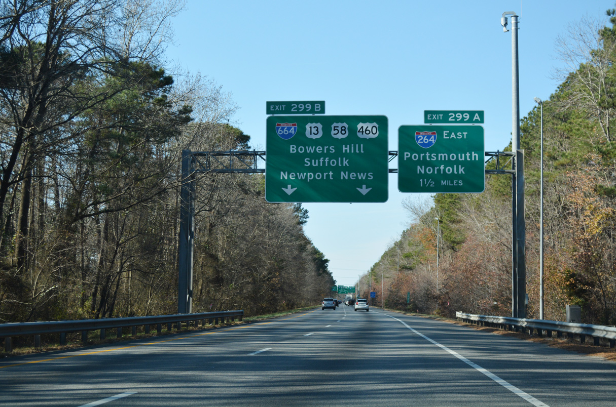
Interstate 64 concludes at a shared endpoint with both I-264 west and I-664 south. Parallel U.S. 13/460 (Military Highway) and U.S. 58 (Airline Boulevard) tie in I-664 at Bowers Hill just to the west. 12/14/17
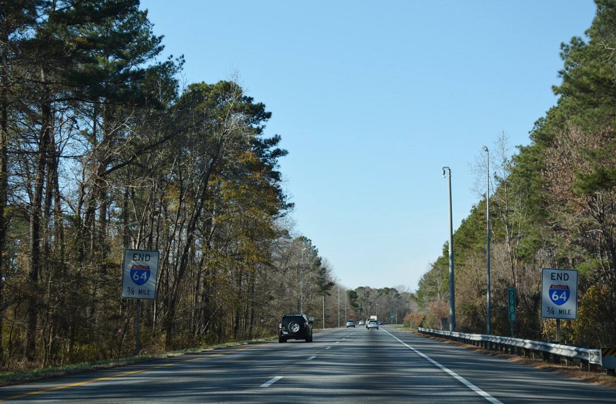
Interstate 64 ends as I-664 north begins. This is the only occurrence within the Interstate system where a 2-digit route concludes at a branch/3-digit route. 12/14/17
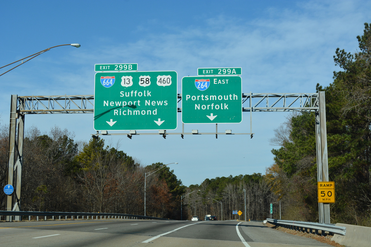
Exit 299A departs from the end of Interstate 64 for Portsmouth as the Hampton Roads Beltway turns west alongside I-664 north to the adjacent exchange with U.S. 13-58-460 for Bowers Hill and Suffolk. 12/14/17
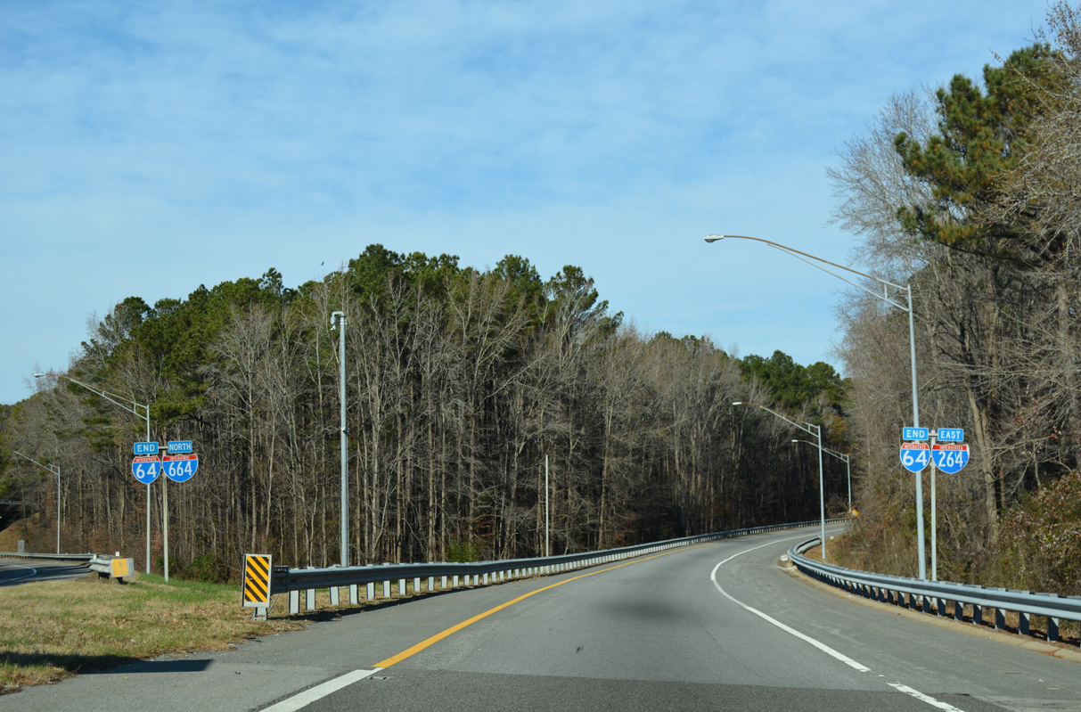
End shield assemblies stand along all ramp connections at the three-wye interchange joining I-64, I-264 and I-664. 12/14/17
![]() South at
South at ![]()
![]()
1.75 miles from Interstate 64, I-664 (Hampton Roads Beltway) crosses Goose Creek south ahead of the SR 191 (Jolliff Road) overpass and Exit 13A for U.S. 13-58-460 west to Suffolk. Photo by Will Weaver (09/05/10).
Interstate 664 (Hampton Roads Beltway) arcs eastward through the exchange with U.S. 13-58-460 at Bowers Hill. Traffic proceeds east one mile to partition for I-264 to Portsmouth and I-64 to Chesapeake. 12/14/17
U.S. 13/460 parallels Interstate 64 along Military Highway across the city of Chesapeake. The Hampton Roads Beltway outer loop takes I-64, 16 miles east to I-264 at Virginia Beach. 12/14/17
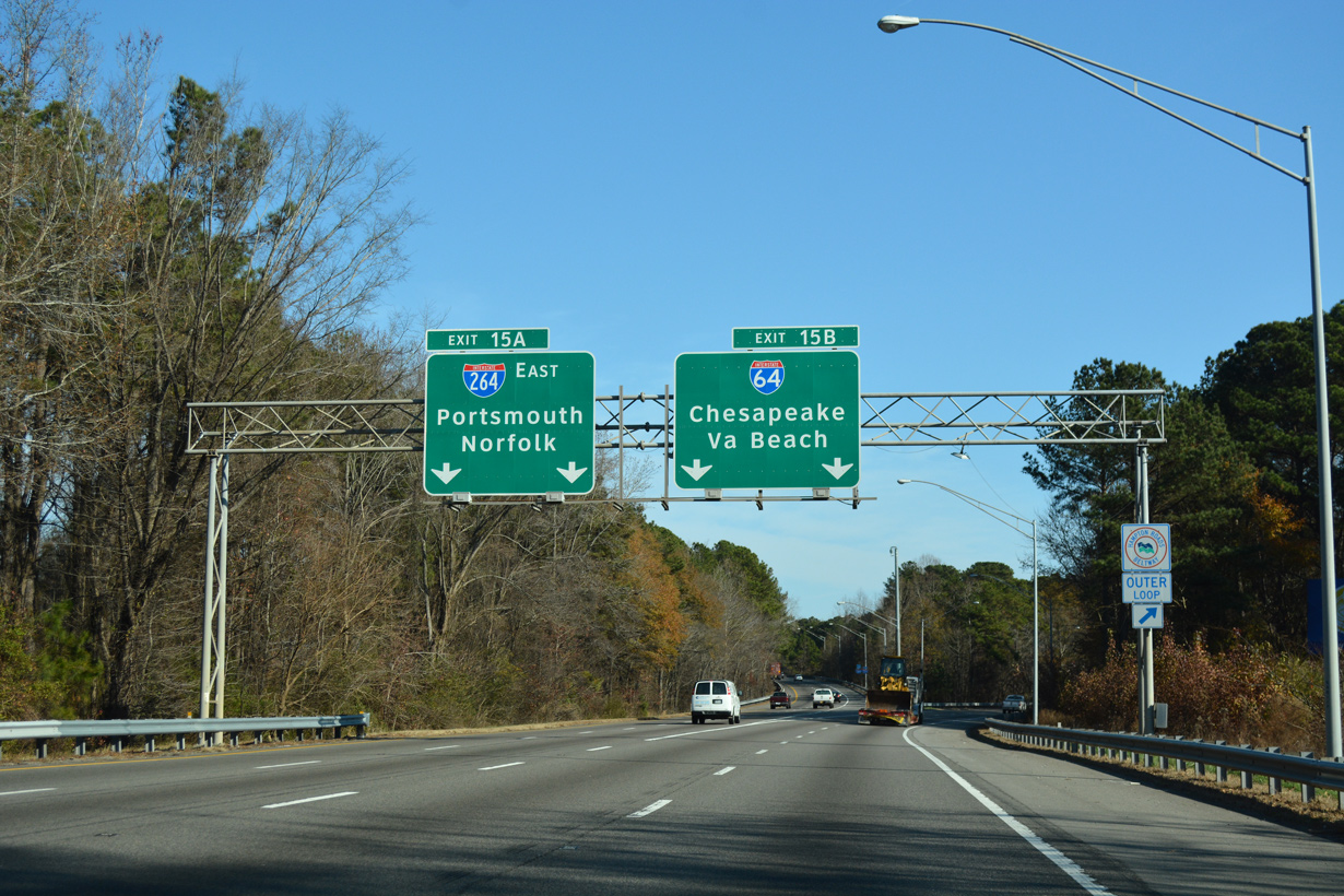
Interstate 664 south defaults onto I-264 toward Norfolk as Exit 15B turns southeast onto Interstate 64. 12/14/17
![]() / Hampton Roads Beltway – Outer Loop
/ Hampton Roads Beltway – Outer Loop
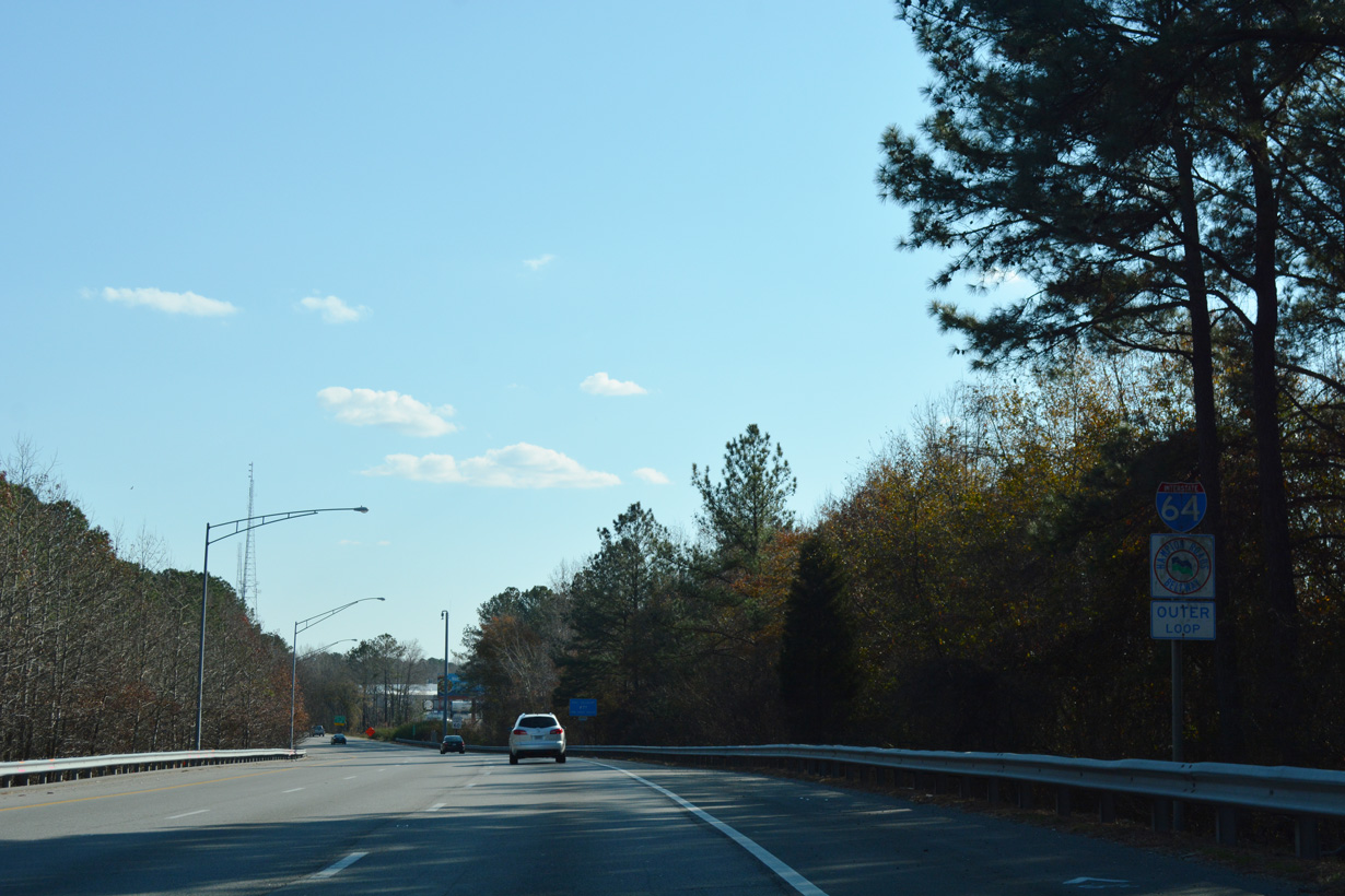
The first confirming marker for Interstate 64 appears just beyond the merge of ramps from I-264 west and I-664 south. 12/14/17
West End – Wentzville, Missouri
![]()
![]() West
West ![]() North at
North at ![]()
I-64/U.S. 40-61 cross Perque Creek two miles southeast of Interstate 70 by Lake St. Louis. 05/24/18
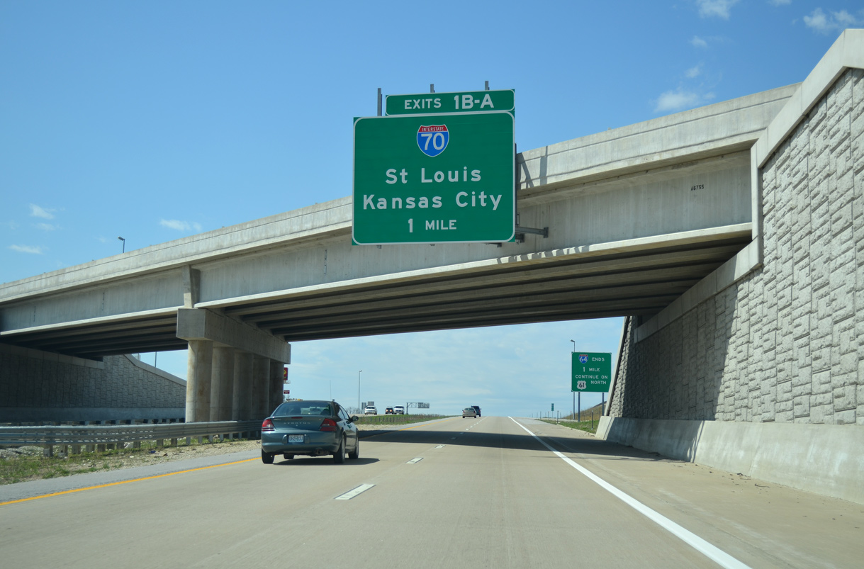
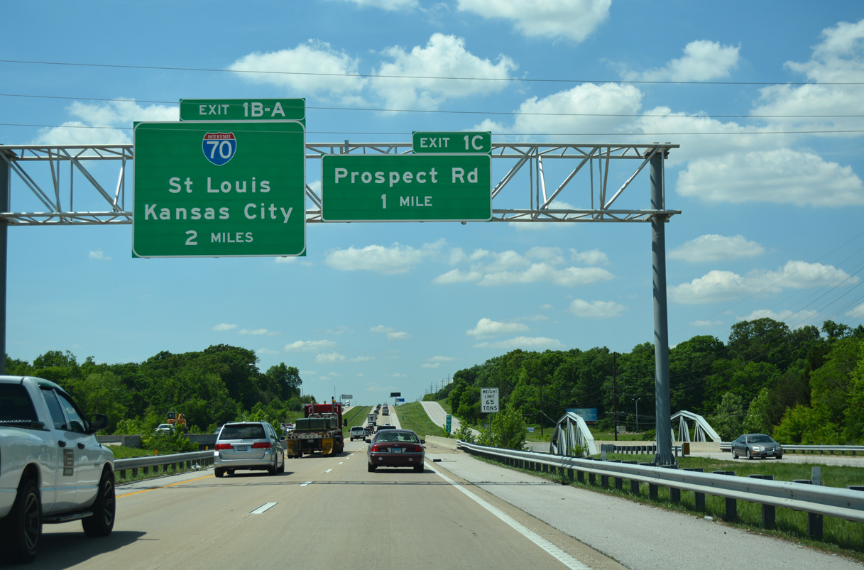
Interstate 64 concludes one mile beyond the dumbbell interchange (Exit 1C) with Prospect Road at the city of Lake St. Louis. 04/13/13
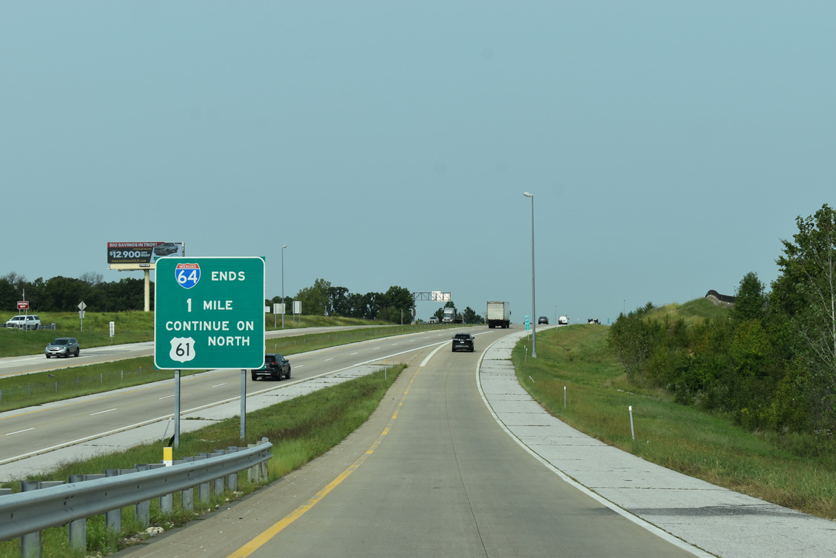
U.S. 61 extends northward from Interstate 64 along the Avenue of the Saints through Wentzville en route to Hannibal. Photo by JP Nasiatka (09/15/20).
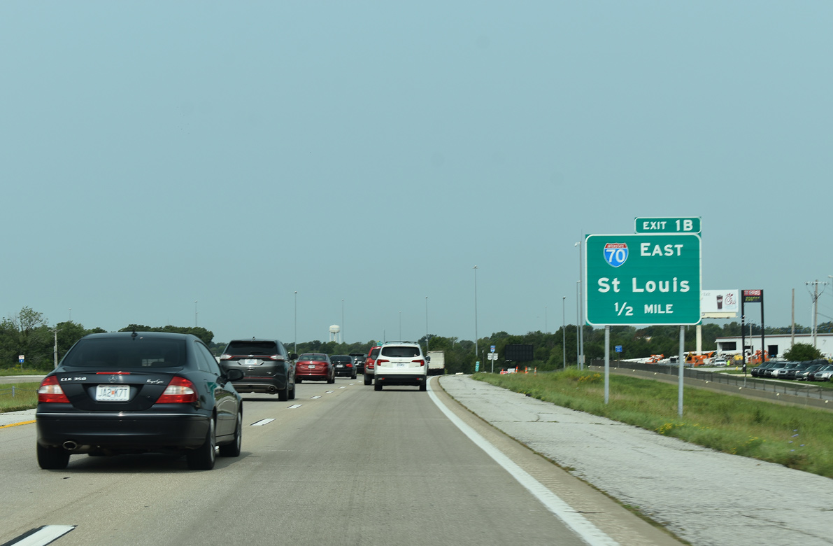
Exit 1B departs from I-64/U.S. 40-70 next for Interstate 70 east through O’Fallon and St. Peters. Photo by JP Nasiatka (09/15/20).
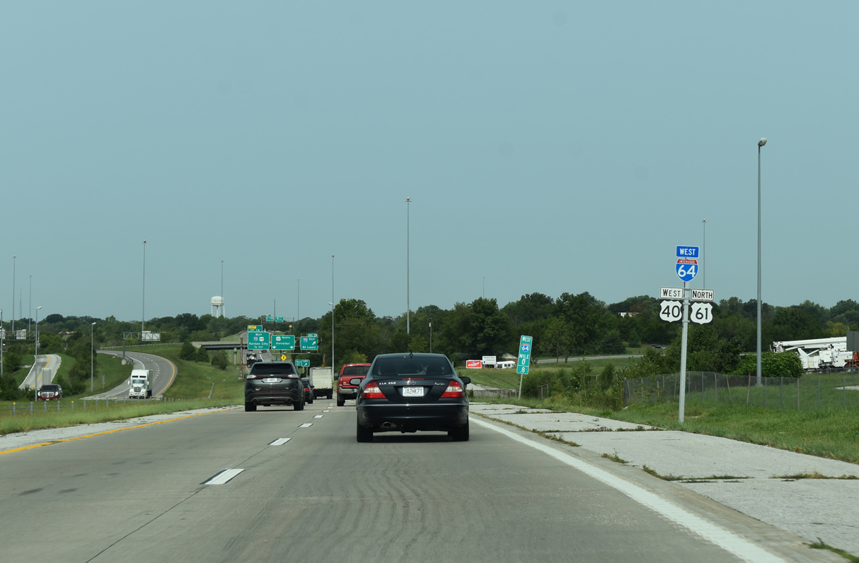
The final confirming marker for Interstate 64 west. Photo by JP Nasiatka (09/15/20).
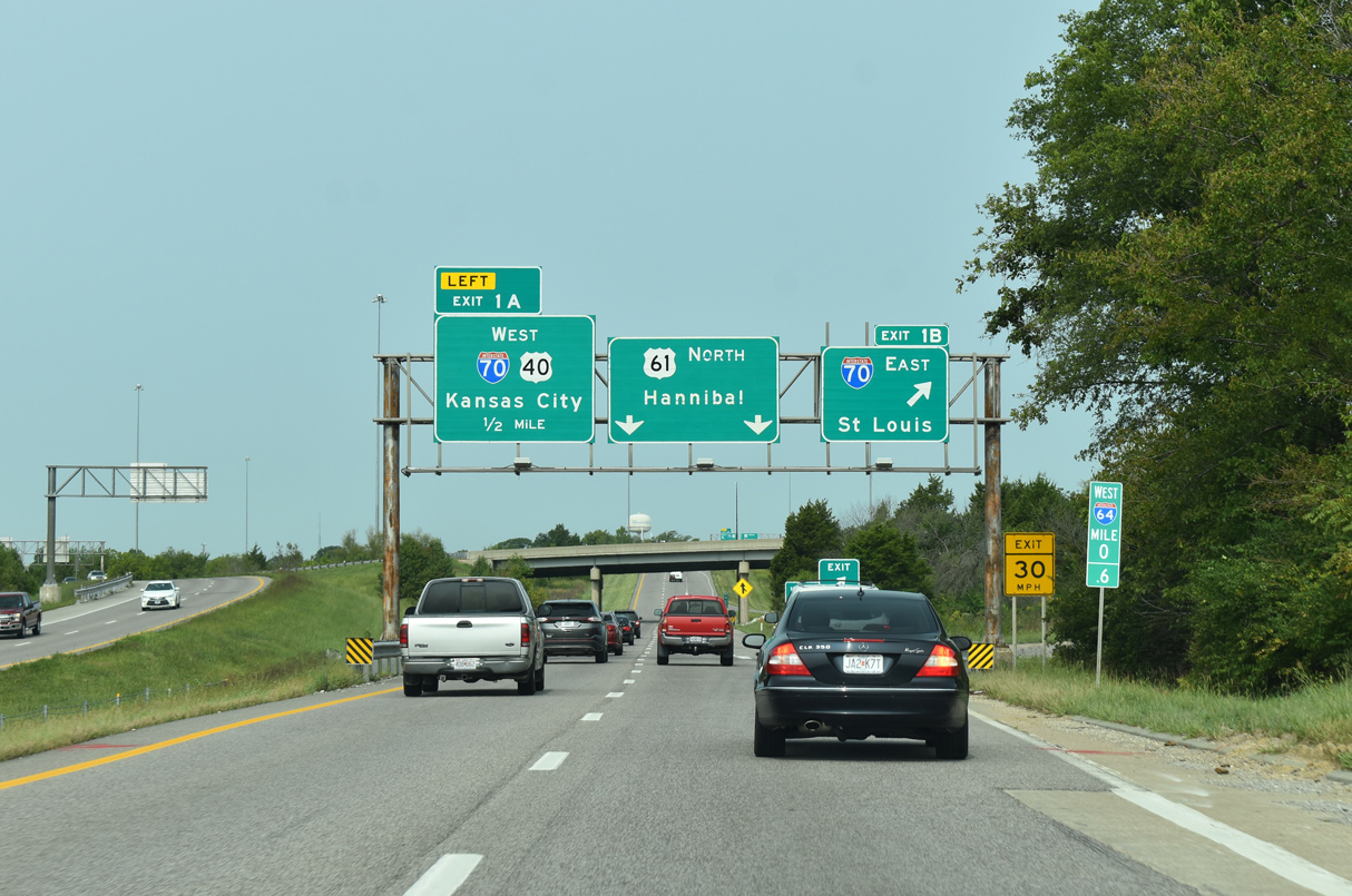
Interstate 64 ends at an elongated interchange with left exit ramps. U.S. 40 splits with U.S. 61 north for I-70 west to Columbia. Photo by JP Nasiatka (09/15/20).
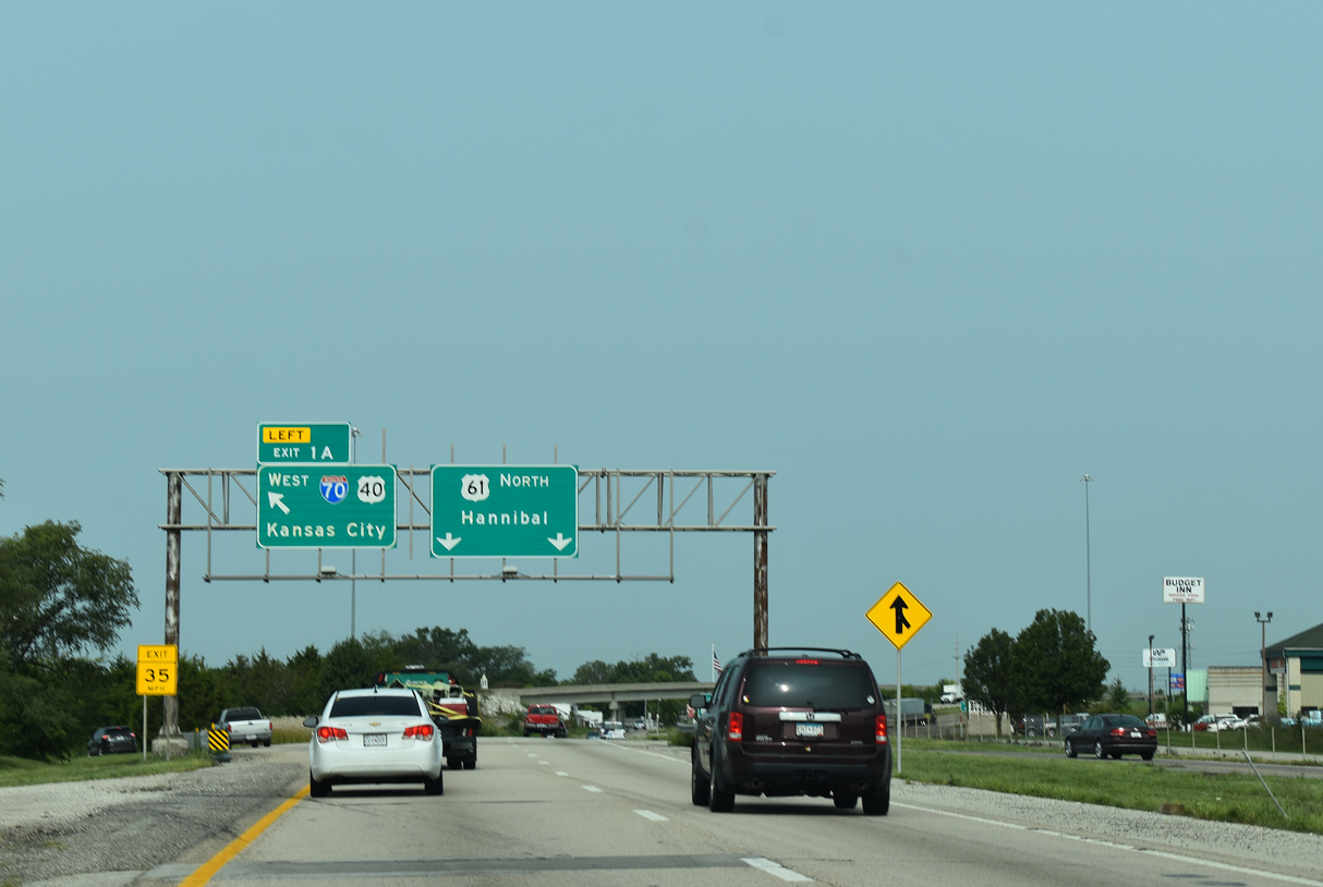
Left Exit 1A separates from U.S. 61 (Avenue of the Saints) for I-70/U.S. 40 west to Kansas City. Photo by JP Nasiatka (09/15/20).
![]() South at
South at ![]()
![]()
![]()
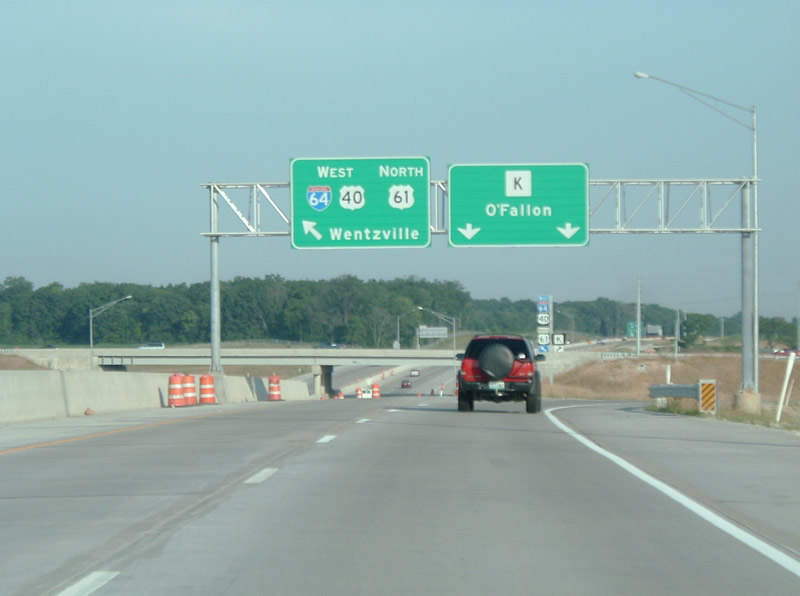
U.S. 61 (Avenue of the Saints) upgrades to limited access standards leading southeast to the exchange with I-64, I-70 and U.S. 40 in Wentzville. 04/13/13
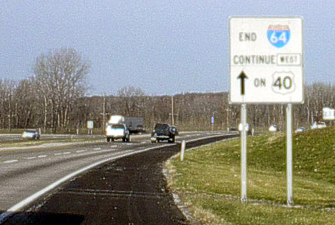
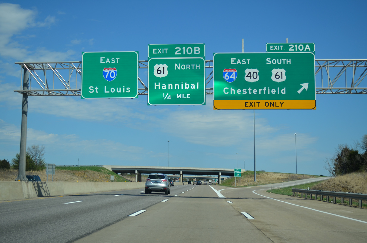
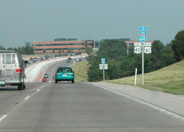
Interstate 64 commences alongside U.S. 61 south at the directional cloverleaf interchange with I-70/U.S. 40. 04/13/13
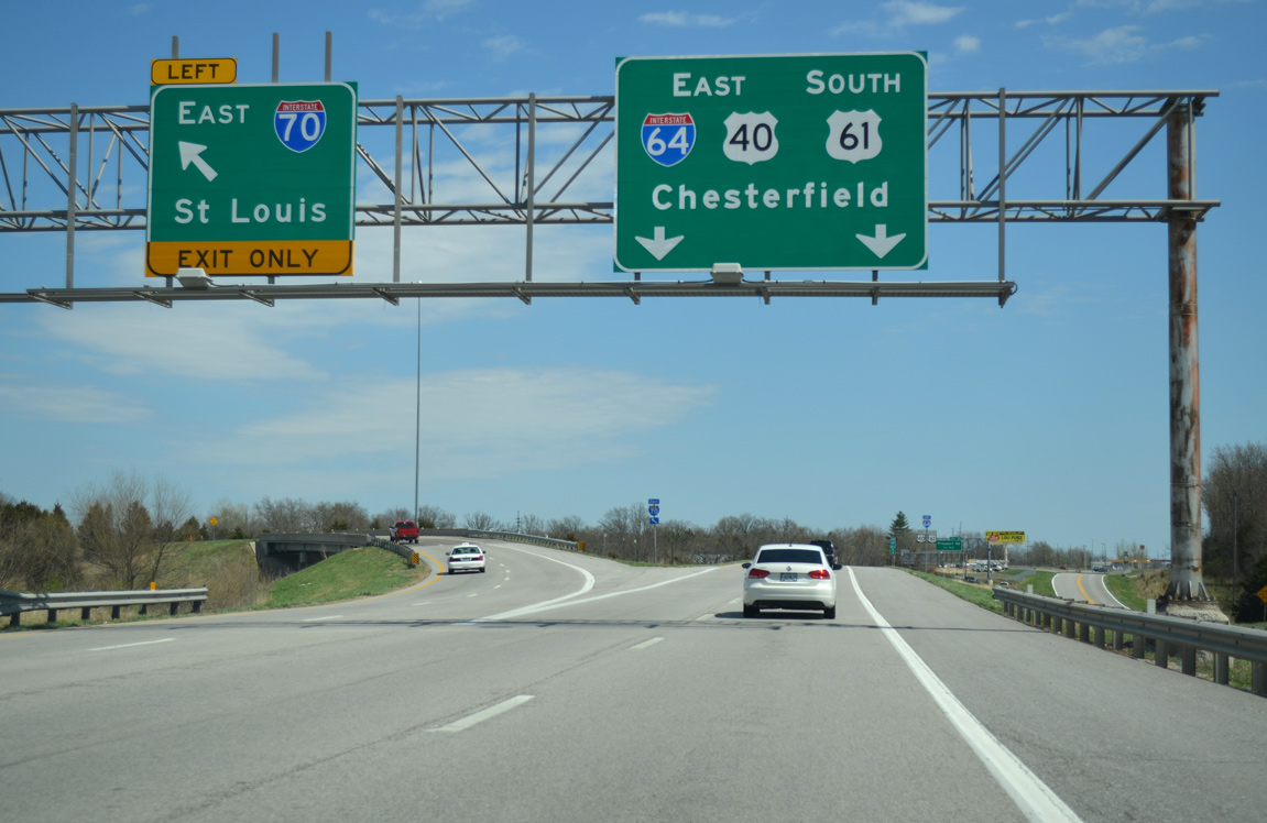
A left exit ramp joins Interstate 70 east to O’Fallon, St. Peters and St. Charles. U.S. 40 combines with I-64 east to the Poplar Street Bridge into East St. Louis, Illinois. 04/13/13
![]()
![]() east to
east to ![]()
![]()
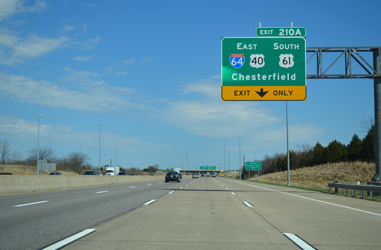
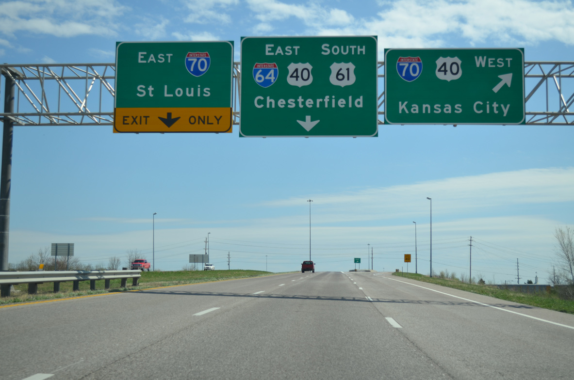
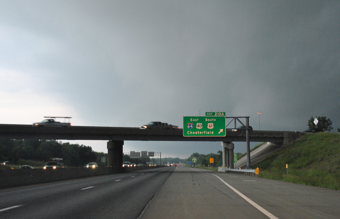
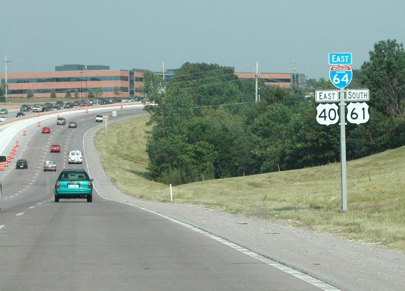
Interstate 70 and U.S. 40 east split at the directional cloverleaf interchange (Exit 210) with I-64 east and U.S. 61 (Avenue of the Saints). 04/13/13
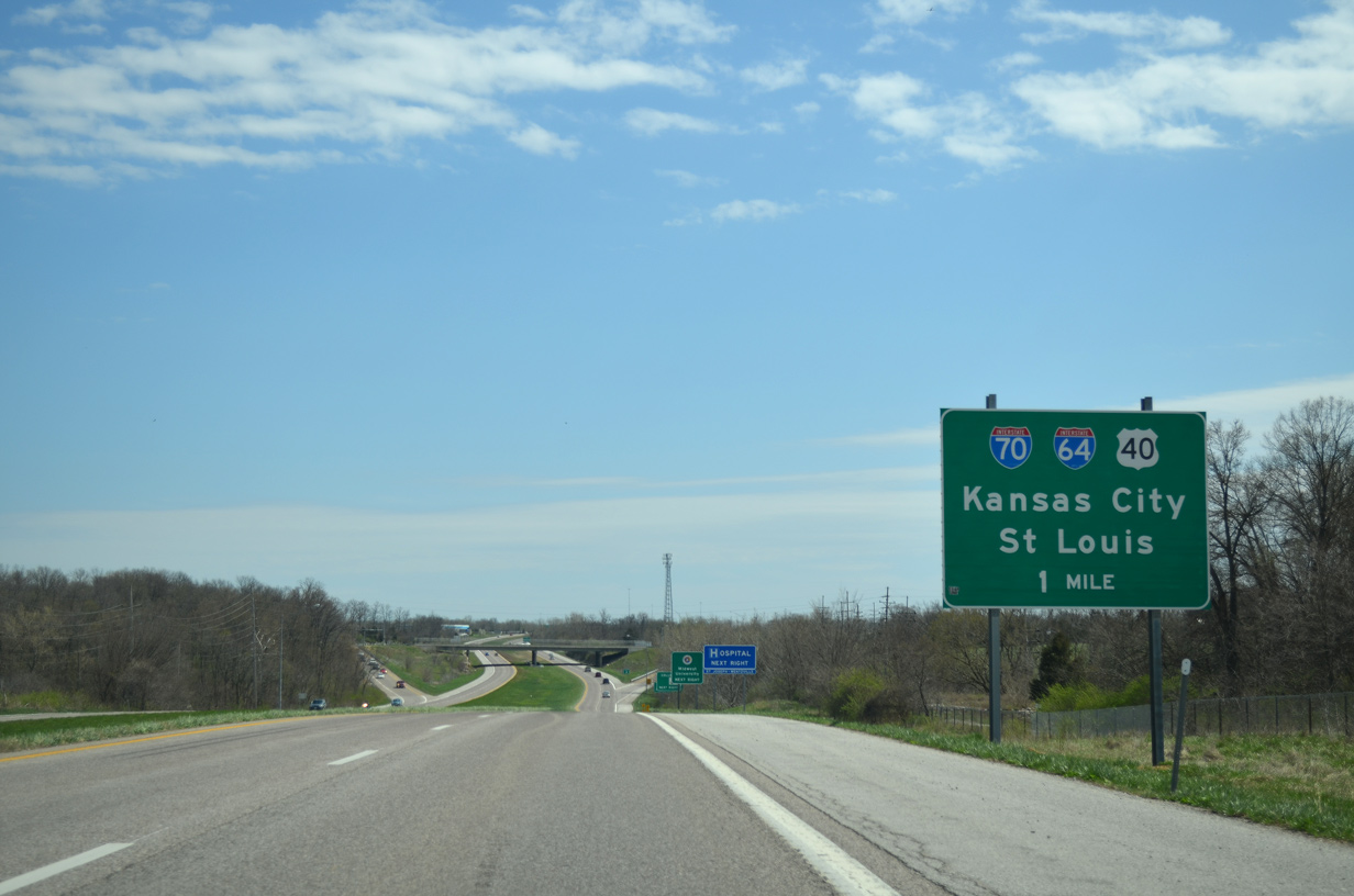
U.S. 40 joins I-64/U.S. 61 east through Chesterfield and Creve Coeur while I-70 stays to the north through O’Fallon and St. Charles. 04/13/13
![]() West at
West at ![]()
![]()
![]()
Interstate 70 runs between the Lake St. Louis and Wentzville city line west to Route A. The succeeding exit is with I-64 east and U.S. 40/61. 05/04/12
Wentzville is the last of the suburbs for the St. Louis area along I-70 west. The Avenue of the Saints corridor follows U.S. 61 north from I-64 toward Keokuk, Iowa. 05/04/12
Exit 210A loops onto Interstate 64 east leading back toward Chesterfield via the Daniel Boone Bridge. 05/04/12
Historic West End – Highway K – O’Fallon, Missouri
![]()
![]() West
West ![]() North
North
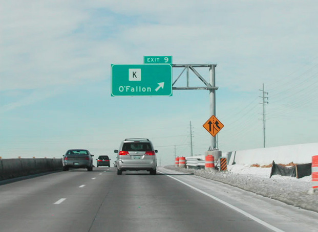
Interstate 64 previously extended west from Route 94 (Exit 10) to Highway K (Exit 9) at Weldon Spring. Photo by Brian Dowd (01/31/04).
Following the c/d roadway from Route 94, traffic partitioned for Highway K to O’Fallon and U.S. 40/61 beyond the west end of I-64. The parclo interchange with Highway K opened to traffic in early 2004. Photo by Jason Oesterreicher (06/18/04).
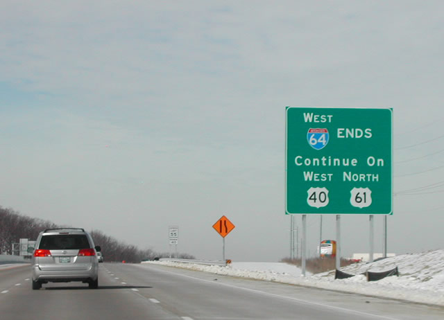
An end sign for Interstate 64 west stood beyond the U.S. 40/61 entrance ramp from Highway K. Photo by Brian Dowd (01/31/04).
![]()
![]() East
East ![]() South
South
I-64/U.S. 40-61 east just beyond the entrance ramp from Route 94. This sign assembly preceded the first confirming marker for the newly designated stretch of Interstate 64. Photo by Brian Dowd (06/02).
The first confirming marker for Interstate 64 appeared just east of the parclo interchange with Route 94 at Weldon Spring. Photo by Brian Dowd (06/02).
Sources:
- Kozel, Scott. “Re: [seroads] VDOT criticizes I81 plans.” Online posting, Yahoo! Groups Southeast Roads and Transport , November 18, 2003.
- Dowd, Brian. Personal email, May 25, 2004.
- “Plan would erase I-64 from downtown: Bridges proposal faces uphill battle.” Louisville Courier-Journal (KY), November 25, 2005.
- Software Marketing Perspectives Conference & Expo: Track One Sessions
http://www.smpevent.com/track1.htm– includes brief biography of J.C. Stites - Welcome to “86” Interstate 64. http://www.8664.org/ a web site that proposed the removal (i.e., “86”) of Interstate 64 from the downtown Louisville waterfront just west of Interstate 65 in front of downtown (by Tyler Allen and J.C. Stites)
- The Ohio River Bridges Downtown Crossing,
http://www.kyinbridges.comproject web site. - Celebrating the 50th Anniversary of the Eisenhower Interstate Highway System: Previous Interstate Facts of the Day by the Federal Highway Administration (FHWA).
- “Bridge plan cost soars to $3.9 billion: New plan: Build eastern span first,” by Marcus Green, Louisville Courier-Journal (KY), December 5, 2006.
- “I-65 drivers brace for three year narrowing of Hospital Curve.” WHAS TV-11 (Louisville, KY), July 8, 2013.
- KentuckyRoads.com – Interstate 64.
- I-64, Virginia Highways Project.
- I-864, Virginia Highways Project.
- Ripple, David Alan. History of the Interstate System in Indiana: Volume 1 – Chapters I-IV: Development of the National Program. West Lafayette, IN: Joint Highway Research Project, 1-1975. Print.
- “Emporia Bypass was First Small Step.” Richmond Times-Dispatch (VA) October 6, 1991.
Page updated July 14, 2021.