Interstate 55
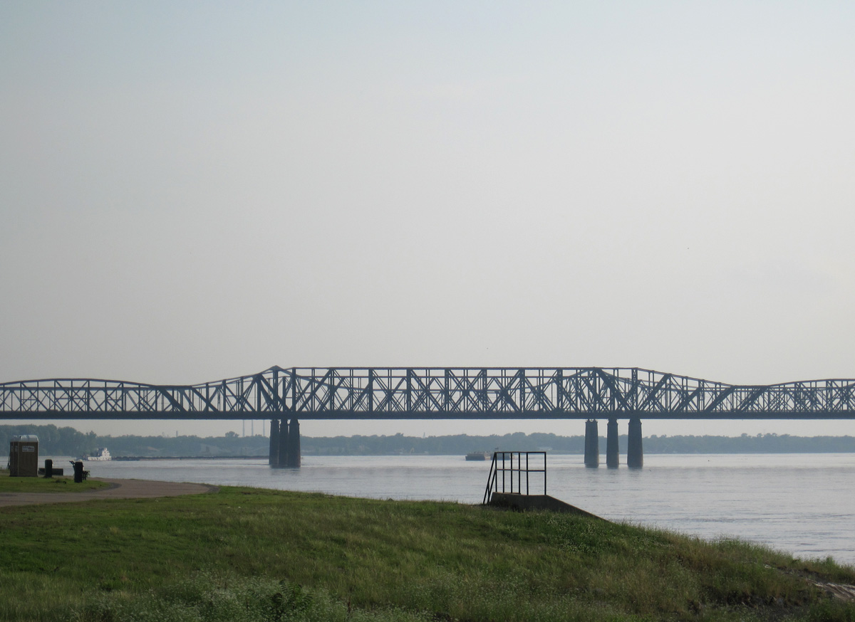
Interstate 55 and U.S. 61-64-70-79 cross the Mississippi River on the Memphis-Arkansas Bridge built in 1949. The cantilever truss bridge does not meet modern Interstate standards due to its lack of shoulders. However, this span is the only Interstate Highway bridge in Tennessee included in the National Register of Historic Places.1 I-55 crosses the Mississippi River again on the Poplar Street Bridge that connects St. Louis, Missouri, with East St. Louis, Illinois. 06/01/10
Overview
Interstate 55 parallels the Mississippi River for much of its length. The route originates at Interstate 10 outside the city of La Place, located west of New Orleans in the Delta region. The freeway runs northward along an isthmus between Lakes Maurepas and Pontchartrain between LaPlace and Ponchatola. This section of Interstate 55 is elevated. Beyond I-12 at Hammond, I-55 traverses timberland en route to McComb and Brookhaven in southern Mississippi.
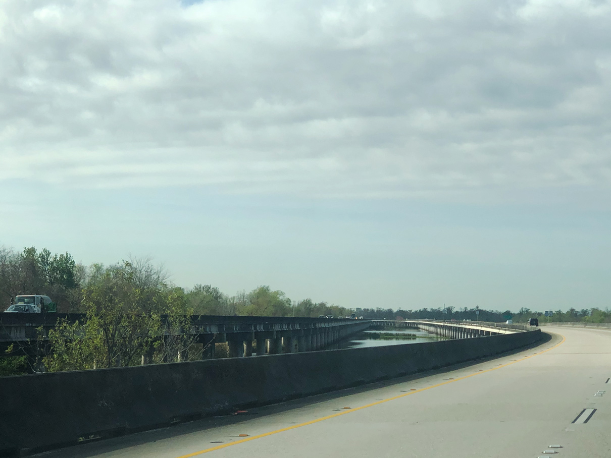
I-55/U.S. 51 southbound on the viaduct system at Ruddock, Louisiana. Photo by Peter Johnson (02/23/20).
Reaching the capital city of Jackson, I-55 dog legs east alongside Interstate 20 across the Pearl River. I-55 resumes a northward heading east of Downtown to Ridgeland, Madison and the north Jackson suburbs. Again a rural freeway, I-55 continues to Grenada, Senatobia, Hernando and the southern periphery of the Memphis metropolitan area.
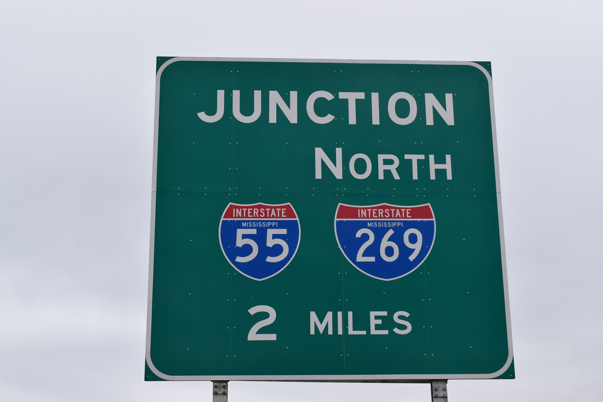
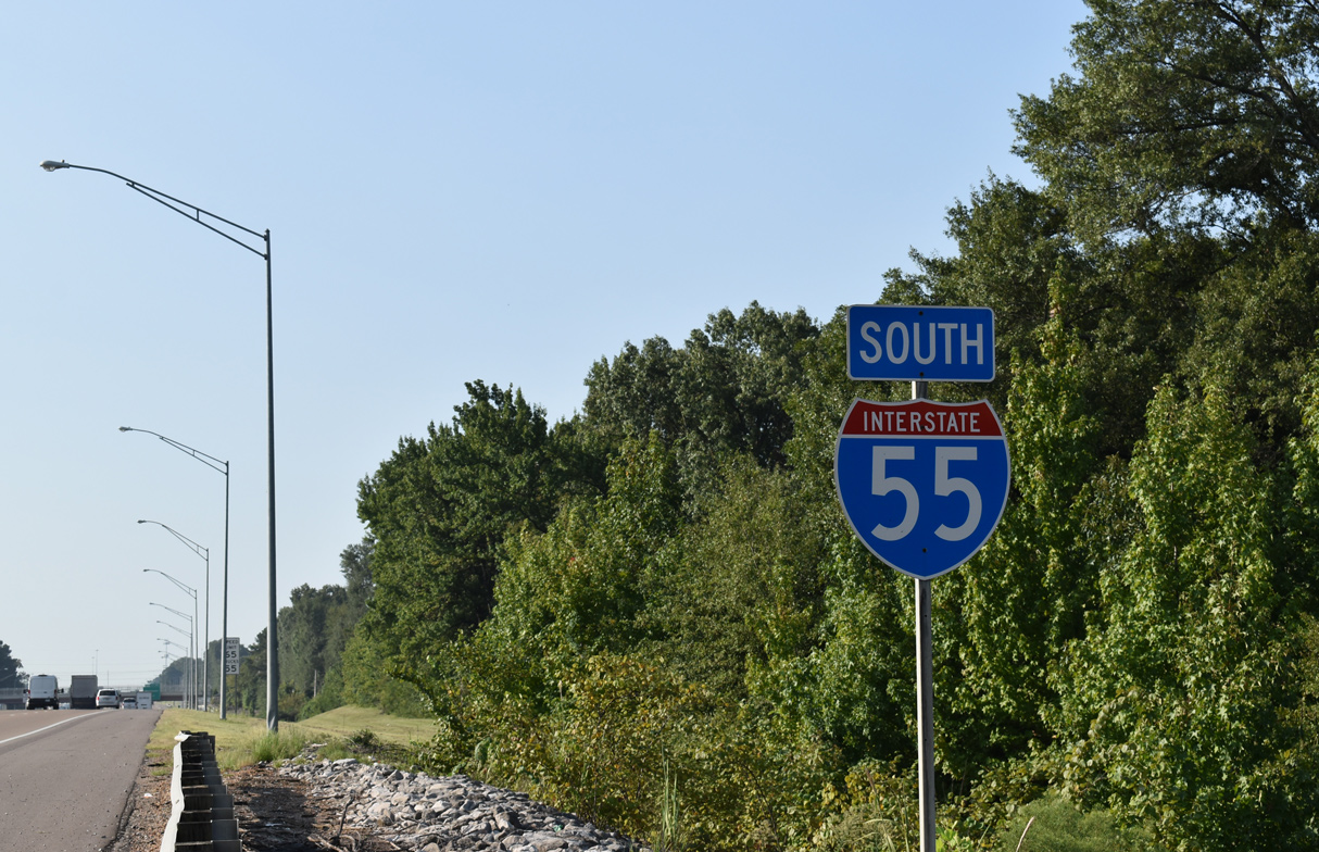
As of May 6, 2008, Interstate 55 combines with I-69 from north of Hernando to the city of Memphis and the exchange with I-240. I-69 follows I-240 north to Downtown Memphis while I-55 turns westward to span the Mississippi River via the Memphis & Arkansas Bridge. Along this stretch is a cloverleaf interchange with Crump Boulevard that includes a turn off to stay on (TOTSO) mainline movement for I-55. Construction originally anticipated through 2019, and later forecast for Winter 2021, addresses this substandard connection. The letting for the project was March 25, 2022, with Bell & Associates Construction the low bidder at $141.2 million.8
Construction on the Interstate 55 / Crump Boulevard Interchange project may take as long as four and a half years. Work redesigns I-55 to bypass the substandard cloverleaf at Crump Boulevard along a sweeping curve. Work also replaces the exchange at Crump Boulevard and Riverside Drive with a five leg roundabout for local traffic. The east approach to the Memphis-Arkansas Bridge is being replaced, coinciding with a planned two week closure of the span.8
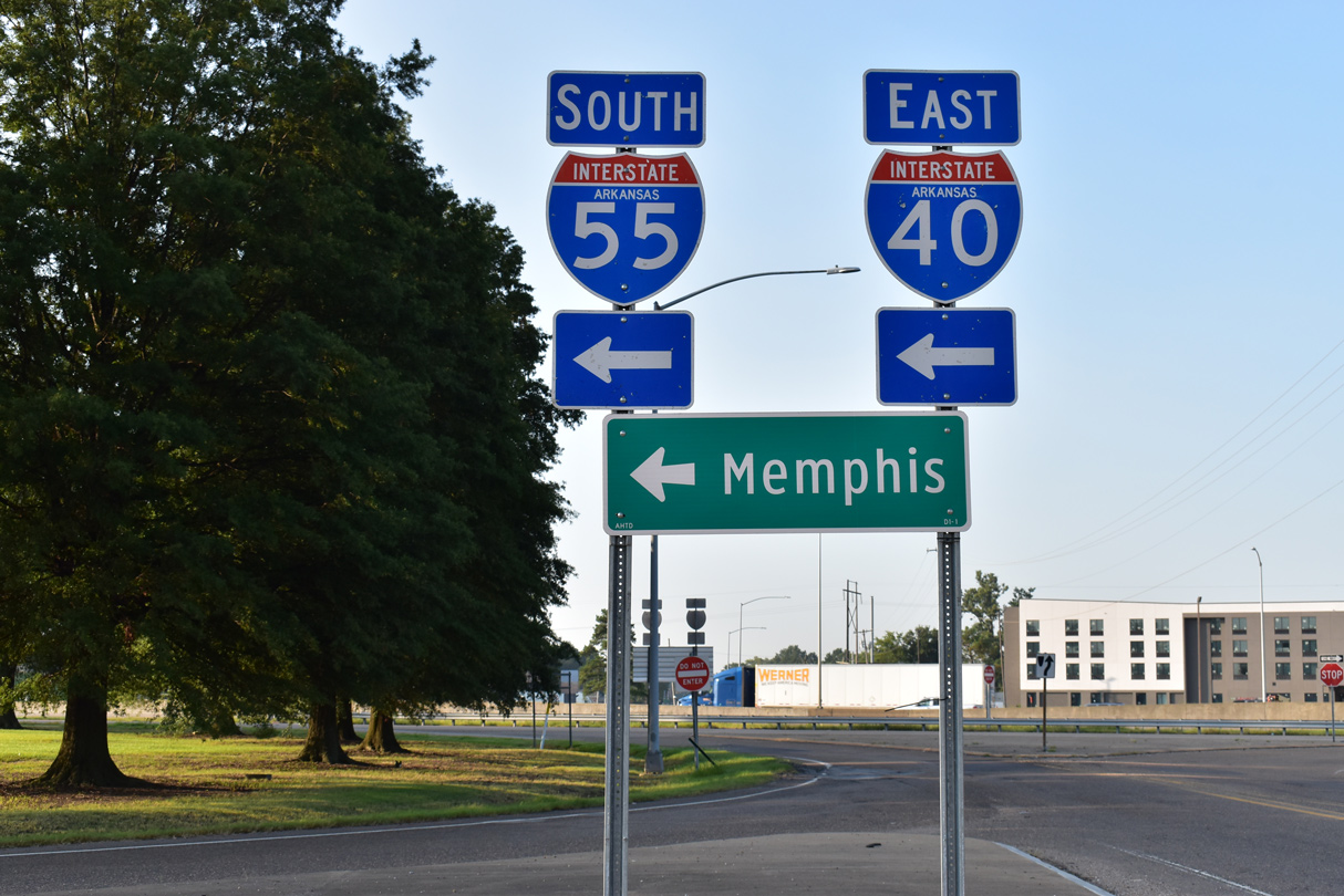
Interstate 40 combines with I-55 for two miles at West Memphis. The two trucking corridors partition with I-55 turning north to Marion and Blytheville and the Missouri state line. Remaining rural, Interstate 55 progresses northward to I-155 at Hayti, New Madrid, and I-57 near Sikeston. Some through traffic bound for Chicago diverts via Interstate 57 while I-55 stays west of the Mississippi to St. Louis.
Beyond Cape Girardeau, Jackson and Festus, all served by Interstate 55 business loops, travelers along I-55 enter the St. Louis suburbs to Mehlville and the exchange with I-270 and I-255. These routes double as bypasses and commuter routes while I-55 stays north into Downtown St. Louis.
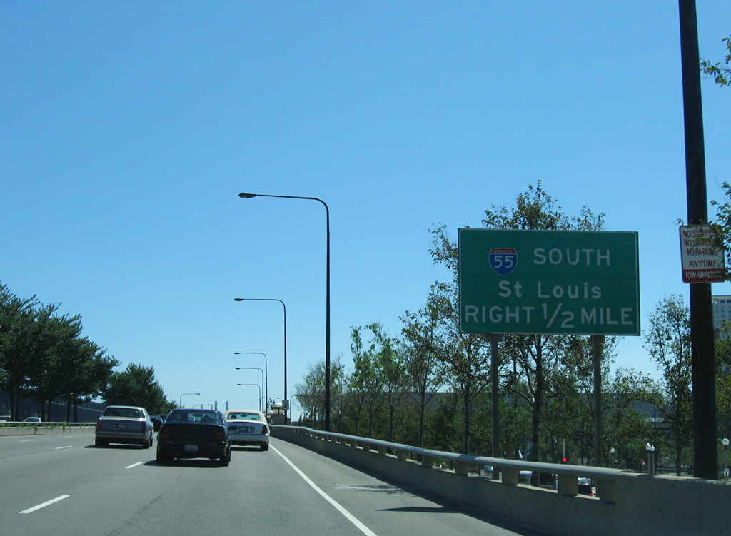
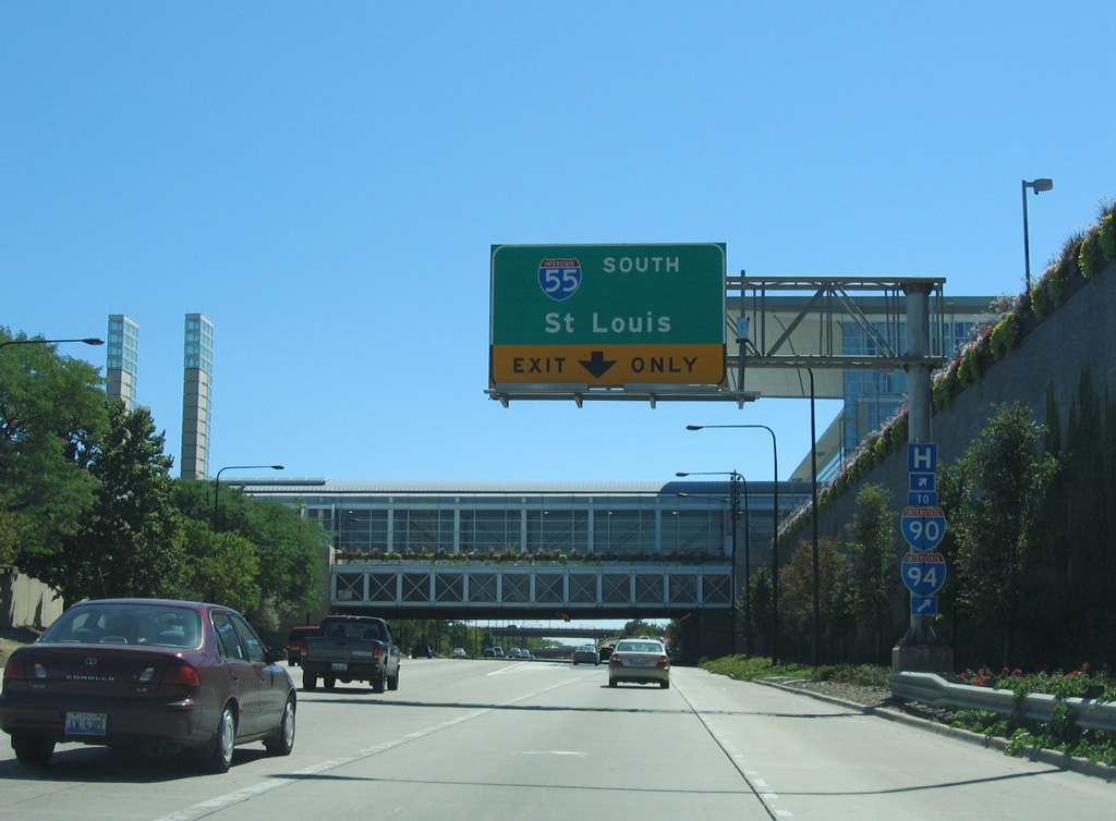
Crossing the Mississippi River for a second time, I-55 joins I-64/U.S. 40 from near the Gateway Arch into East St. Louis. There I-70 ties in from the Stan Musial Veterans Memorial Bridge, which opened to traffic in 2014, to replace I-64 as the northbound counterpart of I-55 to Troy.
The remainder of Interstate 55 through Illinois replaced U.S. 66. Most stretches of Old U.S. 66 are marked as an historical route, and sections through both Springfield and Lincoln double as Business Loop I-55. The freeway overlaps with Interstate 72 through the capital city of Springfield before angling northeast to Lincoln, Bloomington and Normal.
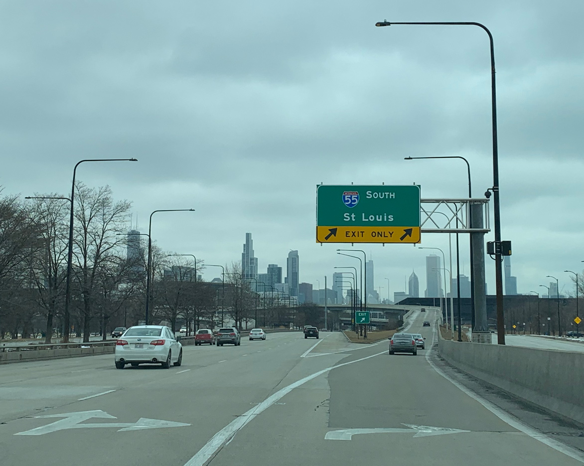
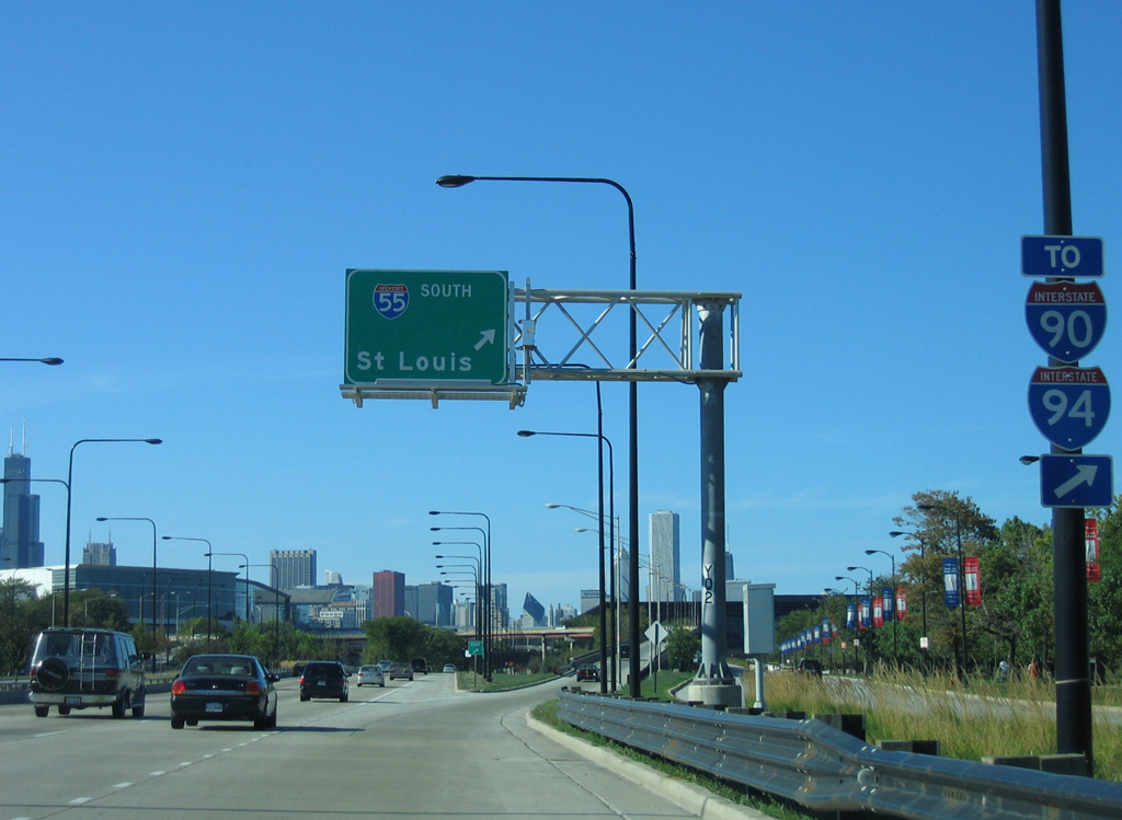
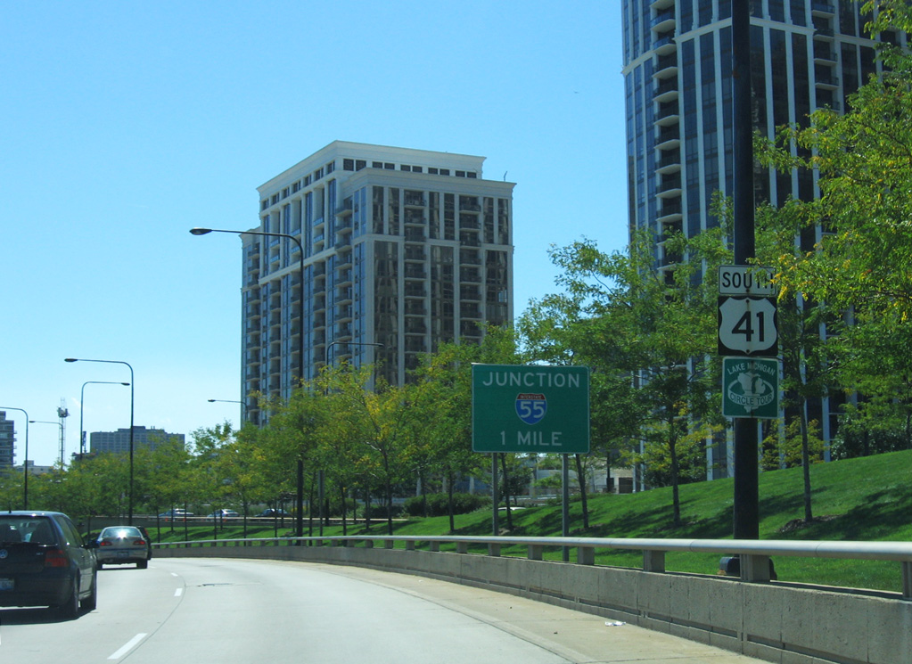
Interstate 74 combines with I-55 to the west of Bloomington while I-39 ends from the north at Normal. Interstate 55 continues northeast from there to Joliet (I-80) and the Stephenson Expressway leading into Chicago. The north end of I-55 is in Downtown Chicago at Lake Shore Drive (U.S. 41) near sprawling McCormick Place, the city’s convention center.
 Parallel U.S. Routes
Interstate 55 parallels U.S. 51 from New Orleans north to Memphis, then follows U.S. 61 from Memphis north to St. Louis. Between Memphis and St. Louis, U.S. 51 remains east of the Mississippi River, while Interstate 55 stays west of the river. Once at St. Louis, I-55 replaced U.S. 66 all the way to Chicago. U.S. 51 and I-55 meet again at Bloomington-Normal, and U.S. 51 north of that city has been largely subsumed by Interstate 39.
History
The first section of Interstate 55 approved for construction in Mississippi was a 27 mile long segment through Hernando, Coldwater and Senatobia. The contract was advertised in late 1956, and groundbreaking for construction followed in July 1957 in Coldwater.2
Interstate 55 was completed between Exit 49 / U.S. 61, north of New Madrid, Missouri, to U.S. 60 at Sikeston on September 1, 1960. An eight mile stretch of freeway opened that day, tieing in with a preexisting seven mile stretch.3 Further north in St. Louis, Interstate 55 was completed between the Jefferson County line and Downtown by 1967.4
Interstate 55 in Chicago, Illinois, follows the Stevenson Expressway. Originally known as the Southwest Expressway, this freeway extends northeast from the Cook-DuPage County Line to I-90/94 (Dan Ryan Expressway). The expressway opened to traffic on September 1, 1964. Exactly one year later, the Southwest Expressway was renamed the Adlai E. Stevenson Expressway, in memory of the former Illinois state Governor. The last section of I-55 completed in Chicago was the short extension from I-90/94 (Dan Ryan Expressway) east to U.S. 41 (Lake Shore Drive) in 1966.5,6
Route Information
Mileage
Louisiana – 65.81
- Cities – Hammond
- Junctions –

Mississippi – 290.41*
- Cities – McComb, Brookhaven, Jackson, Canton, Winona, Southaven
- Junctions –

Tennessee – 12.28
Cities – Memphis
- Junctions –
Arkansas – 72.22**
Cities – West Memphis, Blytheville
- Junctions –
Missouri – 210.45#
Cities – Sikeston, Cape Girardeau, Perryville, St. Louis
Junctions –
Illinois – 313.08##
Cities – East Saint Louis, Edwardsville, Litchfield, Springfield, Lincoln, Bloomington, Pontiac, Joliet, Chicago
Junctions –
Source: December 31, 2021 Interstate Route Log and Finders List
* – 1.60 miles on I-20, 9.20 miles on I-69
** – 2.22 miles on I-40
# – 1.00 mile on I-44, 0.40 miles on I-64
## – 2.70 miles on I-64, 5.89 miles on I-74, 16.00 miles on I-70
I-55 Annual Average Daily Traffic (AADT)
| Location | Vehicles per day |
|---|---|
| Kentwood, LA | 9,898 |
| Hammond, LA | 58,793 |
| Memphis, TN | 131,916 |
Source: 2019 AADT – LADOTD Estimated Annual Average Daily Traffic Routine Traffic Counts
Tennessee Department of Transportation (TDOT) Transportation Data Management System 2021 AADT
The portion of I-55 between MS 16 north of Canton (Exit 124) and Vaiden (Exit 174) was the last section of Interstate 55 opened in Mississippi. It was completed in 1973.7
Through southeastern Missouri, Interstate 55 was completed initially at the Arkansas state line and from Sikeston north to Jackson.
Interstate 72 east combines with I-55 north for 5.1 miles around the southeast side of Springfield, Illinois. The overlap is not acknowledged on the FHWA Route Log and Finder List. 05/24/18
 Photo Guides
North End  (Jean Baptiste Point DuSable Lake Shore) – Chicago, Illinois
![]() North at
North at ![]() Lake Shore Drive
Lake Shore Drive
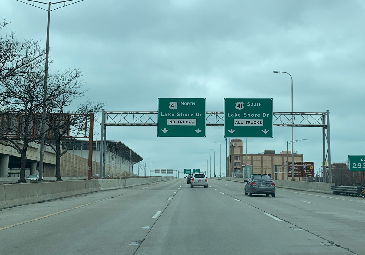
I-55 (Stevenson Expressway) advances east from Chinatown 0.75 miles to U.S. 41 (Lake Shore Drive) by McCormick Place, Chicago’s convention center. Photo by Peter Johnson (01/18/21).
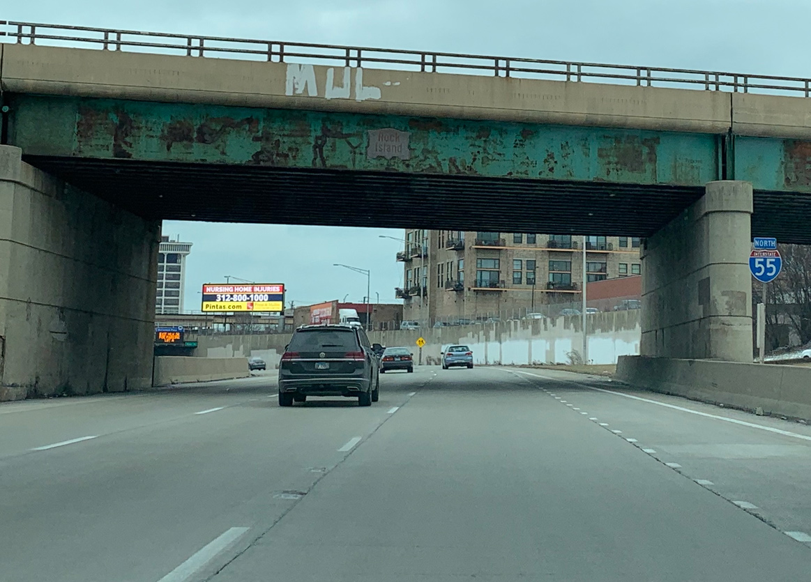
The final reassurance shield for north Interstate 55 stands beyond the Cermak Road exit below the Rock Island Railroad overpass. Photo by Peter Johnson (01/18/21).
I-55 navigates through an S-curve below the freeway spur linking the Dan Ryan Expressway with Cermak Road. The ensuing exit joins the Stevenson Expressway with Dr. Martin Luther King, Jr. Drive. Photo by Peter Johnson (01/18/21).
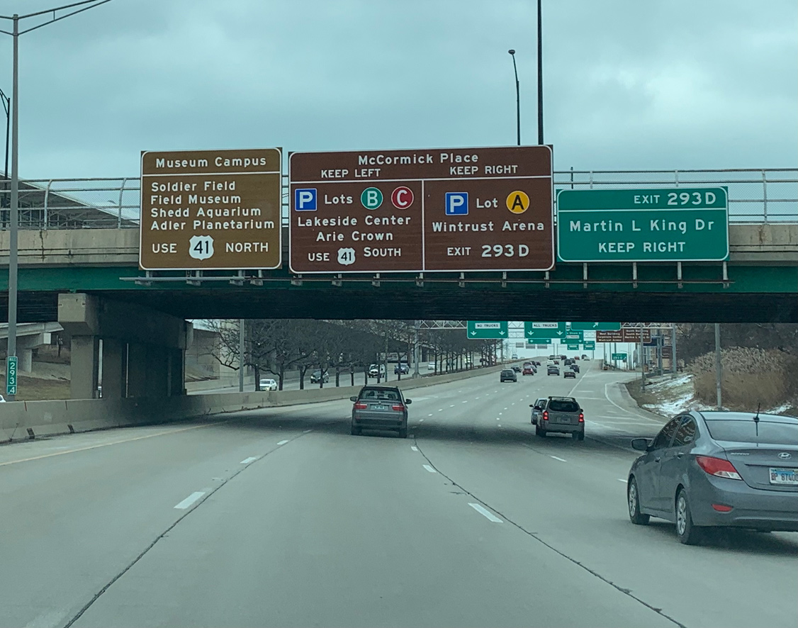
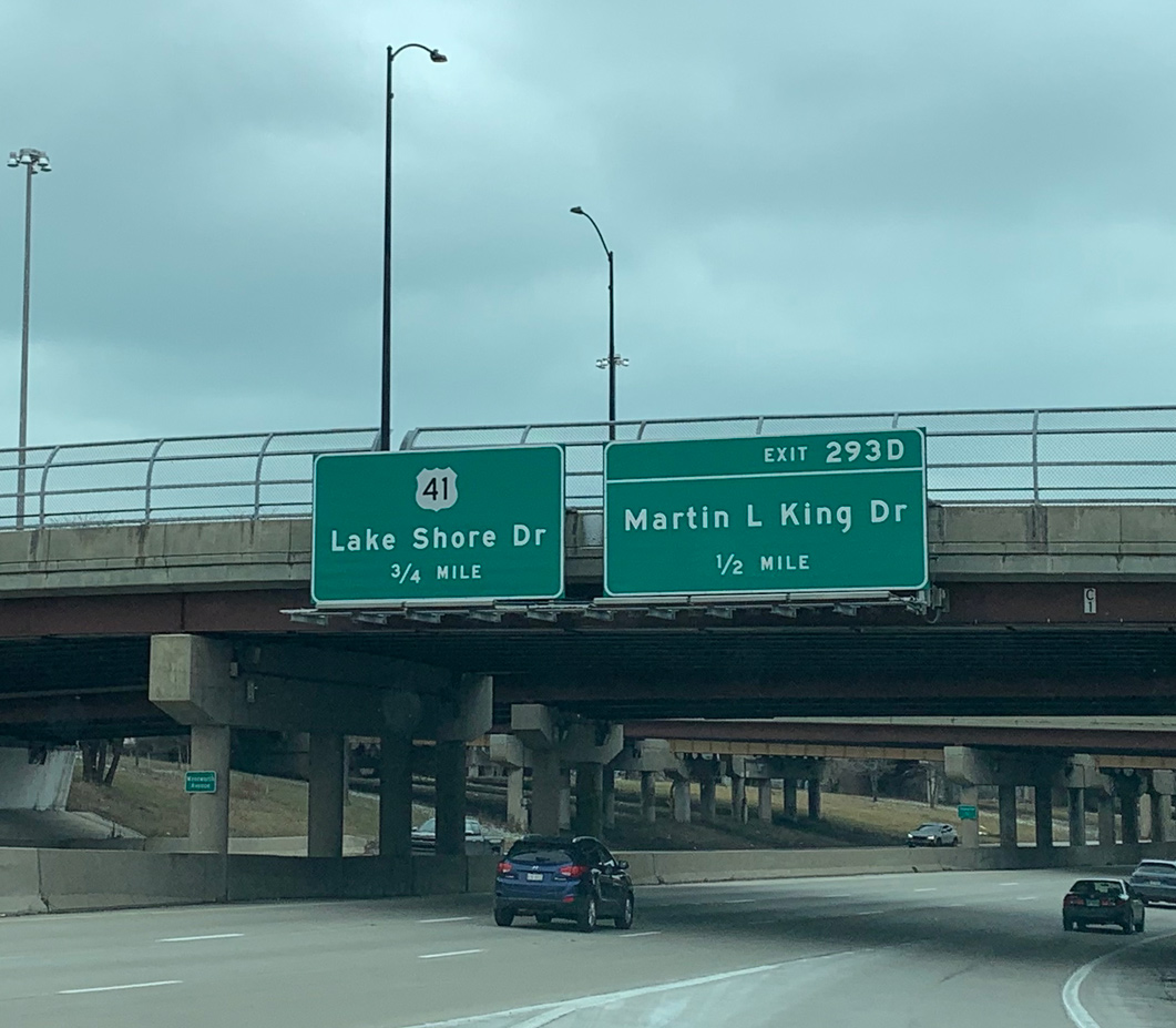
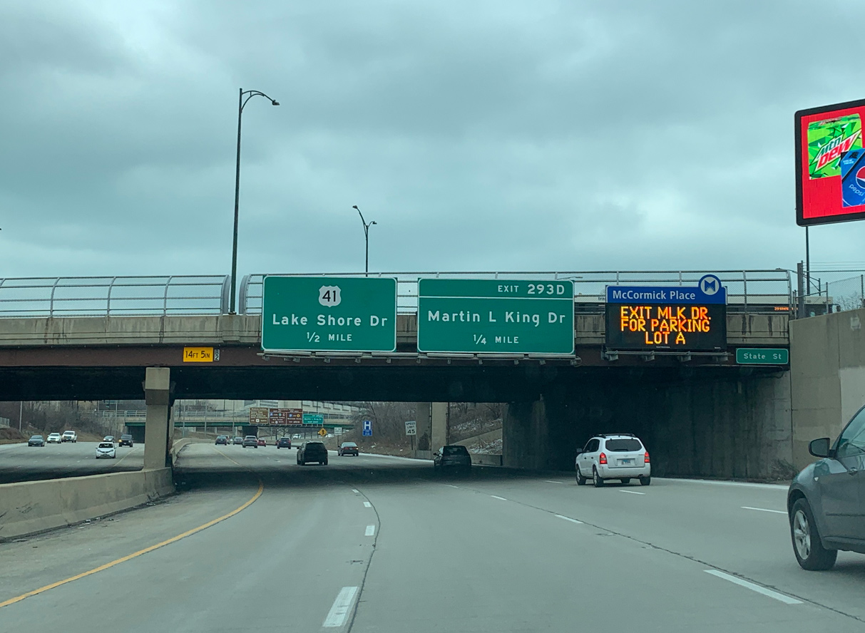
Michigan Avenue spans Interstate 55 just ahead of Exit 293D for E 25th Street to MLK Dive and McCormick Place. Photo by Peter Johnson (01/18/21).
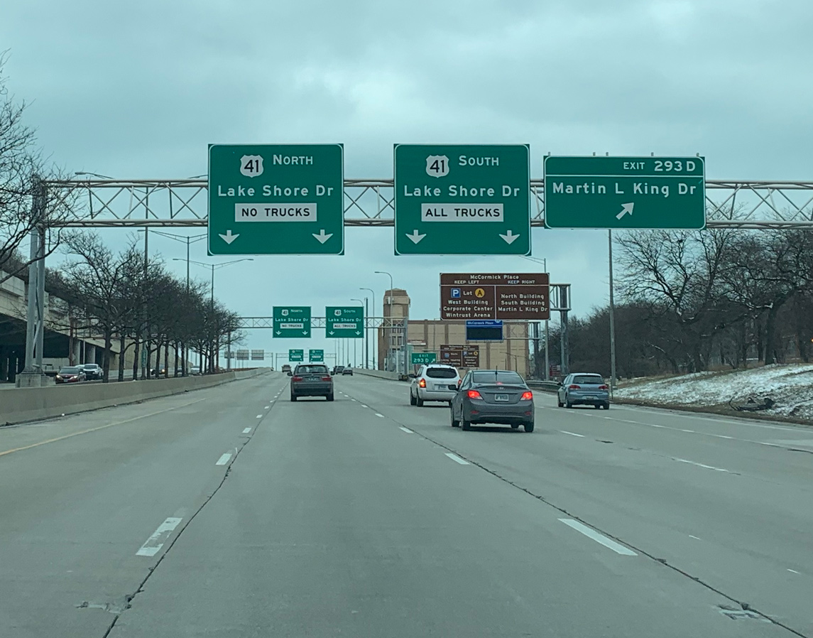
Construction in 2016/17 rebuilt the directional T interchange with U.S. 41 (Lake Shore Drive) so that two lanes connect with the route south along the Lake Michigan shoreline. U.S. 41 was renamed Jean Baptiste Point DuSable Lake Shore Drive in June 2021. Photo by Peter Johnson (01/18/21).
Advancing east along side McCormick Place toward the flyovers for U.S. 41. While Lake Shore Drive travels at-grade within the vicinity of I-55, U.S. 41 upgrades to a freeway to the north of Downtown Chicago. Photo by Peter Johnson (01/18/21).
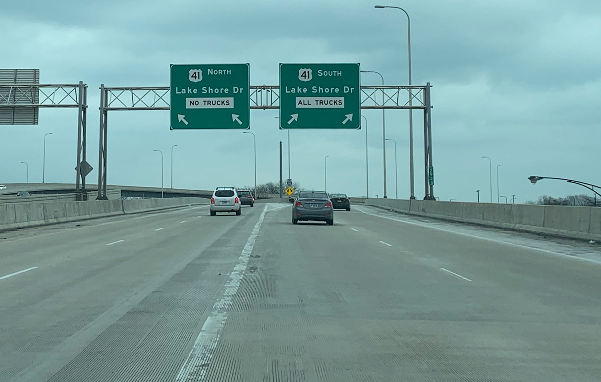
U.S. 41 (Lake Shore Drive) heads north from I-55 to Soldier Field (home of the Chicago Bears), the world renowned Shedd Aquarium, and Grant Park. All trucks are required to take the southbound ramp toward the Douglas and Hyde Park neighborhoods. Photo by Peter Johnson (01/18/21).
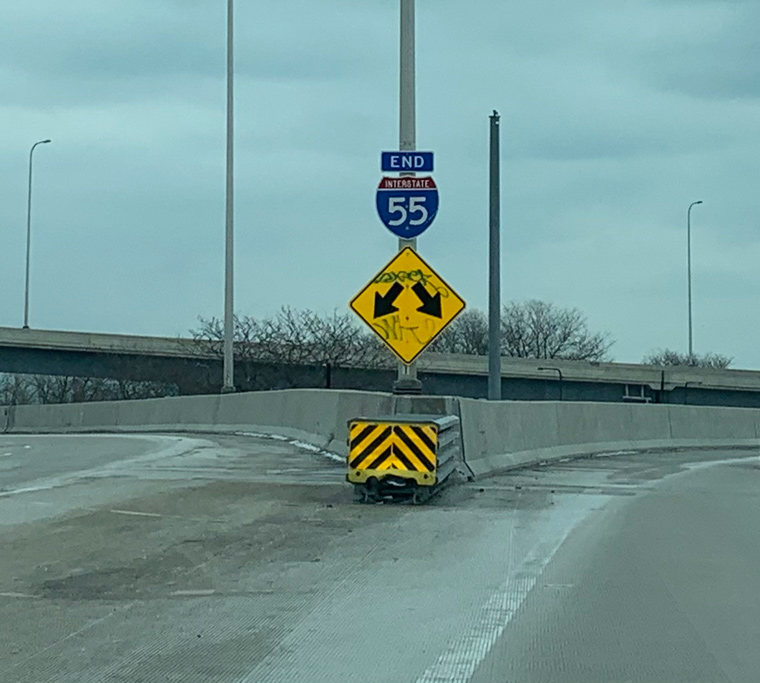
The end shield for I-55 at the gore point separating traffic was installed by 2017. Lake Shore Drive was once proposed as part of an Interstate 494 downtown loop. The highway never came to fruition as it would have involved serious alteration of the Lake Michigan waterfront. Photo by Peter Johnson (01/18/21).
![]() Lake Shore Drive – South at
Lake Shore Drive – South at ![]()
One mile ahead of the directional T interchange with Interstate 55 (Stevenson Expressway) on U.S. 41 (Jean-Baptiste Pointe DuSable Lake Shore Drive) south. 06/24/22
U.S. 41 (Lake Shore Drive) runs along side McCormick Place Convention Center to the exit for I-55 (Stevenson Expressway) south. 06/24/22
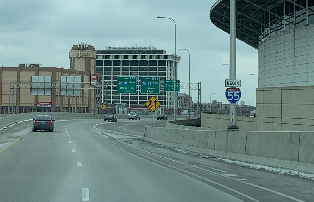
The Stevenson Expressway generally parallels old U.S. 66 en route toward Joliet. The initial exchanges along I-55 connect with State Street and the Dan Ryan Expressway (I-90/94). 06/24/22
![]() Lake Shore Drive – North at
Lake Shore Drive – North at ![]()
U.S. 41 (Jean Baptiste DuSable Lake Shore Drive) runs north from the Kenwood and Oakland neighborhoods along Lake Michigan to Interstate 55 by McCormick Place. Photo by Peter Johnson (01/18/21).
A two lane flyover connects U.S. 41 (Lake Shore Drive) north to Interstate 55 (Adlai E. Stevenson Expressway) southbound. Photo by Peter Johnson (01/18/21).
![]() South
South
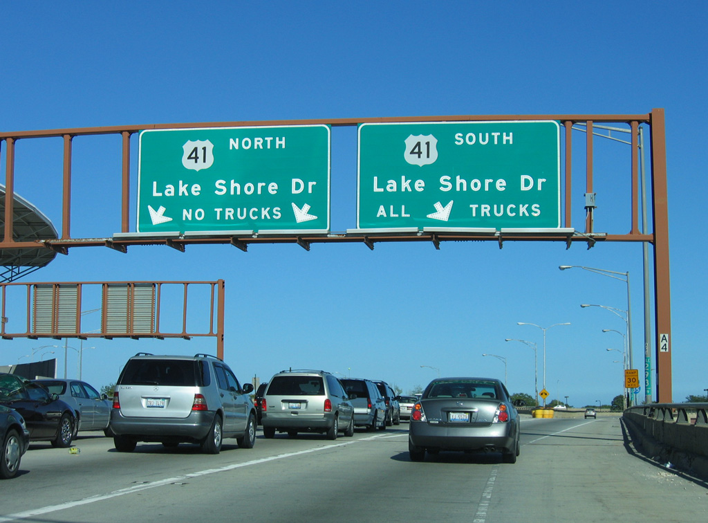
A begin shield for Interstate 55 stands where the two flyovers from U.S. 41 (Lake Shore Drive) converge by McCormick Place. Photo by Peter Johnson (01/18/21).
North End Throwback
![]() North at
North at ![]() Lake Shore Drive
Lake Shore Drive
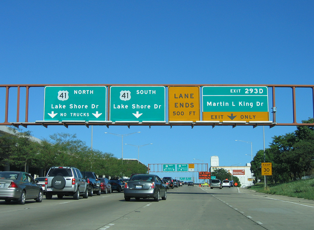
Button copy guide signs for Exit 293D and U.S. 41 (Lake Shore Drive). 09/03/05
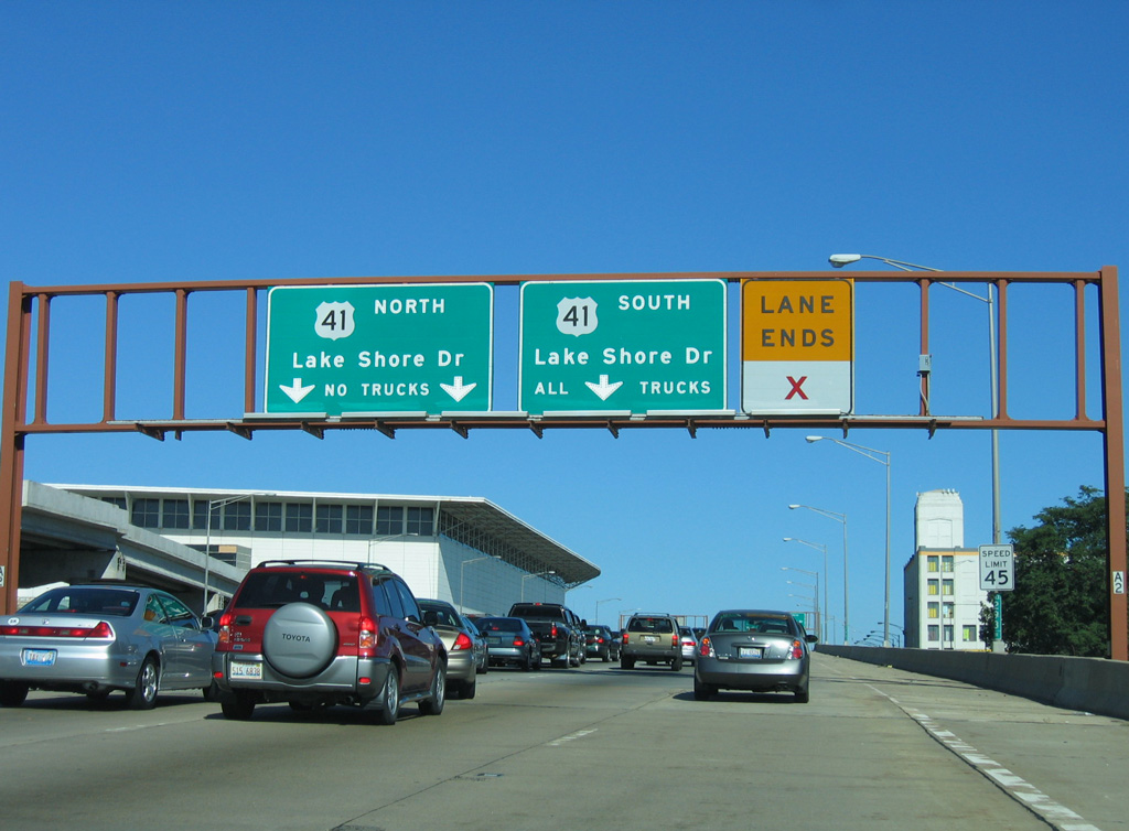
The lane drop preceding the ramp for U.S. 41 (Lake Shore Drive) south was eliminated by 2017. 09/03/05
The flyovers to U.S. 41 (Lake Shore Drive) span Metra transit lines and S Moe Drive. 09/03/05
End shields for I-55 were posted along the previous flyover ramps to U.S. 41. 09/03/05
![]() Lake Shore Drive – North at
Lake Shore Drive – North at ![]()
U.S. 41 (Lake Shore Drive) northbound passes under the 35th Street Pedestrian Bridge one mile ahead of Interstate 55. Photo by Dan Garnell (08/28/03).
The control city for Interstate 55 throughout Chicago is St. Louis, although I-55 connects to Joliet and several downstate cities, such as Bloomington-Normal, Lincoln and Springfield. 09/03/05
![]() Lake Shore Drive – South at
Lake Shore Drive – South at ![]()
U.S. 41 (Lake Shore Drive) heads one mile south from Roosevelt Road to the north end of Interstate 55. 09/03/05
A diamond interchange connects Lake Shore Drive with 18th Street and Museum Campus Drive a half mile north of Interstate 55. 09/03/05
A sky bridge connects the East and West Buildings of McCormick Place above Lake Shore Drive south at the ramp for Interstate 55. 09/03/05
South End – La Place, Louisiana
![]() South at
South at ![]()
![]()
Six miles separate Rudduck from the southbound split of U.S. 51 from Interstate 55 to LaPlace. Photo by Peter Johnson (02/23/20).
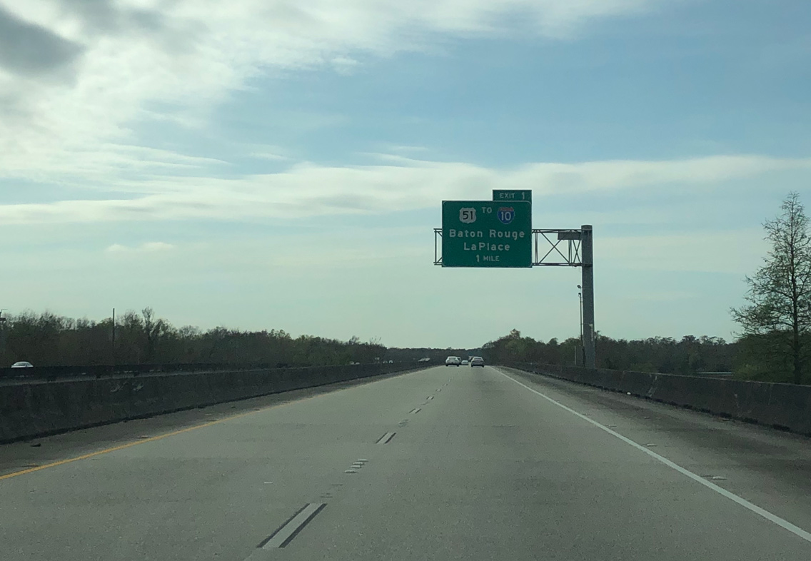
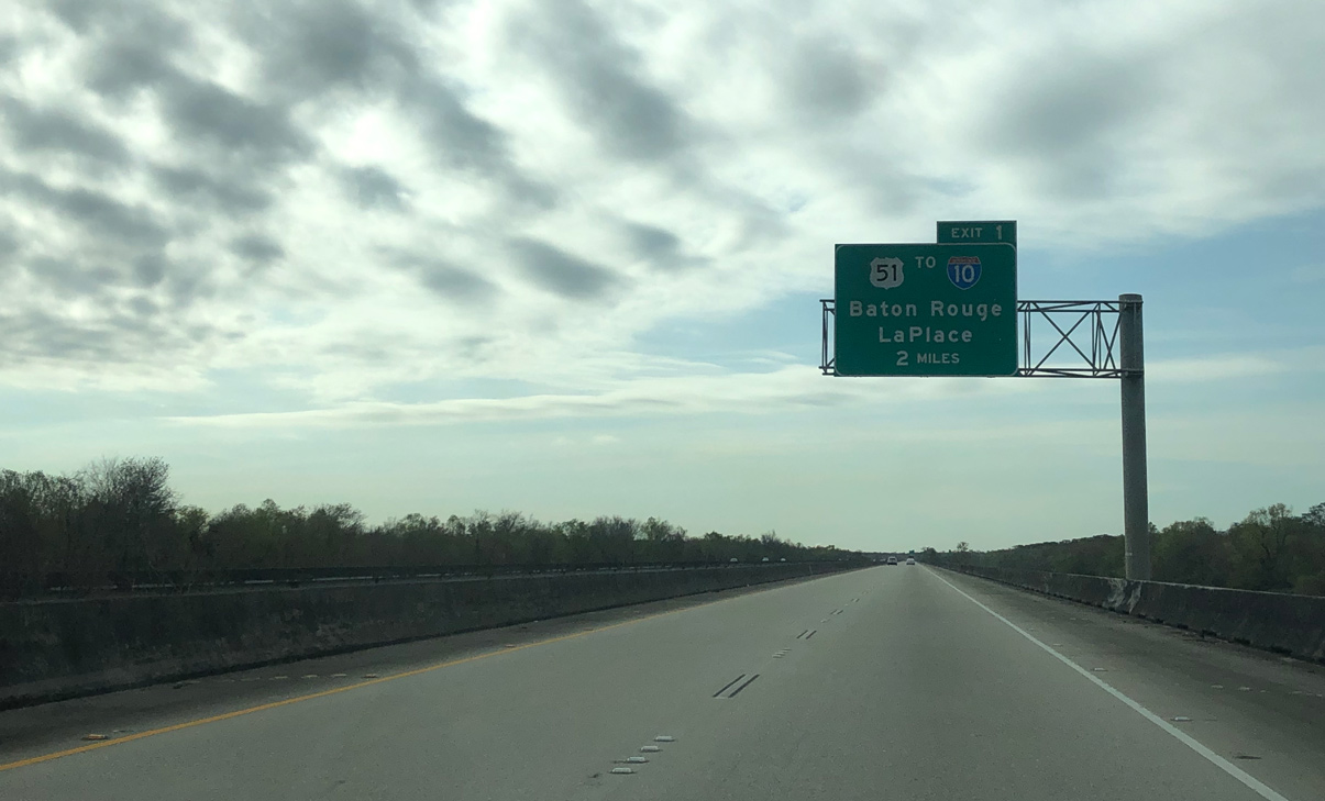
Interstate 55 south defaults onto I-10 east to New Orlenas. A Breezewood connection utilizes U.S. 51 south via Exit 1 for I-10 west to Baton Rouge. Photo by Peter Johnson (02/23/20).
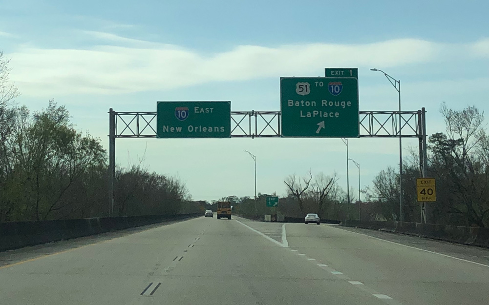
Entering the half diamond interchange with U.S. 51 south and Old U.S. 51 north along Interstate 55. I-10 travels ten miles east to Kenner and along the north side of LaPlace nearby. Photo by Peter Johnson (02/23/20).
Taking the two lane ramp to I-10 east toward Kenner, motorists join a viaduct system over southern reaches of Lake Pontchartrain and the Bonnet Carre Spillway. Photo by Peter Johnson (02/23/20).
![]() West at
West at ![]()
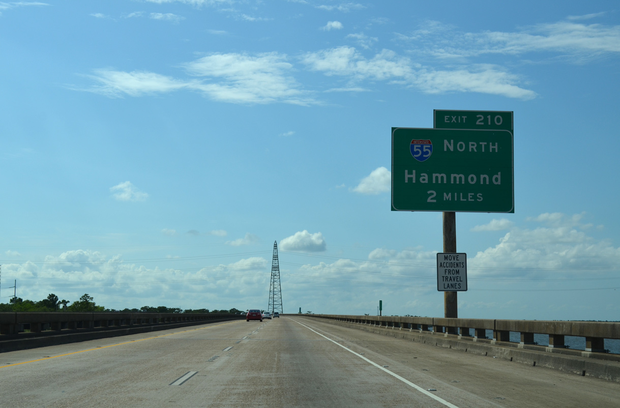
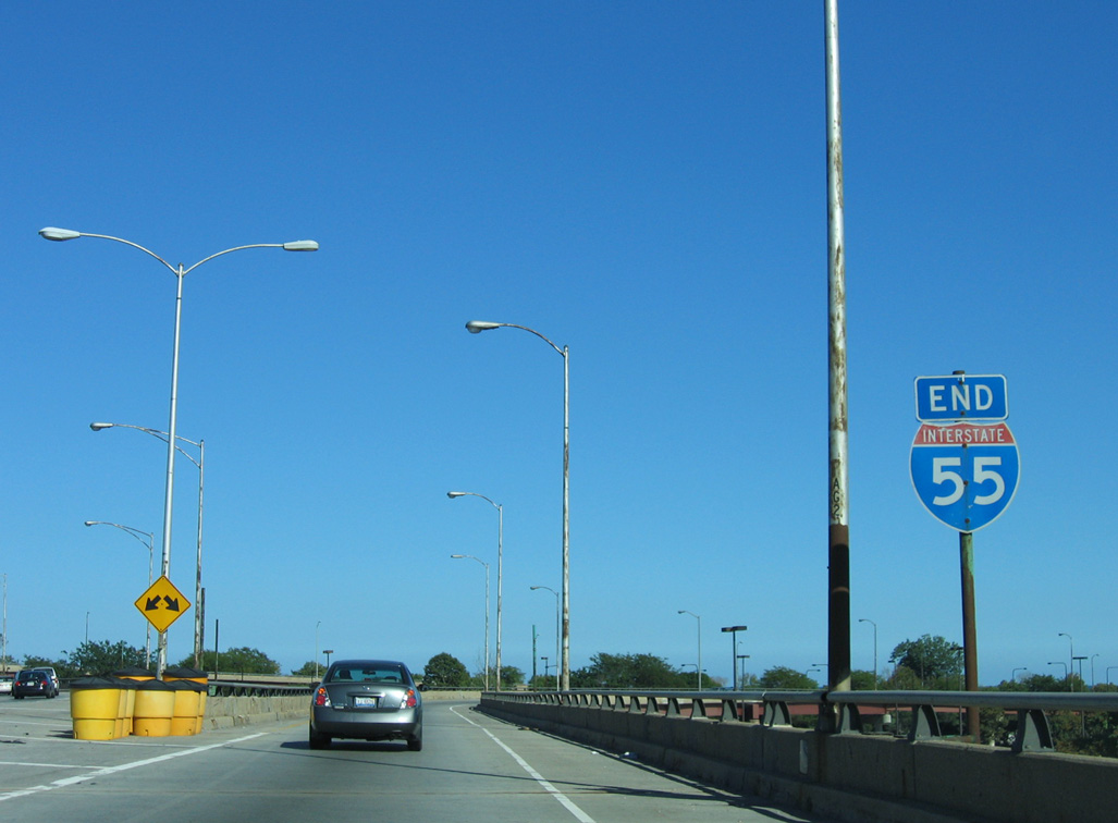
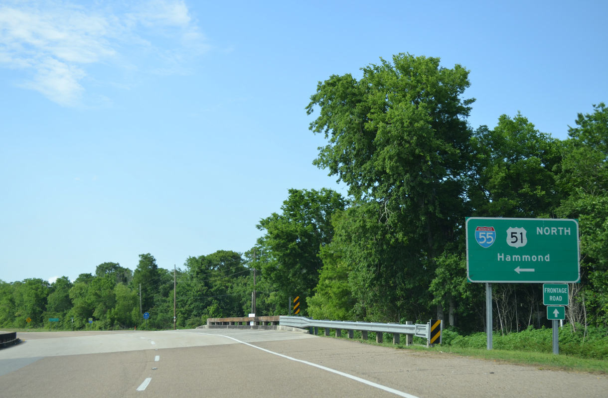
Crossing over southwestern reaches of Lake Pontchartain, Interstate 10 advances two miles west to Exit 210 with I-55 north. Interstate 55 commences along a viaduct, continuing the stretch of elevated highway along I-10 another 23 miles to Pontchatoula. 05/09/15
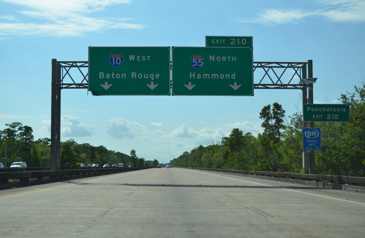
Advancing west over wetland areas, I-10 approaches the elevated wye interchange (Exit 210) with Interstate 55 north. U.S. 51 combines with I-55 northward from La Place to Ponchatoula. The parallel old alignment remains drivable. 05/09/15

Two lanes separate from I-10 west for Interstate 55 north to Hammond (I-12) and Jackson, Mississippi. The succeeding off-ramp connects with U.S. 51 southwest 3.3 miles to its end at U.S. 61 in LaPlace. 05/09/15
![]() East at
East at ![]()
![]()
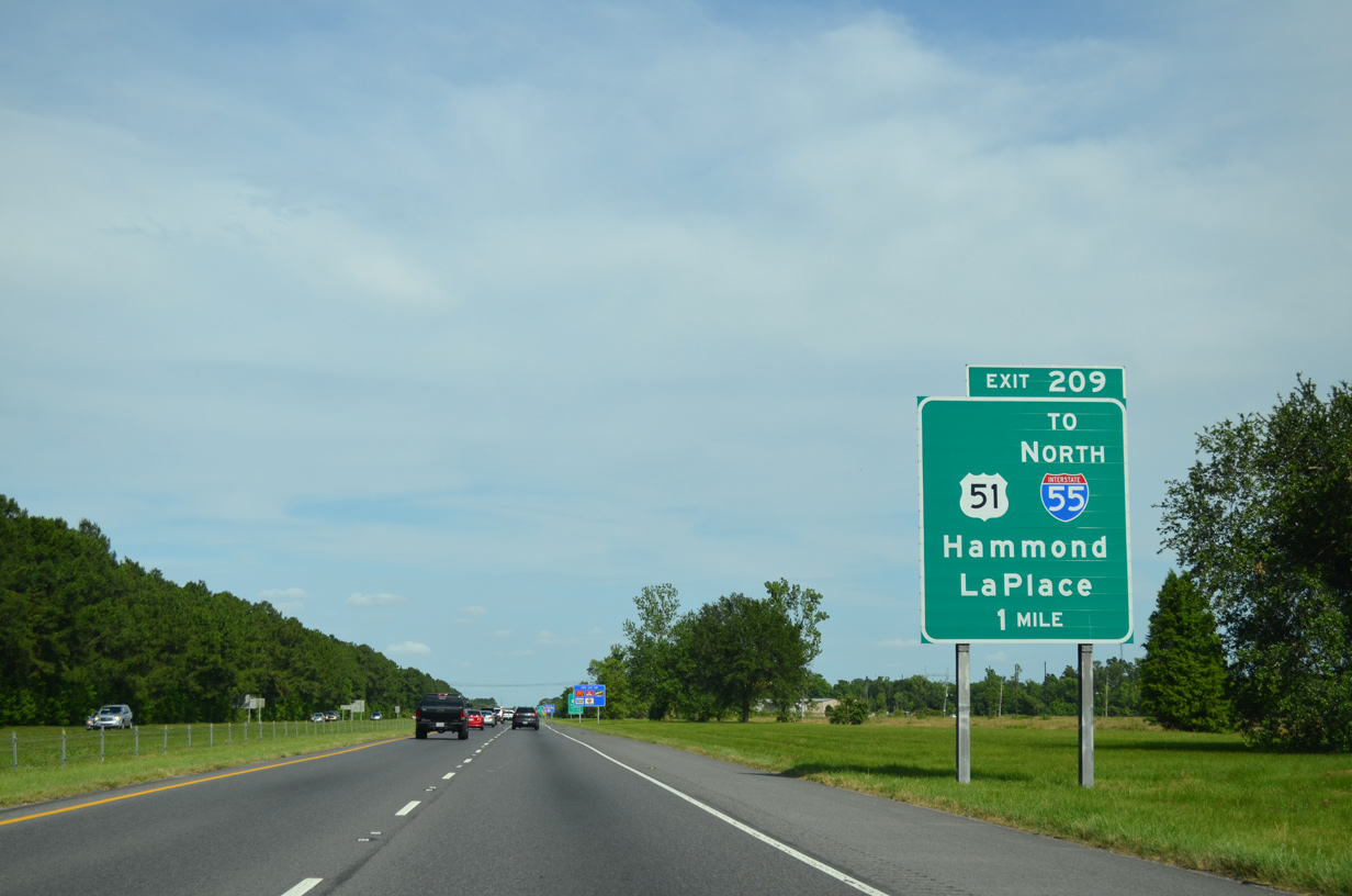
Interstate 10 passes just north of suburban areas of LaPlace to a diamond interchange (Exit 209) with U.S. 51. U.S. 51 extends northeast from U.S. 61 along an arterial route to adjacent ramps with I-55. 05/09/15
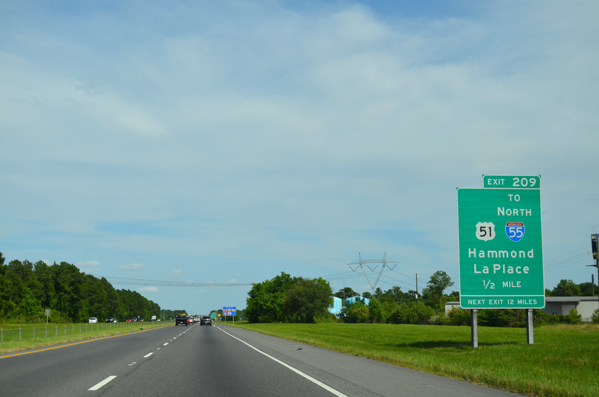
Exit 209 represents the last services for either I-10 east or I-55 north for a substantial distance as both routes elevate across areas around Lake Pontchartrain. U.S. 51 combines with Interstate 55 north for 25 miles to Pontchatoula. 05/09/15
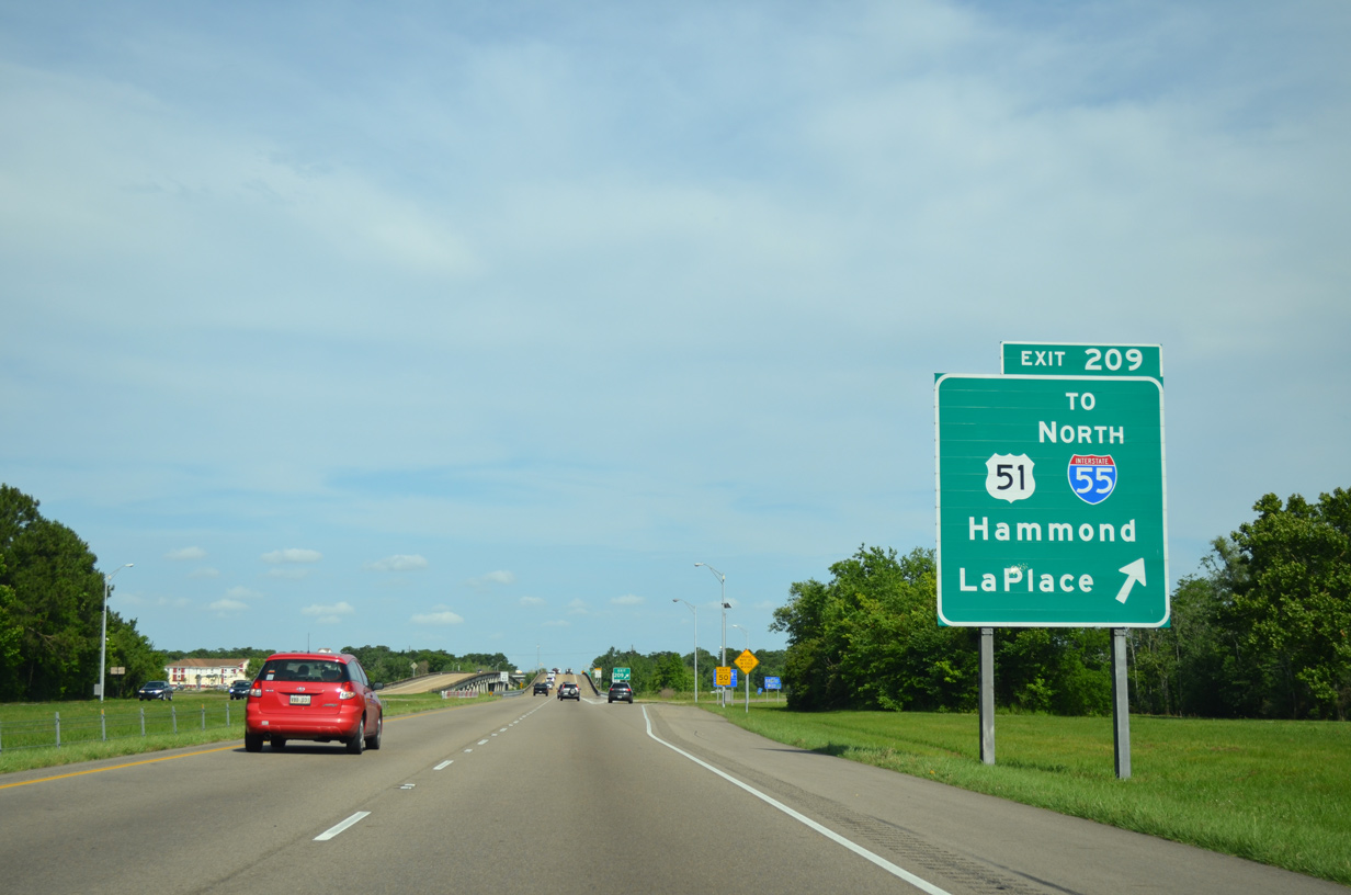
There is no direct access from Interstate 10 east to I-55 north. Instead motorists must navigate along U.S. 51 north from Exit 209 to make the connection. 05/09/15
U.S. 51 leads north from the ramps at I-10 a short distance to combine with Interstate 55 toward Hammond. Old U.S. 51 parallels the east side of the elevated freeway through Ruddock and Manchac. 05/09/15
![]() North
North
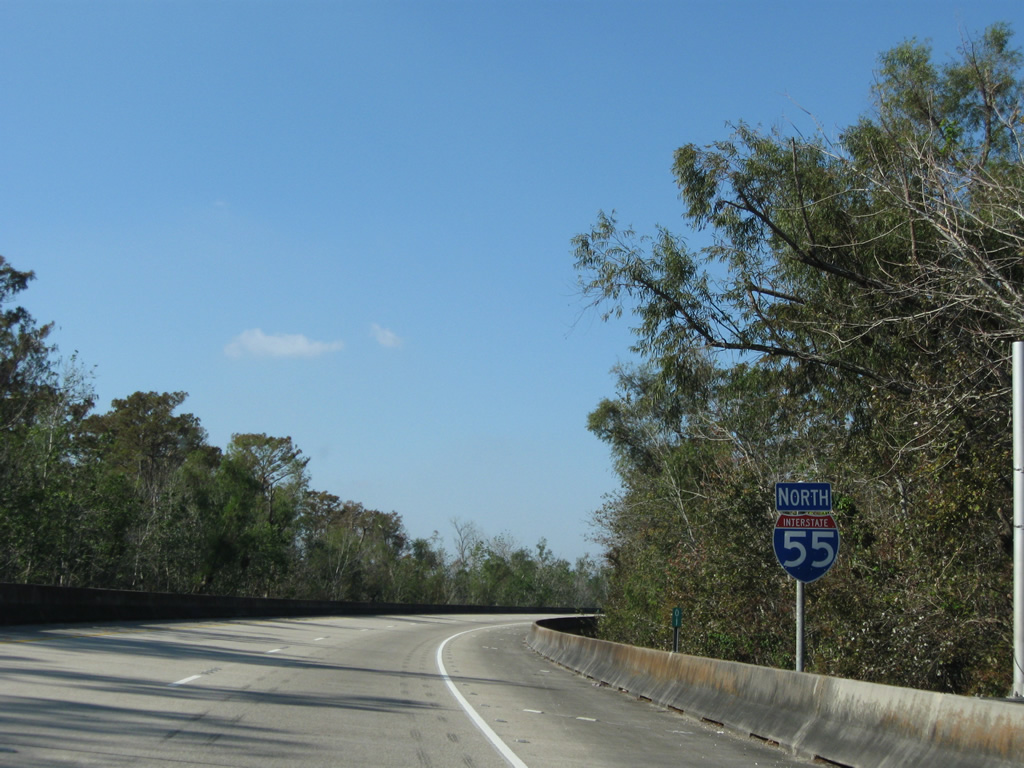
The first confirming marker for Interstate 55 north appears along the ramp from I-10 west at Exit 210. 11/20/08
South End Throwback


Previous overheads for Interstate 10 and U.S. 51 along I-55 south. Photos by Chris Patriarca (05/13/03).
Sources:
- Tennessee Interstate System at 50: Facts and Trivia
http://www.tninterstate50.com/Tnfacts.htm. - Celebrating the 50th Anniversary of the Eisenhower Interstate Highway System: Previous Interstate Facts of the Day by the Federal Highway Administration (FHWA).
- “New Highway Stretch Open.” The Southeast Missourian, September 2, 1960.
- Vintage St. Louis, online posting. Facebook.com. July 14, 2013.
- Chicago Timeline: 1964 Southwest Expressway Opened; September 1, 1965–Renamed Adlai E. Stevenson Expressway, Chicago Public Library, updated August 1997
http://www.chipublib.org/004chicago/timeline/stevensonx.html. - Encyclopedia of Chicago: Expressways by Dennis McClendon of the Chicago Historical Society
- Interstate Highway 55, Adam Froehlig.
- “Whatever Happened To: the I-55/Crump Blvd. Interchange.” Memphis Flyer (TN), March 29, 2022.
Page updated June 29, 2022.