Interstate 49

Overview
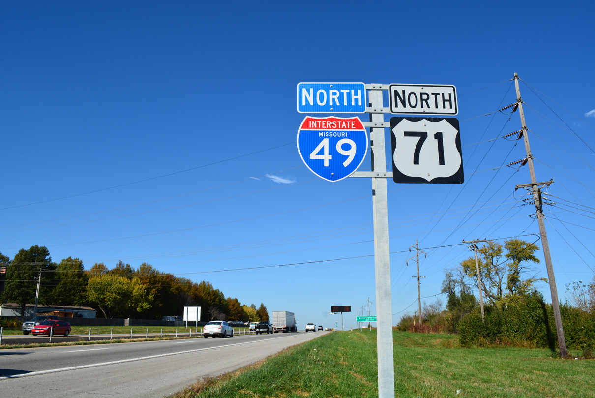
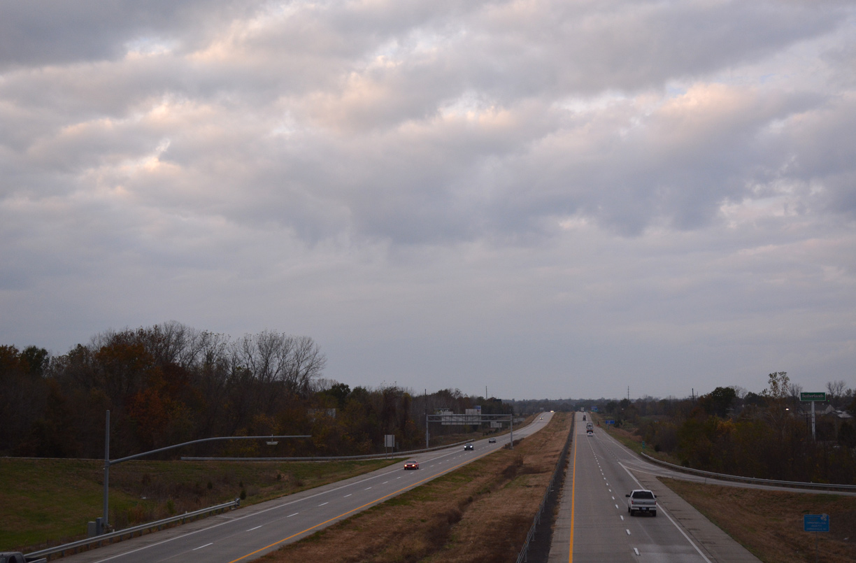
Envisioned as a nearly 850 mile route from New Orleans to Kansas City, Interstate 49 is currently signed on two segments from the Gulf Coast to the Midwest. The original 208 mile long stretch runs north from Lafayette to Shreveport, where it ties into I-20 southwest of Downtown. I-49 dog legs west alongside I-20, 5.3 miles to I-220, which it joins six miles northeast to North Shreveport. The ensuing stretch of I-49 leads 78 miles north from Blanchard, Louisiana to Texarkana, Arkansas.
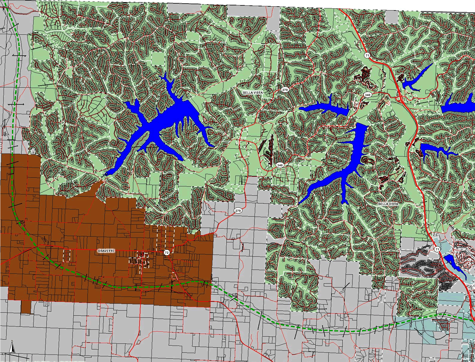
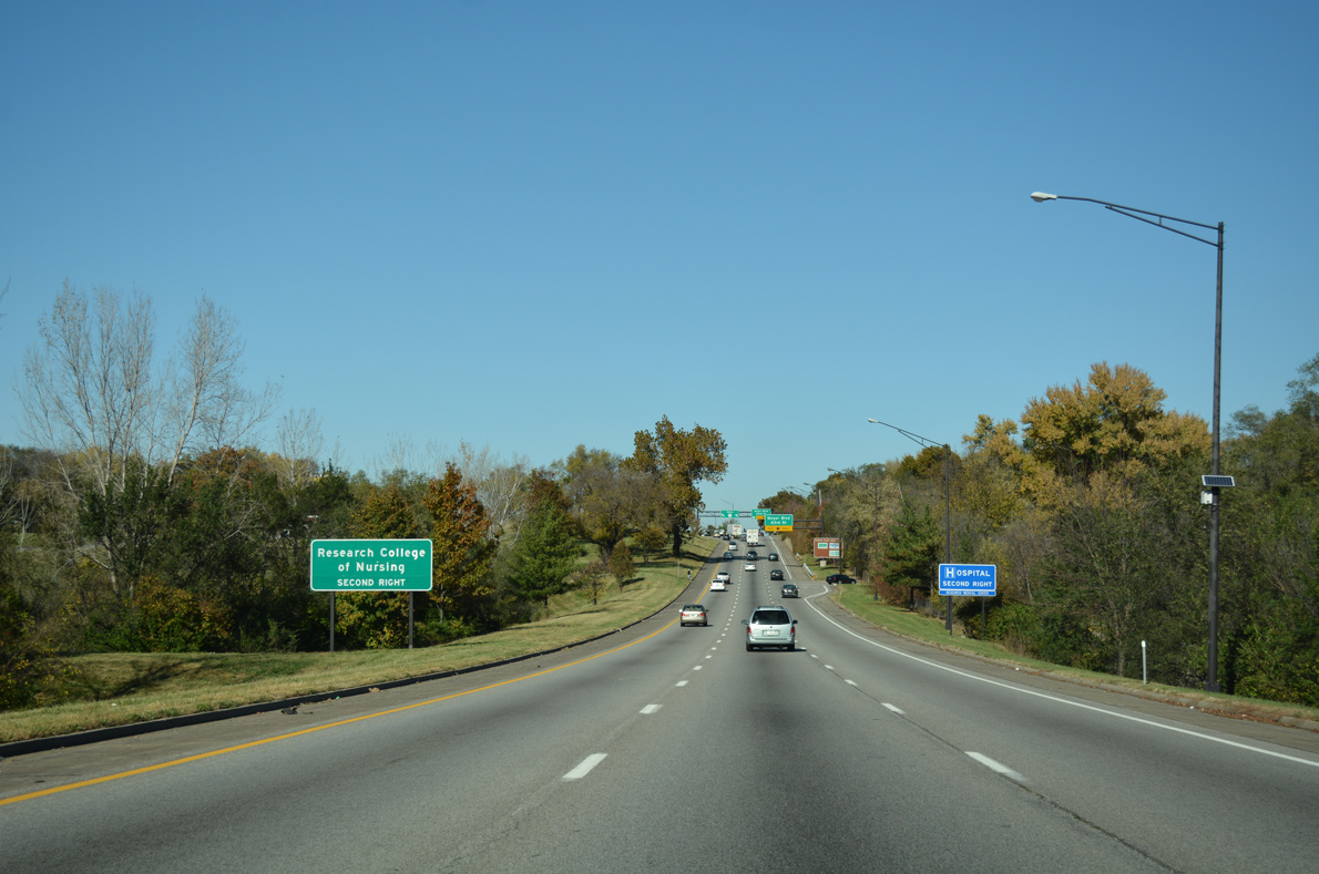
The northern section of Interstate 49 measures 269 miles in length from I-40 at Alma in northwest Arkansas to the Three Trails Crossing interchange joining I-435, I-470, U.S. 50 and U.S. 71 at Grandview, Missouri. Prior to the completion of the Bella Vista Bypass, I-49 replaced I-540 south 72 miles from Bentonville to I-40 northeast of Fort Smith. I-49 also extended north from U.S. 71 at Pineville, Missouri 179 miles to the Kansas City area. These separate segments were joined following a ribbon cutting ceremony held on September 30, 2021 for the completion of the Bella Vista Bypass. 18 miles in length, the Bella Vista Bypass runs around the south and west sides of the city northward into Missouri.
Signed as Arkansas Highway 549, a segment of Future I-49 is open to traffic along the six mile long Chaffee Crossing segment to the southeast of Fort Smith, Arkansas.
Interstate 49 will ultimately extend southeast from Lafayette, Louisiana to the Westbank Expressway leading into New Orleans. Future I-49 corridor signage appears along U.S. 90 and upgrades to Interstate standards are slowly continuing along the corridor. Future I-49 was approved from Lafayette to Interstate 310 at Boutte, Louisiana by the American Association of State Highway Officials (AASHTO) on November 6, 1998. Further east, the section between I-310 and the exchange joining the Westbank Expressway (unsigned I-910) with I-10 in New Orleans was designated as Future I-49 on October 1, 1999.
High Priority Corridor
Interstate 49 from Shreveport to Kansas City is part of High Priority Corridors 1 and 72: North-South Corridor, while the future section between New Orleans and Lafayette is part of High Priority Corridor 37: U.S. 90.
Construction Progress
Louisiana
Construction along Interstate 49 South includes a number of projects converting U.S. 90 into a limited access highway. Within Lafayette Parish, construction for an interchange along U.S. 90 at Ambassador Caffery (LA 3073) started in Summer 2014. The project was slated for completion by Summer 2018, but delayed due to heavy rains and widespread flooding in August 2016. Incurring an additional $6.6 million in costs, the $63.7 million investment continued to late June 2019.45 Construction expanded U.S. 90 to six lanes for 1.6 miles between LA 3073 and built a new overpass joining Albertson Parkway and St. Nazaire Road.39 Southeast in St. Mary Parish, a $55.7 million project added an interchange at U.S. 90 and LA 318. Started in July 2015 and anticipated for completion in December 2017,40 the exchange opened following a ribbon cutting ceremony held on April 27, 2018.46
Further east at Patterson, $15 million in federal money funded the construction of over 30 J-turns from Ricohoc to Berwick to eliminate crossovers along U.S. 90. Work on the safety measure commenced by March 2017 and was finished by Spring 2018.46 The upgrade is a temporary solution for U.S. 90 until state officials can secure funds for the building of permanent overpasses at Red Cypress Road in Patterson, Thorguson Road in Berwick and Southeast Boulevard in Bayou Vista. With a potential interchange added at Tiffany and Lipari Streets in Patterson, frontage roads will connect the cross roads. Costs are estimated at $250 million for the array of projects.40
The I-49 Lafayette Connector is a 5.5 mile long limited access highway proposed southward from I-10/49 to Lafayette Regional Airport (LFT). Government, business and community leaders collaborated in the planning and Conceptual Design Phase, which advanced through 2018. Options considered ranged from a tunnel, a partially below grade roadway and two elevated viaducts. 24 design modifications were under study by consultants as of October 2016.43
Costs for the I-49 Lafayette Connector were estimated to be around $800 million in 2019. A Record of Decision for the project was expected by 2021, but instead the I-49 Lafayette Connector Advisory Group held a series of workshops into 2021. Funding and construction for the roadway will be divided into sections that will open to traffic prior to the project’s completion.47
The gap between the separate segments of Interstate 49 in Shreveport was addressed by designating I-49 alongside I-20 and I-220. AASHTO approved the request by Louisiana for the overlap on May 21, 2019, but I-49 remained unsigned along I-20/220 as of October 2021. The alignment circling around the west side of Shreveport for I-49 may be temporary, as efforts emerged from the city of Shreveport and local officials to build the I-49 Inner City Connector. Approximately 3.6 miles in length, if constructed the Connector will extend I-49 north from I-20 along Peter Harris Drive to Ford Street and then northwesterly along Twelvemile Bayou to I-220. A Feasibility Study and Environmental Inventory was completed in May 2010, followed by work on an Environmental Impact Statement, which continued into 2022.
The State Legislature allocated $100 million in funds for the Inner City Connector in June 2019. The Northwest Louisiana Council of Government Committee voted on a preferred route, with several alternatives still considered at that time. The roadway was estimated to cost around a half billion dollars.48
Arkansas
A half diamond interchange with U.S. 59/71 at the north end of I-49 outside Texarkana, Arkansas will eventually connect with a six to eight mile alignment proposed through Bowie County, Texas. This includes a proposed interchange with Interstate 369.
As of Fall 2016, no construction was underway for Interstate 49 between Texarkana and the Fort Smith area. Chamber of Commerce representatives from along the corridor discussed the final stages of completing I-49 in June 2016. The meeting encouraged moving forward on the project, with a focus on building the I-49 bridge over the Arkansas River at Alma and the initiation of right of way acquisition south of Fort Smith.41 The 2016-20 State Transportation Improvement Plan (STIP) included a $27.4 million request for preliminary engineering for the span. Coupled with right of way purchases and utility costs, the Arkansas River bridge was expected to cost more than $235.4 million. Associated work to build 13.81 miles of new road from AR 22 north to Interstate 40 was estimated to cost $235.4 million.41
The Arkansas Department of Transportation (ARDOT) announce on January 7, 2022 that construction extending Interstate 49 southwest from I-40 near Alma to AR 22 / Chaffee Crossing in Barling will commence in Fall 2022.53 $270 million in funds for the 13.7 mile section of Future I-49 were derived from Issue 1, legislation funding new highway construction statewide passed by voters in November 2020. Coupled with land donation from the Fort Chaffee Redevelopment Authority (FCRA) for the Barling interchange, ArDOT can advance with construction plans, which include building a two lane bridge over the Arkansas River.52,53
An additional $270 million in funding from Issue 1 goes toward long term plans to further extend of Interstate 49 south from Greenwood to U.S. 270 at Y City.52
Missouri
The Interstate 49 corridor will not utilize the Route 249 and Route 171 corridor east of Joplin due to the presence of traffic signals at the diamond interchange between U.S. 71, Route 96 and Route 171 south.
However three options for consideration in the long term are:17
- Retain the I-44/49 overlap, but upgrade the cloverleaf interchange at Exit 18 into a directional interchange.
- Utilize the Route 249/171 corridor by upgrading the interchange between U.S. 71 and Route 96/171.
- Utilize the Route 249/171 corridor by construction a new freeway connection from near Morgan Heights northeast to Interstate 49, bypassing Carthage to the north.
Route Information
Mileage
Louisiana – 239.25
Cities – Lafayette, Opelousas, Alexandria, Natchitoches, Shreveport
- Junctions –


Arkansas – 124.31
Cities – Texarkana, Fayetteville, Bentonville, Springdale, Rogers
- Junctions –
Missouri – 183.96
Cities – Joplin, Kansas City
- Junctions –
Source: December 31, 2021 Interstate Route Log and Finders List
I-49 Annual Average Daily Traffic (AADT)
Source: La DOTD – Average Daily Traffic Counts 2015-17 AADT
ARDOT 2017 Annual Average Daily Traffic Estimates
MoDOT 2016 Traffic Volume and Commercial Vehicle County Map
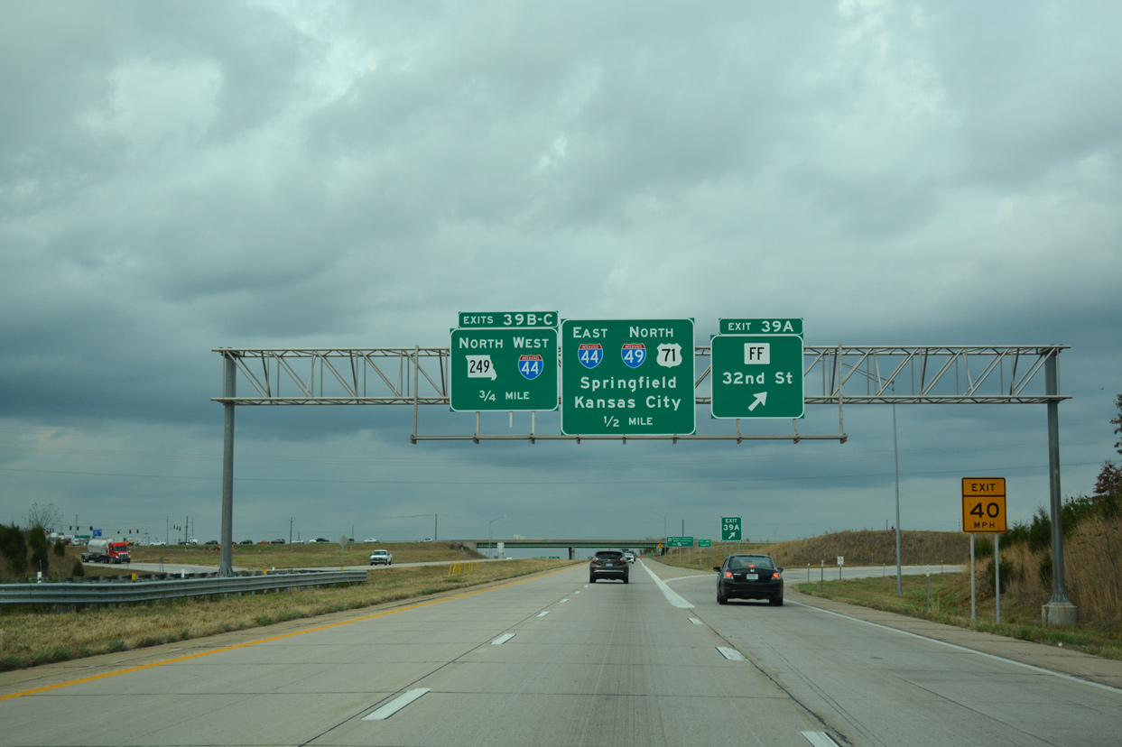
I-49/U.S. 71 north combine with Interstate 44 east for 6.32 miles between Exit 11 and Exit 18.
U.S. 167 was upgraded to a divided highway from Lafayette and Opelousas by the 1970s. It was incorporated into the initial stretch of Interstate 49, which started in April 1980 with an $11.9 million contract for work in St. Landry Parish.35
One of the final segments of Interstate 49 built in Louisiana was the northernmost portion between LA 3132 (Inner Loop Expressway) and I-20 in Shreveport. This was completed by late 1994.
 History
Lafayette to Shreveport
Interstate 49 was first proposed by Governor John McKeithen as the tolled North-South Expressway in 1965.32 AASHTO approved the initial route of I-49 between I-20 in Shreveport and U.S. 190 at Opelousas on July 6, 1977. Work commenced on I-49 in Louisiana in April 1980, and the first portion opened was a six mile segment from U.S. 190 east of Opelousas in September 1983.32 An 18 mile section of I-49 was dedicated on October 13, 1987 within Natchitoches Parish between LA 174 and LA 6.33 That was followed by the completion on March 1, 1989 of a nine mile link in DeSoto Parish, from LA 175 to LA 509.33 Another 35 miles debuted to travelers between Washington and Meeker on May 15, 1989, a few weeks beyond the planned April 22nd opening.34
Work progressed with the opening of another 30 miles of Interstate 49 on November 22, 1989. This section included 18 miles from LA 174 to U.S. 84 in DeSoto Parish and 12 miles from Fierson to LA 526 (Industrial Loop) on the south side of Shreveport.35 Another 7.3 miles of I-49 opened around Boyce to the north of Alexandria on September 26, 1991.36 A movement during that time period shifted the alignment of I-49 from a bypass of Alexandria to a route through Downtown at the urging of merchants, civic leaders and political officials who feared economic losses for the city had it been bypassed. This pushed back the timetable for completion of the 4.5 mile segment through Alexandria to 1996.36 The section through Alexandria was eventually designated the Martin Luther King, Jr. Highway.
Additional stretches of the Interstate 49 in Louisiana were dedicated by Governor Edwin Edwards on May 14, 1992 at the U.S. 167 interchange south of Alexandria. The ceremony preceded the opening of a 20 mile section of I-49 between Alexandria and Meeker, and a four mile segment from England Drive to Rapides Station. The 201 miles opened at the time totaled $598 million in costs.37
The 208 mile long section of I-49 between Interstate 10 and I-20 in Louisiana was completed on May 1, 1996 at a cost of approximately $1.38 billion. I-49 was constructed with federal funds, some of which were redirected from unconstructed urban Interstates within Louisiana, and the rest (153 miles) originated from a “supplemental reserve.” At the time, I-49 was the longest Interstate to begin and end within the same state.10
Louisiana: Interstate 49 South
Interstate 49 through Lafayette received initial approval on January 8, 2003 by the Federal Highway Administration. The motion allowed for funding to commence on the planned five mile, $350 million viaduct between Interstate 10 and Lafayette Regional Airport (LFT). Not all residents sided with this progress, as many near the projected path of the freeway feared impacts to developed and mostly poor neighborhoods nearby. In related opposition, legal action was pursued to move the project eastward into Saint Martin Parish. However, planners contended that the project complied with all applicable laws, and it appeared very unlikely that the highway would be relocated from the original planned route.2
A Congressional group met in 2003 at New Orleans International Airport (MSY) to discuss the estimated $4.9 billion corridor and funding related issues. Representative Tom Pitre of Wisconsin indicated that the House was drafting a $375 billion, six year proposal that would allocate Louisiana $4.28 billion to help pay for Interstate 49 within the state. Considered for I-49 in Louisiana was the creation of a 36 mile portion of freeway between Shreveport and the Arkansas state line, and the upgrade of U.S. 90 between Lafayette and New Orleans to Interstate standards. Total costs within Louisiana were estimated to be $2.3 billion, with the state covering 20% of the expense.3
A number of projects upgraded U.S. 90 to freeway standards in Iberia and Lafayette Parishes. These included a $24.5 million interchange at LA 25 opened in January 2011. An upgrade of U.S. 90, from Pinhook Road to Broussard, was completed in October 2012 at a cost of $20 million. Frontage roads were constructed along the US highway between LA 675 and LA 88 at a cost of $21.4 million. These were completed in January and June 2011 respectively. Additional frontage roads were added to U.S. 90 from LA 83 to Darnell Road ($5.4 million and finished in February 2012), from Darnell Road to LA 85 ($5.8 million and finished in April 2014) and at Captain Cade Road ($1.4 million and complete in August 2012).
Louisiana: Interstate 49 North
The final section of I-49 North opened to traffic at Interstate 220 on October 17, 2018. Photo by J.P. Nasiatka (05/31/19).
Separated into 11 segments, construction of Interstate 49 North cost $670 million overall to build:28
- A – LA 168 to the Arkansas line
- B – Parish Road 16 (Mira-Myrtis Road) to LA 168
- C – LA 2 to Parish Road 16 (Mira-Myrtis Road)
- D – U.S. 71 (south of Hosston) to LA 2
- E – LA 170 to U.S. 71 (south of Hosston)
- F – LA 530 to LA 170
- G – LA 169 to LA 530
- H – LA 173 to LA 169
- I – LA 1 to LA 173
- J – LA 3194 (Dr. Martin Luther King Drive) to LA 1
- K – Interstate 220 to LA 3194 (Dr. Martin Luther King Drive)
Groundbreaking for the first phase (Segment B) of the Interstate 49 North corridor took place north of Mira at the intersection of Parish Road 16 and Parish Road 25 on Thursday, April 7, 2005.8 This section of I-49 was estimated to cost $385 million.9 Work continued in 2007 on I-49 at the state line, where crews completed earth moving on a 6.6 mile long section.
State money was secured to bridge the 20% funding gap needed for I-49 North, allowing the Louisiana Department of Transportation and Development (LaDOTD) to work on seven of 11 proposed freeway segments between Interstate 220 and the state border. Optimistic officials at the time pursued opening the new 6.6 mile section of future Interstate 49 in 2010, if not 2009.9
LADOTD later anticipated having most of Interstate 49 North, from LA 1 (Segment I) to LA 168 south of the Arkansas state line (Segment A), open and signed as I-49 by November 2013.25 This included a temporary end at LA 168 that awaited completion of the Arkansas section from Highway 549 southward, which was projected for May 2014. Widening of LA 168 east from Future I-49 to U.S. 71 was proposed to augment the connection to Arkansas until the freeways were seamlessly linked. The gap between LA 168 and U.S. 71 north of Kiblah, Arkansas opened to traffic after a ribbon cutting ceremony held by officials from both states on the morning of November 10, 2014.28
Segment K, linking I-49 at LA 1 near Blanchard with Interstate 220 at North Shreveport, included the construction of a new systems interchange one mile west of the the exchange joining I-220 with U.S. 71/LA 1.1 Segment K went to bid in December 2013, two years later than expected due to funding issues for the $70-100 million project.22,24 Construction was estimated for completion in 2017-18.25
Totaling $142 million in costs, the interchange joining I-49 North with Interstate 220 opened to traffic following a ribbon cutting ceremony attended by Governor John Bel Edwards, state and local officials on October 17, 2018. Associated work for Segments J and K1 completed the I-49 link from LA 3194 to I-220 and reconstructed LA 3194 (Martin Luther King Drive). Construction also included expanding I-220 between LA 173 (Hilry Huckaby III Avenue) and U.S. 71 (N Market Street). Decorative panels by Shreveport area artists were added to several of the flyover support columns at I-49/220.48
Arkansas
Interstate 49 in southwest Arkansas overtook the Highway 549 freeway between Exit 4 (U.S. 71) near Doddridge and U.S. 59/71 north of McKinney Bayou and Texarkana, as well as Future I-130 along Highway 245. The first segment, from Fouke to Texarkana, was completed on December 16, 2004.7 The remainder south to Louisiana opened on November 10, 2014.
Work in Texarkana focused on upgrading the freeway along AR 245 to Interstate standards from the interchange with AR 549, southeast of Texarkana, to Arkansas Boulevard, where I-49 branches northeast to Interstate 30 along a new alignment. A ribbon cutting ceremony was held on April 30, 2013 for the 10.6 mile segment of new I-49 between Arkansas Boulevard and the Texas state line north of Texarkana. Wet weather delayed opening of the roadway to May 15.23
Costs to complete the 136 miles of I-49 between Texarkana and Fort Smith were estimated at $4.1 billion by Arkansas Highway Commissioner Keith Gibson as of March 2022, though there was no funding for construction at that time.52 The Arkansas Department of Transportation (ARDOT) previously completed an Environmental Impact Study (EIS) for Future I-49 between AR 22 and I-40. This was approved by the Federal Highway Administration (FHWA) in 1997.53 Work commenced in 2010 on a section of AR 549 between County Route 8 and AR 22 in the Fort Smith / Fort Chaffee area. 2.7 miles of roadway embankment, two overpasses and four box culverts for the new freeway were completed in Fall 2011.19 Additional work on the Chaffee Crossing section of I-49 added an interchange at AR 22 (Rogers Avenue) and diamond interchanges at Massard Road and Roberts Boulevard as part of the overall $57.65 million, seven mile stretch of freeway. The contract involving construction of 0.635 miles of roadway and the new interchange with U.S. 71 at the south end was let May 2, 2012.21 This work concluded on July 14, 2015.30 See a set of photos from the ribbon cutting ceremony held that day at David Backlin’s Flickr page.
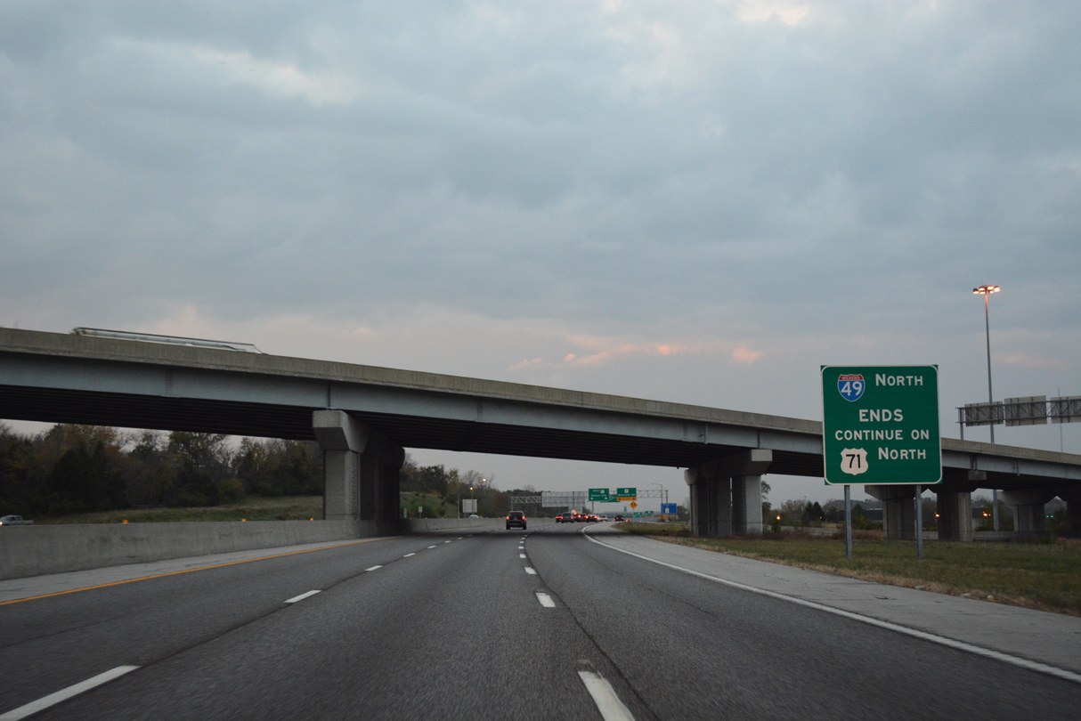
Leading north from Fort Smith to the Bella Vista bypass, Interstate 540 (built as AR 540) was redesignated as I-49 per approval by AASHTO on October 21, 2013. A 30 day project to resign I-540/U.S. 71 as I-49, between I-40 and U.S. 71 Business south of Bella Vista, kicked off on April 21, 2014. Signs on other future sections of I-49, including the Bella Vista Bypass and the stretch between U.S. 71 and AR 22 were signed as both Future I-49 and AR 549.26
What was previously designated as AR 540 was initially submitted to AASHTO for inclusion in the Interstate Highway System as Interstate 49 from I-40 near Fort Smith north to U.S. 71 Business near Fayetteville. This request was denied by AASHTO on April 25, 1997, as the Route Numbering Committee indicated that the lack of connecting routes at the northern end would preclude the route from consideration at that time. AASHTO subsequently approved it as Interstate 540 on November 14, 1997.
Expected to cost $150.6 million,27 the Bella Vista Bypass was planned to be constructed as a toll road. Tolling was approved by the Arkansas State Highway Commission on April 12, 2006.11 A construction contract for the 3.03 mile section of the Bella Vista Bypass was let in February 2011 with ground breaking on July 8, 2011. This work covered a stretch of roadway between AR 72 west of Hiwasse and AR 72 southeast of Hiwasse.20 Work on the $19.8 million contract wrapped up on April 22, 2014.27
Looking north at the temporary end of AR 549 (Bella Vista Bypass) north at CR 34 in Benton County, Arkansas. Photo by David Backlin (07/25/15).
A second Bella Vista Bypass project, building 2.377 miles of two lane roadway leading north from the interchange with AR 72 west of Hiwasse to County Road 34, was let May 2, 2012. Work on this section ran through July 2015. The third segment extended AR 549 east from AR 72 to U.S. 71 Business in Bella Vista. The 6.36 mile long portion was built at a cost of $52.6 million.31 It was completed in May 2017.49
State officials announced the start of construction for the final section of the Bella Vista Bypass at a ground breaking ceremony held on October 15, 2019. Costing $35.52 million, the 2.4 mile stretch extended north to the Missouri state line. The section opened to traffic on October 1, 2021. The Arkansas Department of Transportation (ARDOT) also announced the start of work on a $66.59 million project converting the roundabout joining AR 549 with U.S. 71 in Bentonville into a single point interchange. The new exchange was completed in mid 2021.50
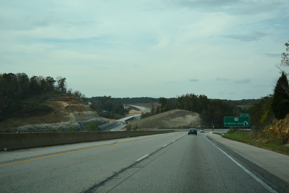
Since replaced by a SPUI, the Belle Vista Bypass previously tied into U.S. 71B just west of I-49 and Exit 93 at a roundabout. 11/02/16
Partially funded with a $25 million federal grant the Northwest Arkansas Regional Planning Commission received in December 2018,50 work on the 4.81 mile section of the Bella Vista Bypass in Missouri commenced in Spring 2020. Attended by Arkansas Governor Asa Hutchinson and Missouri Governor Mike Parson, a ribbon cutting ceremony took place for the new highway on September 30, 2021.51 Totaling $70.3 million in costs, the construction contract for the I-49 Missouri-Arkansas Connector was awarded in Spring 2020 and overall work completed on September 30, 2021. This included building an interchange with Route 90 west of Jane.
Missouri
A toll road was considered for I-49 from the Bella Vista Bypass in Arkansas north to Pineville,3 but subsequently dropped. The right of way was acquired and plans were completed for the five mile section by 2008. The Missouri Department of Transportation (MoDOT) was awaiting completion of the Arkansas section to move forward,29 and eventually allocated funding for its portion in the 2013-17 Draft STIP.
The Missouri Highways and Transportation Commission approved the estimated $47.8 million in costs and the timeline to complete the final five miles of the Interstate 49 Missouri-Arkansas Connector on March 6, 2019. $25 million in prior funding for the Bella Vista Bypass via a Better Utilizing Investments to Leverage Development grant was secured by U.S. House members from Southwest Missouri and Northwest Arkansas in December 2018.44
With partial funding from the federal grant the Northwest Arkansas Regional Planning Commission received in December 2018,50 work on the 4.81 mile section of the Bella Vista Bypass in Missouri commenced in Spring 2020. Attended by Arkansas Governor Asa Hutchinson and Missouri Governor Mike Parson, a ribbon cutting ceremony took place for the new highway on September 30, 2021.51 Totaling $70.3 million in costs, the construction contract for the I-49 Missouri-Arkansas Connector was awarded in Spring 2020 and overall work completed on September 30, 2021. This included building an interchange with Route 90 west of Jane.
The AASHTO Highways Special Committee on U.S. Route Numbering meeting of October 14, 2011 approved the I-49 designation in Missouri contingent on the route being fully upgraded to Interstate standards between Pineville and Kansas City. Additionally business route designations for U.S. 71 at Butler, Joplin, Neosho and Nevada were given conditional approval for renumbering as Business Loops for I-49.
MoDOT approved highway construction on August 4, 2010 on a number of projects to upgrade U.S. 71 between Joplin and Kansas City to Interstate standards in anticipation of redesignating the highway to I-49 by December 2012.3 Four interchanges were completed at a cost between $4 and 5 million along U.S. 71 by September 2010. These included those at Route 126, Routes DD/EE and Routes V/C within Barton County, and Route 52 in Bates County.13 An interchange between U.S. 71 and Route E, north of Milo, opened to traffic on November 18, 2011.14 Work on an interchange between U.S. 71 and Route TT, midway between Horton and Rich Hill, commenced in late January 2012 at a cost of $6.4 million with a planned completion by December 2012.15 Further north, work continued with the opening of the overpass for 327th Street on August 9, 2012 near Archie. This bridge eliminated an at-grade crossing, and was the first of three projects to upgrade U.S. 71 to limited access standards locally. A diamond interchange with 307th Street and an overpass for 283rd Street opened later in 2012.18
Looking northwest at Interstate 49 at the south split with Route 2 at Harrisonville, Missouri. 11/02/16
A contract to erect signs with space allocated for Interstate 49 was let in October 2011 for the eventual planned signing of the route statewide in December 2012. Installing around 1,200 signs for I-49, the project commenced on February 1, 2012 at a cost of $3.5 million. That work was projected for completion by December 1, 2012.16 Interstate 49 was made official in Missouri on December 12, 2012 in a ceremony held at Joplin East Middle School at noon. The designation applied to 180 miles of U.S. 71 between Kansas City and Joplin.
Bruce R. Watkins Drive – Kansas City
The first of two parkway sections along U.S. 71 (Bruce R. Watkins Drive) northbound through Kansas City, Missouri. 11/03/16
Within Kansas City, U.S. 71 follows a combination of freeway and parkway from the Three Trails Crossing Memorial Highway interchange with I-49, I-435 and I-470 north to the Alphabet Loop (I-70 and I-670) at Downtown Kansas City. Known as Bruce R. Watkins Drive and historically as the South Midtown Freeway, the limited access highway for U.S. 71 was constructed for nearly $300 million in phases from 1987 to October 2001.6
Origins of the roadway date back to the “Expressways – Greater Kansas City” document issued by the city in 1951. State engineers presented two alignments for the eventual route in 1964. The South Midtown Freeway roughly followed the current alignment of Bruce Watkins Drive while the Country Club Freeway aligned south to 47th Street, west to Charlotte Street and Frank A. Theis Park and south along Brookside Boulevard before curving back to the east.6
Community opposition arose by February 1965, with a focus on potential disruptions to neighborhood areas along the South Midtown Freeway route to the east. As many as 10,000 residents would be displaced with the freeway project, and with the state highway commission voting to move ahead with land acquisition from Bannister Road north to 63rd Street, area neighborhoods declined. Earthwork started in 1972, but a federal lawsuit filed in 1973 halted work, citing violations of civil rights, environmental and relocation rules. Three quarters of the right of way was already purchased by 1976 while the lawsuit dragged on until 1985. City, state and federal officials eventually compromised on a new design for U.S. 71 in 1982. The redesign called for a hybrid of freeway and parkway sections meant to minimize disruptions to area neighborhoods. The roadway was named after Bruce R. Watkins, a local civic leader and one time city councilman in 1986, six years after his death.6
The two parkway sections include signalized intersections at Gregory Boulevard, 59th and 55th Streets and several right in and right out movements. Thousands of bushes and trees, attractive landscaping and decorative bridges were incorporated into the route as part of the court decision in 1985.6 With the parkway design, it is unlikely that Bruce Watkins Drive will ever be incorporated into Interstate 49.
North End 
 – Kansas City, Missouri
![]()
![]() North at
North at ![]()
The I-49/U.S. 71 mainline navigates between roadways for I-470/U.S. 50 as they link with the Kansas City beltway west between Oakwood and St. Catherines Gardens in south Kansas City. A three-lane ramp follows with Interstate 435 north directly. 06/19/15
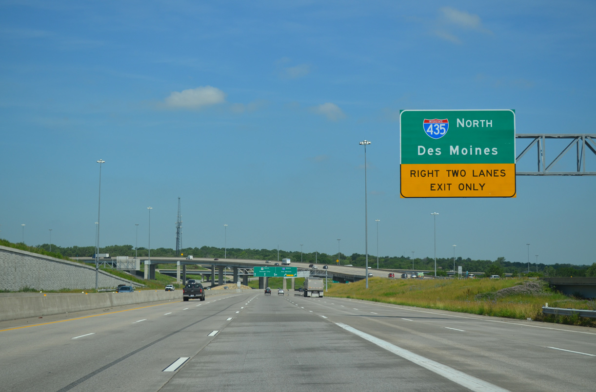
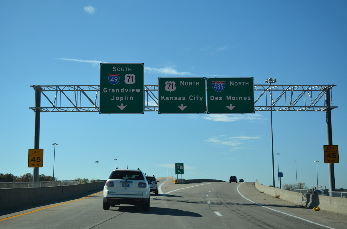
A two lane entrance ramp from I-470/U.S. 50 west adds traffic to I-49/U.S. 71 north through the Three Trails Crossing Memorial Highway interchange. The auxiliary lanes departs for I-435 north toward Raytown, Independence and I-35 for Des Moines, Iowa. 05/07/22
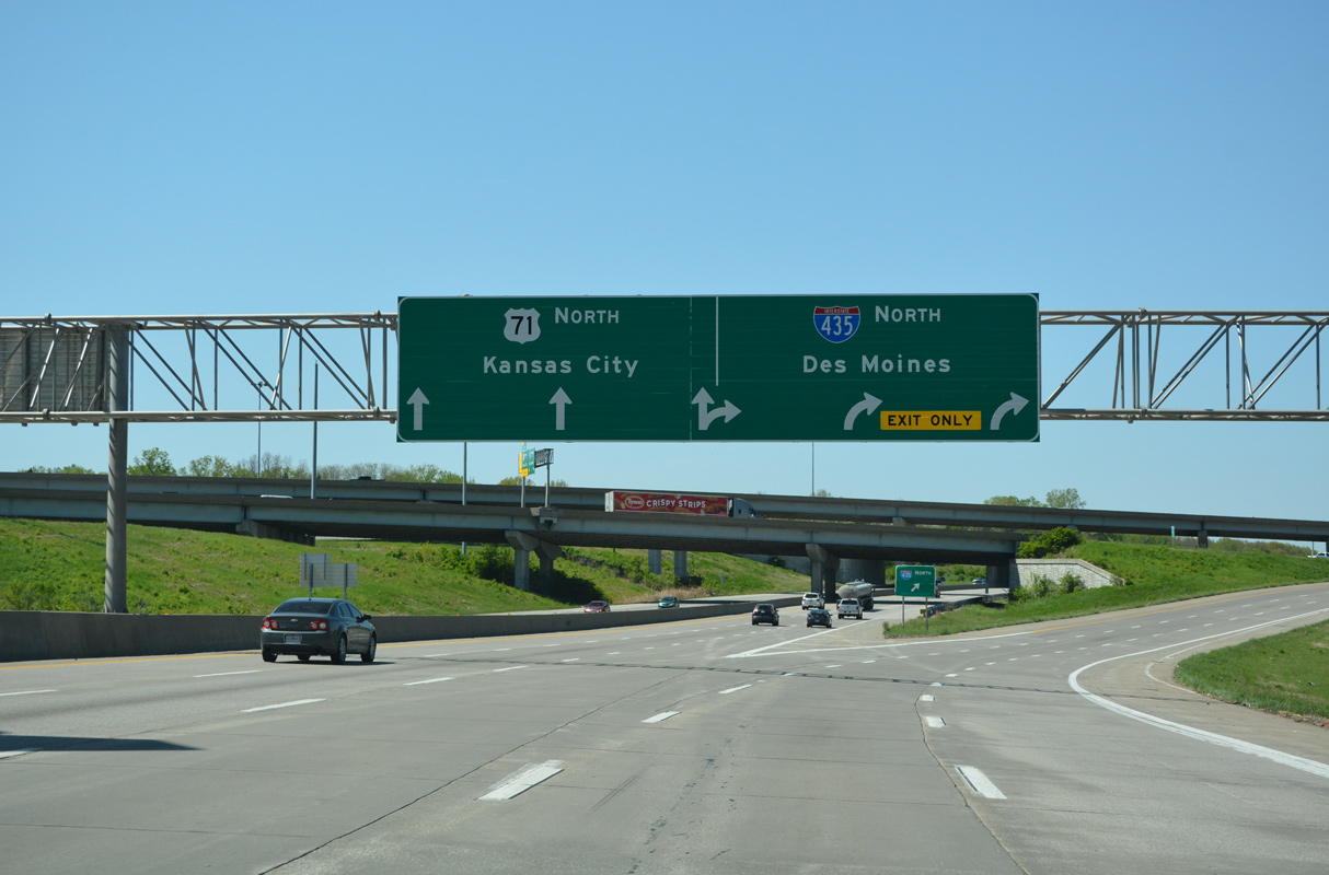
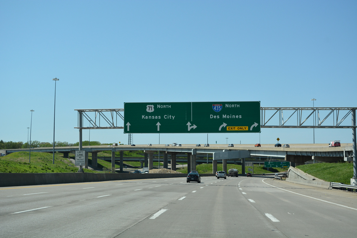
An arrow per lane sign (APL) separates traffic for Interstate 435 north around the east side of Kansas City to Claycomo and U.S. 71 (Bruce R. Watkins Drive) north to Blue Hills, Ivanhoe and Downtown, Kansas City. 05/07/22
Interstate 49 formally concludes northbound at the Kansas City beltway (I-435). U.S. 71 extends north as a hybrid freeway and parkway to the Alphabet Loop (I-70 and I-670). 11/02/16
![]()
![]() East at
East at ![]()
![]()
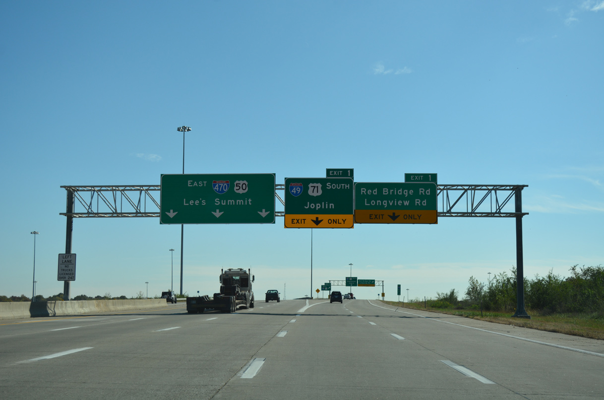
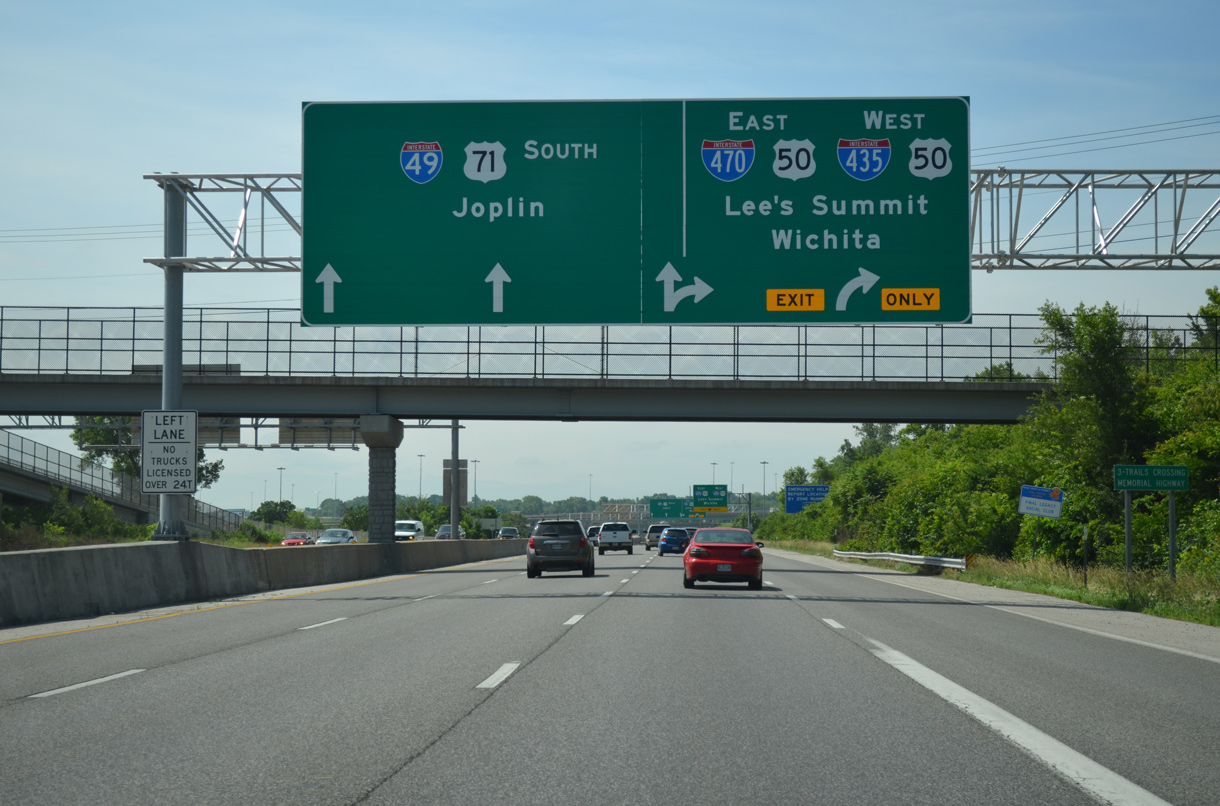
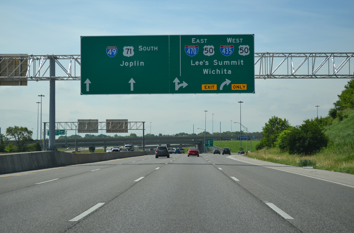
U.S. 50 splits with I-435 east to join the beginning of Interstate 470 east. The initial stretch of freeway runs along side U.S. 71 and the initial stretch of I-49 south. Exit 1 completed the movement from the beltway east to I-49 south toward Grandview and Joplin. 11/03/16
Separate ramps from both I-470 east and I-49 south depart simultaneously and combine to form a service road south to Red Bridge and Longview Roads. This configuration was built during the Three Trails Crossing Memorial Highway project to shift weaving traffic away from the U.S. 71 freeway mainline. 11/03/16
![]()
![]() West at
West at ![]()
![]()
![]()
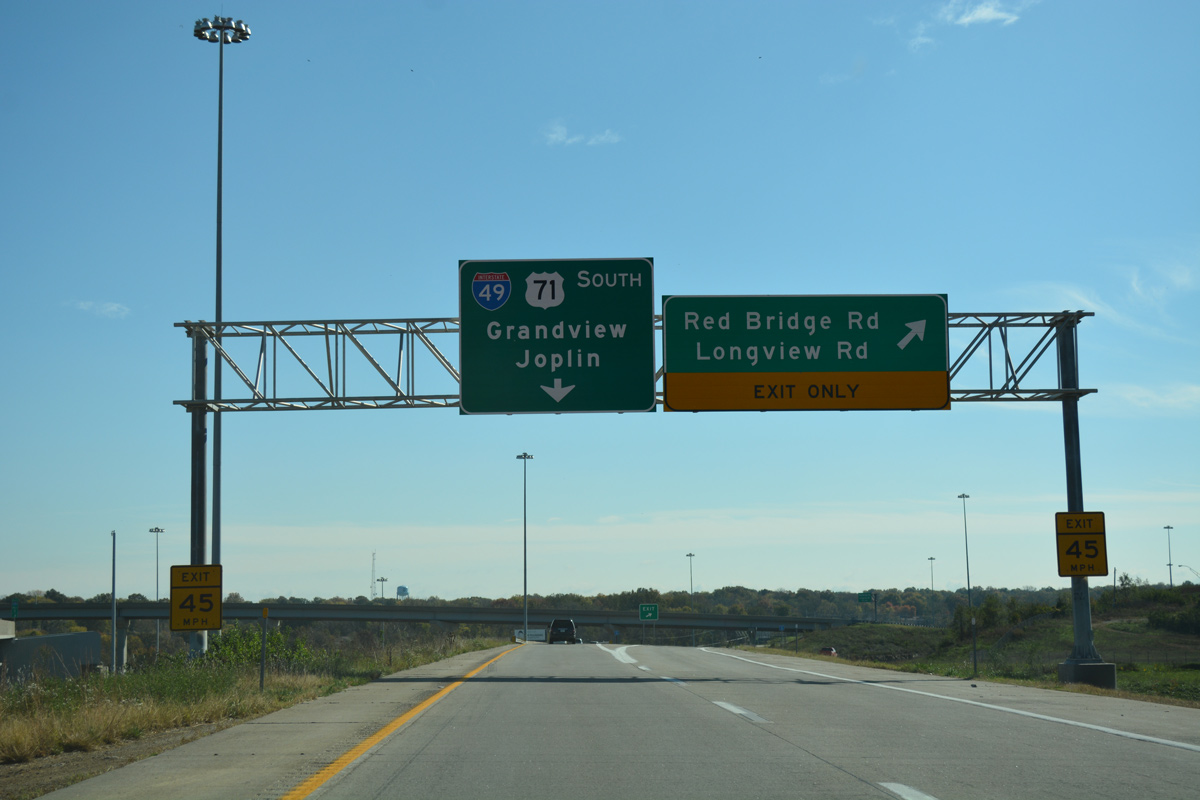
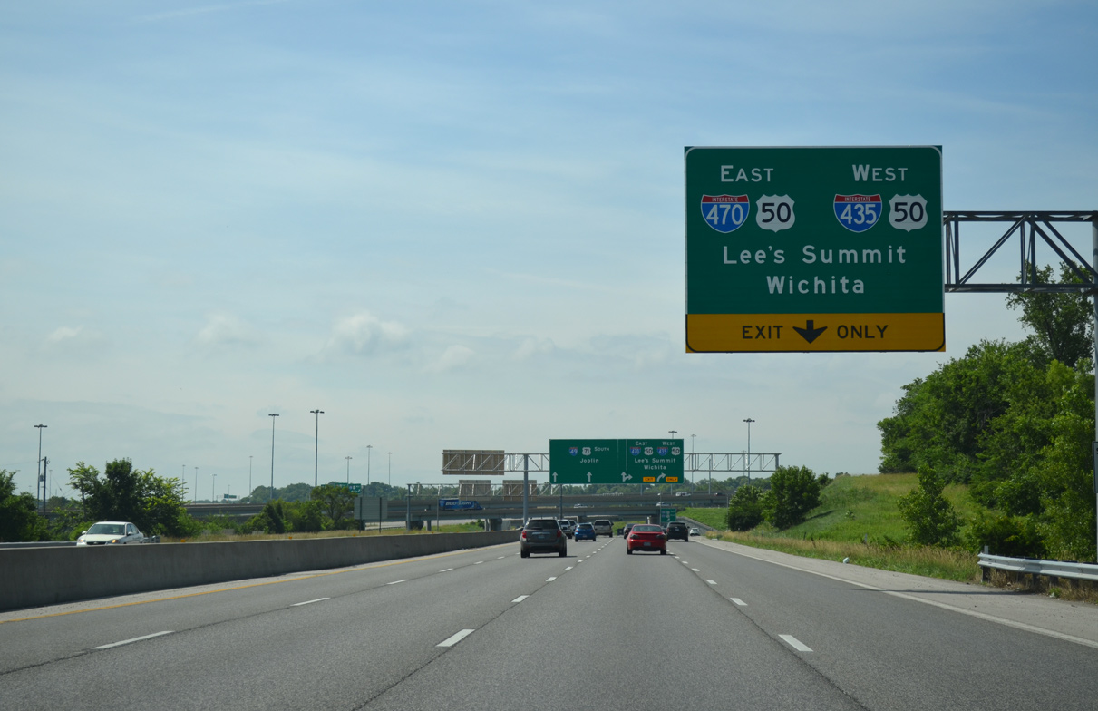
A single lane flyover (Exit 1) departs from Interstate 470 west to the left for I-49/U.S. 71 south for Grandview, Belton and Harrisonville. The right lanes join U.S. 71 (Bruce R. Watkins Drive) north from the end of I-49 just prior to its off-ramp for I-435 north. 11/03/16
![]() South at
South at ![]()
![]()
![]()
![]()


Interstate 435 angles southwest into the Three Trail Crossing Memorial Highway, with a c/d roadway linking to I-49/U.S. 71 south and I-470/U.S. 50 east. 10/07/21
![]() South at
South at ![]()
![]()
![]()
![]()
U.S. 71 (Bruce R. Watkins Drive) expands to four southbound lanes from the Highway W on-ramp to the Three Trails Crossing Memorial Highway interchange with I-435 and I-470. The Kansas City beltway west references Wichita for the connection with I-35 south in Lenexa, Kansas. 06/19/15
All traffic bound for I-435/U.S. 50 west to Overland Park, Kansas or I-470/U.S. 50 east to Lee’s Summit departs in unison via a two lane ramp. There is no access to I-435 north from U.S. 71 south due to low demand. Instead Route W (Bannister Road) provides a surface route connection for I-435 to the north. 06/19/15
U.S. 71 expands to three through lanes as Interstate 49 begins. The two routes overlap southward 138 miles to I-44. Grade level ramps meanwhile carry motorists onto I-435/U.S. 50 west to the Johnson County, Kansas suburbs and I-470/U.S. 50 east toward Sedalia. 06/19/15
Original North End – – Shreveport, Louisiana
![]() North at
North at ![]()
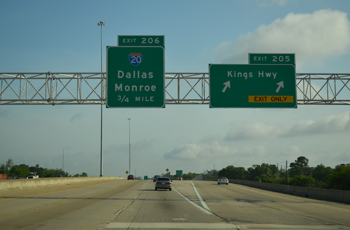
Interstate 49 travels along an elevated route through Shreveport to the four-level interchange (Exit 206) with I-20. Exit 205 lowers from the freeway to Kings Highway and an adjacent medical district 05/20/14

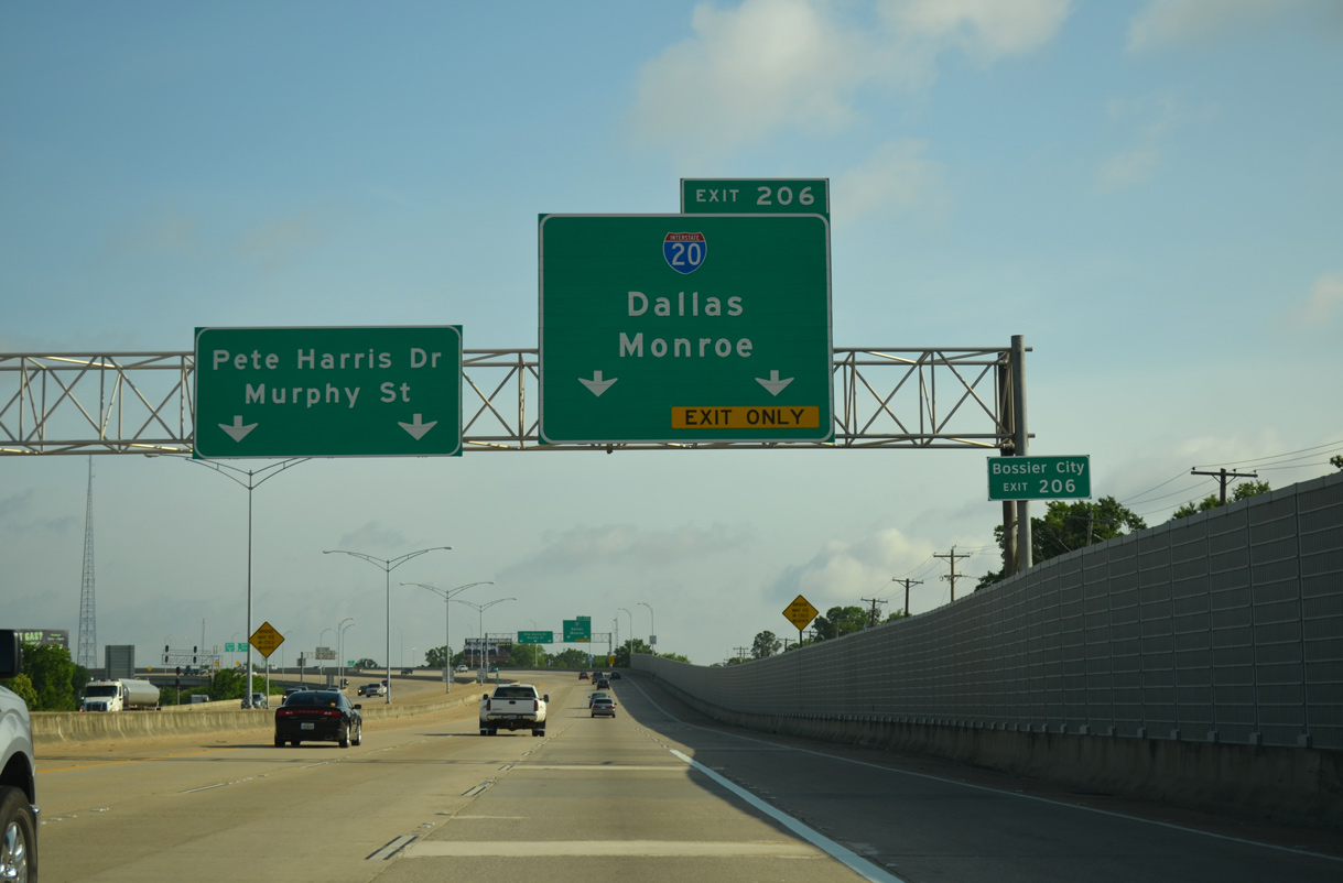
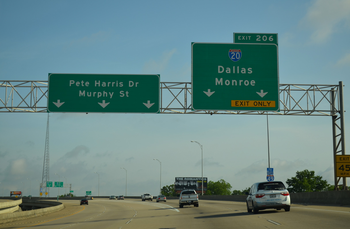
Exit 206 departs in a half mile for Interstate 20 as the freeway kinks northwest to an at-grade end at Murphy Street and Pete Harris Drive. 05/20/14
The Kings Highway entrance ramp adds a fourth northbound lane to Interstate 20. I-20 winds northeast to Downtown Shreveport and across the Red River to Bossier City. 05/20/14
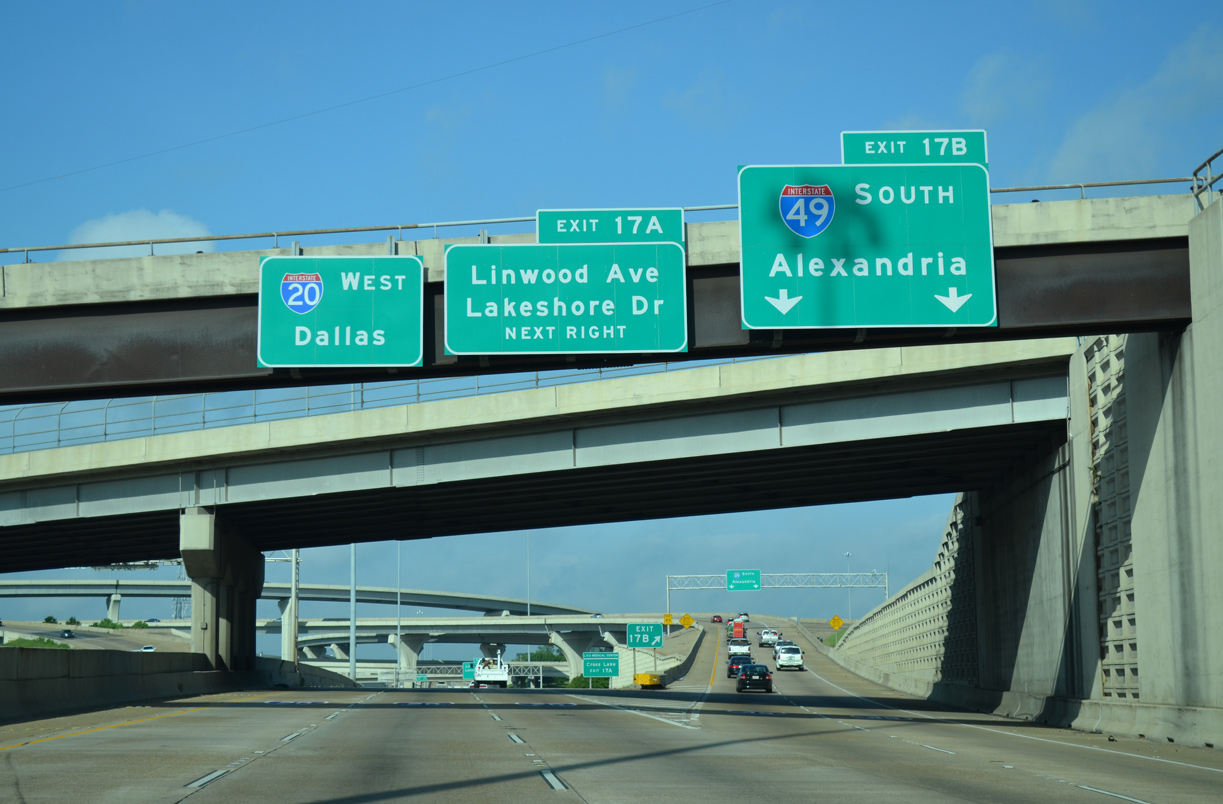
Three lanes extend north from Interstate 49 to the Allendale and Lakeside residential area while Exit 206 separates into flyovers for I-20 west to Dallas, Texas and east to Monroe. 05/20/14
![]() West at
West at ![]()
High rises come into view as I-20 approaches the Red River and southwestern turn to Downtown Shreveport. An advance sign for Interstate 49 appears amid a quick succession off off-ramps. 05/20/14
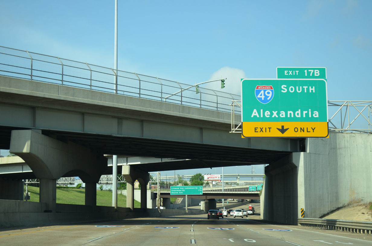
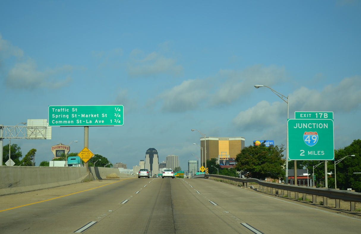
Stoner Avenue, Fairfield Avenue and Murphy Street intersect directly above Interstate 20 west as the freeway drops below grade to Exit 17B for I-49 south. 05/20/14
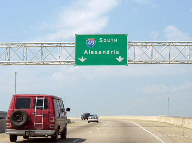
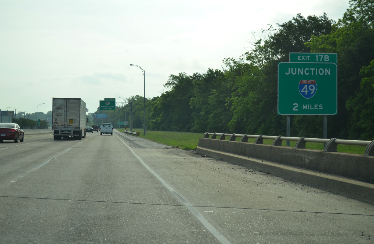
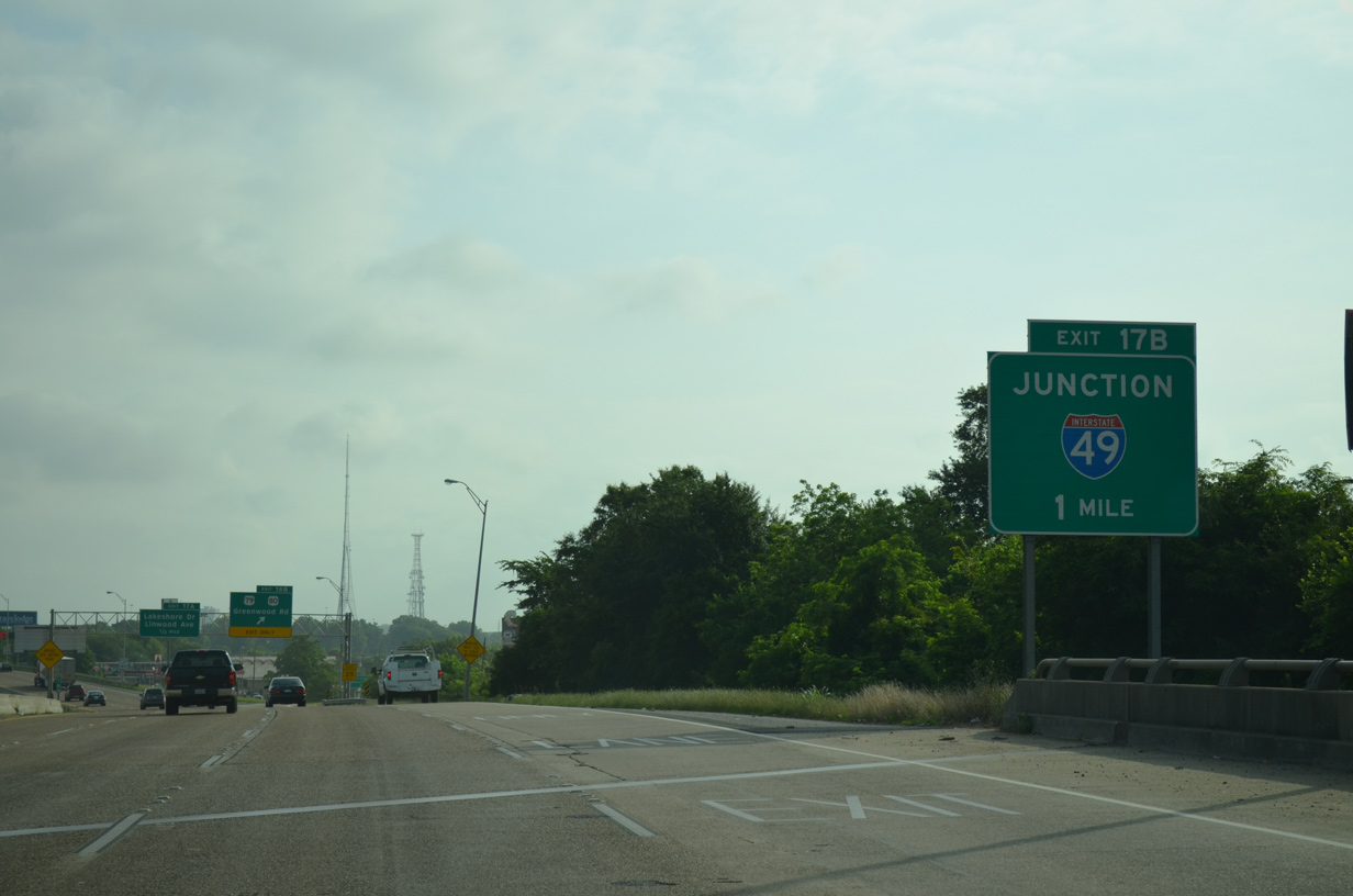
A two lane flyover (Exit 17B) parts ways with I-20 west for Interstate 49 south. Alexandria lies 123 miles to the southeast. 05/20/14
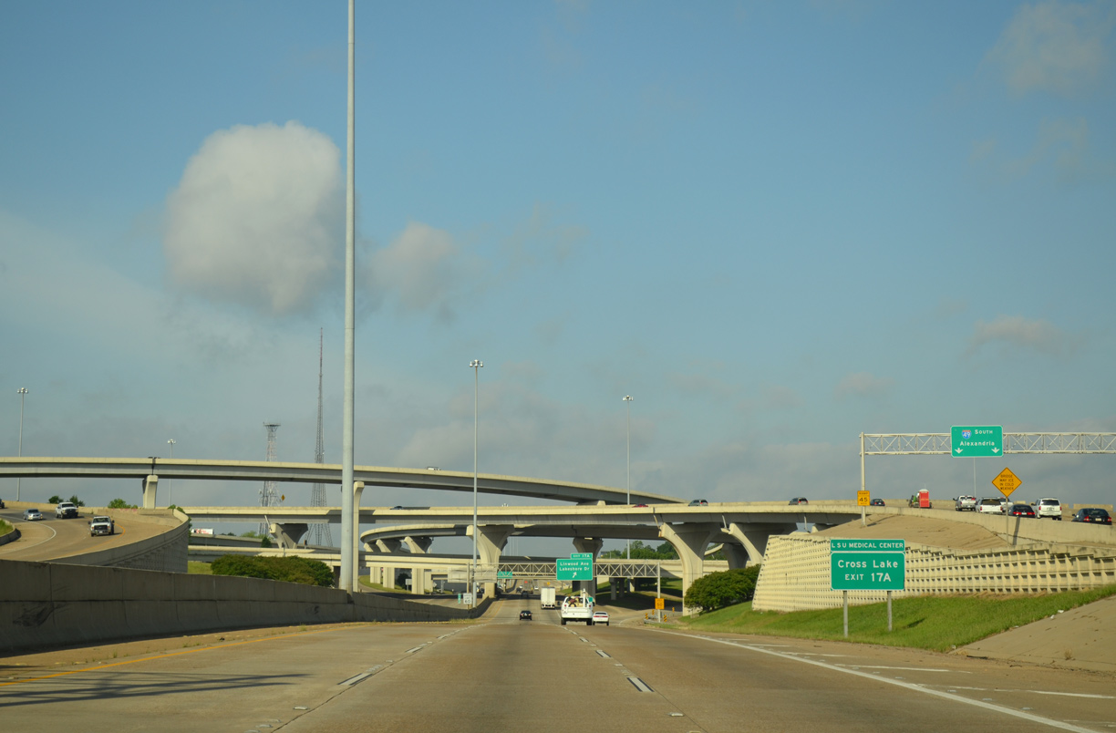
Embedded within the four-level interchange at I-49 are local ramps with Linwood Avenue and Lakeshore Drive. Exit 17A replaced the diamond interchange with Pierre Avenue displaced by the construction of Interstate 49. 05/20/14
A ramp stub was incorporated into the flyover taking traffic from I-20 west to I-49 south for the unconstructed freeway north through Allendale and Lakeside. This will be utilized with the Inner City Connector. Photo by Chris Patriarca (04/08/03).
![]() East at
East at ![]()
I-20 passes by the state fairgrounds and over Hudson Avenue, two miles ahead of Exit 17B for Interstate 49 south. I-49 provides part of a long distance route connecting the Dallas-Fort Worth area with New Orleans via Interstate 10. 05/20/14
The original section of Interstate 49 travels 206 miles south from I-20 in Shreveport to I-10 at Lafayette. I-20 meets U.S. 79/80 just prior to the four level junction with I-49. 05/20/14
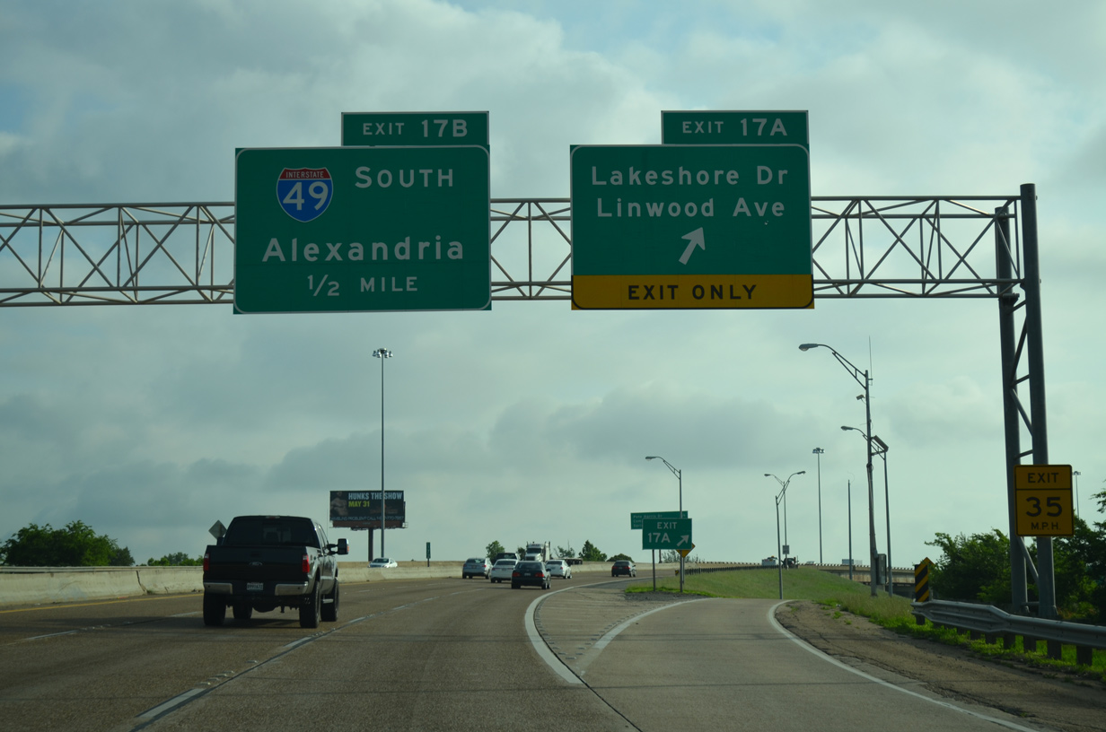
Interstate 20 curves northeast from the diamond interchange (Exit 17A) with Lakeshore Drive to the symmetrical stack interchange (Exit 17B) with I-49 south and Pete Harris Drive north. 05/20/14
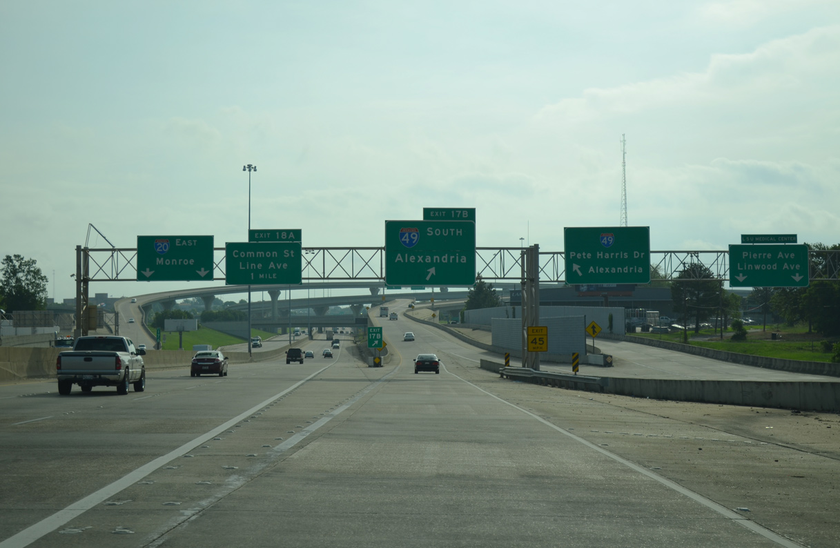
The entrance ramp from Lakeshore Drive separates into prongs for both the I-20 eastbound mainline and departing flyover for Interstate 49 south. 05/20/14
South End – Lafayette, Louisiana
![]()
![]() South at
South at ![]()
Interstate 49/U.S. 167 enter the Lafayette city limits at LA 98 (Gloria Switch Road). The pair proceed south 2.7 miles to the freeway end at Evangeline Throughway. 05/19/14
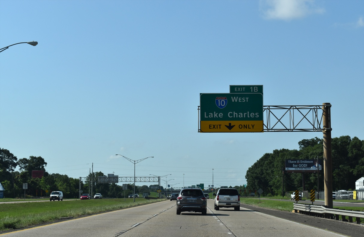
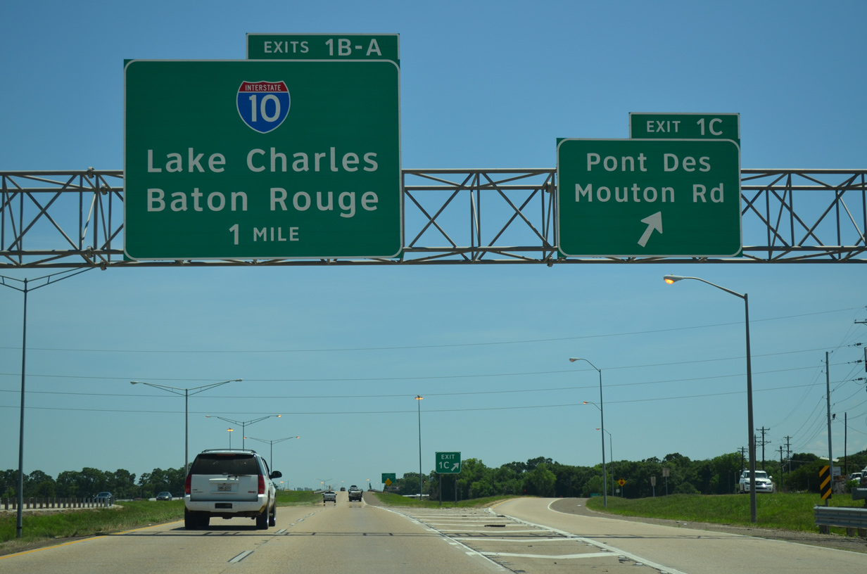
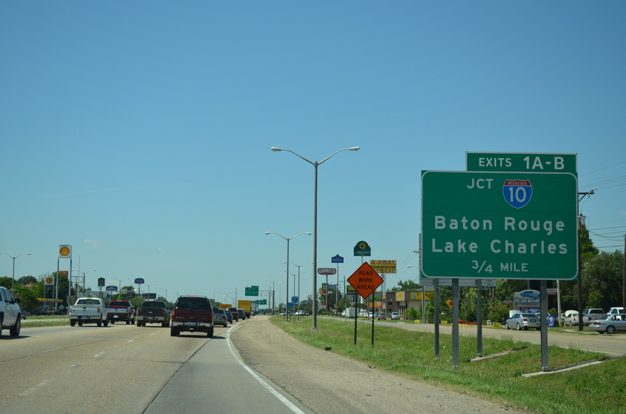
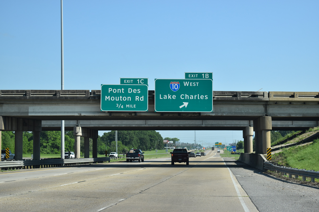
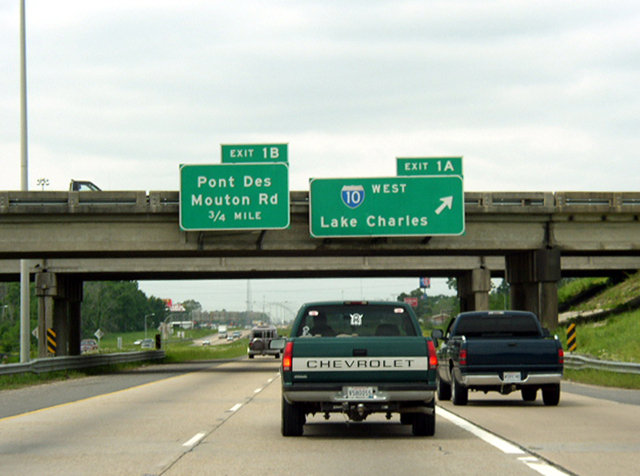
Auxiliary lanes expand I-49 to six overall lanes between Pont Des Mouton Road / Exit 1 C and Exit 1 B for Interstate 10 west. 05/11/22
Interstate 10 proceeds west from Lafayette to Lake Charles, Beaumont and Houston, Texas. 05/11/22
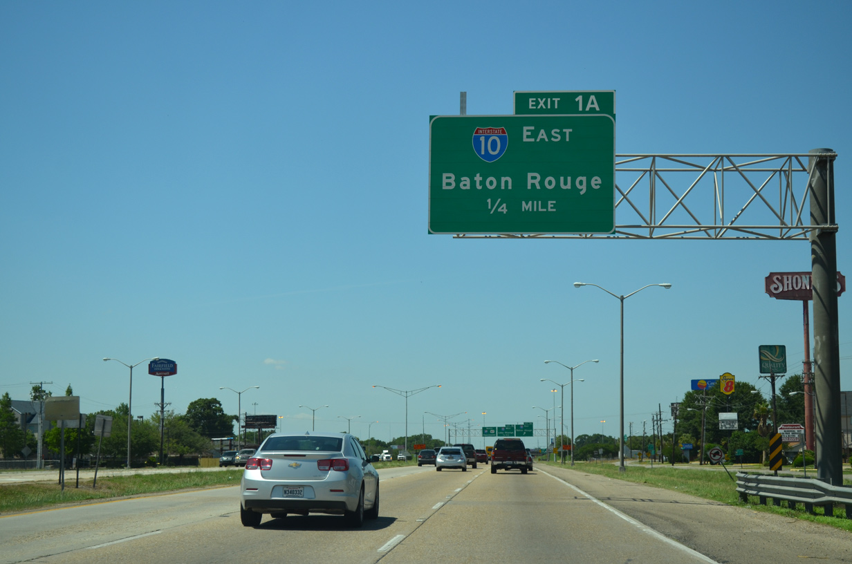
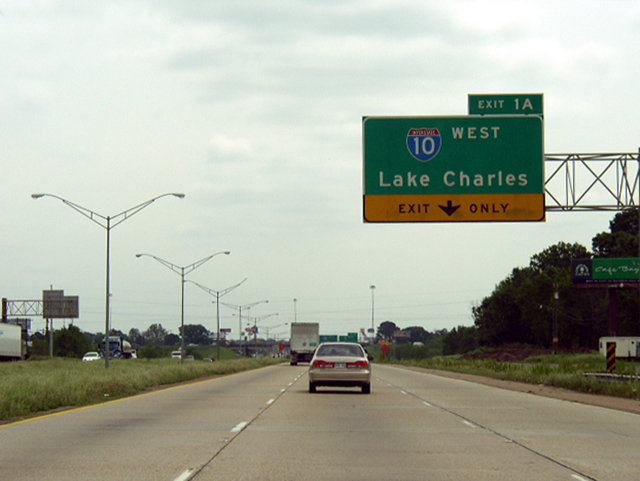
Interstate 49 ends as Exit 1 A parts ways from U.S. 167 south for eastbound I-10. Interstate 10 plies across the Atchafalaya Basin Bridge beyond Henderson to Baton Rouge. 05/11/22
![]() North at
North at ![]()
![]()
U.S. 167 (Evangeline Throughway) north leaves the area of Northgate Mall and transitions into an expressway. A set of J-turns with Chalmette Drive precedes the ramps for Interstate 10 at Exits 1A/B. 05/19/14
Frontage roads accompany U.S. 167 north to the cloverleaf interchange with Interstate 10 and transition to I-49. 05/19/14
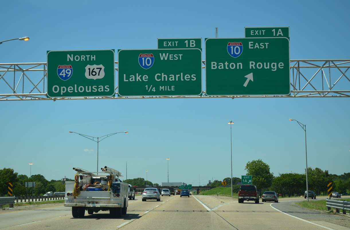
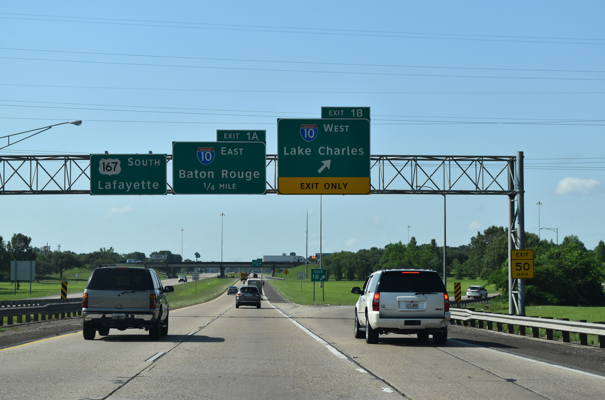
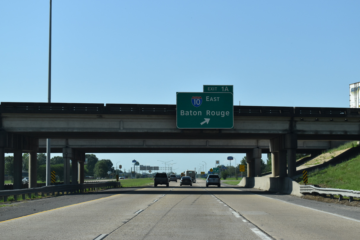
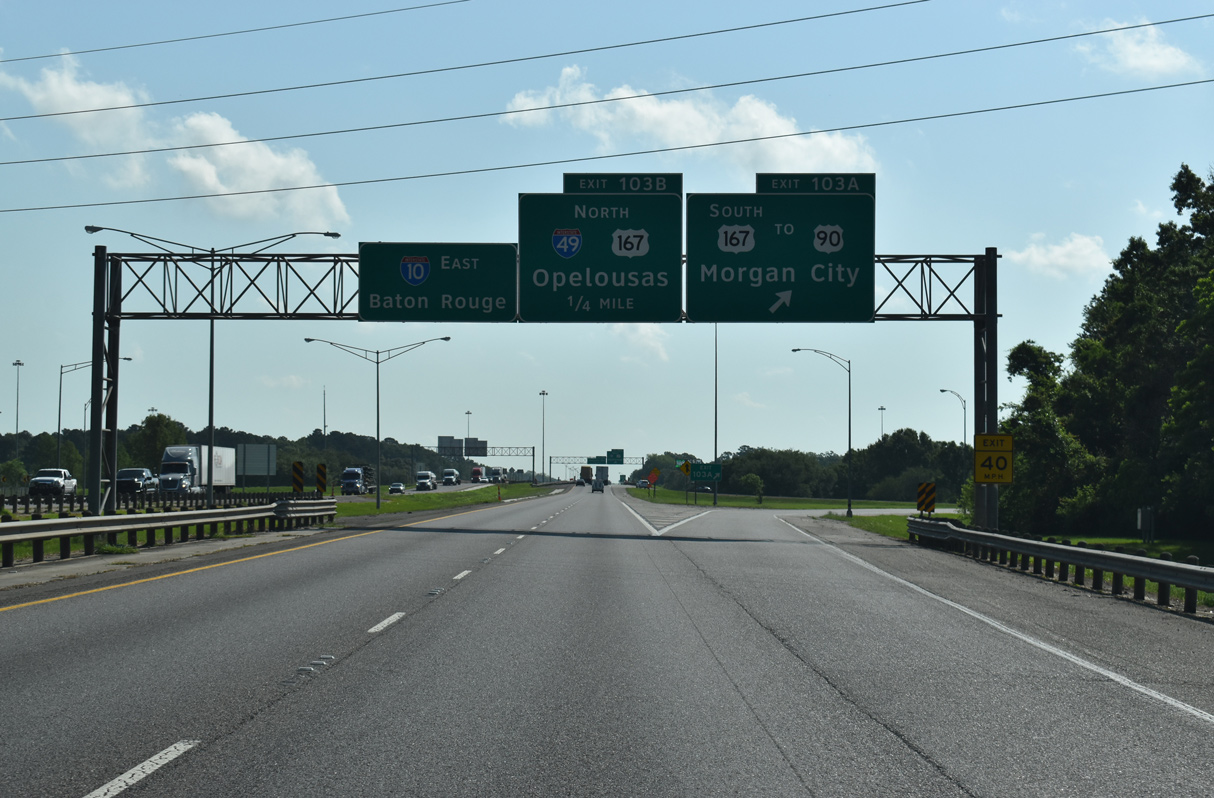
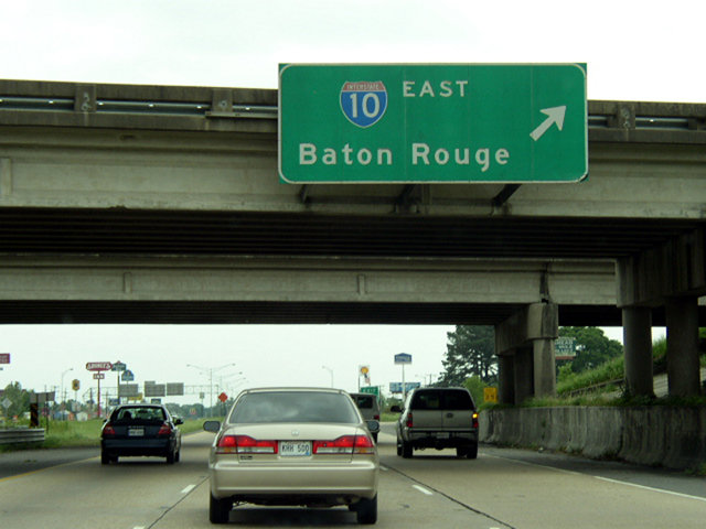
Interstate 49 begins as Exit 1A leaves for I-10 east to Breaux Bridge, Baton Rouge and New Orleans. Alexandria is an 80 mile drive to the north. 05/19/14
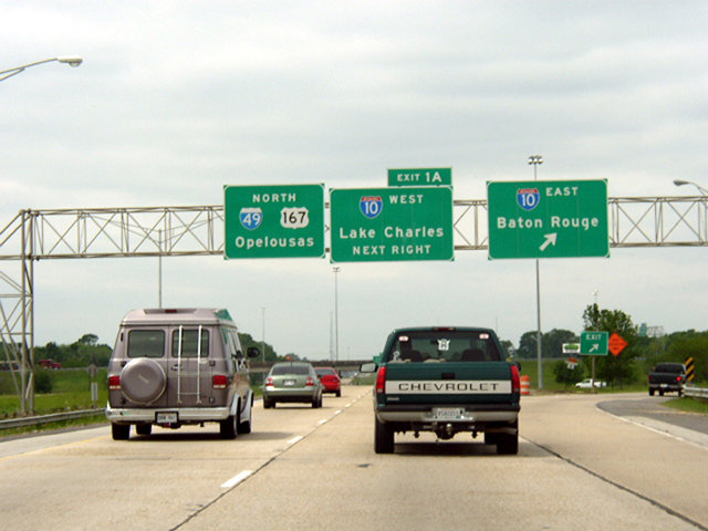
Motorists joining Interstate 10 west will reach Lake Charles in 72 miles while I-49/U.S. 167 continue north by two additional Lafayette exits to Carencro. 05/11/22
![]() East at
East at ![]()
![]()
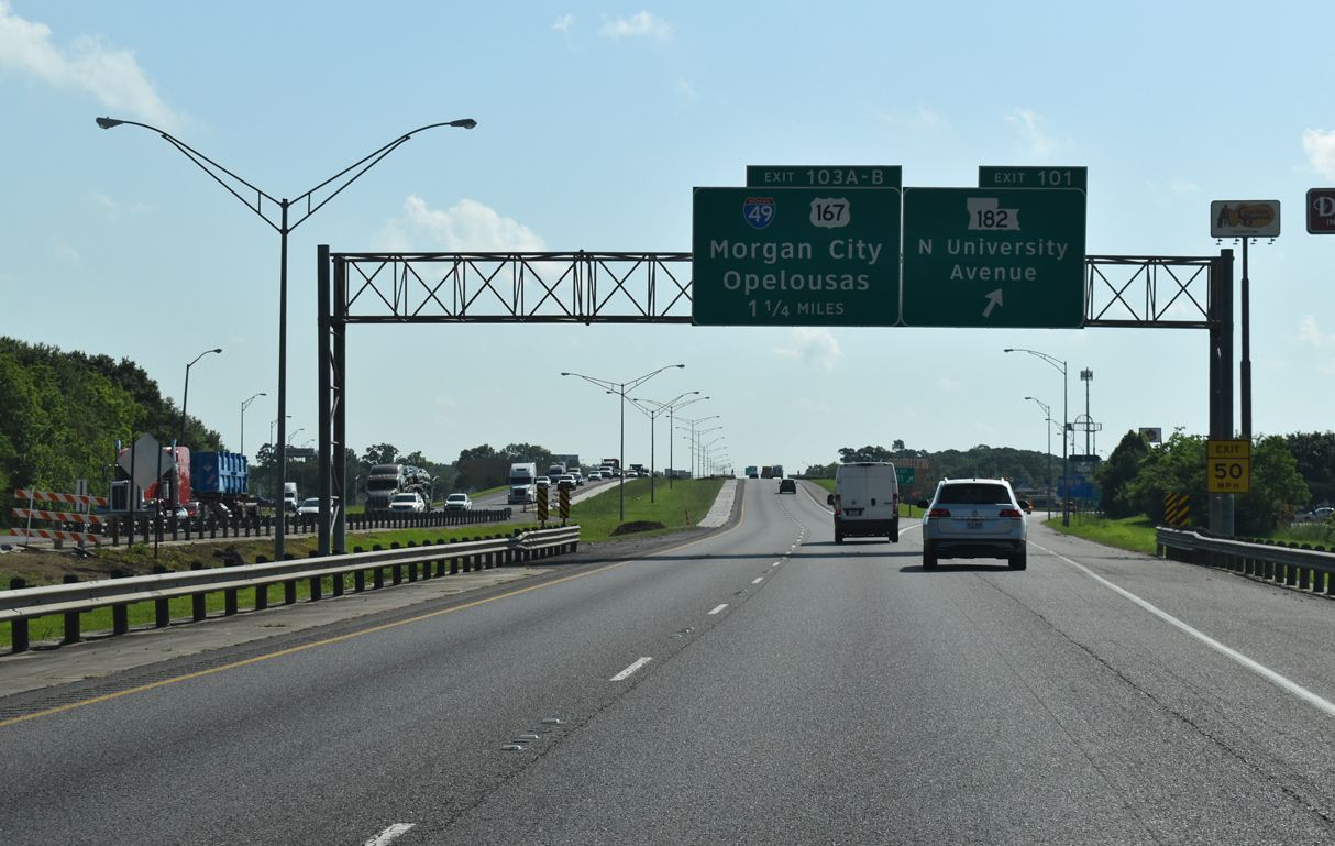
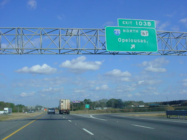
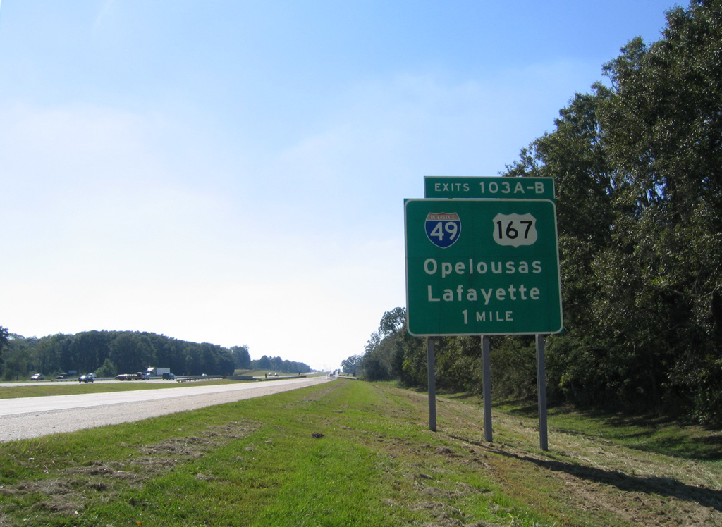
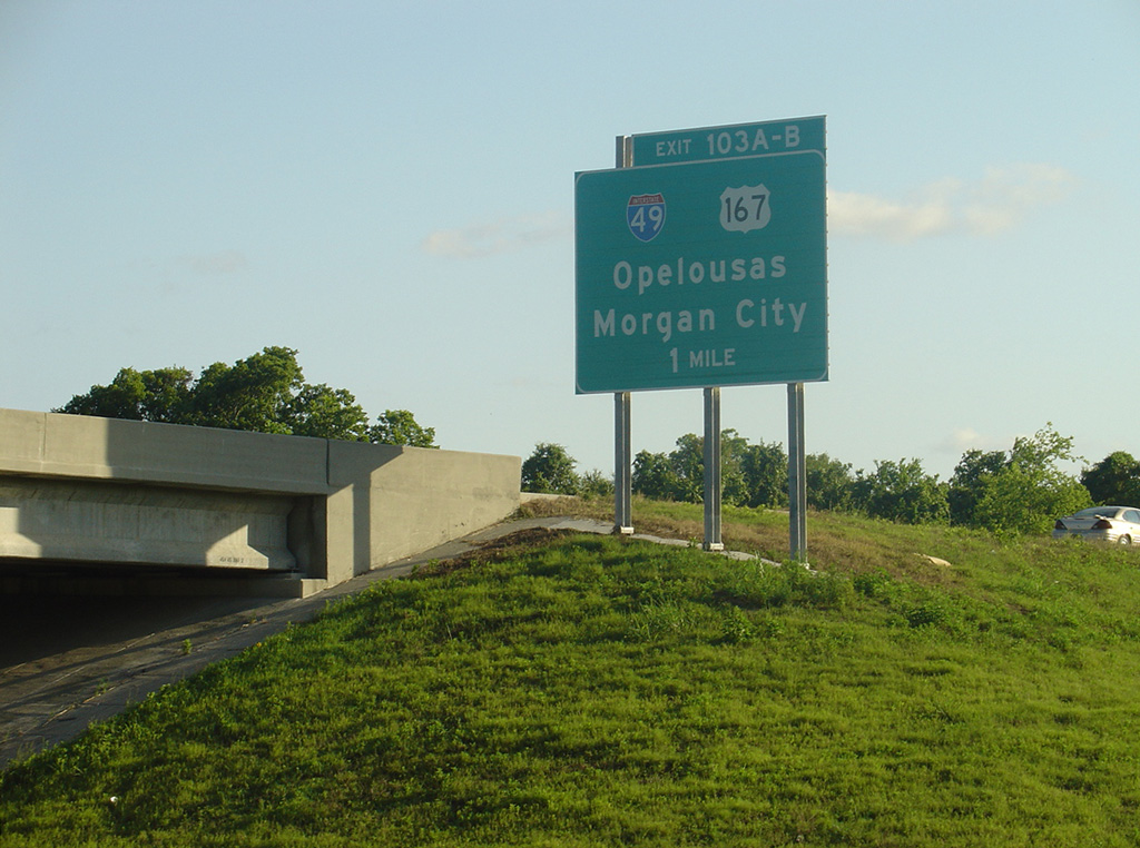
I-49/U.S. 167 is the second of four interchanges along Interstate 10 east within the city limits of Lafayette. Exit 101 departs first for LA 182 (North University Avenue). 05/11/22
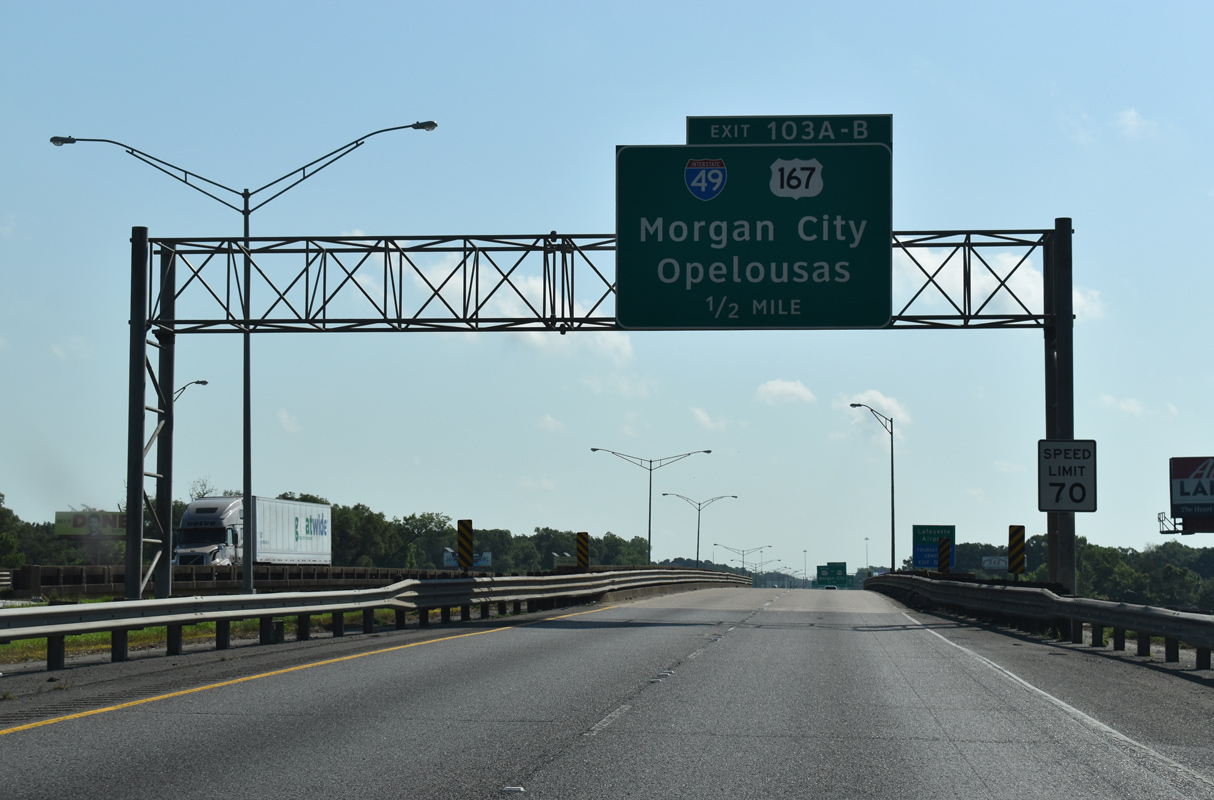
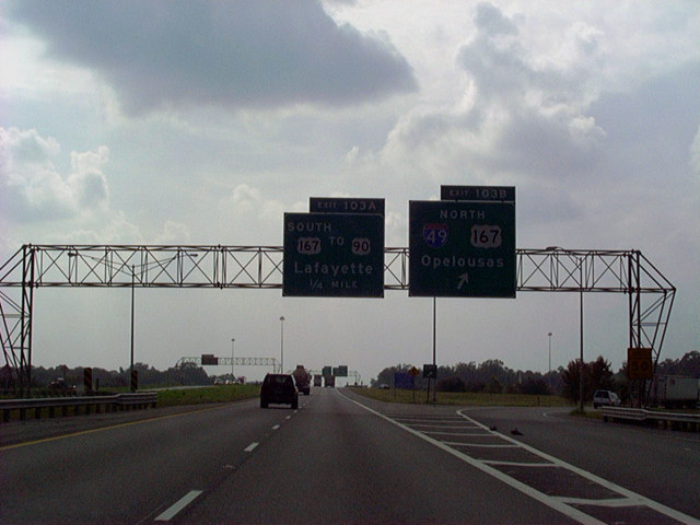
I-10 spans a former railroad grade and St. Antoine Street one half mile ahead of the cloverleaf interchange (Exits 103 A/B) with Interstate 49 and U.S. 167. 05/11/22
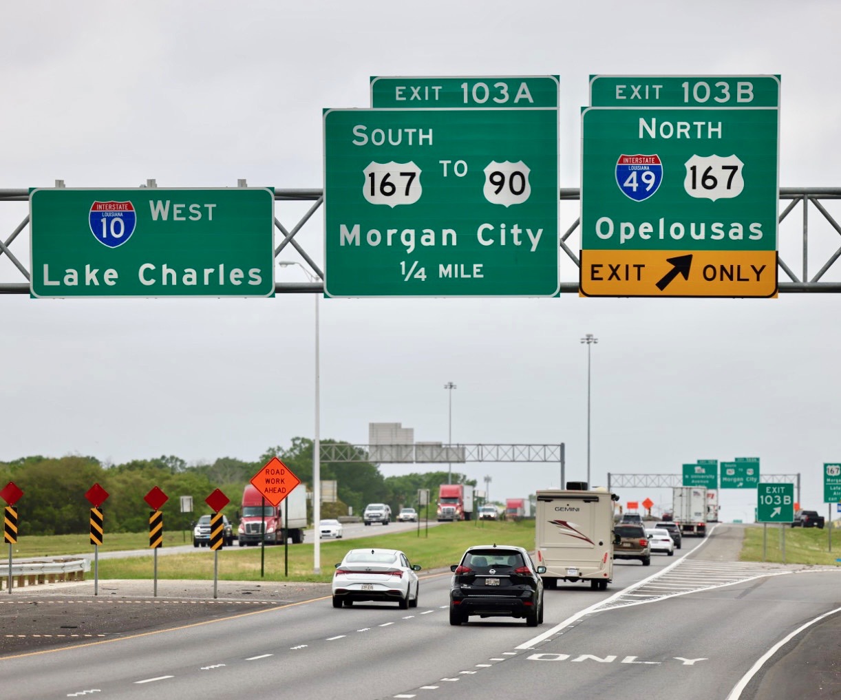
Exit 103 A departs from I-10 east next for U.S. 167 (Evangeline Throughway) south toward Downtown Lafayette and Lafayette Regional Airport (LFT). The I-49 Lafayette Connector will overtake a portion of this route to U.S. 90 and New Iberia. 05/11/22
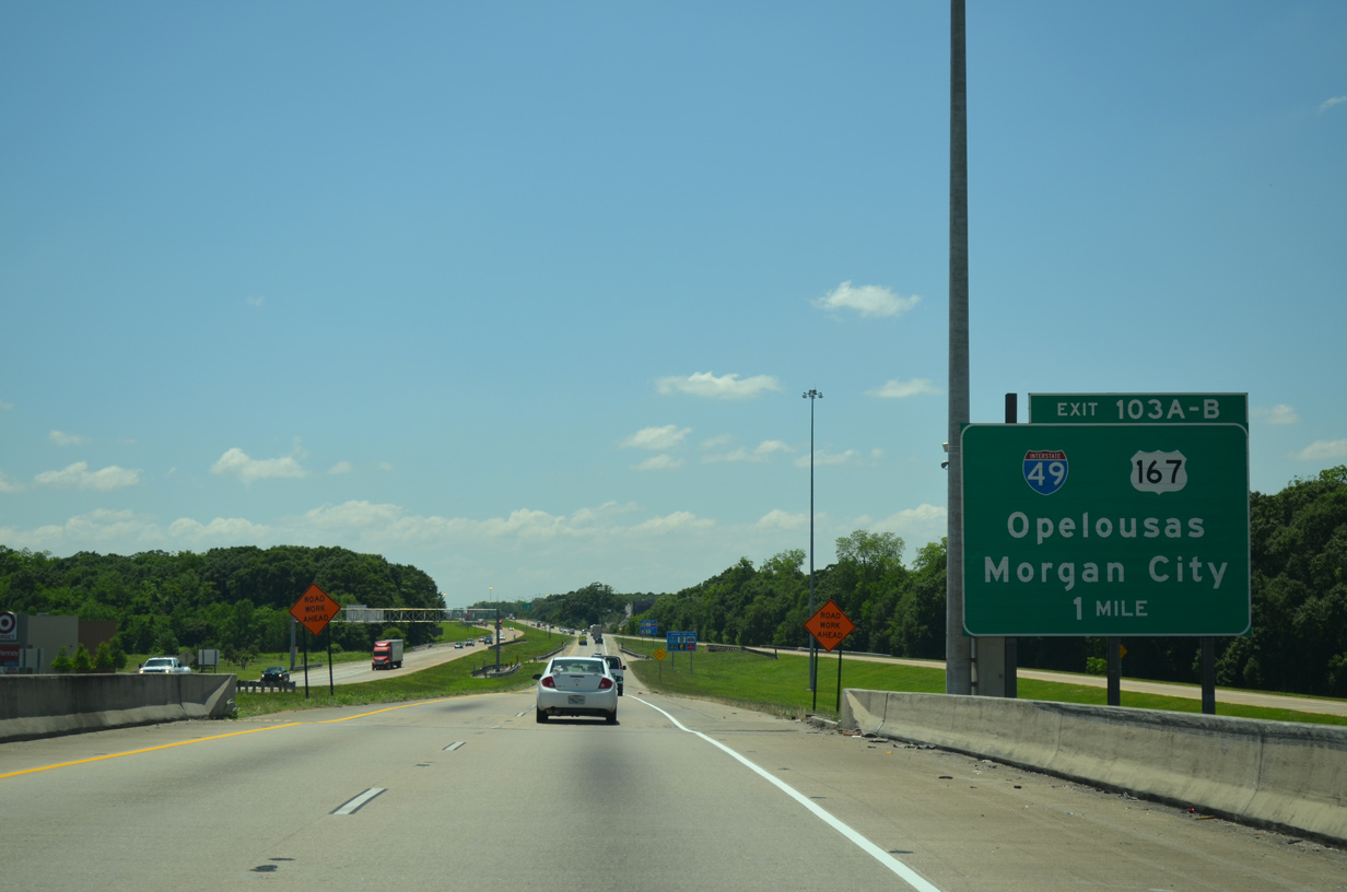
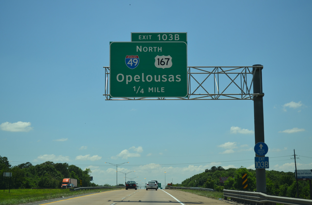
Construction of Interstate 49 directly upgraded the divided highway along U.S. 167 north to Opelousas. Beyond their split at Exit 23, I-49 travels mostly as a rural route to Shreveport, with the exception of an urban stretch through Alexandria. 05/11/22
![]() West at
West at ![]()
![]()
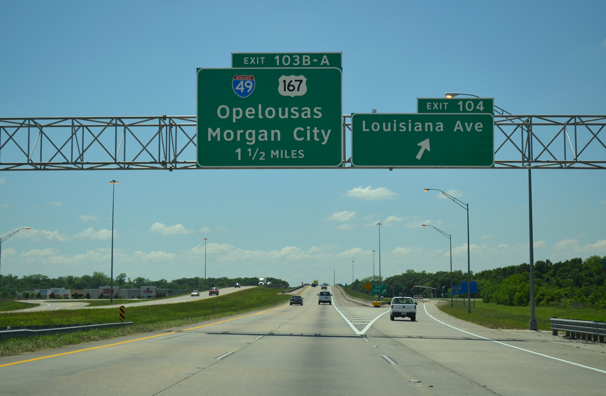
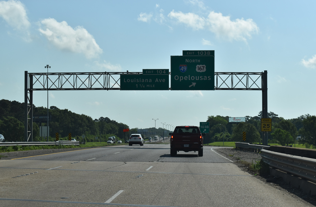
The first guide sign for I-49/U.S. 167 appears at the diamond interchange (Exit 104) with Louisiana Avenue on Interstate 10 west. Exit 104 opened to traffic on August 29, 2003 to both spur economic development and provide a better access to I-10 from Lafayette. 05/19/14
An extended entrance ramp joins Interstate 10 west on the one mile approach to I-49/U.S. 167 as the freeway crosses the Vermilion River. The original westbound lanes of I-10 were repurposed as the on and off-ramps to Louisiana Avenue. 05/19/14
Hurricane Evacuation trailblazers are posted along Interstate 49 from Lafayette northward all the way to Shreveport. The city of Opelousas lies 19 miles to the north at the crossroads with U.S. 190. 05/19/14
Interstate 49 leads north from Lafayette to Alexandria and Shreveport as part of a long distance route joining New Orleans and Baton Rouge with Dallas and Fort Worth, Texas. U.S. 167 overlays the freeway from I-10 to a point near Washington, and again at Alexandria. Photo by Jeff Royston (04/11/22).
South End Throwback
![]()
![]() South at
South at ![]()
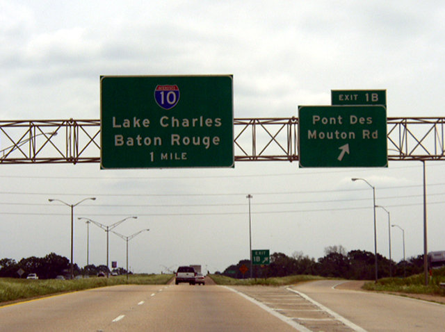
The final mainline exit joins Interstate 49 south with Pont Des Mouton Road. Sign changes made here and I-49 renumbered the ramps for I-10 to Exits 1B/A and Pont Des Mouton Road to Exit 1C. Photo by Chris Patriarca (04/08/03).
Replaced guide sign for Interstate 10 west posted south of Pont Des Mouton Road. Photo by Chris Patriarca (04/08/03).
The loop ramp for Interstate 10 east was unnumbered until sometime after 2009. This panel was replaced by 2007 and again by 2013. Photo by Chris Patriarca (04/08/03).
![]() North at
North at ![]()
![]()
This set of overheads was carbon copied by 2008. A new sign bridge was installed by 2011 as exit numbers changed. Clearview font based signs replaced those panels by 2013. Photo by Chris Patriarca (04/08/03).
A third northbound through lane was added to the left for Interstate 49/U.S. 167 by 2008. Photo by Chris Patriarca (04/08/03).
![]() East at
East at ![]()
![]()
The loop ramp (Exit 103B) to I-49/U.S. 167 leads motorists 200 miles north from I-10 to the city of Shreveport. Opelousas, leftover from the original divided highway taking U.S. 167 north, was retained on subsequent sign replacements. Photo by Eric Stuve (12/17/02).
![]() West at
West at ![]()
![]()

Prior to the construction of the Louisiana Avenue ramps, a two mile sign was posted for Interstate 49 north and U.S. 167 on I-10 west. 01/12/96

When this footage was shot, Interstate 49 was not complete in Alexandria nor in most of Shreveport. The guide signs for I-49 posted in 1986 referenced Opelousas. 01/12/96
Interstate 10 west one mile ahead of I-49 north and U.S. 167 prior to the construction of the diamond interchange (Exit 104) with Louisiana Avenue. 10/18/03
Construction of the exchange at Louisiana Avenue included replacing the guide sign for Exits 103 B/A along westbound I-10. Photo by Andy Jung (06/04/05).
I-49 and U.S. 167 constitute a four lane freeway with a frontage road system between Lafayette and Opelousas. The pair cross paths with U.S. 190, a four lane corridor between Opelousas and Baton Rouge across the Acadiana wetlands, in 19 miles. 10/15/03
Sources:
- Richard Savoie (LADOTD), email. January 2003.
- “I-49 connector gets federal approval.” The Opelousas Daily World, January 9, 2003.
- “I-49 Coming to Missouri.” MoDOT News Release, August 4, 2010.
- U.S. 71 in McDonald County
http://www.modot.state.mo.us/southwest/mac71overview.htmand Statewide Transportation Improvement Plan (2005-2009) – McDonald Countyhttp://www.modot.state.mo.us/southwest/stip/McDonaldCountySTIP.htm - Kent Boyd (Missouri DOT), email to J.P. forwarded to AARoads. Friday, July 16, 2004. Subject: Re: Question about High Priority Corridor 1 (U.S. 71)
- “Bruce R. Watkins Drive nears end of long, bumpy road to – completion.” Kansas City Star, The (MO), October 21, 2001.
- Chip Kelley, personal email dated 11/29/04 and “I-49 awaits bill windfall: Arkansas leg of highway needs $1.5 billion.” Texarkana Gazette, November 25, 2004.
- “DOTD Hosts Ground Breaking Ceremony for I-49 North Pre-Construction Project.” Louisiana Department of Transportation Press Release, April 7, 2005.
- “Interstate 49 extends leg into Pelican State: Louisiana official suggests gas tax hike to pay for road,” Texarkana Gazette, April 8, 2005, and “Welcome Center, I-49 leg open today: Mayor says ‘great change’ will follow opening of highway.” Texarkana Gazette, December 16, 2004.
- Celebrating the 50th Anniversary of the Eisenhower Interstate Highway System: Previous Interstate Facts of the Day by the Federal Highway Administration (FHWA).
- “Toll road on Bella Vista bypass moving forward.” Arkansas News Bureau, April 13, 2006.
- “I-49 in the passing lane.” The Shreveport Times, August 19, 2007.
- “MoDOT completes four interchanges as part of upgrading U.S. 71 to interstate status.” The Joplin Globe, September 12, 2010.
- “U.S. 71 Interchange north of Milo opens.” The Fort Scott Tribune, November 19, 2011.
- “Interchange Construction Begins Jan. 30.” Southwest District News Releases (MoDOT), January 27, 2012.
- “New I-49 Signs Being Installed Along U.S. 71.” Southwest District News Releases (MoDOT), February 1, 2012.
- “Re: I-49 Coming to Missouri” online posting by Grzrd, AARoads Forum, February 2, 2012.
- “New 327th Street Overpass at Route 71 to Open Late Thursday.” MoDOT Kansas City Area District News Release, August 7, 2012.
- “Re: I-49 in AR (Bella Vista, Fort Smith)” online posting by Grzrd, AARoads Forum, August 25, 2010.
- “AHTD Advertises First Bella Vista Bypass Project” online posting by Grzrd, AARoads Forum, January 25, 2011.
- “Re: I-49 in AR (Bella Vista, Fort Smith)” online posting by Grzrd, AARoads Forum, April 3, 2012.
- “I-49 North Segment K Construction to Begin in September 2013?” online posting by Grzrd, AARoads Forum, June 21, 2012.
- “Highway 549 Opens to Traffic in Texarkana Wednesday.” AHTD press release, May 13, 2013.
- “Smoke from I-49 clearing project fills sky.” KTAL, September 25, 2013.
- I-49 North, LaDOTD Project web site.
- “NORTHWEST ARKANSAS TO RECEIVE NEW INTERSTATE HIGHWAY DESIGNATION.” Information Release, AHTD. April 16, 2014.
- “First Section of Bella Vista Bypass to Open.” Arkansas Business April 21, 2014.
- “I-49 opens from Shreveport to Arkansas, beyond.” The Times (Shreveport, LA), November 10, 2014.
- I-49 Maps and Information,
http://www.modot.org/southwest/major_projects/I-49/I-49MapsandInformation.htmMoDOT web site. - “I-49 Opening ‘Finally Here,’ FCRA Boss Says.” Times Record Online Edition, June 22, 2015.
- “Explosions Clear Way For Bella Vista Bypass.” 5News – KFSM/KXNW, October 28, 2014.
- “Completion of I-49 nears halfway mark.” The Advocate (Baton Rouge, LA), June 26, 1988.
- “New segment of I-49 open.” The Advocate (Baton Rouge, LA), October 22, 1987.
- “I-49 section slated to open.” The Advocate (Baton Rouge, LA), March 1, 1989.
- “New section of I- 49 to open Monday.” The Advocate (Baton Rouge, LA), May 12, 1989.
- “New stretch of interstate to be opened.” The Advocate (Baton Rouge, LA), November 10, 1989.
- “I-49 segments to open, should speed up trips.” The Advocate (Baton Rouge, LA), September 11, 1991.
- “Last non-urban section of I-49 complete.” The Advocate (Baton Rouge, LA), May 3, 1992.
- “Road Work Ahead.” Acadiana Advocate, The (LA), August 10, 2016.
- “State will seek bids on U.S. 90 J-turns later this month.” Daily Review, The (Morgan City, LA), September 5, 2016.
- “Area chambers meet to discuss Interstate 49.” TXKtoday.com, June 27, 2016.
- “I-49 Bridge Engineering Makes State Draft Pla.” Times Record (Fort Smith, AR), January 28, 2016.
- “Cost of 1.5-mile I-49 core: $355-668 million.” Daily Advertiser, The (Lafayette, LA), October 27, 2016.
- “I-49 bypass slated for completion in summer 2022.” The Joplin Globe (MO), March 6, 2019.
- “I-49 Corridor Section Nears Completion After Numerous Setbacks.” Engineering News-Record, June 17, 2019.
- “DOTD celebrates completion of LA 318 Interchange.” KLFY-TV (Lafayette, LA), May 15, 2018.
- “I-49 Lafayette Connector final plan may be ready in 2021.” The Advocate (Baton Rouge, LA), February 18, 2019.
- “Shreveport I-49 inner-city connector project receives $100 million boost.” KTBS-TV (Shreveport, LA), June 5, 2019.
- Highway 549: Benton County. Connecting Arkansas Program (CAP) web site.
- “Officials to celebrate start of $102 million in projects for Bella Vista Bypass.” Northwest Arkansas Business Journal, October 7, 2019.
- “Long-awaited I-49 Bella Vista Bypass opens to drivers.” KTBS TV-3 (Shreveport, LA), October 1, 2021.
- “ARDOT holds I-49 extension session in Alma; no interchange planned at U.S. 64.” KSFM TV-5, March 18, 2022.
- “ArDOT announces beginning of I-49 corridor construction at Chaffee Crossing.” KNWA TV-24, January 7, 2022.
Page updated April 12, 2023.