Interstate 44
Overview
Angling northeast from Wichita Falls, Texas to St. Louis, Missouri, Interstate 44 connects the southern Great Plains with the Upper Midwest. Three sections through Oklahoma take toll roads including the H.E. Bailey Turnpike from U.S. 70 near Randlett to Lawton and again from Lawton to Oklahoma City. The Turner Turnpike extends I-44 east from Interstate 35 near Edmond to Sapulpa southwest of Tulsa. Built in the 1950s, Skelly Drive takes Interstate 44 east across Tulsa to the Creek and Will Rogers Turnpikes by Catoosa. The Will Rogers Turnpike carries the remainder of I-44 northeast through Oklahoma to the Missouri state line by Joplin.
Throughout Missouri, Interstate 44 overlaid or parallels Historic U.S. 66 as it travels east to Springfield and northeast to St. Robert, Rolla and greater St. Louis. The eastern extent combines with I-55 north to the Poplar Street Bridge, where it formerly turned east and ended alongside I-64 and I-70. A slight extension was made in 2015 over what was I-70 by the Gateway Arch and Downtown St. Louis to the newly opened Stan Musial Veterans Memorial Bridge.
Creek Turnpike
The SAFETEA-LU of 2005 added the Creek Turnpike as a future segment of the Interstate Highway System. However, no numerical designation was assigned. The language is found in Section 1908(a)(1), INCLUSION OF CERTAIN ROUTE SEGMENTS ON INTERSTATE SYSTEM AND NHS:
CREEK TURNPIKE, OKLAHOMA.-The Secretary shall designate as part of the Interstate System (as defined in section 101 of title 23, United States Code) in accordance with section 103(c)(4) of such title the portion of the Creek Turnpike connecting Interstate Route 44 east and west of Tulsa, Oklahoma.
As such, the Creek Turnpike is signed with Joplin and Oklahoma City for regional traffic along I-44 headed through Tulsa. It was assigned the designation of SH 364 by the Oklahoma Department of Transportation (ODOT) on March 10, 2014. The same minutes included the numbering of SH 351 for the previously unnumbered portions of the Muskogee Turnpike from Tulsa southeast to I-40 near Webbers Falls.7
 Parallel U.S. Routes
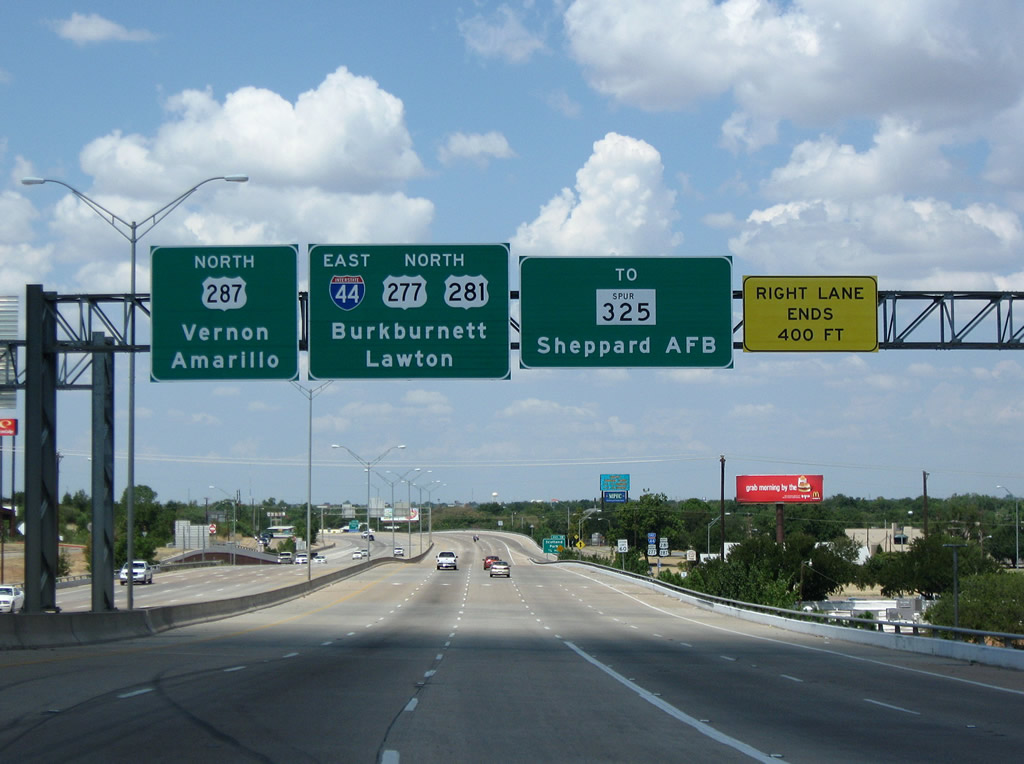
Between Wichita Falls and Lawton, Interstate 44 follows U.S. 277 and U.S. 281. Northeast from Lawton to Oklahoma City, the H.E. Bailey Turnpike portion of I-44 follows U.S. 62-277. The remainder of I-44 from Oklahoma City northeast to St. Louis, replaced famous U.S. 66, although much of that route survives as Oklahoma Highway 66, Missouri Route 66 or Business Loop I-44.
History
IH 44 was approved by the Texas State Highway Commission on August 12, 1982 with 15.398 miles from 8th Street in Wichita Falls northerly with U.S. 277/281 to the Oklahoma line by the city of Burkburnett.2 This addition allowed the designation to continue southwest from Oklahoma City to Wichita Falls via Lawton along the Oklahoma Turnpike system.3
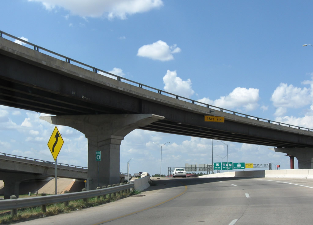
Interstate 44 begins along the Central Freeway (U.S. 277-281-287) where the Broad and Holiday Street ramps tie in from 8th Street near Downtown Wichita Falls. Previously the Central Freeway ended with U.S. 277-281-287 following a one way couplet along Holliday Street south and Broad Street north southeast to an older freeway at 16th Street. Work starting on February 16, 1999 joined the two limited access highways by constructing a 1.7 mile long viaduct system above both Broad and Holliday Streets. With the addition of a $1.6 million flyover from U.S. 277-281-287 north to 6th Street, the $47.8 million project was finished seven months ahead of schedule on May 10, 2002.11
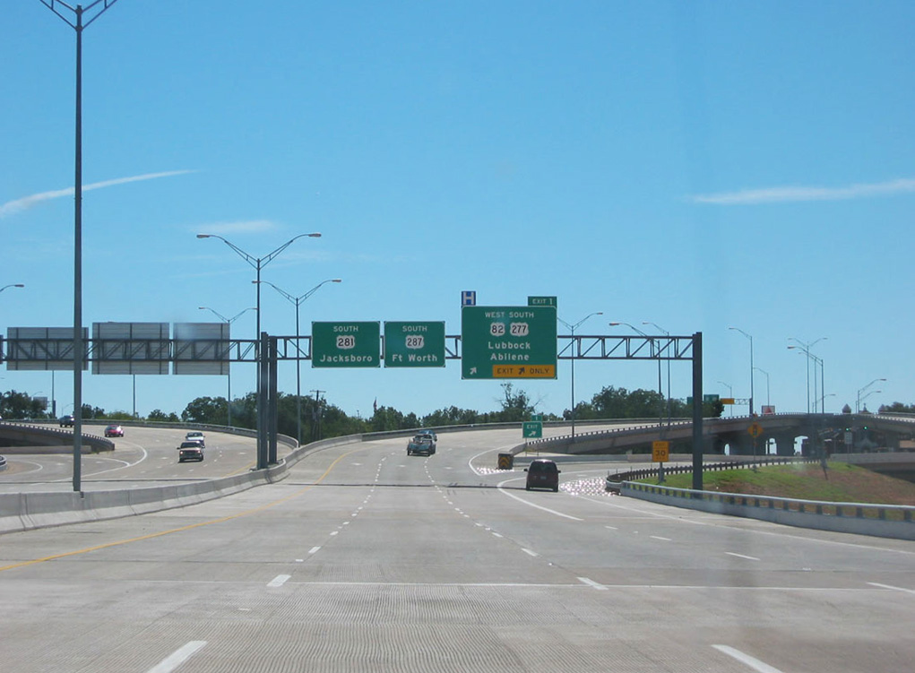
The west end of IH 44 was previously located at the exchange joining IH 35 with the Turner Turnpike in north Oklahoma City, Oklahoma. The extension southwest to Texas was approved by the American Association of State Highway and Transportation Officials (AASHTO) on June 28, 1982. Part of this involved renumbering the northern and western portions of the I-240 urban loop encircling Oklahoma City a part of I-44. It also designated I-44 along the previously unnumbered H.E. Bailey Turnpike, and along side the freeway for U.S. 62 connecting the Turnpike north end (U.S. 62/277) at Newcastle to I-240.13
The H.E. Bailey Turnpike segment of I-44 from Lawton to Oklahoma City opened on April 23, 1964. The section of I-44 from the north end of the H.E. Bailey Turnpike to SW 29th Street in Oklahoma City opened to traffic as part of Interstate 240 in April 1976.4
The Turner Turnpike, which carries I-44 east from I-35 at the Kilpatrick Turnpike to SH 66 at Sapulpa, opened to traffic on May 16, 1953. The toll road was the first superhighway built in Oklahoma.8 It ties I-44 in with Skelly Drive, the historic U.S. 66 bypass of Downtown Tulsa.9
Originally named the 51st Street Bypass, Skelly Drive (I-44 / Historic U.S. 66) was initially planned in 1948. Discussion of the proposed route wavered between backers of a route toward Downtown and those supporting a bypass for through traffic. Ultimately the decision favored the bypass route route versus no route at all. The proposed alignment resulted in a lawsuit that went all the way to the Oklahoma Supreme Court, with a 1954 ruling favoring the current route versus the original along 51st Street to Memorial Drive and then north to U.S. 66 at 11th Street.9
Renamed Skelly Drive to honor oilman W.G. Skelly, the expressway opened on November 21, 1958 at a cost of $15 million. Construction of the expressway was later investigated by a grand jury and congressional subcommittee in 1960, after allegations that substandard material was used. The grand jury indicted three principals in the construction company, but those were later dropped or dismissed.9
A $6.3 million widening in the city of Tulsa expanded Interstate 44 from four to six lanes between 41st and 31st Streets from September 2002 to August 2003. Outlined for 2006 at a cost of $13.6 million, the next section of I-44 expanded to six lanes was the section from 41st Street to Yale Avenue (Exit 229).1
Work to construct the Creek Turnpike (SH 364) around the east side of Tulsa included the relocation of I-44 from Skelly Drive onto the Will Rogers Turnpike. The previous alignment of I-44 split with U.S. 412 east leading directly to the partition with SH 66 north. This configuration changed in July 2002 with I-44 taking U.S. 412 east to a new cloverstack interchange with the Creek Turnpike. The Creek Turnpike south to the Muskogee Turnpike opened a month later.10
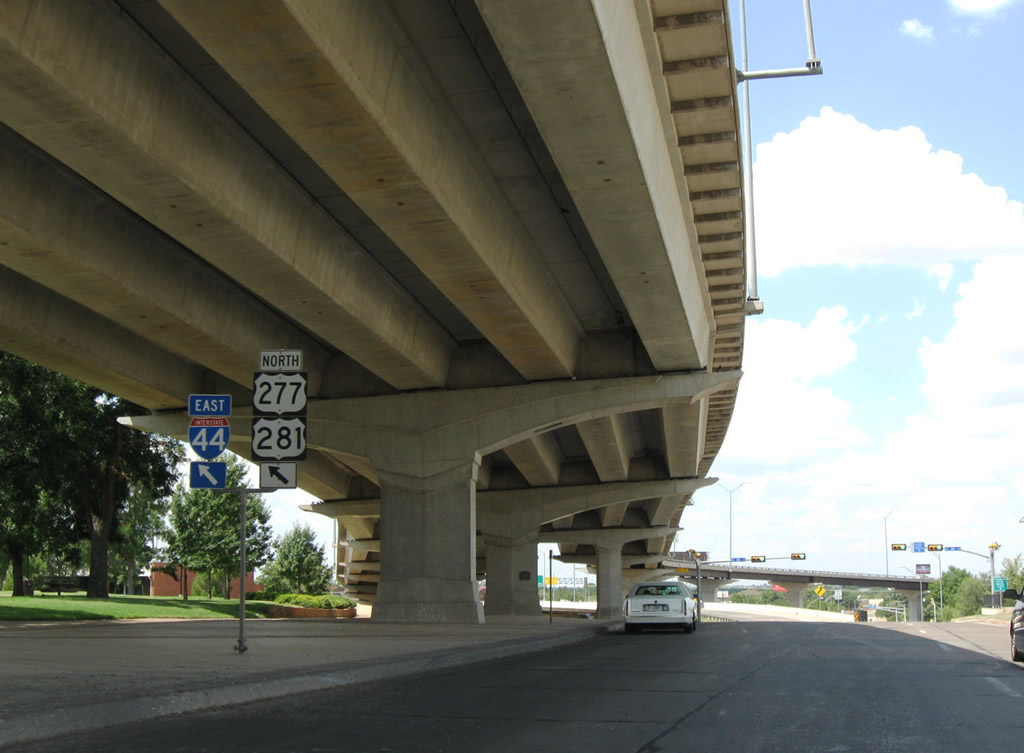
The relocation of Interstate 44 east of Tulsa at the Creek Turnpike and U.S. 412 was approved by AASHTO on May 30, 2003. This included a new alignment for I-44 leading due south directly to the Creek Turnpike at U.S. 412. The angled portion of the Will Rogers Turnpike to SH 66 at U.S. 412 was abandoned, though ramps still link SH 66 east from I-44 east and from SH 66 west to I-44 west.
Route Information
Texas – 14.77
Oklahoma – 328.53*
Cities – Lawton, Chickasha, Oklahoma City, Tulsa, Vinita, Miami
- Junctions –


Missouri – 293.39**
Cities – Joplin, Springfield, Lebanon, Rolla, Sullivan, St. Louis
- Junctions –
Source: December 31, 2021 Interstate Route Log and Finders List
* – 4.37 miles on I-35
** – 1.00 mile on I-55
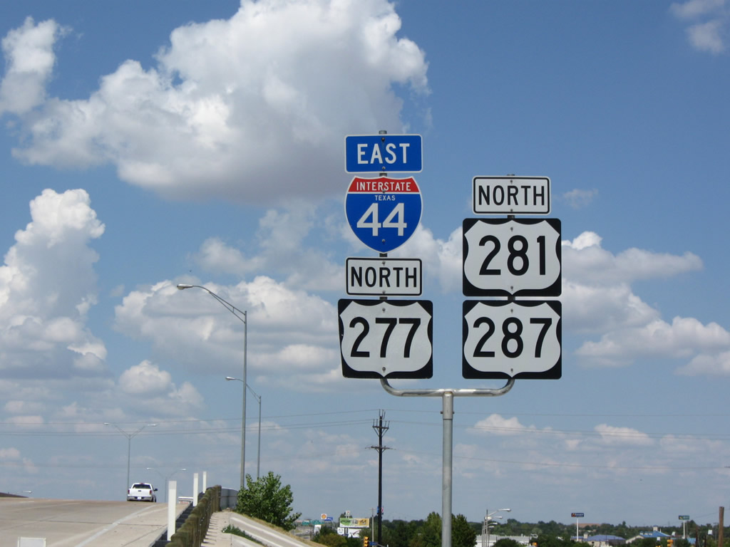
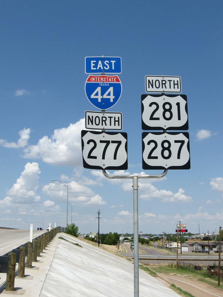
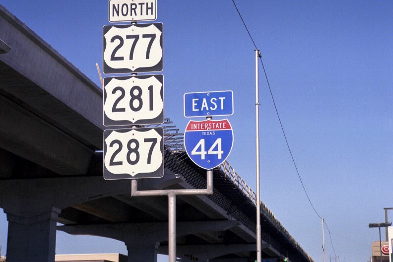
Confirming markers posted beyond the N 8th Street entrance ramp at Wichita Falls, Texas. U.S. 277 overlaps with IH 44 north to Randlett, Oklahoma while U.S. 281 runs concurrent with the freeway for 61 miles through Lawton. 09/06/09
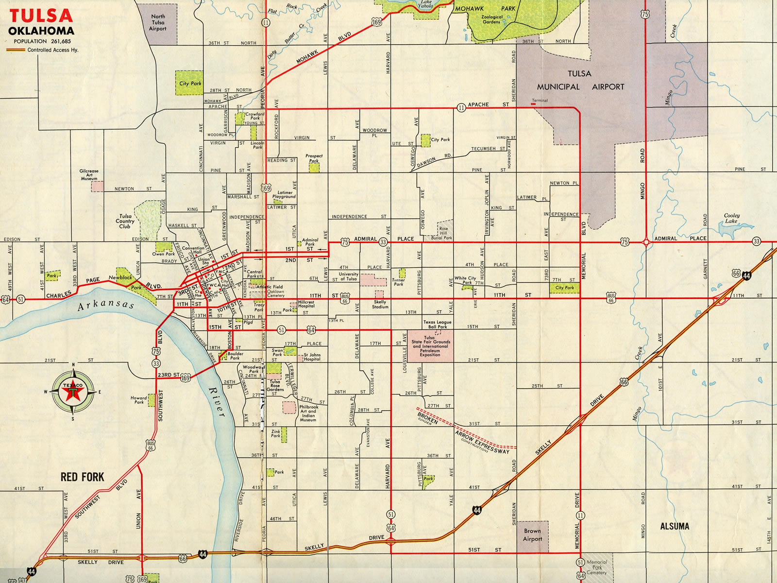
Interstate 44 follows Skelly Drive, the original expressway bypass of U.S. 66, between the Turner and Will Rogers Turnpikes across Tulsa.
Construction for Interstate 44 directly upgraded several four-lane sections of U.S. 66 throughout the ShowMe State.
The eastern extent of I-44 proposed at I-55 and Lafayette Avenue in 1968; I-44 was completed through St. Louis in 1972. Ramps were built here for the incomplete North South Distributor Freeway (Missouri Route 755). Plans for Route 755 were scaled back in the early 1980s and ultimately dropped as a parkway in 2003.
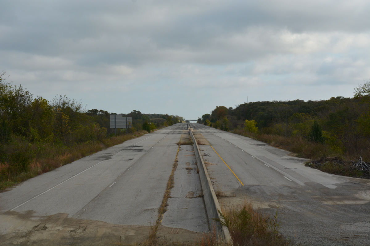
The abandoned section of the Will Rogers Turnpike east of Pine Street in Catoosa, Oklahoma. 11/02/16.
Approval for the Will Rogers Turnpike was initiated by the Oklahoma Turnpike Authority one month after its establishment by the state Legislature in June 1953.8 The toll road features one of the largest McDonald’s restaurants in the world, at the location of the former Glass House Restaurant where it crosses over the Interstate near the city of Vinita. The Vinita Service Plaza closed on June 4, 2013 for renovation and reconstruction. The recognizable bridge and arch was retained during the $14.6 million renovation project5 completed on December 22, 2014.6
Until 2013, the east end of I-44 was located at the Poplar Street Bridge, where I-55/64/70 and U.S. 40 cross the Mississippi River into Illinois. With construction of the Stan Musial Veterans Memorial Bridge and realignment of Interstate 70 to the north, AASHTO approved a 2.9 mile northern extension of I-44 over what was previously I-70, from I-55 at Truman Parkway to the west end of the cable-stayed bridge. Opened on February 9, 2014, the Stan Musial Veterans Memorial Bridge shifted I-70 northward away from both the Poplar Street Bridge and the trenched freeway stretch by the Gateway Arch.

I-44 east leads directly into Interstate 70 west at the end of the Stan Musial Veterans Memorial Bridge in St. Louis, Missouri. Photo by Chris Kalina (03/08/14).
Eastern Terminus –  – St. Louis, Missouri
![]() East at
East at ![]()
Interstate 44 ascends from the below grade section by the Gateway Arch on a viaduct spanning Washington Avenue and Carr Street, one mile south of the merge with I-70 westbound. 05/24/18
The I-70 Express Lane, which flows inbound only, separates the I-44 roadways north of Broadway and Cass Avenue at the Columbus Square neighborhood in St. Louis. 05/24/18
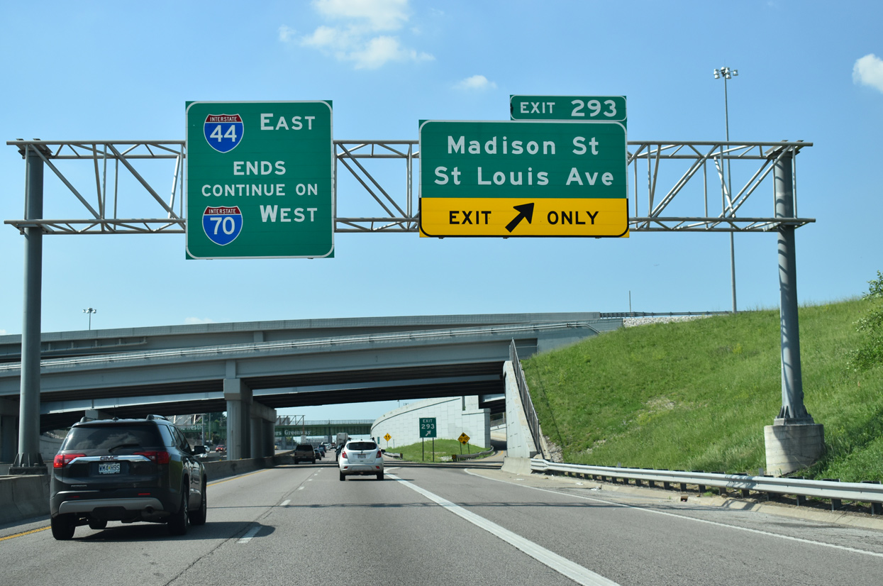
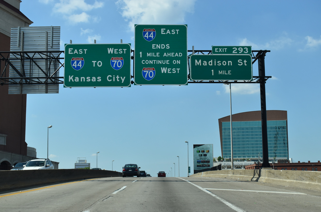
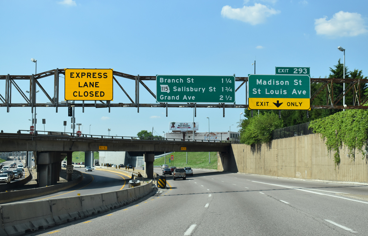
Exit 293 departs from the east end of I-44 to Madison Street and the Near North Riverfront. The freeway mainline defaults onto I-70 west, which runs along the Old North St. Louis and Hyde Park communities beyond the Stan Musial Veterans Memorial Bridge. 05/24/18
![]() East at
East at ![]()
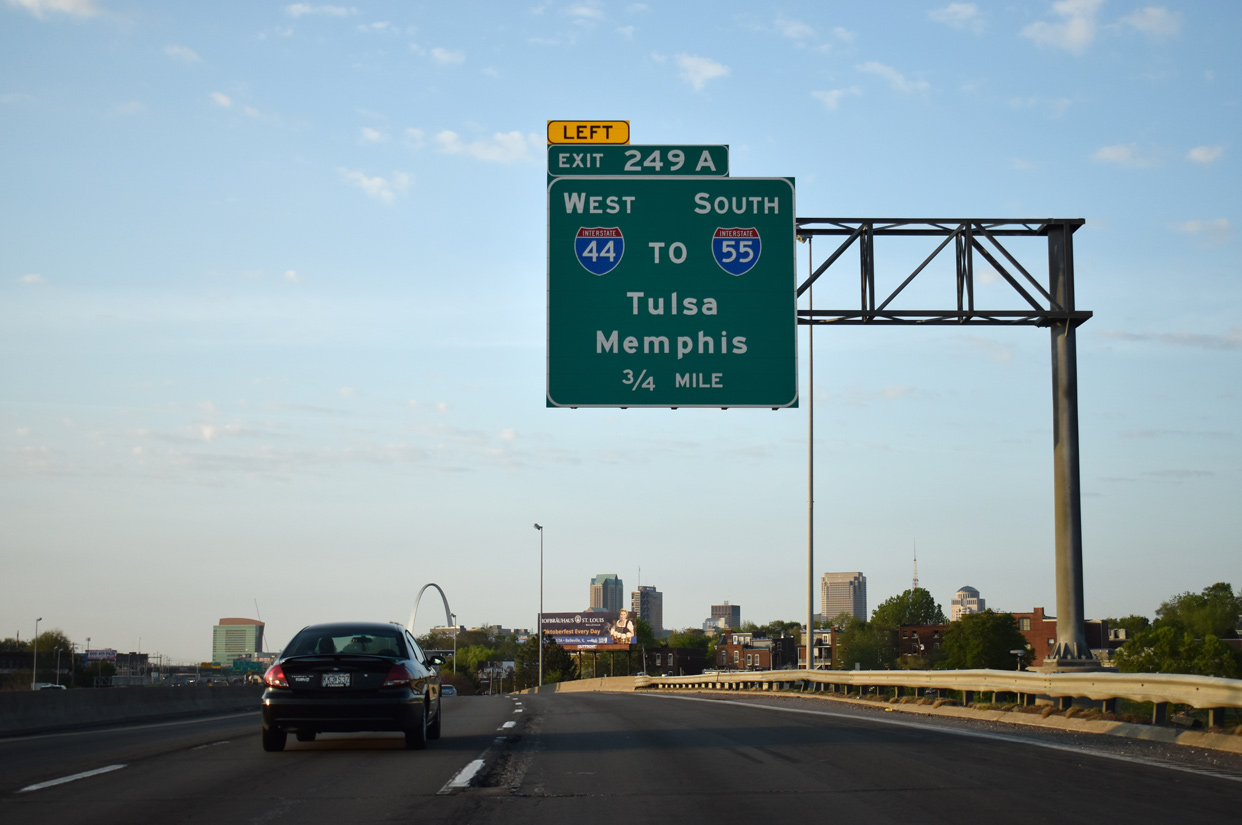
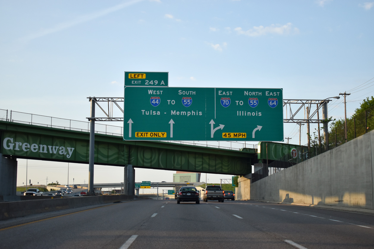
Crossing over Branch Street at Old North St. Louis, I-70 advances 0.75 miles south to separation with Interstate 44 at Left Exit 249A. 05/07/18
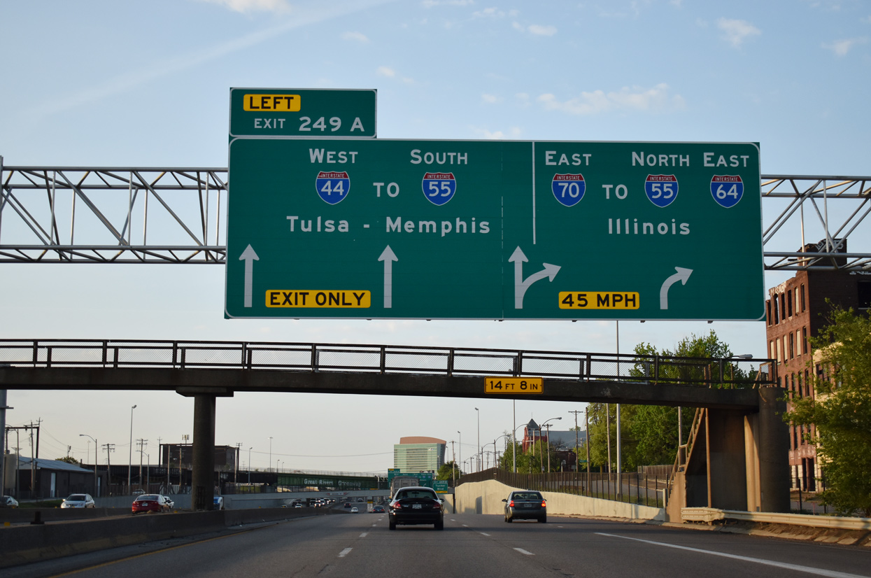
Dropping below grade between Columbus Square and the Near North Riverfront areas of St. Louis, eastbound I-70 expands to four lanes to the exchange with the Stan Musial Veterans Memorial Bridge and Tucker Boulevard (Exit 249B). 05/07/18
Interstate 44 extends southward to Downtown St. Louis, the Jefferson Expansion National Memorial and I-55 at the Poplar Street Bridge. I-70 spans the Mississippi River east to Brooklyn and East St. Louis, Illinois. 05/07/18
Former East End – – St. Louis, Missouri
![]() East at
East at ![]()
An end sign for I-44 east preceded the Compton Avenue overpass at the Compton Heights neighborhood in St. Louis. A sign for an Amtrak Station at Exit 290B took the place of this assembly by 2014. 04/13/13
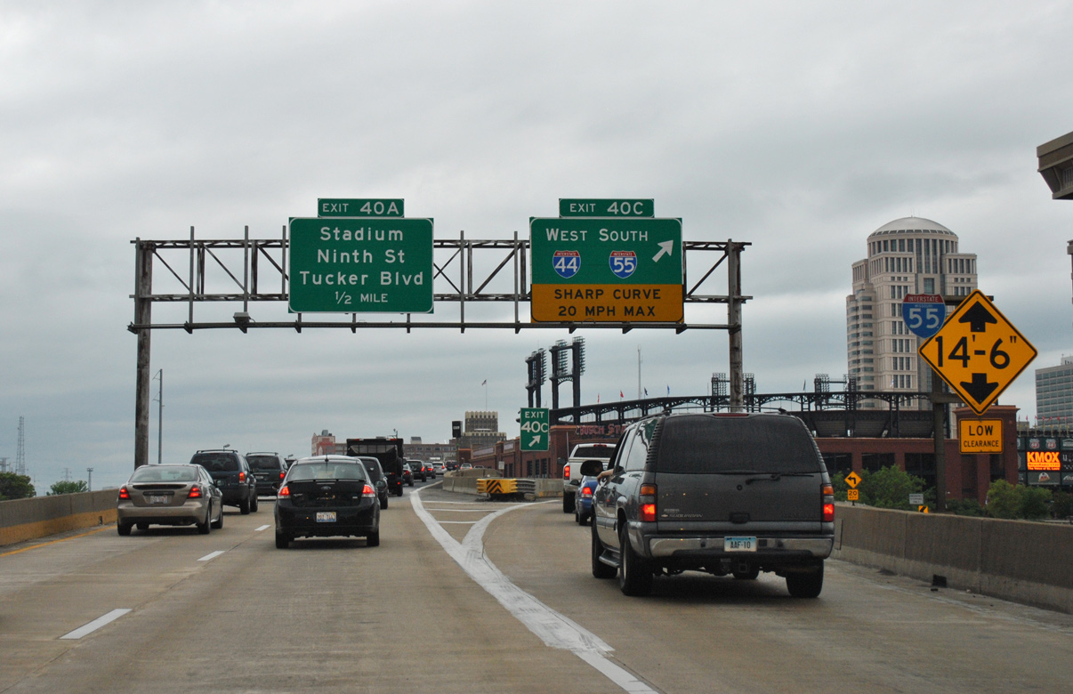
I-44 east at Exit 289 for Jefferson Avenue north to Lafayette Square and south to McKinley Heights. The succeeding exit to Lafayette Street is a remnant from the defunct Route 755 freeway loop proposed around the west side of Downtown St. Louis. Photo by Jeff Morrison (04/19/08).
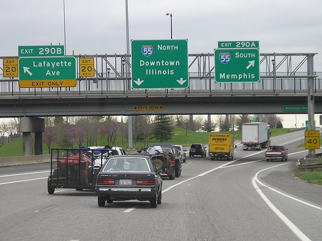
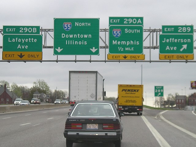
I-44 concluded with the mainline transitioning onto I-55 northbound beyond the departures of Exit 290B to Lafayette Avenue (formerly 18th Street) and Exit 290A to I-55 south. Photo by Jeff Morrison (04/19/08).
![]()
![]()
![]() West
West ![]() South at
South at ![]()
I-55/64/70 and U.S. 40 combined west across the Poplar Street Bridge from East St. Louis, Illinois to Downtown St Louis, Missouri. Initial signs referenced the forthcoming TOTSO movements of I-70 west to Memorial Drive and I-55 south to Interstate 44 west. 05/04/12
The Poplar Street Bridge carried four westbound lanes with no shoulders across the Mississippi River. I-64/U.S. 40 extend west from the left two lanes to Wentzville while back to back lane drops followed for I-70 west by the Gateway Arch and I-44 west / I-55 south. An arrow per lane (APL) sign is positioned here now. 05/04/12
The original interchange at the Poplar Street Bridge west end separated departing traffic into narrow single lane ramps. Both were demolished in 2015-16 as part of the reconstruction of Interstate 44 (former I-70) north between the Gateway and Downtown. 05/04/12
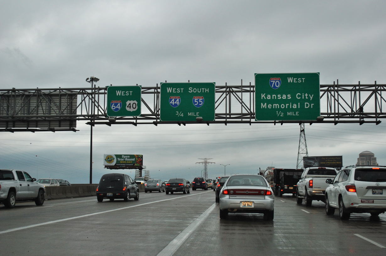
Exit 40C took the I-55 mainline onto the below grade freeway extending south from then I-70 east and Downtown. This ramp was replaced by a two lane flyover in 2016. 05/04/12
![]() East at
East at ![]()
![]()
![]()
![]()
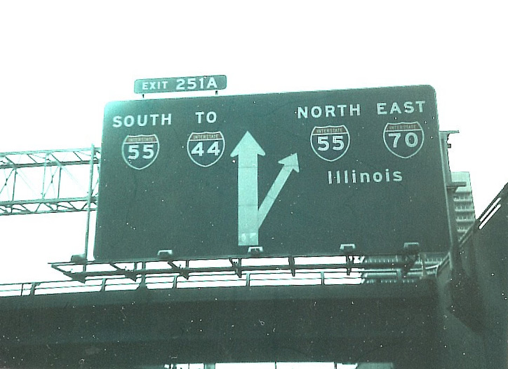
Diagrammatic sign out lining the TOTSO movement of Interstate 70 east from the below grade freeway between Downtown and Jefferson National Expansion Memorial onto the Poplar Street Bridge (I-55 north). The freeway mainline defaulted onto I-55 south ahead of I-44 west. Photo by Michael Summa (1981).
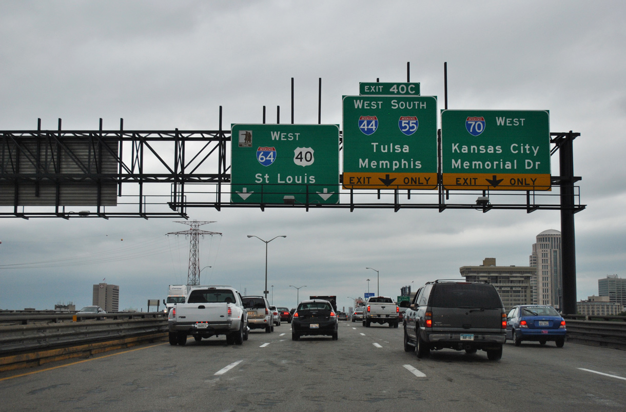
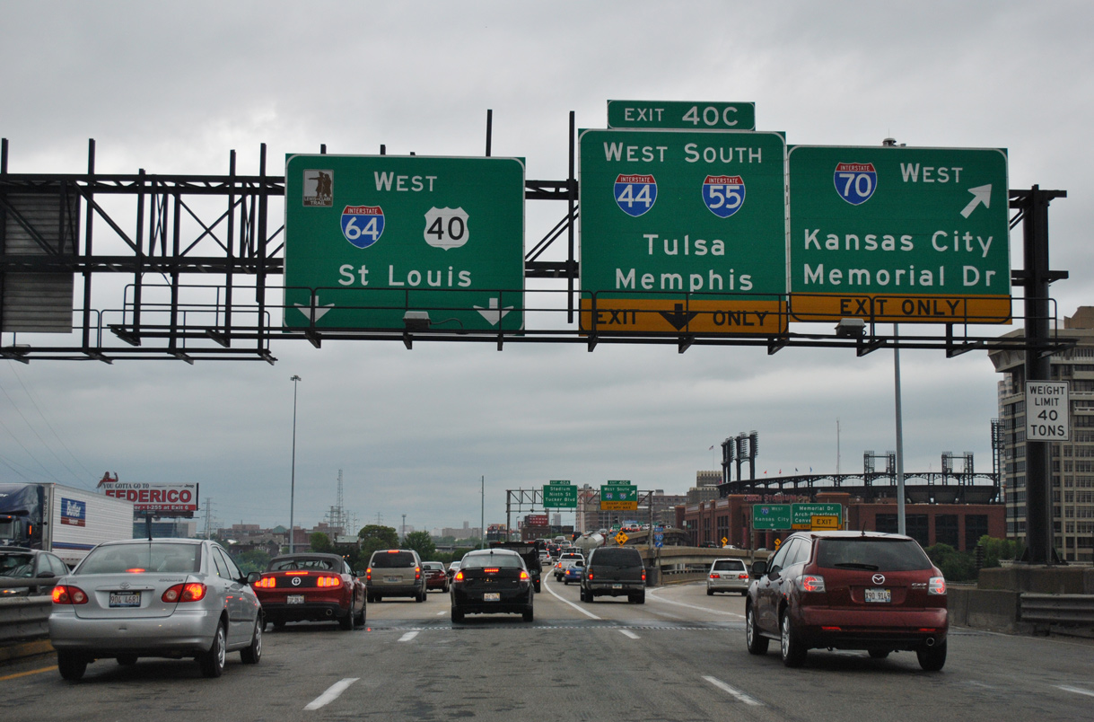
Later sign changes on I-70 east added I-64, reflecting the 1993 extension west across St. Louis, and the long distance cities of Tulsa and Memphis for I-44 west and I-55 south respectively. Photo by Don Hargraves (02/14/03).
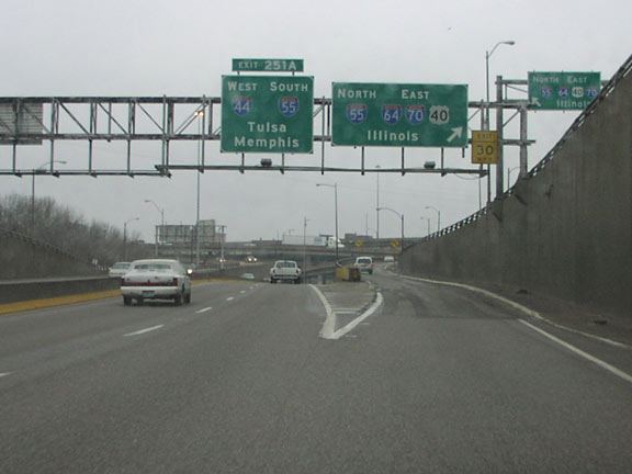
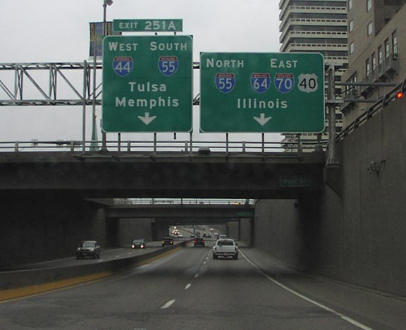
I-70 turned east onto the Poplar Street Bridge, combining with I-55/64 to East St. Louis. I-55 south combined with unsigned I-44 through LaSalle Park. With the relocation of I-70 out of Dowtnown St. Louis in 2014, this ramp was demolished. Photo by Don Hargraves (02/14/03).
![]() South at
South at ![]()
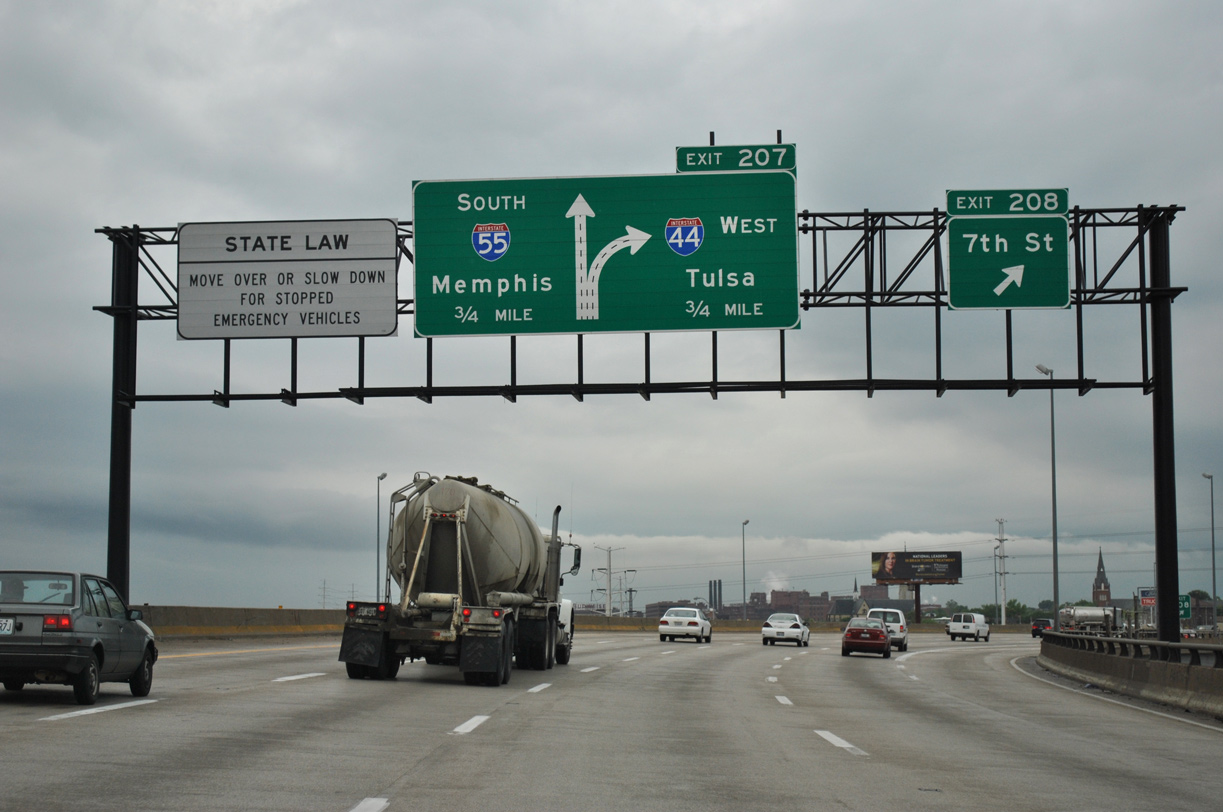
Interstate 55 angles southwest from the Poplar Street Bridge along a viaduct by the LaSalle Park community preceding Exit 207 with I-44 west. 05/04/12
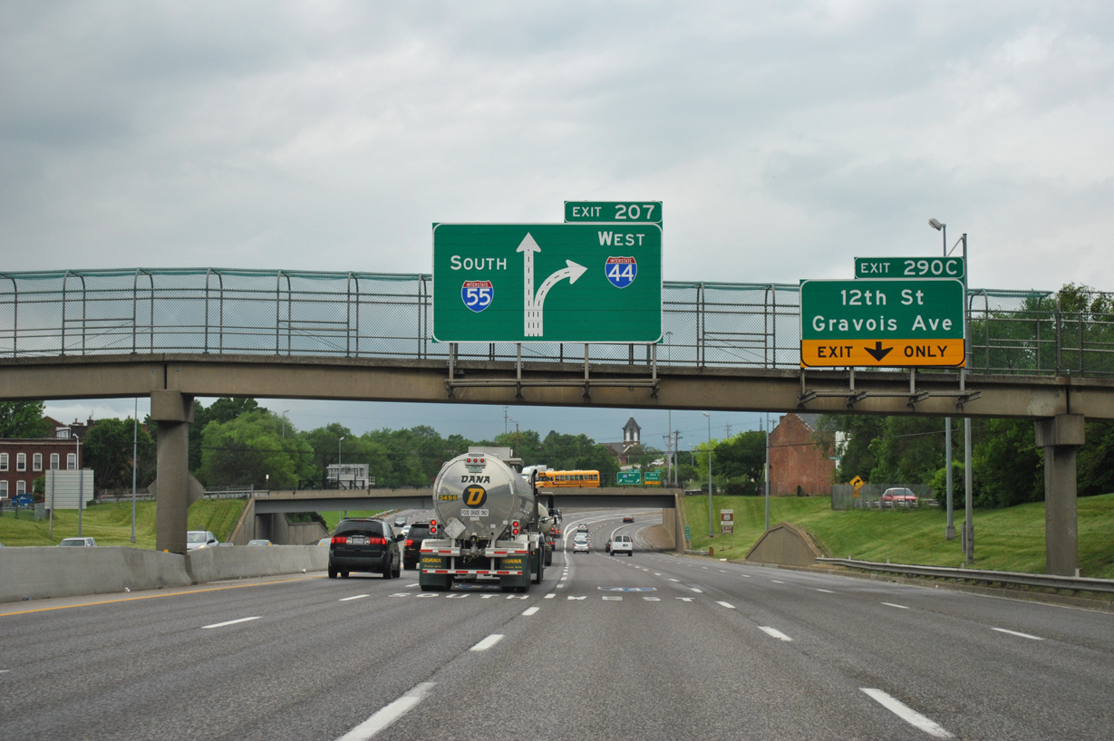
Interstate 55 lowers to grade level by the Soulard community and curves west to the directional T interchange (former Exit 207) with I-44 west. Exits along this stretch were renumbered to use the I-44 system, with the mainline of I-55 reassigned as Left Exit 290B. 05/04/12
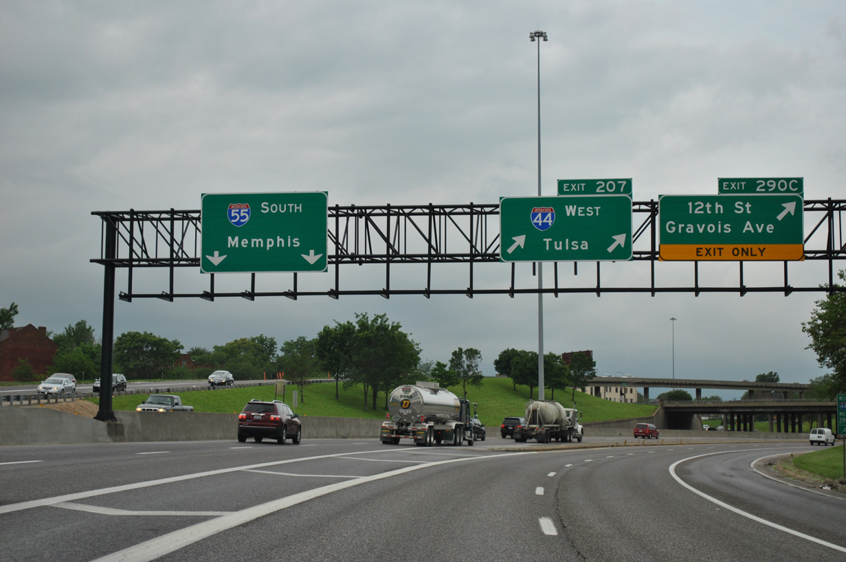
Traffic partitioned with two lanes for the continuation of I-55 south to Cape Girardeau and Memphis, Tennessee and two lanes for the beginning of I-44 west to Rolla, Springfield, Joplin and Tulsa, Oklahoma. 05/04/12
![]() North at
North at ![]()

Heading north between the Kosciusko and Soulard communities, I-55 advance to the left exits for both I-44 west and Lafayette Avenue / Truman Parkway. Had the Route 755 freeway been completed, it would have provided connectivity from I-44 east and I-55 north to I-64/U.S. 40 west and from vice versa. Photos by Brian Dowd (09/27/02) and AARoads (12/20/09).


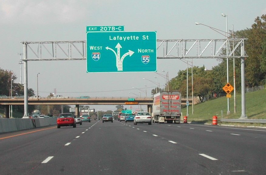
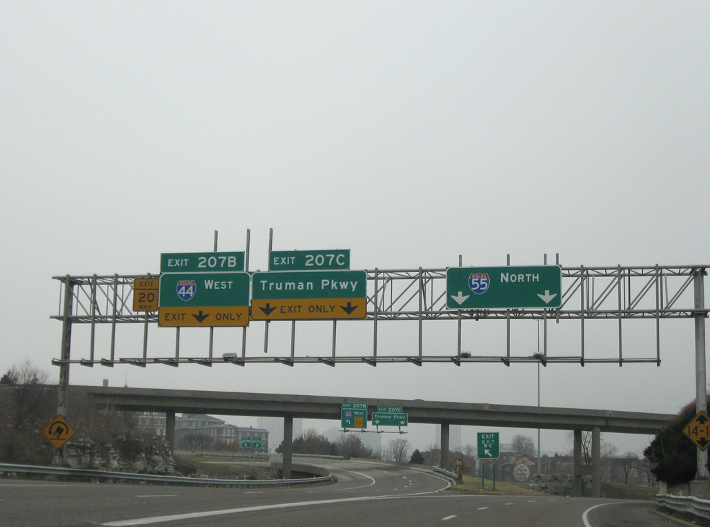
Older signs posted at Exit 207A omitted Route 30 for Gravois Avenue and Tulsa for I-44 west. Subsequent changes renumbered the left side ramp to Exit 207B and replaced Truman Parkway for Lafayette Street. Truman Parkway was developed in place of the cancelled North South Distributor Freeway freeway. FPhotos by Brian Dowd (09/27/02) and AARoads (12/20/09).
12/20/09
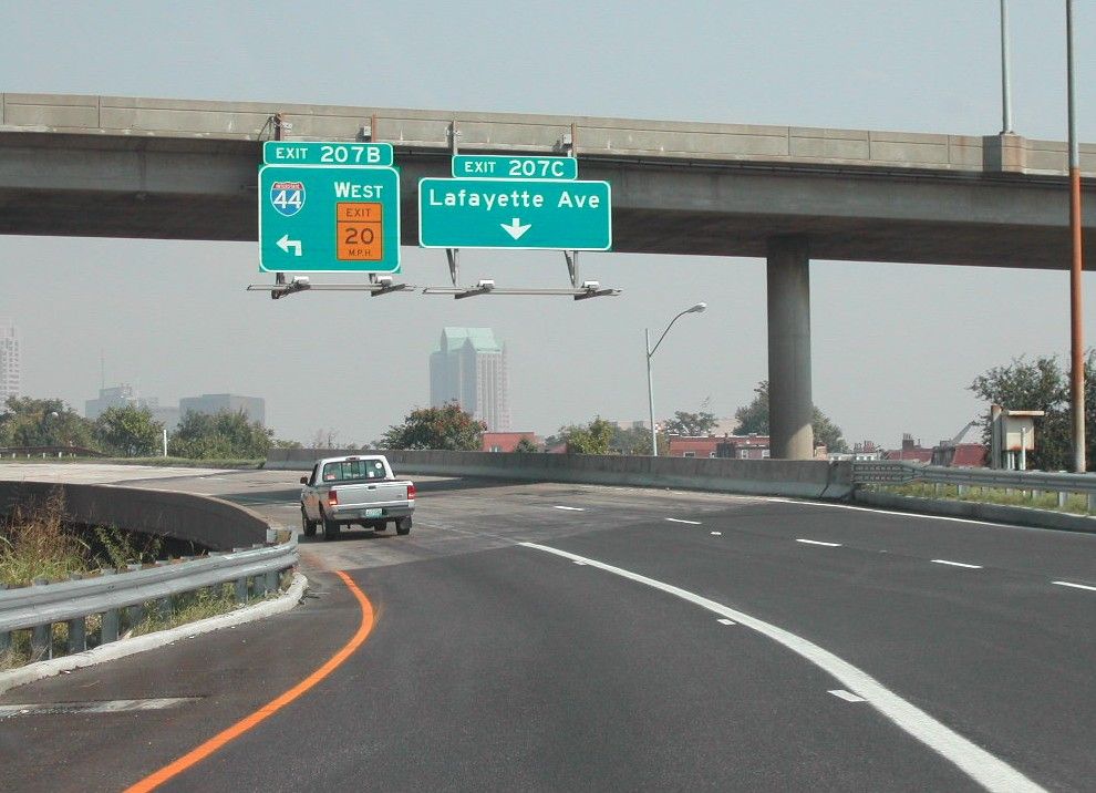
Photo by Brian Dowd (09/27/02).
Taking Exit 207B, traffic partitioned along a sharp curve for Interstate 44 west ahead of The Gate District and a two lane ramp to Truman Parkway / Lafayette Street.
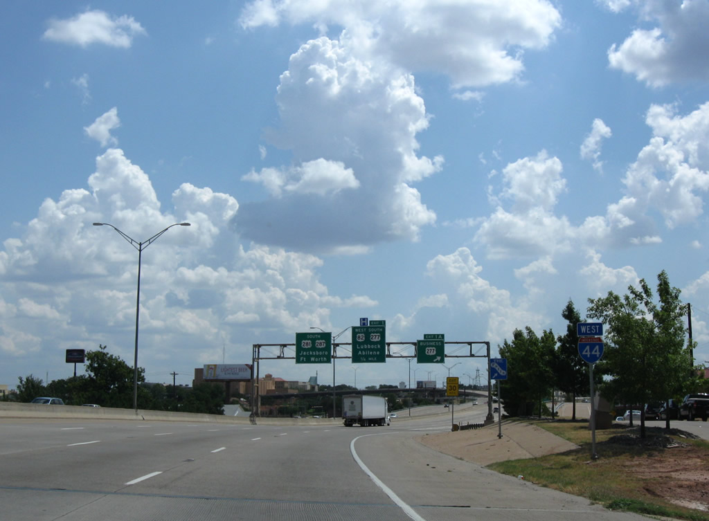
West End  – Wichita Falls, Texas
![]() West
West ![]()
![]()
![]() South
South
The final confirming marker for IH 44 west stands just south of the Central Freeway bridge across the Wichita River. 09/06/09
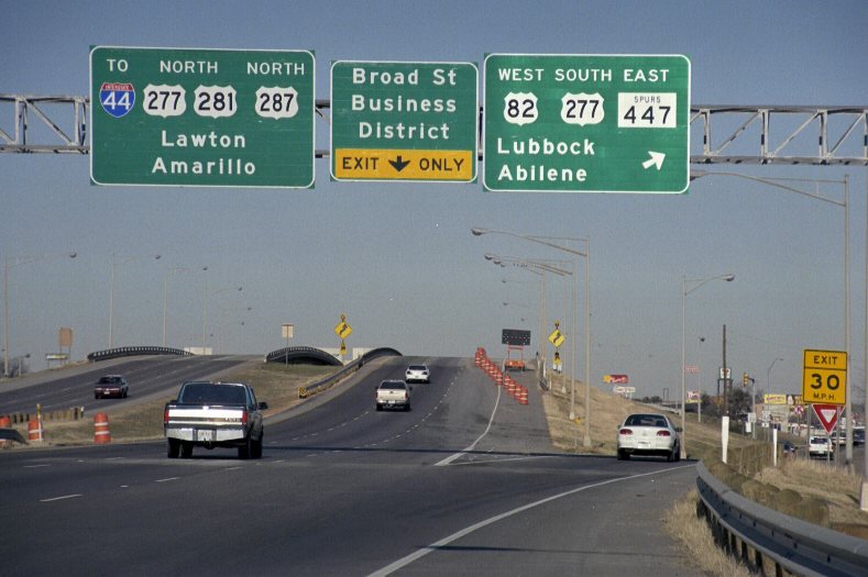
U.S. 277 Business stems west from IH 44/U.S. 277-281-287 to run along the former alignment of U.S. 82/277 to the Kell Freeway at Allendale Road. Exit 1 follows onto Holliday Street for 6th Street east into the Wichita Falls Business District. The overhead for Exit 1 was subsequently removed following the completion of the systems interchange with the Kell Freeway. 09/06/09
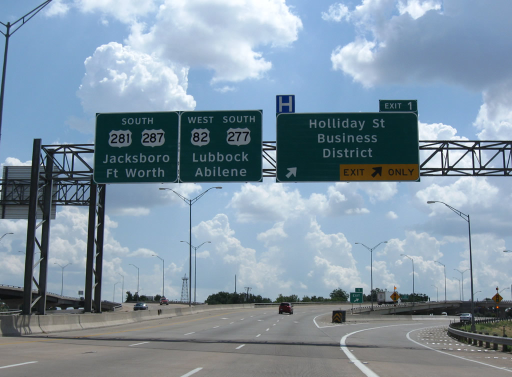
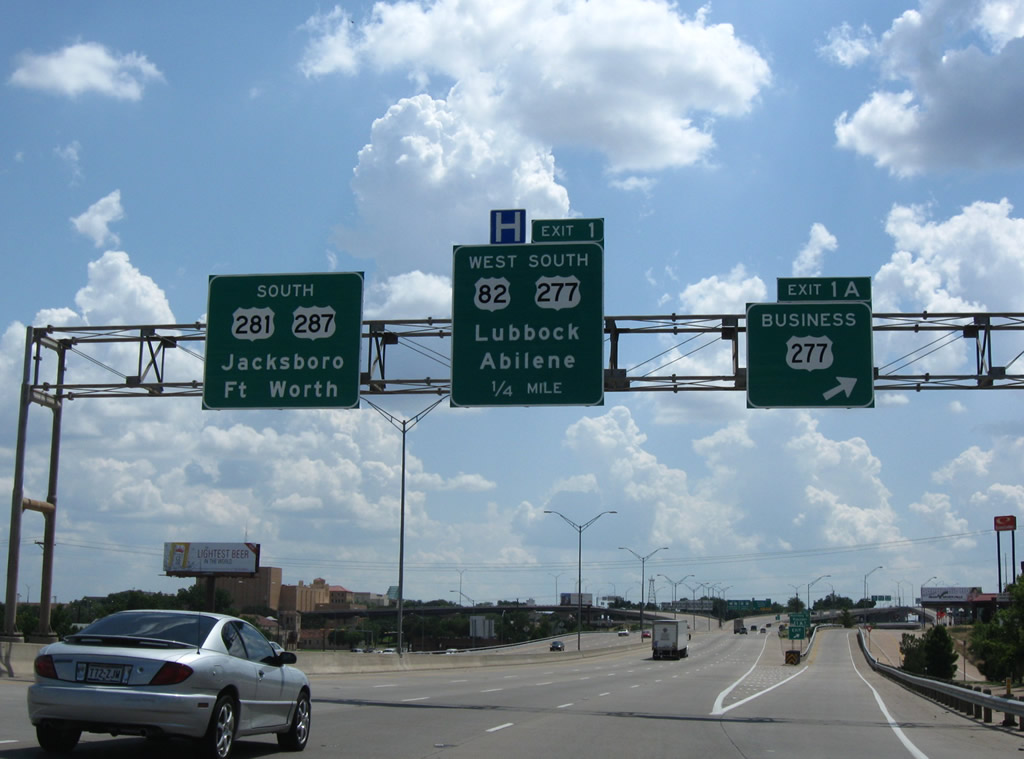
IH 44 ends as Exit 1 departs with two lanes from the Central Freeway south for Holliday Street (old U.S. 277-281-277 south). U.S. 277 splits with U.S. 281/287 toward Abilene at the ensuing exchange. 09/06/09
![]()
![]()
![]() North at
North at ![]()
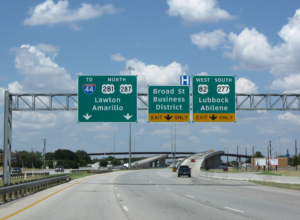
U.S. 82 west separates with U.S. 281/287 north ahead of the Central Freeway viaducts and IH 44 to join U.S. 277 southbound along the Kell Freeway. First proposed in 1964, the Kell Freeway was completed with the opening of a 3.5 mile segment west from Fairway Boulevard to FM 369. Work on the $28 million final section ran from January 2008 to September 24, 2009.12 09/06/09
U.S. 277 combines with U.S. 281/287 (Central Freeway) north from the Kell Freeway. The three routes elevate just west of Downtown Wichita Falls to the 6th Street off-ramp and the start of Interstate 44. 09/06/09
Broad Street north passes by Bellevue Park ahead of 8th Street and the off-ramp for the eastbound beginning of IH 44. 09/06/09
Milepost zero appears along the Broad Street ramp above 7th Street. The 6th Street flyover passes overhead from U.S. 277-281-287 (Central Freeway) north. 09/06/09
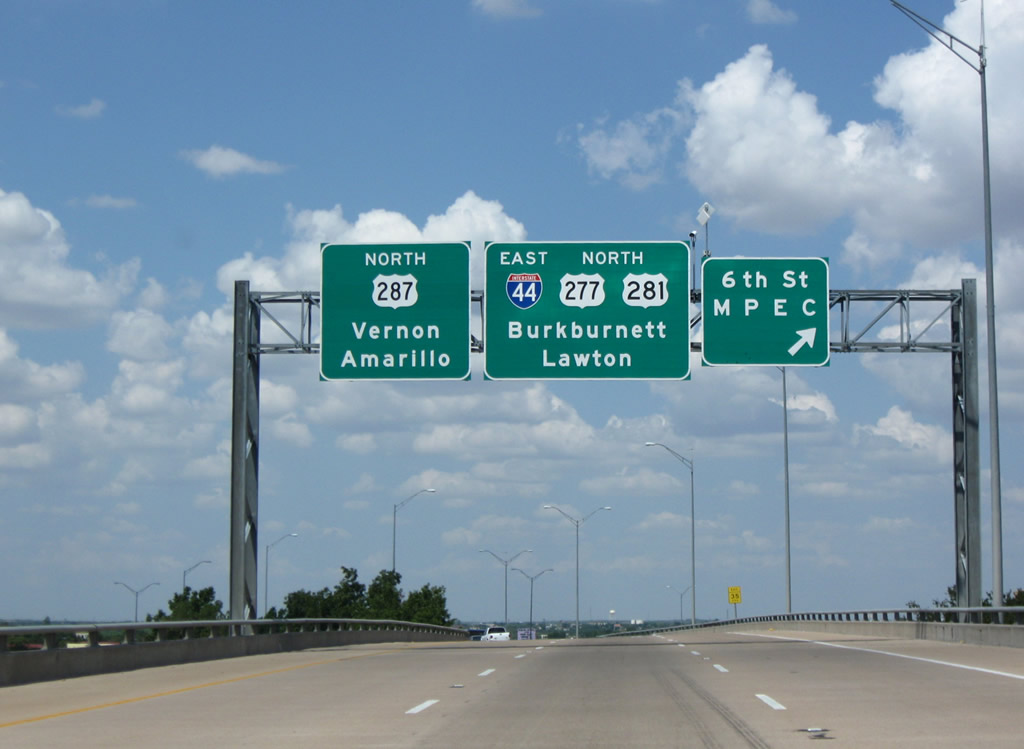
The separate roadways of the Central Freeway converge ahead of 8th Street (U.S. 277 Business). IH 44 east and U.S. 277-281-287 proceed north 2.5 miles to the Northwest Freeway, where U.S. 287 branches west toward Vernon. 09/06/09
West End Throwback
U.S. 281/287 transitioned onto the Central Freeway viaduct above Holliday Street while U.S. 277 shifted onto the surface street south to Kell Boulevard and U.S. 82. Photo by Justin Cozart (09/02).
An older overpass took U.S. 281/287 northward across a Forth Worth and Denver Railroad line and Kell Boulevard, 1.7 miles south of the IH 44 eastbound beginning. U.S. 82 west departed from an on-ramp here to join U.S. 277 (Kell Boulevard) south at FM 447. Photo by Jeff Royston (12/00).
Shields posted along Broad Street north for IH 44 east and U.S. 277-281-277 north during the elevated freeway project. Photo by Jeff Royston (12/00).
Sources:
- “Section of I-44 in Tulsa set to open over a month early.” Oklahoma DOT Public Affairs Media Advisory, August 01, 2003.
- INTERSTATE HIGHWAY NO. 44, Highway Designation File. Texas Department of Transportation.
- From Anywhere to Everywhere: The Development of the Interstate Highway System in Texas
http://tti.tamu.edu/interstate_anniversary/white_paper/by Penny Beaumont, Rhonda Brinkmann, David Ellis, Chris Pourteau, and Brandon V. Webb, Texas Transportation Institute, page 34. - Celebrate the Interstate: America’s Interstate Highway System Turns 50!
http://www.okladot.state.ok.us/okinterstate50/by the Oklahoma Department of Transportation. - OK Turnpike Authority shutting down McDonald’s over I-44 for remodel, likely open in 2013. KJRH, March 26, 2013.
- “Iconic McDonald’s Set To Reopen Along Will Rogers Turnpike.” NewsOn6.com, December 17, 2014.
- Minutes For The Special Transportation Commission Meeting, Oklahoma Department of Transportation, March 10, 2014.
- “There’s no such thing as a ‘free highway'” Tulsa World (OK), September 16, 2002.
- “Only in Oklahoma: City bypass spawned suit, investigations.” Tulsa World, October 18, 2007.
- “Pike-bound lanes revised.” Tulsa World, July 11, 2002.
- “Central Freeway ready Road project comes to end seven months early.” Wichita Falls Times Record News (TX), May 10, 2002.
- “Kell job near done.” Wichita Falls Times Record News (TX), September 25, 2009.
- Darrell Brunson, email: “The H.E. Bailey Turnpike & I-44 at OKC,” August 13, 2017.
Page updated August 21, 2019.