Interstate 41
Overview
Interstate 41 replaced U.S. 41 along the freeway corridor between Milwaukee and Green Bay via Fond du Lac and Appleton. This included the U.S. 41 overlap with I-894 and along I-94 southward from Milwaukee to Russell Road (Exit 1 A) and the Illinois state line. Resigning of U.S. 41 to Interstate 41 through Wisconsin took place between late May and November 2015. The $5.9 million project included the posting of 3,200 signs over the 180 mile long route.1
The first signs for Interstate 41 posted in Wisconsin were installed during the evening of May 29, 2015. This sign appears along WIS 172 eastbound at the interchange with I-41 in Ashwaubenon. Photo by Peter Johnson (05/30/15).
Interstate 41 created the unusual situation where a U.S. route changes into an Interstate route with the exact same number (U.S. 74 and I-74 do the same thing at Rockingham and Laurinburg, North Carolina). U.S. 41 is not acknowledged from intersecting routes or along freeway guide signs however.
High Priority Corridor
Interstate 41 is part of High Priority Corridor 32: Wisconsin Development Corridor and High Priority Corridor 57: U.S. 41 Corridor from Milwaukee to Green Bay for its entire length.
Major Projects
Started in 2012, the Zoo Interchange Project centered around the exchange where I-41, I-94 and I-894 converge on the west side of Milwaukee. Work upgraded the substandard exchange with left exits built in 1963 into a four level systems interchange. Adjacent work expanded and modernized I-41 southward to Lincoln Avenue and I-94 west beyond Wis 100 and east to S 76th Street. Ongoing work through 2023 reconstructs I-41 northward to Burleigh Street. Project elements for Interstate 41 include:
- Greenfield Avenue Interchange – the Greenfield Avenue bridge was replaced in 2013. Landscaping and the addition of a decorative wall were anticipated for 2016 or 2017. Ramp closures continued through early Summer 2018.
- Watertown Plank Road Interchange – upgrading the original diamond interchange into a free-flow directional cloverleaf interchange. This work was completed by the end of 2014.
- Bluemound Road Interchange – new ramps were added from the I-41/ U.S. 45 mainline to U.S. 18 (Bluemound Road). 2014-15 work reconstructed Bluemound Road over I-41. Ramp construction followed from 2015 to Summer 2018, with ramps to and from Wisconsin Avenue removed during the project.
- Zoo Interchange – crews constructed a four level interchange with 23 new bridges and 12 retaining walls. Additionally new lanes were added to I-41/U.S. 41 and along the connecting ramps. Core construction commenced in late 2014 and was completed following a ribbon cutting ceremony held August 27, 2018.
- North Avenue Interchange – reconstruct the parclo interchange with slight geometric changes to improve safety. Engineering and design work was finished in 2016, with construction underway as part of the overall North Leg project through 2023.
Route Information
Mileage
Illinois – 2.50*
Cities – none
- Junctions –

Wisconsin – 172.50**
Cities – Kenosha, Milwaukee, Fond du Lac, Appleton, Green Bay
- Junctions –

Source: December 31, 2021 Interstate Route Log and Finders List
* – 2.5 miles on I-94
** – 25.5 miles on I-94, 5 miles on I-43, 10 miles on I-894

South on I-41 at Wis 29 and Wis 32 at the high speed systems interchange completed in early 2015. Local traffic continues onto Shawano Avenue while regional traffic exits towards Wausau. Photo by Peter Johnson (06/17/15).
The southbound off-ramp from I-41 to Wis 29 / Shawano Avenue ties into a three lane roundabout. The bridges above are part of the directional T interchange joining I-41/Wis 29. Photo by Peter Johnson (06/17/15).
Ramps at the north end of Interstate 43 closed on October 23, 2015 as part of the September 2013 to December 2016 project. The interchange fully reopened on August 26, 2016.
 History
This new freeway corridor became an Interstate Corridor as a result of the Safe, Accountable, Flexible, Efficient Transportation Equity Act: A Legacy for Users (SAFETEA-LU) legislation (signed into law on August 10, 2005). This legislation not only added U.S. 41 between Milwaukee and Green Bay as High Priority Corridor 57, it also designated Corridor 57 as a future Interstate route. An earlier version of this law (HR 3, Section 1839) had language that indicated that High Priority Corridor 57 “is designated as Interstate Route I-41.” However, SAFETEA-LU does not have a similar provision that specifies the route number for the future Interstate to be routed over U.S. 41.2
Numbers discussed by the Wisconsin Department of Transportation (WisDOT) included I-47, I-243, I-594 and I-643 in addition to Interstate 41. The selections went to American Association of State Highway and Transportation Officials (AASHTO) at their meeting held on November 15, 2012 where an endorsement of the number “41” was selected for the future Interstate highway. The numbering moved to the Federal Highway Administration (FHWA) for approval before Interstate 41 was made official.3
A WisDOT map of the US 41 Conversion showed the proposal to extend Interstate 41 southward along all of I-894 and I-94 south from Milwaukee to the first exit in Illinois.3 Logic behind this overlap retained mileposts and exit numbers along the preexisting freeway along U.S. 41 between Milwaukee and Green Bay.
The non-freeway portion of U.S. 41 along Appleton Avenue from the Stadium Freeway/Miller Park Way northwest to I-41 at Exit 47 near Menonmonee Falls was renumbered as an extension of WIS 175.
Upgrades
Two projects along Interstate 41 and U.S. 41 involved upgrading the freeway through Brown and Winnebago Counties. The Brown County work involved a 14 mile long stretch from Orange Lane to Lineville Road (CTH-M). Construction commenced in 2010 and was completed in 2017. Aspects of work included rebuilding nine interchanges, adding 24 roundabouts and widening the freeway from four to six and ten overall lanes. More details are as follows:
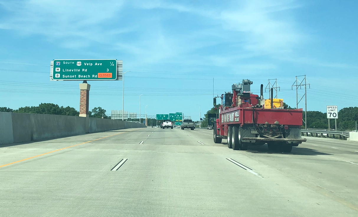
- Lineville Road (County Trunk Highway M) interchange – work completed from June 2013 to May 2015.
I-41 was expanded to six lanes below a new overpass for CTH M while ramps were expanded to two lanes. - I-41 and I-43 Interchange – work started in September 2013 and ran through December 2016. The new northbound ramp from I-43 to I-41 opened on July 27, 2015. Following was opening of the new I-41 north to I-43 south flyover opened on August 28, 2015. The new flyover from I-43 north to I-41 south opened on August 26, 2016.
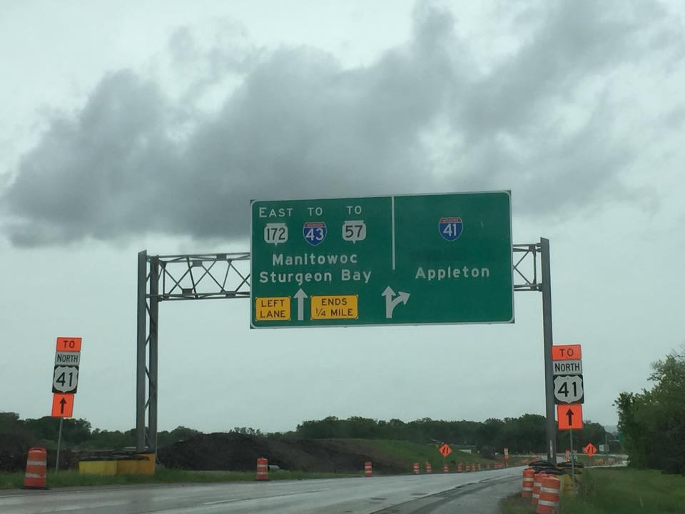
Construction replaced all loop ramps with directional ramps as part of new directional T interchange. Adjacent work separated movements to Velp Avenue (U.S. 141) and eliminated weaving traffic to and from I-43. - Packerland Drive – WIS 29 Interchange – work completed in early 2015 included construction to add flyovers from and to WIS 29/32 leading west from I-41/U.S. 41. The new directional T overlays a diamond interchange with roundabouts at Shawano Avenue.
- WIS 172 Ramps – construction started in Fall 2013 and concluded in Fall 2016.
Ramps were expanded and realigned to join new collector distributor lanes along Interstate 41.
Work in Winnebago County affected 17 miles of I-41/U.S. 41 from WIS 26 to Breezewood Lane. Construction was completed between 2009 and 2014. Upgrades included a new eight lane Lake Butte des Morts Causeway, reconstruction of four interchanges, and the addition of 16 roundabouts. Of this work, the interchange with U.S. 45 received a substantial makeover with free flow movements added from north I-41 to north U.S. 45 and from U.S. 45 south to I-41 south.
 Photo Guides
North End 
 / Lineville Road – Suamico, Wisconsin
![]()
![]() North at
North at ![]()
![]()
![]()

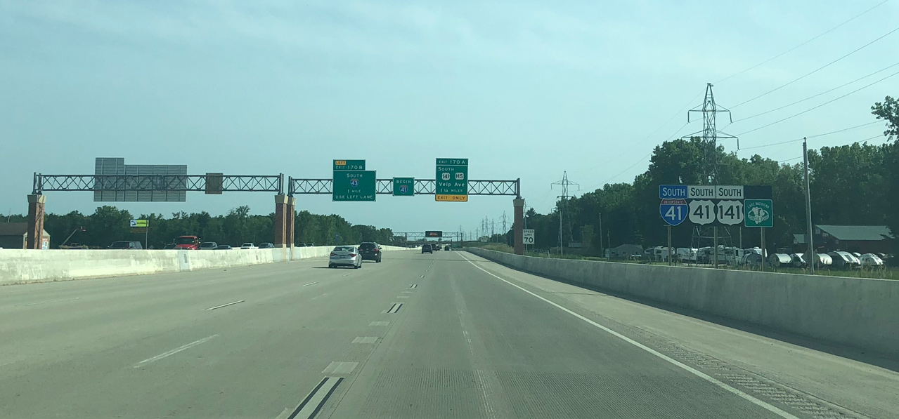
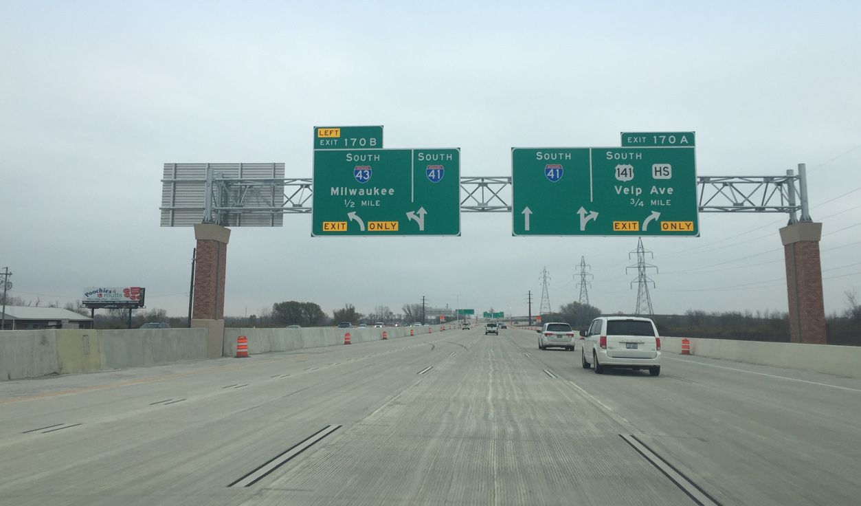
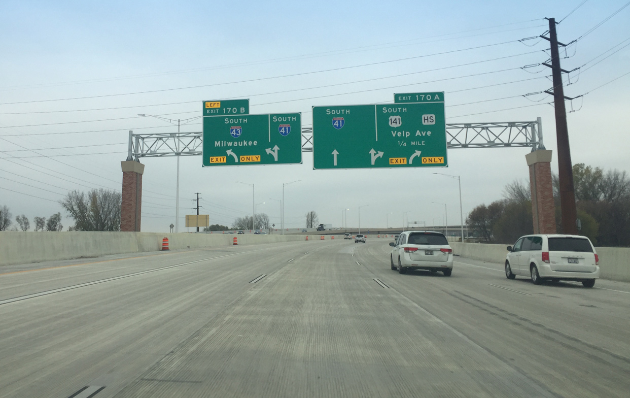
The last confirming marker for Interstate 41 precedes back to back ramps for Velp Avenue / U.S. 141 south and CTH HS north (Exit 170A), and the southbound beginning of I-43 (Exit 170B). Photo by Peter Johnson (06/14/18).
Less than three miles remain along Interstate 41 north to Brown County M (Lineville Road). U.S. 141 commences a 16 mile overlap with the freeway along U.S. 41 north to Abrams from the ensuing entrance ramp. Photo by Peter Johnson (06/14/18).
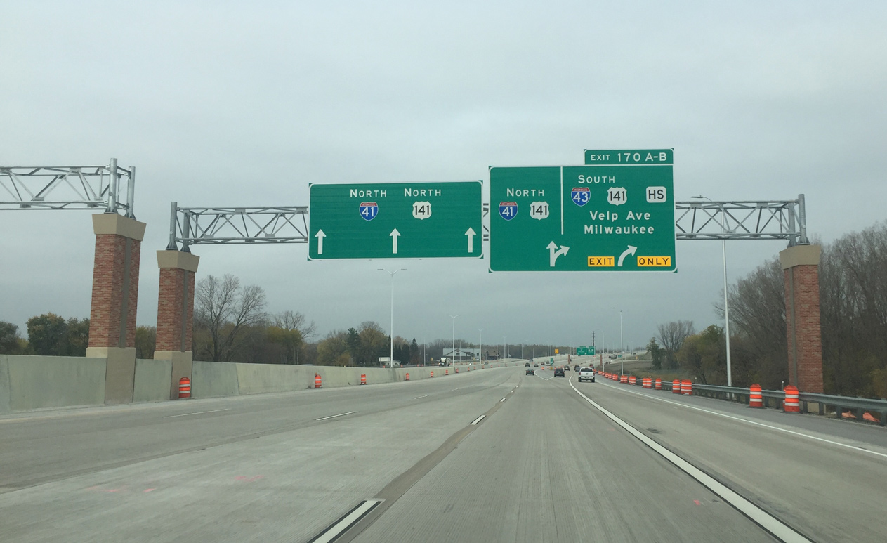
A distributor roadway separates from Interstate 41 north to U.S. 141 (Velp Avenue) south and the two lane flyover for I-43. The systems interchange joining I-41 and I-43 was completed in December 2016. Photo by Peter Johnson (10/28/16).
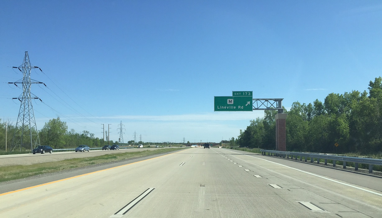
Continuing past the north end of Interstate 43, I-41/U.S. 41-141 advance with four northbound lanes across wetlands west of Peats Lake. A pair of end shields for I-41 precede Exit 173 with Lineville Road (CTH-M). Photo by Peter Johnson (06/14/18).
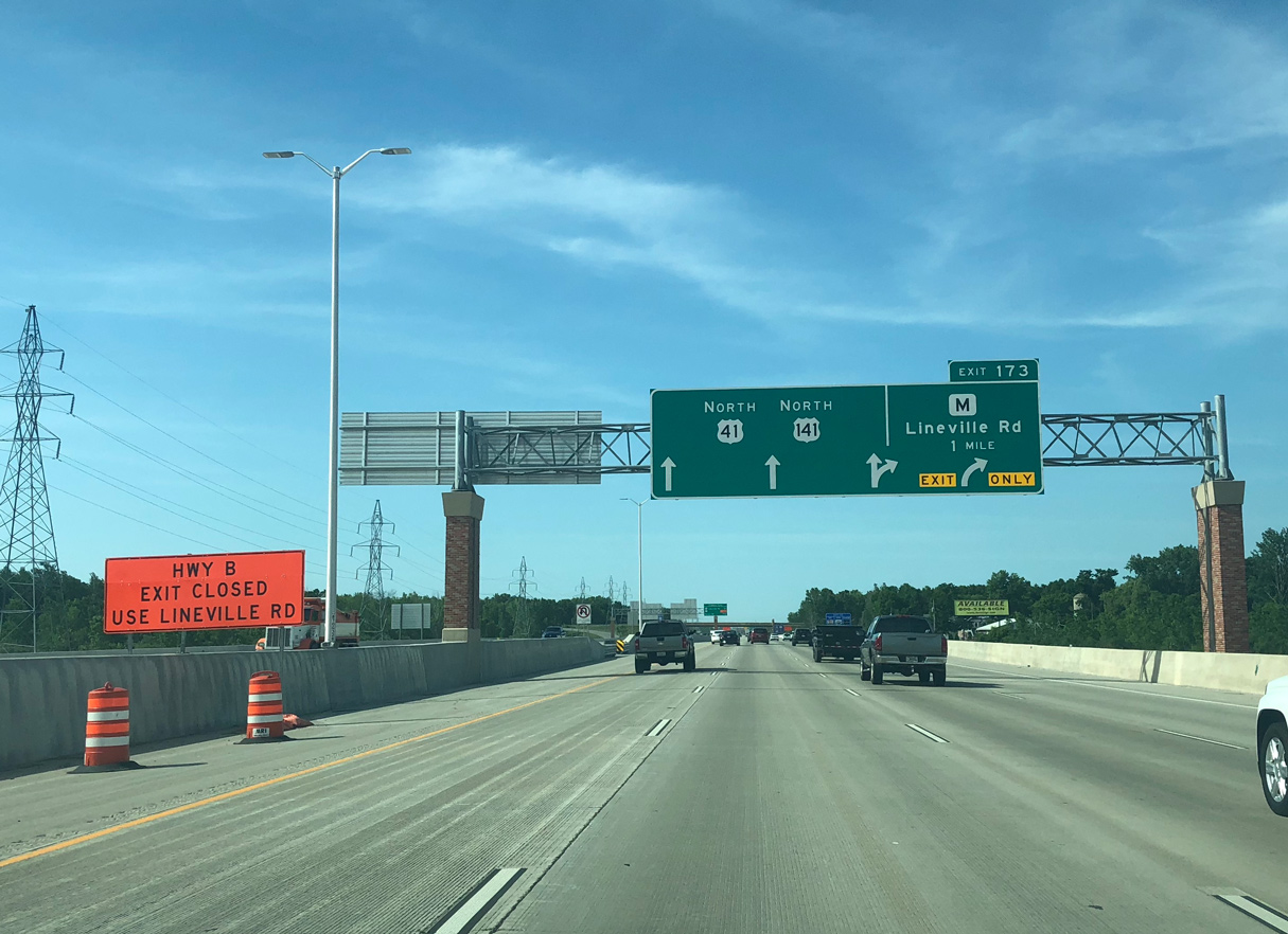
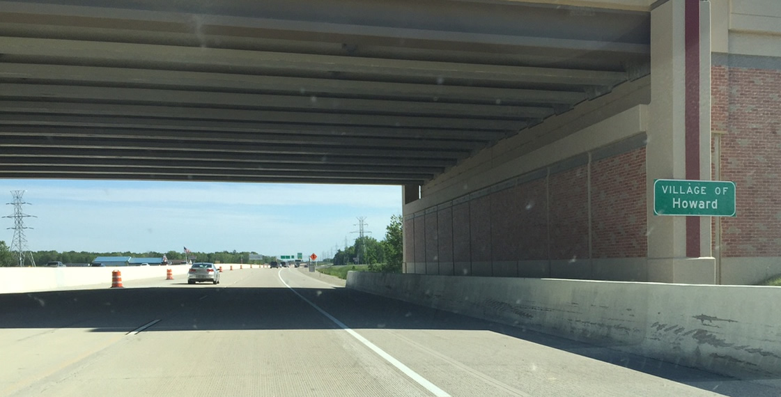
A lane drop occurs at the north end of Interstate 41 for Exit 173 to Brown County M. Lineville Road separates the villages of Howard and Suamico. Photo by Peter Johnson (06/14/18).
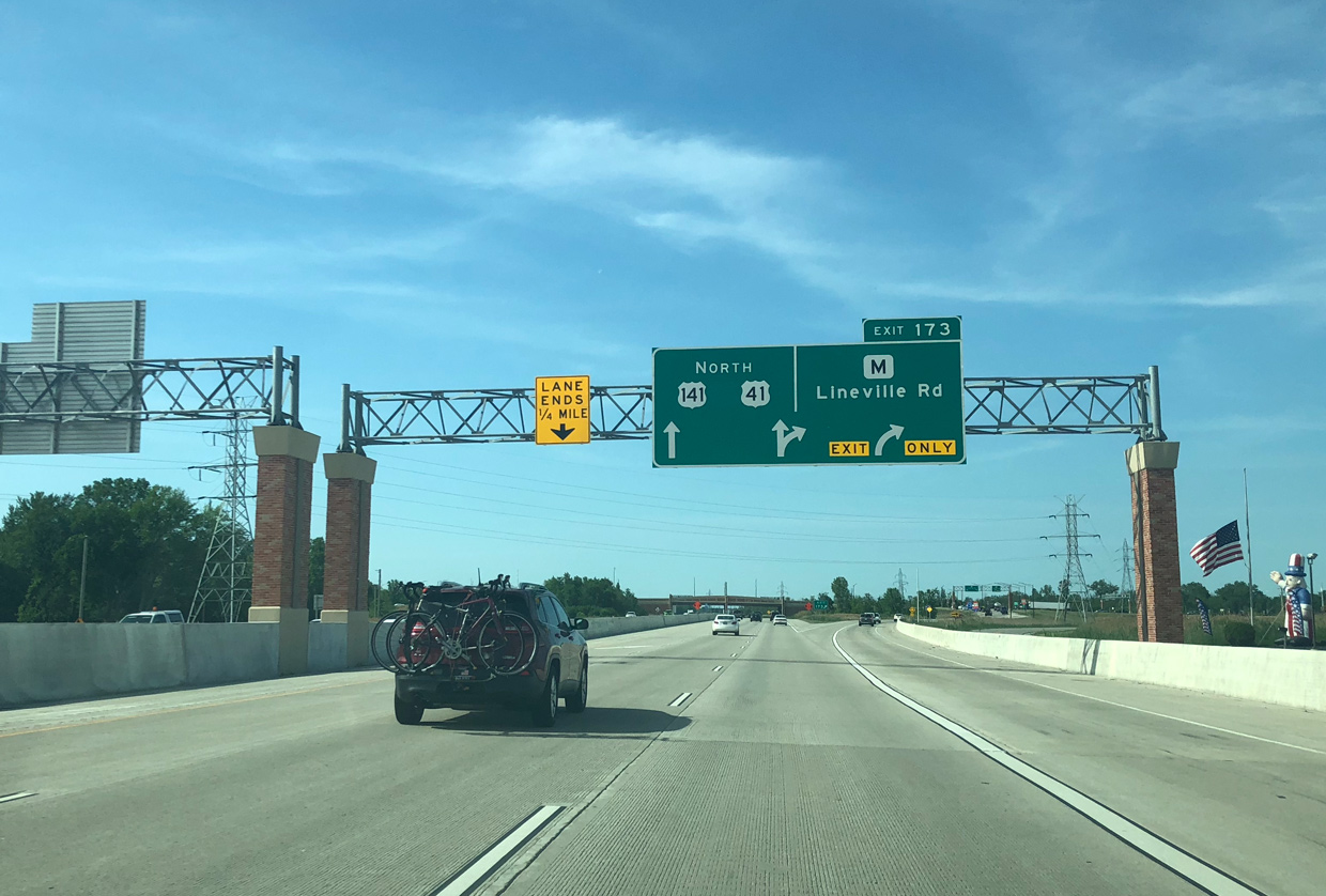
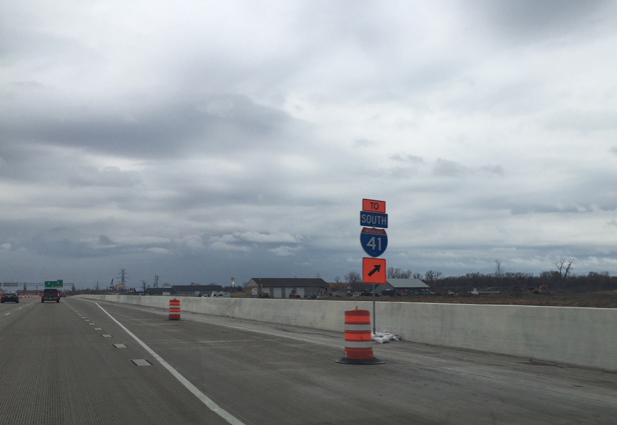
The diamond interchange (Exit 173) joining U.S. 41-141 with CTH-M (Lineville Road) was upgraded to a dumbbell interchange during the I-41 conversion project between 2013 and 2015. Photo by Peter Johnson (06/14/18).
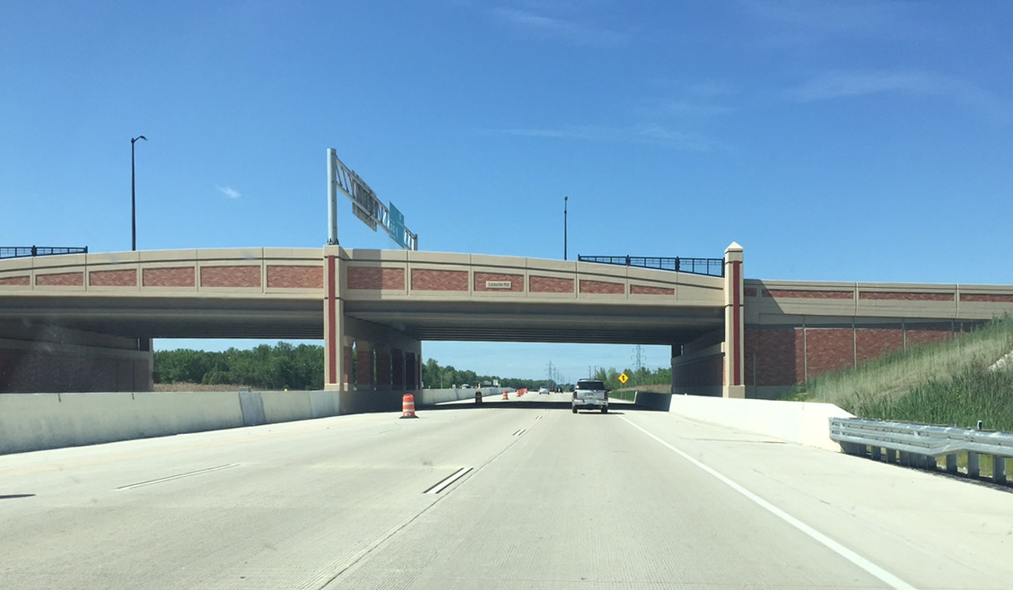
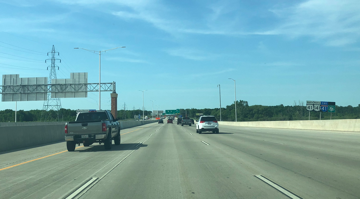
US 41/141 north at the Lineville Road overpass where I-41 ends. Photo by Peter Johnson (06/17/15).
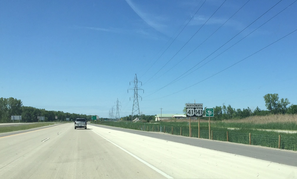
The first reassurance signs that omit I-41. US 41/141 continue as a freeway for about 13 miles until a directional T interchange at Abrams. Photo by Peter Johnson (06/17/15).
![]()
![]()
![]() South at
South at ![]()
![]()
U.S. 41-141 south enter the dumbbell interchange (Exit 173) with Brown County M (Lineville Road). Interstate 41 begins just beyond the exchange. Photo by Peter Johnson (06/17/15).
Lineville Road separates the villages of Suamico and Howard above the U.S. 41-141 freeway at Exit 173. Photo by Peter Johnson (06/17/15).
The first I-41 reassurance sign appears just south of the Lineville Road entrance ramp. Photo by Peter Johnson (06/14/18).
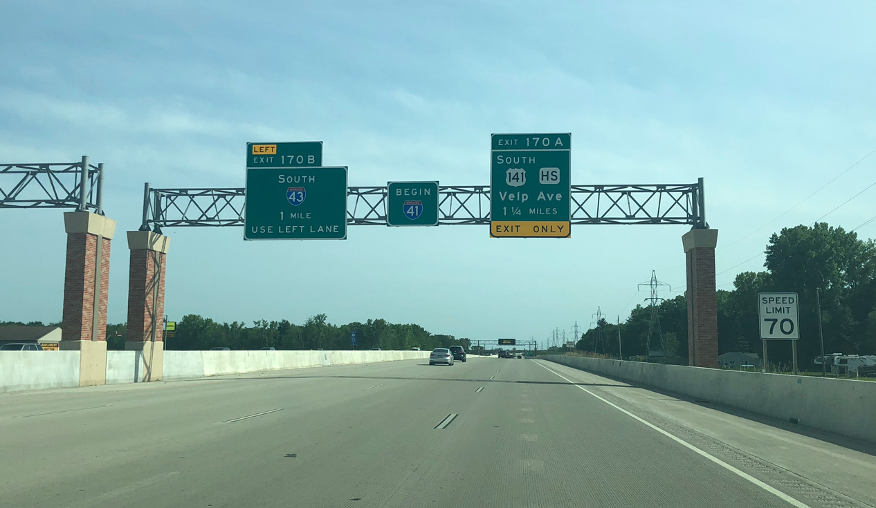
A begin I-41 sign was posted on November 5, 2015. I-41/U.S. 41-141 continue south with four lanes to the systems interchange (Exit 170B) with Interstate 43. Photo by Peter Johnson (06/14/18).
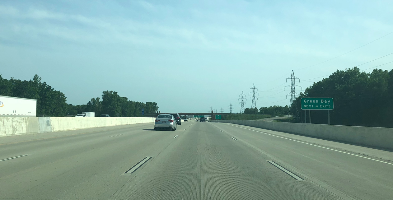
The first four interchanges along Interstate 41 serve the city of Green Bay. The freeway passes through western reaches of the city between Wis 29 and CTH-VK. Photo by Peter Johnson (06/14/18).
The forthcoming split of I-41/43 lies one quarter mile ahead over an area of wetlands and Duck Creek. Upgrades here replaced a low speed folded diamond type interchange between the two freeways. Photo by Peter Johnson (10/28/16).
Exit 170B separates from the left lanes of I-41/U.S. 141 south for Interstate 43. I-43 wraps around the north and east sides of Green Bay to Bellevue. Photo by Peter Johnson (10/28/16).
South End – Russell, Illinois
![]()
![]() South
South ![]() East
East
The final set of confirming markers for I-41/U.S. 41 south and I-94 east appears beyond Wis 165 and County Q / Exit 347. Photo by Peter Johnson (06/25/16).
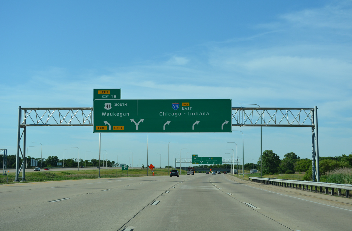
U.S. 41 separates from I-94 at Left Exit 1 B to IL 173 at Rosecrans. 06/24/22
A pair of shields mark the end of Interstate 41 along I-94 east / U.S. 41 south at the Illinois state line. 06/24/22
Though not signed on the Illinois side, I-41 continues an additional 2.5 miles south along U.S. 41 to IL 173 in the village of Wadsworth. Photo by Peter Johnson (06/25/16).
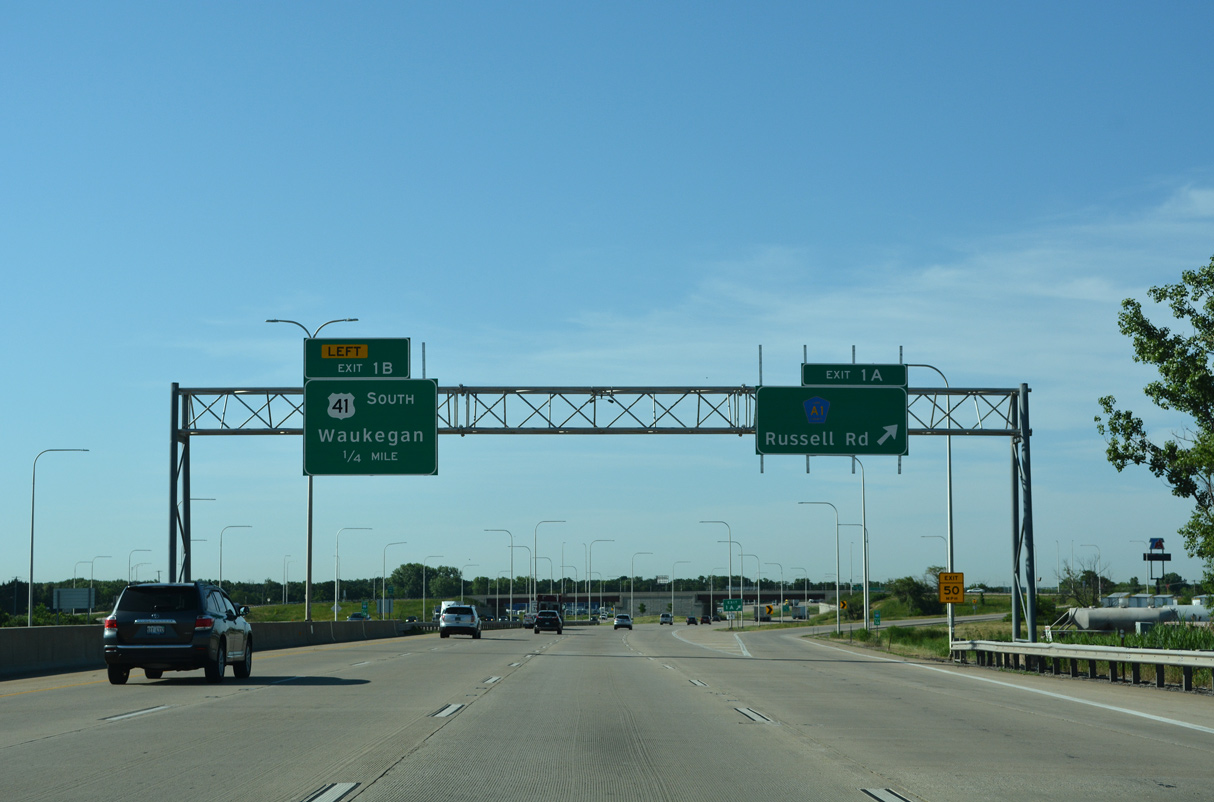
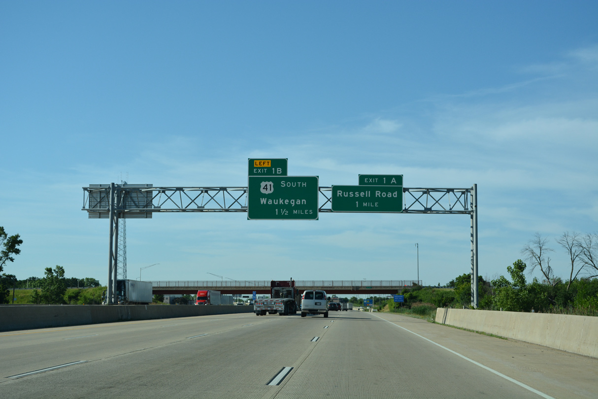
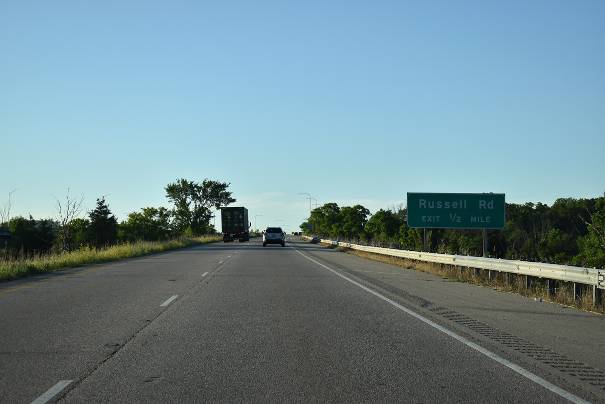
Four lanes continue south from Exit 1 A for CR A1 (Russell Road) to the wye interchange (Left Exit 1 B) with U.S. 41 south. 06/24/22
U.S. 41 parallels I-94 to the east along Skokie Highway south from Wadsworth to Gurnee and expressway along the west side of Waukegan. 06/24/22
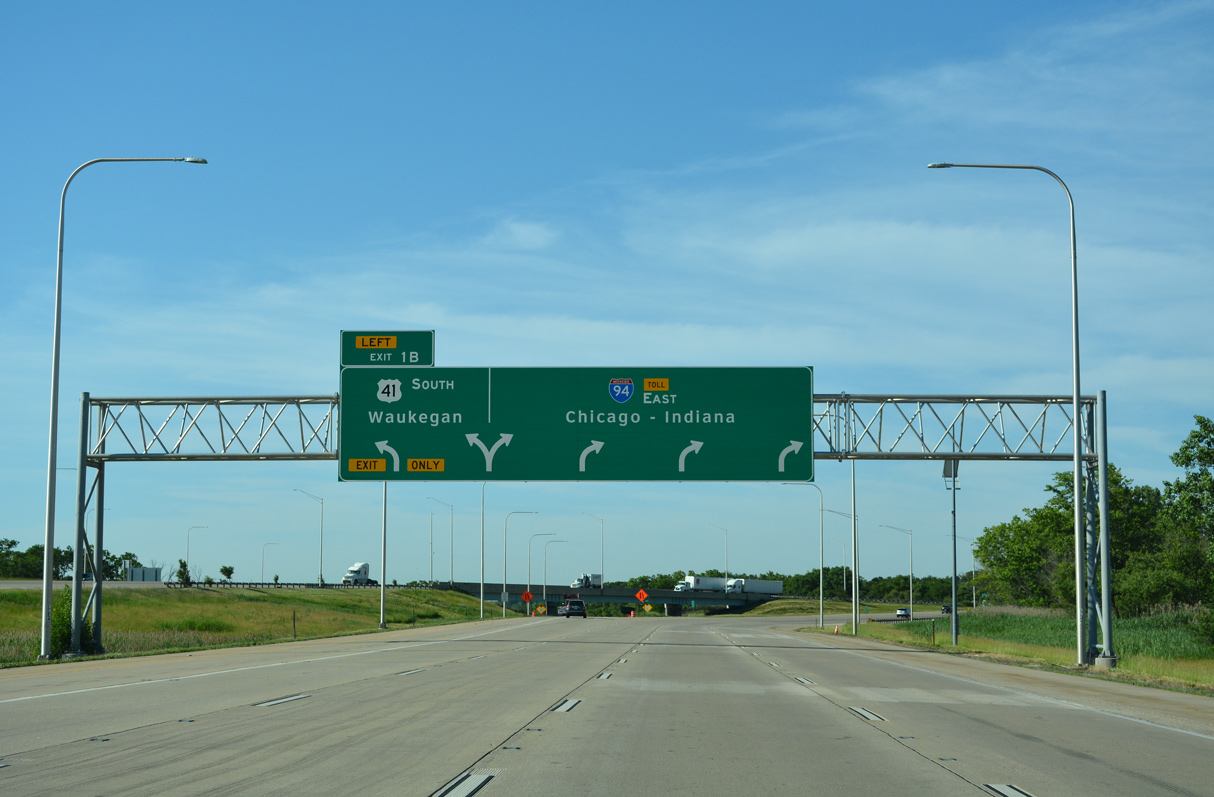
I-94 shifts onto the Tri-State Tollway south from Left Exit 1 B to I-294 and the Edens Spur toward Chicago. U.S. 41 advances southward to North Chicago, Lake Forest and Highland Park before converging with I-94 again at the Eden Spur in Northbrook. 06/24/22
![]()
![]() South
South
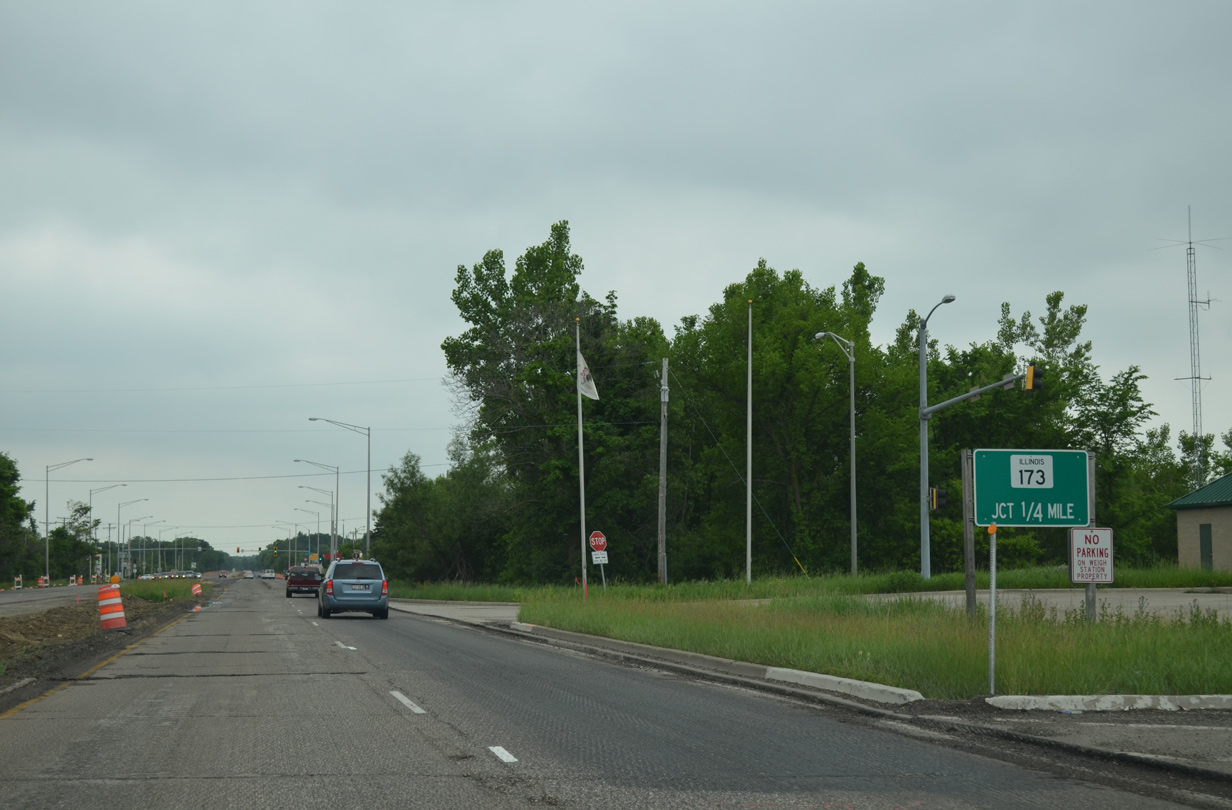
A weigh station lines the west side of U.S. 41 ahead of the signalized intersection with IL 173. Van Patten Woods County Forest Preserve spreads to the east surrounding Sterling Lake. 06/13/15
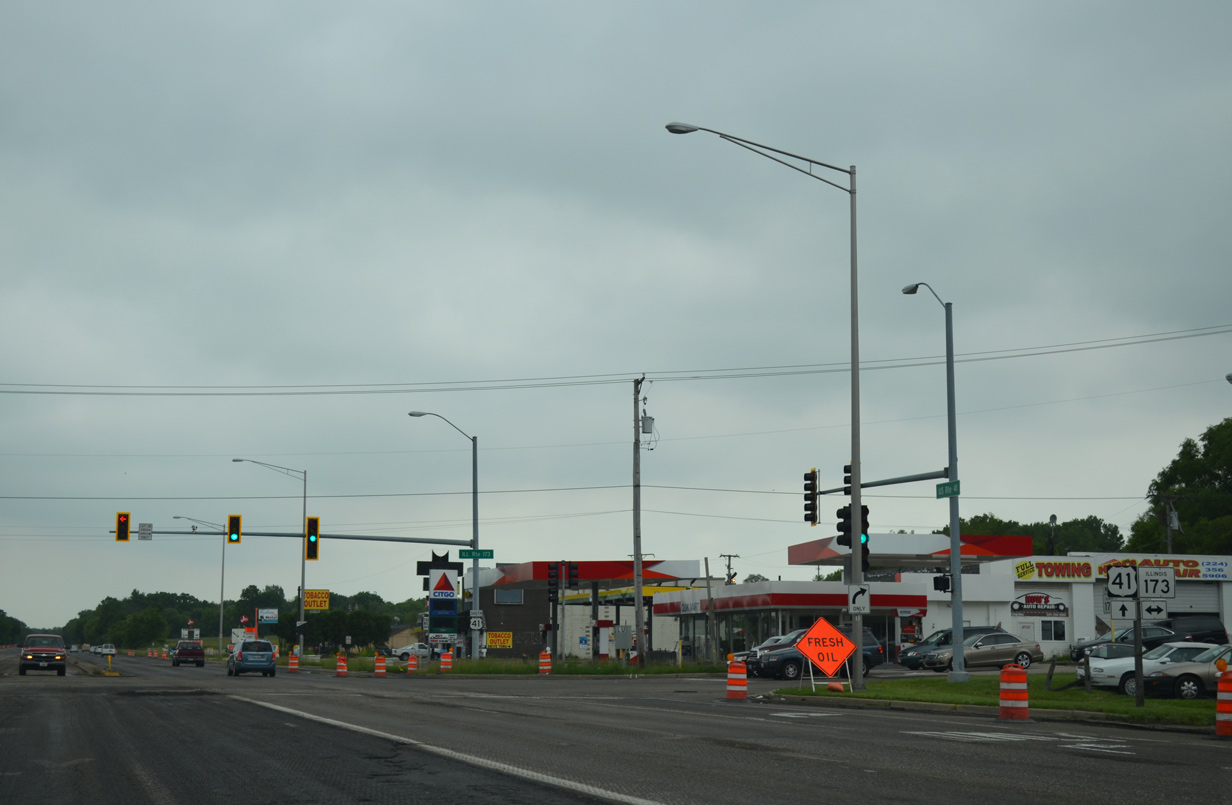
IL 173 runs 66 miles across the northern tier of the state between Machseney Park and Zion. U.S. 41 runs along the west side of Wadsworth south into the village of Gurnee. 06/13/15
![]()
![]() North
North
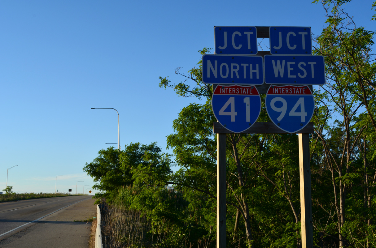
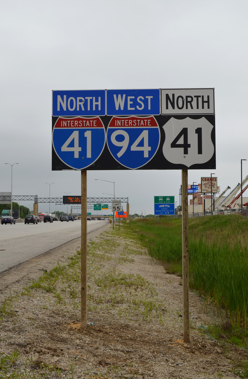
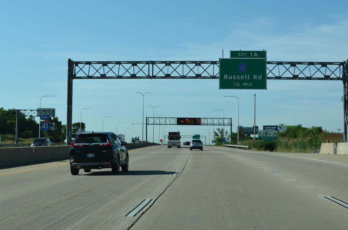
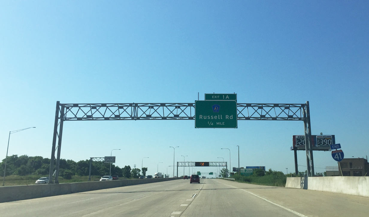
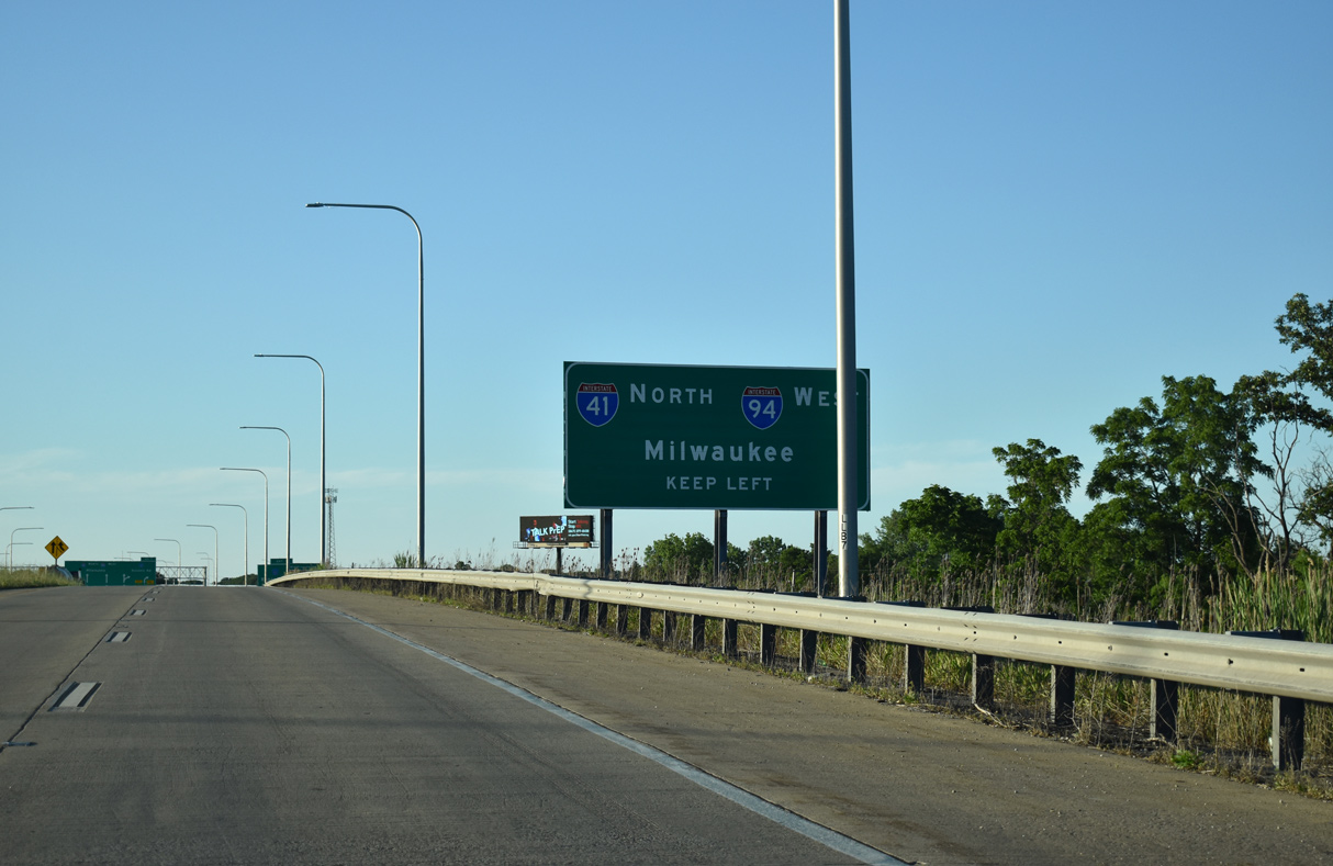
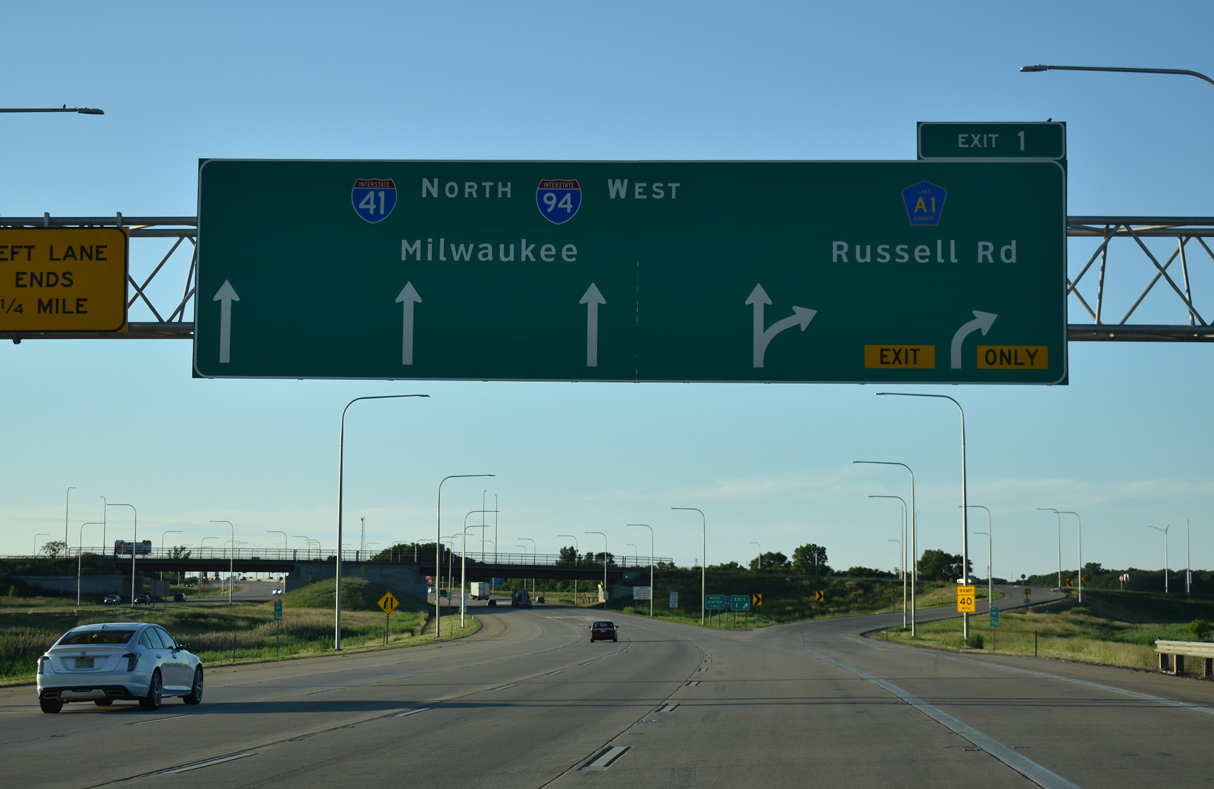
U.S. 41 advances north from IL 173 (Rosecrans Road) by Sterling Lake and a weigh station to become Interstate 41 alongside I-94 west just ahead of CR A1 (Russell Road). 06/23/22
U.S. 41 transitions into I-41 north at a wye interchange with Interstate 94. 06/23/22
A weaving traffic pattern ensues between the entrance ramp from U.S. 41 and Exit 1 for Russell Road. 06/23/22
![]()
![]() North
North ![]() West
West
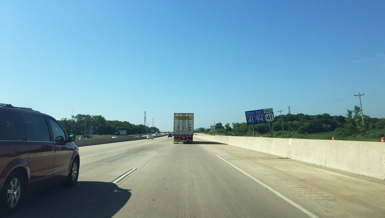
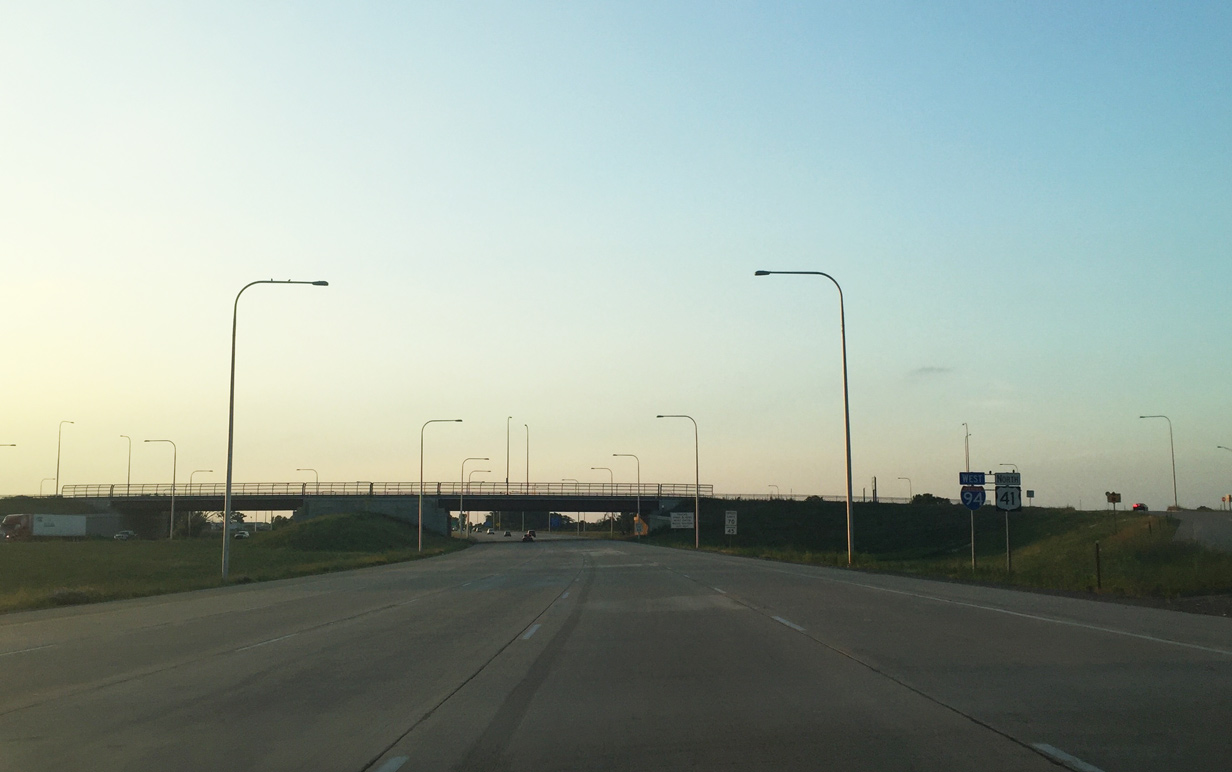
I-41/94 run concurrently for 33 miles from Exit 1 at Wadsworth to the Mitchell Interchange in south Milwaukee. 06/23/22
The last confirming markers for I-94 west / U.S. 41 north in Illinois stand along the freeway within the exchange at Exit 1. Photo by Peter Johnson (06/25/16).

Removed by 2021, the previous first confirming marker for Interstate 41 was posted just beyond the Wisconsin state line adjacent to a weigh station. Interstate 41 was fully signed in the Badger state by November 2015. Photo by Peter Johnson (06/25/16).
Sources
- “Dignitaries cheer Interstate 41.” WBAY, May 28, 2015.
- Fiscal Year 2005 Transportation Equity Act: A Legacy for Users (H.R. 3) – PDF file.
- “Interstate 41 a step closer to reality.” Fox 11 News, November 19, 2012.
Page updated June 28, 2022.