Interstate 40
Overview
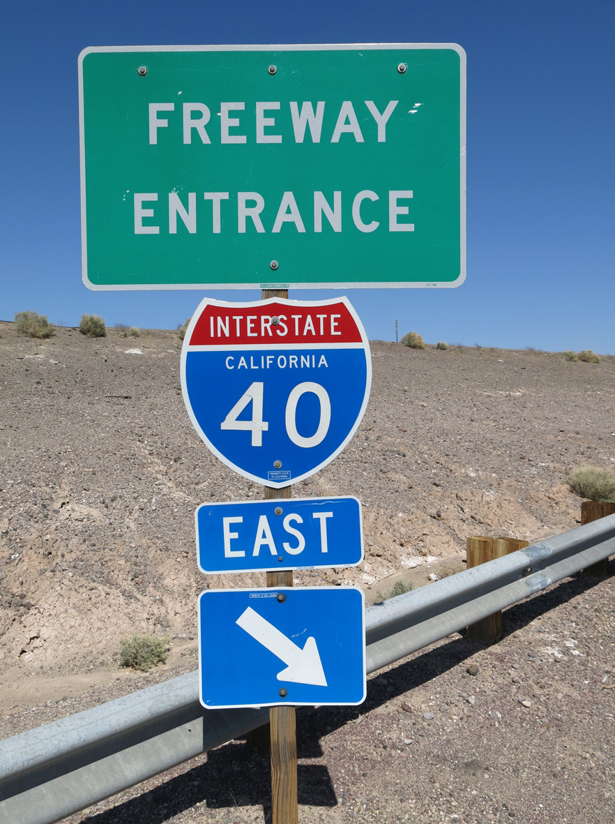
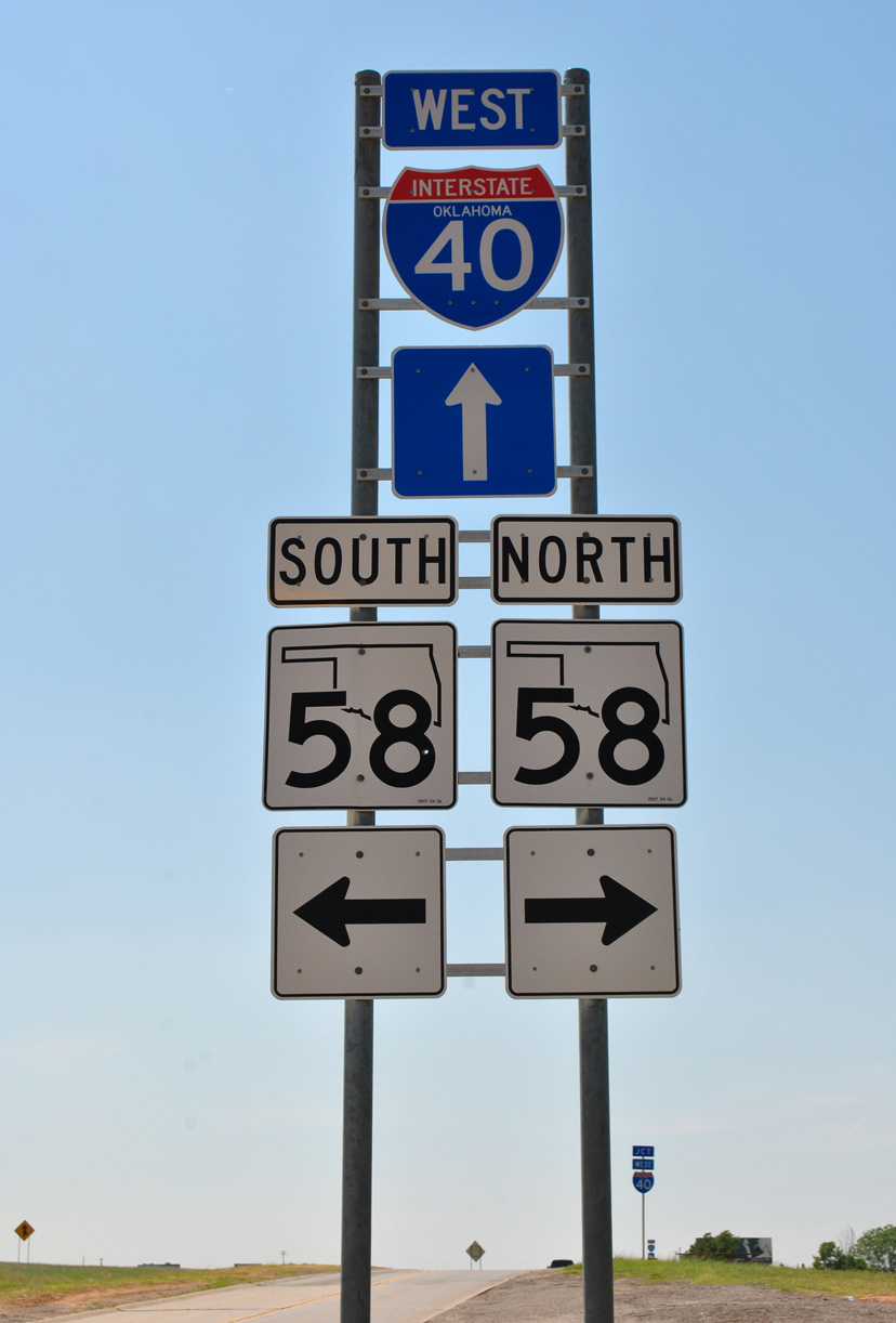
Spanning eight states Interstate 40 is a major cross country freeway connecting the Desert Southwest with the Southeastern United States. Starting in Barstow, California, the freeway generally follows the alignment of Historic U.S. 66 across the Mojave Desert into the high desert. Spanning the Colorado River west of Kingman, I-40 gains elevation on a course south of the Grand Canyon to the city of Flagstaff. Advancing east across New Mexico, the freeway spans the width of the state, converging with Interstate 25 in Albuquerque.
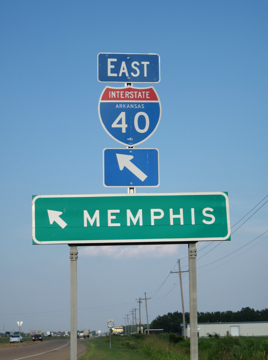
Continuing to Amarillo, Interstate 40 transitions into the Great Plains in eastern New Mexico, leading into the Texas Panhandle. The freeway splits from Historic U.S. 66 at Oklahoma City, remaining generally eastward while U.S. 66 diverges northeast toward Tulsa, St. Louis and Chicago. Entering Arkansas, Interstate 40 trends southeast from Fort Smith along the Oklahoma state line to Little Rock. The freeway follows U.S. 70 east from the capital city to West Memphis. A short concurrency with I-55 precedes the Hernando DeSoto Bridge taking I-40 across the Mississippi River.
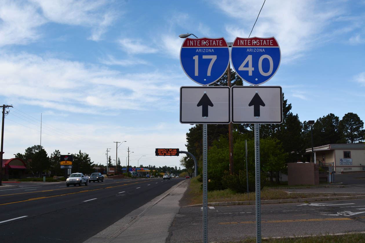
Through Memphis, I-40 follows the northern arc of the inner beltway; the southern half is I-240. The original planned alignment took I-40 across the city, using Sam Cooper Boulevard, a partially completed freeway/boulevard spur from the east toward Overton Park. Leaving Memphis, I-40 heads to Jackson and then Nashville, where it briefly overlaps with both I-65 and I-24. I-40 joins Nashville with Knoxville, overlapping with I-75 along an eight to ten lane freeway leading into the metropolitan area from Farragut.
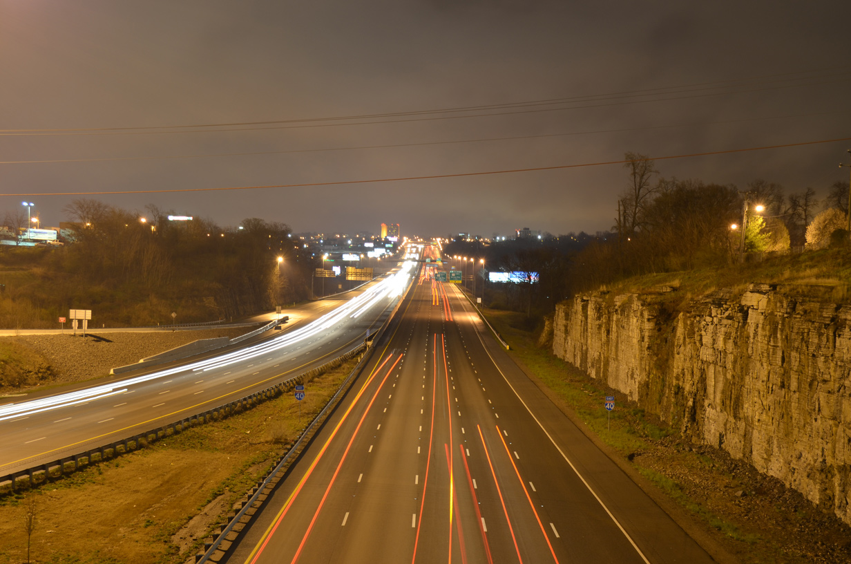
Interstate 40 carries ten lanes of traffic between I-24 and SR 155 (Briley Parkway) in east Nashville. 04/04/13
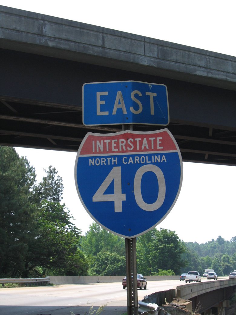
Turning along a southeasterly course, Interstate 40 traverses the Great Smoky Mountains into North Carolina. Spanning nearly the width of the Tar Heel State, I-40 connects regional cities in western parts of the state including Asheville, Hickory and Statesville with the Triad area (Winston-Salem and Greensboro). Combining with I-85, I-40 proceeds east to Durham, where it turns southward for the remainder of the 420 mile long route in North Carolina to Raleigh and Wilmington.
High Priority Corridor
Interstate 40 through California and Arizona is part of High Priority Corridor 16 and 70: Economic Lifeline Corridor. I-40 between Little Rock and Memphis is part of High Priority Corridor 55: Dallas to Memphis via Little Rock.
Contraflow
Contraflow plans for Interstate 40, where all lanes of the freeway are switched to one-way traffic leading away from the coast, arose in 2003 during the threat of Hurricane Isabel, which packed 160 mile per hour winds at one point. Under the plan, North Carolina officials would convert 90 miles of I-40, from Wilmington north to I-95, so that all lanes accommodated westbound traffic during the evacuation phase of a major hurricane threat. The configuration will end several hours before the arrival of Gale Force or higher winds from the threatening storm. A maximum 12 hour window will be implemented for contraflow, so that emergency vehicles and other traffic needing to travel toward the coast can do so.5
Contraflow was first implemented nationally in August 1999 when Hurricane Floyd threatened the Eastern Seaboard.5 Interstate 16 leading west from Savannah, Georgia was switched to one-way traffic to aid in what was considered the largest peace time evacuation in U.S. history. Floyd eventually made landfall in Wilmington, North Carolina with sustained winds of 105 miles per hour. The storm lingered over eastern North Carolina, producing substantial flooding inland. Hurricane Isabel also made landfall in North Carolina, crossing the coastline at Drum with 105 mph winds on September 18, 2003. The storm was blamed for 29 deaths and resulted in $1 billion in damage, including substantial erosion along N.C. 12, the coastal route along North Carolina’s Outer Banks.
Major Projects
The Big I – Albuquerque, New Mexico
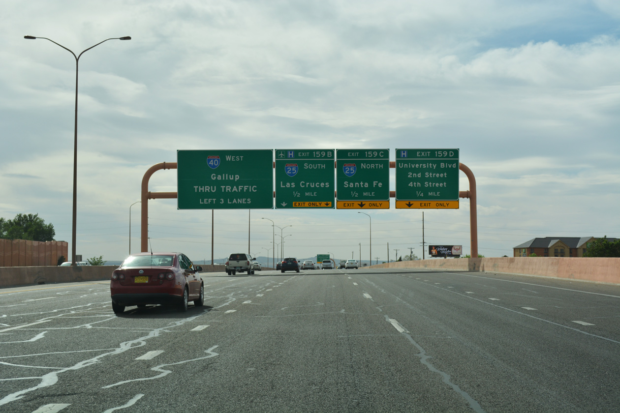
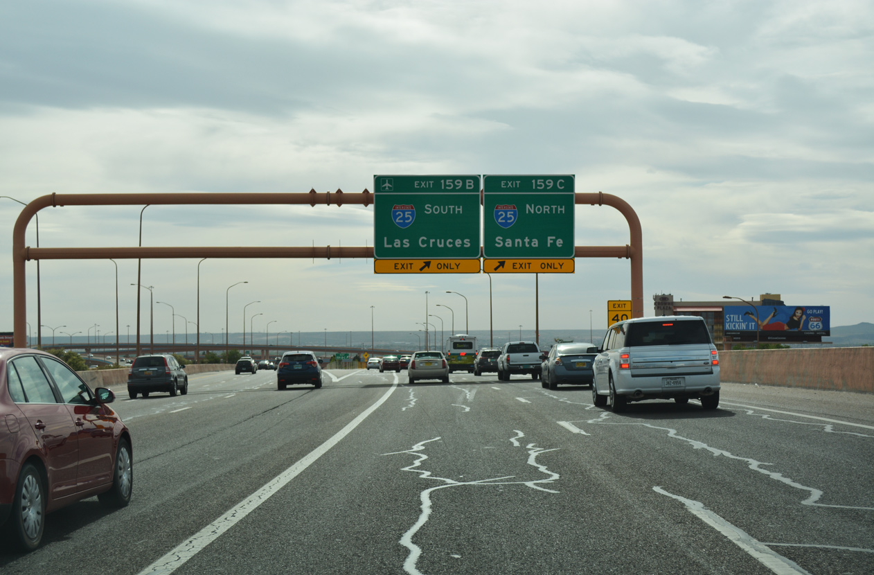
The Big I construction project rebuilt the exchange joining I-40 with I-25 to the northeast of Downtown Albuquerque, New Mexico. Utilizing left side ramps, the original “Crossroads of the Southwest” interchange was completed in 1966. Addressing weaving traffic patterns, poor sight lines, and increasing traffic congestion, the Big I rebuild the junction into a five level systems interchange. Construction also straightened out an S-curve along I-25 at adjacent Candelaria Road and expanded the frontage roads along both freeways to better accommodate local traffic. Totaling $293 million in costs, the Big I project ran from June 30, 2000 to May 25, 2002.17


Crosstown Expressway – Oklahoma City, Oklahoma
The finishing touches were made in December 2013 on an ambitious construction project that replaced the ailing Crosstown Expressway in Oklahoma City along Interstate 40 with a new alignment. Opened in 1966 and substandard in design, the elevated section of I-40 degraded into a state of disrepair by the mid 1990s. Due to structural issues, a weight restriction was enacted, prohibiting larger trucks from traveling on the viaduct system. Coupled with the cost of inspections and bridge upkeep, which increased to $1 million annually, improvements were needed.3
The Oklahoma Department of Transportation (ODOT) held the first public meeting for the Crosstown Expressway project in January 1996. Seven alternatives were generated from early discussions, including a no build option and the evaluation of Transportation Systems Management. ODOT added Alternative B-3 in December of 1996.
Various committees and public forums narrowed down the options to Alternate B-3 and Alternate D. Public review took place throughout 1998, and in December of that year, Alternate D was selected as the preferred alternative. A Draft Environmental Impact Statement for the project was prepared through January 2001 and open to public comment the following month.3
Alternate D represented a new alignment following an existing railroad corridor, located five blocks south of the Crosstown Expressway. It outlined the construction of a surface or partially below grade freeway with multiple access choices into Downtown, including a full interchange at Shields Boulevard (old U.S. 77). Alternative D also converted the former alignment of I-40 along the Crosstown Expressway into Oklahoma City Boulevard, a six lane arterial. With ample traffic capacity, Oklahoma City Boulevard was designed to provide direct access to the Bricktown section of the city.
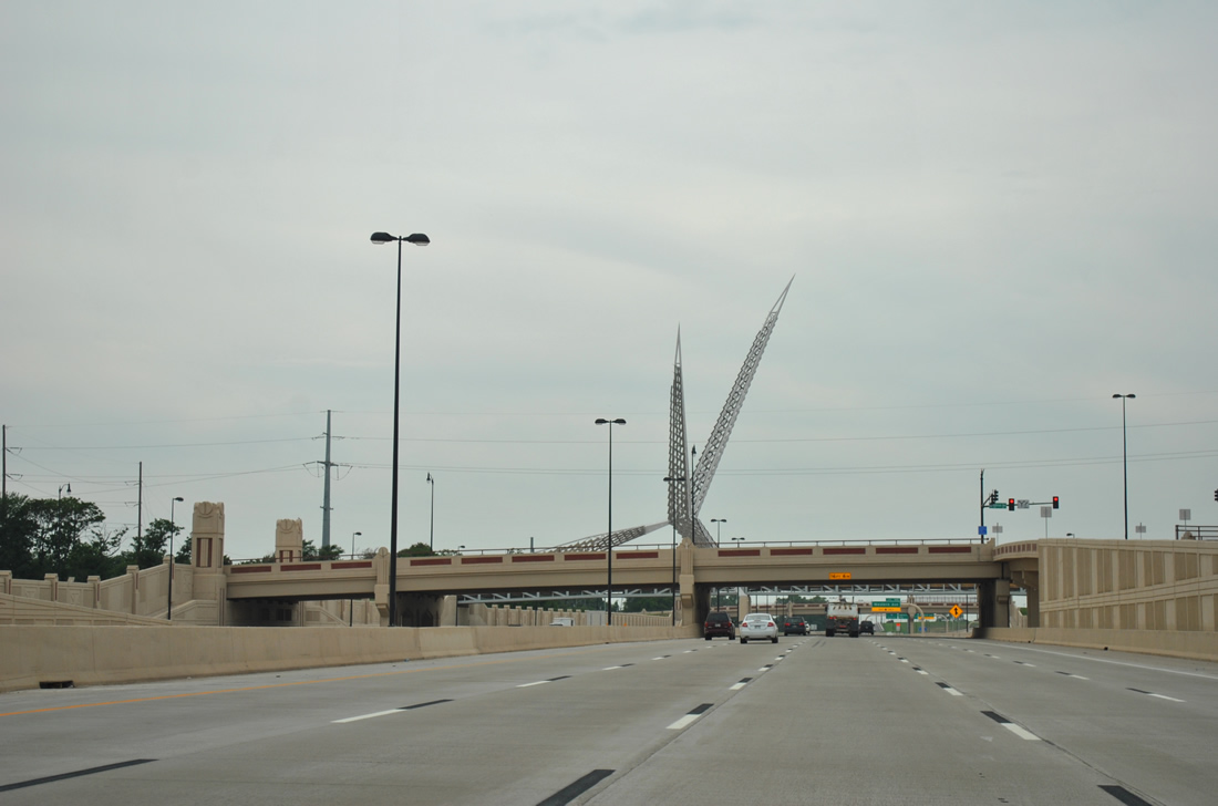
The Crosstown Expressway Project measured 3.96 miles in length between May Avenue and Interstate 235. Amenities factored into the design to improve area neighborhoods included a sound wall to the south between Walker and Robinson Streets. The placement of the barrier close to I-40, which features a motif reflecting the Little Flower Church, allowed for a larger area of adjacent green space. Within the same vicinity a 20 foot wide pedestrian bridge was built across the freeway near Union Station. Known as the SkyDance Bridge, the 380 foot long span features an architectural wing, based off the state bird: the scissor-tailed flycatcher, rising 192 feet above Interstate 40. The Riverside neighborhood also benefited from a park (MAPS 3) created in 2003 with the added right-of-way acquisition.3
Final Federal Highway Administration (FHWA) approval for the Crosstown Expressway project was granted in May 2002. This allowed ODOT to proceed with design, commence right-of-way acquisition, and ultimately construct the ten-lane highway. Ground breaking took place in 2005.
Interstate 40 eastbound shifted to the new lanes on January 5, 2012. Westbound traffic moved to the new roadway on February 19, 2012. Final costs for the project exceeded $670 million, substantially higher than the $274 million4 estimated in 2003.
Route Information
Mileage
California – 154.61
Cities – Barstow, Needles
- Junctions –

Arizona – 359.48
Cities – Kingman, Flagstaff, Winslow, Holbrook
- Junctions –
New Mexico – 373.51
Cities – Gallup, Grants, Albuquerque, Tucumcari
- Junctions –
Texas – 177.10
Cities – Amarillo
- Junctions –
Oklahoma – 331.73*
Cities – Elk City, Clinton, Weatherford, El Reno, Oklahoma, City, Henryetta
- Junctions –

Arkansas – 284.69**
Cities – Fort Smith, Russellville, Morrilton, Conway, Little Rock, Forrest City, West Memphis
- Junctions – Future
Tennessee – 455.28#
Cities – Memphis, Jackson, Nashville, Lebanon, Cookeville, Crossville, Knoxville, Newport
- Junctions –
North Carolina – 420.21##
Cities – Asheville, Morganton, Hickory, Statesville, Winston-Salem, Greensboro, Burlington, Durham, Raleigh, Smithfield, Wilmington
- Junctions – Future
Source: December 31, 2021 Interstate Route Log and Finders List
* – 1.53 miles on I-35
** – 2.22 miles on I-55
# – 2.70 miles on I-24, 1.00 mile on I-65, 19.60 miles on I-75 (17.03 miles is the actual distance per TDOT GIS, as the FHWA figure predates the 1982 realignment of I-75 at Knoxville), 3.00 miles on I-69
## – 31.51 miles on I-85
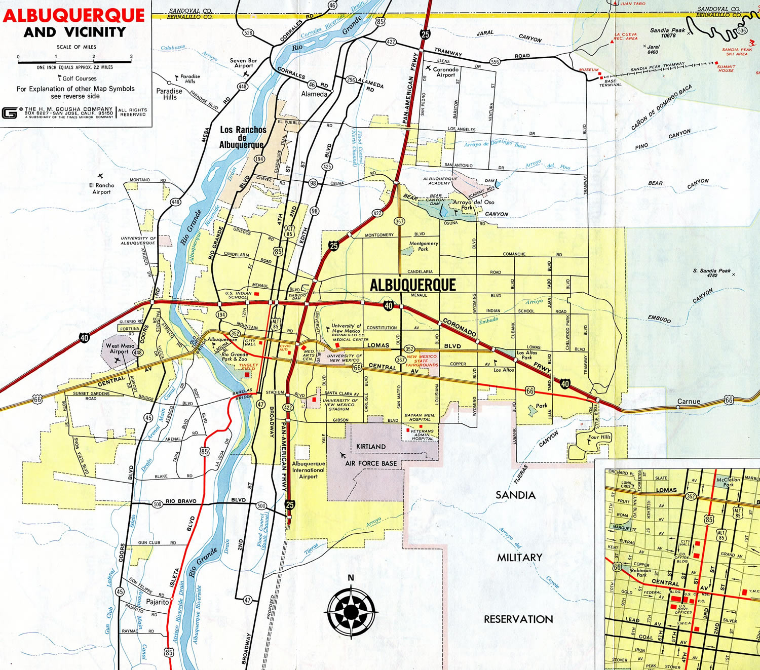
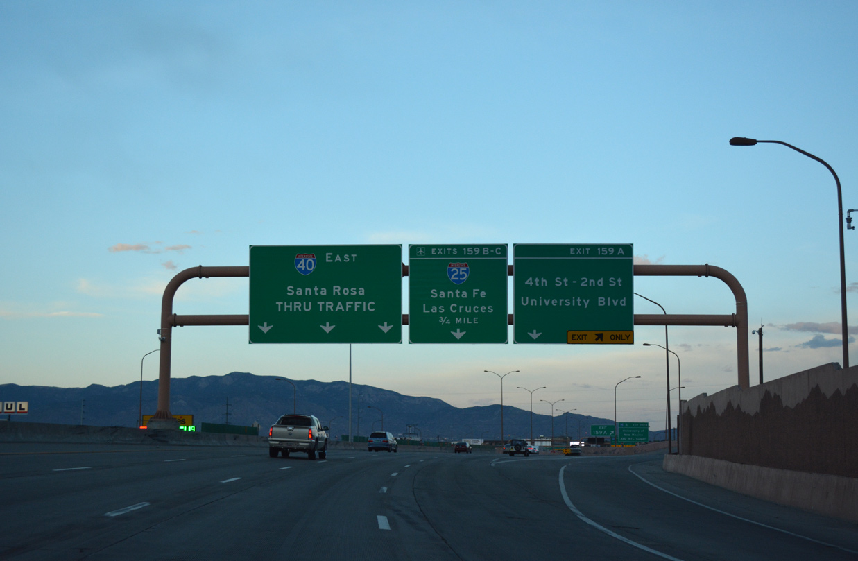
Interstate 40 (Coronado Freeway) was fully open across the city of Albuquerque in 1972. East of the city through Tijeras Canyon, I-40 directly overlayed U.S. 66 to El Refugio. This portion of I-40 freeway was the last to open in New Mexico when it was completed in 1980.16
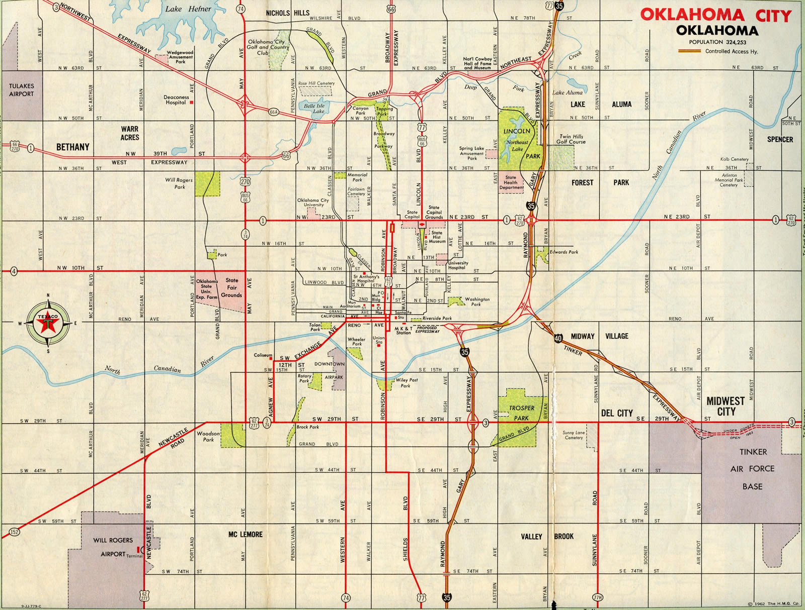
Construction had yet to break ground on the Crosstown Expressway leading west from Interstate 35 in Oklahoma City in 1962. Only a short portion of I-40 was open at this time, from the brief overlap with I-35 to then-SH 3 (SE 29th Street) at Tinker A.F.B.
A $670 million project started with design work in 2002 and ground breaking in 2005. The roadwork shifted Interstate 40 onto a new alignment five blocks to the south from the Crosstown viaduct that was built in 1965. Work continued to 2014.
Smartfix40 – Knoxville, Tennessee
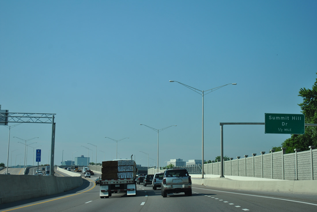
Long term road work in eastern Tennessee widened Interstate 40 from the west end of the overlap with I-75 near Farragut to the south end of Interstate 81 near Danridge. Mid to late 1990s road work expanded I-40/75 to eight lanes, and I-40 east of Knoxville to six lanes. The Tennessee Department of Transportation (TDOT) followed those projects with Smartfix40, a reconstruction and widening project along 2.5 miles of I-40 between I-275 and Cherry Street (Exit 390).
I-40 west through the completed SmartFix40 project area and interchange with SR 158 (James River Parkway). 06/25/12
Smartfix40 road work included an extension of Hall of Fame Drive (5th Avenue Connector) southeast to Summit Hill Drive from Broadway (U.S. 441) and modifications to the interchange for Broadway and SR 158 (James White Parkway) at Exit 389. Improvements were also made at the interchange with Cherry Street. Associated work realigned U.S. 11-70 (Magnolia Avenue) to East 5th Avenue and Fourth Avenue to the west of Interstate 40.2
An innovation of the SmartFix40 project was the concept of fulling closing a road to accelerate the construction time table. James White Parkway (SR 158), an urban freeway spur from I-40 to Downtown and South Knoxville, was closed to traffic in 200. This allowed crews to proceed with rebuilding the highway and constructing parallel Hall of Fame Drive. The complete closure of I-40 between I-275 and Cherry Street followed in 2008, with work demolishing the old viaduct and building its replacement. Overall construction was finished in 2009.
I-40/77 Interchange – Statesville, North Carolina
Major road work commenced in August 2012 to reconstruct Interstate 40 between U.S. 21 and I-77 at Statesville. Separated into multiple phases, the I-40/77 Interchange project was previously expected to run until March 2017. The first phase expanded I-40 to six lanes from Old Mocksville Road to a point east of NC 115. Work included reconfiguring the exchange with U.S. 21 into a diverging diamond interchange (DDI) and adding a c/d roadway along I-40 westbound. Underway until 2020 Winter 2022 2023, the succeeding phase added collector distributor lanes along I-40 east and expanded I-77 north from Salisbury Road (Exit 49) to a newly built partial turbine interchange with Interstate 40.
 History
Approved by the Texas State Highway Commission in 1962 with 182 miles,13 IH40 was an original Interstate Highway in the Lone Star State. The portion of IH 40 across the Texas Panhandle was mostly built prior to the completion of the freeway leading west into New Mexico, which opened in the mid 1970s from Tucumcari to Glenrio on the state line. Bypasses around Vega and Shamrock were added in the 1970s and early 1980s. The IH 40 bypass of McLean, Texas, was constructed between March 1982 and Summer 1984. A number of at-grade intersections tie into IH 40 west of Vega for ranch access.
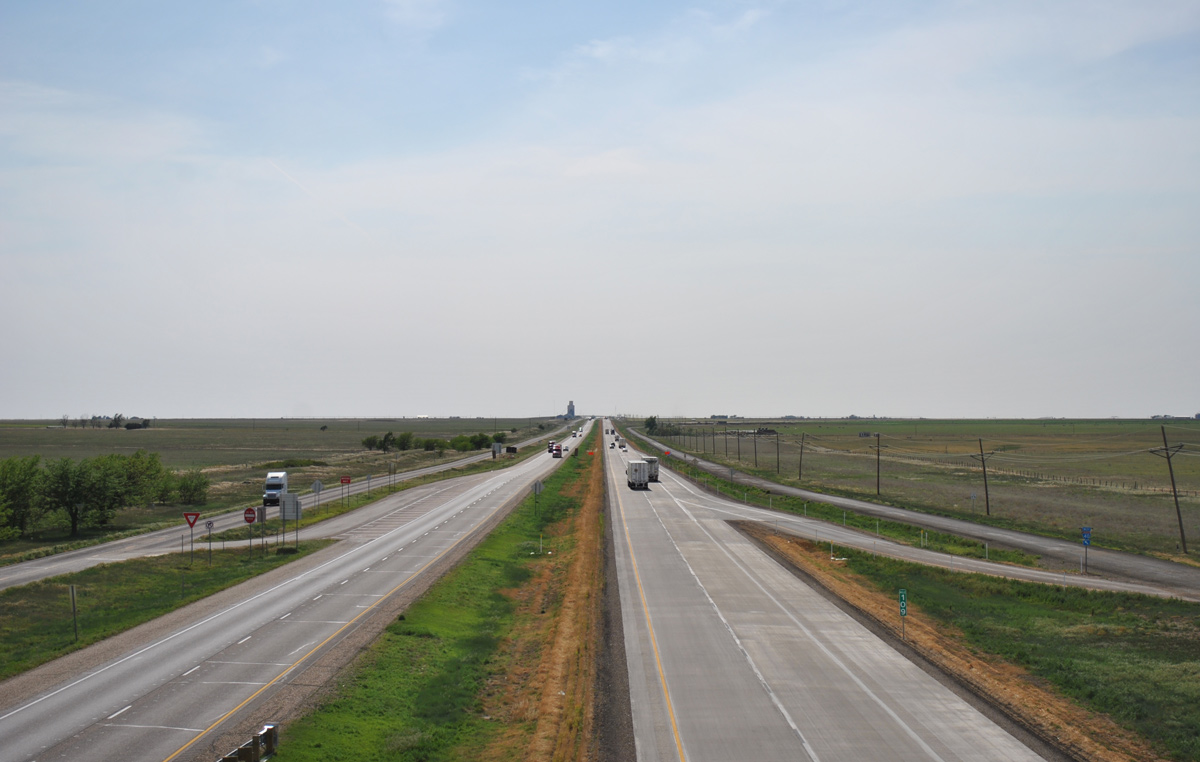
IH 40 traverses the open plains of Carson County, Texas in this scene looking west from FM 294 at Exit 109. 05/05/12
Oklahoma
Opened to traffic in April 1959, the first section of Interstate 40 in Oklahoma was the five mile stretch east from Canute to SH 44 (Exit 53). I-40 in Oklahoma was declared complete in the Sooner State when the 17 mile long bypass of Erick was finished in June 1975.14 Old U.S. 66, which had carried traffic through Erick, was recommissioned as Business Loop I-40.
Tragedy fell on the morning of May 26, 2002, when two barges moving upstream along the Arkansas River struck pier supports for the I-40 bridge near Webber Falls, Oklahoma. The barges were traveling outside the marked channel of the Arkansas River navigation system when the accident took place. The bridge collapsed due to the collision, costing 14 their lives when a number of vehicles plummeted into the murky waters.
Interstate 40 crossing the McClellan-Kerr Arkansas River Navigation System near Webbers Falls, Oklahoma. 05/06/12
With a major highway corridor out of commission, ODOT proceeded rapidly on reconstructing I-40 across the Arkansas River. Finished a week ahead of time, the I-40 bridge near Webbers Falls reopened to traffic July 29, 2002.6 The Federal Highway Administration, ODOT and the Town of Webbers Falls dedicated a memorial on May 26, 2003 to those that died at the bridge. Located upstream from the crossing, a bronze and granite memorial features a design depicting a clock frozen at the time of the accident and a pedestal supporting a child releasing a dove to the heavens. Five pillars represent the survivors.7
North Little Rock, Arkansas
Construction in North Little Rock started in 2003, expanded Interstate 40 from I-430 southeast six miles to I-30. Widening of the freeway from four to six lanes included replacements of the I-40 bridges over Shilcotts Bayou, the Highway 107 (John F. Kennedy Boulevard) overpass and the Levy viaduct taking I-40 over Highway 365 and Pike Avenue. The JFK Boulevard overpass was completed after 2004.10 Work on the Levy viaduct continued through 2007.15
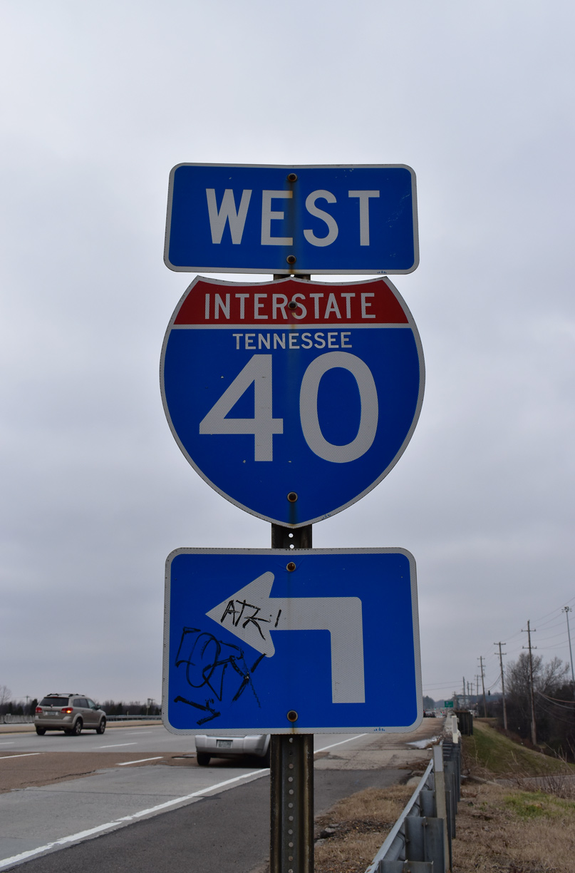
Memphis, Tennessee
Opened to traffic in October 1973, Interstate 40 crosses the Mississippi River on the Hernando de Soto Bridge between West Memphis, Arkansas and Memphis, Tennessee. The through arch bridge was seismically retrofitted to withstand a magnitude 7.0 earthquake in 2006.12 Northeast of Downtown Memphis at the west end of I-240, I-40 turns north along side Interstate 69 to SR 300. I-69 was established along I-55, I-240 and I-69 in southwestern Tennessee on May 6, 2008.
The 1956 plan for Interstate 40 in Memphis continued the freeway east directly across the city. Adopted in 1966, the proposed alignment took I-40 across the Evergreen neighborhood and Overton Park to East Parkway, then along the eventual route of Sam Cooper Boulevard to Interstate 240. The Tennessee Department of Transportation (TDOT) proceeded with acquiring the necessary rights-of-way from the city of Memphis. Approval of design work and construction of I-40 was anticipated for November 1969. Construction ensued on the eastern leg, but work on the western segment was mired in controversy due to impacts of residential areas and Overton Park.
The group “Citizens to Preserve Overton Park” sued to obtain an injunction to stop construction within the park. Successfully halting work on the freeway through Overton Park, the lawsuit progressively made its way through various appeals and courts. Ultimately, the U.S. Supreme Court offered its opinion in the case Citizens to Preserve Overton Park v. Volpe, 401 U.S. 402, (1971) on March 2, 1971. The freeway would not be built through Overton Park.12
As a result of these actions, the unbuilt section of Interstate 40 between I-240 and East Parkway, as well as the freeway (Sam Cooper Boulevard) already under construction from East Parkway to I-240, were removed from the Interstate Highway System. I-40 was redirected onto the northern arc of the Memphis freeway loop (I-240). Sam Cooper Boulevard was built as an at-grade arterial from East Parkway to Vandalia Street and as a limited access highway from there to the exchange with I-40/240. The route is unnumbered.
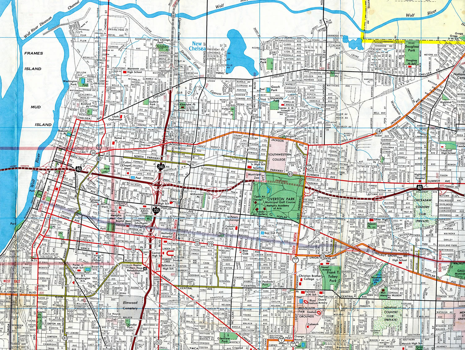
The cancellation of I-40 through Midtown Memphis resulted in the relocation of the mainline to run along side Interstate 240 to the north. The two routes were cosigned until 1982, when I-240 was dropped from the overlap. Subsequent work between June 2003 and December 2006 reconfigured the junction between I-40/240 at Midtown to remove unused ramps and redesign the exchange into a high speed directional T interchange.


Sam Cooper Boulevard extends west from I-40/240 as a city maintained freeway to Highland Street. Beyond Highland Street, a numbered of signalized intersections connect Sam Cooper Boulevard with side streets west to U.S. 64-70-79 and SR 57-277 (East Parkway N) across from Overton Park. Photos by Steve Hanudel (08/19/05).
North Carolina
One of the first Interstate 40 relocation projects was the construction of Corporation Parkway, a southern bypass of Winston-Salem completed in 1993. This was approved by the American Association of State Highway and Transportation Officials (AASHTO) Special Committee on Route Numbering on October 2, 1992. The former freeway alignment across Winston-Salem was recommissioned as Business Loop I-40. Construction completed on February 2, 2020 rebuilt a portion of the Business 40 freeway through Downtown Winston-Salem. Coinciding with the project was the rebranding of the roadway as U.S. 421 / Salem Parkway and decommissioning of the Business Loop.
The Greensboro Urban Loop, a 360 degree beltway to completed on January 23, 2023, was temporarily a part of Interstate 40. The freeway loop was built in stages, with the southeastern section opened on February 21, 2004 as a new alignment for Interstate 85. The southwestern portion of the Greensboro Urban Loop opened on February 21, 2008. With the completion of the southern half of the loop, I-40 was relocated onto the bypass, while the old alignment was redesignated as Business Loop I-40. This lasted just seven months. Changes implemented in September 2008 rerouted I-40 back across Greensboro and moved U.S. 421 onto the southwestern bypass along side a newly established section of Interstate 73. The northeastern half of the loop is Interstate 840.
The original plan for Interstate 40 concluded the route east at I-85 in central Greensboro. This changed in 1968, with a proposed extension of I-40 eastward to Interstate 95. However there was some difficulty in determining which route I-40 would ultimately take. The state first petitioned for Interstate 40 to follow U.S. 70 from Raleigh-Durham east to Morehead City in 1962. Although that plan was rejected, U.S. 70 eventually was upgraded to freeway and expressway standards from 2000 onward, and ultimately became a part of the Interstate 42 corridor.
Providing a freeway link to one of North Carolina’s principal ports and largest coastal cities at Wilmington, and an additional route for hurricane evacuations, a southerly course from Raleigh to Wilmington was selected.9 It took two decades for I-40 to be completed; the last section opened to traffic on June 29, 1990. AASHTO formally approved the designation of Interstate 40 between Raleigh and Wallace, located about 30 miles north of Wilmington, on December 7, 1990.
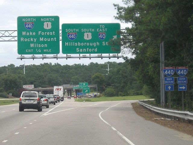
The east end of Interstate 40 was previously located in Raleigh, North Carolina, where the Wade Avenue freeway ties into the Raleigh Beltline (I-440/U.S. 1). Photo by Jeff Morrison (08/08/05).
Raleigh-Durham
Growing traffic demands along Interstate 40 through the Research Triangle resulted in traffic counts exceeding 147,000 vehicles per day by 2001. Commencing that year, a $12 million project expanded the freeway to eight overall lanes between the Durham Freeway (Exit 279) and I-540 (Exit 283). The fourth westbound lane along this segment was completed on October 1, 2003.1
Further east, the Fortify I-40/440 Rebuild Project reconstructed both Interstate 40 east from U.S. 1/64 and I-440 at Cary to the east end of I-440, and I-440 northeast to the Knightdale Bypass (I-87/U.S. 64-264). Started in May 2013, Phase I work through Summer 2015 expanded the easternmost three miles of the project area, covering I-440 from I-40 (Exit 301) to I-87 (Exit 14). Underway between late 2014 and late 2016, Phase II rebuilt Interstate 40 between Exit 293 and Exit 301 on the south side of Raleigh.
I-40 Extension
There are no official plans to extend Interstate 40 west beyond Barstow along California State Route 58. Several sections of SR 58 west from I-15 to SR 99 are built to Interstate standards. At-grade expressway sections however remain along portions of the corridor to Bakersfield.
A proposal introduced in December 2004 and later discussed by local planning and business groups,11 outlined lengthening Interstate 40 southwest from U.S. 117 into the city of Wilmington, North Carolina. The extension would tie into Martin Luther King, Jr. Parkway, an expressway bypass taking U.S. 74 north of Wilmington, along a new route between Kerr Avenue and Wilmington International Airport (ILM). I-40 would follow MLK Parkway from the airport west to the Isabel Holmes Bridge and 3rd Street north of Downtown Wilmington. No further development of this plan followed.
 Photo Guides
East End 
 – Wilmington, North Carolina
![]() East at
East at ![]()
![]()
The last shield assembly for Interstate 40 eastbound. The freeway advances south from I-140 along side an industrial park. 12/31/17

Parallel U.S. 117 and NC 132 (College Road) converge with Interstate 40 at the final eastbound interchange (Exit 420) in two miles. 01/19/19
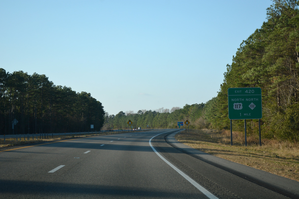
Interstate 40 shifts westward by Olsen Park along an S-curve leading into the parclo interchange with U.S. 117/NC 132 (College Road) north at Gordon Road. 12/31/17
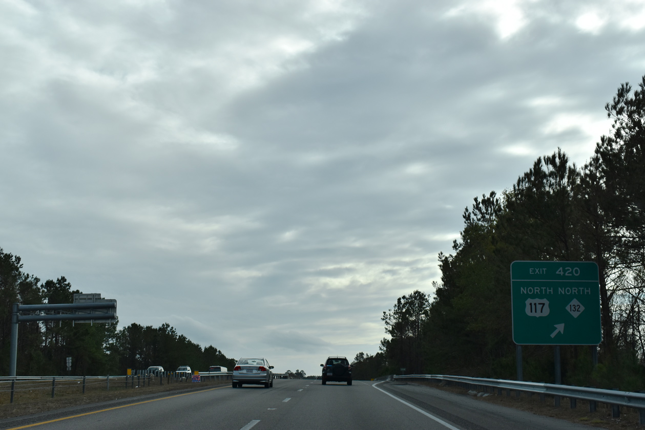
Exit 420 loops away from I-40 east to U.S. 117/NC 132 north to Castle Hayne. The mainline freeway transitions directly onto southbound U.S. 117 and NC 132 ahead. 01/19/19

Traffic from U.S. 117/NC 132 forms a third southbound lane as I-40 crosses Smith Creek by an end shield that was removed in 2018. College Road extends south from the freeway end as a six lane arterial into Wilmington. 12/31/17
![]()
![]() North at
North at ![]()

U.S. 117/NC 132 overlap 5.5 miles north through Wilmington along College Road. Passing through the Kings Grant community, the arterial approaches the westbound beginning of I-40 and Exit 420A with Gordon Road. 12/31/17
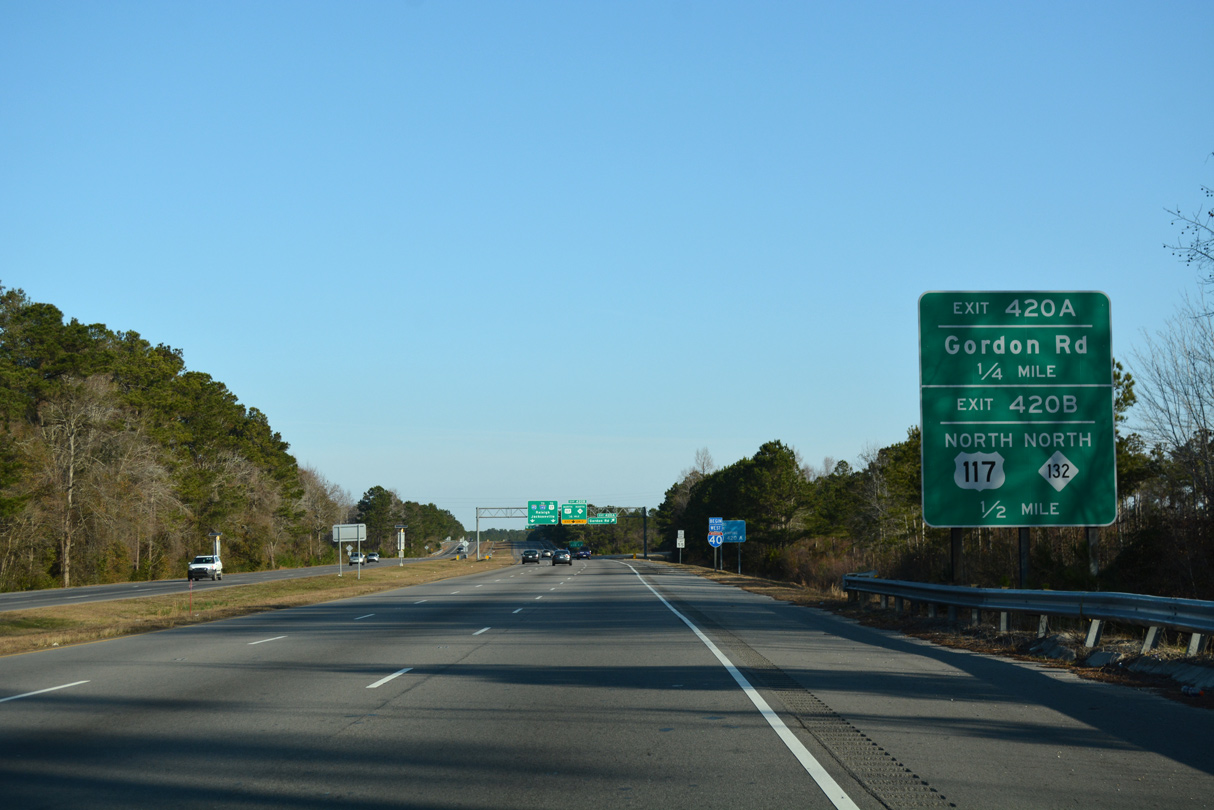
Back to back ramps depart from Interstate 40 west just beyond Smith Creek. Exit 420A links the nascent freeway with Gordon Road to the east side of Wilmington International Airport (ILM). U.S. 117/NC 132 resume along College Road north via Exit 420B. 12/31/17
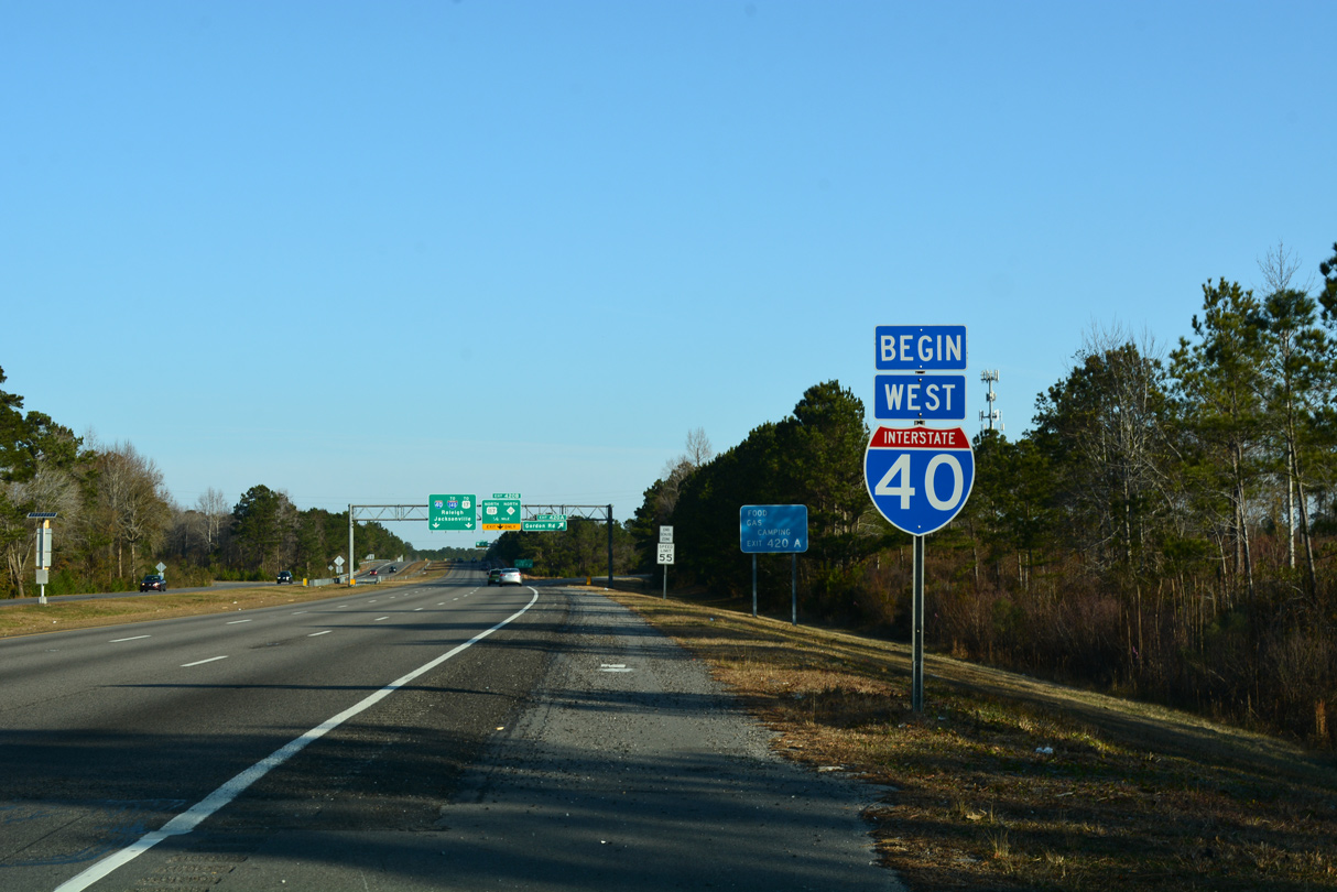
Begin Interstate 40 shield assembly posted ahead of the lane drop for U.S. 117/NC 132 (Exit 420B). The freeway travels along a mostly rural route north 111 miles to Future I-42 west of Clayton and to the south of the Raleigh metropolitan area. 12/31/17
![]() West
West

U.S. 117 branches west and parallels Interstate 40 along side NC 132 to Castle Hayne. A previous overhead assembly here referenced Benson, where I-40 meets I-95, in place of Raleigh and Jacksonville for I-140 east to U.S. 17 north. 12/31/17
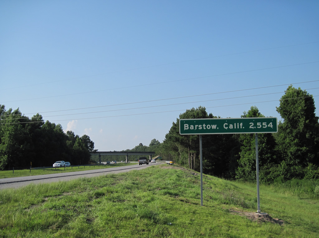
Complimenting the mileage sign at the eastbound beginning of I-40 in Barstow, this assembly stood along westbound just ahead of the Murraysville Road overpass outside Wilmington. The 2,554 mile distance sign was eventually removed and never replaced. 06/24/10

The first westbound shield follows the Murraysville Road overpass. Drivers along I-40 will reach I-140 in two miles, Benson in 94 miles and Raleigh in 123 miles. 12/31/17
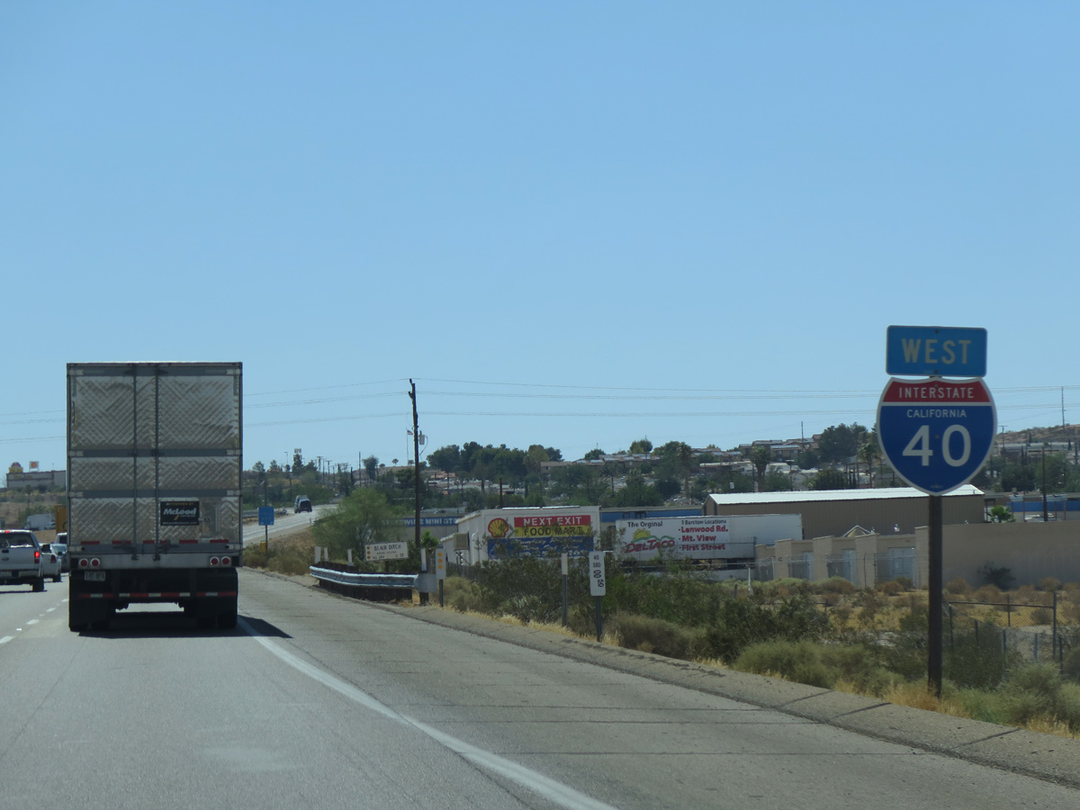
West End – Barstow, California
![]() West at
West at ![]()
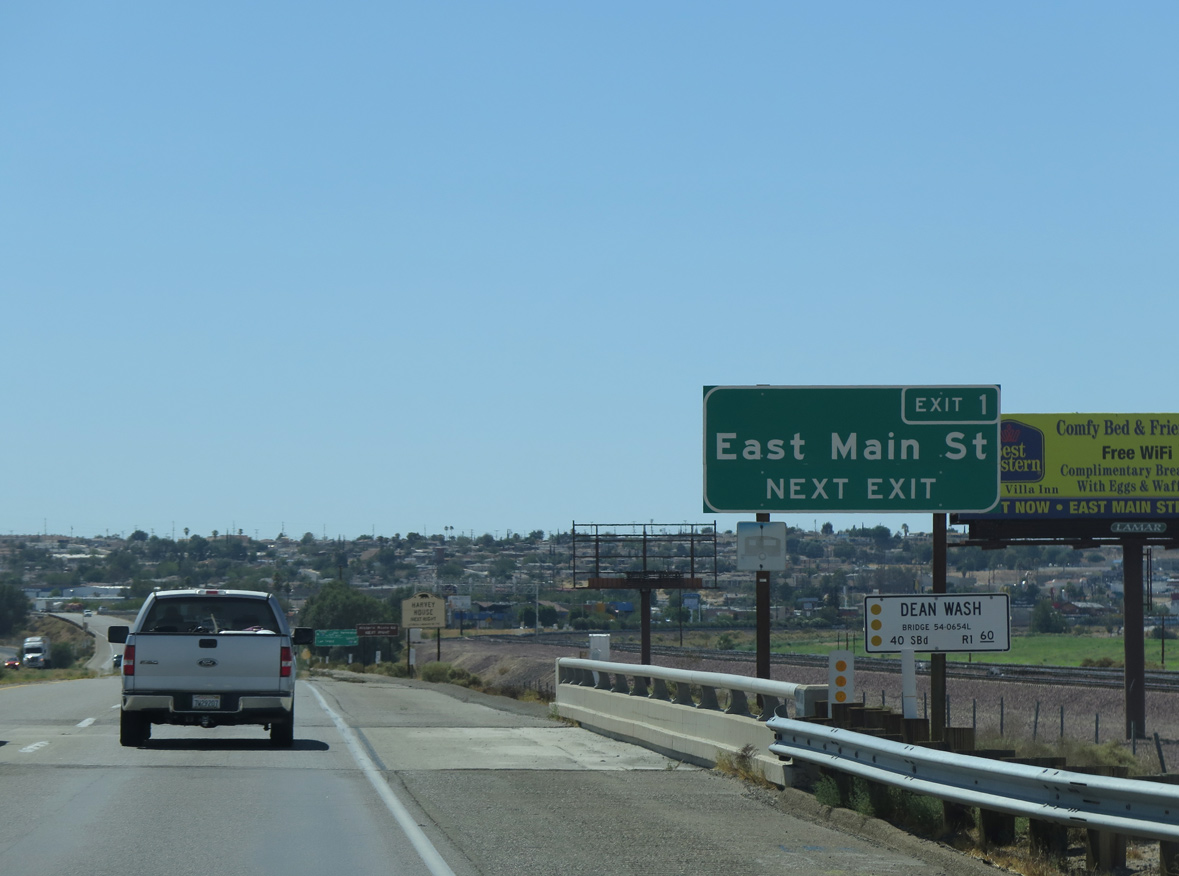
Interstate 40 runs along side a Union Pacific Railroad line and the dry bed of the Mojave River to Exit 1 with Main Street (Historic U.S. 66). Main Street is Business Loop I-15 leading northwest to I-15 and Downtown Barstow. 07/12/15
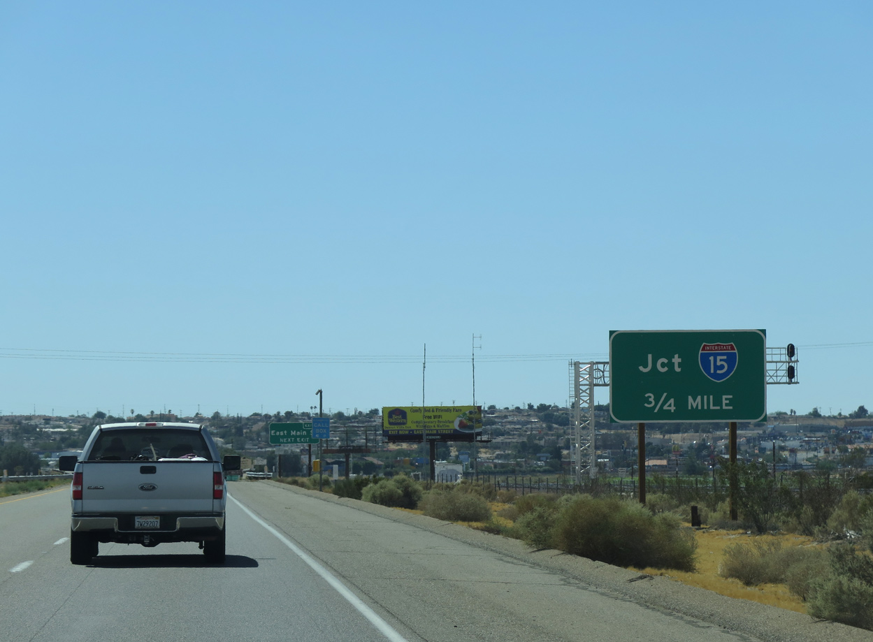
A small guide sign is the first indication to westbound travelers of the pending merge with Interstate 15 south. 07/12/15
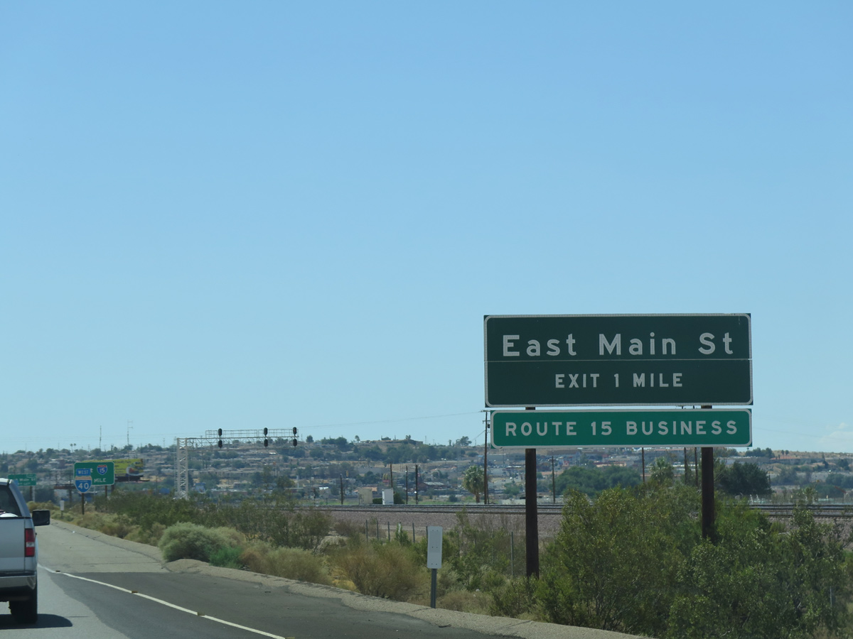
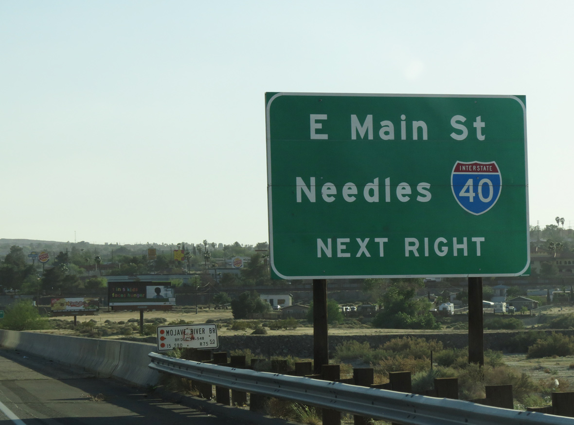
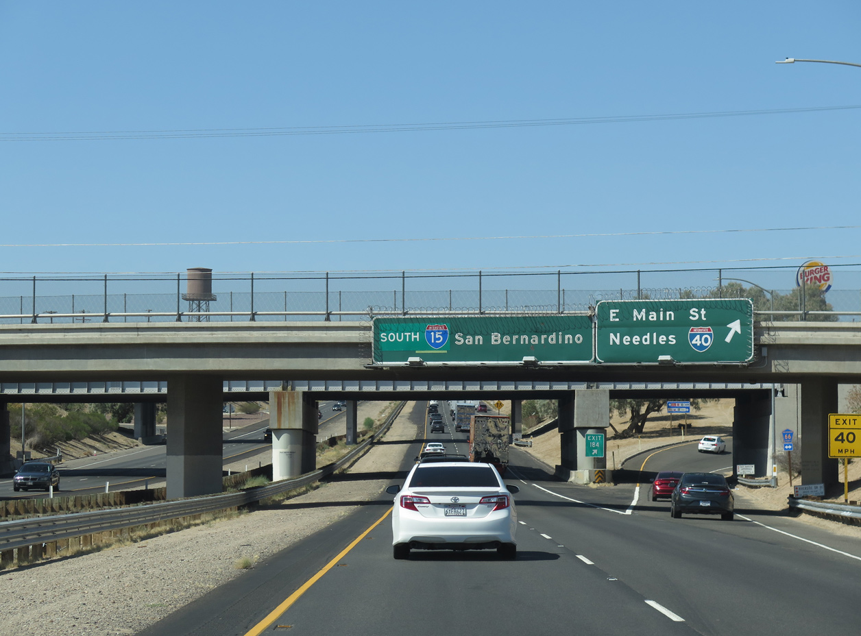
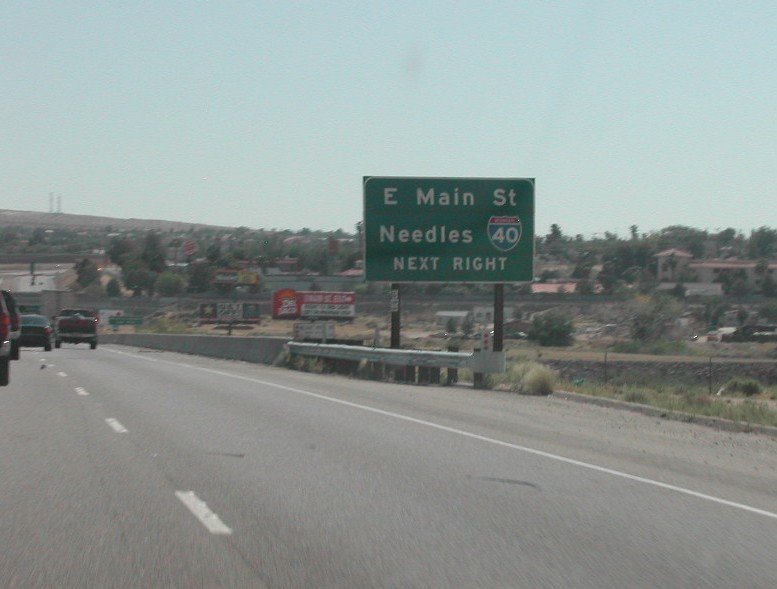
The parclo interchange (Exit 1) with E Main Street lies just west of Dean Wash along I-40. A Breezewood style connection links I-40 west with I-15 north via a half mile of Main Street. 07/12/15
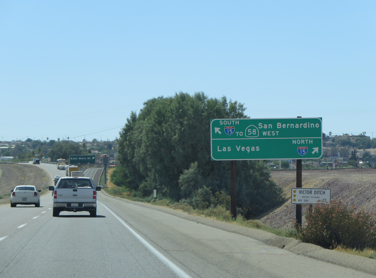
Traffic partitions for Main Street to I-15 north to Las Vegas and the final 1.3 miles of I-40 west to I-15 south to San Bernandino and San Diego. 07/12/15

Exit 1 leaves I-40 west for Historic U.S. 66 / Main Street northwest to I-15 and central Barstow and south to Montara Road. 07/12/15
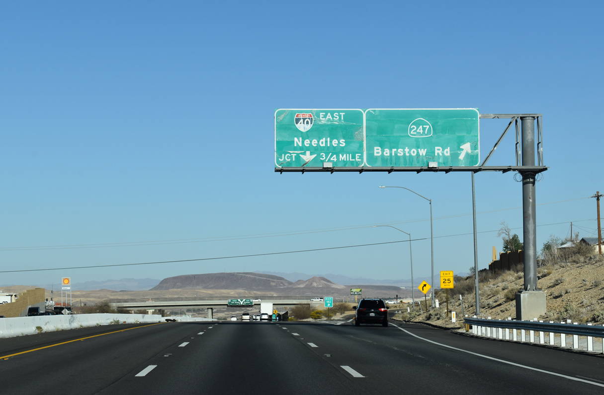
The last reassurance marker for Interstate 40 precedes Blair Ditch and the wye interchange with I-15 south. 07/12/15

The merge with Interstate 15 south was expanded by 2000. The ensuing exit departs in 0.75 miles for SR 274 (Barstow Road). 07/22/14
![]() North at
North at ![]()
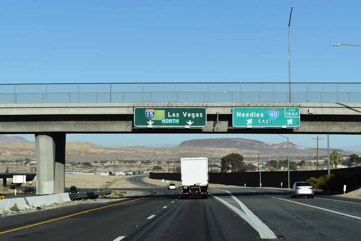
Interstate 15 north, 0.75 miles ahead of the split with I-40 east at Exit 183 to SR 247 (Barstow Road). 03/27/22

A lane drop occurs along I-15 northbound at the wye interchange (Exit 184 A) with I-40 east a half mile beyond the Barstow Road overpass. 03/27/22

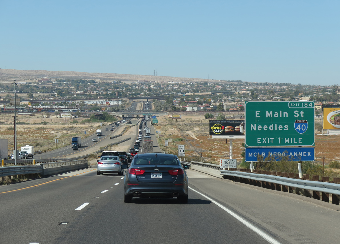
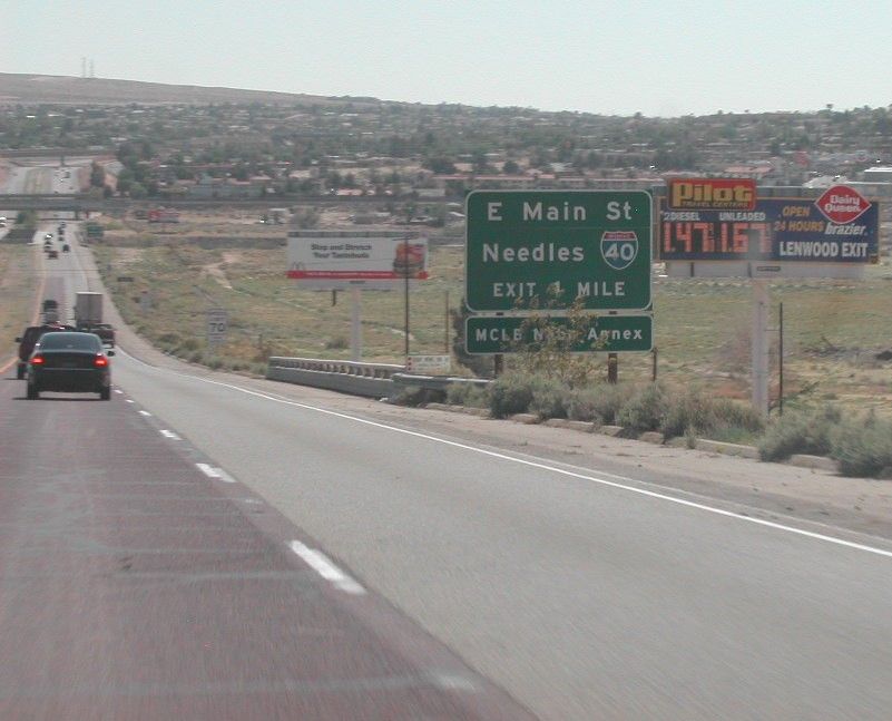
Interstate 40 travels 141 miles east from Barstow across of series of arid mountain ranges and desert valleys to U.S. 95 at Needles. 03/27/22
Northbound Interstate 15 reaches I-40 in Barstow. Greenout overlays conceal original shields for both U.S. 66 and U.S. 91. 03/27/22
![]() South at
South at ![]()
Crossing the dry Mojave River, I-15 south progresses one mile to Main Street (Exit 184) in Barstow. There is no direct ramp from I-15 south to I-40 east. Instead motorists are directed onto a half mile of Main Street east to make the connection. 08/14/16
Main Street doubles as both Business Loop I-15 and Historic U.S. 66 east to I-40 by Barstow Mall and west through Downtown Barstow. 03/31/15
Vintage button copy signs on the Riverside Drive overpass mark the parclo interchange (Exit 184) with Business Loop I-15, CR 66 and Main Street. I-15 continues five miles west to SR 58 toward the San Joaquin Valley and south 71 miles to San Bernandino. 08/14/16
West End Throwback
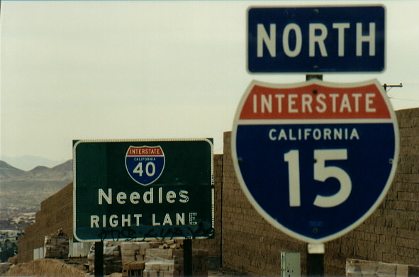
Interstate 40 button copy sign formerly posted just ahead of the eastbound beginning from I-15 north. Photo by Jeff Royston (01/99).
Replaced button copy sign posted one mile ahead of Main Street east to I-40 on Interstate 15 south at the Soapmine Road underpass. Photo by Brian Dowd (05/19/03).
A second button copy sign preceded Main Street along I-15 south at the Mojave River. Photo by Brian Dowd (05/19/03).
Sources:
- “I-40 east lane opens.” News and Observer (Raleigh, NC), September 2, 2003.
- “Hall of Fame Drive/Interstate 40 Project,” Tennessee Department of Transportation, web site, accessed August 2003.
- “I-40 Crosstown History.” Oklahoma DOT.
- “ODOT, partners celebrate approval of Crosstown project.” Oklahoma DOT. May 13, 2002.
- “Officials review I-40 reversal plan.” News and Observer (Raleigh, NC), September 15, 2003.
- “I-40 in El Reno gets face lift.” Oklahoma DOT Public Affairs Media Advisory, August 13, 2002.
- “I-40 victims’ memorial to be dedicated.” Oklahoma DOT Public Affairs Media Advisory, May 22, 2003.
- “I-40 Bridge Opened to Traffic 7-29.”
http://www.okladot.state.ok.us/public-info/i40-bridge.htmOklahoma DOT Public Information. - Prince, Adam; Personal Email, 01/04/04
- Price, John; Personal Email, 12/10/04
- Lansford, John; “Wilmington Proposes Extending I-40,” post to Misc.Transport.Road newsgroup; 12/26/04; based on article appearing in the Wilmington Star-News.
- Tennessee Interstate System at 50: Facts and Trivia.
http://www.tninterstate50.com/Tnfacts.htm - “From Anywhere to Everywhere: The Development of the Interstate Highway System in Texas.” by Penny Beaumont, Rhonda Brinkmann, David Ellis, Chris Pourteau, and Brandon V. Webb, Texas Transportation Institute, page 29.
http://tti.tamu.edu/interstate_anniversary/white_paper/ - Celebrate the Interstate: America’s Interstate Highway System Turns 50!.
http://www.okladot.state.ok.us/okinterstate50/Oklahoma Department of Transportation. - Skiles, Kent; Personal Email “AARoads feedback: I-40 In Little Rock,” 12/09/06.
- U.S. and Interstate Highways in New Mexico (Steve Riner).
- “World Premiere” Albuquerque Tribune, The (NM), May 24, 2002.
Page updated April 10, 2023.