Interstate 37
Interstate 37 north at the four-level interchange with IH 410 (Connally Loop) and U.S. 281 in south San Antono. 09/29/07
Overview
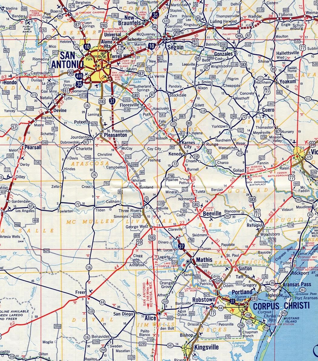
Interstate 37 links San Antonio with Corpus Christi and the Gulf Coast in South Texas. IH 37 along with U.S. 281 / IH 69C and U.S. 77 / IH 69E provides connectivity to the Rio Grande Valley. The freeway is also one of the only limited access hurricane evacuation routes from the South Texas coastline inland towards San Antonio and Austin. Like IH 45, IH 37 is located entirely within the Lone Star State.
 Parallel U.S. Routes
IH 37 combines with U.S. 281 south from the McAllister Freeway and IH 35 at Downtown San Antonio to IH 410 at the Stinson Airport Vicinity in southeast San Antonio. U.S. 281 shifts westward along IH 410 to parallel IH 37 south to Leming and Pleasanton. The two come together again between Exits 103 and 72 near Three Rivers. U.S. 281 branches south from there toward Alice while the remainder of IH 37 mirrors the course of U.S. 181 southeast to Corpus Christi. U.S. 77 also briefly combines with IH 37 to IH 69E at Calallen in Corpus Christi.
Route Information
North End – San Antonio, TX
South End – Corpus Christi, TX
Branches – 0
Mileage – 143.00
Cities – Corpus Christi, Mathis
- Junctions –


Source: December 31, 2021 Interstate Route Log and Finders List
IH 37 was completed from San Antonio south to FM 1303 (where Loop 1604 crosses IH 37 now) by 1972 and from Corpus Christi north to FM 534 at Swinney Switch.
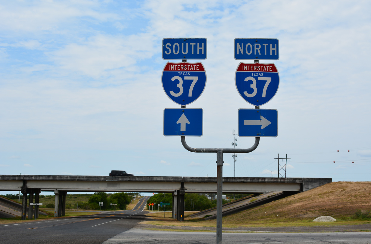
IH 37/U.S. 281 north ahead of FM 541 near Liveoak Creek in Atascosa County. 09/29/07
Harbor Bridge
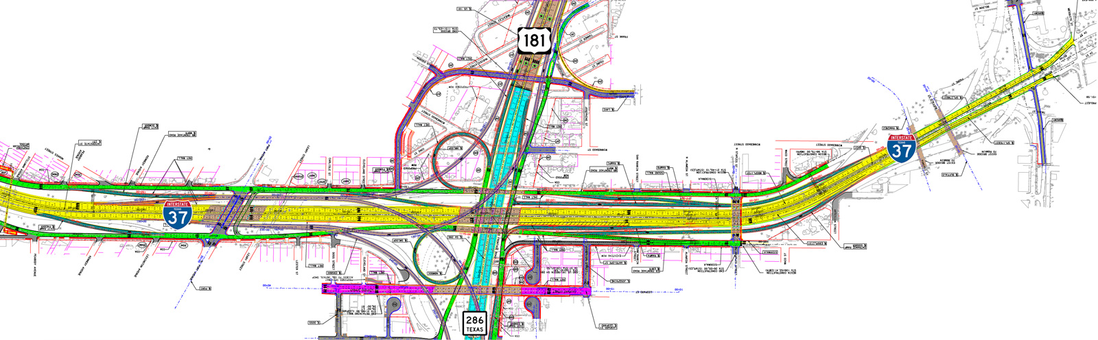
Construction on the U.S. 181 Harbor Bridge Replacement Project replaces the bridge built in 1959 taking U.S. 181 over Corpus Christi Channel, a waterway linking Industrial Canal with Corpus Christi Bay. An $802.9 million investment, the project broke ground on August 8, 2016.1,2
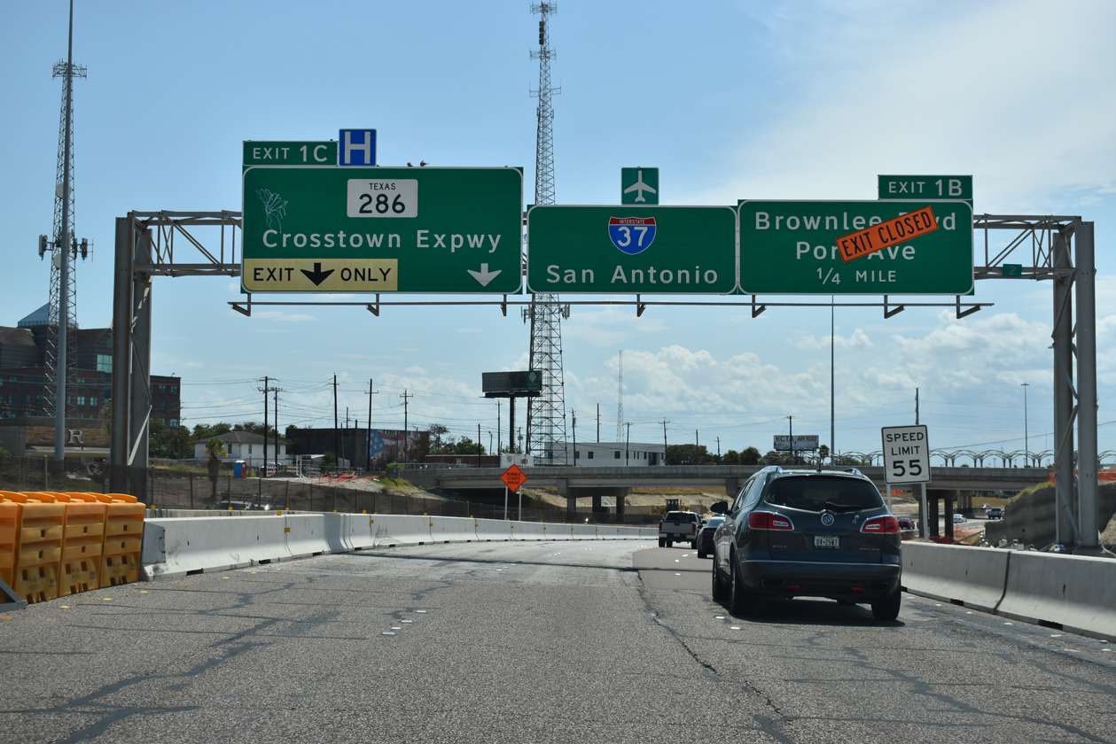
Four Proposed Build Alternatives were considered as of July 2013. The Red Alternative was ultimately chosen. It ties in the new 538 foot high cable-stayed bridge2 and alignment with the interchange joining IH 37 with the Crosstown Expressway (SH 286). Construction rebuilds that exchange into a directional T interchange with high speed flyovers between U.S. 181 to the north, SH 286 to the south and IH 37 to the west. Connections with the IH 37 spur to the east will use the frontage roads in place of direct ramps.
An additional refinement considered for the bridge design was the elimination of the Staples Street overpass above Interstate 37 to the east of the Crosstown Expressway. An at-grade intersection between the two was proposed in place of the crossing. This effort was meant to make the Downtown area more pedestrian friendly.1 It would have also shortened IH 37 by at least 0.6 miles. Work on the Harbor Bridge Replacement Project runs through April 20212 2024, with demolition of the old span in 2025.3
History
IH 37 was added to the original Interstate system in October 1957. It was included within the Texas Interstate Highway System by the State Highway Commission in 1962 with 142 miles.4
The proposed section of IH 37 north of Downtown San Antonio to IH 410 was the North Expressway, a route connecting Downtown with the airport. Original plans called for the freeway to travel a straight line north from Downtown. However, local opposition arose due to the potential local impacts of the freeway. A lawsuit by the San Antonio Conservation Society resulted in an injunction preventing construction of the freeway as an Interstate in 1967.
Opposition to the freeway project remained through the late 1960s and early 1970s. The struggle reached a national audience when the freeway was profiled in Helen Leavitt’s book Superhighway-Superhoax. With its proximity to or passage through parkland, a college campus, schools, residential neighborhoods and other sensitive areas, the route was changed to avoid these features. This resulted into the number of S-curves along the freeway between IH 35 and IH 410. In 1973, the freeway was resurrected as a project to be built without federal funds as a new alignment for U.S. 281. Construction ensued through the mid 1970s, and the Walter McAllister Expressway (U.S. 281) opened to traffic on February 7, 1978.5 The systems interchange providing direct connection ramps between U.S. 281 and IH 410 did not begin construction until 2006. It was completed in June 2008.
 Photo Guides
North End  – San Antonio, Texas
![]()
![]() North at
North at ![]()
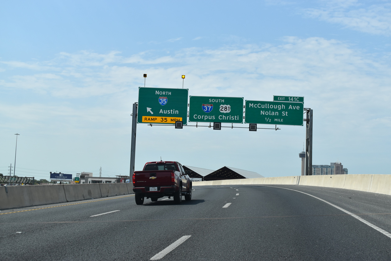
Traveling between the Alamodome and the Henry B. Gonzalez Convention Center, IH 37/U.S. 281 north reach the final mainline off-ramp (Exit 141) for Commerce Street to Downtown San Antonio. 09/29/07
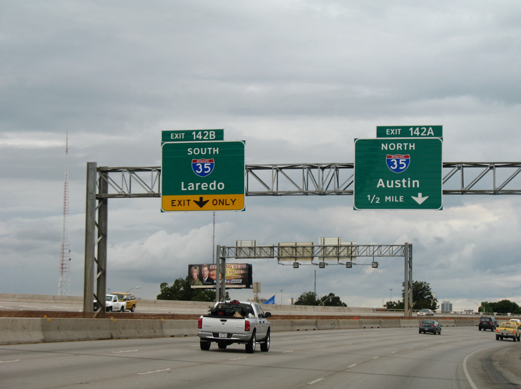
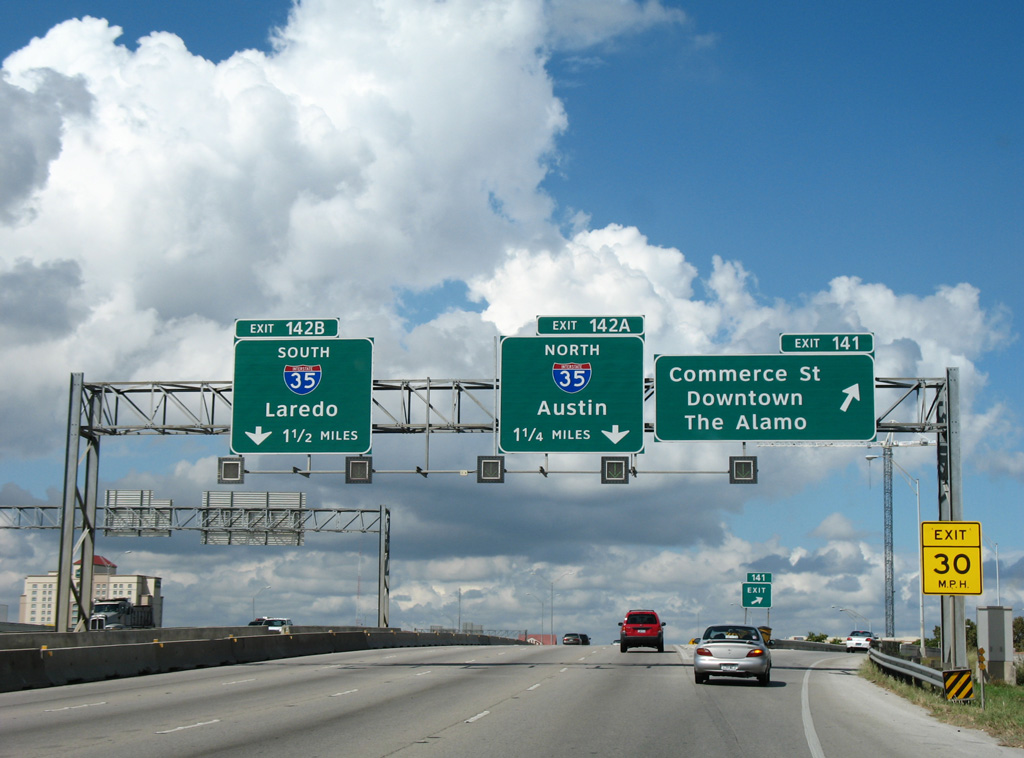
IH 37 wraps around the east side of Downtown San Antonio along a viaduct system to the systems interchange (Exits 142A/B) with IH 35. 09/29/07
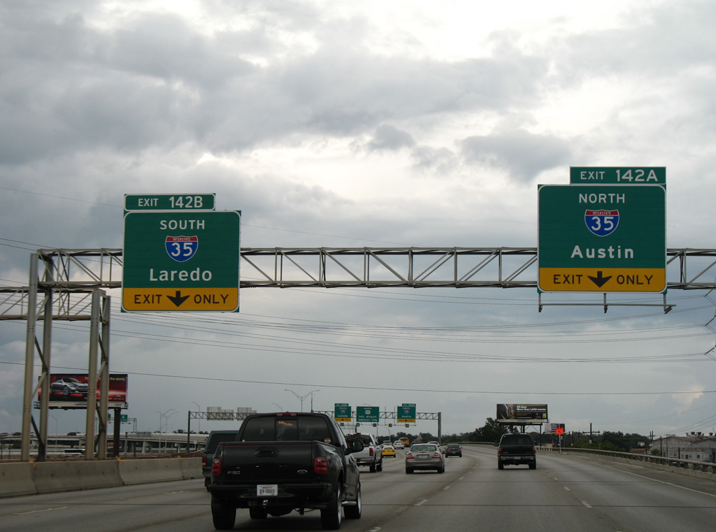
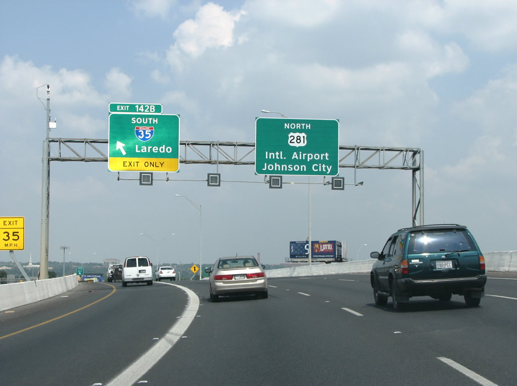
Exit 142A departs next for IH 35 heading east to IH 410 and north to Austin and Dallas/Fort-Worth. 09/29/07
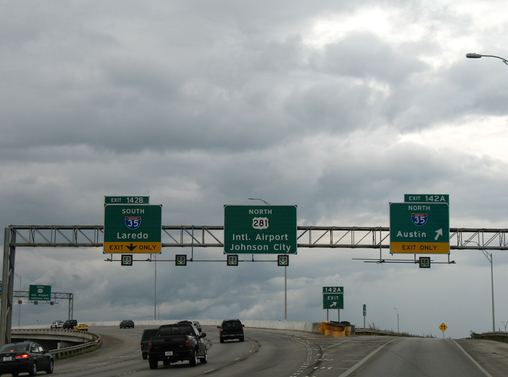
U.S. 281 extends the freeway from IH 37 north eight miles to San Antonio International Airport (SAT) at IH 410 and 14 miles to SL 1604 (C.W. Anderson Loop). 09/29/07
Left Exit 142B joins IH 35 south around the north side of Downtown San Antonio. IH 35 combines with IH 10 west of the central business district, while IH 10 leads northwest to Kerrville and Junction. Photo by Justin Cozart (08/31/08).
![]() South at
South at ![]()
![]()
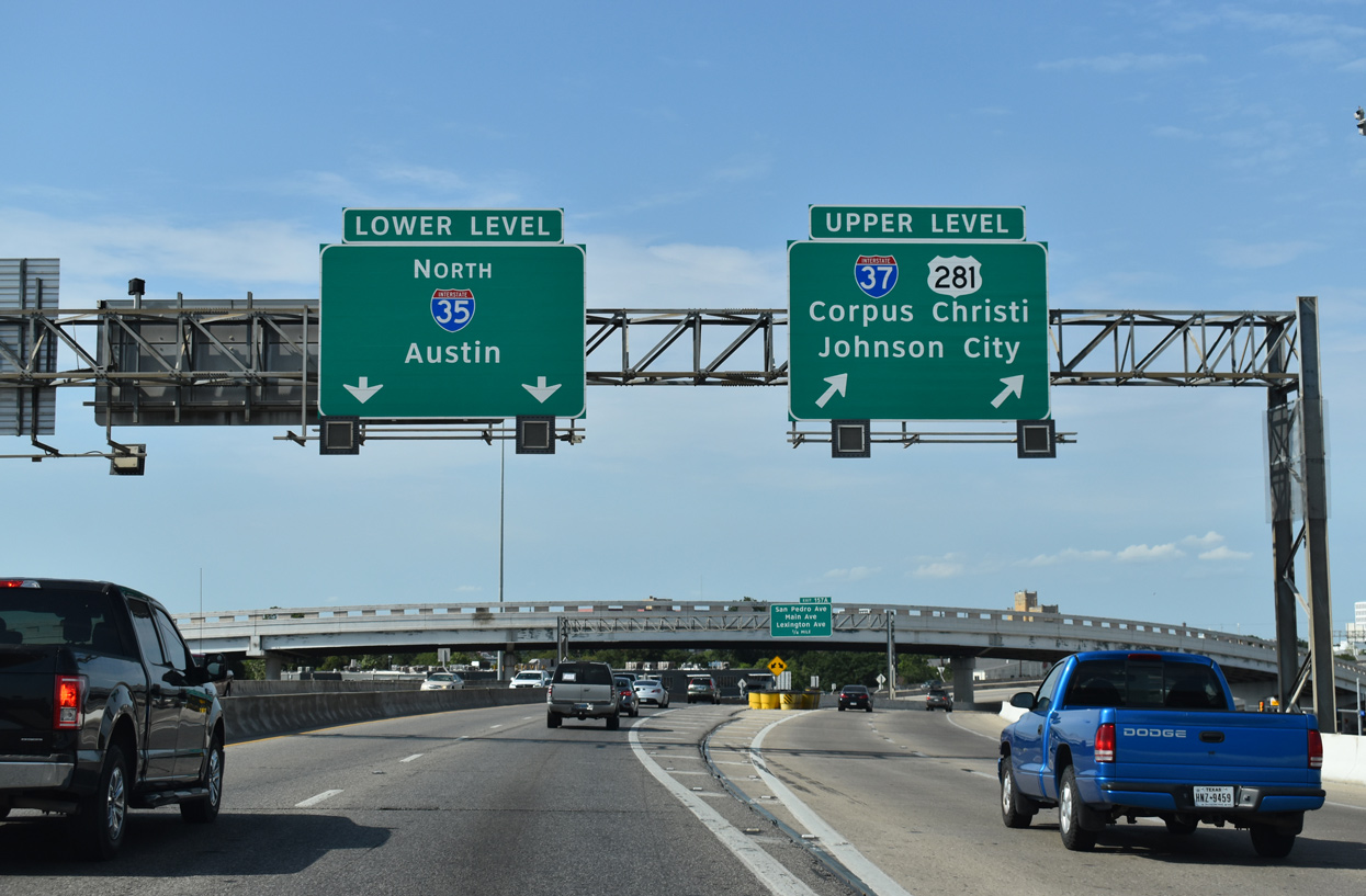
U.S. 281 (McAllister Freeway) emerges from Brackenridge Park along an elevated roadway leading directly onto IH 37 at IH 35. 08/03/19
Unnumbered ramps depart from U.S. 281 south for IH 35 south between Tobin Hill and Downtown San Antonio and IH 35 north between Government Hill and Digonowity Hill. 08/03/19
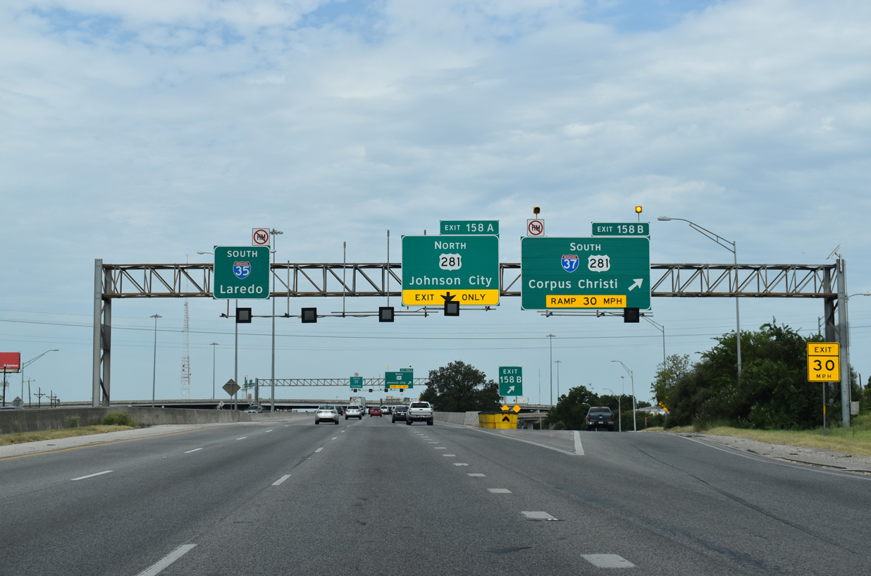
IH 37 begins along U.S. 281 south at the exit ramp for IH 35 north to Kirby, Windcrest and Austin. 08/03/19
![]() South at
South at ![]()
![]()

Exit 159A departs IH 35 south at the Walters Street overpass, 1.25 miles ahead of IH 37 south and U.S. 281 (McAllister Freeway). 08/03/19
Broadway and Alamo Street parallel IH 37/U.S. 281 within the vicinity of the exchange with IH 35. Broadway Street is the former alignment of U.S. 81 and SL 368 south of Alamo Heights. 08/03/19
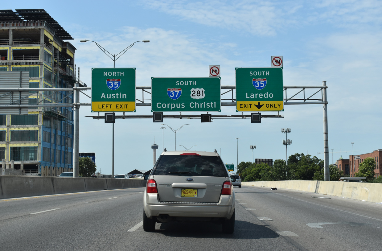
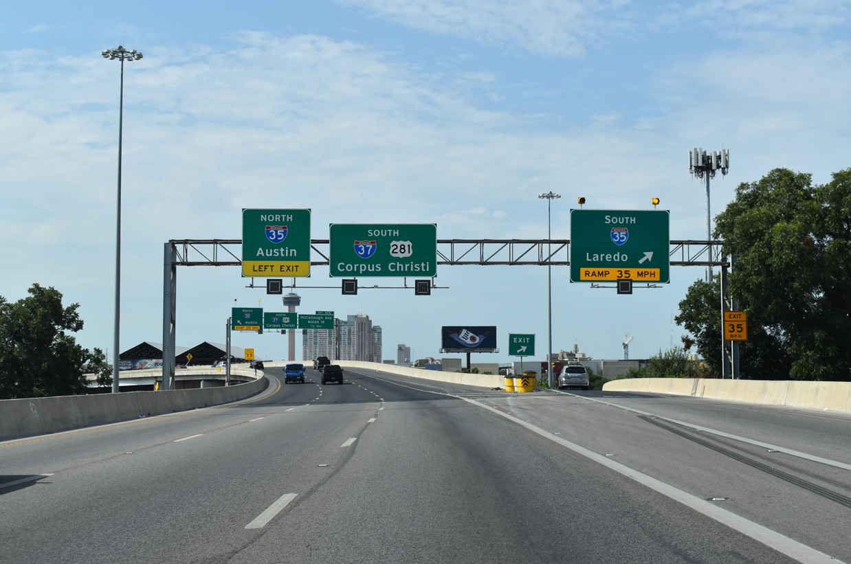
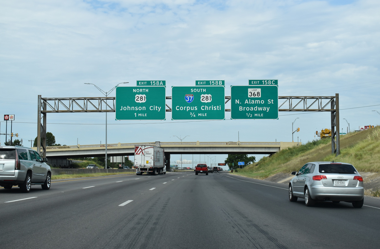
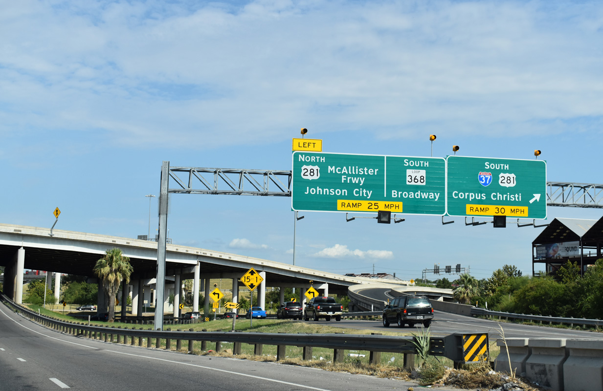
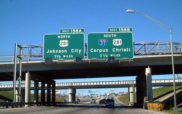
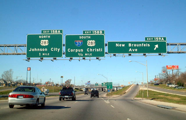
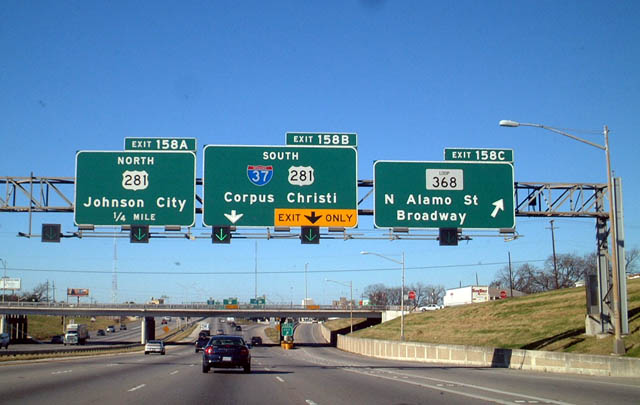
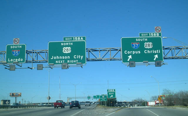
Exit 158B separates from IH 35 south to IH 37/U.S. 281 south as both freeways encircle Downtown San Antonio. U.S. 281 travels 61 miles north from Exit 158A to Johnson City in Blanco County. 08/03/19
Exit 158B separates from IH 35 south to IH 37/U.S. 281 south as both freeways encircle Downtown San Antonio. U.S. 281 travels 61 miles north from Exit 158A to Johnson City in Blanco County. 08/03/19
![]() North at
North at ![]()
![]()
Like IH 10 heading northwest to IH 410, IH 35 separates into upper and lower levels. The lower level constitutes a four lane, grade level freeway while a system of three lane viaducts carry the upper level to IH 37/U.S. 281. 08/04/19
The upper level of IH 35 provides an express route to IH 37, while the lower level has local access to the adjacent street grid. Photo by Chris Patriarca (06/24/03).
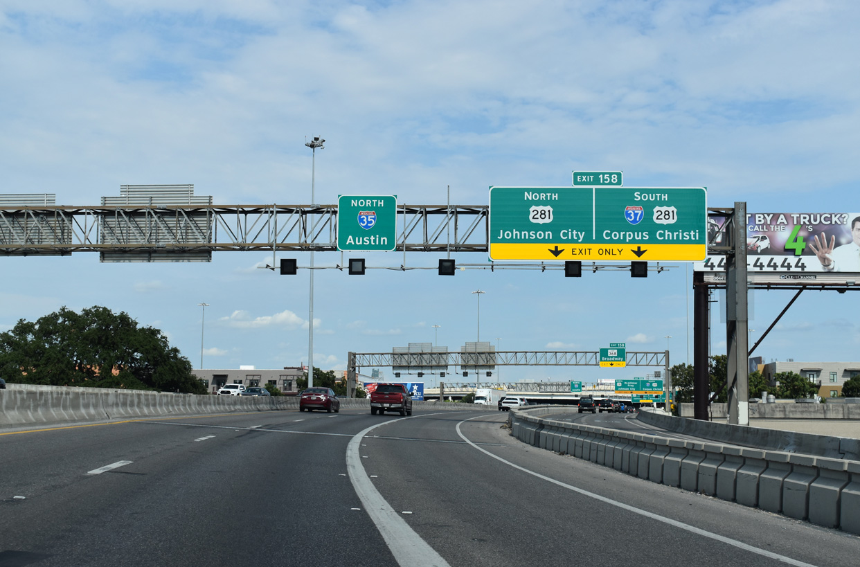
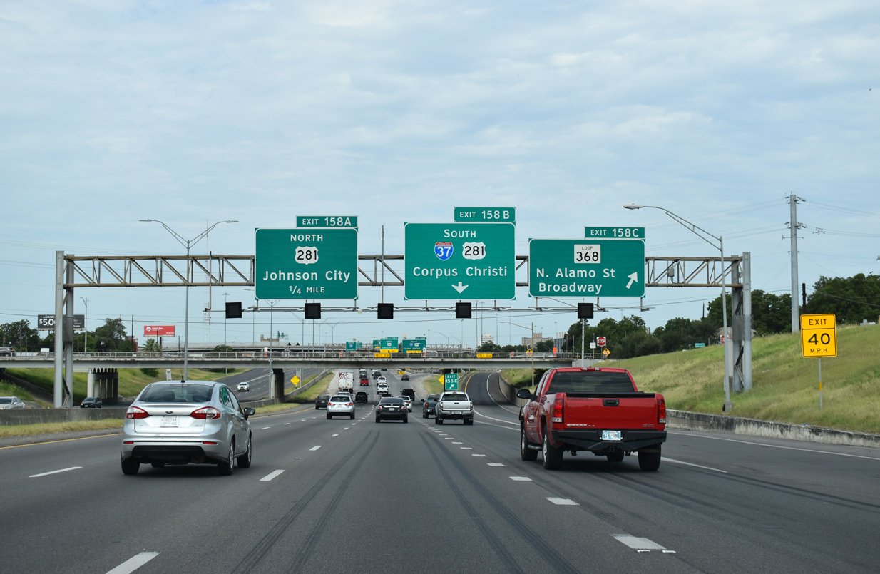
The lower level lanes emerge just ahead of the four level interchange (Exit 158) with IH 37 south and U.S. 281. 08/04/19
Exit 158 carries traffic to both IH 37/U.S. 281 south to Corpus Christi and the Rio Grande Valley and U.S. 281 (McCallister Freeway) north to SAT Airport. The IH 35 mainline continues east with three through lanes. 08/04/19
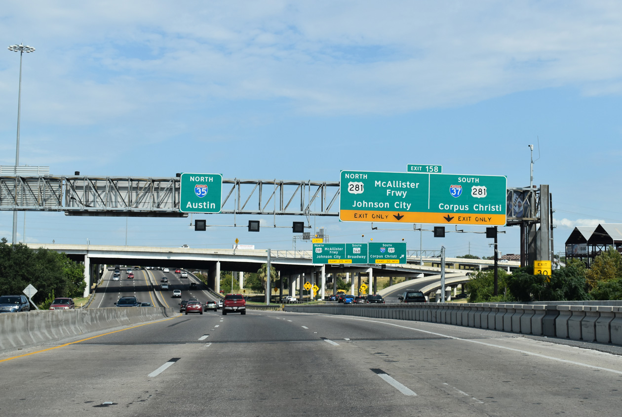
Exit 158 partitions into a local ramp for Broadway Street (old SL 368), which threads through the exchange at grade level along the historical route of U.S. 81. IH 37 and U.S. 281 overlap nine miles south to IH 410. 08/04/19
North End Throwback
1.25 miles east of IH 37/U.S. 281 on IH 35 south at Walters Street, prior to an expansion project that added a lane to each direction. 12/31/02
The New Braunfels Avenue off-ramp was relocated eastward to depart ahead of Frank Street as part of eventual IH 35 widening. The freeway proceeds west 0.75 miles to Exit 158B for IH 37 south to The Alamo and Downtown. 12/31/02
Changes made to Exit 158B by 2016 restriped the off-ramp to just one lane for IH 37/U.S. 281 south to Corpus Christi. 12/31/02
Two lanes were allocated for IH 37/U.S. 281 southbound from IH 35 south until 2016. IH 37 straddles eastern reaches of Downtown to the Alamodome. 12/30/02
South End  – Corpus Christi, Texas
![]() South at
South at ![]()
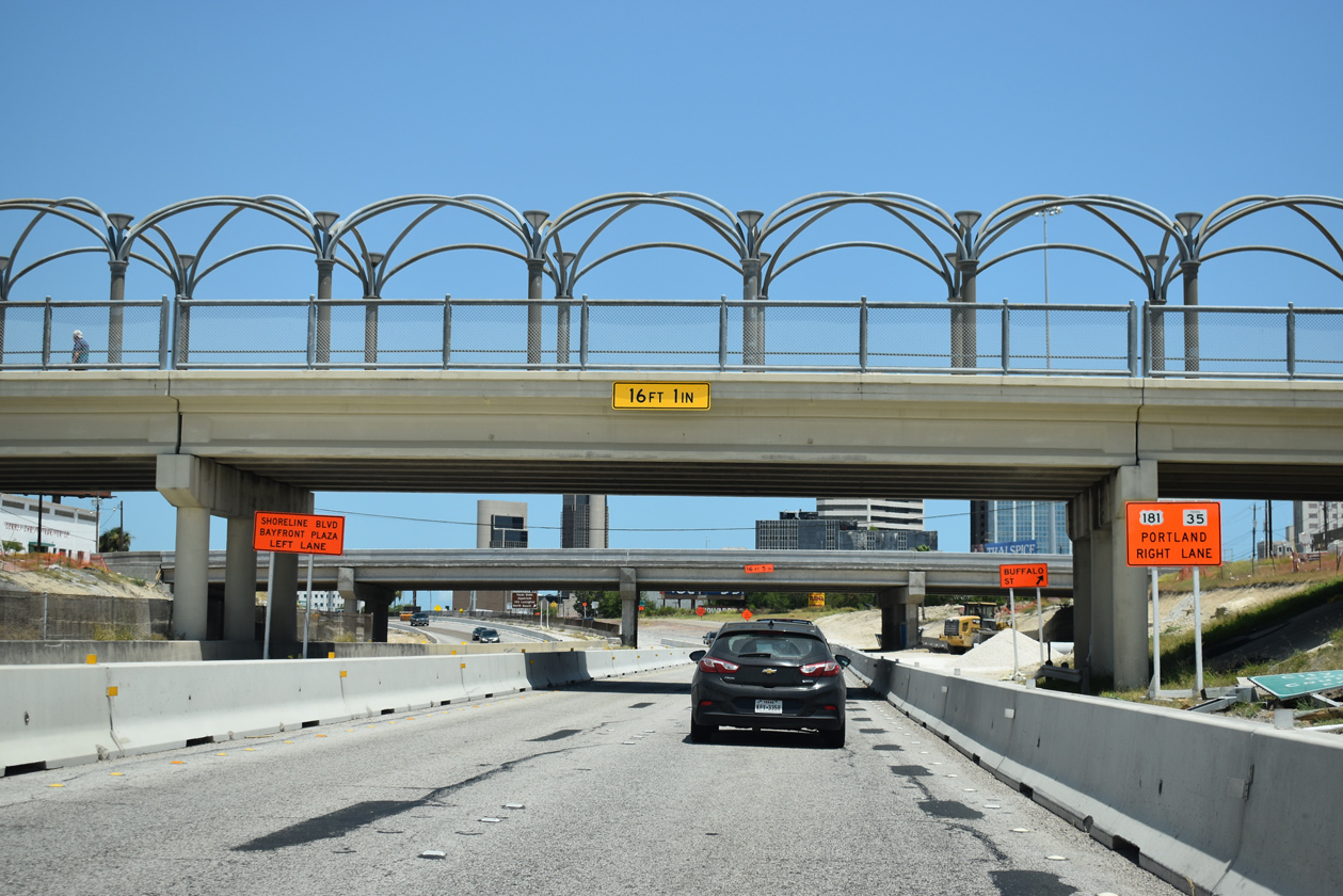
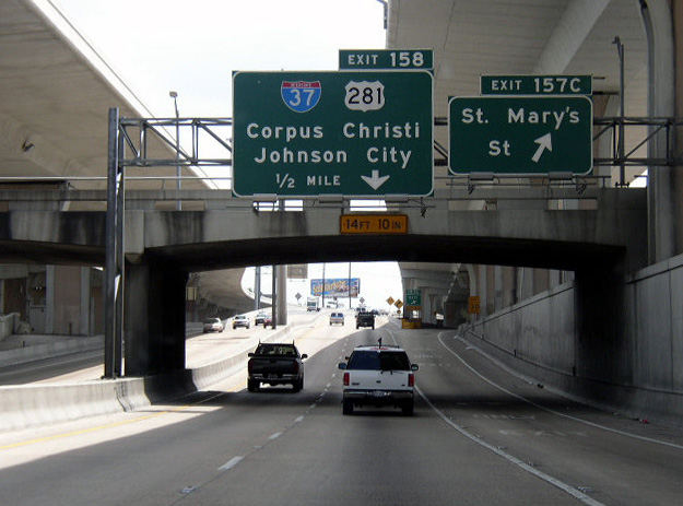
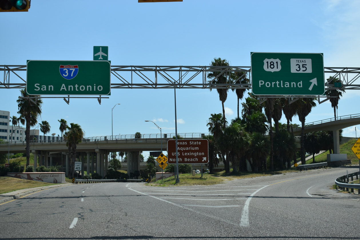
Heading east from the Crosstown Expressway (SH 286) south, back to back ramps depart from IH 37 south for Buffalo Street (Exit 1A) and U.S. 181/SH 35 north to the Harbor Bridge. The new alignment for U.S. 181 will tie into a rebuilt cloverstack interchange with SH 286 here as part of the U.S. 181 Harbor Bridge Replacement Project. 08/03/19
All ramps associated with the directional T interchange joining IH 37 and U.S. 181/SH 35 north will be demolished. Broadway Street will be redesigned as a six lane boulevard in place of the Harbor Bridge approach. 08/03/19
IH 37 south extends east from the U.S. 181 flyover with two lanes for another quarter mile to Mesquite Street. 09/29/07
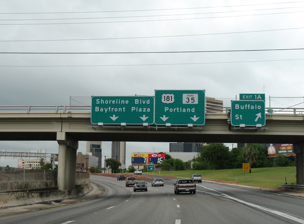
Ramps from U.S. 181/SH 35 south partition above the ending freeway for Broadway Street south and Twigg Street east to Shoreline Boulevard and the Corpus Christi waterfront. A right in right out (RIRO) intersection will replace this exchange between IH 37 and Broadway Street. 08/03/19
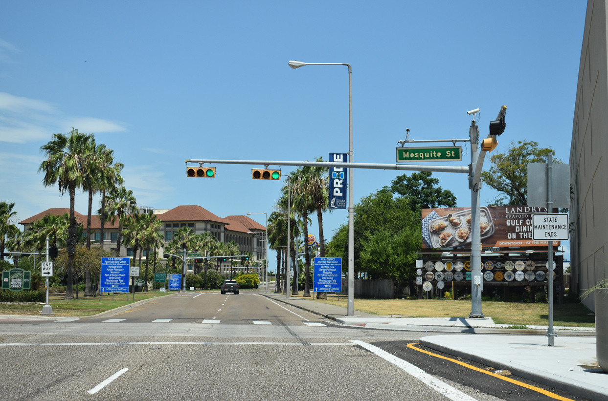
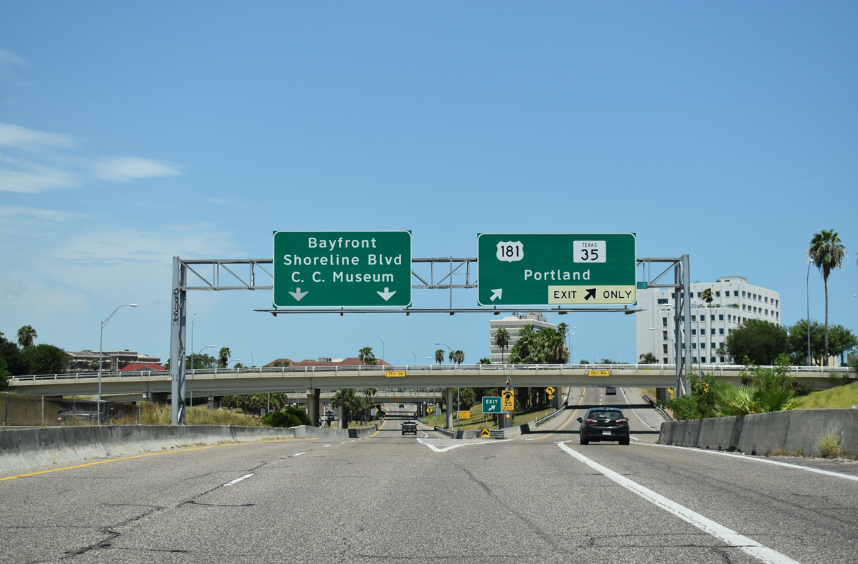
Interstate 37 ends as a four lane boulevard extending three blocks east from Mesquite Street to North Shoreline Boulevard and Corpus Christi Bay. 08/03/19
![]() North at
North at ![]()
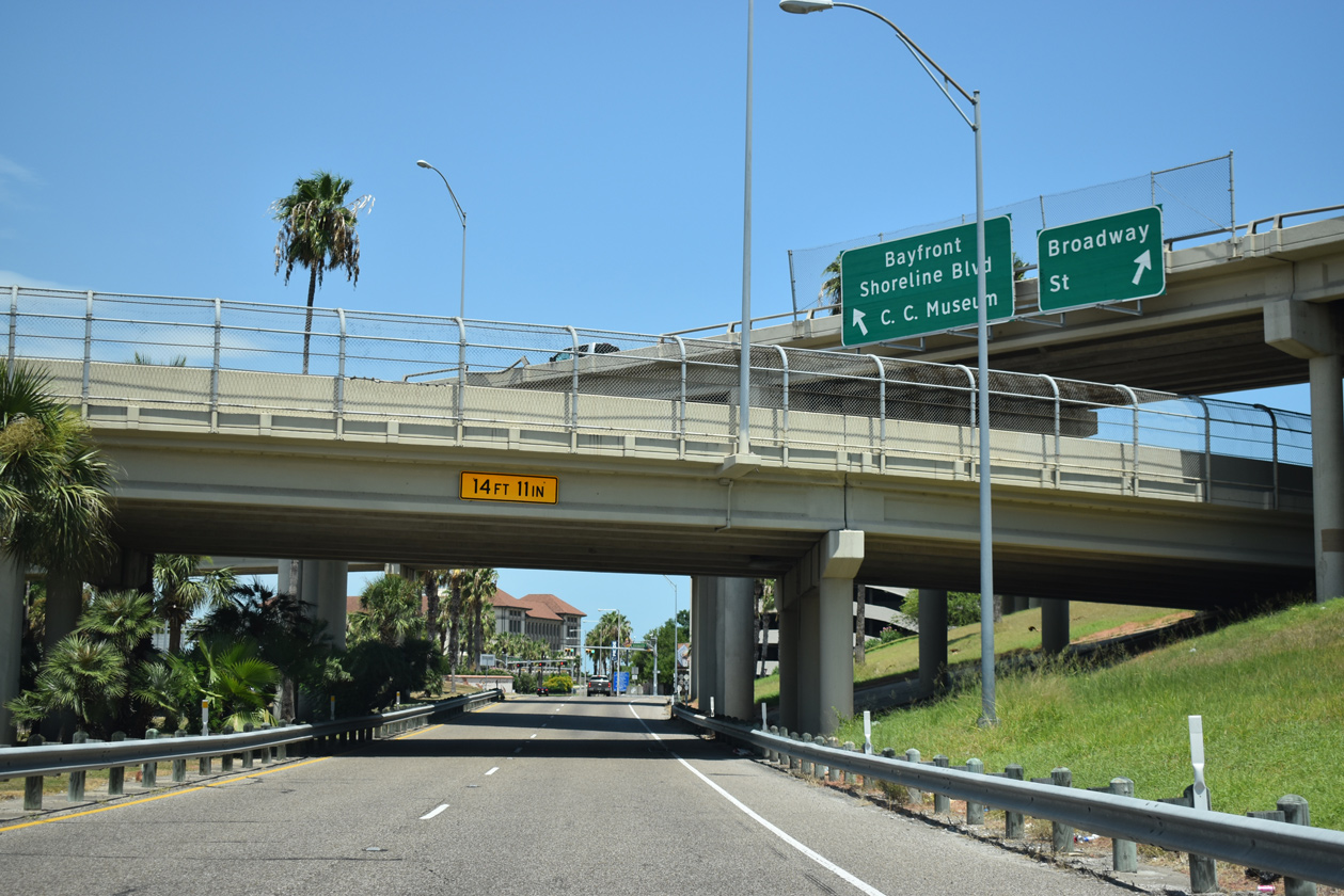
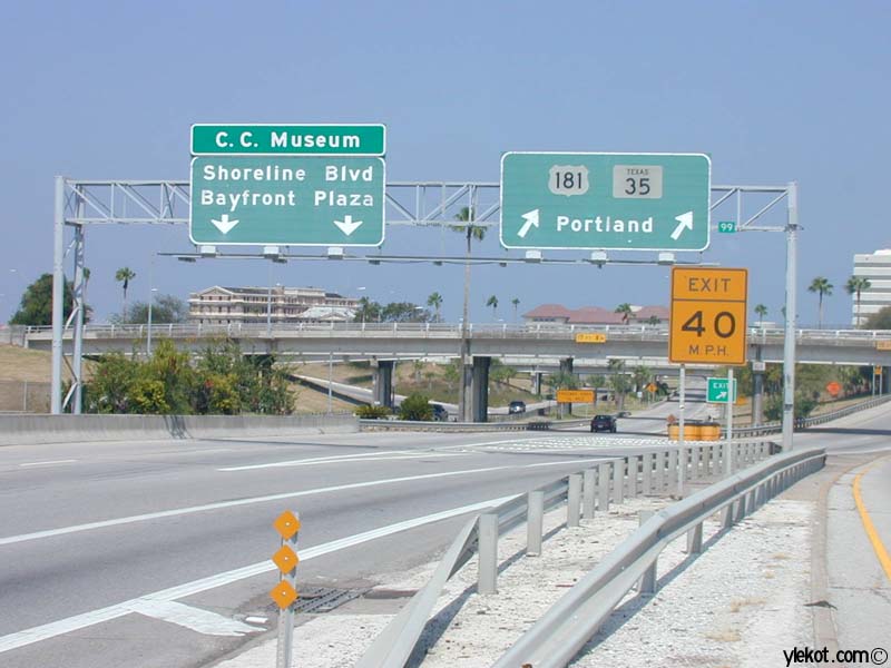
IH 37 stems west from Shoreline Boulevard along a landscaped boulevard three blocks to Mesquite Street. The freeway commences at the separation with the northbound on-ramp for U.S. 181/SH 35 to the Harbor Bridge and Portland. 08/03/19
Flyovers join IH 37, U.S. 181 and SH 35 at Broadway Street. This exchange will demolished and IH 37 redesigned westward to the Crosstown Expressway as part of the Harbor Bridge Replacement Project through 2024. 08/03/19
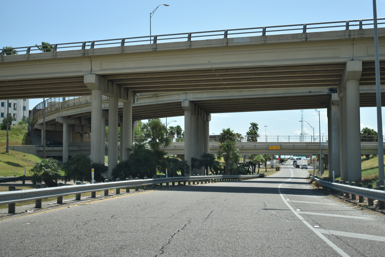
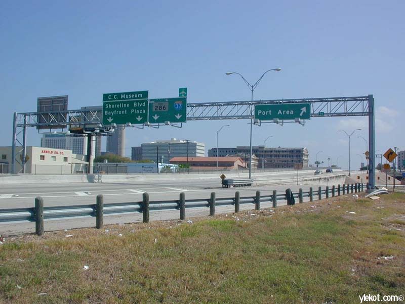
The initial stretch of IH 37 north travels below grade between Downtown Corpus Christi and Martin Luther King Drive. Ramps join the freeway from U.S. 181 south and Padre Street as the freeway progresses west a quarter mile to SH 286 (Crosstown Expressway) south. Construction redesigns the forthcoming exchange with SH 286 to accommodate the new Harbor Bridge approach. 08/03/19
South End Throwback
IH 37 south at the Buffalo Street off-ramp prior to Harbor Bridge Replacement Project. 09/29/07
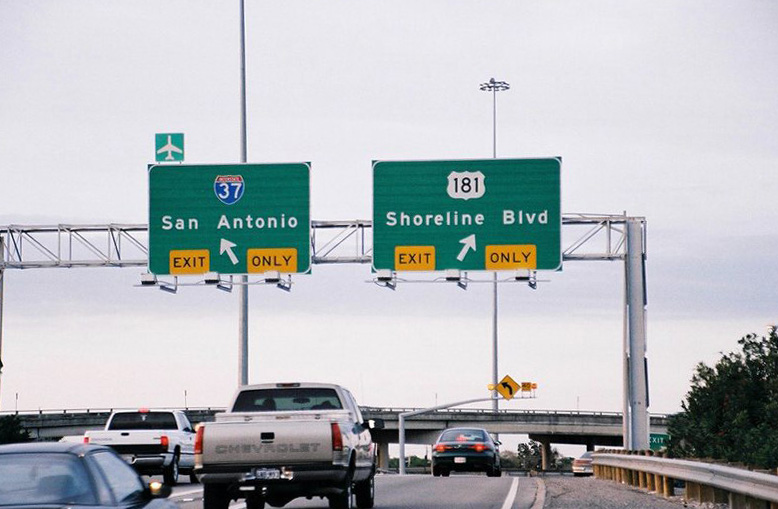
SH 286 ends at the ramp split for IH 37 north to San Antonio and south to U.S. 181 (Harbor Bridge) and Shoreline Boulevard. With the new Harbor Bridge approach tying into this exchange from the north, all ramps here will be replaced as part of an interchange redesign. Photo by Jeff Royston (12/00).
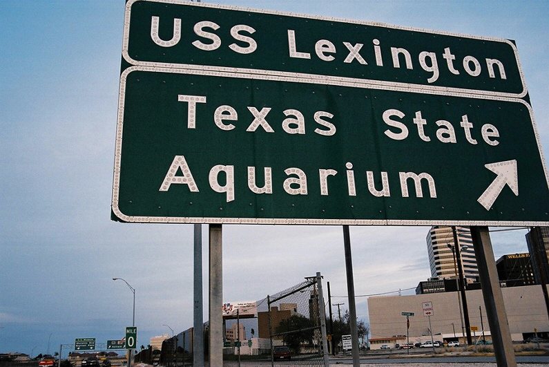
Former button copy sign posted ahead of the U.S. 181/SH 35 northbound off-ramp from IH 37 south. The Harbor Bridge carries both routes across Corpus Christi Channel to North Beach, where the Texas State Aquarium and the U.S.S. Lexington are located. SH 35 branches northeast from U.S. 181 in ten miles en route to Aransas Pass and Rockport. Photo by Jeff Royston (12/00).
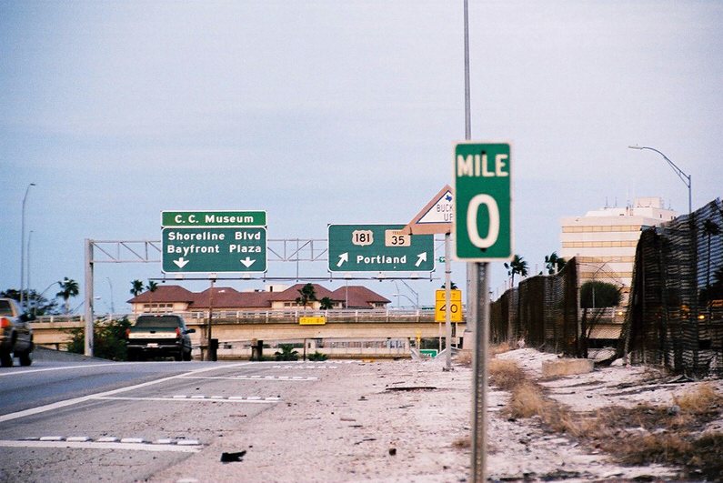
Milepost zero preceded the flyover for U.S. 181/SH 35 north from IH 37 south. The assembly was removed in 2016. Also ending here are U.S. 181 and SH 35. Historically U.S. 181 ran three blocks to the east along Water Street. Photo by Jeff Royston (12/00).
Non reflectorized signs directed traffic to U.S. 181/SH 35 north to Portland and to the IH 37 boulevard east to Shoreline Boulevard and Bayfront Plaza, the previous name of the American Bank Center convention center and arena. Photo by Mike Wiley (09/00).
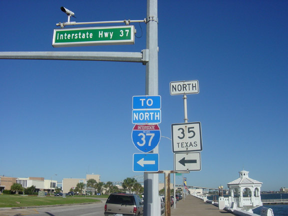
Trailblazers for IH 37, U.S. 181 and SH 35 north were formerly posted at the intersection of Shoreline Boulevard north with the Interstate Highway 37 boulevard extending west to the freeway. The IH 37 end point is a rare example where an Interstate, U.S., and State Highway all conclude at the same location. Photo by Jeff Royston (12/01).
U.S. 181 and SH 35 southbound conclude as traffic separates into ramps for the Corpus Christi Port Area to the northwest, IH 37 north to the Crosstown Expressway and Broadway Street south into Downtown. Photo by Mike Wiley (09/00).
Sources:
- “Harbor Bridge open house to show possible bridge modifications.” Corpus Christi Caller Times (TX), June 23, 2016.
- “Groundbreaking ceremony held for Corpus Christi Harbor Bridge.” Rio Grande Guardian (TX), August 9, 2016.
- Harbor Bridge Project (2022, May 2). The new Bridge is scheduled to open in 2024, and demolition will be complete in 2025. [Status update]. Facebook. https://www.facebook.com/HarborBridgeProject/videos/307828184688915/
- From Anywhere to Everywhere: The Development of the Interstate Highway System in Texas by Penny Beaumont, Rhonda Brinkmann, David Ellis, Chris Pourteau, and Brandon V. Webb, Texas Transportation Institute, page 29.
http://tti.tamu.edu/interstate_anniversary/white_paper/ - From Anywhere to Everywhere: The Development of the Interstate Highway System in Texas by Penny Beaumont, Rhonda Brinkmann, David Ellis, Chris Pourteau, and Brandon V. Webb, Texas Transportation Institute, page 24.
http://tti.tamu.edu/interstate_anniversary/white_paper/
Page updated May 22, 2022.