Interstate 35


Overview
Interstate 35 serves the heartland of America, connecting South Texas with the Arrowhead of Minnesota. Starting in Laredo, IH 35 traverses an arid region northward to San Antonio, where it briefly overlaps with Interstate 10 by Downtown. The freeway angles northeast from there along a busy corridor to the capital city of Austin, Waco and Hillsboro where it partitions into east and west branches. Interstate 35W serves Fort Worth while Interstate 35E retains the exit numbering scheme of IH 35 through Dallas. The two reconvene at Denton, where IH 35 resumes a northward heading to Gainesville and a crossing of the Red River into Oklahoma.
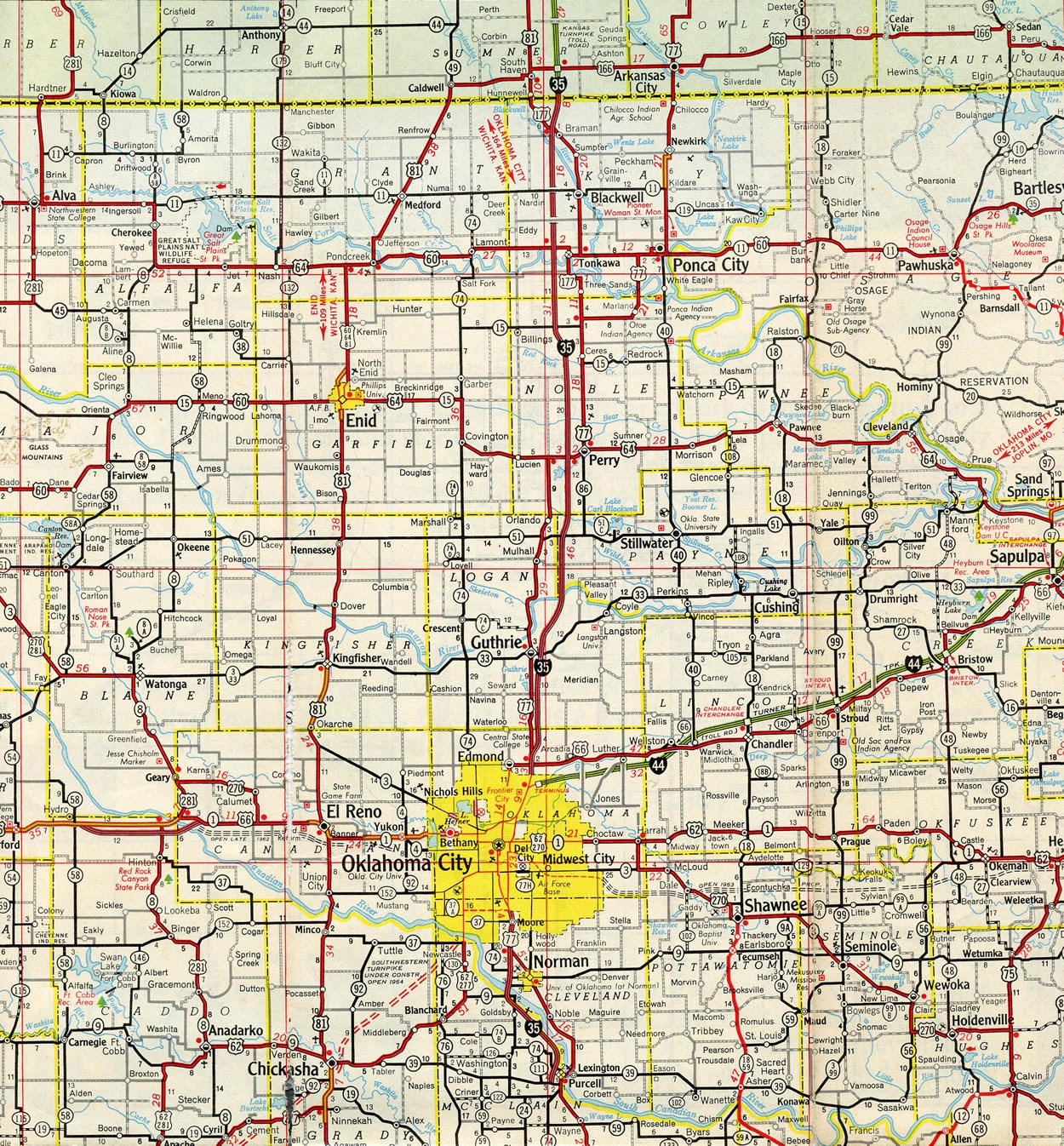
Leaving the Lone Star State behind, Interstate 35 travels north to Ardmore and the scenic Arbuckle Mountains ahead of Pauls Valley. The freeway continues to Norman, home of the University of Oklahoma, and Moore, a south suburb of Oklahoma City. Once in OKC, I-35 overlaps with I-40 to the southeast of Downtown and with I-44 from Lake Aluma to Lake Arcadia. The freeway advances from Edmond and the northern suburbs along a rural course to Perry and the Cimarron Turnpike (U.S. 412).
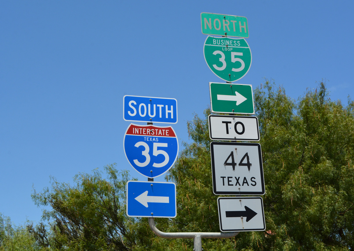
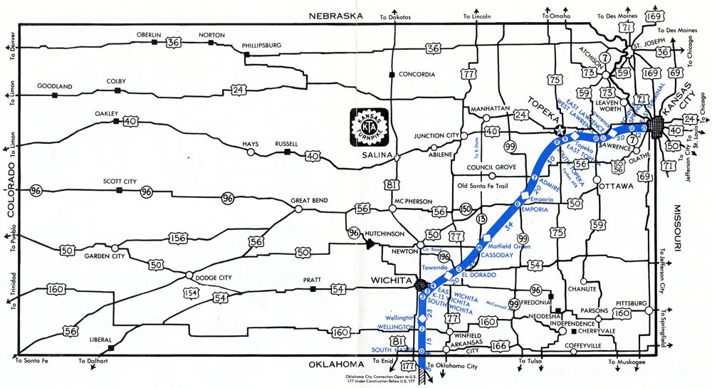
Paralleling U.S. 77, then U.S. 177, I-35 crosses into Kansas north of Blackwell. A 123 mile long section of Interstate 35 through southern Kansas overlays the Kansas Turnpike. The toll road extends north from near the Oklahoma state line to Emporia. The remainder of the turnpike northeast to Kansas City includes all of I-335 and portions of I-470 and I-70.
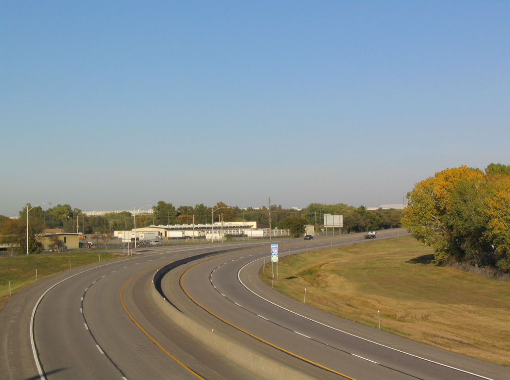
Most of the Kansas Turnpike is characterized by four lanes with a concrete barrier separating the north and southbound roadways. This view looks northeast at I-35 from the trumpet interchange with Interstate 135 north into Wichita. 10/20/03
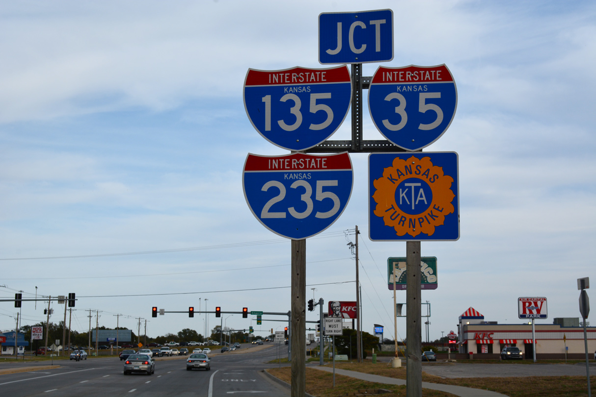
The northern heading of Interstate 35 shifts northeastward at Wichita, with Interstate 135 (Former I-35W) branching northward to Salina and I-70. I-35 remains along the tolled Kansas Turnpike northeast to El Dorado and across the Flint Hills to Emporia, where it splits for an easterly route via Ottawa and Olathe. Turning more northeast, I-35 progresses through Overland Park, Shawnee and other suburban cities to Kansas City, Kansas and Downtown Kansas City, Missouri.
I-29, I-35, I-70 and I-670 come together to encircle the central business district of Kansas City. These routes form an inner belt, and the exits along the route are all numbered 2 with a suffix. This is known as the Alphabet Loop, as lettered suffixes are used from 2 A through 2 Y except for the letters I and O. I-35 briefly overlaps with I-70 on the north side of Downtown and with I-29 from the split with I-70 to Avondale.
Heading away from Kansas City, Interstate 35 remains suburban to Liberty and the split with U.S. 69. A signing anomaly takes place along this stretch as Missouri Route 110, the Chicago Kansas City Expressway, takes precedence on confirming markers posted along the freeway mainline from Interstate 435 northward to Cameron. This MoDOT signing practice also takes place along I-70 where it overlaps with U.S. 24/40 in Kansas City and on I-44 where it overlaps with U.S. 50 to the southwest of St. Louis. Interstate markers are omitted from shield assemblies on the mainlines of all three overlaps.
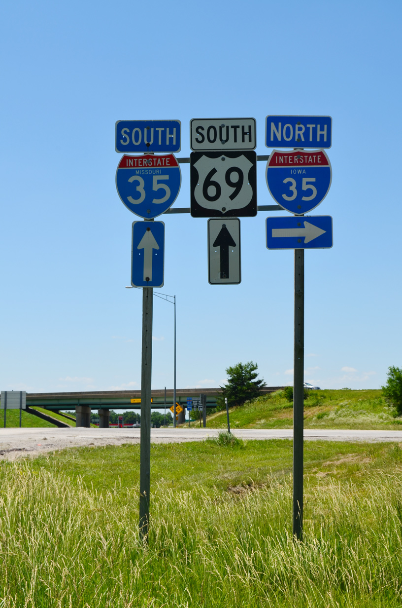
The terrain becomes hilly as Interstate 35 advances northward to Bethany. Crossing the Iowa state line continues by Lamoni to Osceola and the capital city of Des Moines. I-35 combines with I-80 to the west and north of the city while Interstate 235 loops east to Downtown. I-35 exits the Des Moines area northward via Ankeny, Ames – the home of Iowa State University, and Mason City.
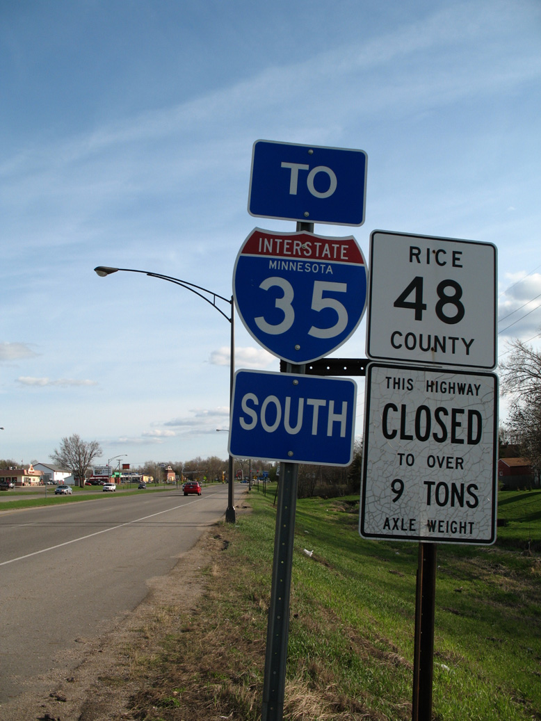
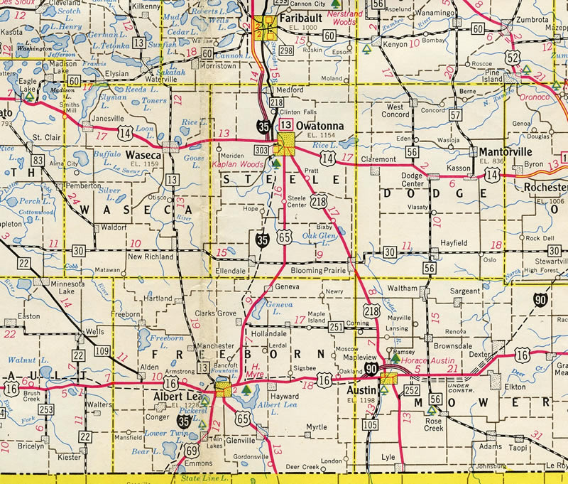
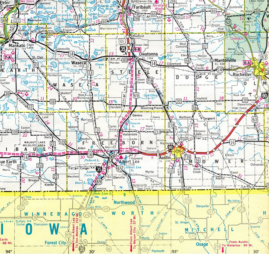
The Avenue of the Saints Corridor, Iowa 27, accompanies I-35 north from U.S. 18 and Clear Lake into southern Minnesota. A short distance beyond the state line is Albert Lea and the crossroads with Interstate 90. The rural freeway extends north from there to Owatonna, Faribault and the Minneapolis-St. Paul area.
Like Dallas-Fort Worth in Texas, Interstate 35 again partitions into separate branches. I-35W stays northward from Burnsville to Bloomington, Downtown Minneapolis, Mounds View and Lino Lakes while I-35E continues the I-35 exit numbers northeast to Apple Valley, St. Paul, White Bear Lake and Centerville. The remainder of I-35 extends northward from near Forest Lake to Hinckley, Moose Lake and the Twin Ports of Duluth and Superior, Wisconsin.
Proponents of the I-35 Corridor refer to it as the “real” NAFTA (North American Free Trade Agreement) highway, since the proposed NAFTA Highway (Interstate 69) is currently incomplete. I-35, together with I-29, provides a direct freeway connection between Mexico and Canada. Interstate 35 concludes at Duluth, Minnesota, 148 miles southwest of the Canadian line, nearly affording it border-to-border status from Laredo, Texas.
High Priority Corridor
Interstate 35 in its entirety is part of High Priority Corridor 23: Interstate Route 35 Corridor.
 Parallel U.S. Routes
Interstate 35 replaced all of U.S. 81 from Laredo north to Hillsboro (I-35W replaced U.S. 81 northward to Blue Mound and Wautaga). The southernmost 18 miles doubles as U.S. 83 as well. Overlaps further north include U.S. 190 between Belton and Temple, U.S. 77 from Waco to Hillsboro (I-35E maintains an unsigned overlap with U.S. 77 northward through Dallas) and U.S. 77 again from Denton to Exit 1 in Oklahoma. U.S. 77 parallels or overlaps with I-35 through Oklahoma to Tonkawa. Shorter overlaps also exist in the Sooner State with U.S. 70 and U.S. 64.
U.S. 81 rejoins the Interstate 35 corridor from South Haven to Wichita in southern Kansas. Where I-35 leaves the Kansas Turnpike, U.S. 50 takes over as the parallel highway or cosigned route. The pair head east from Emporia to Interstate 435, where U.S. 50 parts ways for Lees Summit, Missouri. U.S. 56 east from Gardner and U.S. 169 north from Olathe also join I-35 northward to Overland Park. There U.S 69 briefly forms a four way overlap with the freeway before U.S. 56 & 169 separate for Shawnee Mission Parkway at Merriam. U.S. 69 follows suit and parts ways for the 18th Street Expressway north into Kansas City.
U.S. 24, U.S. 40, U.S. 71 and U.S. 169 tie into the Alphabet Loop at various locations. Heading north from there, U.S. 71 accompanies the I-29/35 overlap, staying with Interstate 29 to St. Joseph. This leaves I-35 to travel solo briefly before U.S. 69 rejoins the corridor from Claycomo north to Osceola, Iowa and again from Des Moines to Blairsburg.
U.S. 18 overlaps with I-35 at Clear Lake. Northward into Minnesota, U.S. 65 and U.S. 69 come to separate ends at Albert Lea. U.S. 69 ends at Minnesota Trunk Highway 13 (former U.S. 16) west of Downtown while U.S. 65 ends at I-35 south of Interstate 90. U.S. 65 historically ran north along what is now I-35 to Minneapolis. Another truncated route, U.S. 8, paralleled / overlapped with I-35W from Downtown Minneapolis to Forest Lake. The route now begins at I-35, one exit south of the truncated end of U.S. 61. Historic U.S. 61 lines the I-35 corridor northward from Wyoming to Duluth.
Split Routes
Until 2013, when IH 69C and IH 69E were established, the only two remaining split routes (route numbers with a letter suffix indicating direction) in the Interstate Highway System were the Interstate 35 branches through Dallas/Ft. Worth and Minneapolis/St. Paul. The other suffixed route along I-35, Interstate 35W between Wichita and Salina, was replaced with Interstate 135 in 1976.
An American Association of State Highway Officials (AASHO) study to eliminate cardinal initials on Interstate Routes offered recommendations for Interstate 35 on January 18, 1973:16
Dallas – Fort Worth Area
Changes were made in September 1971, relocating IH 20 south of Downtown Fort Worth and Dallas, and extending IH 30 west over what was IH 20 through Fort Worth. Recommendations to eliminate cardinal initials on IH 35:
- Renumber IH 35E north from the split with IH 35W at Hillsboro to Dallas as a southwestern extension of IH 30.
- Renumber IH 35E north from Dallas to Denton as a northwestern extension of IH 45.
- Renumber all of IH 35W as IH 35.
- Renumber IH 635 around Dallas as IH 645
- Renumber IH 30 from west of Fort Worth to Downtown Dallas as either IH 230 or IH 245.
Wichita / Salina, Kansas
The recommendation for I-35W between Wichita and I-70 northwest of Salina, outlined renumbering the 95.7 mile long route as I-31. I-235, the freeway loop around Wichita, was recommended for renumbering to I-231.
Minneapolis – St. Paul Area
The reasonable solution advocated for the Twin Cities specified renumbering one of the routes as a loop. This was due to the more complicated alignment and geometrics along I-35W when compared to I-35E. Recommendations called for renumbering I-35W as I-235 and I-35E as Interstate 35. It was believed that I-35E was the more direct and less confusing route for through traffic. An additional suggestion was to combine I-494 and I-694 into a single belt route.
History
Within Texas, Interstate 35 was an original Interstate Highway, and it was approved by the Texas State Highway Commission in 1962 with 492 miles (this figure includes both IH 35E and IH 35W).7 The segment of Interstate 35 through Austin was completed in 1962.
Within Oklahoma, the first section of Interstate 35 opened to traffic was the four mile link from U.S. 177 / Exit 232 north to the Kansas Turnpike. This connection opened on April 22, 1958, and it was considered to be the first Interstate highway to cross state lines and connect to another state.9
Interstate 35 through the Ardmore, Oklahoma area in Carter County was reconstructed in a two phase project. The first phase affected seven miles of I-35 from a point seven miles north of U.S. 70 to the Murray County line (Exits 40 to 47). This portion of the overall 12 mile long project was completed in Fall 2003. The second phase of the project began ran throughout 2004.1
IH 35/U.S. 77 south of SW 19th Street in the city of Moore. This stretch of freeway was completed on July 31, 1967. 05/10/22
Further north in Oklahoma, a long term widening and reconstruction project for Interstate 35 entered its final phase in 2003. 14 months of construction expanded a 1.5 mile segment between SE 82nd Street and SE 66th Street in Oklahoma City. The new travel lanes were built within the median of the existing right of way. This stretch of freeway accommodated 74,000 vehicles per day (vpd) at the time. Upon completion, the $23 million project concluded the overall I-35 widening from the city of Norman northward to Interstate 40 in Oklahoma City.2
Route Information
Mileage
Texas – 504.15*
Cities – Laredo, Pearsall, San Antonio, Austin, Georgetown, Temple, Waco, Hillsboro, Waxahachie, Dallas, Denton, Gainesville
Junctions –


Oklahoma – 235.96**
- Cities – Ardmore, Pauls Valley, Norman, Oklahoma City, Guthrie, Perry
- Junctions –
Kansas – 235.51
Cities – Wichita, Emporia, Ottawa, Olathe, Kansas City
Junctions –
Missouri – 114.74***
Cities – Kansas City, Cameron
- Junctions –
Iowa – 218.33#
Cities – Des Moines, Ames
- Junctions –
Minnesota – 259.69##
Cities – Albert Lea, Owatonna, Faribault, St. Paul, Duluth
Junctions –
Source: December 31, 2021 Interstate Route Log and Finders List
* – 2.39 miles on I-10, 96.95 miles on I-35E
** – 1.53 miles on I-40, 4.37 miles on I-44
*** – 1.00 mile on I-70, 5.50 miles on I-29
# – 14.29 miles on I-80
## – 39.23 miles on I-35E
I-35 in Oklahoma was named the Raymond Gary Expressway per state legislation in 1957 after the Governor in office at the time (1955-59). Signs were taken down by the time Gary’s predecessor J. Howard Edmonsdon took office and few know of the designation today.14
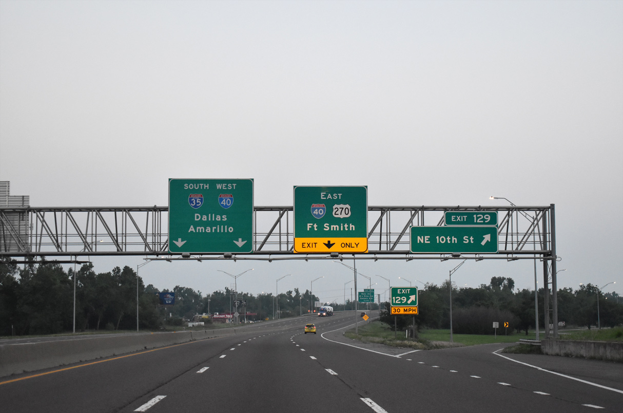
IH 35 south at NE 10th Street in Oklahoma City. The succeeding exit is where IH 35 combines with IH 40/U.S. 270 west toward Downtown. 05/09/22
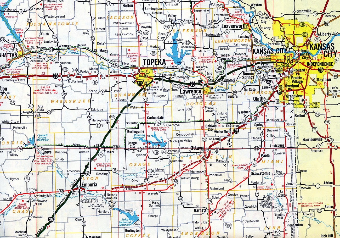
Interstate 35 replaced U.S. 50 between Emporia and Olathe
Interstate 35 was built from Ottawa northeast to Kansas City during the late 1960s.6
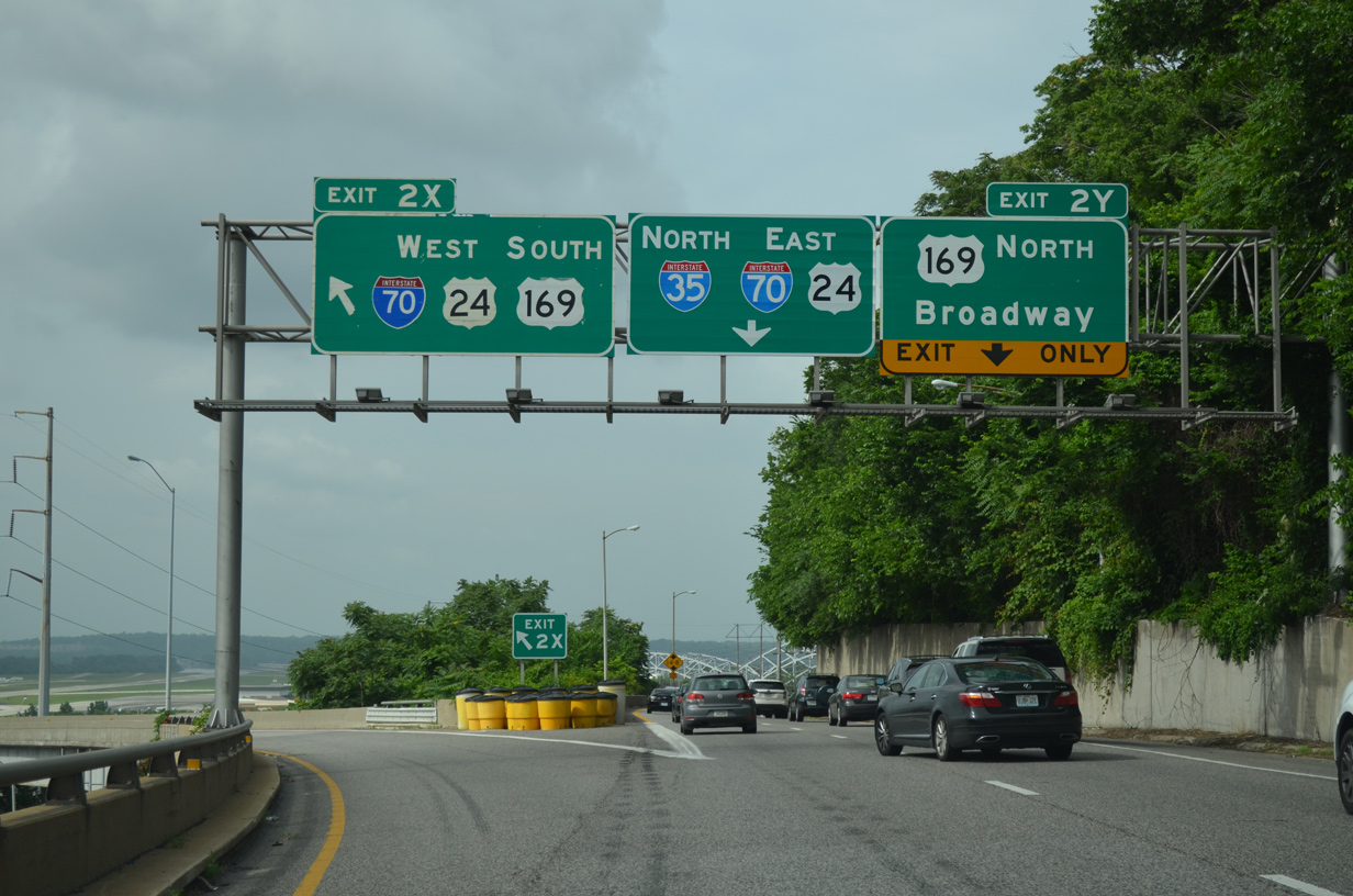
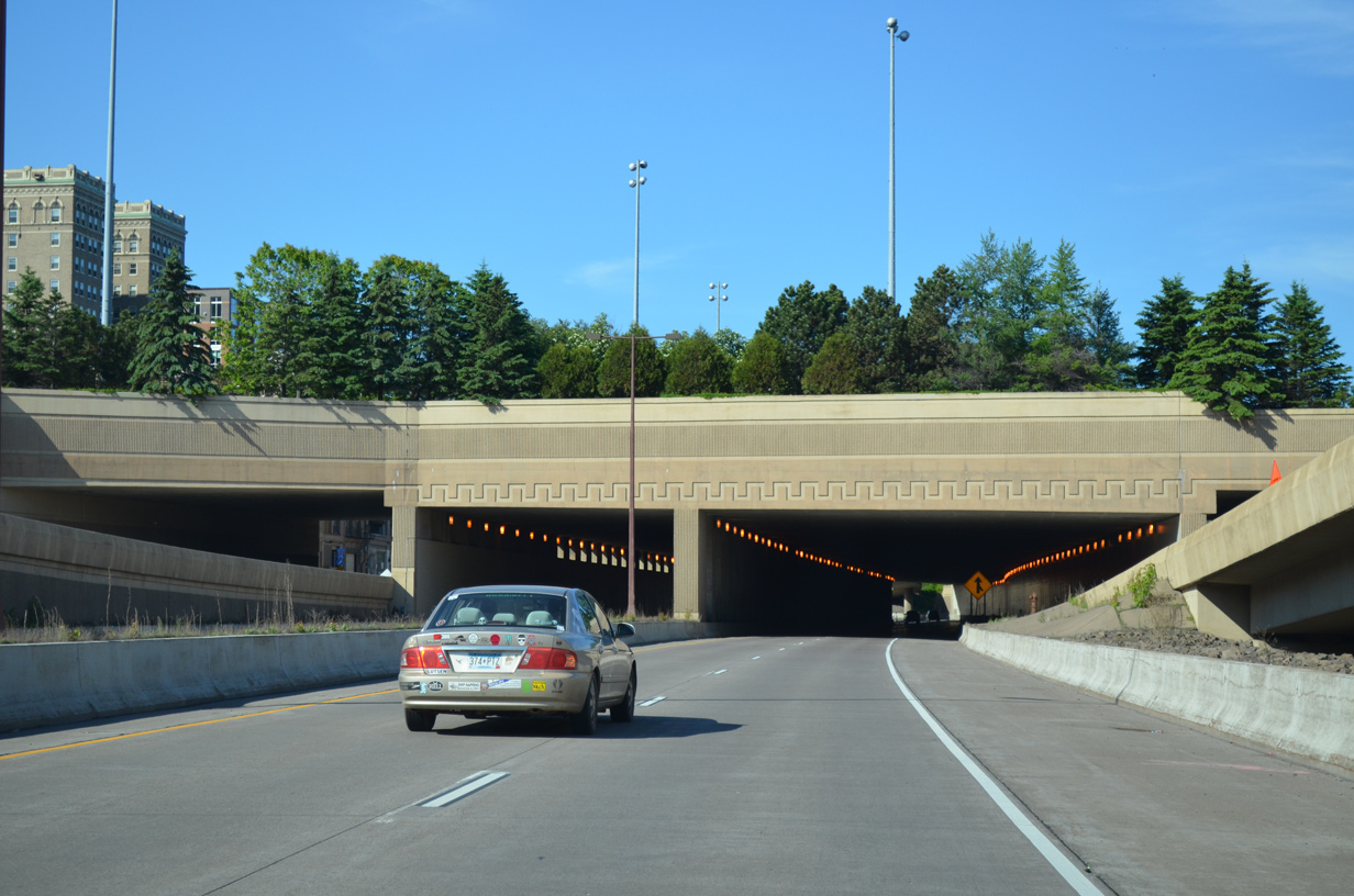
Encircling Downtown Kansas City, I-35 follows the west leg of the Alphabet Loop along Quality Hill and the north leg alongside I-70/U.S. 24-40. 06/18/15
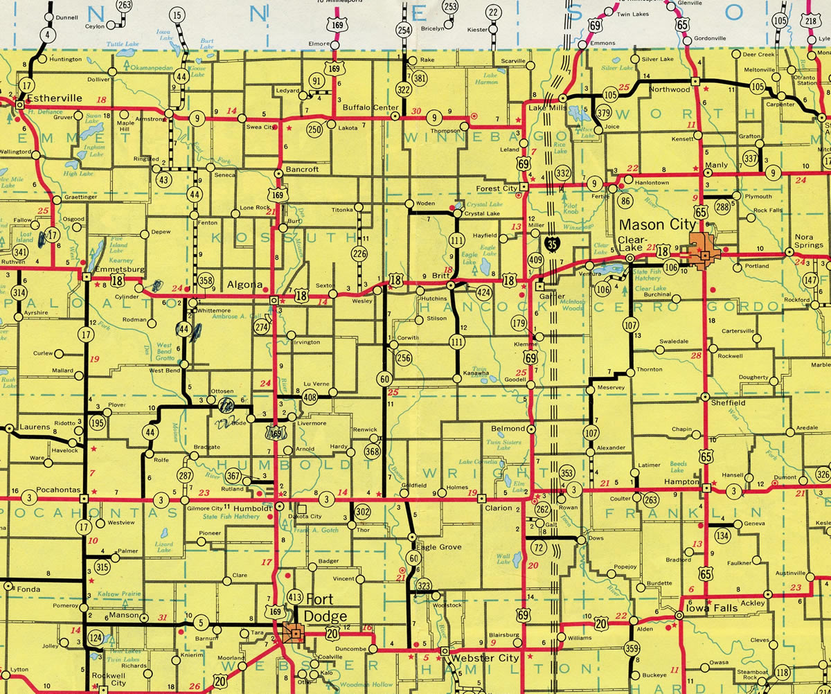
Due to the efforts by Mason City officials, the planned alignment of Interstate 35 shifted eastward to run closer to U.S. 65 from Latimer to Clear Lake on September 1, 1965. This included a reroute northeast through Wright and Franklin Counties across what was known as the “Mason City Diagonal.” The alignment shift was contested by area farmers with litigation. This delayed construction until 1972.15
Early Interstate system maps show I-35 proposed along the U.S. 69 corridor from Iowa to an overlap with I-90 across Albert Lea.
The overlap between I-35 and I-90 was no longer proposed by 1964, with I-35 realigned to the southeast of Albert Lea. Another change was made by 1965 when I-35 was relocated again to run south midway between U.S. 65 and U.S. 69, coinciding with changes along the corridor made in Iowa.
Interstate 35 had the following highlights in its Kansas history:6
- U.S. 24, U.S. 40, U.S. 69, U.S. 75 (Topeka to Nebraska), and U.S. 81 were first considered as potential Interstate routes by Kansas on June 5, 1945. A subsequent submission by the Kansas State Highway Commission on May 22, 1946, resulted in three primary routes to be considered by the federal government: Route 1 (today’s I-70), Route 2 (today’s I-35), and Route 3 (today’s K-66; I-44 avoids the Sunflower State).
- The section of Interstate 35 that overlays the Kansas Turnpike was constructed in 1955 and 1956, with the entire turnpike opening on October 21, 1956.
- The portions of the Kansas Turnpike that carry I-35, I-70, and I-470 were approved as part of the Interstate Highway System by the Federal Highway Administration (FHWA) in 1957. Interstate 335 was designated for the remaining unnumbered section of the Kansas Turnpike in 1987.
- I-35 was designated by AASHO on August 14, 1957, as an original Interstate Highway from Laredo north to Duluth.
- During the late 1960s, most of Interstate 35 (Kansas) from Ottawa to Kansas City (excluding the segment around Emporia) was constructed and opened to traffic.
- The ten mile section of I-35 east from the Kansas Turnpike around Emporia opened to traffic in 1974. Interstate 35 was complete in Kansas at that time.
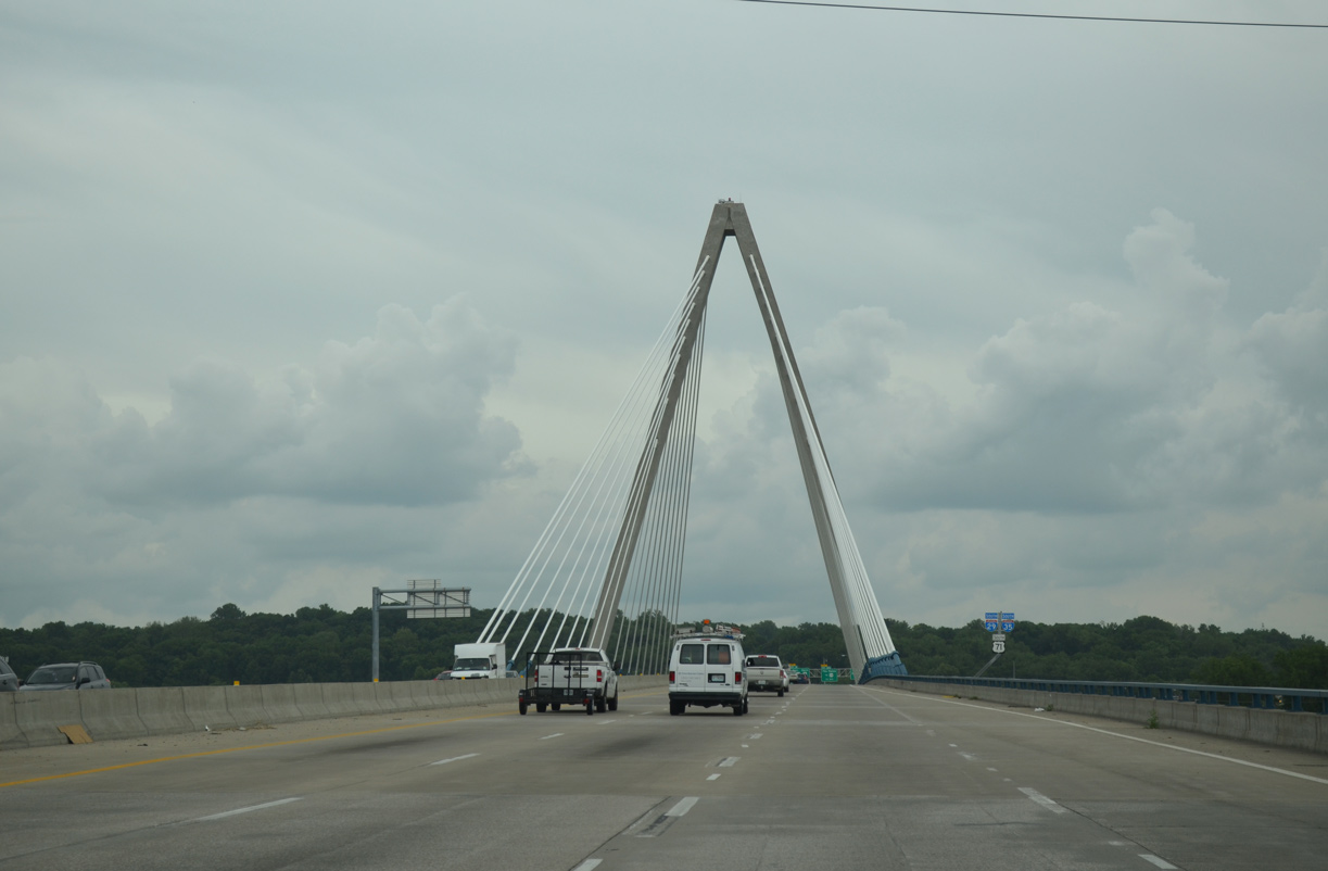
I-29/35-U.S. 71 south cross the Missouri River in Kansas City over the Christoper S. Bond Bridge. 06/18/15
Within Kansas City, Missouri, the Paseo suspension Bridge over the Missouri River was replaced by a seven-lane cable stay bridge. Named the Christopher S. Bond Bridge, construction began on April 21, 2008. The span cost $245 million, of which $195 million was derived from Missouri Amendment 3 and $50 million from federal SAFETEA-LU funds. The Interstate 29/35 Connections Project was mostly finished in December 2010, when the Missouri Department of Transportation (MoDOT) opened all ramps and lanes on the new bridge. This was accomplished on budget and six months ahead of schedule. Touch-up work however continued to July 3, 2011, when the multi-colored LED lighting system went operational.13
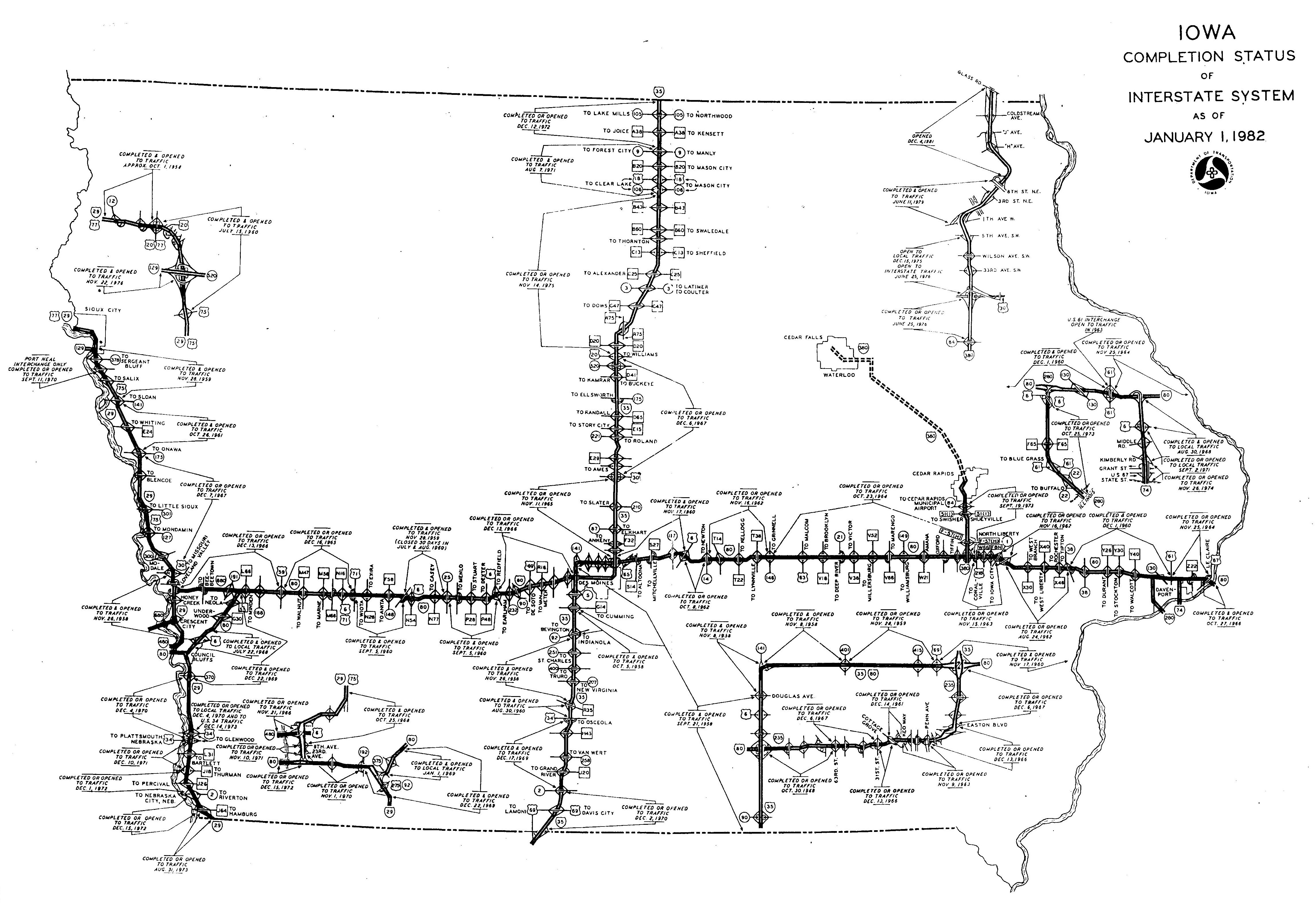
Interstate 35 opened in Iowa during phases between 1958 and 1975.4 5
- Missouri state line to Iowa 2: December 2, 1970
- Iowa 2 to U.S. 34: December 17, 1969
- U.S. 34 to Iowa 152: August 30, 1960
- Iowa 152 to Iowa 92: November 26, 1958
- Iowa 92 to County Route G-14: October 5, 1958
- County Route G-14 to Douglas Avenue: September 21, 1958
- Douglas Avenue to Exit 131, Merle Hay Road: November 9, 1958
- Exit 131, Merle Hay Road to U.S. 69 (Exit 136): November 26, 1958
- U.S. 69 (Exit 136) and I-235 South and I-80 East: November 17, 1960
- Interstate 80 to U.S. 30: November 11, 1965
- U.S. 30 to U.S. 20: December 6, 1967
- U.S. 20 to Iowa 106: November 14, 1975
- Iowa 106 to Iowa 9: August 7, 1971
- Iowa 9 to Minnesota state line : December 12, 1972
Within Minnesota, the first section of Interstate 35 to open was between Owatonna and Medford in 1958. The last section of Interstate 35E through St. Paul, Minnesota, opened to traffic on October 15, 1990.8
Interstate 35 through Duluth concludes after a series of cut and cover tunnels at what was the largest public works project in northeastern Minnesota. This stretch of freeway was proposed in 1958 by the Federal Highway Administration. It extended I-35 3.2 miles to the East End residential district of Duluth, but not the Two Harbors Expressway as originally envisioned. The cut back from the Expressway as approved by a residential vote,11 allowed $55 million in funds to be used for bridge and road work in Downtown Duluth. The initial 1.4 mile stretch of the $200-million12 extension opened on October 29, 1987.10 It includes the 500 foot long Lakeplace Park tunnel.11
Interstate 35 was again extended on November 21, 1989, when an 18-block section of the freeway opened. Included on this stretch are 600 foot and 700 foot long tunnels. The trenched freeway design of I-35 using tunnels spared the historic Fitger’s Brewery, two other historic buildings and the rose garden in Leif Erikson Park.11
A ribbon cutting ceremony finalized the 3.2 mile Duluth Extension of I-35, when the 36-block section of freeway was finally completed on October 28, 1992. Capping 11 years of construction, the fourth tunnel (Leif Erikson Tunnel) in Duluth opened to traffic as Minnesota’s second longest tunnel. The tunnel passes under Leif Erikson Park at a total length of 1,480 feet (which is 12 feet shorter than the Lowry Tunnel on I-94 in Minneapolis). The I-35 Extension won the Federal Highway Administration’s 1991 Excellence in Highway Design award.12
Also within the state of Minnesota, Interstate 35 between Minneapolis and Duluth is designated the “Red Bull Division Highway.” The legislation for the memorial was approved in 2000.3
North End  – Duluth, Minnesota
![]() North at
North at ![]()
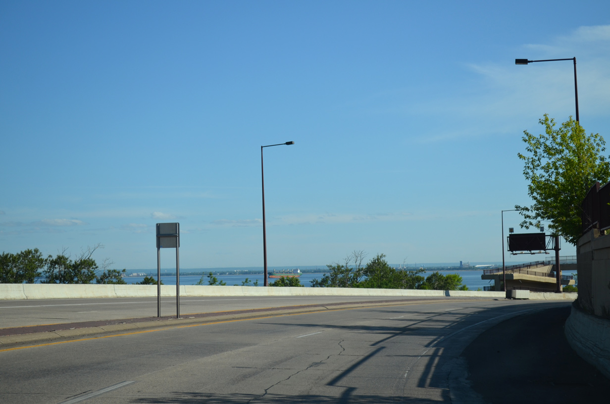
Ramps from the SPUI with Lake Avenue connect with Interstate 35 at the first of four tunnels along the Duluth lakefront. The freeway passed below Lake Place park here. 06/14/15
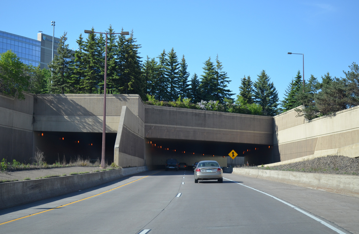
A flyover ramp ties into Interstate 35 north from parallel Michigan Street as the freeway enters a tunnel below Superior Street and the Fitger’s Complex. 06/14/15

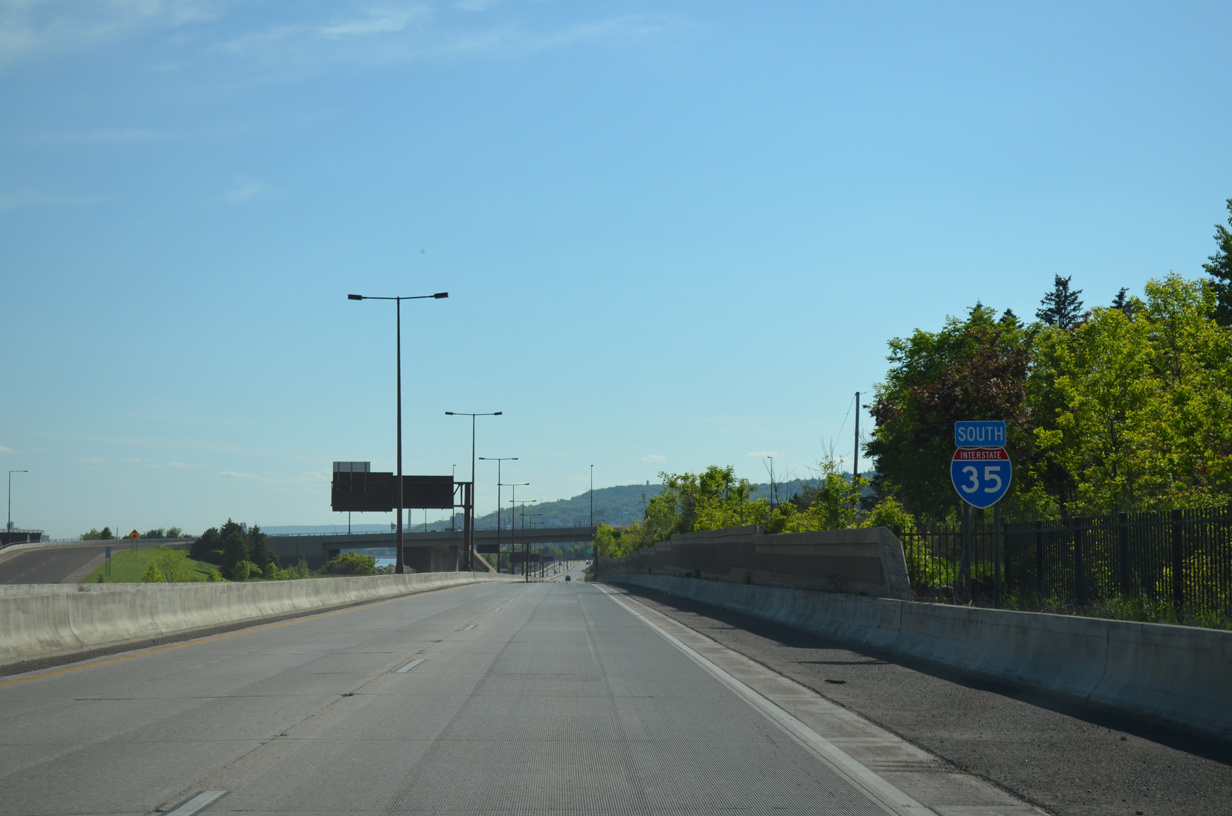
The last northbound reassurance marker stands one mile south of the half diamond interchange (Exit 258) with 21st Avenue East. A third tunnel takes the freeway below Superior Street at North 8th Avenue and Jay Cooke Plaza. 06/14/15

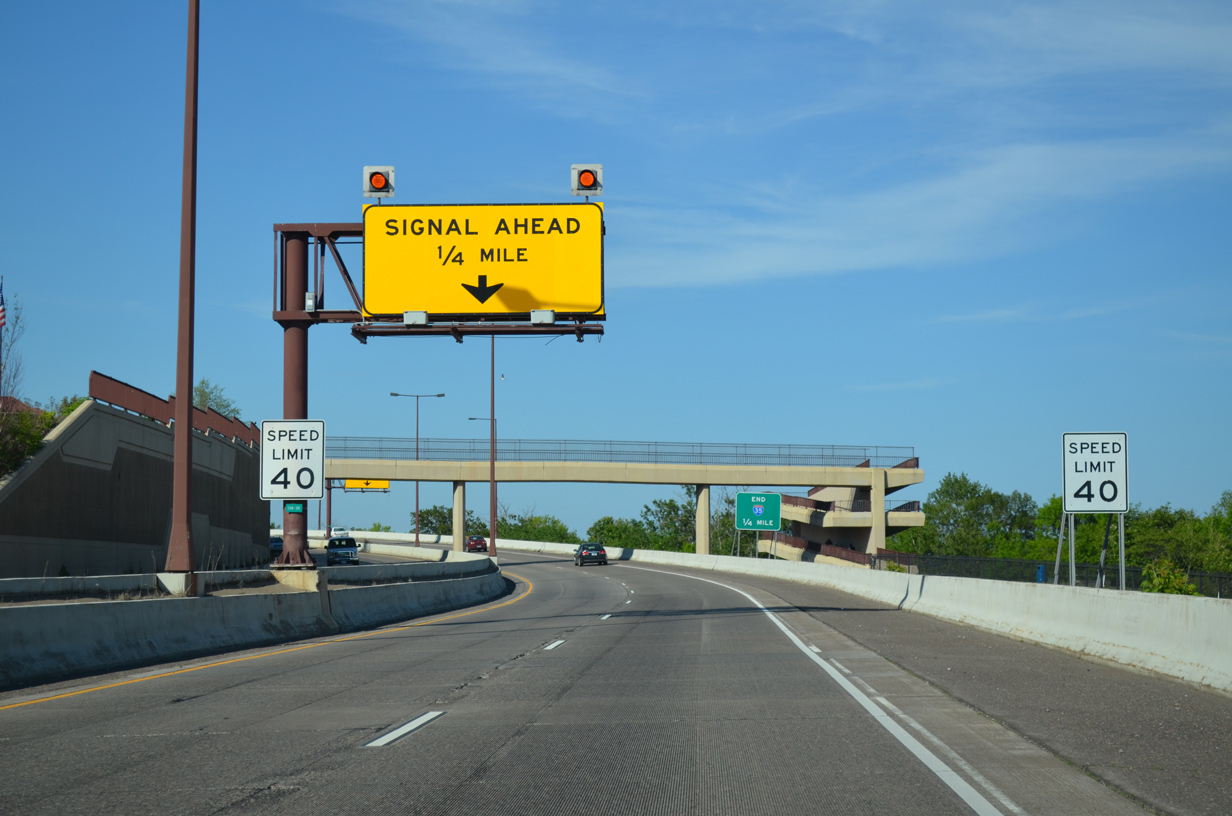
The final tunnel along northbound kinks I-35 eastward below London Road, Leif Erikson Park and The Rose Garden. 06/14/15
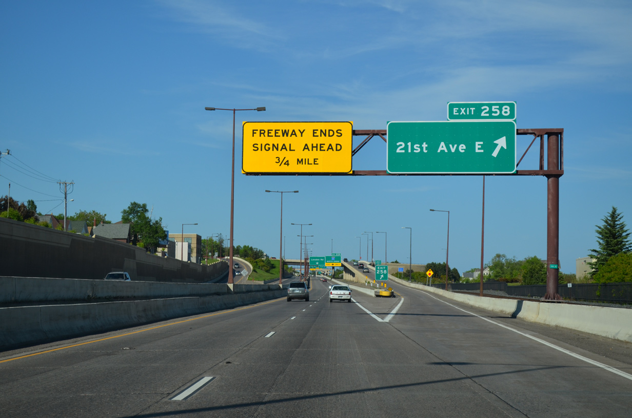
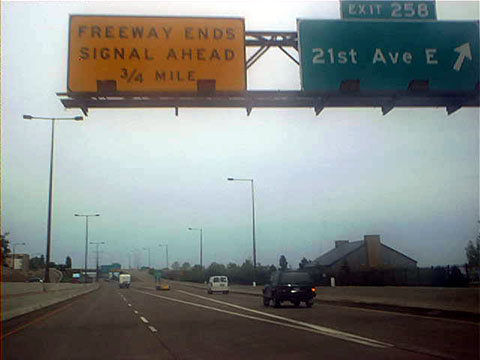
Exit 258 parts ways with Interstate 35 north for 21st Avenue East. 21st Avenue East spans I-35 to the Beacon Pointe Resort and The Ledges community along Lake Superior and west to Woodland Avenue through the Duluth residential street grid. 06/14/15

London Road, the former alignment of U.S. 61, parallels Interstate 35 one block to the west to the northern terminus of the freeway. MN 61 lines the road north from there to the North Shore. 06/14/15
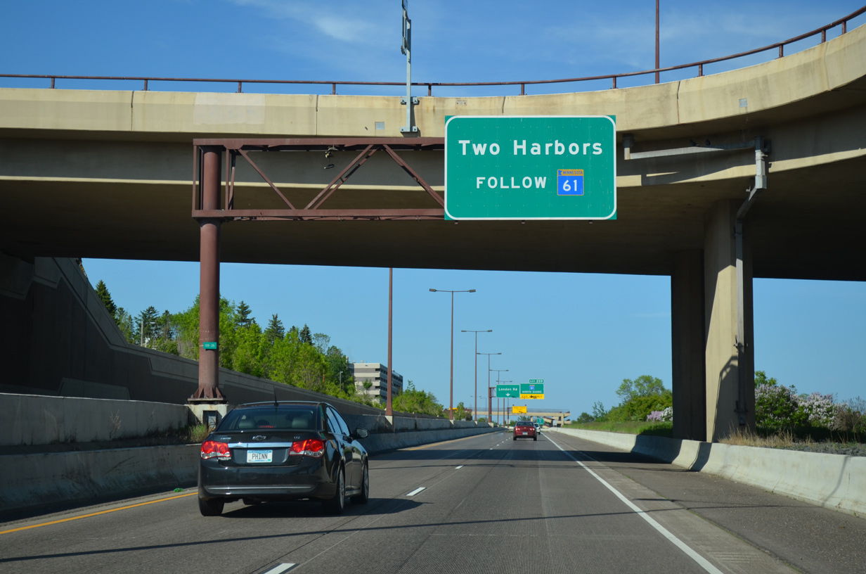
MN 61 follows old U.S. 61 northeast 24 miles to the city of Two Harbors. The trunk highway constitutes an expressway from north Duluth to the Lake County seat. 06/14/15
A pedestrian bridge crosses over I-35 between Edgewater Resort & Waterpark and The Lakewalk, one quarter mile south of the signalized end of Interstate 35 at London Road. 06/14/15
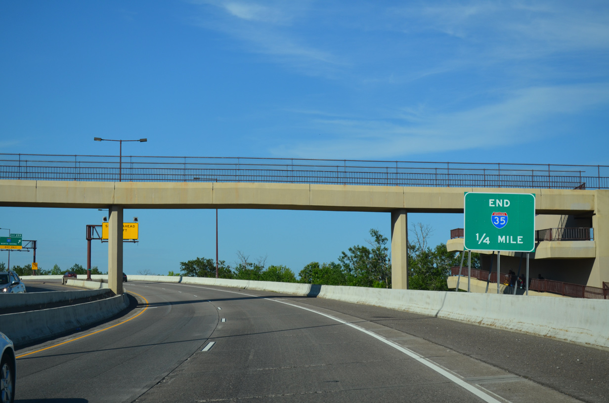
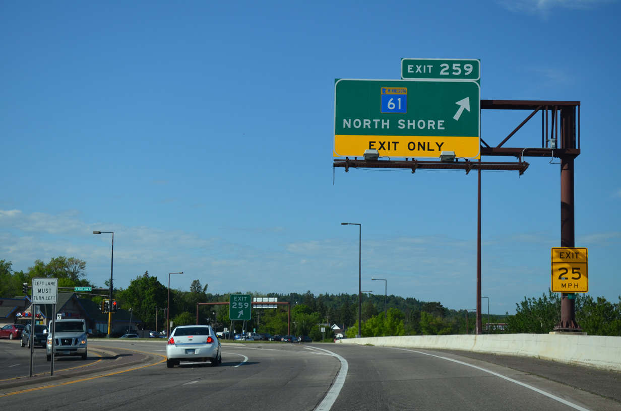
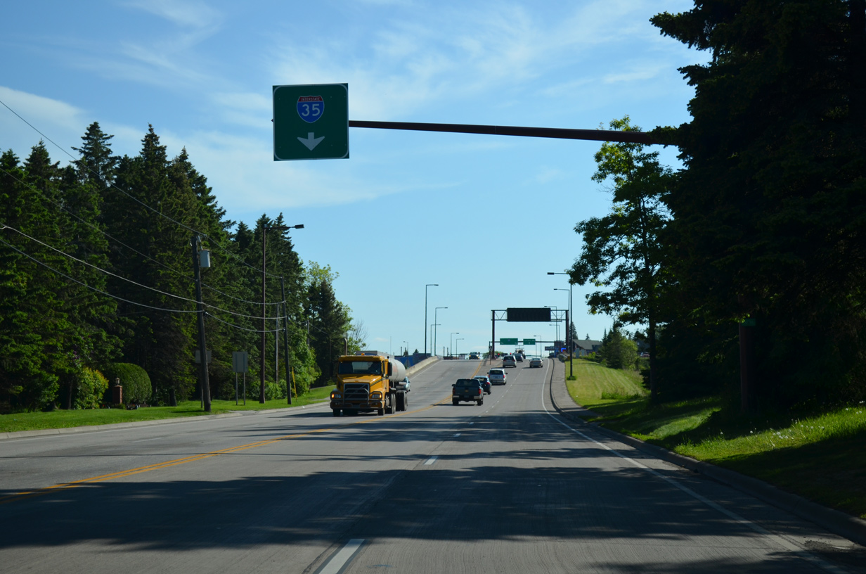
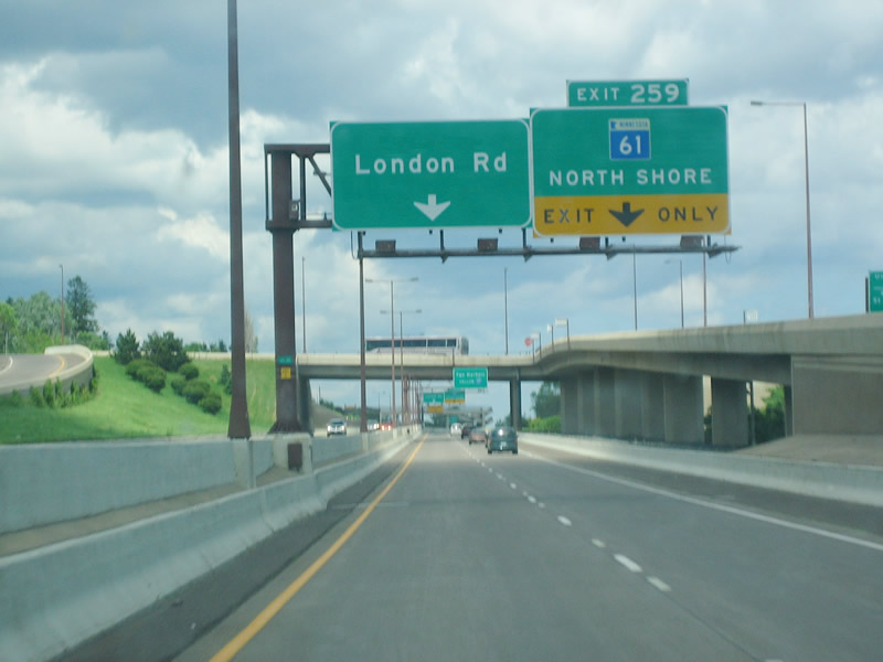
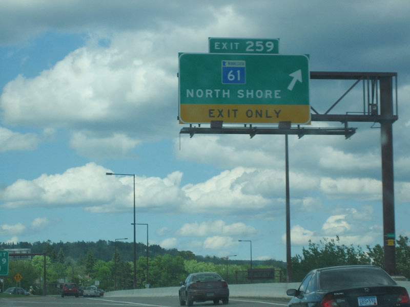
An end sign for Interstate 35 precedes the Exit 259 turn onto MN 61 (London Road) north. 06/14/15
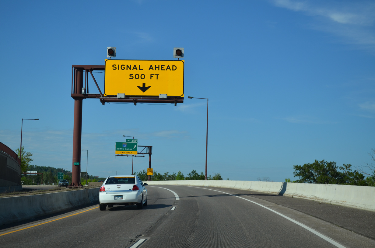
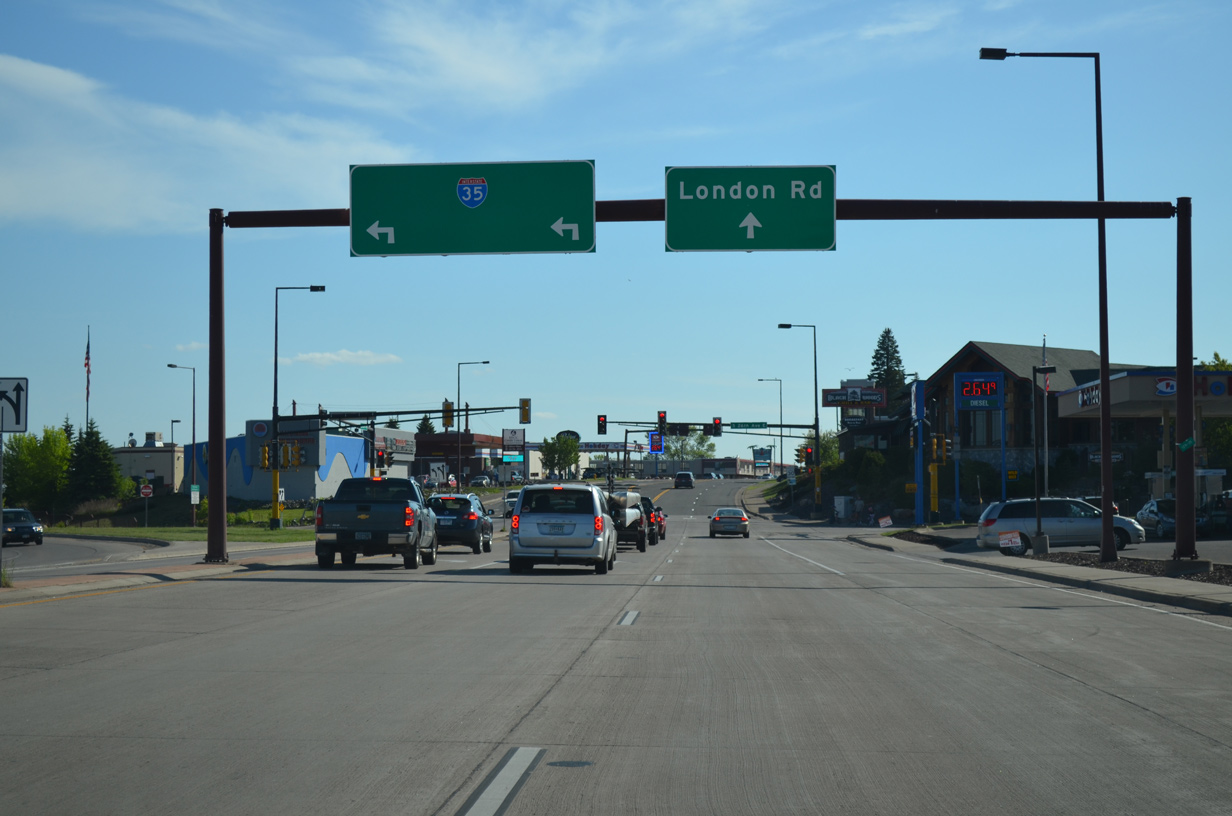
Curving north, motorists approach the commercialized intersection with 26th Avenue E and London Road. 06/14/15
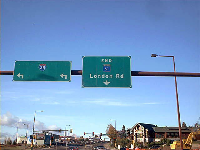
MN 61 commences a 149-mile route to Grand Portage and the Canadian border as I-35 ends. Connections with Kings Highway 61 lead motorists north to Thunder Bay, Ontario.
The trunk highway replaced U.S. 61 when it was decommissioned in 1991. 06/14/15
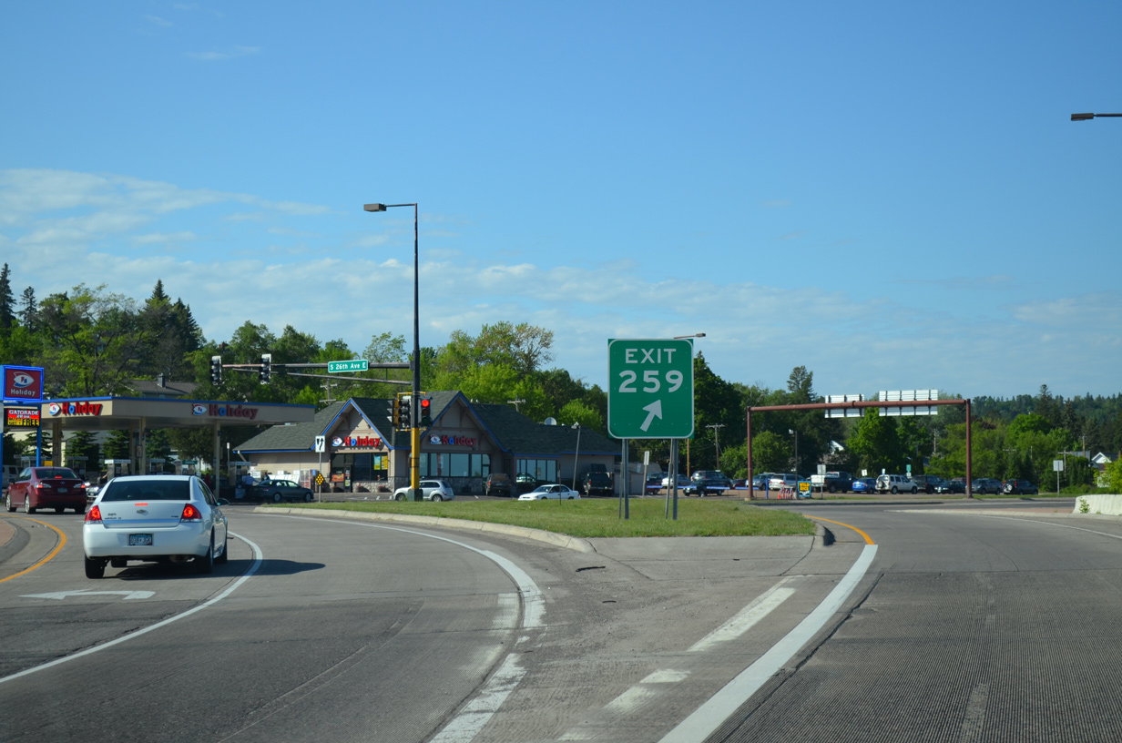
Exit 259 consists of just a free flow right turn lane onto MN 61 (London Road) north. 26th Avenue E stems northwest from the freeway end to E 8th Street while London Road south forms a commercial boulevard leading southwest. 06/14/15
![]() South at
South at ![]()
MN 61 (London Road) expands to four lanes south of 32nd Avenue E on the approach to Interstate 35. The boulevard rises above The Lakewalk to intersect the freeway beginning at 26th Avenue E. 06/14/15
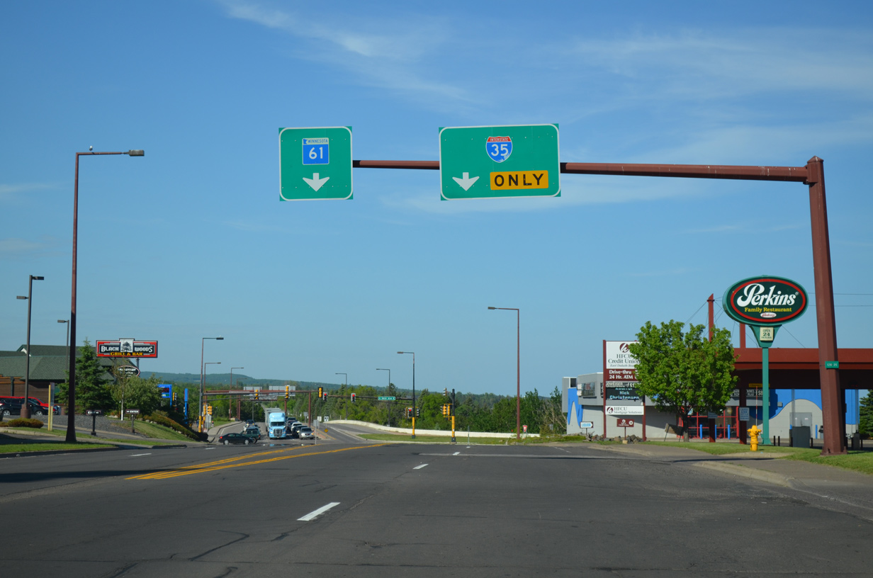
A dual turn lane connects the ending MN 61 with the southbound beginning of Interstate 35 London Boulevard continues along the former U.S. 61 alignment as a commercial boulevard toward Downtown Duluth. 06/14/15
London Road north at ![]()
![]()
London Road parallels Interstate 35 north from Leif Erikson Park to the northern terminus at 26th Avenue E. MN 61 begins and lines London Road from here to Congdon Boulevard at the Lester River. 06/14/15
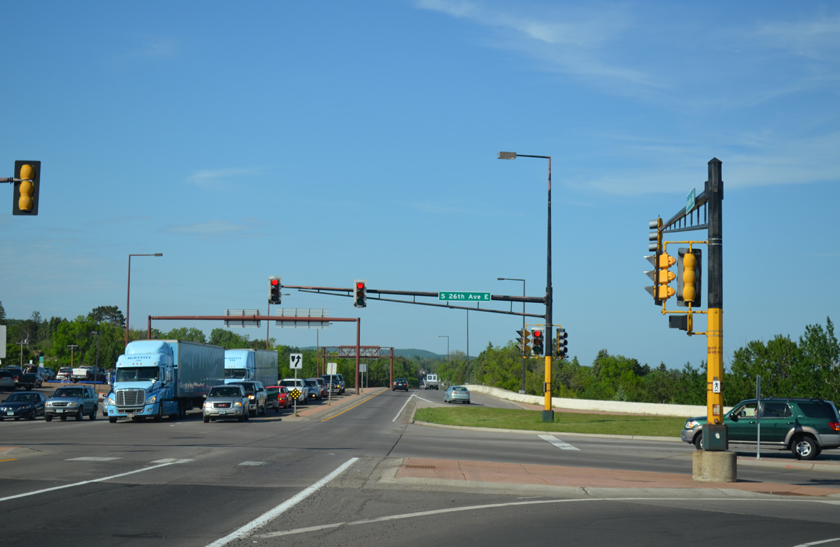
A lane drop defaults motorists onto Interstate 35 south back toward Downtown Duluth as London Road intersects South 26th Avenue E. 06/14/15
![]() South of
South of ![]()
Interstate 35 curves away from London Road and MN 61 to run along side The Lakewalk and Lake Superior. 06/14/15
The first reassurance marker for Interstate 35 south. 21st Avenue E passes overhead in the distance. 06/14/15
North End Throwback
The signs at the 21st Avenue E off-ramp (Exit 258) were replaced by 2008. Lighting fixtures were also removed. Photo by Don Greiskalns (05/01).
Exit 258 rises to intersect 21st Avenue N as I-35 defaults to MN 61 and London Road. This set of overheads was replaced after 2008. Lighting fixtures were also removed. Photo by Patrick Lilja (07/03/05).
Replaced guide sign for MN 61 (London Road) and Exit 259 at the northern terminus of Interstate 35. Photo by Patrick Lilja (07/03/05).
The end sign for MN 61 posted at the turn for Interstate 35 south was replaced by 2008. Photo by Don Greiskalns (05/01).
South End – Laredo, Texas
![]()
![]() South at
South at ![]()
![]()
The last reassurance marker for Interstate 35 south is posted at the Jefferson Street under crossing. 09/27/07
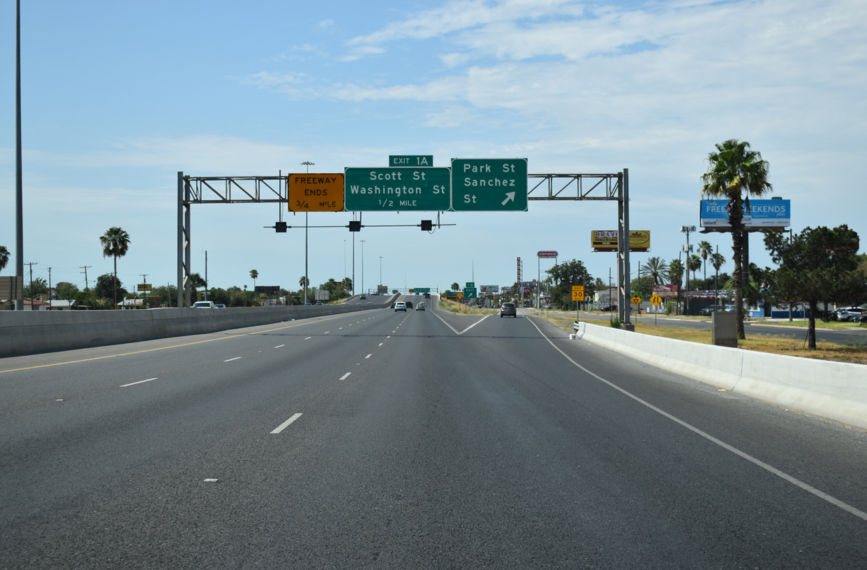
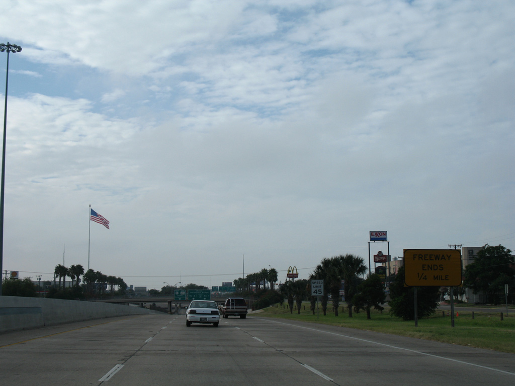
The second to last southbound exit from Interstate 35 departs for Park and Sanchez Streets by the Laredo Civic Center. The freeway ends in 0.75 miles. 08/04/19
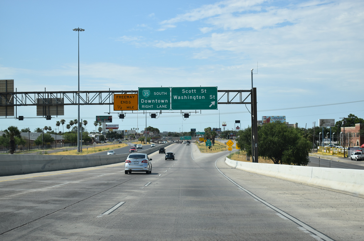
Exit 1A follows onto adjacent Santa Ursula Avenue for Scott and Washington Streets. Washington Street connects IH 35 with Laredo State University while forthcoming Business Loop I-35 links the freeway end with Downtown. 08/04/19
Three southbound lanes continue past Exit 1B as IH 35 drops below grade at Scott Street. Speed limits reduce to 45 miles per hour as the freeway concludes in one quarter mile. 09/27/07
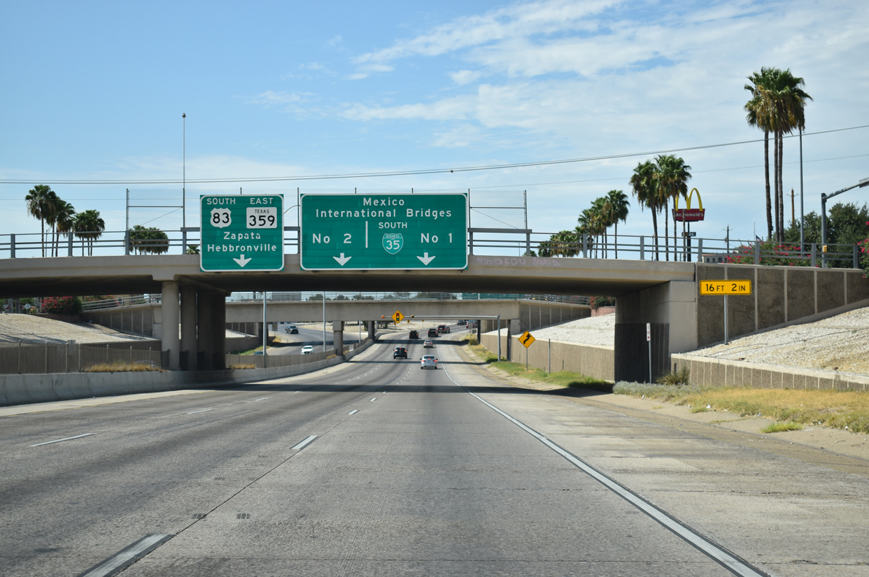
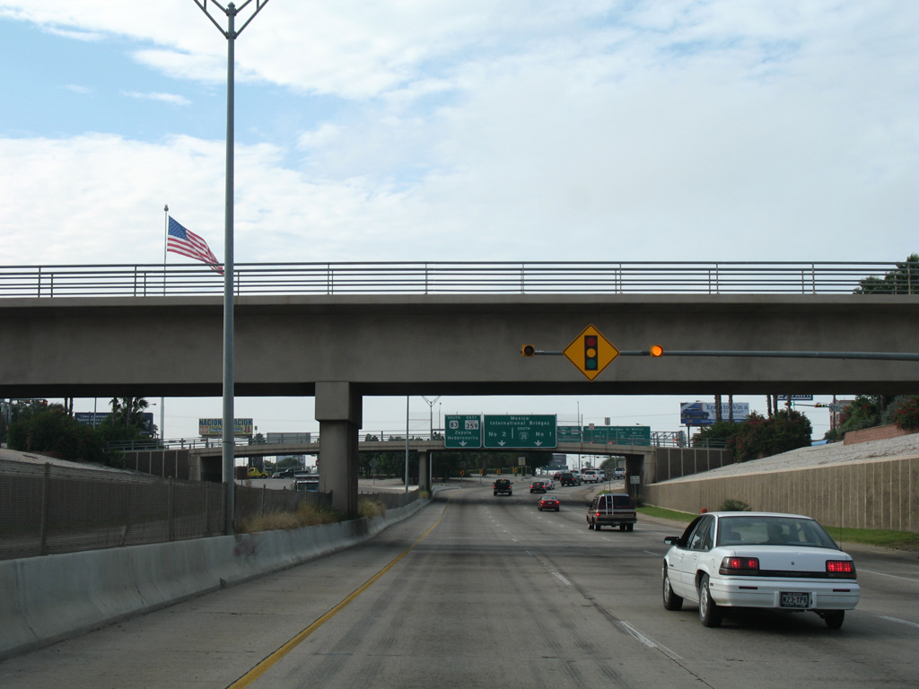
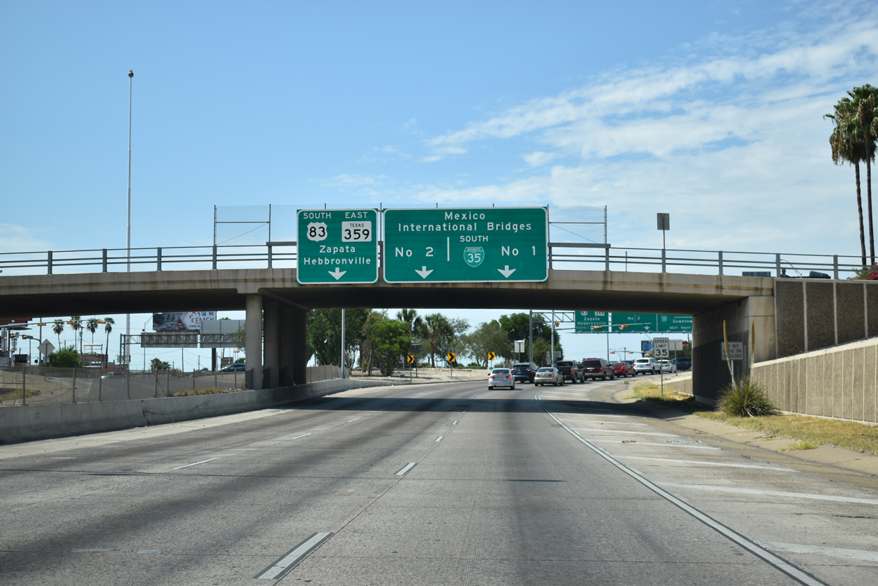
Traffic at the south end of IH 35 transitions onto Santa Ursula Avenue (Business Loop I-35) ahead of both the couplet of Houston and Matamoros Streets (U.S. 83/SH 359) and the Juarez-Lincoln International Bridge. U.S. 83 continues south from Laredo to McAllen, Harlingen and Brownsville, mostly along a two-lane highway. U.S. 83 becomes a part of IH 2 within the Lower Rio Grande Valley. Long range plans call for IH 2 to extend northwest to Laredo. 08/04/19
A railroad bridge crosses over IH 35 two blocks ahead of the signalized end at Victoria Street and Santa Ursula Avenue. U.S. 83 proceeds two blocks south to Matamoros Street east, where SH 359 begins. 09/27/07
Business Loop I-35 links the ending IH 35 with the Gateway to the Americas International Bridge to Nuevo Laredo at the south end of Downtown. The route navigates five blocks west along Houston Street to Salinas Avenue south and the former end of U.S. 81. Convent Avenue returns the loop northward. 08/04/19
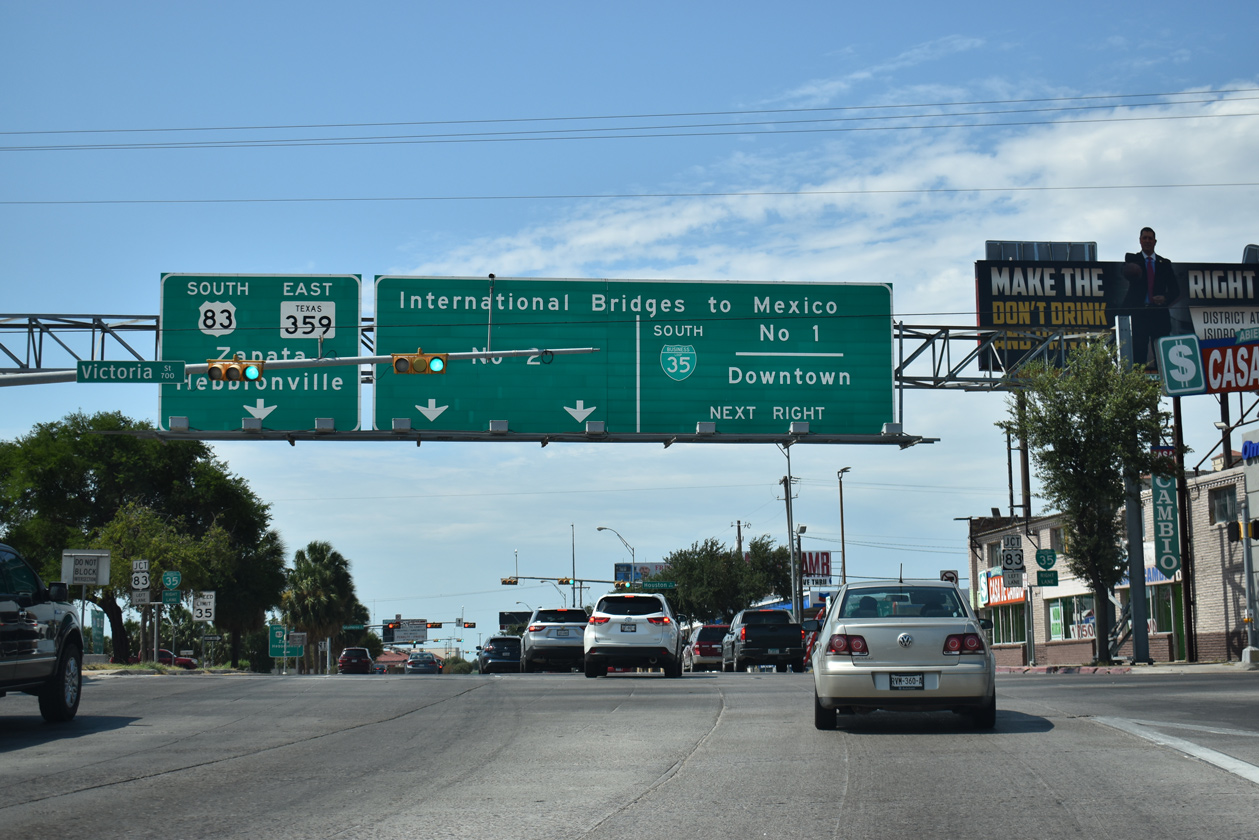
Santa Ursula Avenue carries motorists four blocks south to the Port of Entry. SH 359 connects Laredo with Hebronville and Falfurrias to the east. Zapata is located on U.S. 83 southward near the International Falcon Reservoir. 08/04/19
![]() North
North ![]() South at
South at ![]()
Business Loop I-35 heads east from Downtown Laredo along Matamoros Street and north two blocks on San Dario Avenue to the beginning of IH 35. 08/04/19
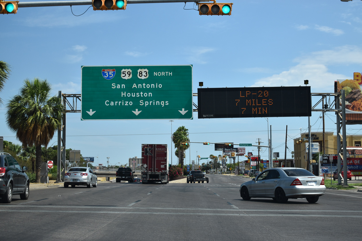
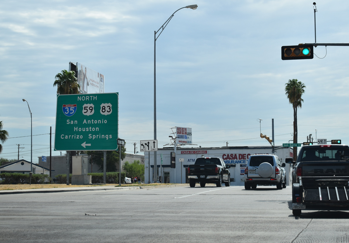
Three lanes depart from San Dario Avenue north onto Interstate 35. U.S. 83 accompanies IH 35 to Exit 18 at Botines. U.S. 59 ties into IH 35 at IH 69W (Exit 8). 08/04/19

San Dario Avenue forms an east side frontage street to IH 35 northward throughout the city of Laredo. U.S. 59 formerly ended at Exit 2 (Lafayette Street), but was relocated northward when IH 69W was designated in 2014. 08/04/19
Sources:
- “I-35 narrowed near Ardmore.” Oklahoma DOT Public Affairs Media Advisory, March 06, 2003.
- “The long-awaited widening of I-35 to begin!”
http://www.okladot.state.ok.us/public-infoOklahomaDOT. - Copeland, Brian. “I-35 in Minnesota designated as Red Bull Division Highway.” Personal email, November 18, 2003.
- “Iowa Completion Status of Interstate System as of January 1, 1982.” Iowa Department of Transportation.
- Forty Years of Iowa Interstates.
- Kansas Interstate 50th Anniversary
- “From Anywhere to Everywhere: The Development of the Interstate Highway System in Texas”
http://tti.tamu.edu/interstate_anniversary/white_paper/by Penny Beaumont, Rhonda Brinkmann, David Ellis, Chris Pourteau, and Brandon V. Webb, Texas Transportation Institute, page 29. - Celebrating the 50th Anniversary of the Eisenhower Interstate Highway System: Previous Interstate Facts of the Day by the Federal Highway Administration (FHWA).
- Celebrate the Interstate: America’s Interstate Highway System Turns 50!
http://www.okladot.state.ok.us/okinterstate50/by the Oklahoma Department of Transportation. - “Duluth opens the first section of I-35 extension.” Star Tribune: Newspaper of the Twin Cities (MN), October 30, 1987.
- “Section of I-35 opening in Duluth features tunnels, waterfront park.” Star Tribune: Newspaper of the Twin Cities (MN), November 19, 1989.
- “In Duluth , the end of the road – Final part of I-35 will be opened on Wednesday” Star Tribune: Newspaper of the Twin Cities (MN), October 25, 1992.
- Kidwell, Brian. “KcICON Quarterly Project Newsletter.” (June 2011).
- “Famous, Infamous Get Roads, Bridges Named After Them.” The Oklahoman (Oklahoma City, OK), October 30, 1983.
- I-35, Iowa Highways Page.
- A Study to Eliminate Cardinal Initials on Interstate Routes and Other Needed Changes in Interstate Route Numbering by AASHO Representation on NACUTCD and OTA-FHWA January 18, 1973.
Page updated April 11, 2023.