Interstate 20
Overview
Starting in the vastness of western Texas, then emerging in the southeastern states as a major highway through several metropolitan areas, Interstate 20 provides a connection through the northern tier of the Deep South states. It originates in West Texas and passes through the Dallas-Forth Worth area en route to Shreveport, Birmingham, Atlanta and Columbia before concluding in Florence, South Carolina.
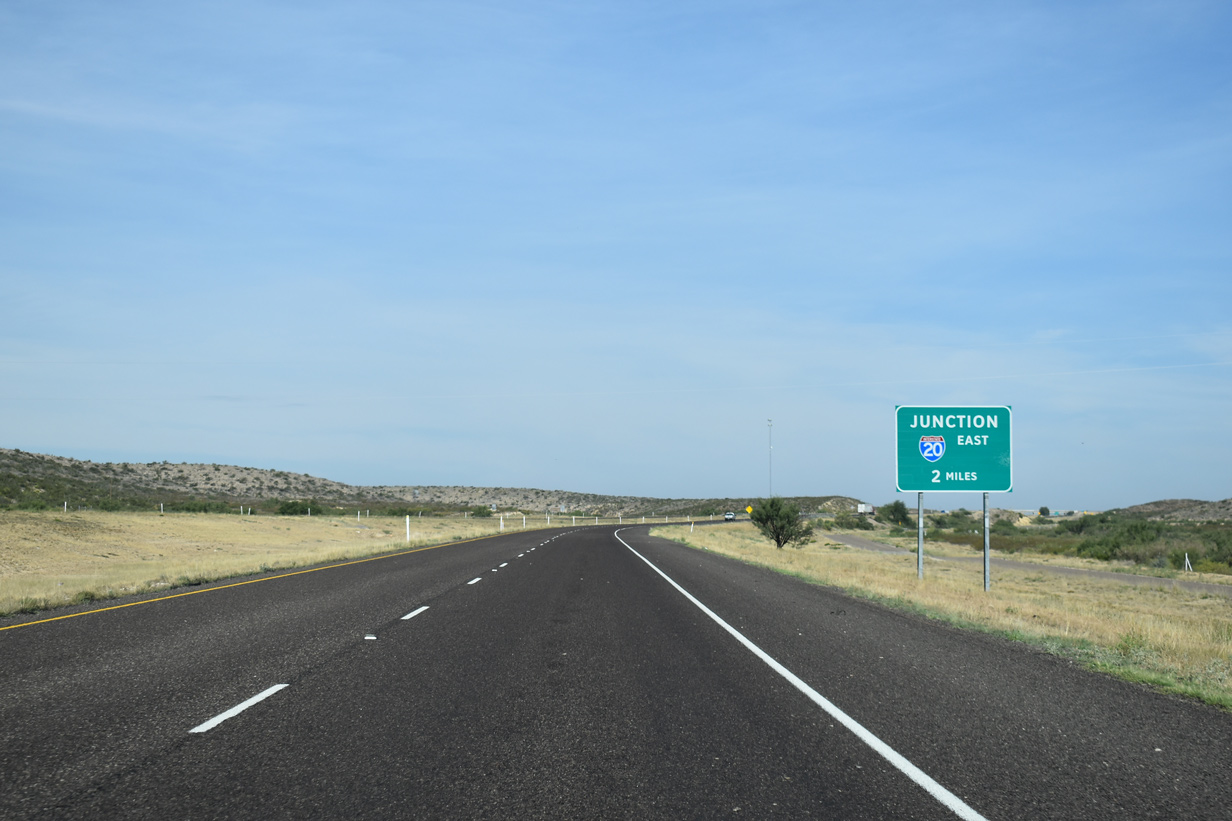
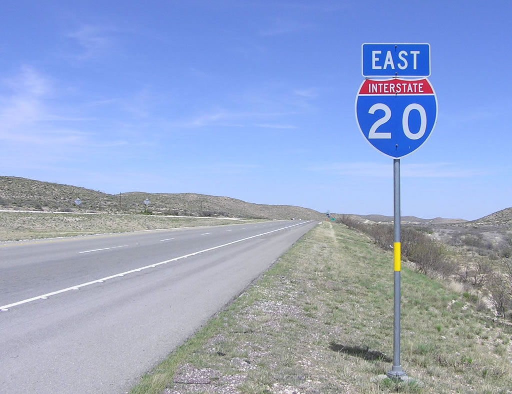
Interstate 20 begins in a remote area from IH 10 near Kent, Texas. The westernmost section of IH 20 travels through some sparsely populated, isolated terrain, which resulted in the 2006 enactment of an 80 miles-per-hour speed limit along an 89 mile stretch between IH 10 and Monahans.

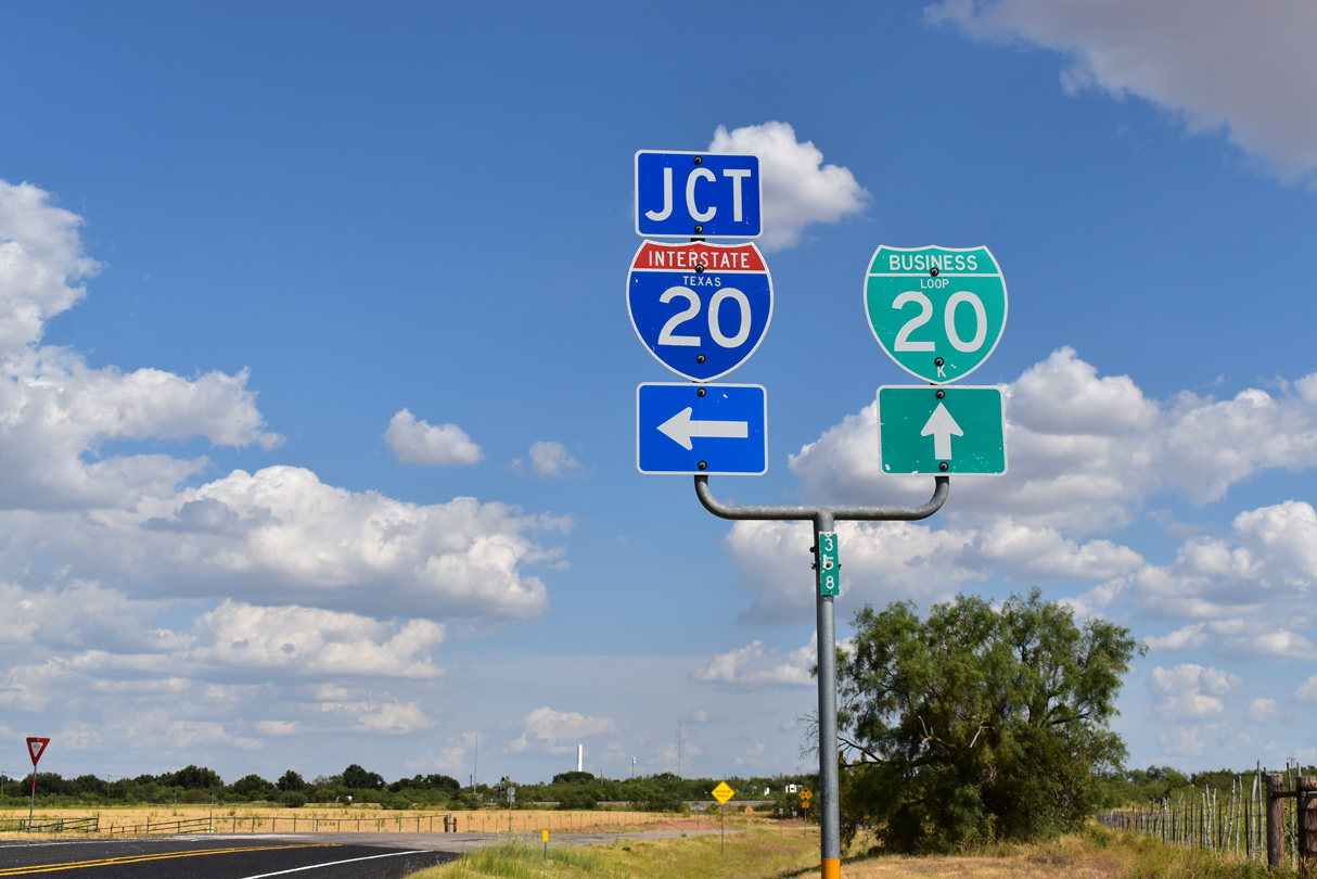
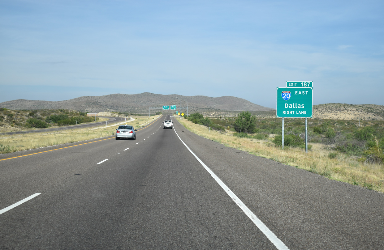
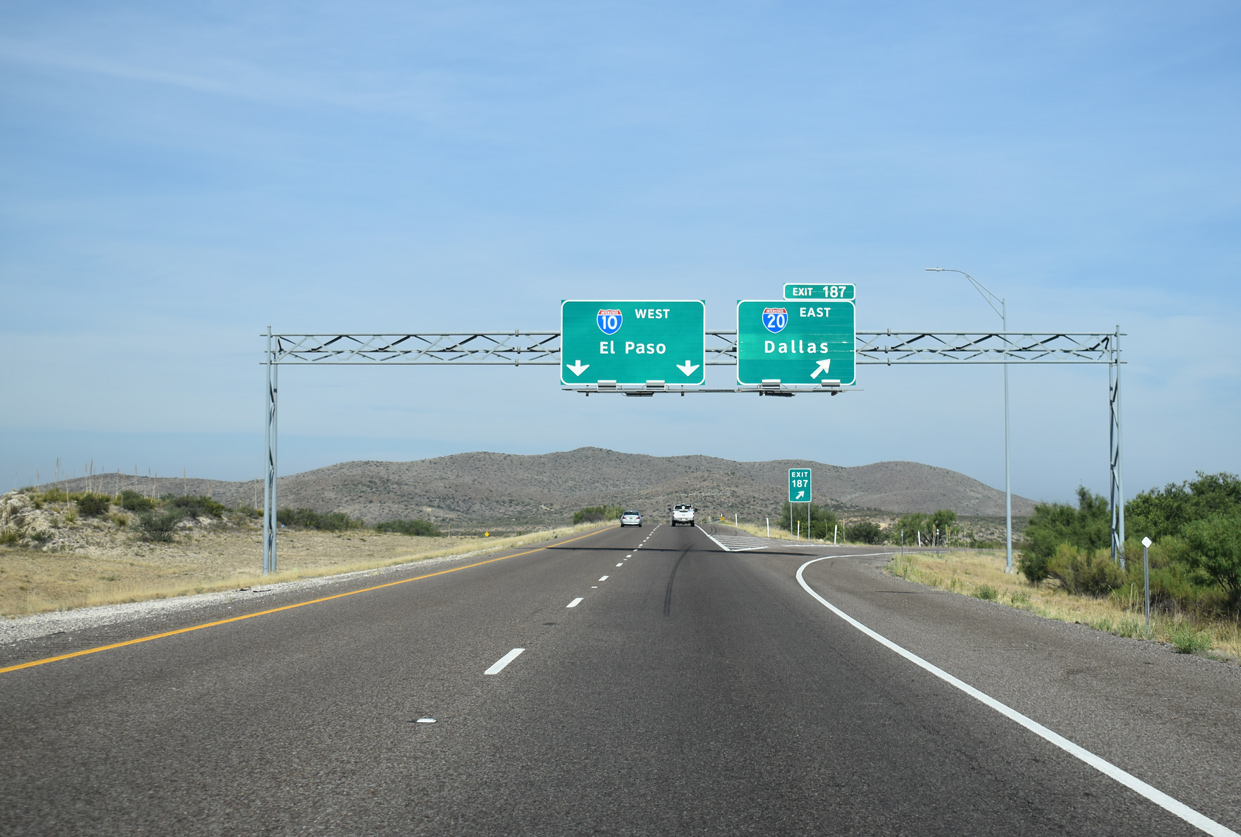
This section of Interstate 20 serves mid-sized Lone Star communities such as Midland, Odessa and Abilene. The highway acts at the main conduit between the West Coast and the Dallas-Fort Worth Metroplex. There IH 20 bypasses both cities to the south, overriding portions of original alignments of IH 820 and IH 635 respectively. IH 30, beginning at IH 20 west of Fort Worth, connects long distance travelers with Downtown and to Dallas by way of the original Dallas Fort-Worth Turnpike. IH 820, the first branch of IH 20 from the west, constitutes a belt route around the west, north, and east side of Fort Worth as well.
East from Fort Worth, IH 20 varies between six and eight lanes as it travels through cities such as Arlington, Grand Prairie and Duncanville to south Dallas. Leaving Dallas, the freeway passes through Mesquite where it transitions from urban to rural areas as it enters the vast Piney Woods region of East Texas. Through the Piney Woods, IH 20 serves the cities of Tyler, Longview and Marshall east to the Louisiana state line.
Upon entering Caddo Parish, Louisiana, Interstate 20 enters the Shreveport metropolitan area. Continuing east across the city, I-20 splits with I-220, a bypass to the north, and combines with I-49. I-49 joins I-20 for 5.8 miles between I-220/LA 3132 and its original north end outside Downtown. Interstate 49 is proposed to continue north along the Inner City Connector from a systems interchange with I-20 to the exchange where it separates from I-220 north of Cross Lake.
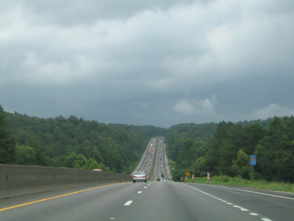
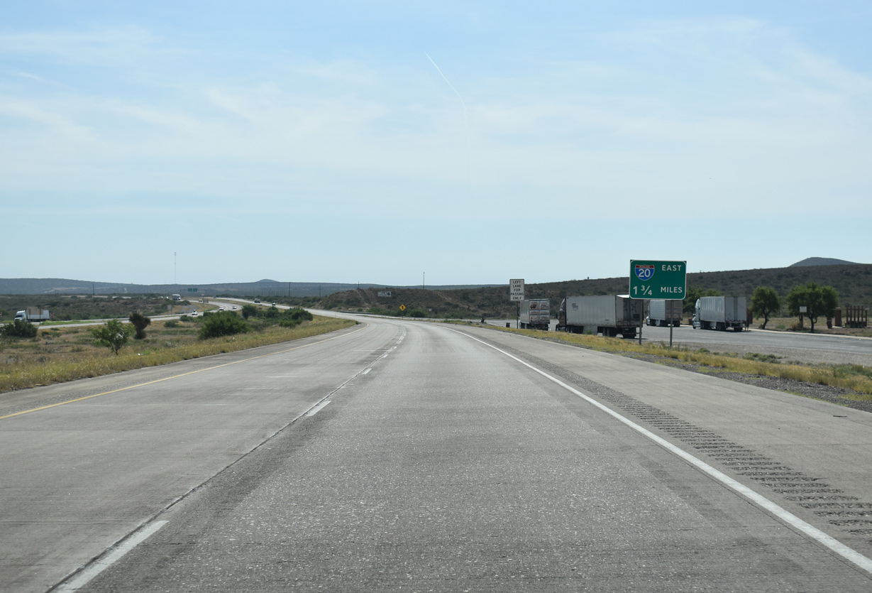
East of Bossier City, Interstate 20 passes by Barksdale A.F.B. and transitions back into a rural freeway. Paralleling U.S. 80, I-20 proceeds to Minden, Arcadia and Rustin. Once it reaches Monroe, I-20 becomes an urban freeway again along the busiest stretch between Dallas and Jackson, Mississippi. Monroe was also the location of another proposed branch loop, Interstate 420.2 72 miles beyond Downtown Monroe, I-20 spans the Mississippi River across the Vicksburg Bridge, a four lane cantilever span.
Vicksburg is a city rich in Civil War history. For Interstate 20, it is the entrance into the Deep South and the first of three urban centers along the route across the Magnolia State. 40 miles separate the western city with the capital of Jackson. Jackson is the largest urban area of the state, and I-20 expands there to six and eight lanes as it overlaps with U.S. 49 and I-55 through the southern reaches of the city. The overlap with I-55 ends at “The Stack”, a three-level interchange nicknamed for its flyovers. U.S. 49 ties into the directional-T interchange with I-55 via flyovers constructed as part of a three year project to upgrade “The Stack” between 2003 and 2006.1
I-220 comprises the third urban loop of Interstate 20. The freeway bypass carries U.S. 49 northward to an exit of the city and Yazoo City before it concludes at I-55. The metropolitan area spreads eastward along I-20 and U.S. 80 through the suburbs of Pearl and Brandon. East of Exit 59, Interstate 20 resumes along a rural course.
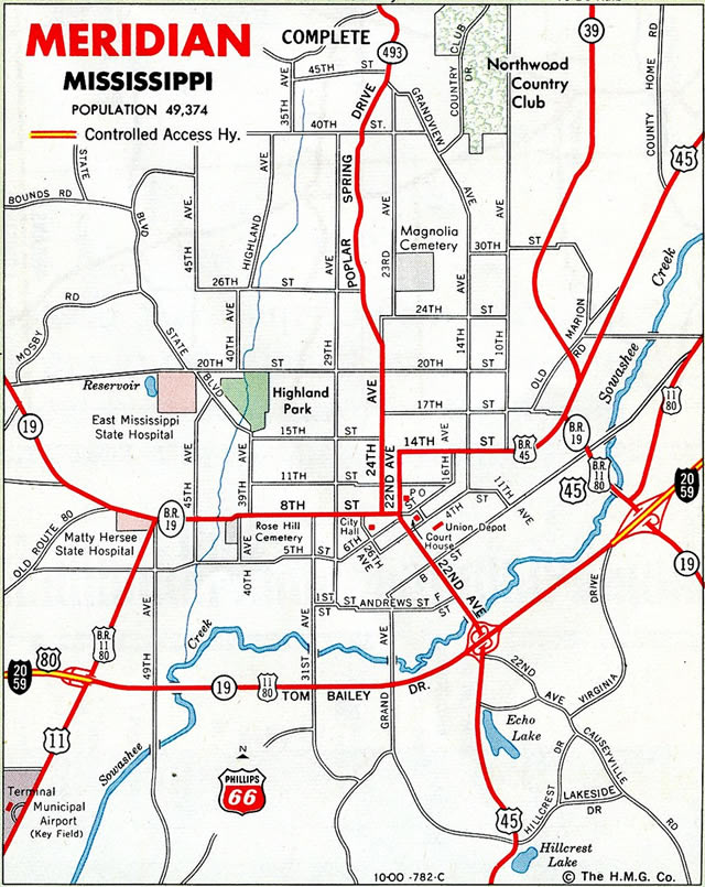
The last urban center along Interstate 20 in Mississippi is Meridian. Here the freeway commences a lengthy overlap with Interstate 59. Forming part of a regional corridor between New Orleans and the Gulf Coast to Birmingham and Nashville, I-59 enters Meridian from Laurel and Hattiesburg to the southwest. Passing south of Downtown Meridian, U.S. 11-80 and MS 19 combine along I-20/59 as well.
Entering the state of Alabama, I-20/59 travel to Cuba, were State Route 8 ties in from the east. SR 8 and U.S. 80 are part of High Priority Corridor 6, a federally mandated corridor between Meridian and Savannah, Georgia. The corridor is part of the planned extension of Interstate 14 east to Montgomery.
I-59/20 travel northeast from the Mississippi state line to Tuscaloosa, home to the University of Alabama. Bryant-Denny Stadium in Tuscaloosa has a capacity of over 100,000 as of 2010, and during Crimson Tide home games traffic congestion arises along I-59/20 . Interstate 359 connects the freeway with the Tuscaloosa central business district and U.S. 43 bridge to North Port.
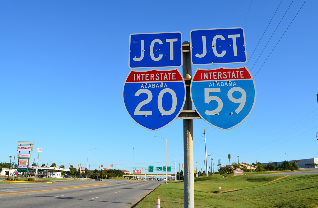
Continuing northeast toward Birmingham, Alabama’s largest city, I-59/20 maintain six lanes with increasing traffic counts. Interstate 459 provides a bypass for through traffic around Birmingham and Jefferson County for points north and east. While the southwest suburb of Bessemer is more industrial based, Hoover, Vestavia Hills and other suburbs south of Birmingham and within Shelby County add substantial commuter traffic to I-459. Staying north to Downtown Birmingham, I-59/20 proceed to Interstate 65 and the locally named “Malfunction Junction”. The exchange with I-65 utilizes left side ramps, with roadways along both freeways switching sides.
Downtown Birmingham lies south of a viaduct along I-59/20 and north of Red Mountain. With preliminary work started in 2015, a four year project through January 2020 replaced the aging six-lane viaduct. The 154 mile overlap along I-59/20 ends east of there at a trumpet interchange (Exit 130) south of Birmingham-Shuttlesworth International Airport (BHM).
Interstate 20 turns briefly southeast, cutting across Red Mountain as it heads through the eastern suburb of Irondale and over Shades Mountain. A four-level interchange joins this stretch with I-459. Another 11 miles of suburban areas buffer I-20 before the highway leaves the metropolitan area beyond Leeds and Moody.
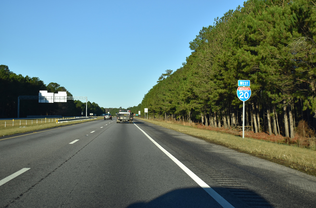
Interstate 20 traverses mountainous areas eastbound near Cook Springs, Alabama (Exit 152) after a rain shower. The freeway remains rural as it advances toward Atlanta, Georgia. Subsequent work along this segment expanded I-20 to six overall lanes. 07/15/05
Route Information
Mileage
Texas – 636.08
- Cities – Pecos, Monohans, Odessa, Midland, Big Spring, Colorado City, Sweetwater, Abilene, Fort Worth, Dallas, Longview, Marshall
- Junctions –


Louisiana – 189.87
- Cities – Shreveport, Bossier City, Minden, Ruston, Monroe, Tallulah
- Junctions –


Mississippi – 154.61*
Cities – Vicksburg, Jackson, Meridian
- Junctions –
Alabama – 214.70#
Cities – Tuscaloosa, Bessemer, Birmingham, Anniston
- Junctions –
Georgia – 202.61
Cities – Atlanta, Covington, Thomson, Augusta
- Junctions –
South Carolina – 141.51
Cities – North Augusta, Columbia, Camden, Florence
- Junctions –
Source: January 26, 2022 Interstate Route Log and Finders List
* – 1.60 miles on I-55 and 23.60 miles on I-59, # – 130.10 miles on I-59
A short portion of Interstate 20 was open to traffic in Mississippi by 1967. With the exception of through Meridian, the freeway ran east from MS 15 (Exit 109) near Newton to U.S. 11/80 (Exit 169) at Kewanee. Subsequent sections were opened in 1968 from Meridian west to Pearl and in 1970 on the south side of Jackson.
The overlap of I-20/59 through Meridian was not completed until the mid-1970s.6

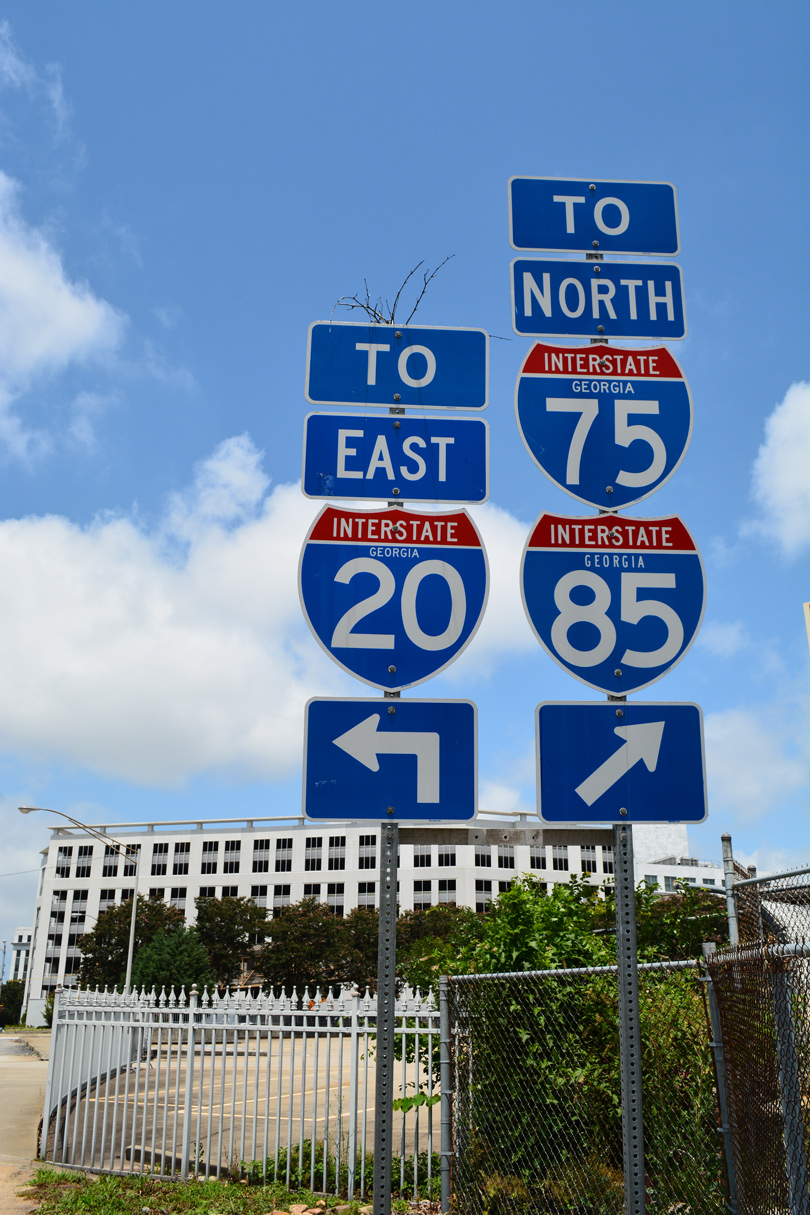
The original configuration of the Capitol Hill Interchange joining I-20 with I-75/85 (Downtown Connector) in Atlanta utilized a number of left exit ramps. This exchange was redesigned into a three-level interchange as part of the “Freeing the Freeways” megaproject between 1985 and November 1988.
East from Karr Gap, Interstate 20 returns to rural scenery, albeit this time across the Appalachian Piedmont. The freeway lines northern reaches of Talladega Superspeedway, a 2.66 mile NASCAR track, east of the Coosa River and west of Anniston. I-20 passes south of the Anniston Army Depot and Anniston through the city of Oxford at Exits 179, 185 and 188.
A short distance east into the Peach State, Interstate 20 enters the sprawling Atlanta metropolitan area. The freeway expands to six lanes initially, and eventually 16 lanes overall through areas south of Downtown Atlanta. The Capitol Hill Interchange joins I-20 with the Downtown Connector (I-75/85) near the Georgia State Capitol. Shifting southward by Decatur, I-20 passes by the unconstructed east end of I-420, an urban loop previously proposed along the Lakewood Freeway (SR 166).
26 miles east of Interstate 285 at Covington, I-20 reduces from six to four lanes as it departs the Atlanta metropolitan area. The ensuing 150 miles to Augusta takes I-20 across vast areas of pine forest. Suburbia appears along the freeway frontage from Exit 190 eastward to North Augusta, South Carolina. Interstate 520 (Bobby Jones Expressway), a freeway loop around the west and south side of Augusta, ties into this stretch of I-20. I-520 ended ahead of the Savannah River until 2004, when the first of two extensions lengthened the route into South Carolina. The Palmetto Parkway section of I-520 in North Augusta was completed to I-20 at Exit 6 on December 16, 2009.
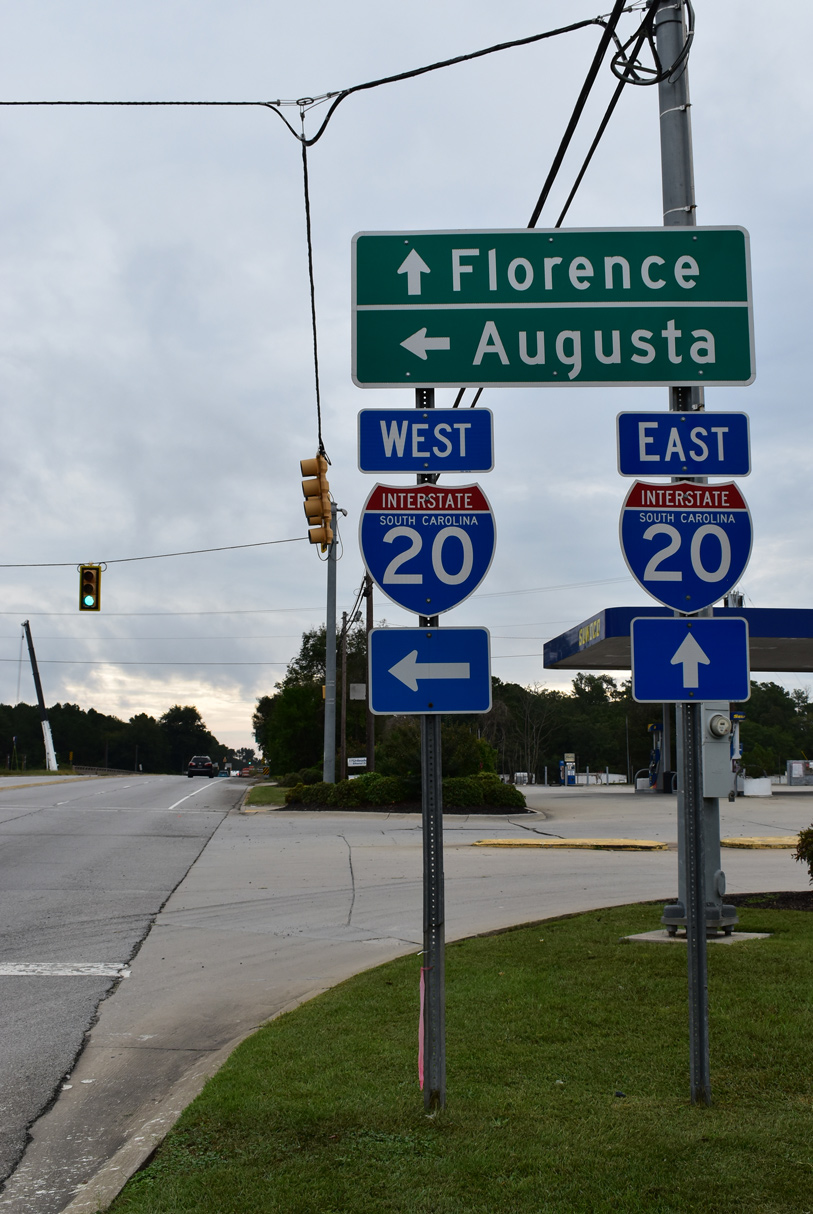
Once across the Savannah River, Interstate 20 enters the Palmetto State. The 141-mile route across South Carolina is designated the Strom Thurman Freeway, named after James Strom Thurman (1902-2003), S.C. member of the U.S. Senate from 1954 until his death. I-20 traverses areas of pine forest from North Augusta to Lexington. The freeway expands to six lanes at Exit 61 ahead of St. Andrews and the north side of Columbia.
The exchange with Interstate 26, northwest of the capital city, represents a second locally nicknamed “Malfunction Junction” along I-20. A substandard cloverleaf interchange joins the two freeways adjacent to the I-26/126 split southeast toward Downtown Columbia. Started in 2020, construction on the Carolina Crossroads project upgrades the I-20/26 junction into a systems interchange.
Collectively with I-26 along the west side of Columbia and I-77 (Southeastern Beltway) to the south and east, I-20 forms part of the Capital Beltway. A high speed exchange joins I-20 with I-77 and Alpine Road near Fort Jackson to the northeast of the city. East from there, I-20 was widened to six lanes in 2014, as suburban expansion lines U.S. 1 to Pontiac and Exit 82.
Leaving central South Carolina, the final 60 miles of Interstate 20 to Florence traverse a mixture of pine forest, agricultural areas and wetlands. The freeway avoids the main population centers along this stretch, and lower traffic counts reflect this. The freeway concludes at I-95 and Business Spur I-20 east. The city of Florence spreads to the east of I-95, with two shopping malls and other assorted retail lining Business Spur I-20 (David H. McLeod Boulevard) to U.S. 76.
Major Projects
Carolina Crossroads
The Carolina Crossroads Project rebuilds the cloverleaf interchange joining I-20 and I-26 at Columbia and the adjacent exchange with I-126/U.S. 76, both dating back to the original Interstate construction in 1960.11 This area is locally known as Malfunction Junction, due to weaving traffic patterns with the closely placed ramps.
A new turbine interchange will be constructed at I-20/26, with collector distributor roadways added. Interchanges along I-20 at Bush River Road and Broad River Road will be improved as well. Ground breaking for the $1.7 billion project took place on November 8, 2021. Split into five phases, work rebuilding 14 miles of I-20, I-26 and I-126 extends to 2029.11 Constructing the systems interchange at I-20/26, Phase 3 is scheduled to run from 2023 to 2028.
I-20/59 Viaduct – Birmingham
I-20/59 separate Downtown Birmingham, Alabama from the Birmingham-Jefferson Convention Complex along a six lane viaduct completed in 1971. The aging roadway was designed to accommodate 80,000 vehicles per day (vpd) but instead carried 160,000 vpd. Deterioration of the elevated road, including the formation of large potholes, led to an estimated $150 million plan by the Alabama Department of Transportation (ALDOT) to replace the bridge decks on top of the existing foundations. The City of Birmingham and Jefferson County petitioned ALDOT in 2012 to instead consider replacing the existing roadway with a new structure to improve aesthetics and reduce noise. Design improvements reviewed included wider shoulders, adding auxiliary lanes and reconfiguring the existing traffic pattern to reduce weaving.
Cultural impacts were cited by the city that the existing viaduct divided Downtown from neighborhood areas to the north. Therefore two scenarios were also studied by ALDOT to realign I-59/20 further north onto the Finley Boulevard Corridor. The short route branched west from I-59/20 at Tallapoosa Street (Exit 128) 2.5 miles to I-65, and then southward 1.3 miles along a widened (eight lanes) stretch of I-65. Estimated costs for the short route exceeded $1.5 billion with a 20 year plus time table.
The long route took the same course as the short route west to I-65, but then extended further along Finley Boulevard to U.S. 78 north of the Burlington Northern Railroad Yard. It would involve the demolition of most businesses along Finley Boulevard, cost over $2 billion and take at least 28 years to complete. Both routes would run through minority or low-income areas, including the Enon Ridge and Fountain Heights communities. Affecting federal funding for either route along the Finley Corridor, federal policy disapproves of this while another satisfactory route is available. Additionally Superfund and historical sites in the Village Creek flood plain necessitated an elevated design, adding to costs.7
ALDOT instead committed $450 million to reconstruct the existing roadway. The I-59 / I-20 Bridge Replacement Project reconstructed the freeway with a new viaduct system traveling higher than the predecessor while accommodating ten overall lanes of traffic. A number of other changes were also factored into the design, including new entrance and off-ramps, flyovers joining I-65 with I-59/20 and new 17th Street ramps to Downtown.
Phase One of the four year project commenced in August 2015. The $7.4 million project included widening sections of road and elevating bridges in preparation for the second and third phases.8 Phase Two, involving construction of the new exit ramps, was scheduled to start in Spring 2016. Phase Three, with bids taken by late 2016, tore down the old viaduct and built the new roadway.
The new viaduct for I-59/20 opened to traffic southbound on January 17, 2020. The northbound roadway opened on January 19, 2020.
High Priority Corridor
Interstate 20 in Dallas County is part of High Priority Corridor 55: Dallas to Memphis via Little Rock.
 Parallel U.S. Routes
Interstate 20 replaced U.S. 80 from IH 10 in West Texas to the east side of Dallas. The freeway parallels or overlaps with the remainder of the route east to Cuba, Alabama. There U.S. 11 accompanies I-20/59 northeast to Birmingham. U.S. 11 remains along side I-59 northward while U.S. 78 joins the I-20 corridor east to Atlanta.
U.S. 78 leaves I-20 for Stone Mountain while U.S. 278 takes over as the freeway companion to Augusta, Georgia. The west to east alignment of U.S. 1 starts in Augusta and takes the US route to Columbia and Camden parallel to Interstate 20. The final miles of the freeway leading into Florence do not parallel a US Highway.
History
Within Texas, Interstate 20 was an original Interstate Highway, and it was initially approved by the Texas State Highway Commission in 1962 with 634 miles. Early maps showed I-20 passing through Downtown Fort Worth and Dallas along the route currently occupied by Interstate 30; the route shifted once adequate funding for today’s I-20 was made available from Interstate Highway Funds. Since the federal funding formula for new Interstate freeways allocated only a certain number of miles to each state, Texas leaders had to find innovative ways to construct an Interstate bypass of both areas to the south of each city. To that end, Texas repaid the federal government the small amount of money it contributed for I-30, thereby reclaiming the mileage for use on Interstate 20.4 The final route for I-20, including those adjustments through Dallas-Fort Worth, was approved in 1971.5
Interstate 20 across the state of Georgia was constructed between August 1958 and November 1980.7 The western most section of I-20, from Villa Rica to the Alabama state line, opened to traffic on December 20, 1977.8
I-20 Extension
As part of the High Priority Corridor 5 project in South Carolina and North Carolina, a proposal for an easterly extension of Interstate 20 to Wilmington, North Carolina, was outlined by the governor of North Carolina as part of his Strategic Transportation Plan for Southeastern North Carolina on May 5, 2003. This proposal would lengthen I-20 along the route of U.S. 76 from Florence east to Wilmington.2
I-20 would tie into Interstate 74 at Chadbourn, where U.S. 74 and U.S. 76 combine east toward Wilmington. I-20 and I-74 would follow U.S. 74-76 east to Whiteville, then continue on via U.S. 74-76 due east to Bolton. The two would separate at this point, with I-20 continuing into Wilmington, and I-74 turning south along N.C. 211 toward Myrtle Beach.
Beyond Interstate 140, I-20 would conclude along U.S. 17-76 and NC 133 over the Brunswick and Cape Fear Rivers into Downtown Wilmington. There would be no direct connection to Interstate 40, which ends at U.S. 117/NC 132 northeast of Wilmington.
 Photo Guides
East End  – Florence, South Carolina
![]() East at
East at ![]()
![]()
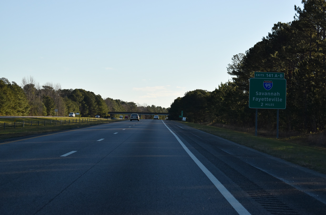
Interstate 20 crosses the Darlington / Florence County and proceeds east to I-95 at Exits 141A/B. 01/05/19
Forthcoming I-95 leads northeast 90 miles to Fayetteville, North Carolina and south 170 miles to Savannah, Georgia. Florence is the only major city along the Interstate 95 corridor in the Palmetto State. 01/05/19
Older button copy signs erroneously showed Business Spur I-20 as Interstate 20. Tricolor shields were also posted at the time along I-95 for Business Spur I-20 east as well. Photo by Michael Summa (1995).

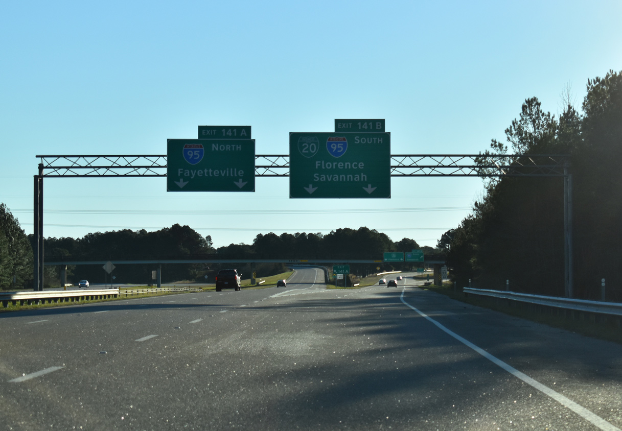
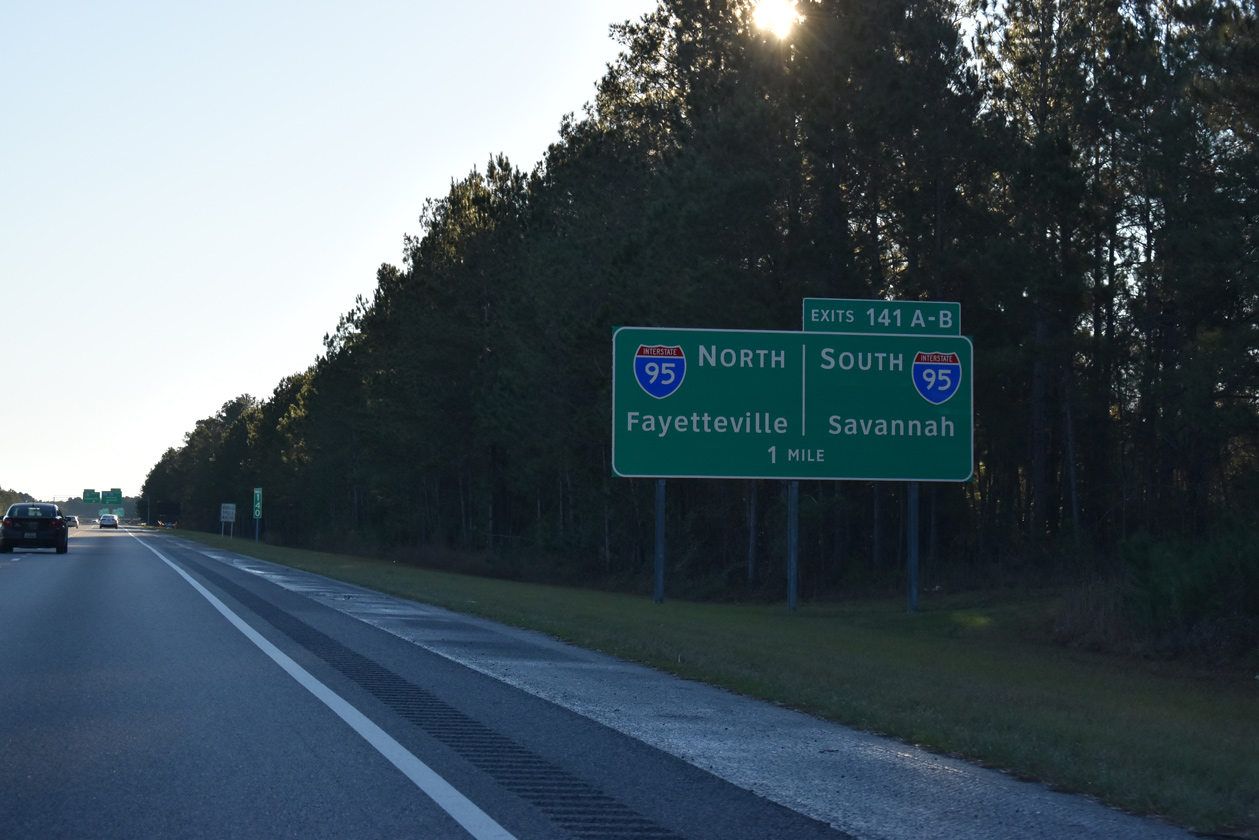
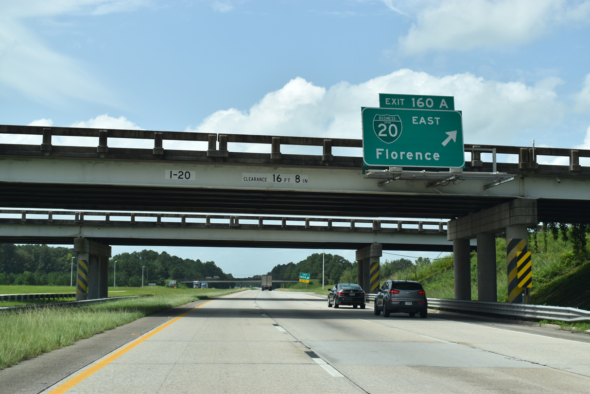
The northbound ramp (Exit 141A) for I-95 departs on the left while mainline traffic splits between Business Spur 20 east and Exit 141B to I-95 south. Business Spur I-20 to U.S. 76 east leads four miles to Downtown Florence. 01/05/19
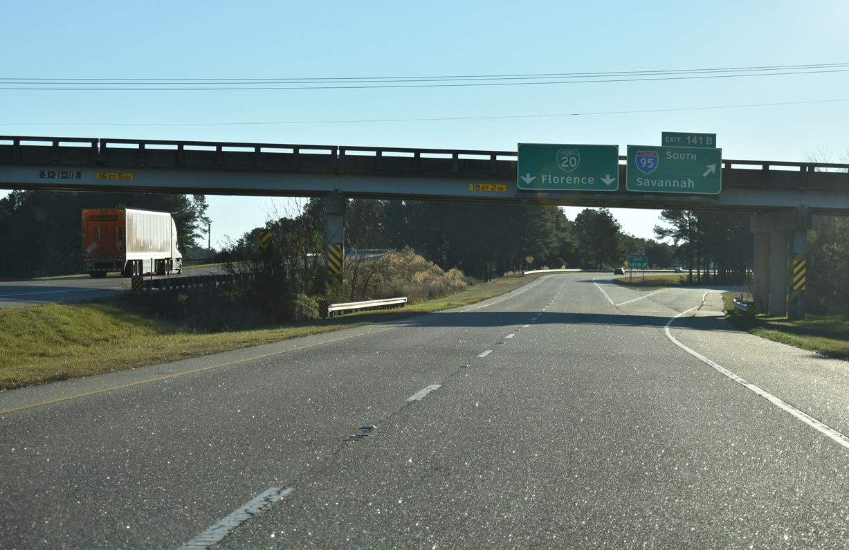
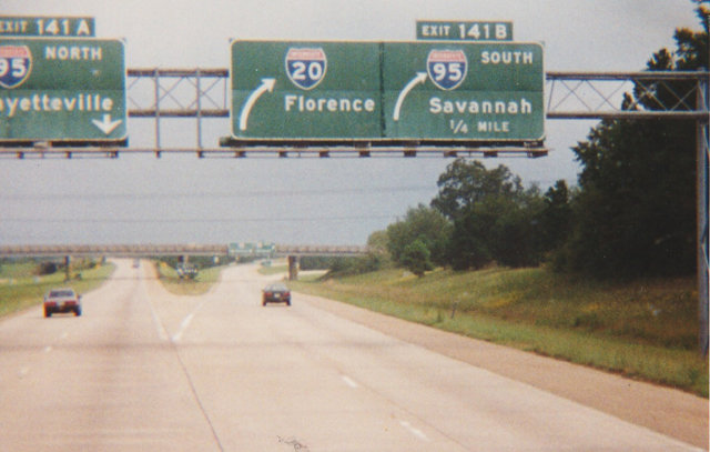
Exit 141B departs from the east of I-20 for I-95 south to Manning, the South Carolina Low Country and Savannah, Georgia. Business Spur I-20 extends 2.3 miles east to Magnolia Mall, Florence Mall and U.S. 76 (Palmetto Street). 01/05/19
![]() West at
West at ![]()
![]()
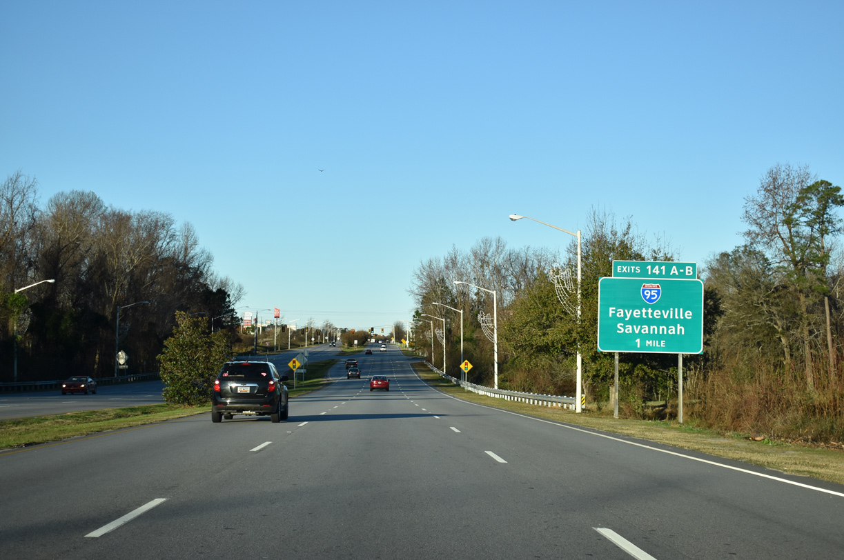
The first guide sign for I-95 (Exit 141) along Business Spur I-20 (David H. McLeod Boulevard) west precedes the intersection with Evans Street. 01/05/19
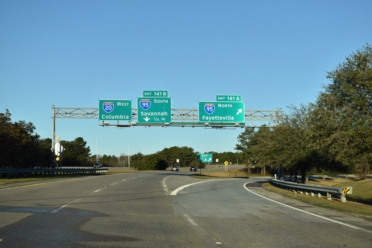
Business Spur I-20 transitions directly onto Interstate 20 at the exchange with I-95. The next business route from I-20 is located over 1,100 miles to the west in Baird, Texas along an old alignment of U.S. 80. 01/05/19

Exit 141A loops onto I-95 south toward Manning and Savannah, Georgia. The capital city of Columbia lies 79 miles ahead via I-20 and S.C. 277. 01/05/19
![]() South at
South at ![]()
![]()
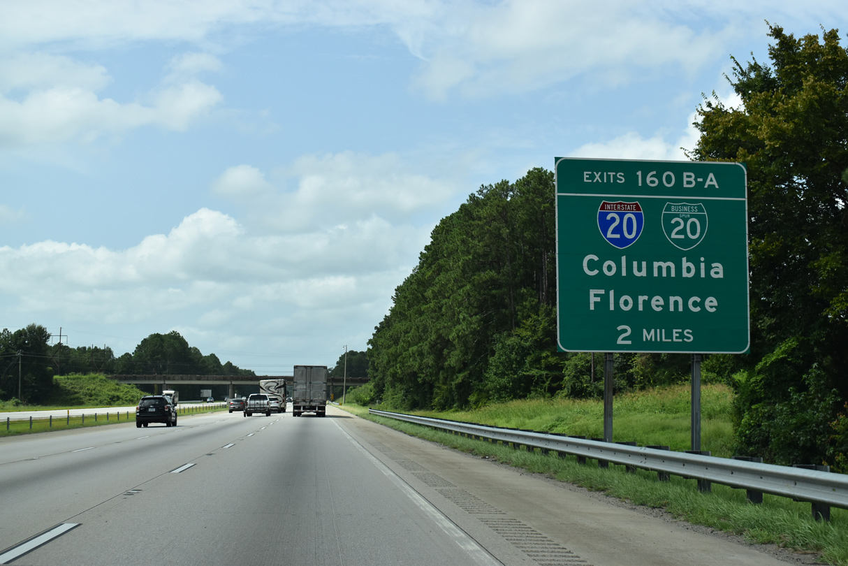
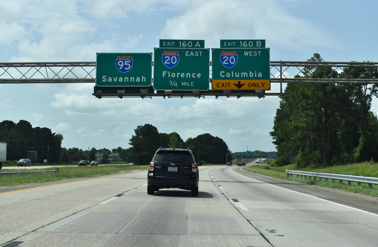
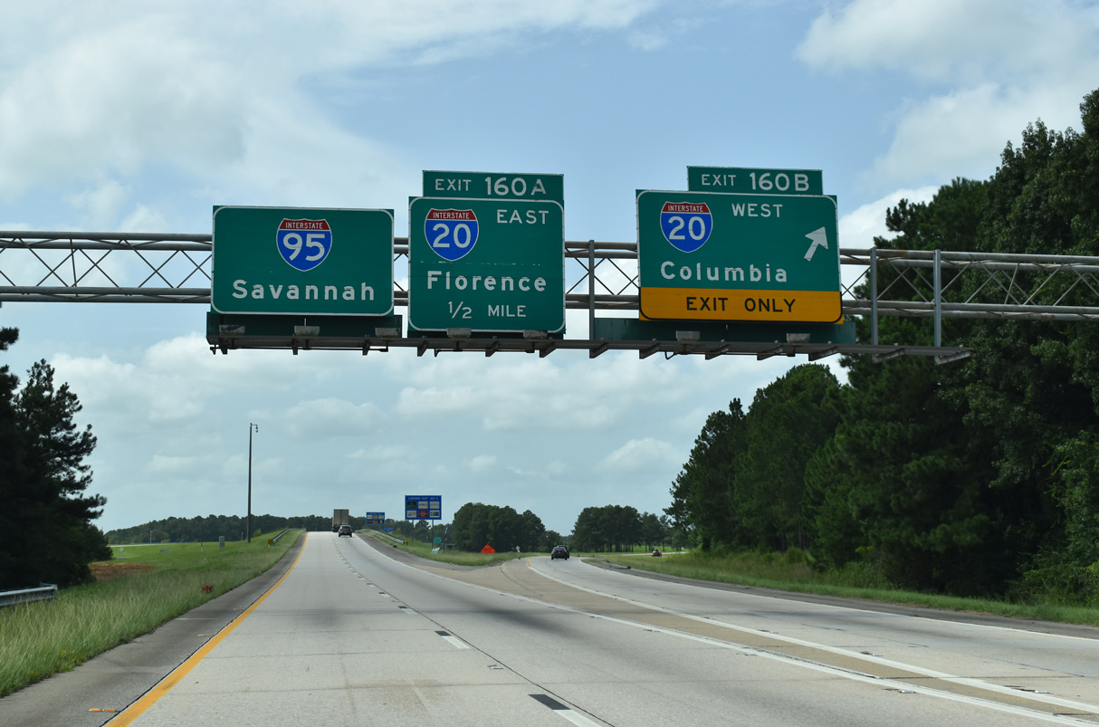
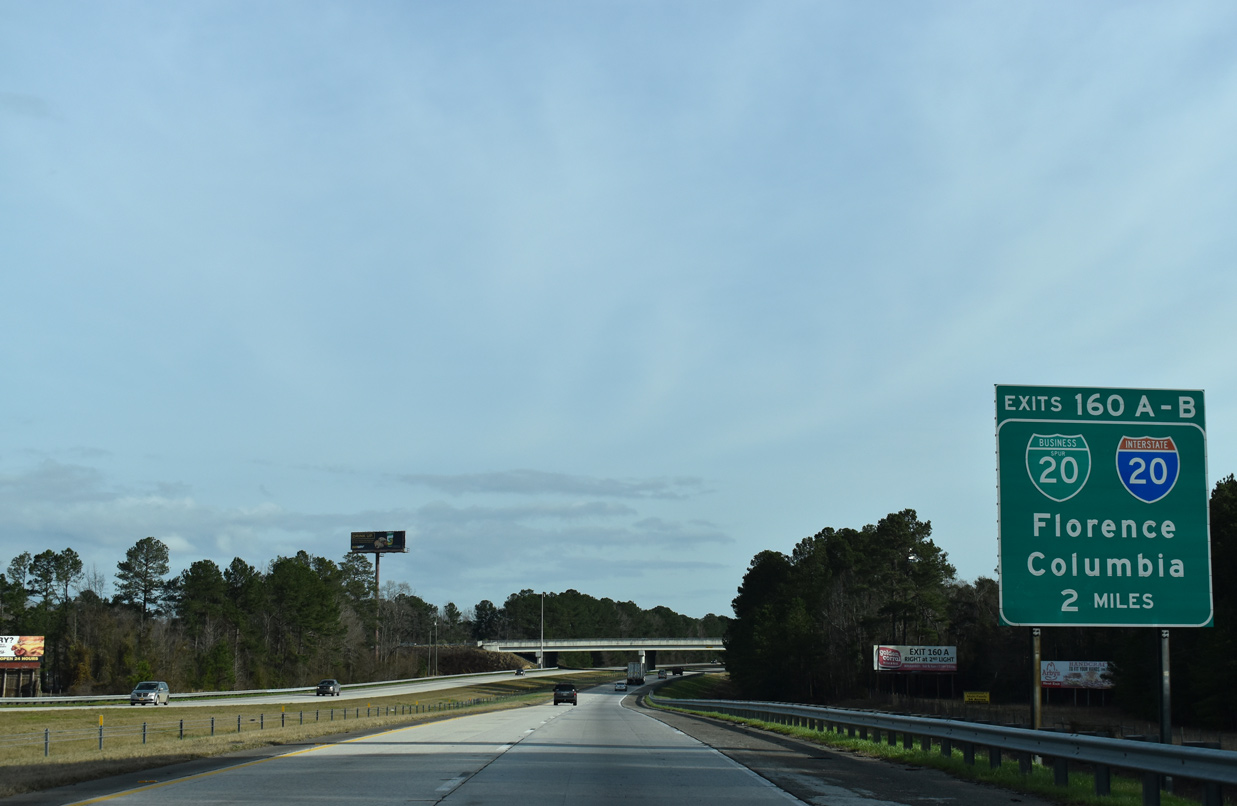
Interstate 95 bypasses Florence to the west, straddling the city limits between the directional cloverleaf interchange (Exits 160B-A) with I-20 west and Business Spur I-20 east to U.S. 76. 08/08/21

The first section of I-95 expanded to six lanes within the Palmetto State was the stretch leading south from S.C. 327 to I-20 at Florence. The third lane added along I-95 southbound in 2004 defaults onto Exit 160B for I-20 west to Columbia. 08/08/21
Signs for Exits 160B/A erroneously show Business Spur I-20 as Interstate 20. The forthcoming ramp connects with David H. McLeod Boulevard, a commercial arterial leading east to Magnolia Mall and U.S. 76 at Florence Mall. 08/08/21
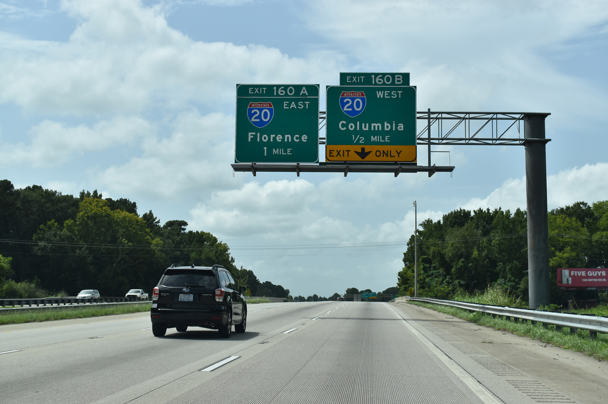
A second set of overheads outline the ramps for I-20 west and Business Spur I-20 east. Speed limits are posted at 70 miles per hour on I-20 west between Florence and Columbia as the freeway traverses mostly rural areas of forest and wetlands outside Bishopville and Camden. 08/08/21
I-95 south at the lane drop for Exit 160B and the westbound beginning for I-20. I-20 is designated the Strom Thurman Freeway between Florence and Columbia. The capital city lies 75 miles to the west. 08/08/21
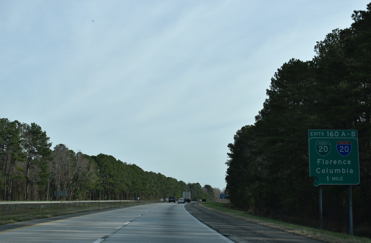
A loop ramp joins the east end of I-20 and Business Spur I-20 ahead of Magnolia Mall. Business Spur I-20 travels 2.11 miles east to U.S. 76, which leads directly to Downtown Florence. 08/08/21
![]() North at
North at ![]()
![]()
Two miles south of Interstate 20 at Middle Swamp. The succeeding ramp joins I-95 north with Business Spur I-20 east at Exit 160A. 02/15/19
One mile south of Interstate 20 west and Business Spur I-20 east on I-95 north near the Oakdale community. 02/15/19
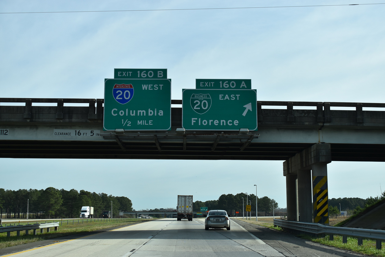

A cloverleaf interchange (Exit 160) joins I-95 north with Business Spur I-20 east into Florence and I-20 west to Columbia. 02/15/19
![]() West
West
The first westbound confirming marker for Interstate 20. Leading away from Florence, the freeway traverses forest land north of Jeffries Creek. 01/05/19
East End – Throwback

Original button copy sign for I-20 west and Business Spur I-20 east on I-95 south. 08/26/96

Button copy guide signs for the cloverleaf interchange with Interstate 20 were replaced by 2000. 08/26/96

Overheads at Exit 160B erroneously displayed a tricolor shield for I-20 in place of Business Spur I-20. 08/26/96

Replacement signs added by Winter 2000 corrected the shield for I-20 east. These were replaced with six lane expansion of I-95 in 2004. 02/11/01
West End – near Kent, Texas
![]() West at
West at ![]()
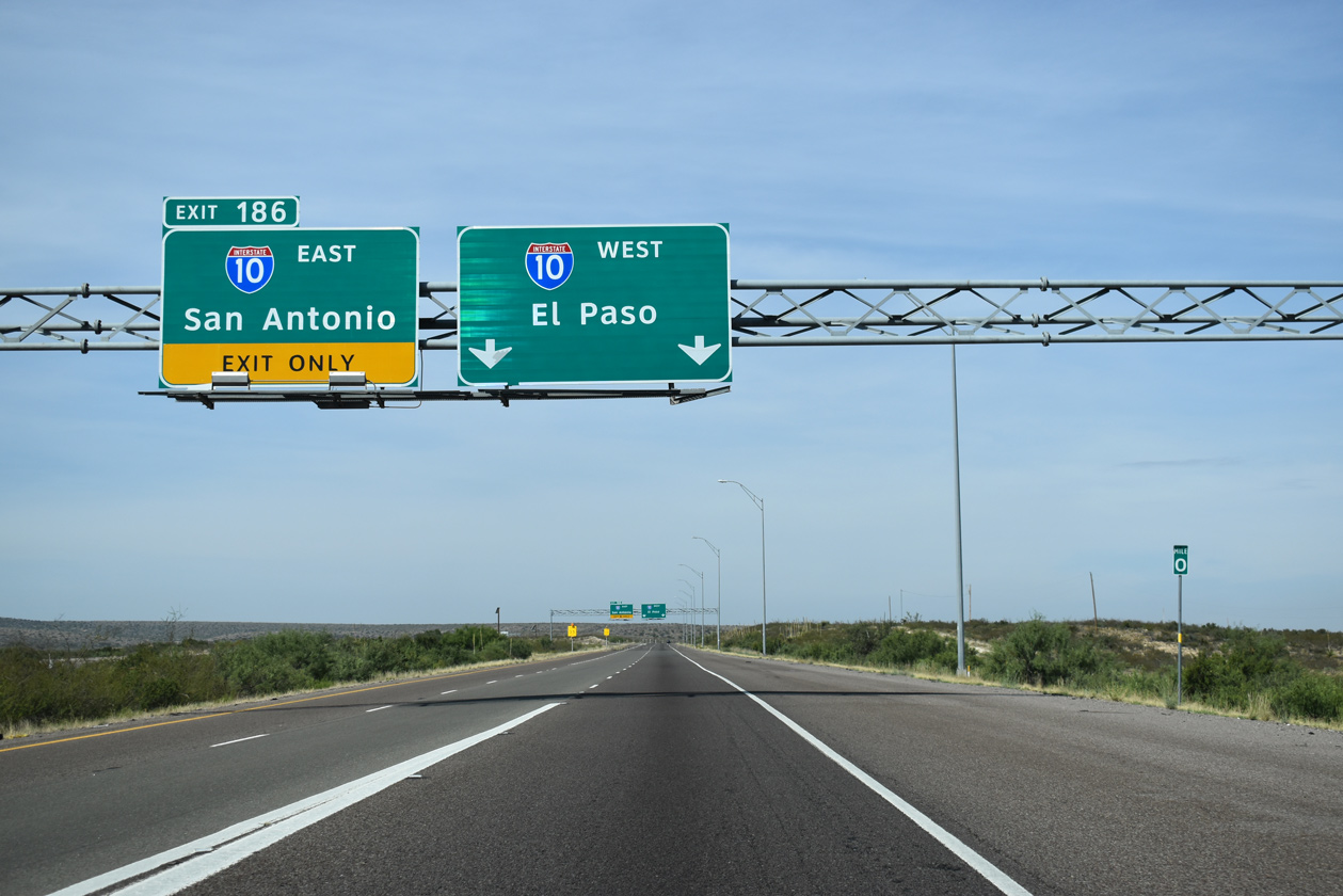
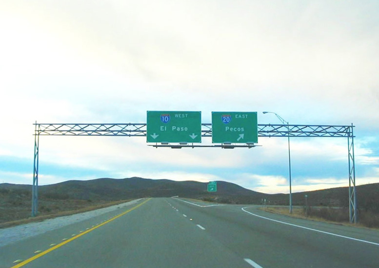
Interstate 20 angles southwest along Ninemile Draw through a series of hills to a trumpet interchange with IH 10 in two miles. 06/14/08
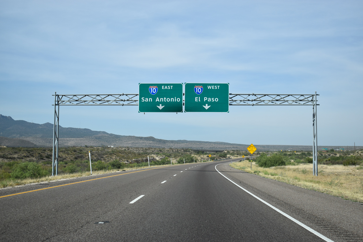
IH 20 defaults onto IH 10 westbound, which enters the exchange from Balmorhea and Fort Stockton to the southeast. 08/05/19
The zero milepost for IH 20 stands at the merge with IH 10 westbound. IH 10 continues west to Van Horn, Sierra Blanca and El Paso. 08/05/19
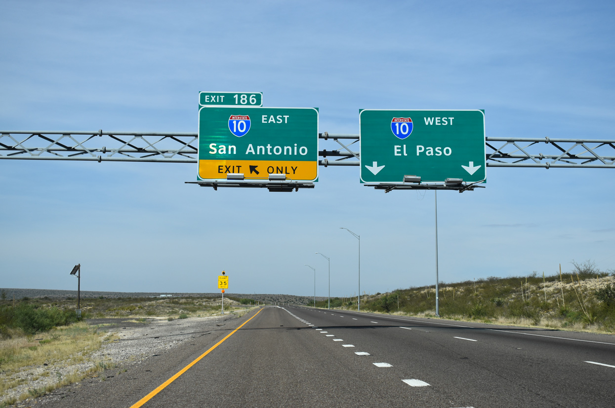
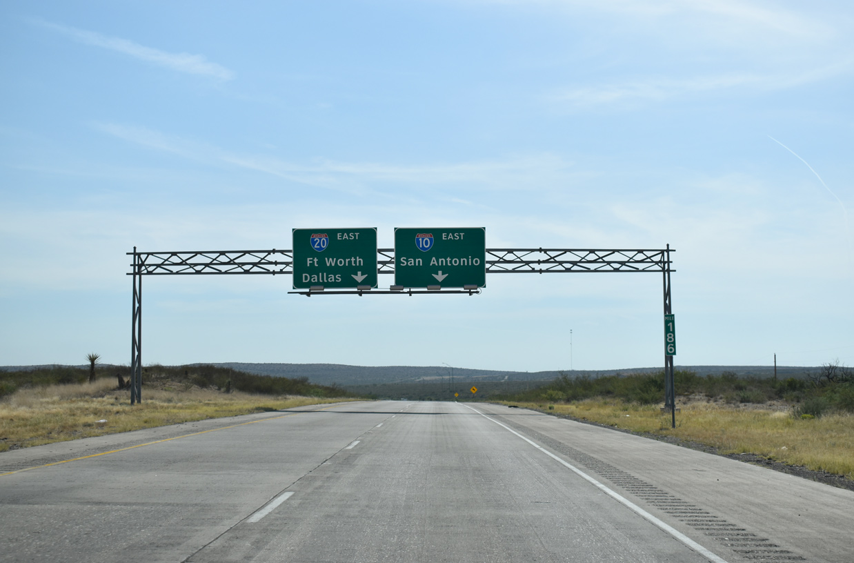
A U-turn ramp (Exit 186) provides access from the west end of IH 20 to IH 10 east back toward Fort Stockton, Ozona and Sonora. 08/05/19
![]() East at
East at ![]()
Ten miles east of Kent and 1.75 miles from IH 20, IH 10 passes between a set of parking areas. 08/05/19
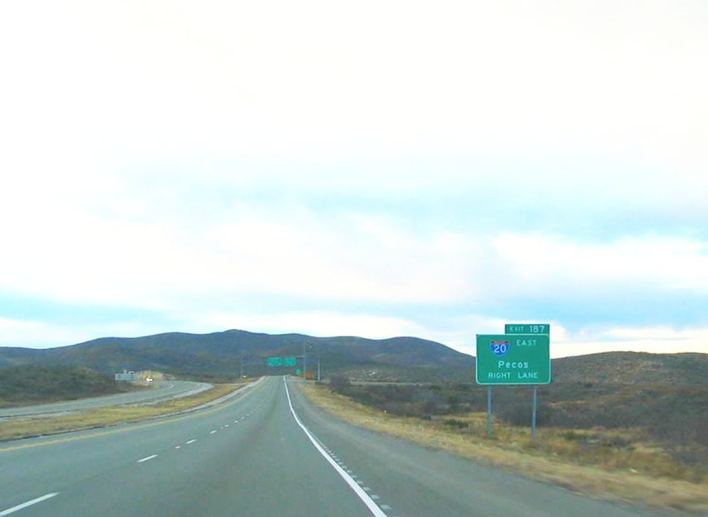
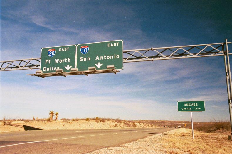
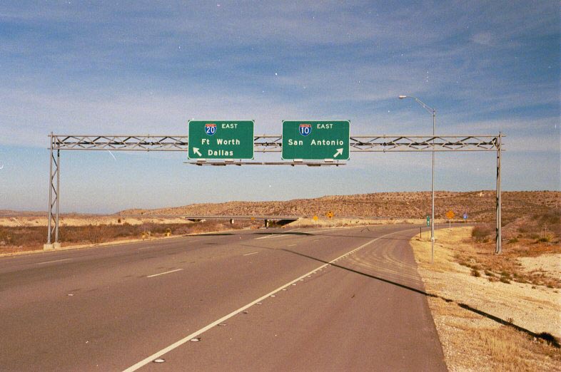
The roadways of IH 10 separate through a valley east of the Spring Hills leading to the split with IH 20 at the Reeves County line. The left exit for IH 20 to Pecos is unnumbered. 08/05/19
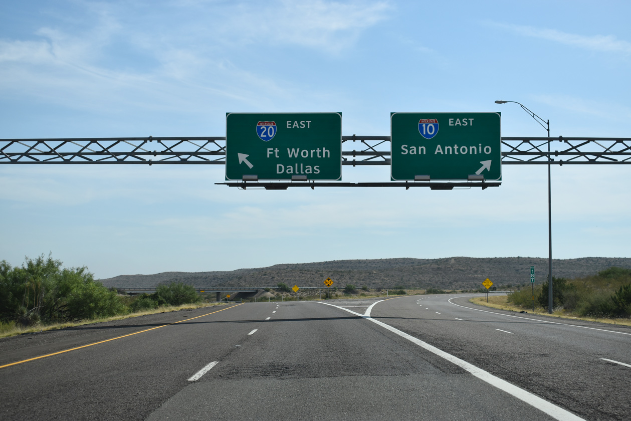
Traffic partitions for IH 20 to northern Texas destinations such as Midland and Odessa, Abilene, Dallas and Fort Worth. IH 10 follows a southerly route 383 miles to Fort Stockton, Sonora, Junction and San Antonio. 08/05/19
![]() West at
West at ![]()
Interstate 10 proceeds north to meet IH 20 a short distance beyond the diamond interchange with Giffin Road. IH 20 travels northeast toward Pecos, Monahans and Odessa-Midland. 08/05/19
![]() East
East
The first shield for eastbound Interstate 20 appears just beyond the split with IH 10 through Ninemile Draw. IH 20 travels northeast toward Toyah and Pecos, mostly over the former alignment of U.S. 80. Photo by Chris Elbert (03/31/07).
West End Throwback
Previous guide signs for IH 20 east from IH 10 west referenced Pecos in place of Dallas. Photos by Steve Hanudel (01/11/05).

Older guide signs posted ahead of IH 20 included space for U.S. 80. U.S. 80 was truncated west of Mesquite, Texas in 1991. Photo by Steve Hanudel (01/11/05).
Overheads at the Reeves County line formerly displayed a shield for U.S. 290 along IH 10 east. U.S. 290 was dropped from IH 10 eastward to Kimble County in 1992. Photo by Jeff Royston (12/30/00).
Replaced guide signs at the trumpet interchange with IH 20 east. IH 20 trends northward 428 miles to Fort Worth and 460 miles to Dallas. The first population center along the route is Toyah, located 22 miles away. Photo by Jeff Royston (12/30/00).
Sources:
- Metro Area Projects – Rankin County.
http://www.mdot.state.ms.us/news/projects/stack.htmMississippi DOT. - Stephen Summers’s Interstate system route numbering page.
http://www.nwindianahwys.homestead.com/INTER_MAIN.HTML - North Carolina Department of Transportation Strategic Highway Planning Documents.
http://www.ncdot.org/planning/tpb/SHC/documents/ - “From Anywhere to Everywhere: The Development of the Interstate Highway System in Texas.”
http://tti.tamu.edu/interstate_anniversary/white_paper/Texas Transportation Institute, page 17. - “From Anywhere to Everywhere: The Development of the Interstate Highway System in Texas.”
http://tti.tamu.edu/interstate_anniversary/white_paper/Texas Transportation Institute, page 29. - Interstate Highway 59, Adam Froehlig.
- “Happy Birthday to the open road.” Gwinnett Daily Post (Lawrenceville, GA), June 25, 2006.
- “Completion near for interstate road systems,” Rome News-Tribune (GA), November 14, 1977.
- “ALDOT director: Plan for I-20/59 bridges is best for Birmingham,” The Birmingham News (AL), January 24, 2016.
- “ALDOT: Phase One of I-20/59 construction to begin in coming weeks,” WBRC (Birmingham, AL), July 29, 2015.
- “SCDOT, Governor McMaster held groundbreaking on years-long project to improve ‘Malfunction Junction’.” WIS TV-10 (Columbia, SC), November 8, 2021.
Page updated March 10, 2022.