Interstate 17
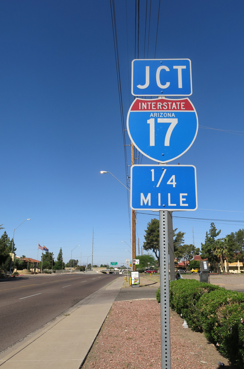
Overview
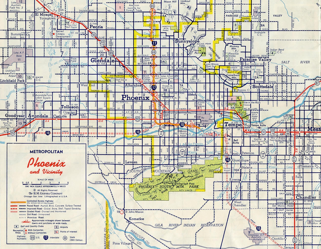
Connecting Phoenix with Flagstaff in central Arizona, Interstate 17 is a regional corridor joining I-10 with I-40. Heavily traveled in the Phoenix metropolitan area, I-17 is commuter freeway joining Downtown with North Mountain Village, Deer Valley and suburban areas across the north Valley.
Within Phoenix, I-17 follows the Black Canyon Freeway, one of the older freeways in the city completed in the early 1960s1. Heading north from urban areas across Deer Valley, it continues to the North Gateway area between Biscuit Flat and the Union Hills. Suburban development extends northward to the master planned community at Anthem and Rio Vista.
Beginning its ascent onto the Mogollon Plateau at New River, Interstate 17 crosses the Yavapai County line into Black Canyon City, where the lone business loop for I-17 was located until 2011. Continuing north, I-17 travels between Black Canyon and Black Mesa en route to Cordes Junction, where Arizona State Route 69 branches northwest toward Prescott.
Traversing areas of Prescott National Forest, Interstate 17 winds northeast into the Black Hills via Copper Canyon. The scenic route drops over 1,000 feet in elevation into a broad valley fed by the Verde River near Campe Verde before rising again across the White Hills.
The freeway has two major connections to the famous Sedona area, via SR 260 near Camp Verde and SR 179 near Rimrock. Northeast from Hog Canyon, I-17 runs through Coconino National Forest to the Coconio County line. The highway turns more northerly to Munds Park and Kachina Village en route to Flagstaff, where it concludes at a cloverstack interchange with I-40 and SR 89A (Milton Road).
 Parallel U.S. Routes
The northernmost reaches of Interstate 17 replaced U.S. 89 Alternate. The remainder of the freeway south to Phoenix replaced state routes. U.S. 60-70-89 and U.S. 80 converged east of I-17 at Downtown Phoenix historically. U.S. 60 accompanies I-17 from Exit 201 southeast to the terminus at I-10.
I-10/17 “Spine” Corridor Master Plan
The Black Canyon Freeway, originally constructed in Phoenix between Jefferson Street and Northern Avenue with four lanes, was designed for 20,000 vehicles per day (vpd). As of 2003, the congested highway carried up to 220,000 vpd with six through lanes and two HOV lanes.
Expansion options to mitigate traffic congestion along I-17 were included in the Maricopa Association of Government 20-year Regional Transportation Plan. Funds earmarked for Interstate 17 in the plan included one study to build an upper deck to the freeway. Inspiration for the I-17 plan was derived from the construction of a second deck for the LeRoy Selmon Expressway (SR 618) in Tampa, Florida, in addition to the population density adjacent to the Black Canyon Freeway. The Selmon Expressway was expanded as part of a $350 million project between April 2004 and July 2006. Supporting a reversible roadway, six miles of elevated viaduct were added along the toll road. These were supported with single pier-supports placed in the expressway median. Within Phoenix, the second deck of the Black Canyon Freeway was considered for the stretch between Interstate 10 (Exit 199) north and Dunlap Avenue (Exit 207), a distance of eight miles.
Similar to the Tampa roadway, the I-17 roadway would have carried Express lanes with only a few entry and exit points. Some early public comments on the project were positive. A west Phoenix community group, Community Leaders Organizing for Urban Transformation (CLOUT), however were not supporters. They contested that the highway would help divide west Phoenix from the rest of the city and advocated a relocation of funds toward mass transit-based projects. Projections in 2003 outlined potential construction of the upper deck for Interstate 17 as unlikely until 2016 and 2020.1
No progress was made since and by 2011 a new I-17 Corridor Improvement Study was underway. This Arizona Department of Transportation (ADOT) study was rescinded in 2012, along with the concurrent ADOT I-10 Corridor Improvement Study. Planning, engineering and environmental information derived from those studies were folded into a new I-10/I-17 Corridor Master Plan. Referred to as the “Spine”, because of its role as the backbone of transportation mobility in the Phoenix area, the study covers 31 miles of I-17 from Loop 202 at the Pecos Stack to the south to Loop 101 at the North Stack. The first round of public meetings on the Spine Study were conducted by the Maricopa Association of Governments (MAG) in partnership with ADOT and the Federal Highway Administration (FHWA) in March 2015.
The Recommended Alternate for the Corridor Master Plan was accepted into the 2040 Regional Transportation Plan by the MAG Regional Council on May 24, 2017. ADOT, the FHWA and MAG signed a Planning and Environmental Linkages (PEL) Statement summarizing the project’s findings on March 28, 2018. Final recommendations included bringing the freeway up to current design standards, adding at least one additional lane along the entire corridor in addition to implementing a managed lane system, modernizing 24 of the 31 interchanges, and improving pedestrian and bicycle connectivity at 20 locations.
Route Information
North End – Flagstaff, AZ
South End – Phoenix, AZ
Branch Routes – 0
Mileage – 145.76
Cities – Phoenix, Flagstaff
- Junctions –

Source: January 26, 2022 Interstate Route Log and Finders List
I-17 Annual Average Daily Traffic (AADT)
Source: ADOT Traffic Monitoring 2018 AADT

Portions of Interstate 17 were open to traffic by 1964, including the Black Canyon Freeway in Phoenix and upgraded sections of SR 69 around Black Canyon and Cordes Junction. A super-two section of SR 79 bypassed Sedona. It was four-laned by 1976.
The Black Canyon Freeway opened first in 1958 at Grand Avenue (U.S. 60) and Thomas Road. Subsequent sections opened in 1960 north to Glendale Avenue (Exit 205) and 1961 from Exit 205 to Dunlap Avenue (Exit 207).
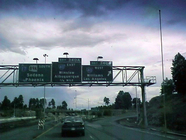
Previous control points for I-40 at the southbound beginning of I-17 included the Arizona city of Winslow and town of Williams. Photo by Jonathan Osborne (07/99).
History
Interstate 17 between Phoenix and Cordes Junction (Exit 262), replaced the southern extent of State Route 69. This is significant because the exit numbering scheme still follows the original mileage of SR 69. According to the Misc.Transport.Road FAQ (Marc Fannin) and based on comments from Richard C. Moeur, a unique milepost system was utilized in Arizona until the mid-1980s. The system specified that any route that did not enter Arizona from another state used the mileage of the intersecting route’s mileage at its south or west end as its starting value. The former route of SR 69 originated from U.S. 89 at milepost 201. Since I-17 and SR 69 overlapped originally, the exit numbers along the freeway used the mileposts of SR 69.
The exit numbers on I-17 are not related to those along Interstate 19. 174 miles separates the respective south end of each route.
The Black Canyon Freeway was the first section of I-17 to be built, with construction opening segments from I-10 northward to Little Deer Valley between 1958 and 1965. The freeway was completed in 1978 when the road north from Exit 268 (Dugas Road) through Spring Gulch to SR 169 (Exit 269) opened to traffic. See the I-17 Arizona guide for the rest of the time line.
A seven mile section of Interstate 17 along the Black Canyon Freeway was widened from Thomas Road (Exit 201) to Peoria Avenue (Exit 208) in Phoenix during a $82 million project completed in September 2000. Expansion added at least one continuous lane in each direction along the six lane freeway, including new carpool lanes, in addition to auxiliary lanes between interchanges. Bridges at Camelback Road and Glendale Avenue were replaced, and new lighting, sound walls and dynamic message signs were added. The design-build project was completed in 21 months.3
Further north in Phoenix at Deer Valley, the North Stack interchange joining I-17 with Loop 101 was completed with the November 1, 2000 opening of a 1.5 mile section of Loop 101 opened between 27th and 19th Avenues. The systems interchange was built in two separate projects totaling $63.7 million.4
According to the journal Roads and Bridges in 2000, Interstate 17 could be considered for an extension described as follows:
Interstate 17 — Phoenix to Salt Lake City: Like Phoenix, Salt Lake City is one of the nation’s fastest growing metropolitan areas with a population of 1.2 million. There is no direct Interstate connection between Phoenix and Salt Lake City. Completion of this corridor would require building or upgrading approximately 300 miles of roadway from Flagstaff, Arizona, to Sevier, Utah.
I-70 and I-15 would complete the connection to Salt Lake City. The costs to construct a new terrain route between Flagstaff and southern Utah, both economic and environmental, would be significant.
 Photo Guides
North End 
 – Flagstaff, Arizona
![]()
![]() North at
North at ![]()
SR 89A combines with Interstate 17 north from Exit 337 into Flagstaff. The freeway proceeds two miles from Flagstaff Pulliam Airport (FLG) to Interstate 40. 04/26/17
I-17/SR 89A curves northeast between Beulah Boulevard (old U.S. 89 Alternate) and the Ponderosa Trails community to the exchange (Exit 340) with Interstate 40. 04/26/17
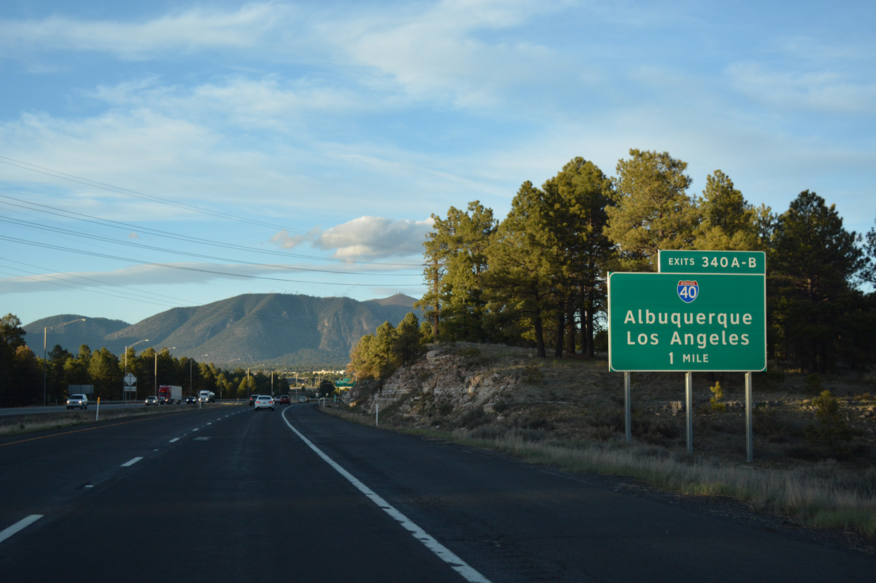
Elden Mountain rises to the northeast of Flagstaff. Succeeding off-ramps depart from I-17/SR 89A north for Lake Mary Road and I-40 to East Flagstaff. 04/26/17
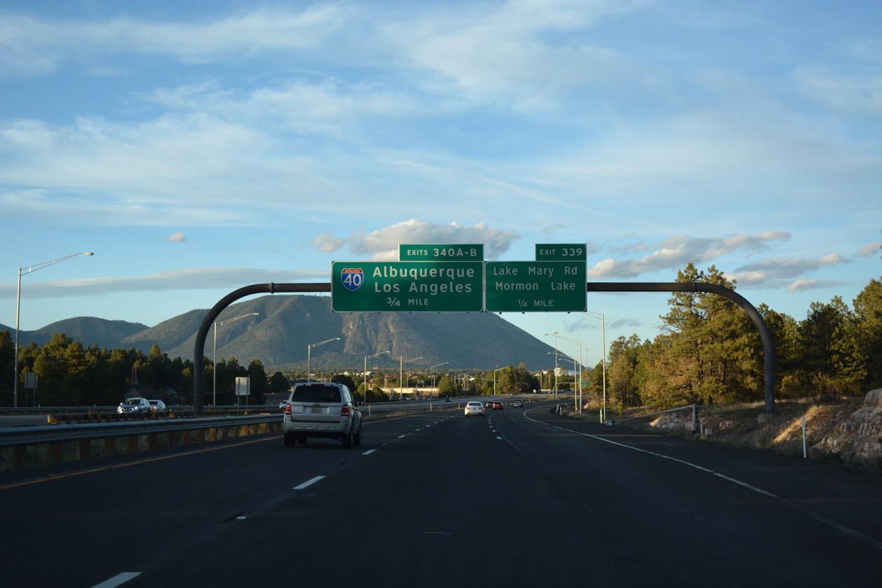
Exit 339 parts ways with I-17/SR 89A north to S Lake Mary Road to adjacent suburban development and Lake Mormon far to the southeast. Flyovers appear ahead from the cloverstack interchange (Exit 340) with Interstate 40. 04/26/17
Two lanes separate from I-17/SR 89A north for Interstate 40 east to Winslow, Holbrook and Albuquerque, New Mexico. 04/26/17
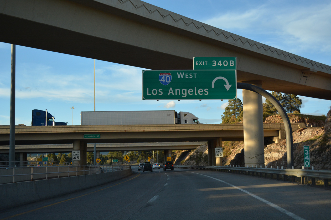
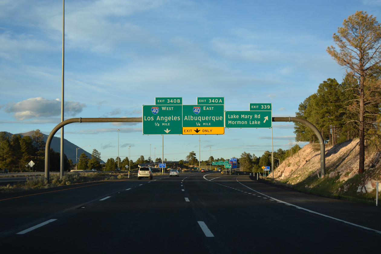
A loop ramp (Exit 340B) follows from I-17/SR 89A north for I-40 west to Williams, Seligman and Kingman. 04/26/17

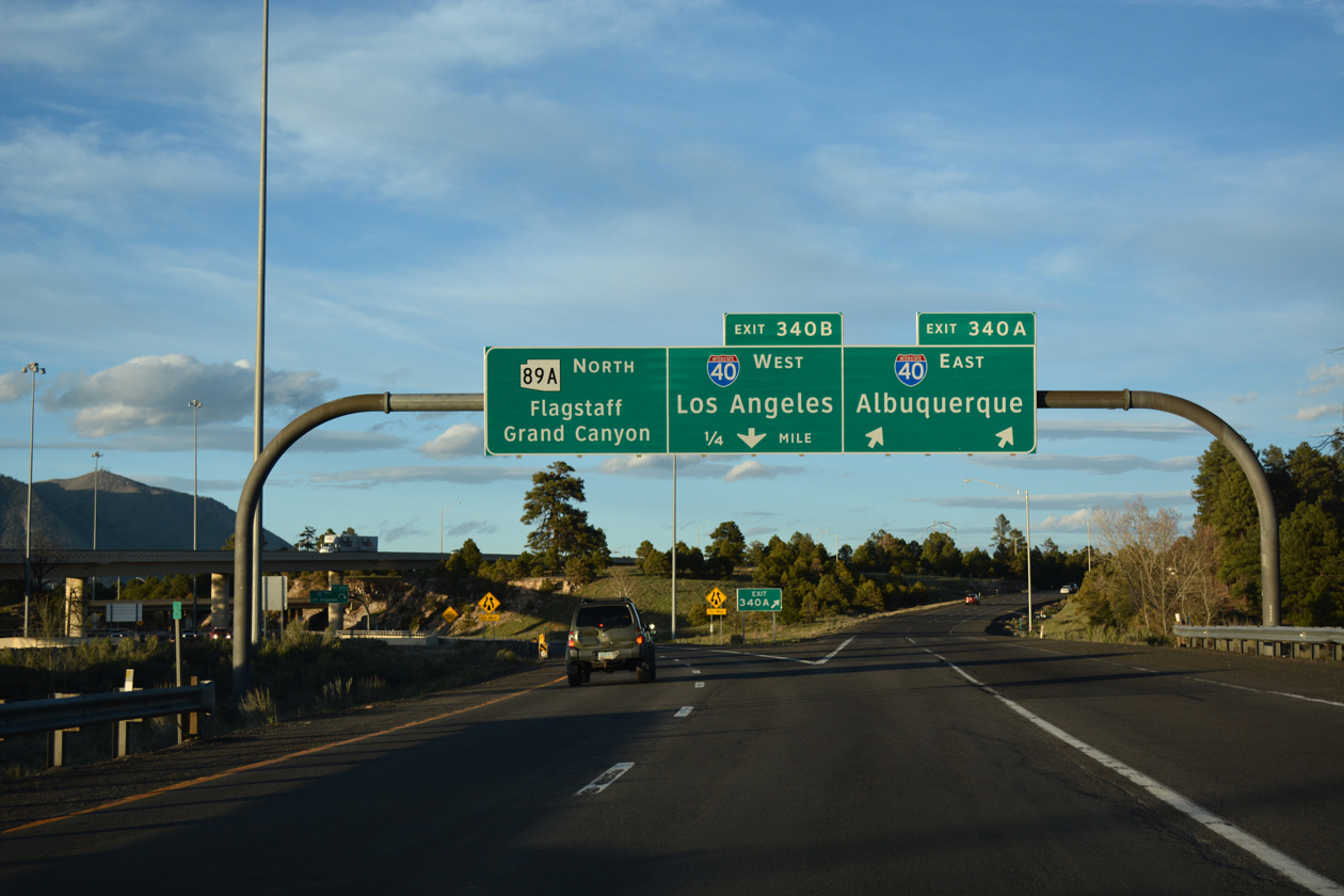
The freeway spurs north from I-40 to McConnell Drive by Northern Arizona University. SR 89A transitions into Milton Road, a commercial boulevard north to Business Loop I-40 (Historic U.S. 66) and Downtown Flagstaff. 04/26/17
![]() South at
South at ![]()
![]()
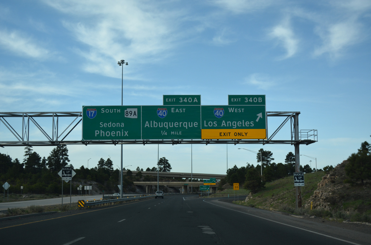
Arizona Route 89A (Milton Road) upgrades into Interstate 17 at a half diamond interchange with McConnell Drive. The freeway proceeds south into the cloverstack interchange (Exit 340) with Interstate 40. 04/27/17
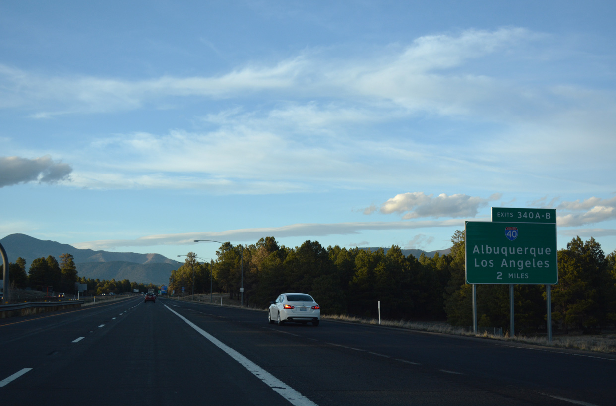
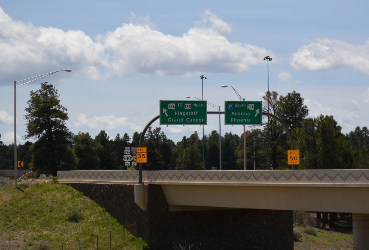
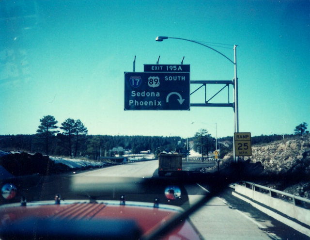
Exit 340A leaves I-17/SR 89A south for I-40 east to Albuquerque, New Mexico. I-17/SR 89A overlap another 2.6 miles to Exit 337, where the state route branches southwest toward Sedona. 04/26/17
![]() East at
East at ![]()
![]()

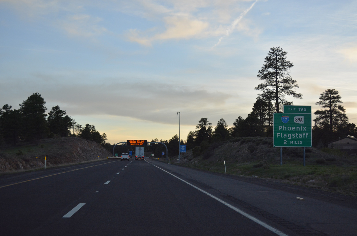
Business Loop I-40 / Historic U.S. 66 partitions from I-40 east, 3.5 miles west of the systems interchange (Exit 195) with Interstate 17 south and SR 89A. 04/28/17
Two miles ahead of I-17/SR 89A on I-40 east. Woody Mountain Road crosses over the freeway north of the Flagstaff Ranch golf course community here. 04/28/17
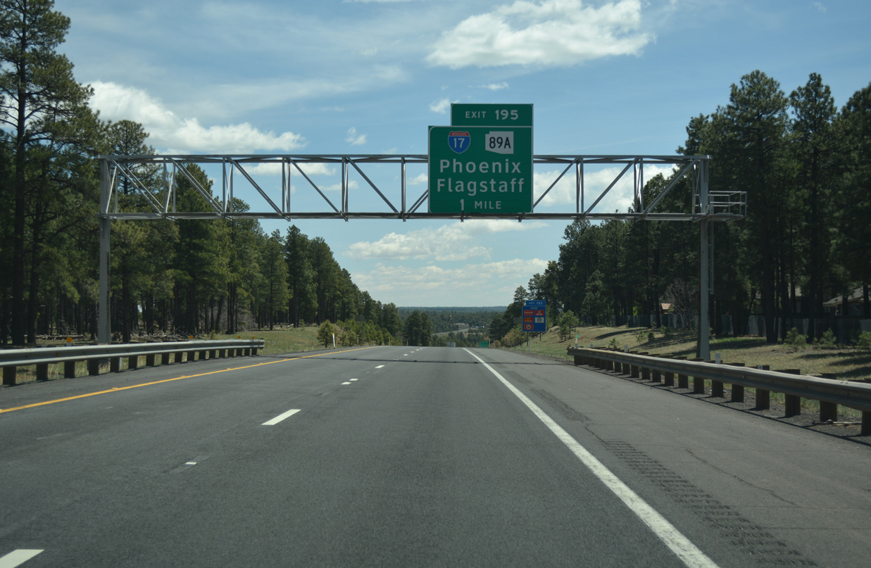
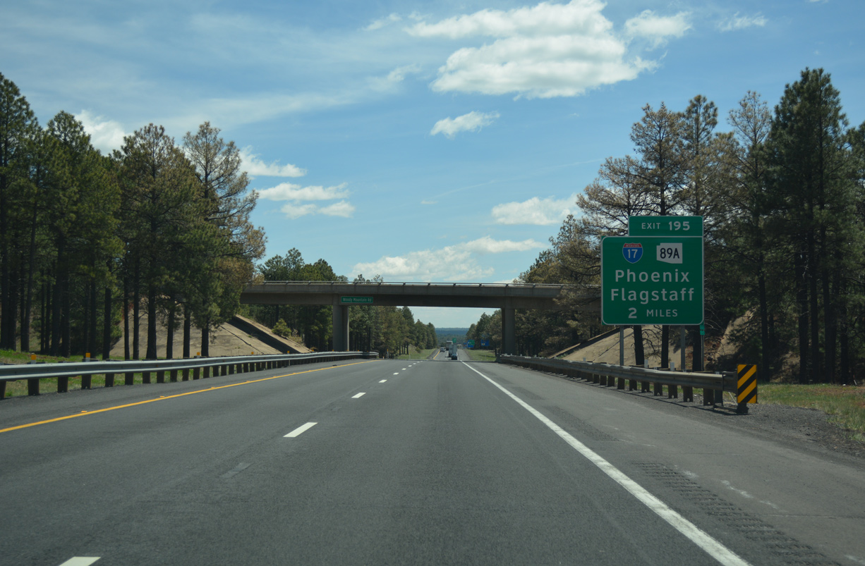
Lowering 200 feet in elevation to Exit 195, I-40 passes by the University Heights community. 04/28/17
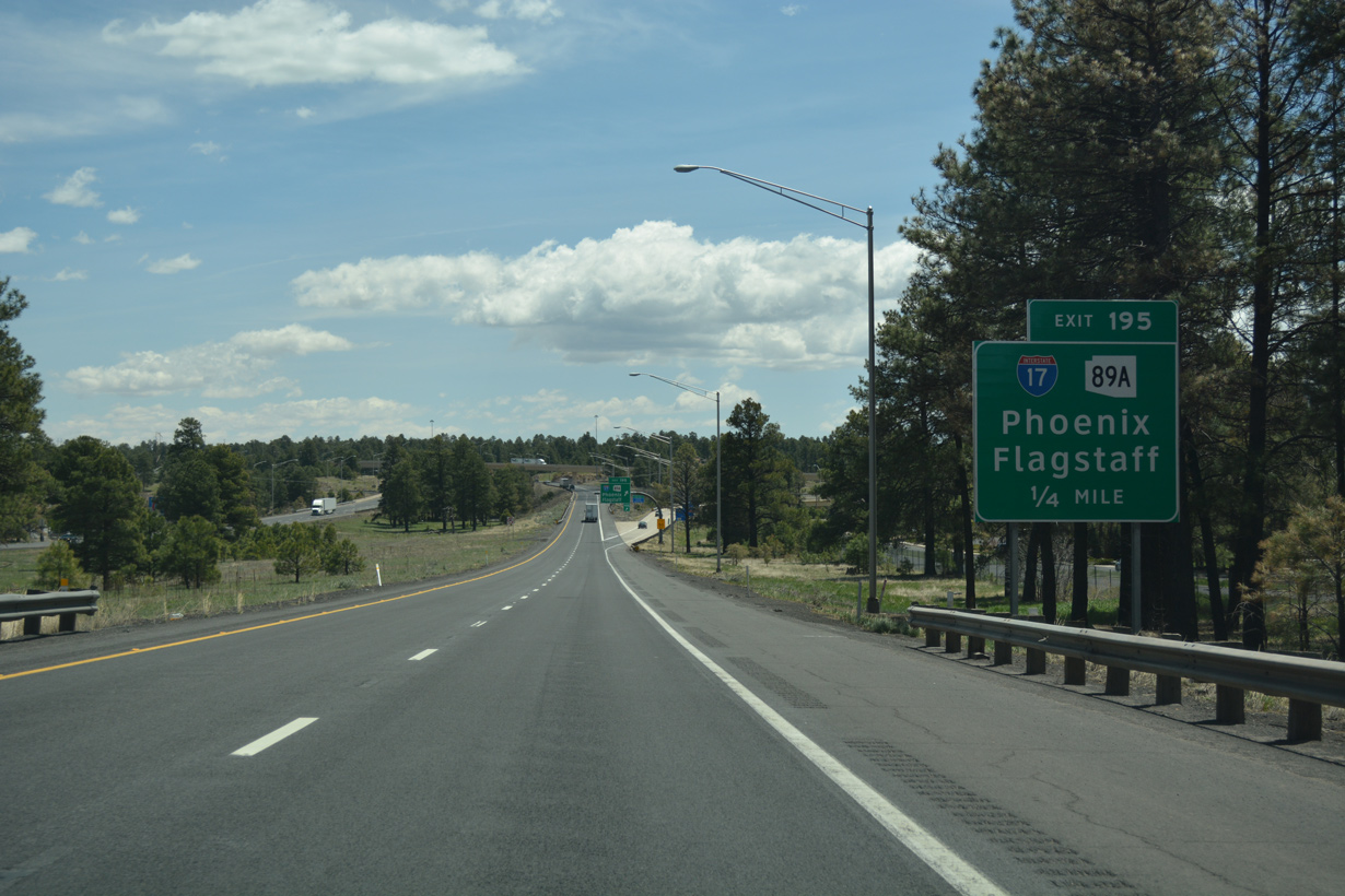
Exit 195 separates just ahead of Beaulah Boulevard (old SR 89A). Measuring 83.87 miles in length, SR 89A spurs north to Business Loop I-40 / Historic U.S. 66 in Flagstaff and originates from SR 89 in the city of Prescott. 04/28/17
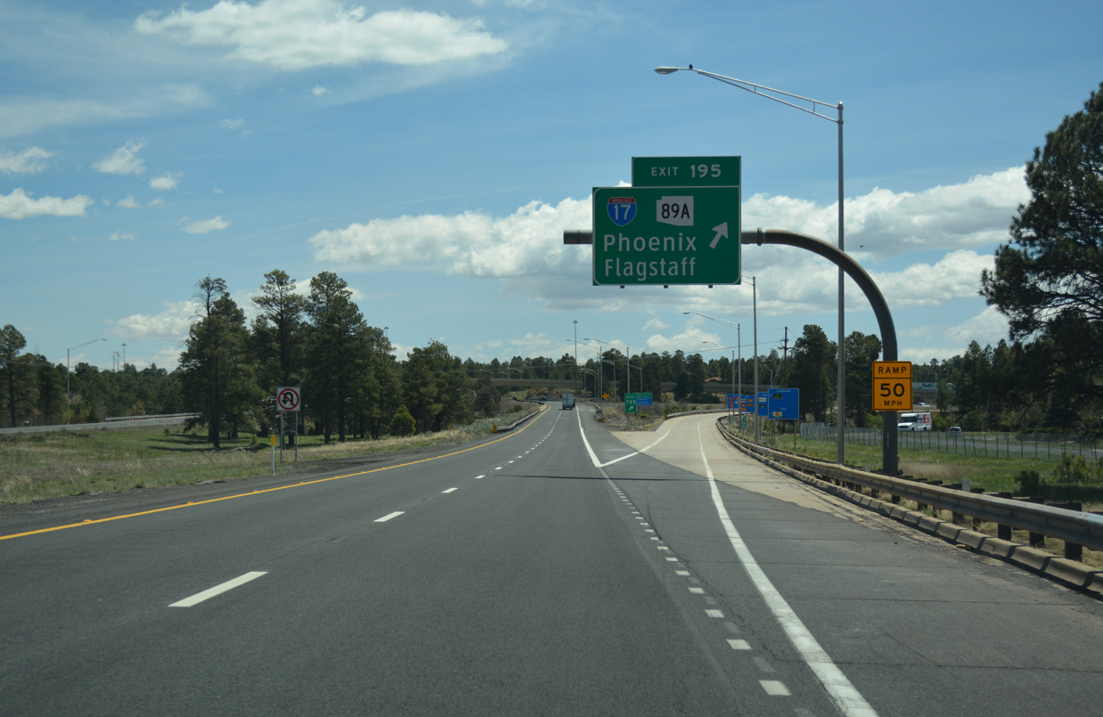
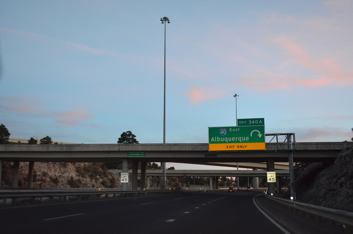
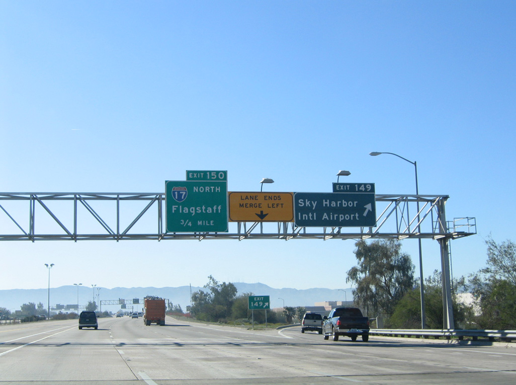
A single lane ramp leaves I-40 east for I-17/SR 89A south to Phoenix and Sedona and SR 89A north to Milton Road in Flagstaff. 04/28/17
The overpass taking Exit 195 over Beulah Road (old U.S. 89 Alternate) and Lake Mary Road was completed in late Fall 1998. Constructed during the $12.7 million, first phase of the I-40/I-17 interchange reconstruction project, work also included building the undercrossing for the ramp to I-17 north from I-40 east.5 04/28/17

Interstate 40 east at the cloverleaf interchange with I-17 and U.S. 89A. U.S. 89A was decommissioned in 1992 when U.S. 89 was truncated south of U.S. 180/Business Loop I-40 in Flagstaff. Photo by Bill Manning (08/78).
![]() West at
West at ![]()
![]()
Interstate 40 runs along the south side of Flagstaff from U.S. 180 to I-17/SR 89A at Exit 195. 04/26/17
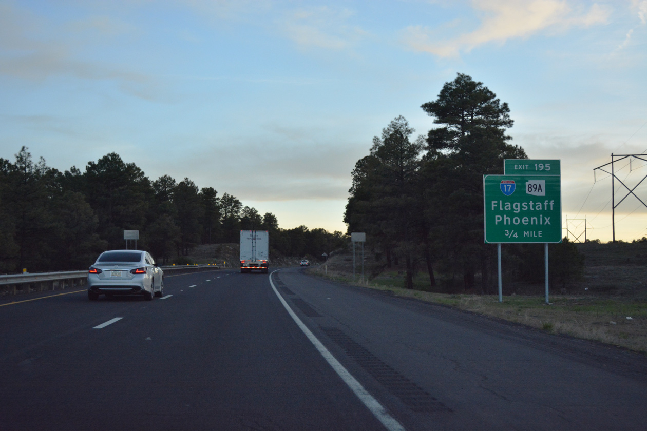
Passing by a number of apartment complexes to the south, I-40 advances three quarters of a mile to Interstate 17 south and SR 89A north. 04/26/17
A third westbound lane opens for the two-lane off-ramp (Exit 195) to I-17 and SR 89A. Reconstruction of the former cloverleaf interchange at I-17/40 was completed in September 2002.6 04/26/17
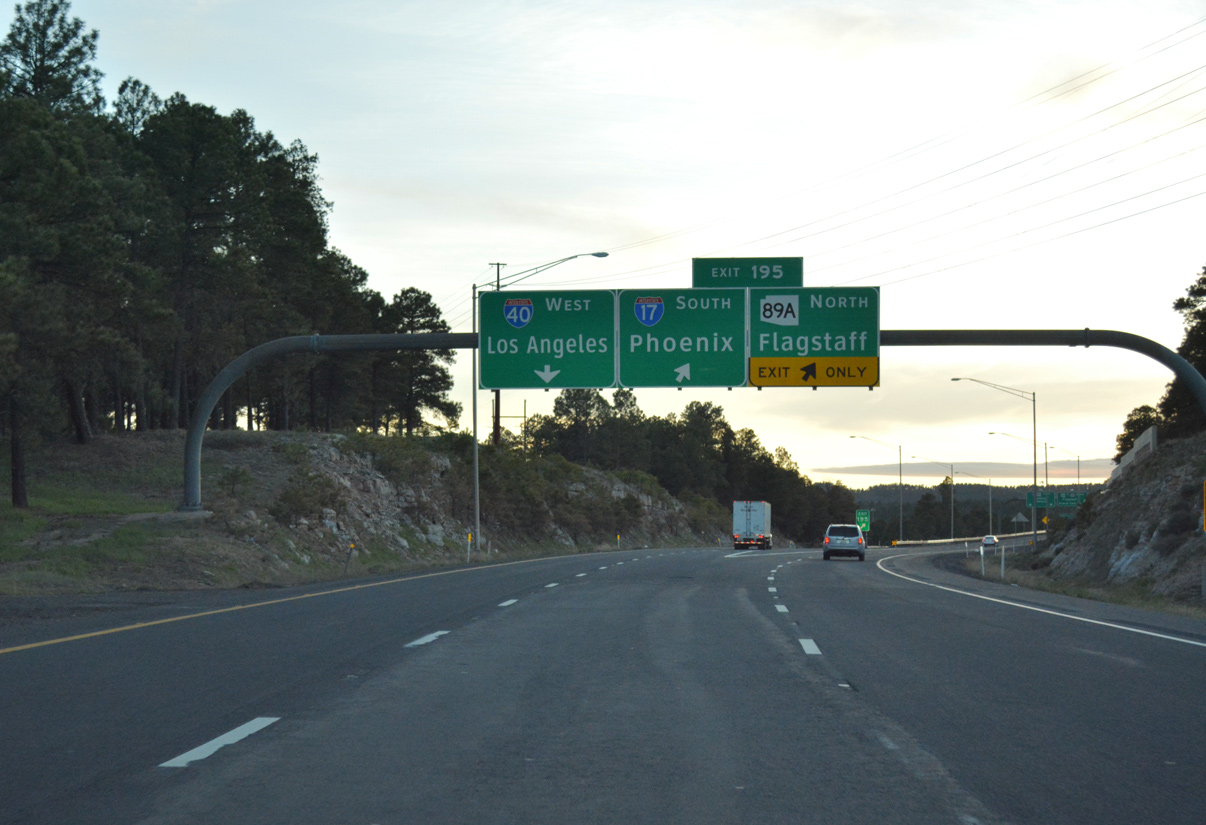
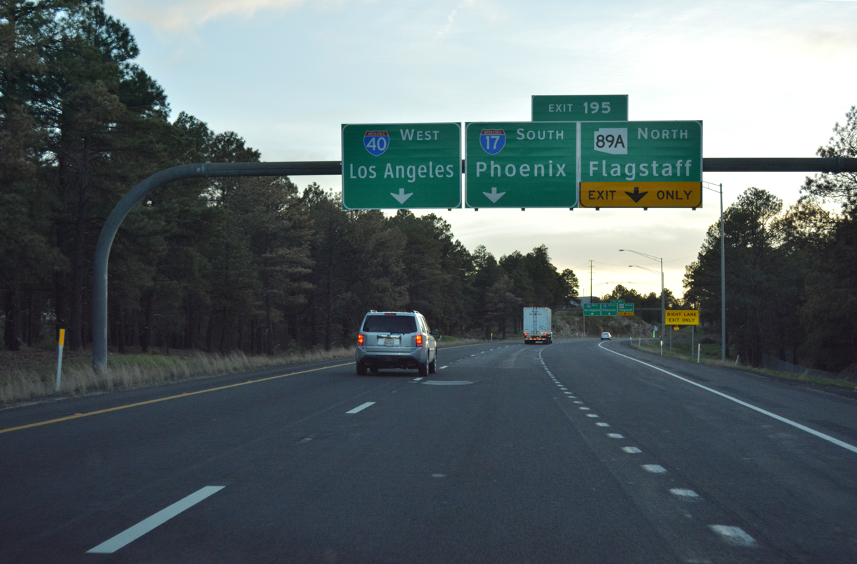
Interstate 17 lowers from an elevation of 6,910 feet at Flagstaff to 1,090 feet above sea level at the capital city of Phoenix. Barstow, California is another 352 miles to the west at the end of Interstate 40. 04/26/17

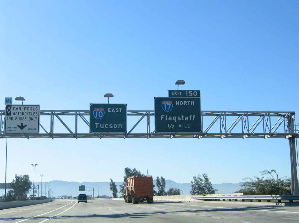
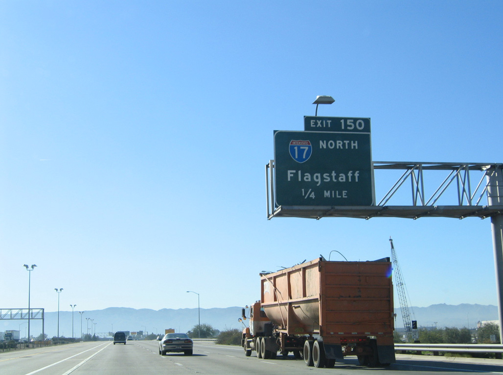
Exit 195 splits with the flyover for Interstate 17/SR 89A south. I-17 reaches Downtown Phoenix in 140 miles. SR 89A travels 32 miles southwest to Sedona. 04/26/17
Interstate 40 west at the former cloverleaf ramp for I-17 and U.S. 89A south. Photo by Michael Summa (1988).
South End – Phoenix, Arizona
![]() South
South ![]() East at
East at ![]()
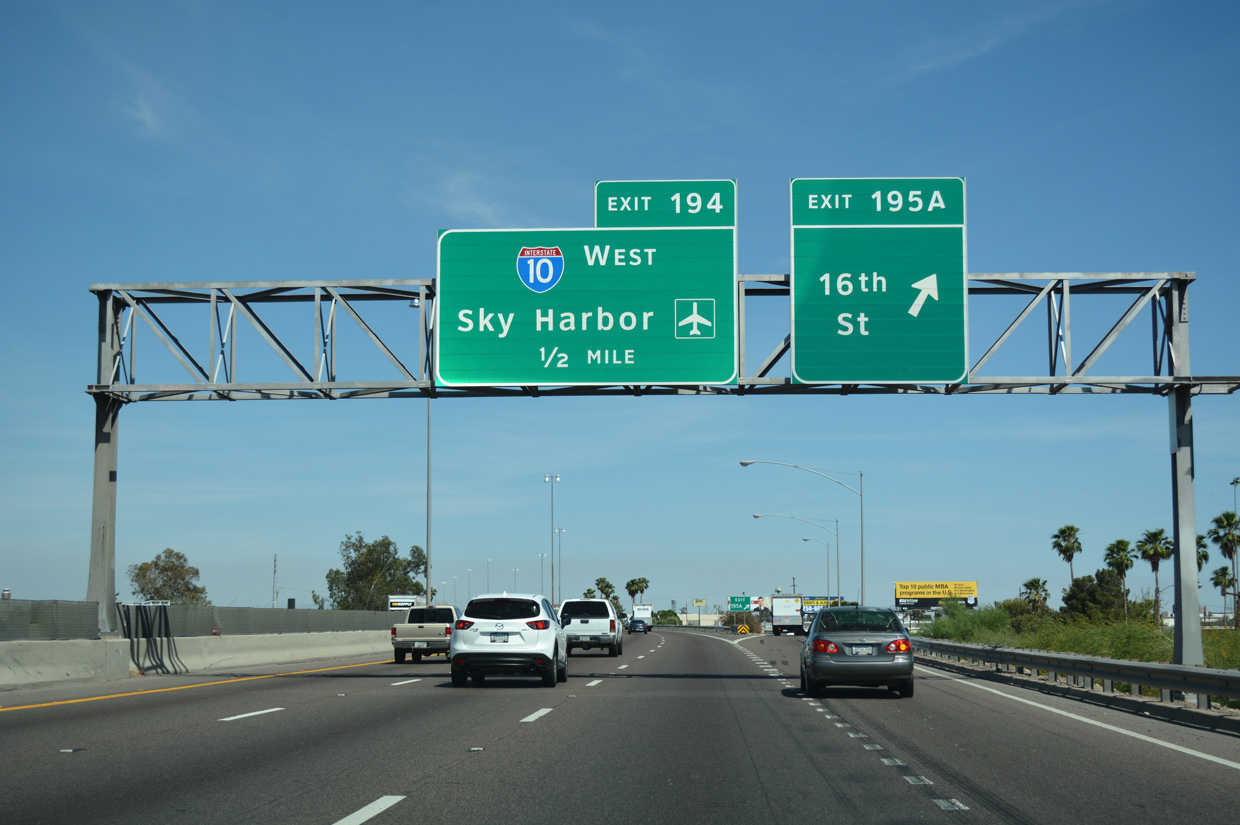
I-17 south / U.S. 60 east meet 16th Street at a half diamond interchange (Exit 195A) just ahead of Interstate 10 and the Rental Car Center for Phoenix Sky Harbor International Airport (PHX). 04/26/17

Exit 194 departs next for Interstate 10 westbound. I-10 forms the northern half of the freeway loop encircling Downtown Phoenix, with connections to SR 51 (Piestewa Freeway) and Loop 202 (Red Mountain Freeway). 04/26/17

Entering the two-wye interchange (Exit 194) with the Papago Freeway, I-10 to the north, and the Maricopa Freeway, I-10 to the east. 04/26/17
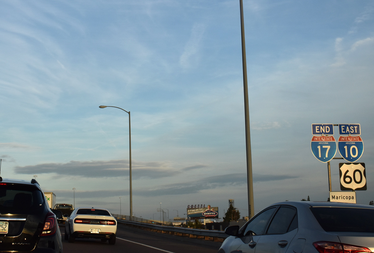
An end shield for I-17 stands ahead of the merge with I-10 east at the S 24th Street underpass. U.S. 60 continues along side Interstate 10 five miles to the Superstition Freeway across the cities of Tempe and Mesa. 03/01/19
![]()
![]() West at
West at ![]()

I-10/U.S. 60 shift northward across the Salt River through an S-curve between University Drive and Interstate 17 (Exit 150A). Trucks carrying hazardous materials are directed onto I-17 to avoid the Deck Park Tunnel along I-10. 04/26/17
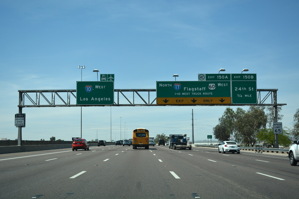
Westbound Interstate 10 expands to seven lanes across the Salt River leading to 24th Street by Phoenix Sky Harbor International Airport (PHX) and the split with I-17/U.S. 60. 04/26/17
U.S. 60 overlaps with northbound I-17 eight miles from I-10 west to Thomas Road and Grand Avenue in Phoenix. 04/26/17

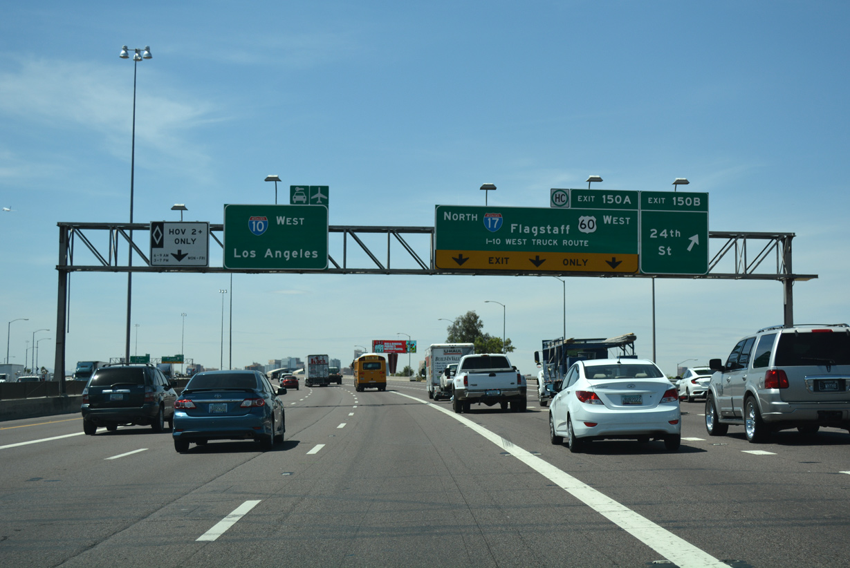
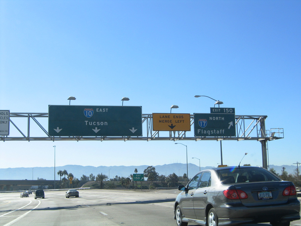
Exit 150A departs I-10 west for Interstate 17 (Maricopa Freeway), which loops to the south and west of Downtown Phoenix. I-10 and I-17 converge again in 6.5 miles. 04/26/17
![]() East at
East at ![]()
![]()
A wye interchange (Exit 149) connects I-10 (Papago Freeway) eastbound with Sky Harbor Boulevard leading into Phoenix Sky Harbor International Airport (PHX) just north of Interstate 17/U.S. 60. 01/17/05
Spanning Buckeye Road, I-10 advances a half mile south to the directional T interchange (Exit 150) with Interstate 17 (Maricopa Freeway) north. Although unmarked here, U.S. 60 accompanies I-17 to the west and I-10 to the east from this exchange. 01/17/05
Interstate 10 makes an eastern turn from the south end of I-17 and continues by the cargo areas of Phoenix Sky Harbor International Airport (PHX). I-17 extends the Maricopa Freeway west from I-10 to S 23rd Avenue and the Black Canyon Freeway north. 01/17/05
Exit 150 separates from I-10 east with a single lane for I-17 north and U.S. 60 west. I-10 proceeds southeast to Tempe, Guadalupe and Chandler. 01/17/05
Sources:
- “Double deck urged for I-17 in Phoenix.” The Arizona Republic, September 16, 2003.
- “$15.7 billion transit plan endorsed.” The Arizona Republic, September 18, 2003.
- “I-17 Widening Project finished on schedule, ADOT officials credit “Design-Build” process for success.” ADOT News (Arizona Department of Transportation), September 14, 2000.
- “It’s Completed! Final piece of I-17/Loop 101 interchange opens in north Phoenix.” ADOT News (Arizona Department of Transportation), November 1, 2000.
- Active Highway Construction Updates for Projects Outside Phoenix. Arizona Department of Transportation, September 7, 2001.
- “SR 89A detour to start next week for I-40/I-17 interchange project.” ADOT News (Arizona Department of Transportation), June 11, 1998.
Page updated January 28, 2020.