Interstate 10

Overview
Transcontinental Interstate 10 serves the southern tier of the United States from Southern California and the Desert Southwest east across Texas to the Southeastern United States. Known as the Christopher Columbus Transcontinental Highway, I-10 is one of three coast-to-coast Interstates, the others being I-80 and I-90.
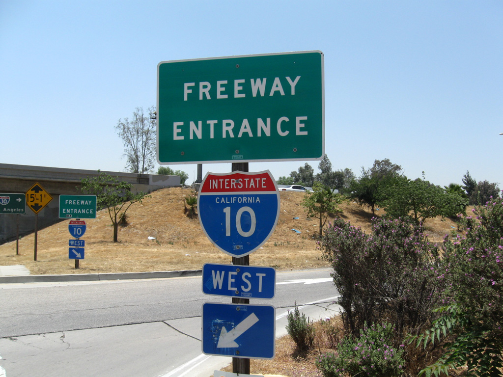
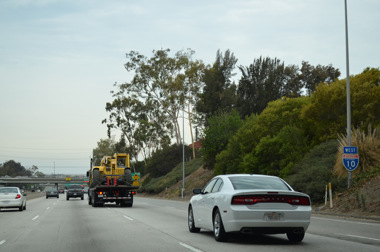
Within California, Interstate 10 originates in Santa Monica just off the Pacific Ocean. A heavily traveled freeway, I-10 advances east across Los Angeles where it briefly combines with Interstate 5. Following the San Bernardino Freeway from I-5, I-10 continues to the Inland Empire, leaving the greater Los Angeles metropolitan area some 70 miles east of Downtown Los Angeles. I-10 enters the desert just beyond the narrow San Gorgonio Pass. Beyond there, the freeway becomes characteristic of a rural desert, one it will retain through much of its course through the west. Desert cities in California include Palm Springs, Indio and Blythe.
Phoenix is the next major city, which is growing at an amazing rate through central Arizona. Interstate 10 forms a freeway loop with I-17 through Downtown Phoenix before making a southeasterly turn across the Sacaton Mountains and Santa Cruz Flats toward Tuscon. I-10 runs west of the Tuscon business district, representing one of just two freeways serving the metropolitan area. The freeway navigates along a gradual arc southeast from the city to San Pedro Valley at Benson and then northeast across Sulphur Springs Valley toward Bowie.
Heading east across the Peloncillo Mountains, Interstate 10 enters New Mexico. This stretch is prone to high winds and during periods of dust storms the freeway may be shut down with traffic detoured north of the Animas Valley via U.S. 70 from Lordsburg. I-10 overlays U.S. 70 and historic U.S. 80 east across open desert to Deming to the Mesilla Valley and Las Cruces.
Skirting the Mexican Border and the Rio Grande near El Paso, Interstate 10 crosses the vast expanse of West Texas. The freeway has several at-grade ranch access points between The El Paso County line and Van Horn, due to the remote character of the highway and the extremely low traffic volumes of the region. Those same aspects allow for it to be posted with an 80 mile per hour speed limit.
Traveling east from Van Horn, I-10 traverses northern reaches of the Davis Mountains, splitting with Interstate 20 in a sparsely populated area east of Fort Kent. Elevation changes mark the next several hundred miles, as I-10 progresses east to small cities such as Junction and Kerrville. When approaching San Antonio from the northwest, I-10 transitions to a suburban freeway from Boerne into the Alamo City.
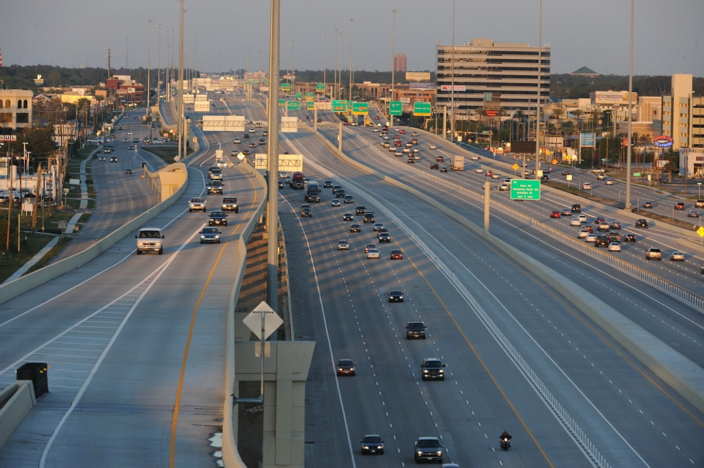
Comprising a heavily traveled commuter route, Interstate 10 forms part of a loop encircling Downtown San Antonio with I-35 to the west and U.S. 90 to the south. The freeway overlaps with or parallels U.S. 90 for the remainder of the route east to Houston. Suburban frontage reappears along I-10 at Katy, with the freeway swelling to 16 lanes along the Katy Freeway through the western Houston suburbs. The Baytown East Freeway continues I-10 toward industrial areas at Channelview and Bayport. The freeway eventually exits the Lone Star State at Orange, east of Beaumont.
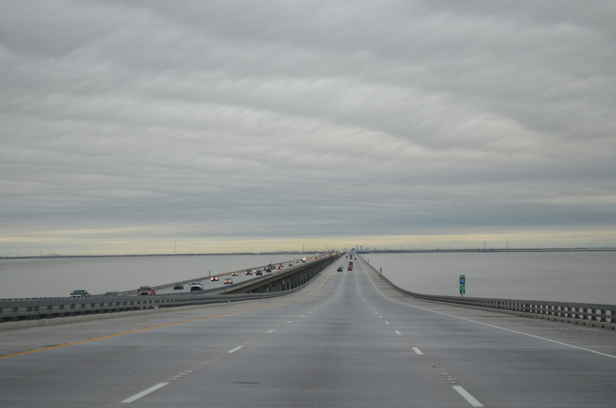
Entering southern Louisiana, Interstate 10 stays in land through areas of timberland, agricultural areas, and bayous. The freeway joins the urban centers of Lake Charles, Lafayette and Baton Route. Several major sections of the highway are elevated in the Pelican State, including the Acadian Thruway leading toward Baton Rouge and along the periphery of Lake Pontchartrain. I-10 splits with I-12 to loop southward into Greater New Orleans while I-12 provides a bypass for long distance travelers east into coastal Mississippi.
I-10 and I-12 reconvene at Slidell, just west of the Pearl River and Mississippi state line. Interstate 10 crosses the Mississippi Gulf Coast through northern reaches of Gulfport, Biloxi and Moss Point. Combined with commuter traffic and long distance freight, a substantial section of Interstate 10 in the Magnolia State was expanded to six lanes.
Turning northeast toward the Port City of Mobile, I-10 circumvents Mobile Bay through the George Wallace Tunnel at Downtown, and across the four lane Mobile Bayway to Spanish Fort and Daphne. The freeway becomes rural again east of Loxley, traversing areas of pine forest into the Sunshine State outside Pensacola.
Once in Florida, Interstate 10 travels across the Pensacola area before turning more inland from the coastal estuary of Escambia Bay. The freeway runs along the northern boundaries of Elgin Air Force Base along a lightly traveled stretch to Crestview and Defuniak Springs. Crossing the Apalachicola River, I-10 enters Eastern Time Zone and proceeds east toward the capital city of Tallahassee.
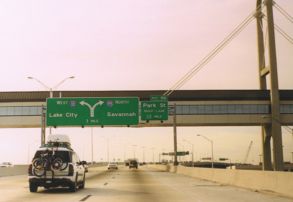
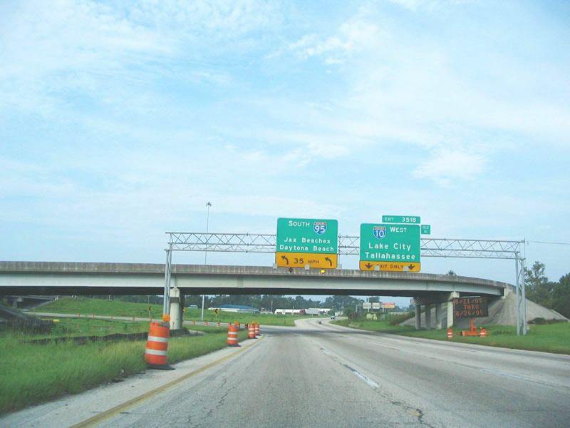
Interstate 10 stays through rural areas of Northern Florida, meeting I-75 outside Lake City and crossing a wide swath of Osceola National Forest toward Jacksonville. Continuing into Jacksonville, Florida’s largest city, I-10 expands into a six and eight lane urban freeway, concluding at I-95 between Downtown and the Fuller Warren Bridge spanning the St. Johns River.
Mobile River Bridge
Within the state of Alabama, Interstate 10 will eventually be relocated onto a new alignment and bridge over the Mobile River. Associated work will rebuild the Mobile Bayway from twin two lane bridges to an eight lane viaduct system. A Draft Environmental Impact Statement was released on July 22, 2014 for the new bridge and Bayway widening.
First envisioned in the 1990s, the proposed 2,300 foot long bridge was estimated to cost $350 million, with funding primarily from federal dollars. A spokesman for U.S. Rep. Jo Bonner R-Mobile indicated in 2003 that local officials have to agree to support the plan first, but that support was not concrete. However then-Mayor Mike Dow of the city of Mobile gave the project his full support. Mobile County Commission President Freeman Jockisch concurred with that, adding that Mobile area leaders were united in their support for the project. 2003 state traffic studies concluded that the Wallace Tunnel was reaching capacity and that the adjacent Bayway, the seven mile twin viaduct over Mobile Bay, was in need of expansion. The average daily traffic for the Wallace Tunnel in 2002 was 59,898 vpd. The tunnel was designed to handle 36,000 vpd.1,15
A unique bridge design was sought for the span, with “V” shaped towers built on single piers. Ron Poiroux, then-division engineer at the Alabama DOT District 9 Mobile Office, indicated that it was up to the U.S. Congress to approve the $200 million bridge and $150 million Bayway expansion. A $650,000 feasibility study was previously completed in 1997. The project was slated to take about eight years to complete, with a potential completion date by 2012.1 As of 2012, no bridge plan was agreed upon by city or DOT officials and the tunnel and Bayway remained with four overall lanes.
The new span gained traction in 2013, with more public support and potential funding, leading to the DEIS issued in July 2014. The 2014 estimate for building the Mobile River bridge and expand the Bayway is $850 million.15
With funding secured and rights of way purchased, construction was anticipated to take six to eight years to complete. The cable stayed span would provide a vertical clearance of 215 feet.15 All electronic tolling would be implemented both on the new bridge and the George Wallace Tunnel to cover the costs. The tunnel would remain open, serving local traffic to Downtown Mobile, and be designated as Business Loop I-10.
Growing community opposition to tolling of the Mobile River Bridge and overall costs rising to over $2 billion, ultimately resulted in the cancellation of the project. The Eastern Shore Metropolitan Planning Organization withdrew the Interstate 10 Mobile River Bridge and Bayway project from its short term plan in August 2019. Alabama Governor Kay Ivey declared the transportation plan as dead following the vote.17
The Mobile River and Bayway project was eventually revised to limit car tolls to $2.50 and not include tolling the adjacent Wallace or Bankhead Tunnels. These changes resulted in the Eastern Shore and Mobile Metropolitan Planning Organizations both endorsing the $2.1 billion plus project in unanimous votes on December 15, 2021. The project previously received $125 million in funding from the Infrastructure for Rebuilding American (INFRA) grant required usage by September 2022.18
High Priority Corridor
The section of Interstate 10 through Southern California is part of High Priority Corridor 34: Alameda Corridor East and Southwest Passage. East in Arizona, Interstate 10 between Phoenix and Tucson is part of High Priority Corridor 26: CANAMEX Corridor.
 Parallel U.S. Routes
The completion of Interstate 10 in the Southwestern States resulted in the demise of several parallel U.S. Highways, including U.S. 60, U.S. 70, U.S. 80 and U.S. 290. U.S. 60 and U.S. 70 previously followed I-10 from Los Angeles to Phoenix. U.S. 60 ends at I-10 east of Quartzsite, Arizona, and U.S. 70 ends at U.S. 60 in Globe, Arizona.
U.S. 80 was superseded by several Interstates in the west; I-10 replaced U.S. 80 between Phoenix and the I-10/20 split near Kent, Texas. Prior to 1992, U.S. 290 also followed the I-10 corridor from I-20 to the Kimble County, Texas. East of San Antonio, I-10 closely parallels, but for the most part does not replace, U.S. 90 all the way to Jacksonville.
History
California
Within the Golden State, Interstate 10 is a major through traffic corridor, connecting Southern California with the growing Inland Empire and desert cities such as Palm Springs, Indio and Phoenix, Arizona. As such, the freeway is often as busy as Interstate 5 in the Central Valley, carrying weekend travelers across the vast desert. In the Los Angeles Basin and Inland Empire, relief to perennial traffic was sought with the construction of Interstate 210, the Foothill Freeway, between Redlands and San Dimas. Completed July 24, 2007, the freeway remains signed as California State Route 210.
Arizona
For a complete history of I-10 construction in Arizona, visit the Interstate 10 Arizona guide on AARoads. The final segment of the route in Arizona built was the Papago Freeway in Downtown Phoenix, which opened on August 10, 1990. This included the Deck Park Tunnel north of Downtown and represented the final section of the transcontinental route completed.10 Original plans called for an elevated Interstate 10 freeway through Downtown Phoenix in 1960, but the ultimate facility built travels mostly below grade.
A $12.2 million widening project along Interstate 10 in West Phoenix got underway in Fall 2003. The widening resulted in the expansion of I-10 from six to eight lanes between 59th Avenue (Exit 134) and 91st Avenue (Exit 139). An additional westbound lane, along with new auxiliary lanes , opened to traffic on November 9, 2003. An new eastbound through lane and auxiliary roadways were open to traffic in December 2003.6 These projects were two of many taken to provide additional traffic relief in Phoenix, fueled by major expansion of the metropolitan area with new developments in formerly virgin desert.
Long-range plans for I-10 within Maricopa County in the mid 2000s suggested additional expansion and a parallel freeway (SR 30 / I-10 Reliever) to be constructed southward Plans for Loop 202, the southern and eastern belt route for the Phoenix area, advanced with freeway construction south from I-10 underway through 2020.
Texas
Within Texas, Interstate 10 was an original Interstate Highway, and it was approved by the Bureau of Public Roads in 1959 and by the Texas State Highway Commission in 1962 with 879 miles.9 Sections of I-10 were under construction in the Lone Star State between 1959 and 1982. Early emphasis was on completing the freeway through and between San Antonio and Houston; this was mostly done by 1968 and completely by 1972. In West Texas, much of the construction occurred in the 1960s and 1970s. The El Paso and Van Horn bypasses were built first; the last section to open was the Fort Stockton bypass.
The significant reduction in traffic between El Paso and San Antonio is the least populated stretch of Interstate 10. Due to low traffic counts and long sight lines through remote West Texas, transportation officials approved an increase in the speed limit for 432 miles of IH 10 between El Paso and Kerrville to 80 miles per hour in 2006.11
Through central San Antonio, I-10 was built on two decks to maximize utility of space in a tight right of way. Leading into Houston, the 2002-08 Katy Freeway reconstruction rebuilt all of I-10 from Katy into Houston with additional lanes, ramp realignments, and the Katy Tollway.
Louisiana
Storm surge from the August 29, 2005 landfall of Hurricane Katrina toppled or misaligned many of the 309 ton concrete segments of the twin spans built in 1965 for Interstate 10 across Lake Pontchartrain in southeastern Louisiana. The bridges were closed and an emergency contract of $30.9 million13 was awarded to reopen the crossing. This occurred October 14, 2005 with the opening of the eastbound bridge with two-way traffic. The westbound bridge was restored with one lane of traffic on January 5, 2006.
Route Information
Mileage
California – 242.54*
- Cities – Santa Monica, Los Angeles, Pomona, Ontario, San Bernardino, Beaumont, Banning, Indio, Blythe
- Junctions –


Arizona – 392.33
- Cities – Phoenix, Casa Grande, Tucson
- Junctions –
New Mexico – 164.27
Cities – Lordsburg, Deming, Las Cruces
- Junctions –
Texas – 881.00#
- Cities – El Paso, Fort Stockton, Kerrville, San Antonio, Houston, Beaumont, Orange
- Junctions –
Louisiana – 274.42
Cities – Lake Charles, Lafayette, Baton Rouge, New Orleans, Slidell
- Junctions –
Mississippi – 77.19
Cities – Gulfport, Biloxi, Pasacagoula
- Junctions –
Alabama – 66.31
Cities – Mobile
- Junctions –
Florida – 362.28
Cities – Pensacola, Tallahassee, Lake City, Jacksonville
- Junctions –
Source: December 31, 2021 Interstate Route Log and Finders List
* – 1.60 miles on I-5, # – 2.39 miles on I-35
I-10 Annual Average Daily Traffic (AADT)
Source: 2017 Traffic Volumes: Route 7-10 (Caltrans)
2019 AADT – Traffic Monitoring – ADOT
2015-19 AADT – LaDOTD – Average Daily Traffic Counts
2019 AADT – Florida Traffic Online (FDOT)
432 miles of Interstate 10 between El Paso and Kerrville and 89 miles of Interstate 20 from its beginning to the Monahans have 80 mph speed limits. Limits were raised from 75 mph to 80 mph in May 2006.

IH 10 was open from El Paso east to Van Horn in 1965. Segments east from Van Horn to Stockton directly upgraded U.S. 80 into freeway by 1966. By 1969, IH 10 was complete from Ozona to Sonora. The final portion built was the Fort Stockton bypass in 1982.
The Katy Tollway runs between the general travel lanes of IH 10 between SH 6 and the West Loop of IH 610 in Houston. Opened to motorists on April 18, 2009, the managed lanes operate 24 hours a day. Occupancy requirements and tolls vary depending upon traffic conditions and time of day.
An $733 million project replaced the substandard spans with new wider (six lanes with full shoulders) and higher (30 feet versus nine feet) bridges. Eastbound traffic shifted to a combination of both new bridges in July 9, 2009 as crews demolished the original westbound span. Eastbound I-10 shifted entirely to the new bridge on March 12, 2010 as westbound traffic continued solely on the original eastbound span. Westbound traffic finally shifted to the new bridge on April 7, 2010. Work was completed on the Twin Span Bridge approach from the south side of the lake on August 15, 2011. Work on the north side approach followed with completion in September 2011.13 The new spans crest at 80 feet above Lake Pontchartain.
Crossing Lake Pontchartrain along Interstate 10 west along what is officially named Frank Davis “Naturally N’Awlins” Memorial Bridge. The New Orleans skyline appears along the southwestern horizon. 02/22/13
A portion of the 1965 twin spans were retained for use in the St. Tammany Fishing Pier. Former Parish President Kevin Davis pushed for the idea as the eastern end of St. Tammany Parish was without a public public fishing facility. Discarded spans were purchased by the parish for $19,300 with the pier constructed between September 2011 and May 18, 2012 at a cost of $1.6 million.14 A 700 foot long wooden bridge connects the pier to the shore.
Mississippi
Addressing traffic congestion with population growth in coastal Mississippi, a multi year plan expanded the freeway from Shorecrest Road in Harrison County east to the Jackson County line. The $29 million project began in September 1999 and concluded in October 2003.3 Construction increased capacity from four to six lanes between Exit 28 and Exit 46 in the Gulfport-Biloxi area. Also a part of I-10 construction along the Mississippi Gulf Coast was the $47 million Jourdan River bridge replacement project started in January 2001. This roadwork added lanes between MS 43/607 at Exit 13 and the Diamondhead interchange at Exit 17. The new bridges were completed by September 5, 2004.4
Growth in the D’Iberville area surrounding retail development at The Promenade, Lakeview Village and Lakeview Towne Square on the north side of I-10 at I-110, plus the expansion of MS 67 into a four lane expressway, rapidly increased traffic at the cloverleaf interchange between the two freeways. Multiple projects were undertaken by the Mississippi Department of Transportation (MDOT) to address congestion, starting with the addition of an overpass linking Promenade Parkway and Sangani Boulevard across MS 15/67 at the north end of I-110. New ramps were built between the bridge as well, eliminating the signalized intersection north of I-10. Completed on August 15, 2013, this work preceded upgrades at the cloverleaf, which included adding a eastbound c/d roadway and the future construction of a flyover from westbound I-10 to southbound I-110. Adjacent work started in July 2013 built a diverging diamond interchange (DDI) with D’Iberville Boulevard (Old Highway 67) just to the west. Opened on June 2, 2015, the DDI was the first in Mississippi. Additional ramps were added between I-10 and Lamey Bridge Road and I-110 at Popps Ferry Road, with all remaining work completed on September 3, 2015.
Alabama
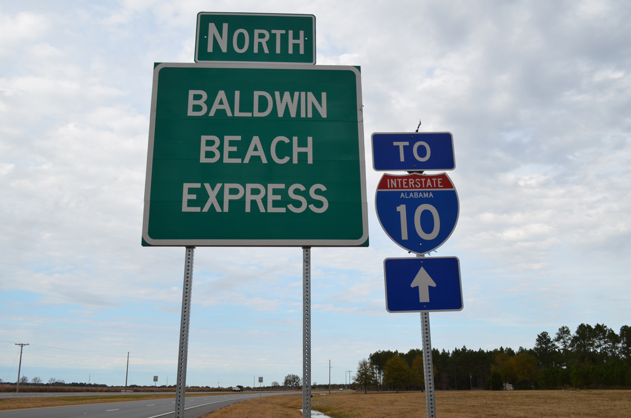
A new interchange (Exit 10) was constructed along Interstate 10 in Mobile County, Alabama at County Road 39 / McDonald Road CR 39 constitutes a four lane connector leading southeast to U.S. 90 at Irvington and the town of Bayou La Batre. Started in Spring 2003, construction was completed by Winter 2005.5 A second interchange opened at Exit 49 with the extension of the Baldwin Beach Express on August 15, 2014.
Widening of Interstate 10 southwest 4.8 miles from a point just west of the Plantation Road (CR 69) overpass to just west of Exit 10 with CR 39 commenced in September 2021. The expansion project adds a lane per direction within the existing right of way while adding a median barrier. Costing $24.9 million, work runs through May 24, 2024.19
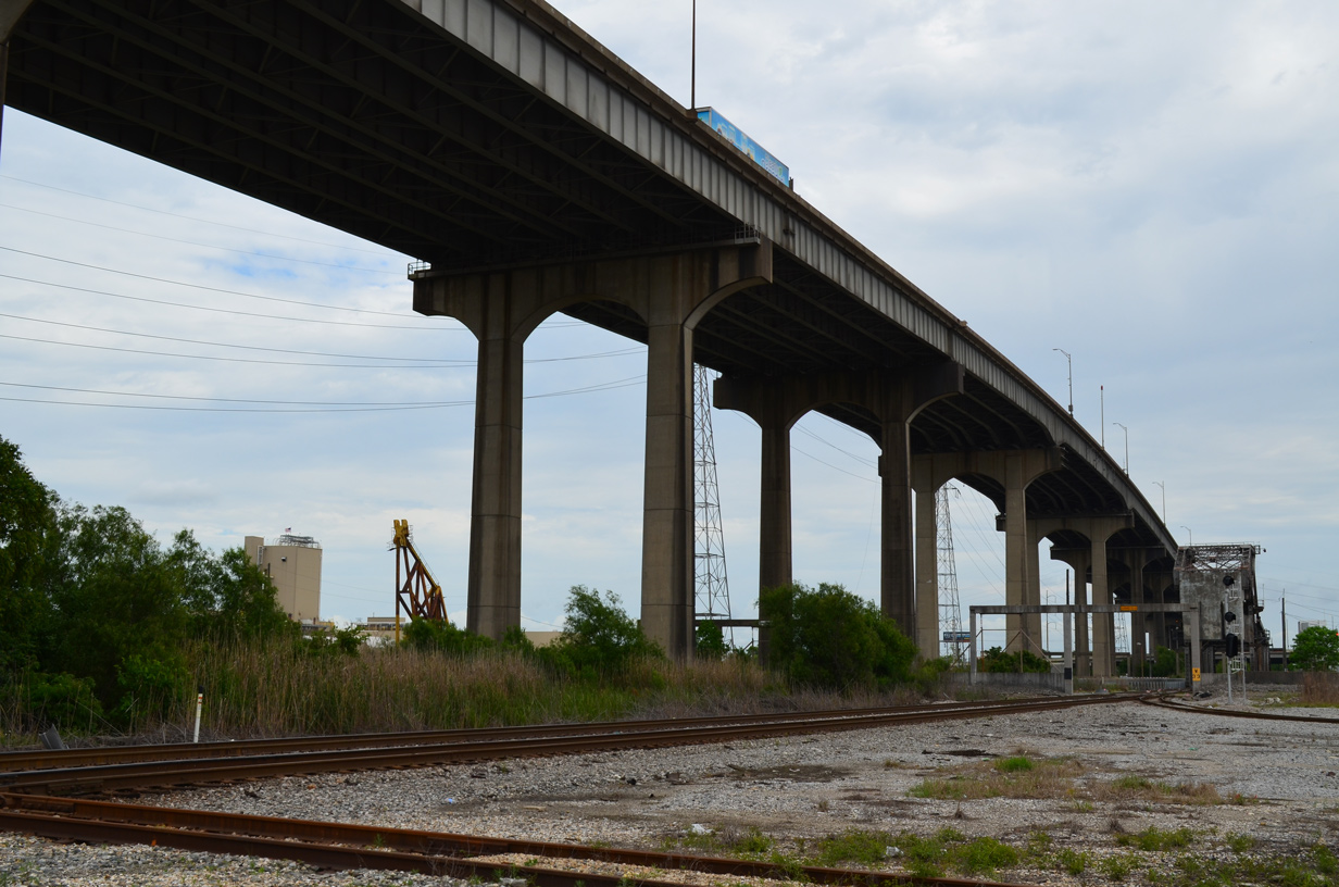
A substantial portion of Interstate 10 travels along elevated roadway through southeastern Louisiana. A 6,700 foot section of viaduct in New Orleans culminates at the High Rise Bridge spanning the Industrial Canal. 05/09/15
Interstate 10 opened initially in Mississippi from Exit 75 (Franklin Creek Road) to the Alabama state line in 1966. The final portion completed was the stretch between Exit 57 (MS 57) and Franklin Creek Road, including the viaduct over the West and East Pascagoula Rivers, in the early 1980s.16
Florida
Key dates in the history of Interstate 10 in Florida:8
- 1961 – the first segment statewide opened from Sanderson east into Jacksonville.
- 1962 – under construction in vicinity of Pensacola, and from Winfield east to Sanderson.
- 1963 – opened from Winfield to Sanderson.
- 1967 – completed from the Alabama State Line to SR 87 and under construction from Falmouth to I-75.
- 1968 – opened from SR 87 to Mossy Head
- 1969 – opened from Falmouth to Interstate 75.
- 1970 – opened from Mossy Head to De Funiak Springs. Construction continued on the section from Midway to near Capitola and from near Drifton to Falmouth.
- 1973 – opened from De Funiak Springs to Caryville and from Drifton to Falmouth. I-10 remained under construction between Capitola and Drifton.
- 1974 – opened from Capitola to Drifton. New construction extended from Caryville to Chipley.
- 1975 – under construction between Chipley and Midway.
- 1977 – opened from Chipley to Midway. Entire route was complete except for section from Kynesville to Oakdale.
- 1978 – opened from Kynesville to Oakdale. The original planned route of I-10 was complete from Alabama-Florida State Line east to I-95 in Jacksonville.
Within Northwest Florida, Interstate 10 was widened to six lanes between U.S. 29 / Exit 10 and SR 291 / Exit 13 between 2002 and 2008. This project coincided with a reconstruction of the trumpet interchange (Exit 12) at Interstate 110, and widening of the freeway spur southward to Exit 3 in Pensacola. Improvements at the exchange included building a flyover from westbound I-10 to southbound I-110 and adding collector distributor roadways separating traffic between Exit 12 and 13. The project was completed by Fall 2008.
Similar to the Lake Pontchartrain Twin Span collapse of Hurricane Katrina, the I-10 bridges across Escambia Bay in northwest Florida were substantially damaged by storm surge during Hurricane Ivan. Waters compromised 124 spans of the 2.5 mile long crossing between Pensacola and Santa Rosa County during the early morning of September 15, 2004. An emergency contract was awarded to repair the twin spans while design work got underway for their eventual replacement. Traffic on I-10 resumed over Escambia Bay on October 5, 2004 with one lane per direction using the westbound span. Subsequent work on the eastbound span restored it for use with one overall lane on November 27, 2004.
The Florida Department of Transportation (FDOT) awarded a $243 million contract in January 2005 for new bridges across Escambia Bay. Built at a height of 25 feet above the bay waters, 13 feet higher than their predecessors, the new eastbound bridge opened on December 19, 2006 with two-way traffic. The replacement westbound span opened to traffic on December 12, 2007, expanding I-10 across Escambia Bay to six overall lanes.
Within Tallahassee, a previously planned route of Interstate 10 in Leon County took the freeway into Downtown Tallahassee via Gaines Street, presumably as an elevated structure. Dubbed the “Seminole Expressway”, since it bordered Florida State University to the south, opposition from the city and the university ultimately caused I-10 to be rerouted. Furthermore a developer in the northern part of the city donated land to build Interstate 10 near the Killearn development that eventually started in the 1970s.7
Additional work in the capital city took place between 2006 and 2009. The Moving I-10 Forward project expanded the freeway to six overall lanes between the Gadsden / Leon County line and U.S. 319 / Exit 203. Work improved the interchanges at SR 263 (Capital Circle NW), U.S. 27 (Monroe Street) and U.S. 319 / SR 61 (Capital Circle NE).
Major roadwork also expanded and modernized Interstate 10 in the city of Jacksonville, including a massive redesign of the interchange with I-95. Costing $154 million, work commenced on the The Big ‘I’ project in February 2005 and was completed in May 2011. The project wrapped up under budget and six months early using innovative management. The Big ‘I’ earned the top roadway project in the country by the American Association of State Highway and Transportation Officials (AASHTO).12
The interchange joining I-10 with SR 23 / Cecil Commerce Parkway opened to traffic at Exit 350 on October 1, 2009. SR 23 is part of the First Coast Expressway, a toll road completed 15 miles south from I-10 to SR 21 near Middleburg in July 2018. The First Coast Expressway will eventually extend east across the St. Johns River to connect with I-95 in St. Johns County.
 Photo Guides
East End  – Jacksonville, Florida
![]() East
East ![]() North at
North at ![]()
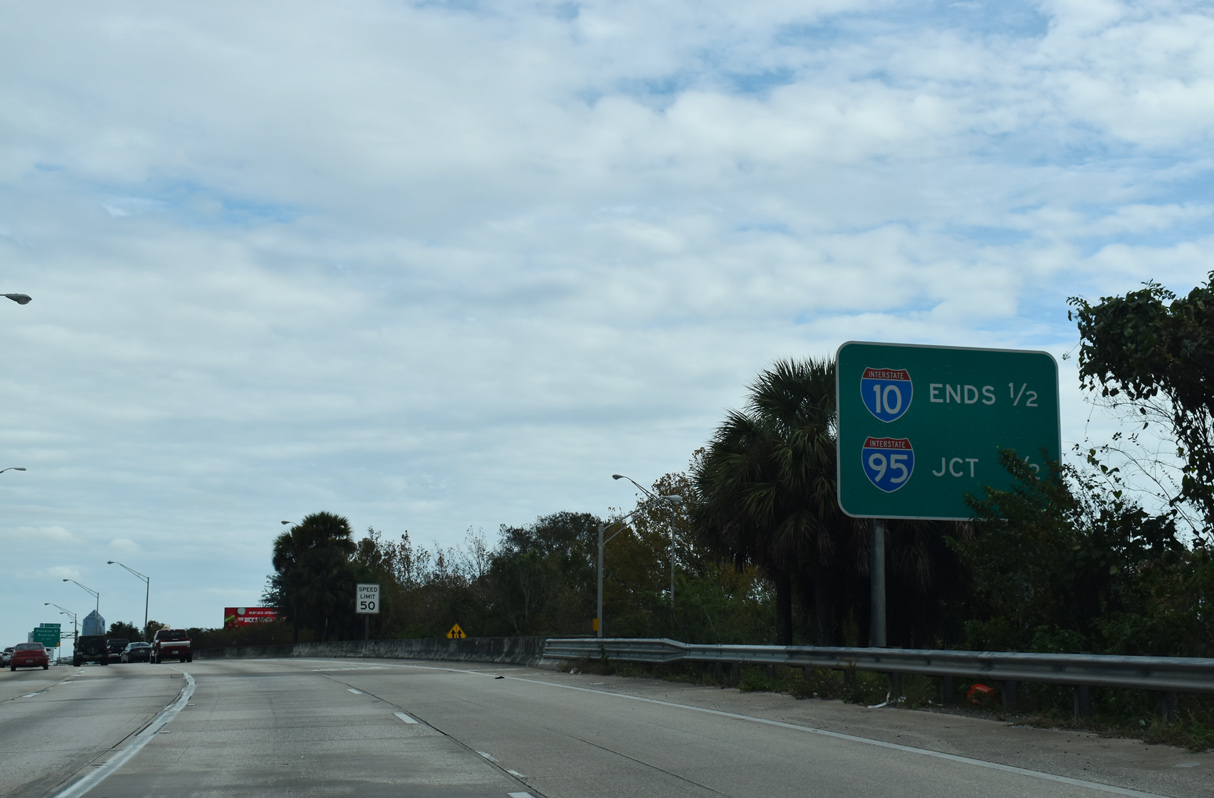
Interstate 10 ends one half mile east of the wye interchange with U.S. 17 north and SR 228 east. U.S. 17/SR 228 overlap with I-10 east to a c/d roadway along I-95 north to U.S. 23 (Union Street). 12/04/20
The Big I interchange project at I-95 reconfigured the east end of Interstate 10 into separate roadways ahead of Exit 362 to Stockton Street. The dual freeway eliminates weaving traffic from the prior merge with U.S. 17 (Roosevelt Expressway). 12/04/20
A $126 million project underway from May 5, 2017 to Spring 2021 Summer 2022 early 2023 expanded the exchange joining I-10 and I-95. Construction both added an additional lane to the flyover joining I-95 north with I-10 west and a dedicated ramp westbound for Stockton Street to reduce weaving traffic along Interstate 10. Expansion along the Fuller Warren Bridge taking I-95 across the St. Johns River added an additional lane per direction and a multi use path between the Riverside and San Marco neighborhoods.20
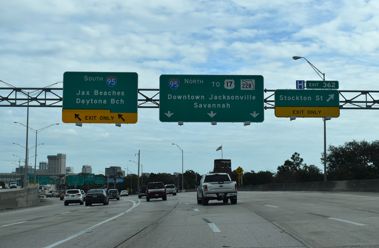
Both roadways of I-10 connect with I-95 north and south. The outer roadway joins a collector distributor roadway along I-95 north with ramps to Forest Street, Forsyth Street and Monroe Street leading east to LaVilla and Downtown Jacksonville. 12/04/20
Traffic bound for Interstate 95 south departs for the Fuller Warren Bridge to Southside Jacksonville and Daytona Beach. Separate flyovers connect with I-95 north to Brunswick and Savannah, Georgia. 12/04/20
![]() South at
South at ![]()
![]()
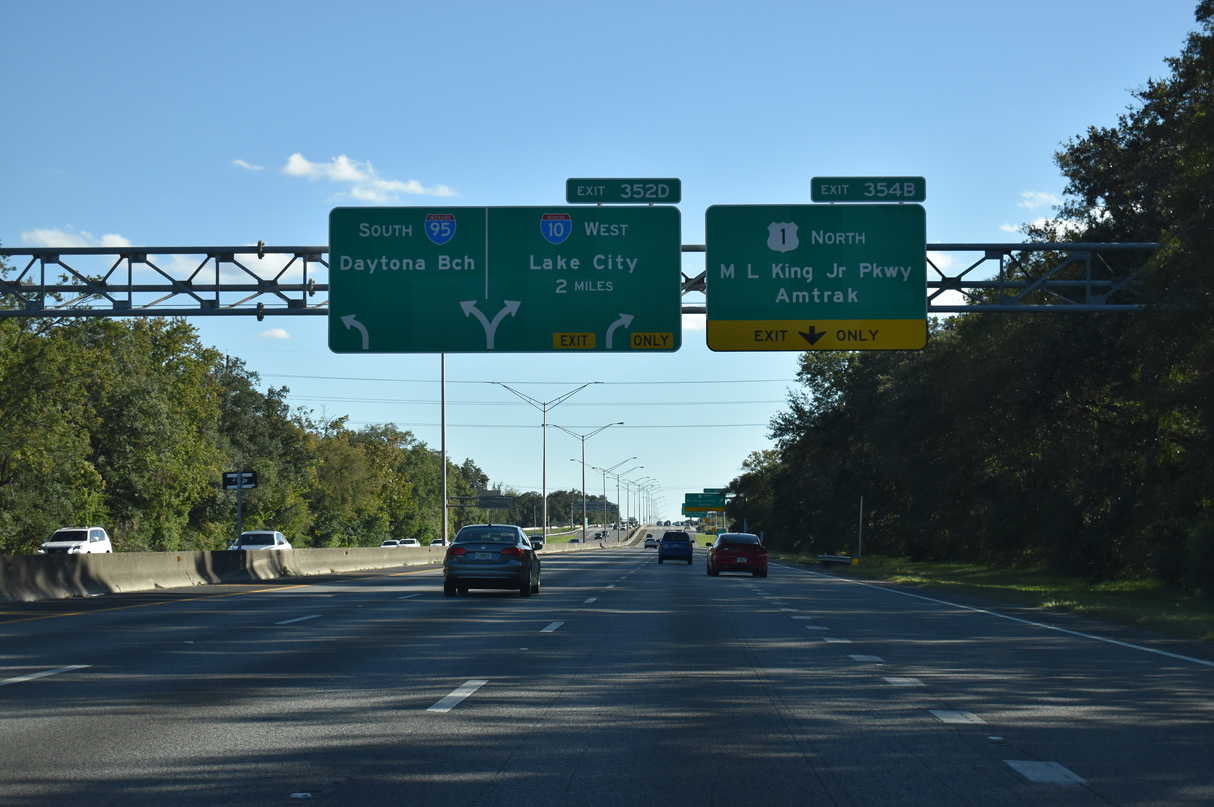
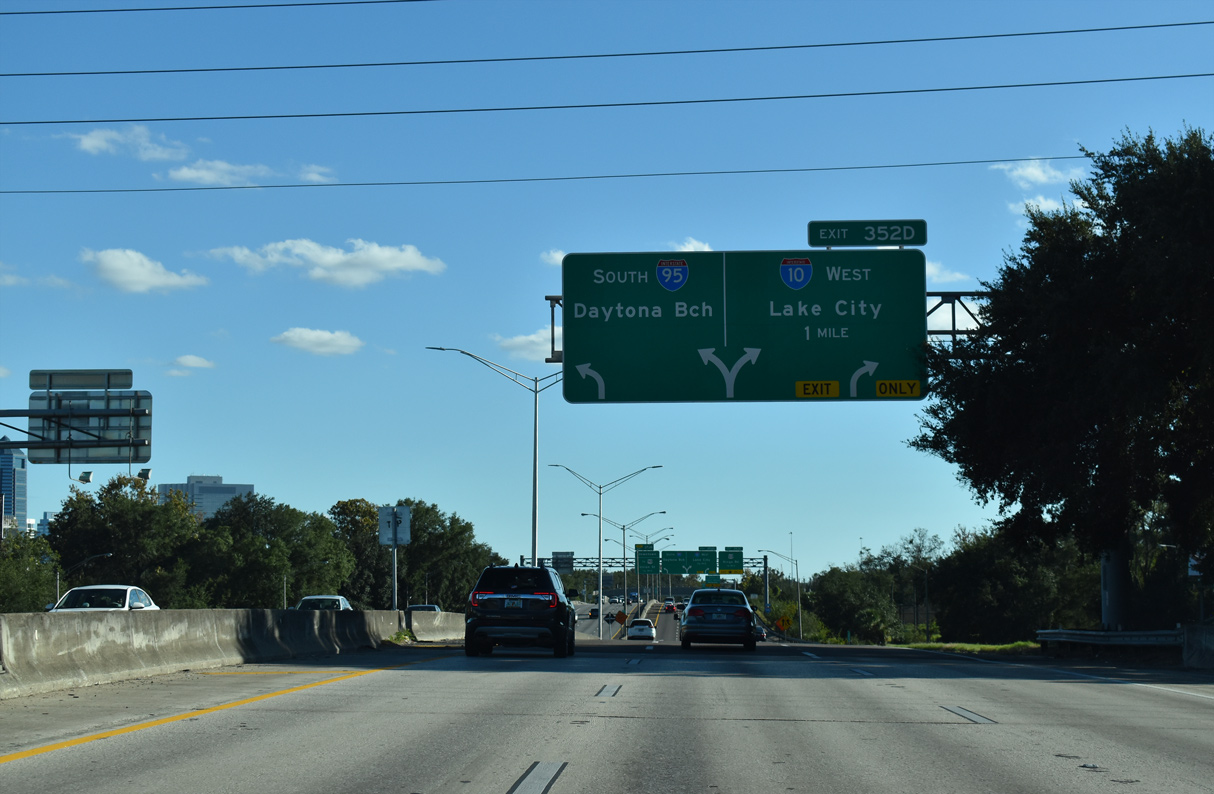
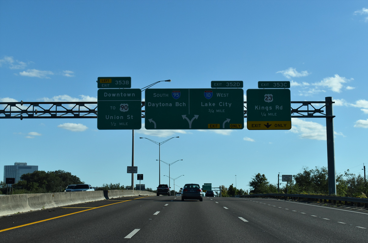
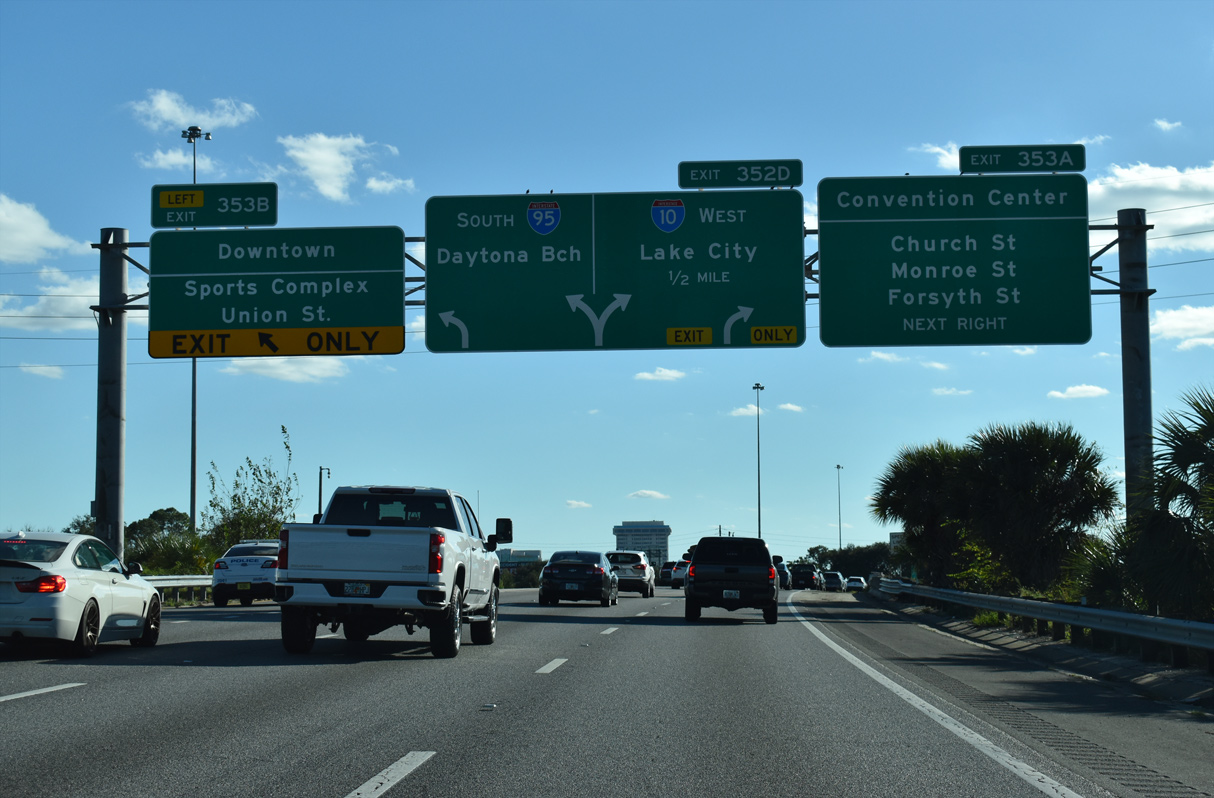
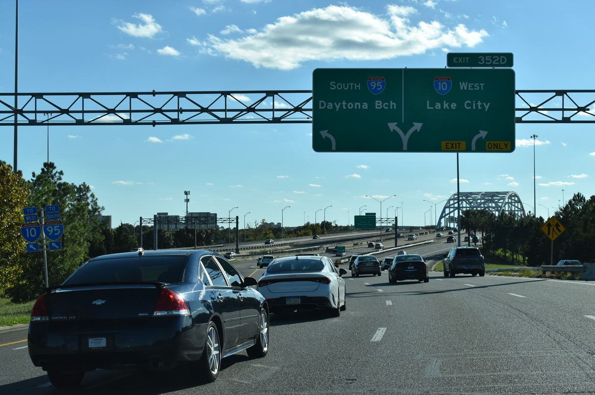
A series of arrow per lane (APL) overheads appear along southbound I-95 in Jacksonville from U.S. 1 (Martin Luther King, Jr. Parkway) at Mid West Side to the systems interchange (Exit 352 D) with I-10 at Brooklyn. 10/15/23
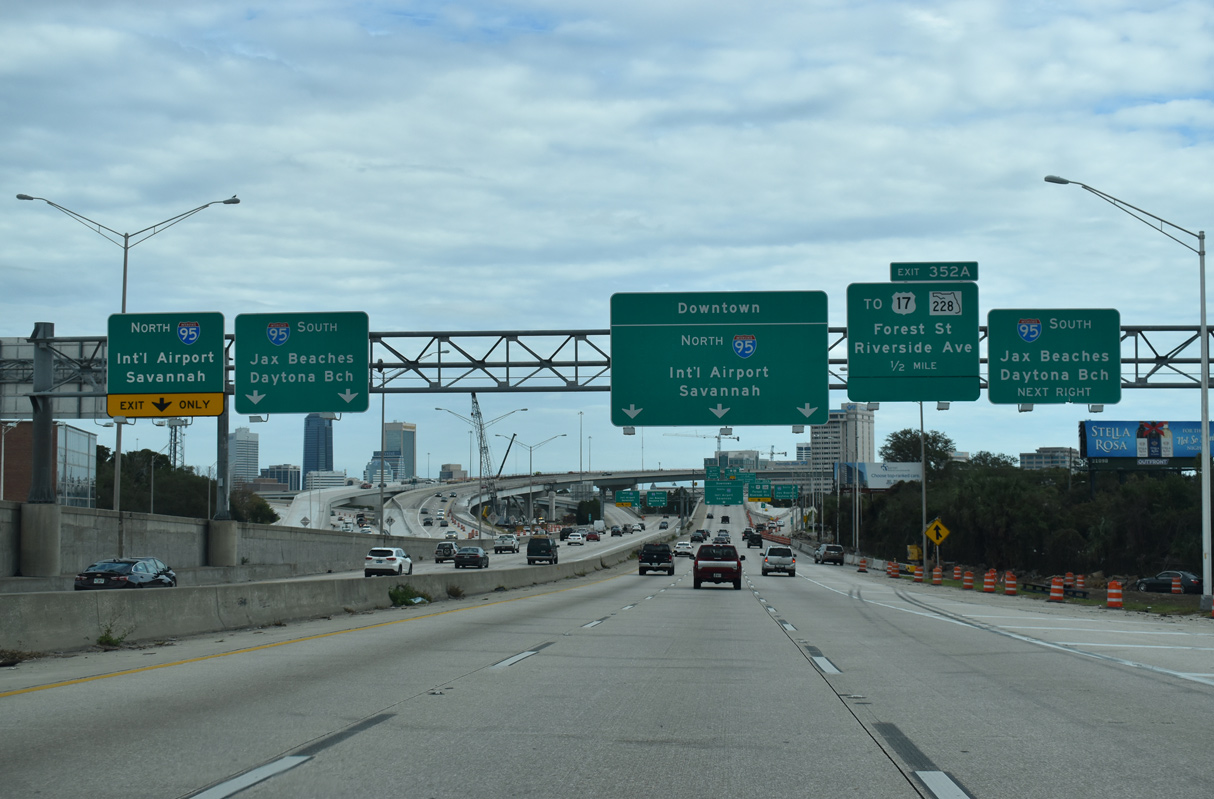
I-95 separates into a dual freeway from Church Street southward to the three-wye interchange with I-10 west. The inside roadway provides access to I-10 west and Forest Street while the outer roadway defaults onto I-10 west with a single lane ramp to I-95 across the Fuller Warren Bridge. 10/15/23
A tied-arch bridge along the inside roadways of I-95 spans a Norfolk Southern Railroad line and several streets ahead of Interstate 10 west. 10/15/23
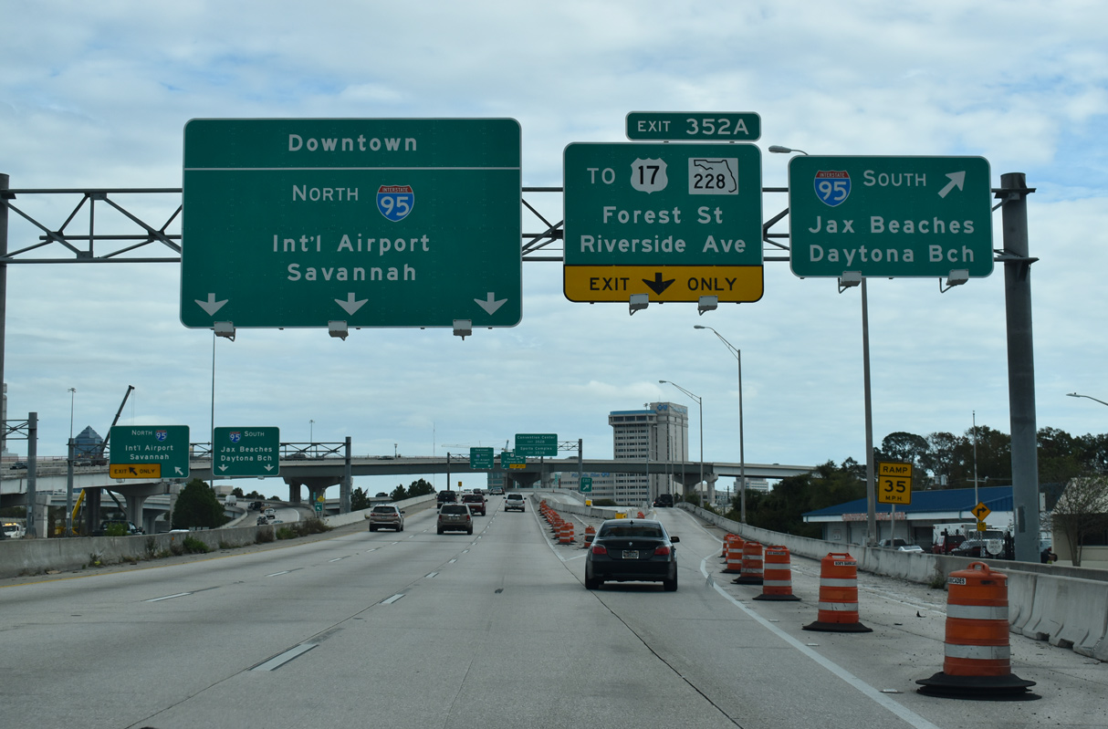
I-95 continues with two through lanes south to the Fuller Warren Bridge over the St. Johns River as Exit 352 A departs for Forest Street just ahead of Interstate 10 west. 10/15/23
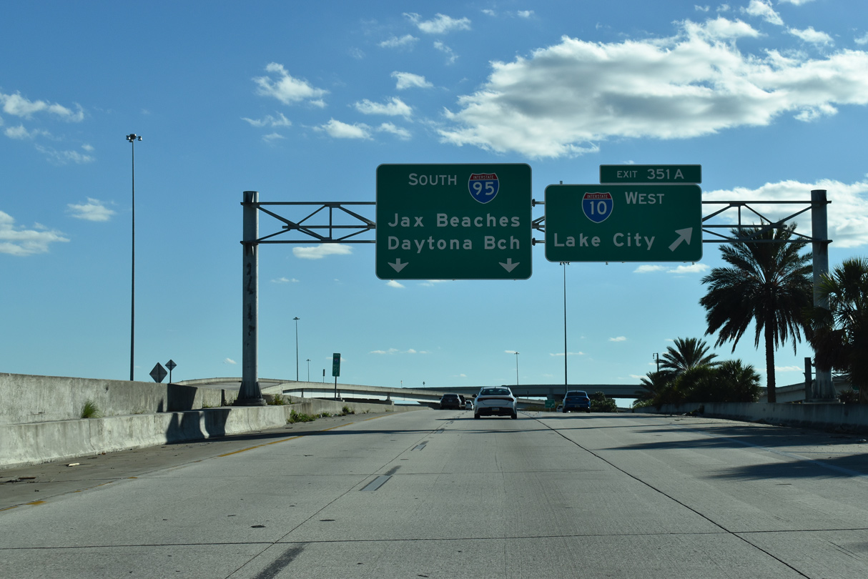
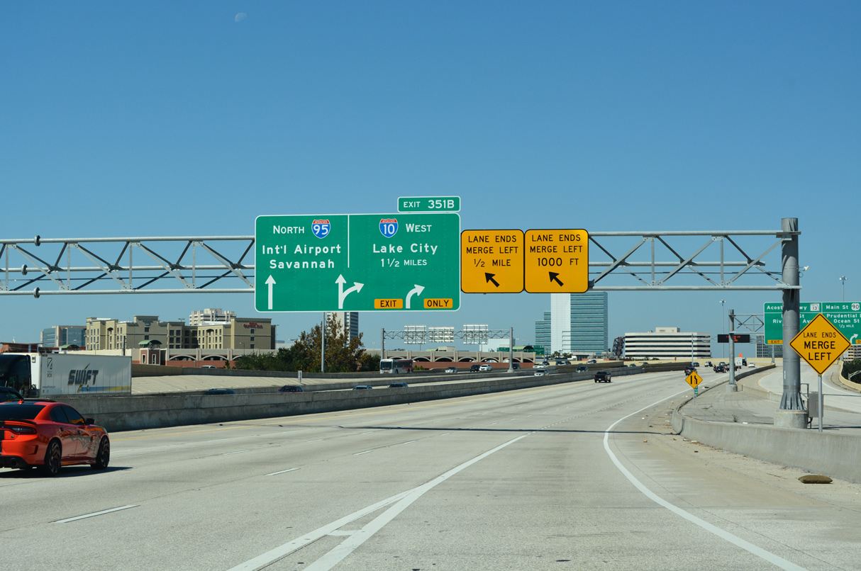
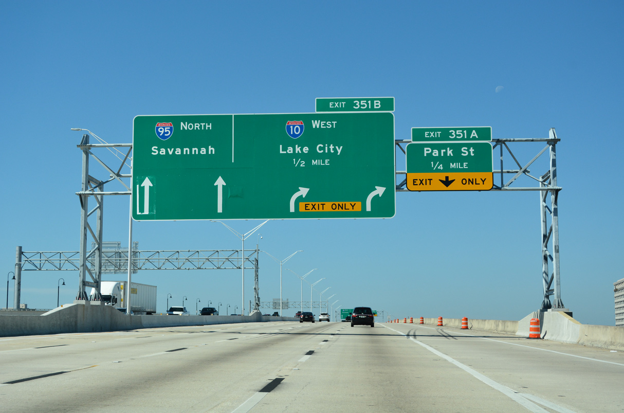
The outer roadway along I-95 south ahead of Exit 351 B for Stockton Street and former Exit 351 B to Interstate 10 west. 08/28/21
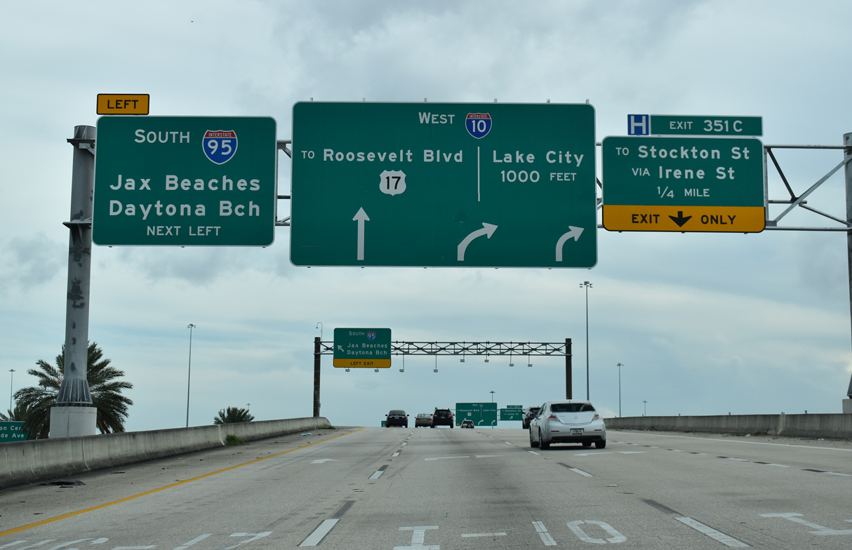
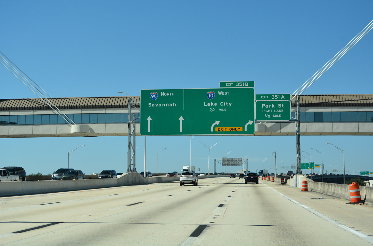
Exit 351 A leaves the inner roadway of I-95 south for I-10 west to Lake City, Tallahassee and Pensacola, Florida. 10/15/23
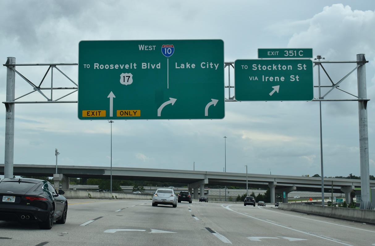
Exits 351 C departs to Stockton Street from the westbound beginning of I-10 from I-95 south. U.S. 17 south / SR 228 west take I-10 west to Roosevelt Expressway, bypassing their former alignment through Five Points. 08/28/21
![]() North at
North at ![]()
![]()
The 2013-18 Overland Bridge Replacement Project expanded I-95 leading north toward Downtown Jacksonville with collector distributor roadways for U.S. 1/90 and the Acosta Bridge (SR 13). 10/16/22
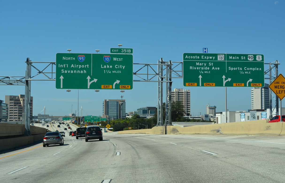
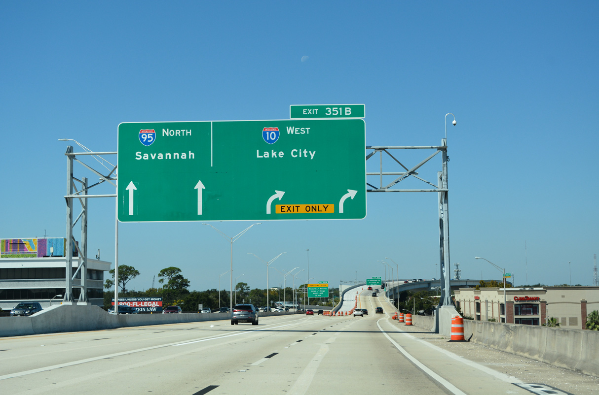
The c/d roadway partitions with ramps for the Main Street Bridge (U.S. 1/90) into Downtown Jacksonville and SR 13 (Acosta Bridge) to the Central Civic Core District. I-95 proceeds north 1.25 miles to Interstate 10 west. 10/16/22
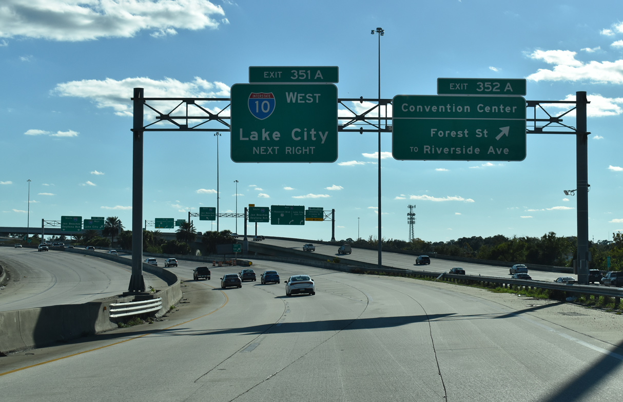
Interstate 95 crosses the St. Johns River on the Fuller Warren Bridge directly into the Big I interchange (Exit 351 B) with I-10 west. 10/16/22
A two lane flyover at Exit 351 B joins I-10 west while the I-95 mainline reduces to two lanes. Lake City is where I-10 crosses Interstate 75. 10/16/22
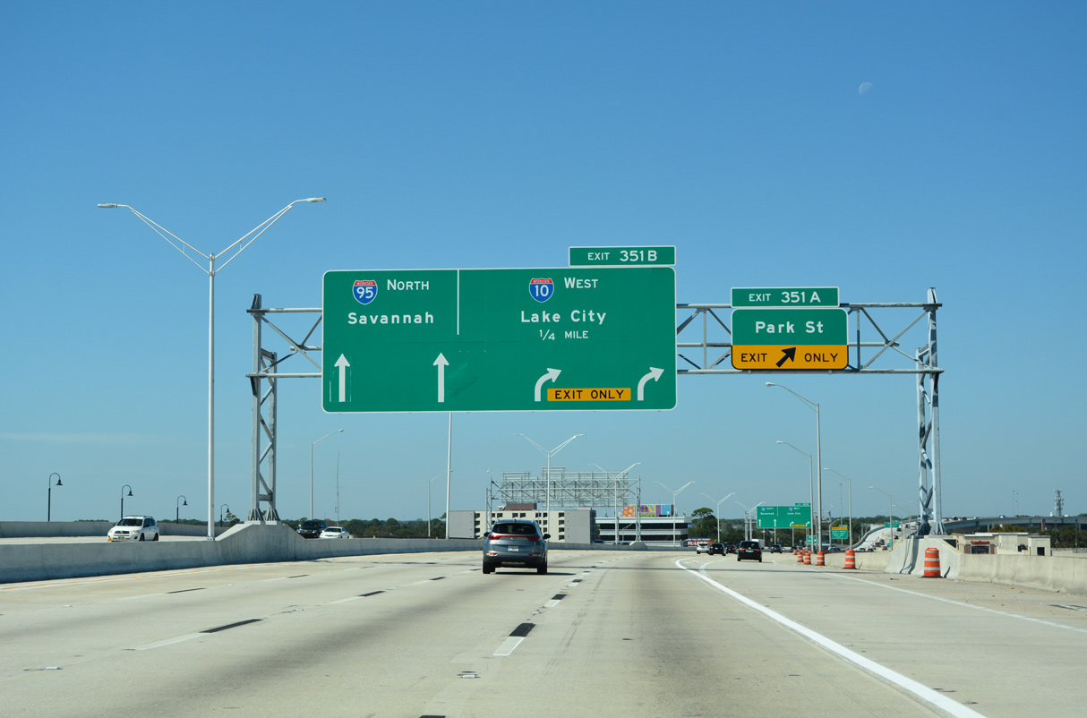
A local and express configuration along I-95 ensues beyond Exit 351 B, with exits to Downtown mixing in with one of the two ramps from I-10 east. 10/16/22
U.S. 17 joins I-95 north from the east end of I-10 to U.S. 90 (Union Street) east at the LaVilla neighborhood of Jacksonville. 10/16/22
East End Throwback
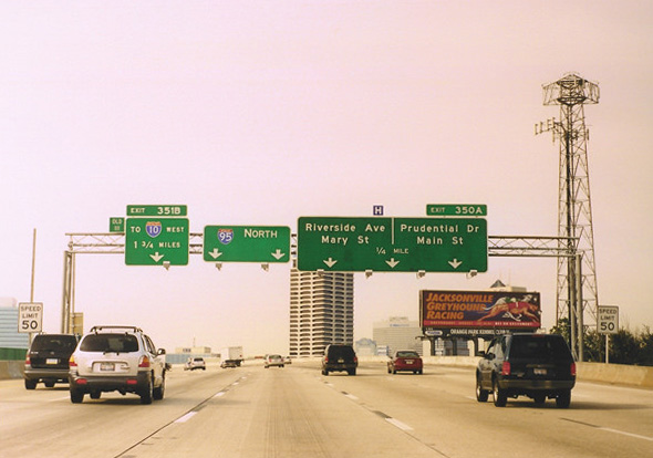
Approaching the Fuller Warren Bridge, 1.75 miles southeast of I-10 west on Interstate 95 north. Photo by Carter Buchanan (01/03).
A left exit previously joined I-95 north with I-10 west, one mile beyond a cable-stayed pedestrian bridge at Southside, Jacksonville. Photo by Carter Buchanan (01/03).
The original exchange with Interstate 10 west was substandard with the I-95 mainline navigating through a sharp curve. Photo by Steve Hanudel (08/14/05).
West End  / Lincoln Boulevard – Santa Monica, California
![]() West at
West at ![]()
Traveling below grade into Santa Monica, Interstate 10 westbound enters the final mile leading to Lincoln Boulevard and the Pacific Coast Highway (SR 1). 07/14/14
The final westbound shield for Interstate 10 appeared after the entrance ramp from 20th Street. The sign was not included in a replacement of the light assembly in 2016. 07/14/14
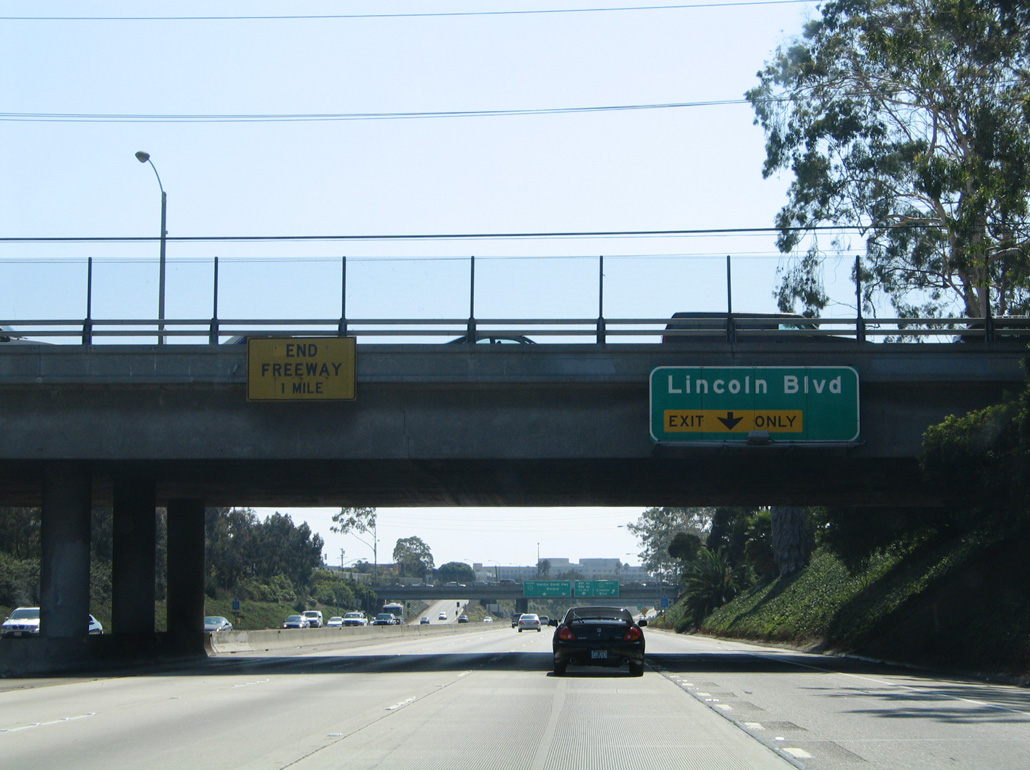
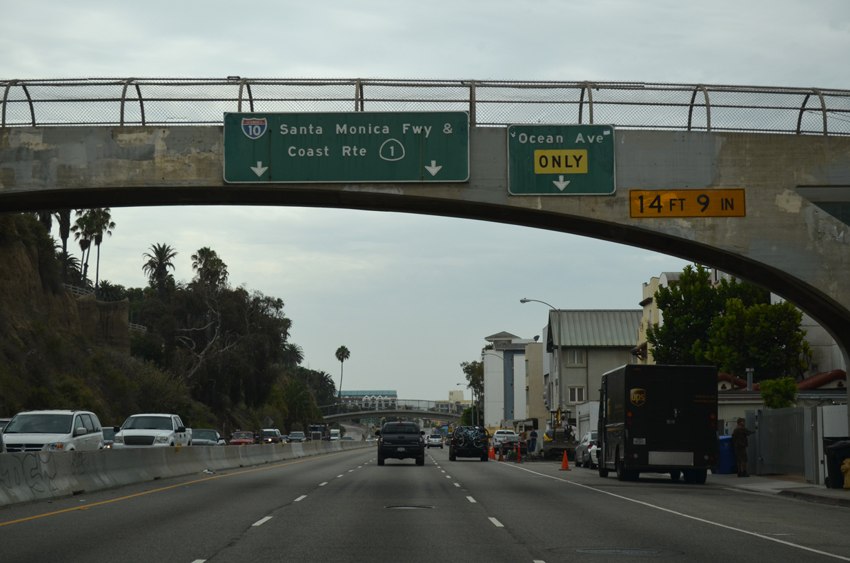
An auxiliary lane joins I-10 west to Exit 1B / Lincoln Boulevard. Sign changes made here by 2017 added the exit number and referenced Lincoln Boulevard as leading to SR 1, since it was relinquished from I-10 south to the Santa Monica city line in 2012. 08/24/04
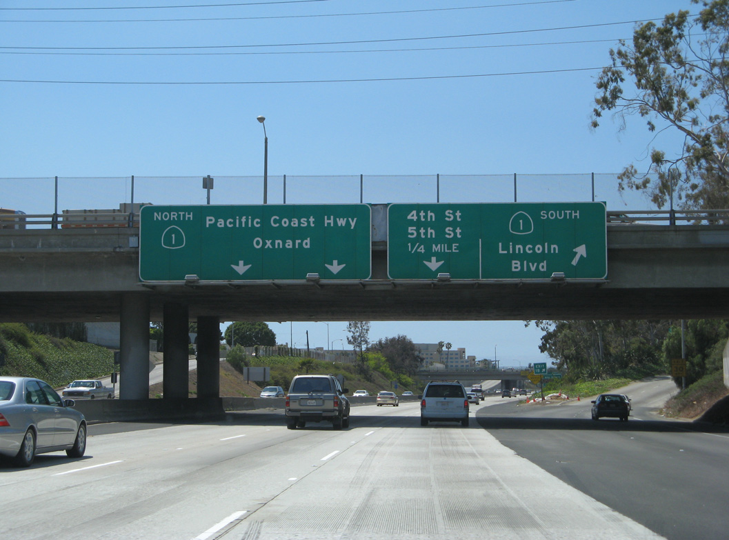
Back to back ramps depart for Olympic Boulevard west to Lincoln Boulevard (Exit 1B) and 4th and 5th Streets (Exit 1A). Prior to 2012, SR 1 followed Lincoln Boulevard south to Venice in Los Angeles. The state route resumes there, skirting the edge of Marina del Rey, where it meets SR 90 (Marina Freeway). These overheads were replaced by 2017. 04/21/07
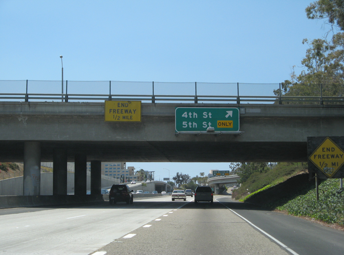
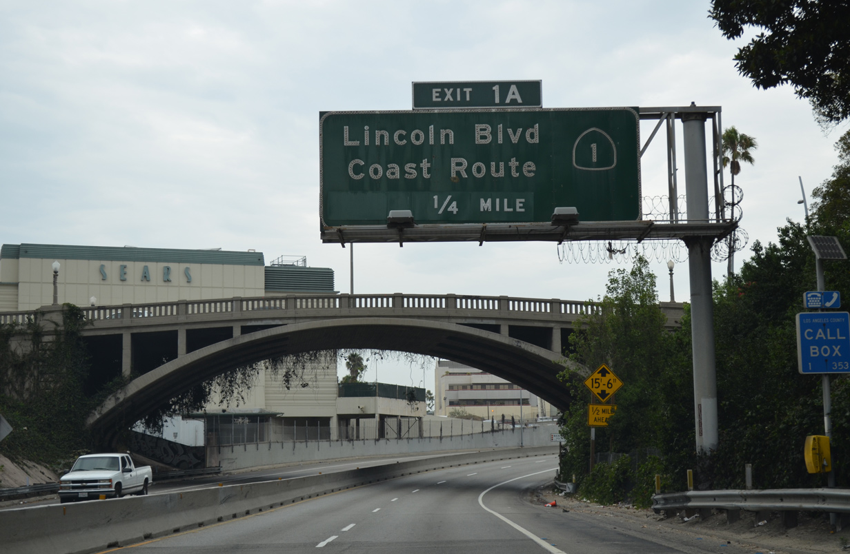
Prior signs at the Lincoln Boulevard overpass referenced the freeway as continuing another half mile west. Replacements made here in 2017 show three lanes for 4th and 5th Streets (Exit 1A), while indicating that the freeway has ended. 04/21/07
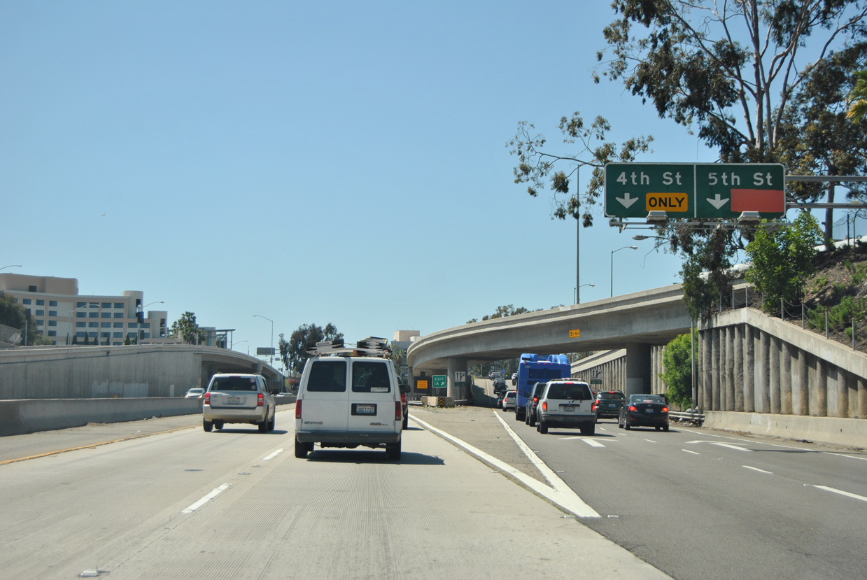
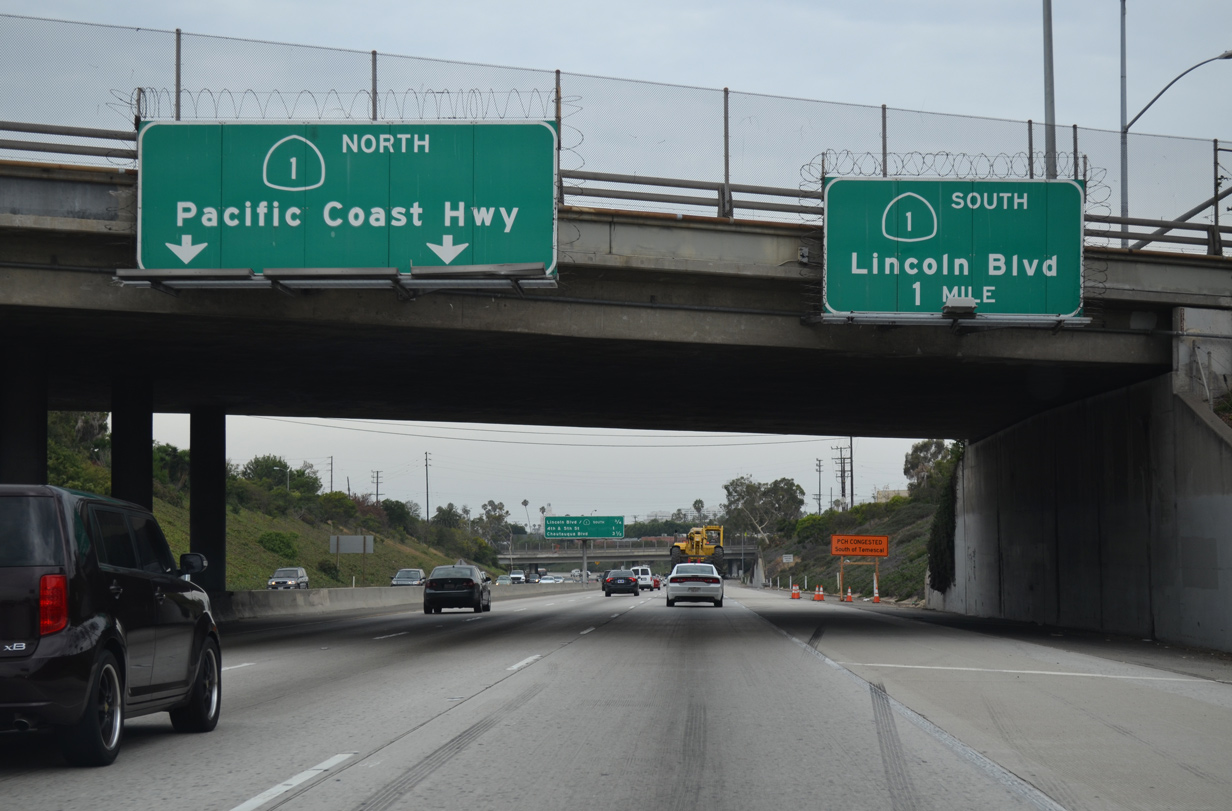
Exit 1A passes below the Olympic Boulevard on-ramp that used to carry SR 1 north from Lincoln Boulevard. SR 1 begins resumes here and overtakes I-10 west onto the Pacific Coast Highway north. 03/24/16
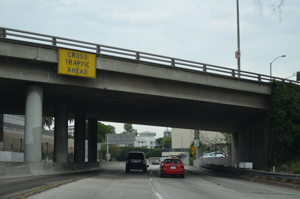
The speed limit reduces to 45 miles per hour as SR 1 joins the Santa Monica Freeway ahead of the Robert E. McClure Tunnel. A watch for stopped vehicles sign took the place of this cross traffic ahead panel at the 4th Street over crossing. 07/14/14
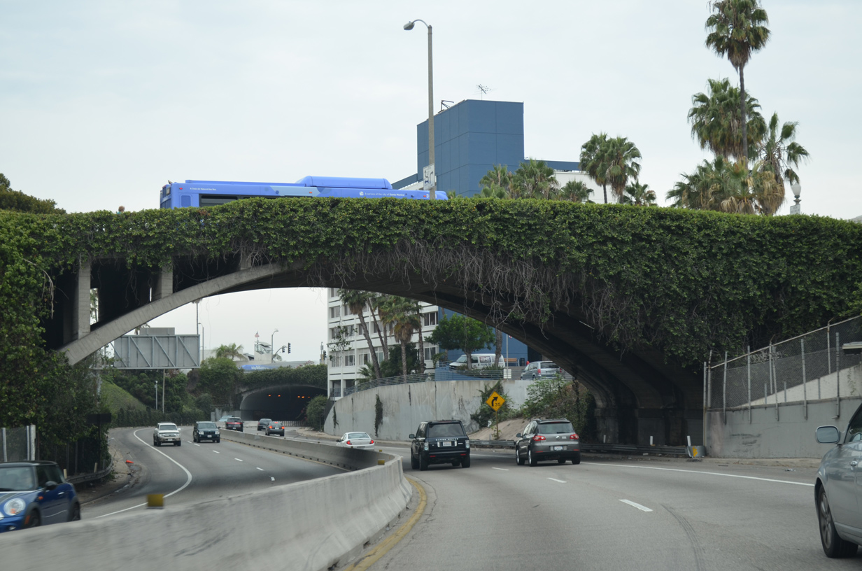
SR 1 (Pacific Highway) navigates through an S-curve below the Main Street overpass as it turns north to Santa Monica Beach. A concrete barrier (k-rail) separates the two-lane roadways. 07/14/14
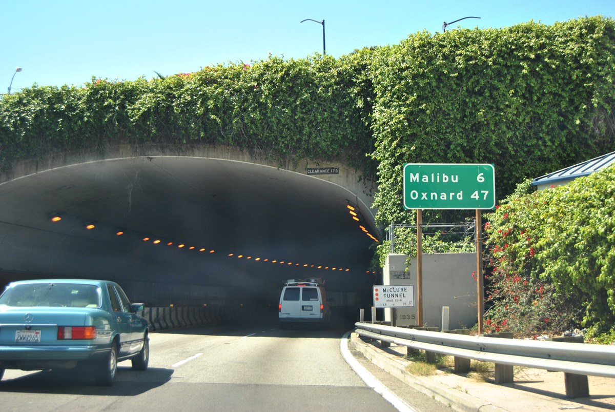
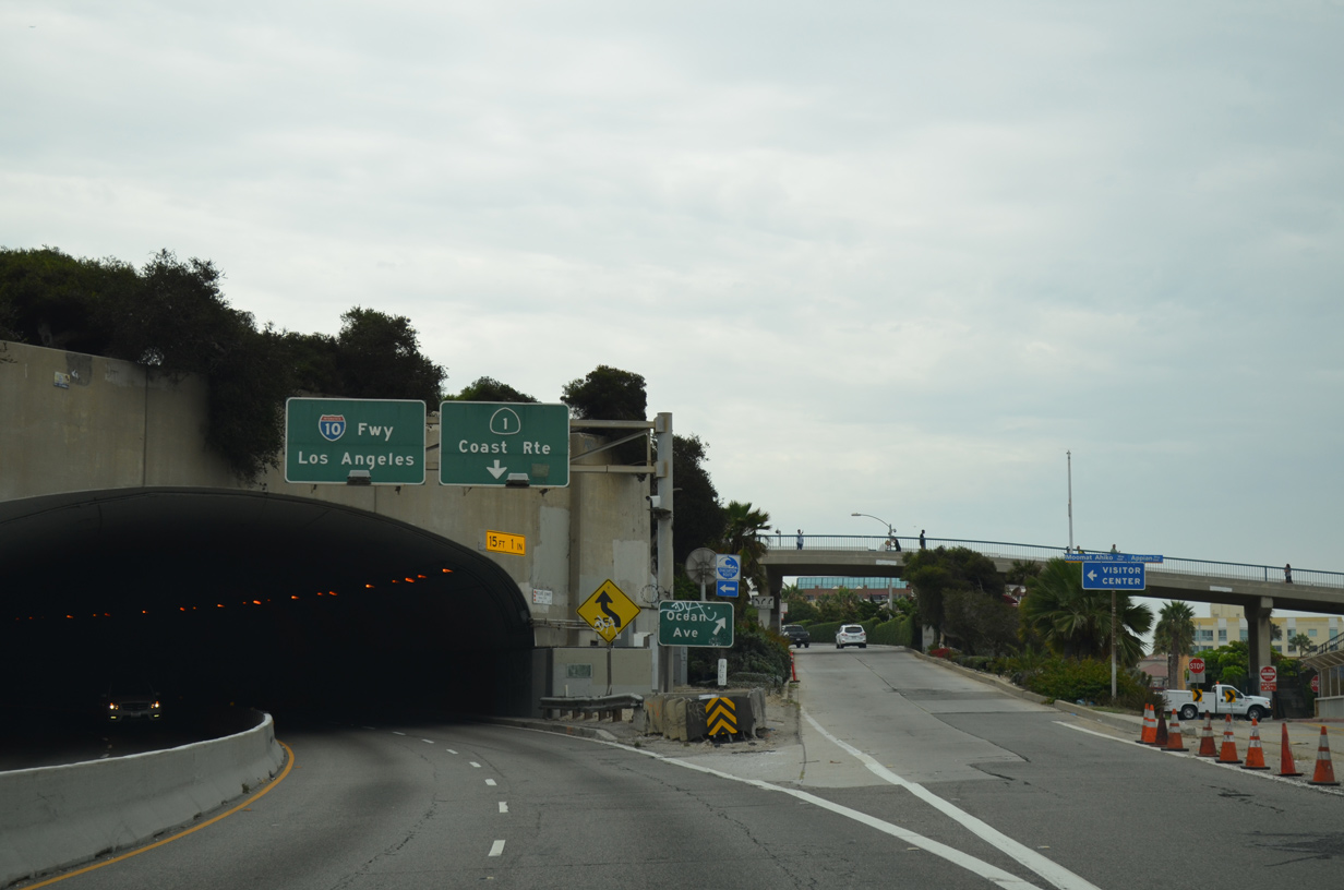
Entering the Robert E. McClure Tunnel along SR 1 (Pacific Coast Highway) north. According to the Caltrans Structure Log, this tunnel was built in 1939, well before the advent of the Interstate Highway System. 03/24/16
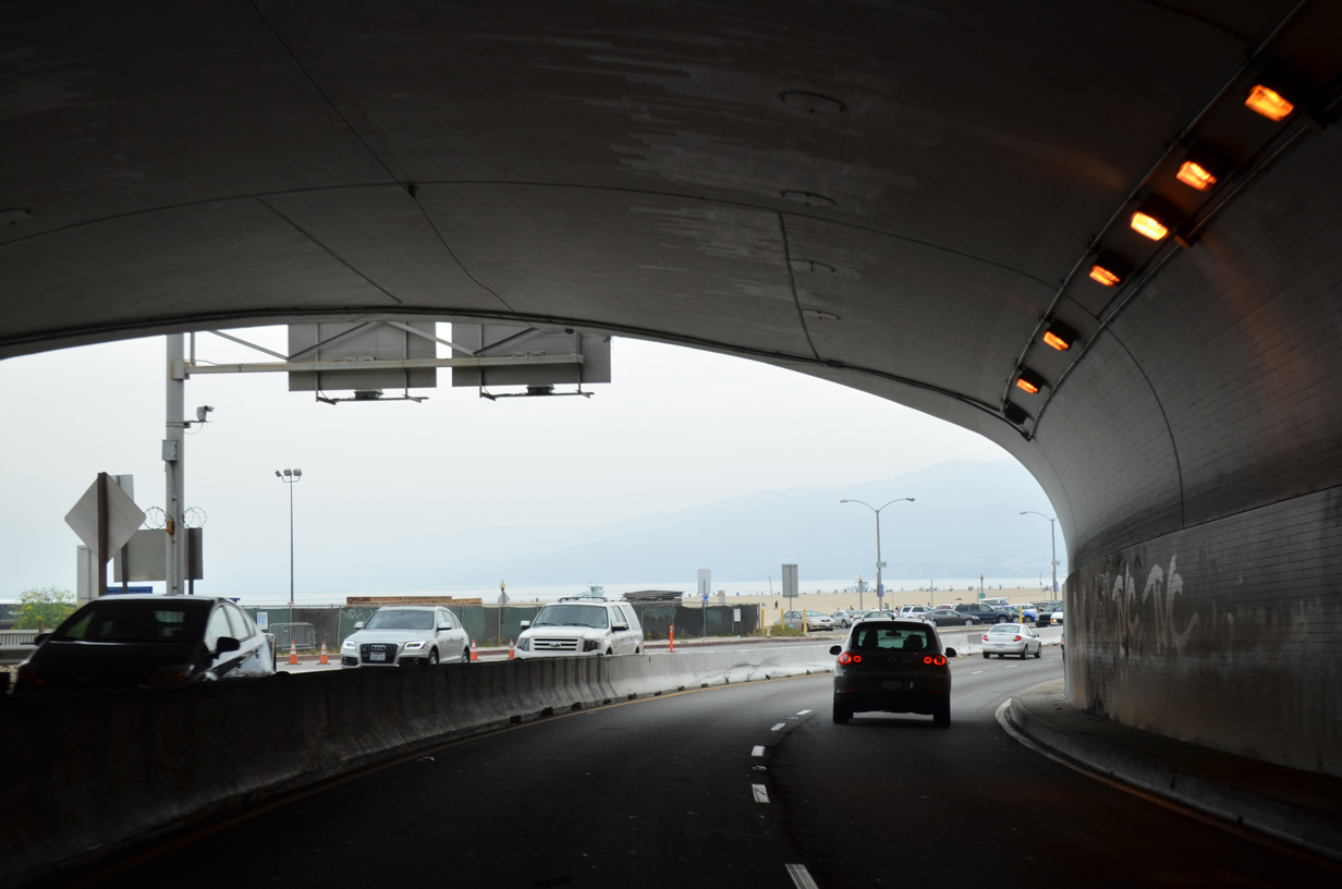
The Pacific Ocean comes into view as SR 1 (Pacific Coast Highway) exits the McClure Tunnel. 07/14/14

Northbound SR 1 (Pacific Coast Highway) follows the ocean side from Santa Monica northwest toward Malibu and Oxnard. The state route initially parallels Santa Monica State Beach with some access control. 07/14/14
![]() South at
South at ![]()
Traveling south on the Pacific Coast Highway, SR 1 passes through Santa Monica State Beach en route to the Robert E. McClure Tunnel and Interstate 10 (Santa Monica Freeway) east. 07/14/14
The Ocean Avenue off-ramp separates from the Pacific Coast Highway southbound as SR 1 curves east into the McClure Tunnel ahead of I- 10. A pedestrian overpass extends west from Colorado Avenue above the tunnel to Santa Monica Pier. 07/14/14
Emerging from the Robert E. McClure Tunnel, SR 1 passes below Tongva Park and Main Street just ahead of the Lincoln Boulevard off-ramp (Exit 1A). Lincoln Boulevard was relinquished from state control in May 2012, leaving SR 1 as a discontinuous route from I-10 south to the Santa Monica city line. 07/14/14
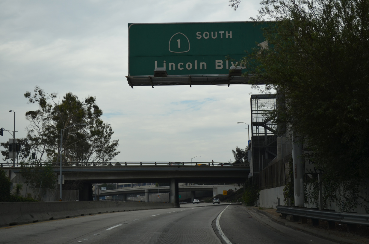
Interstate 10 (Santa Monica Freeway) begins at Lincoln Boulevard (former SR 1 south). Lincoln Boulevard north connects with Historic U.S. 66 (Santa Monica Boulevard). 07/14/14
The first confirming marker for Interstate 10 stands east of the 11th Street overpass and the Olympic Boulevard entrance ramp. 05/31/15
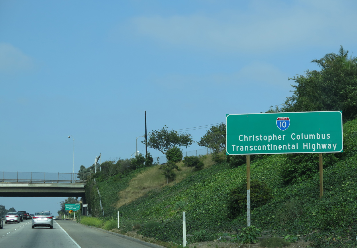
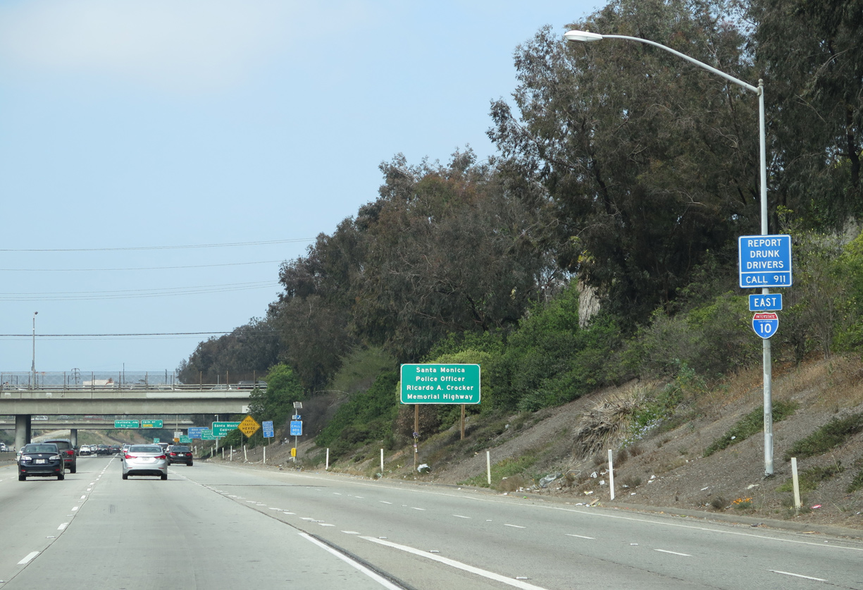
Posted between the 20th Street and Cloverfield Boulevard overpasses in Santa Monica, this is the lone identifier of I-10 nationwide as the Christopher Columbus Transcontinental Highway. 05/31/15
Sources:
- “Differences to bridge – Competing interests mark battle over location of I-10 span.” Mobile Register (AL), June 1, 2003.
- Interstate 10 between Alabama 59/Exit 44 at Loxley, AL and Florida 87/Exit 31 at Milton, FL opened to traffic in 1962. Historical information researched at the Pensacola Museum of History.
- Gulf Coast Projects – Harrison County.
http://www.mdot.state.ms.us/news/projects/harrison_project01.htmMississippi DOT. - Gulf Coast Projects – Hancock County.
http://www.mdot.state.ms.us/news/projects/hancock_project01.htm
Mississippi DOT. - Alabama Department of Transportation — Construction.
http://www.dot.state.al.us/bureau/construction/bulletin.htmALDOT. - Jason P. “Phoenix I-10 Widening Nearly Complete.” Online posting, misc.transport.road, November 7, 2003.
- Jason Learned, Personal Email, “Fw: I-93 Tunnel Open in Both Directions, I-75 Florida,” December 27, 2003.
- Florida’s Interstates: A Half-Century of Progress
http://www.fl-interstate.com(official Florida Department of Transportation site) - From Anywhere to Everywhere: The Development of the Interstate Highway System in Texas
http://tti.tamu.edu/interstate_anniversary/white_paper/by Penny Beaumont, Rhonda Brinkmann, David Ellis, Chris Pourteau, and Brandon V. Webb, Texas Transportation Institute, page 29. - Celebrating the 50th Anniversary of the Eisenhower Interstate Highway System: Previous Interstate Facts of the Day by the Federal Highway Administration (FHWA).
- “Texas Raises Rural Speed Limits to 80 MPH.” Associated Press, May 25, 2006.
- “‘The Big I’ Earns Big Transportation Award.” FirstCoastNews (Jacksonville, FL), October 19, 2011.
- Twin Span Bridge (LADOTD web site)
http://www.twinspanbridge.com/. - “St. Tammany Pier set to open – Ceremony today marks completion.” The Times-Picayune (New Orleans, LA), May 17, 2012.
- “MDOT Prepares to Open the State’s First Diverging Diamond Interchange in Harrison County.” MDOT, press release. May 30, 2015.
- Interstate Highway 10 in Mississippi. Adam Froehlig.
- “Gov. Kay Ivey declares I-10 Mobile River Bridge and Bayway project ‘dead’.” AL.com, August 28, 2019.
- “Officials unveil framework for $2.1 billion I-10 project with $2.50 toll.” AL.com, December 15, 2021.
- “ALDOT to widen I-10 between 10 and 15 in Mobile County from September 2021-May 2024.” WPMI TV-15 (Mobile, AL), September 15, 2021.
http://nflroads.com/ProjectDetails.aspx?p=5176
Page updated January 25, 2024.