Interstate 8
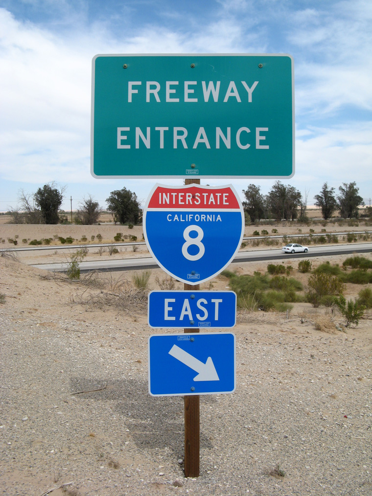

Well removed from the Pacific Ocean, Interstate 8 lowers to Sea Level in the Imperial Valley of California. 01/27/06
Overview
The lowest freeway in the country at one point, as it drops below sea level in the Imperial Valley near El Centro, Interstate 8 also traverses several mountain passes en route between San Diego, California, and Casa Grande, Arizona. Beginning in the Ocean Beach neighborhood, I-8 proceeds east along an urban course through the San Diego metro area. Beyond El Cajon and Alpine, the freeway winds through Cleveland National Forest and Laguna Mountain range before angling southeast. I-8 passes through the In-ko-pah Gorge ahead of Ocotillo and the rolling desert hills and farmland in the Imperial Valley. The freeway enters Arizona at the Colorado River and Yuma, and advances east across more desert terrain, including the famed Arizona saguaro. I-8 concludes at I-10 midway between Phoenix and Tuscon.
 Parallel U.S. Routes
Interstate 8 only intersects one U.S. route for its entire length, U.S. 95, thus lending credibility to the paucity of U.S. highways in the Southwestern United States. However, it parallels a well-preserved historic U.S. route, Old U.S. 80.
U.S. 80 follows Interstate 8 from San Diego to Gila Bend, Arizona, where U.S. 80 turned north along what is now Arizona Route 85 to Interstate 10 near Buckeye. Well-preserved stretches of Highway 80 are otherwise accessible as frontage roads and county roads along the freeway corridor.
The easternmost stretch of I-8 between Gila Bend and Casa Grande was not a former U.S. route; the Interstate instead replaced former SR 84. (A shorter section remains close to Casa Grande.)
History
Origins of Interstate 8 in San Diego date back to 1957 with construction for a new U.S. 80 freeway between U.S. 395 and Ward Road. The majority of the U.S. 80 freeway was completed east from U.S. 101 to El Cajon by the early 1960s, with I-8 formally posted in 1964. Originally, I-8 was planned to end at Interstate 5. However, with the construction of the Ocean Beach Freeway (former California State Route 109), the route was extended west to the intersection of Nimitz Drive and Sunset Cliffs Boulevard.
The Pine Valley Creek Bridge opened to traffic in 1975. This segmental balanced cantilever bridge carries the freeway over 200 feet above the valley floor.1 A more detailed history for I-8 posted at the Interstate 8 California guide.
Within Arizona, the earliest sections of Interstate 8 completed ran between Sentinel (Exit 87) and Piedra (Exit 102) and from Gila Bend (Exit 119) to SR 84 (Exit 151) in 1959. The Colorado River bridge west of Yuma opened in 1979 as the last portion of I-8 opened overall. See the Interstate 8 Arizona guide for a more detailed time line.
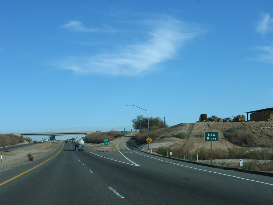
The lowest point on the entire Interstate Highway System (excluding underwater tunnels) is located on Interstate 8 at this point, when the freeway crosses the New River at an elevation of 52 feet below sea level. The lowest point is located near Exit 107 (Drew Road), which is west of El Centro in California’s Imperial Valley. Further west, I-8 climbs to over 4,000 feet above sea level to cross the Cuyamaca Mountains. 01/27/06
Route Information
Mileage
California – 169.92
- Cities – San Diego, El Centro
- Junctions –


Arizona – 178.33
- Cities – Yuma, Casa Grande
- Junctions –
Source: December 31, 2021 Interstate Route Log and Finders List
I-8 Annual Average Daily Traffic (AADT)
Source: 2017 Caltrans Traffic Volumes
ADOT Traffic Monitoring 2018 AADT

Interstate 8 ended at I-5 until 1971, when the Ocean Beach Freeway was renumbered from SR 109 to I-8.
U.S. 80 was decommissioned formally by the state of California in 1964, but signs remained along I-8 until 1972.

Long pieces of Interstate 8 were open by 1963 along U.S. 80 through San Cristobal Valley and across Sentinel Plain and over SR 84 between the Sand tank and Maricopa Mountains and across Vekol Valley.
Within Arizona, U.S. 80 was truncated from Yuma east to Benson in 1977. The remainder was dropped in 1989.
 Photo Guides
East End  – Casa Grande, Arizona
![]() East at
East at ![]()
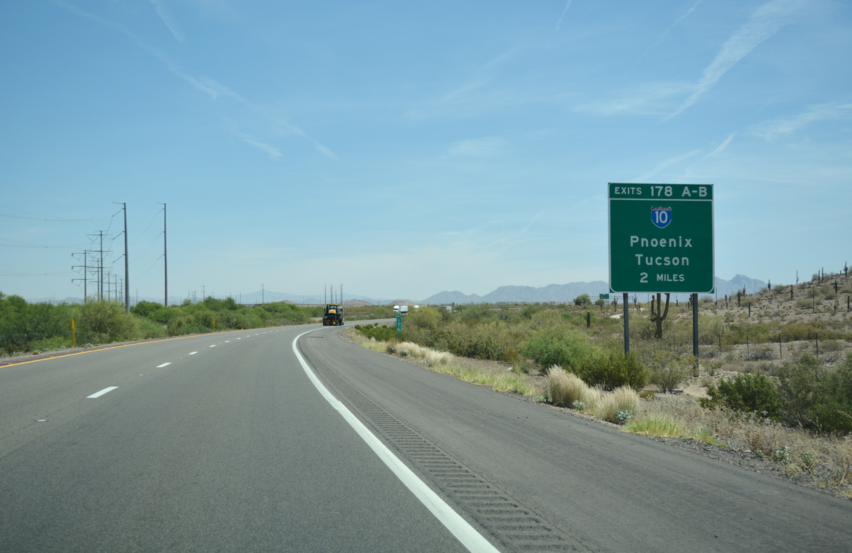
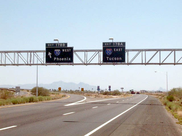
Advancing east to I-10, Interstate 8 circumvents the northern slopes of the Casa Grande Mountains. 04/26/17
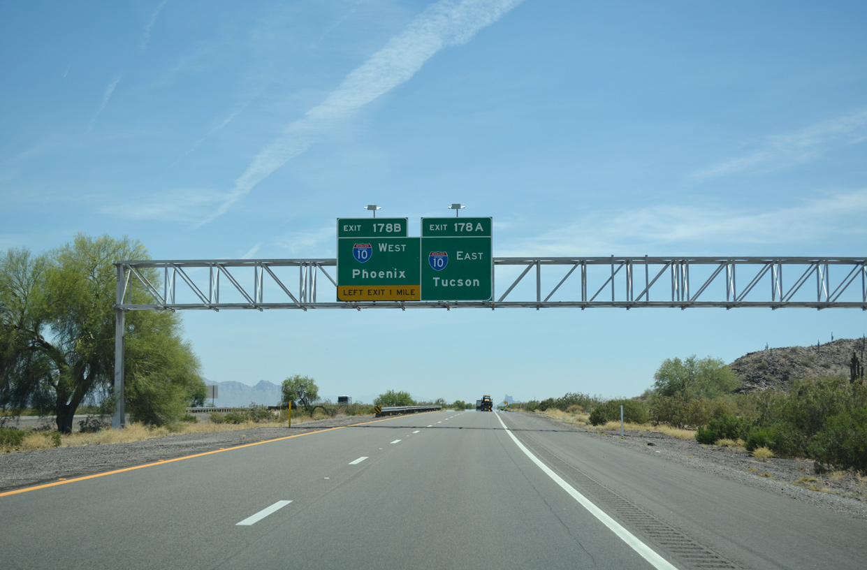
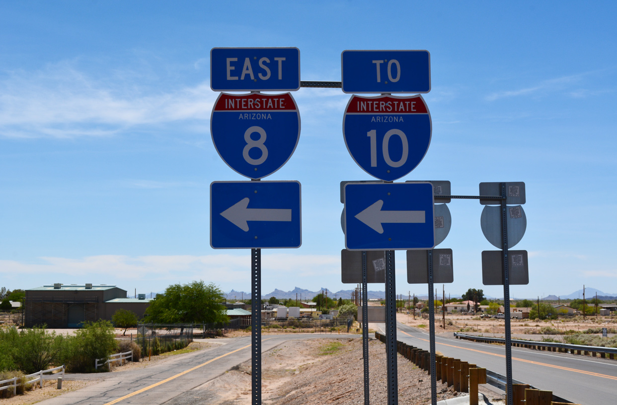
Traffic on Interstate 8 defaults onto I-10 east to Tucson in one mile. Left Exit 178B provides return access to Casa Grande and the greater Phoenix metropolitan area via I-10 west. 04/26/17
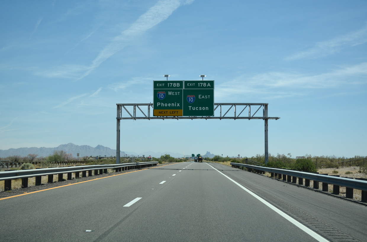
Interstate 10 ventures southeast from I-8 across the Santa Cruz Flats 57 miles to Tucson. The Arizona capital of Phoenix is 47 miles to the northwest. 04/26/17
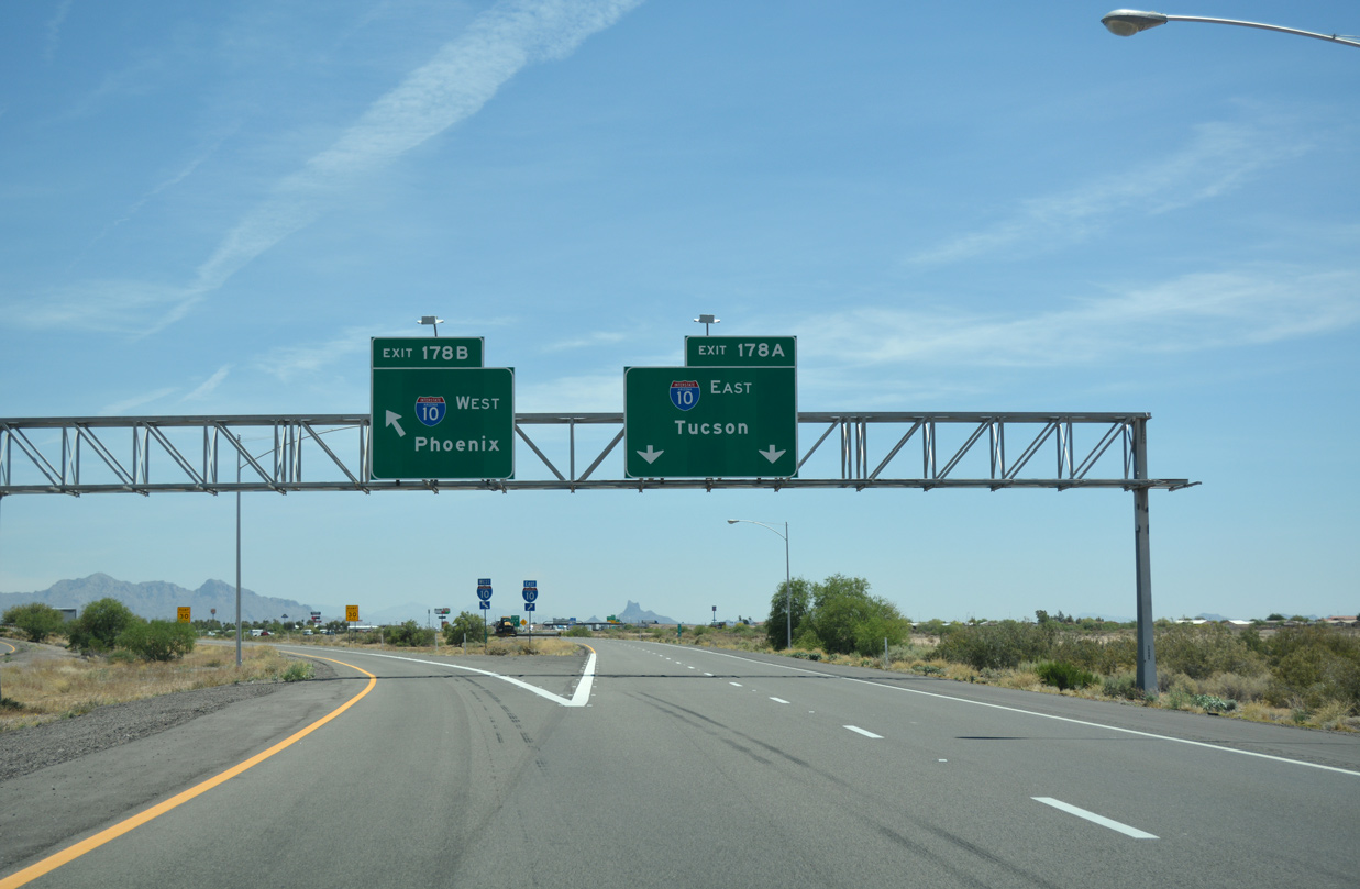
Interstate 8 ends at a trumpet interchange (Exit 178) within southeastern reaches of the Casa Grande city limits. 04/26/17
![]() West at
West at ![]()

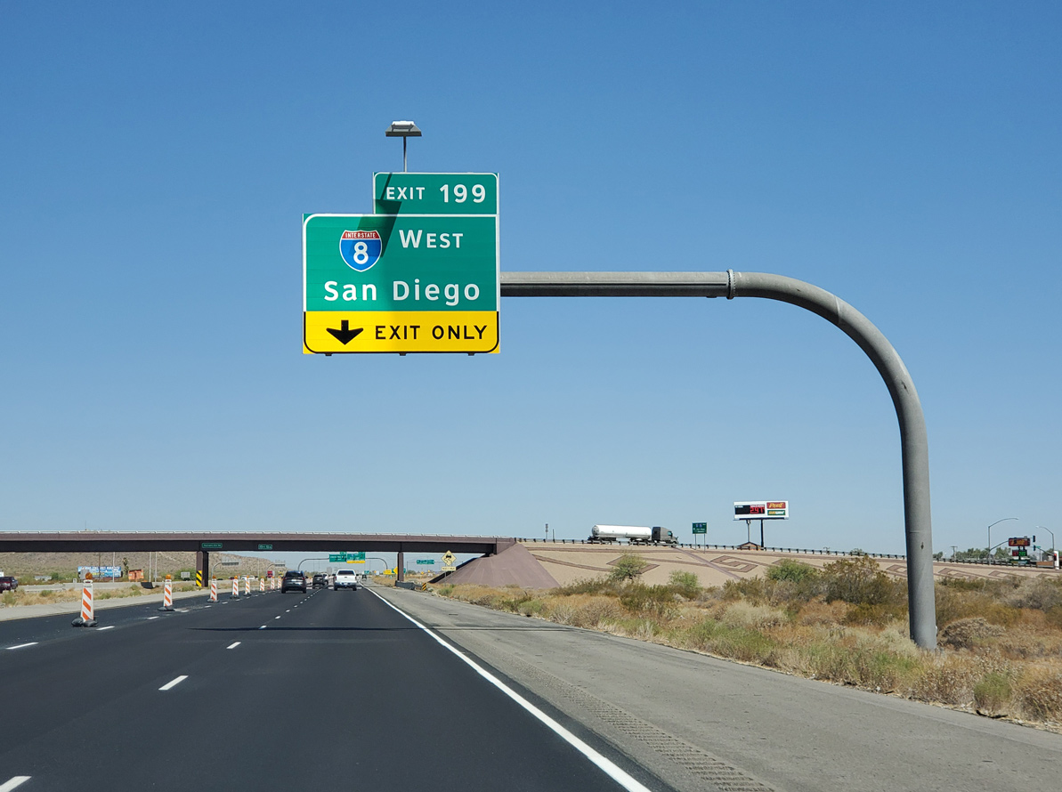
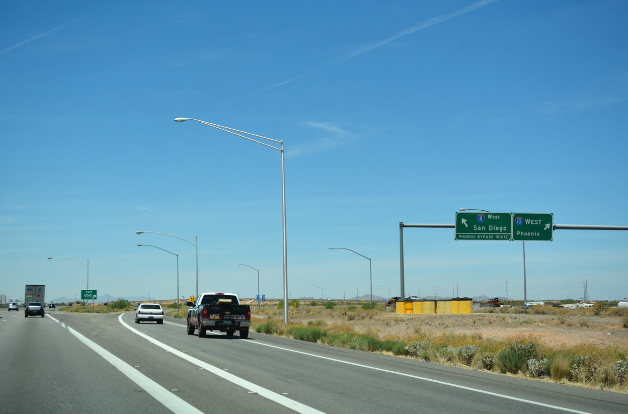
Interstate 10 advances northwest across the Santa Cruz Flats toward the trumpet interchange (Exit 199) with I-8 west. 07/08/19

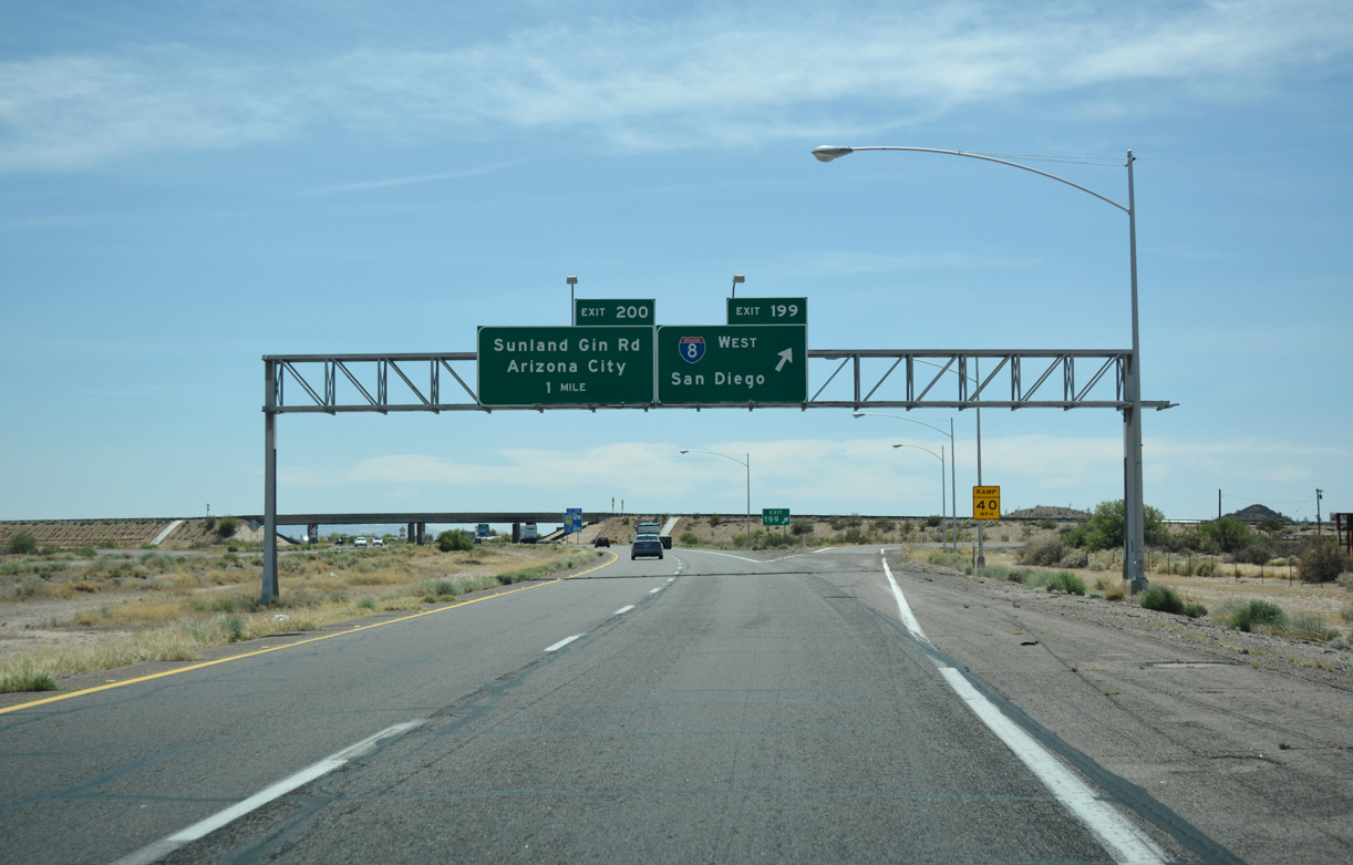
Sunland Gin Road leads north from Arizona City to meet I-10 just ahead of the split with Interstate 8 west. I-8 and SR 85 form the preferred bypass route around Phoenix for travelers bound for I-10 west to Los Angeles, California. 07/08/19

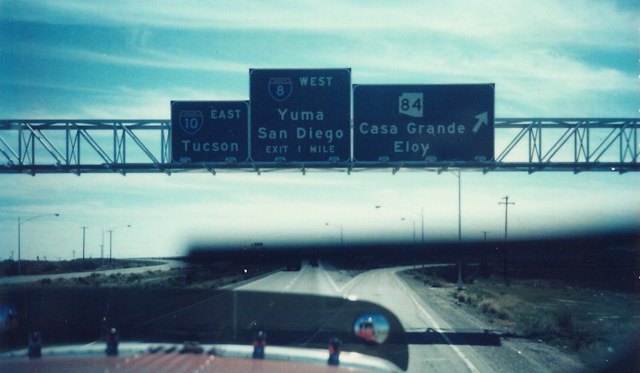
The Sunland Gin Road exit includes several fuel options. Interstate 8 splits from I-10 west nearby and travels 60 miles with limited travel services to Gila Bend. 07/08/19
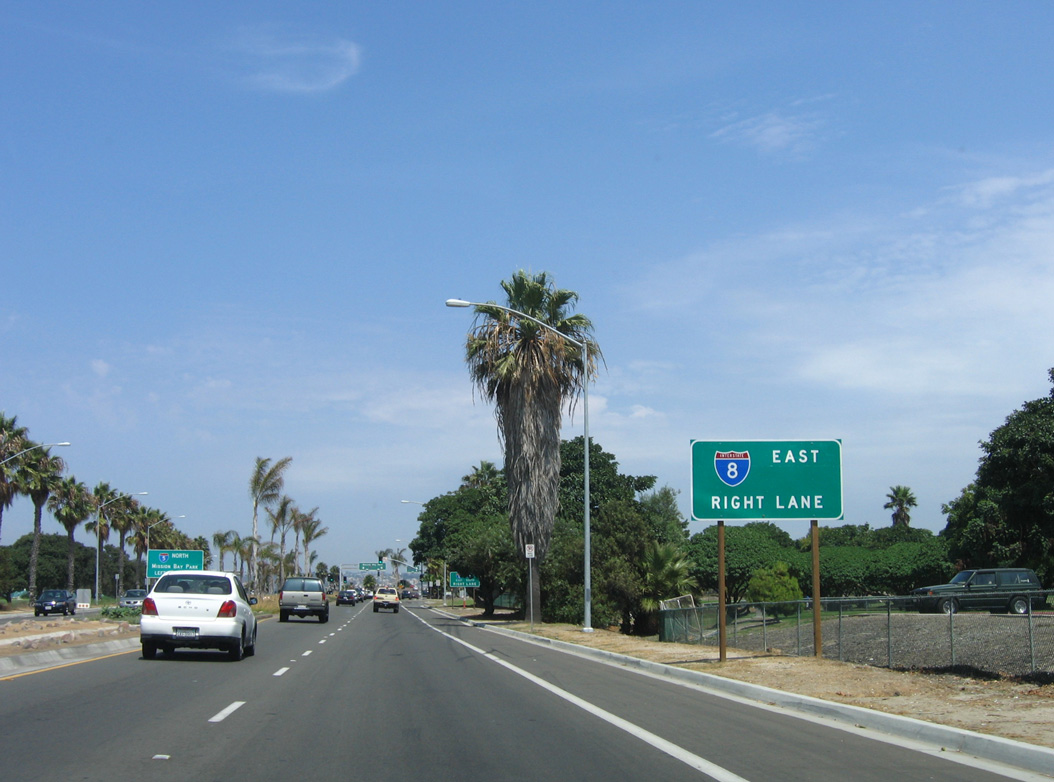
Interstate 8 travels through southwestern Arizona en route to California’s Imperial Valley and San Diego on the coast. 07/08/19

Interstate 10 continues northwest from I-8 to Phoenix, Chuckwalla Valley, Coachella Valley, and ultimately the Los Angeles Basin. 07/08/19
The entrance from Sunland Gin Road west partitions with ramps for I-8 and I-10 west ahead of Jimmie Kerr Boulevard. This configuration was added to offset weaving traffic between the closely placed interchanges. 04/26/17
![]() East at
East at ![]()
I-10 advances a half mile southeast from Jimmie Kerr Boulevard (old SR 84) to Interstate 8 in south Casa Grande. 04/26/17
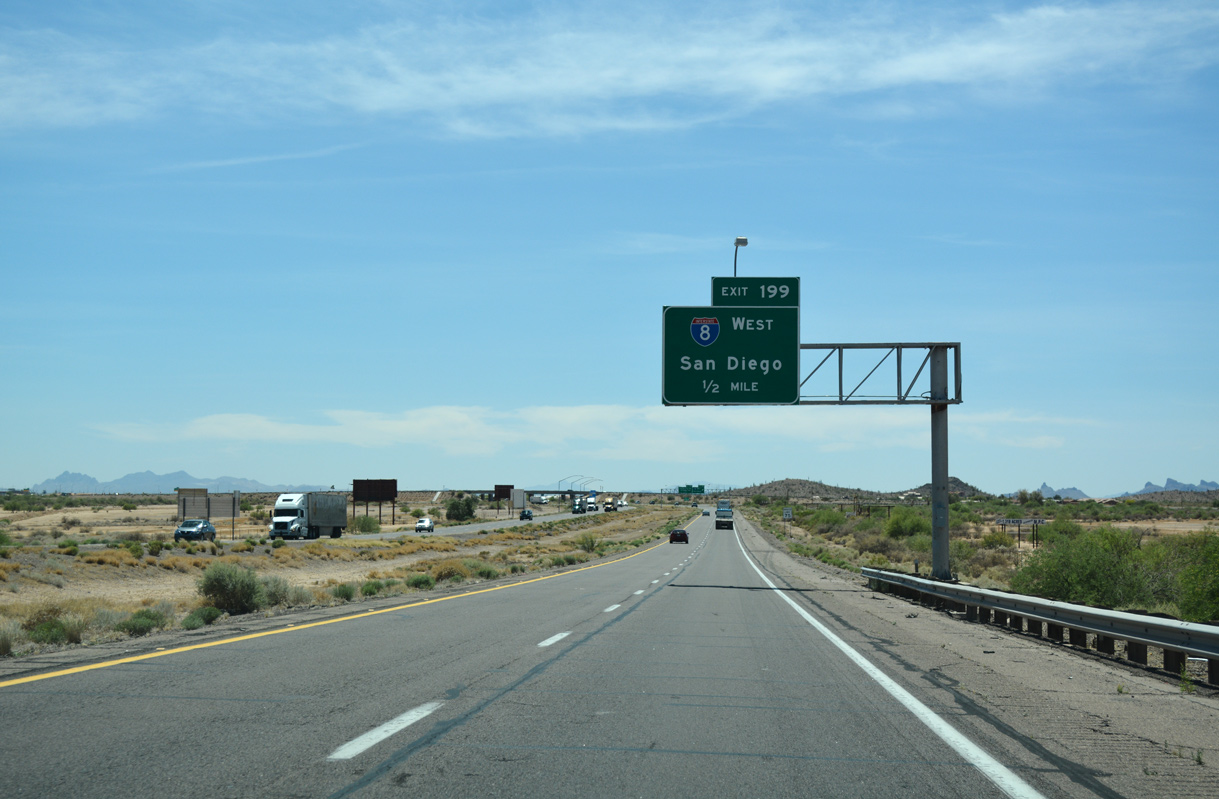
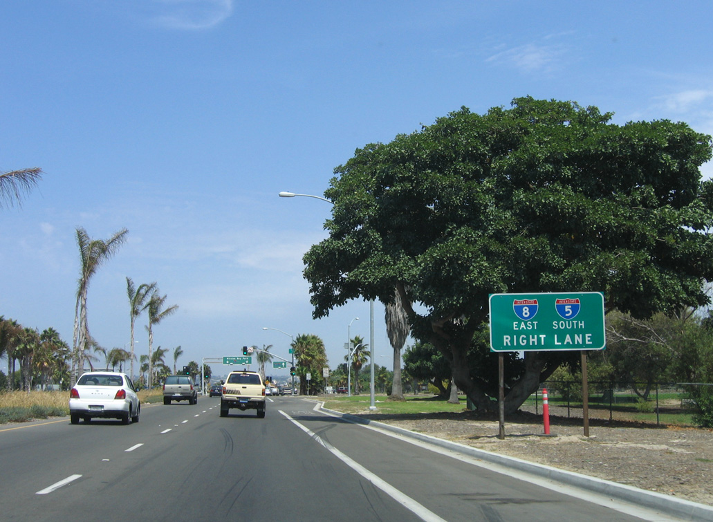
Completed in September 2019, a $43 million project expanded I-10 to six overall lanes from the Earley Road overpass in Casa Grande four miles to the trumpet interchange (Exit 199) with Interstate 8.2 I-8 travels 341 miles west from I-10 to meet I-15 in Mission Valley, San Diego. 04/26/17
![]() West
West

The first confirming marker for Interstate 8 west. I-8 travels 60 miles west from I-10 to Gila Bend and 176 miles to Yuma. 04/26/17
East End Throwback
Button copy overheads at the separation of Exit 178A/B. The Picacho Mountains rise along the eastern horizon. Photo by Alan Hamilton (08/02).
Guide signs for Interstate 8 east used to include Yuma as a second control city. Exits were also previously unnumbered. Photo by Michael Summa (1988).


Interstate 10 west at I-8 prior to the 2011/12 six lane expansion. 01/17/05
West End – Sunset Cliffs Blvd / Nimitz Blvd – San Diego (Ocean Beach), California
![]() West
West
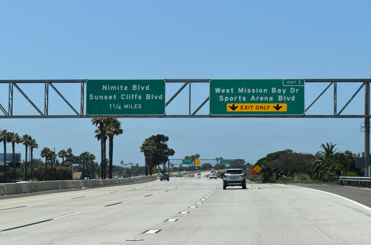
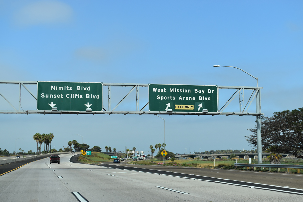
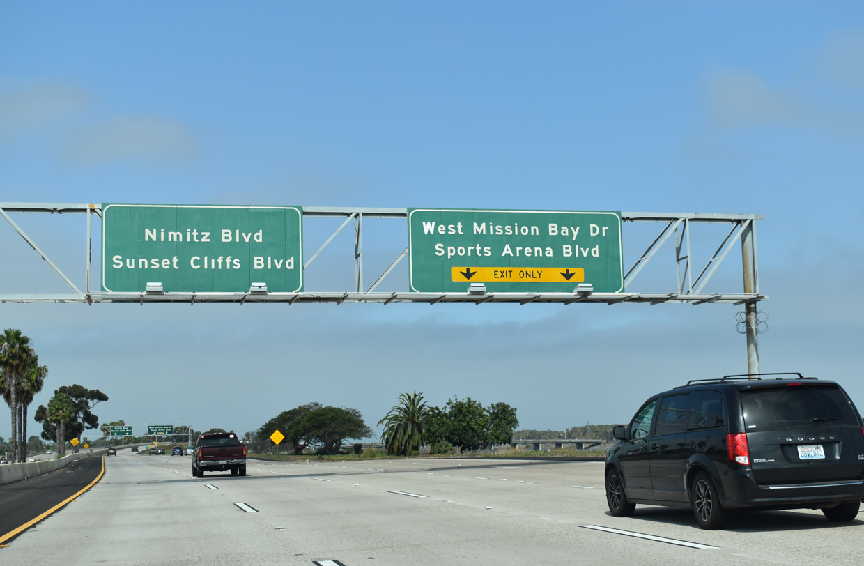
Shifting onto the Ocean Beach Freeway beyond Interstate 5, I-8 expands to four westbound lanes ahead of the parclo interchange (Exit 1) with West Mission Bay Drive north and Sports Arena Boulevard south. 07/19/21
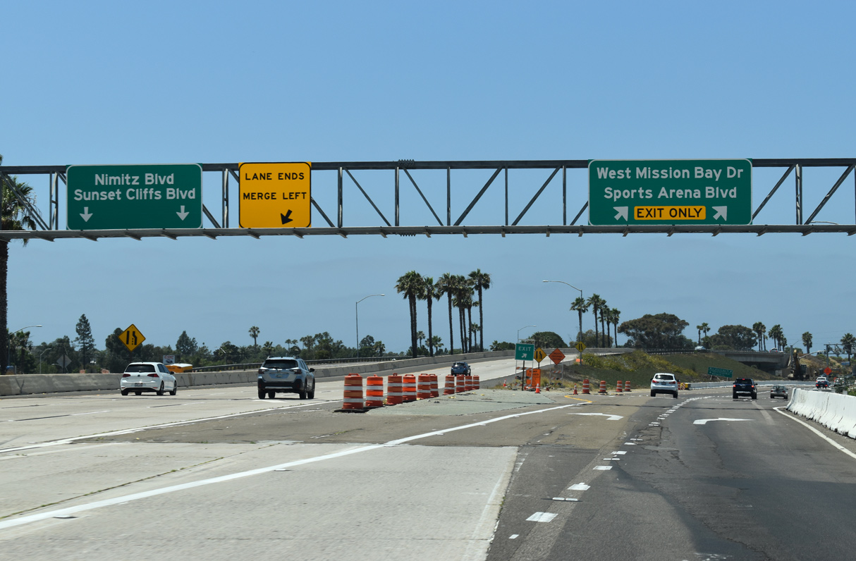
Two lanes depart from I-8 west for Mission Bay Drive north and Sports Arena Drive south. Spanning the San Diego River, Mission Bay Drive heads to Mission Beach and Pacific Beach. Sports Arena Drive continues the arterial southeast through the Midway-Sports Arena District, which houses Pechanga Arena San Diego (San Diego Sports Arena). 07/19/21
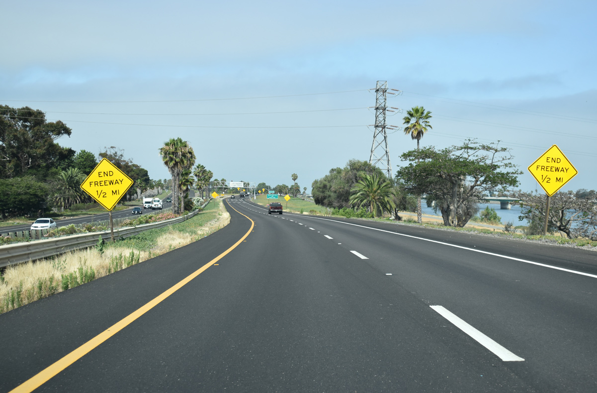
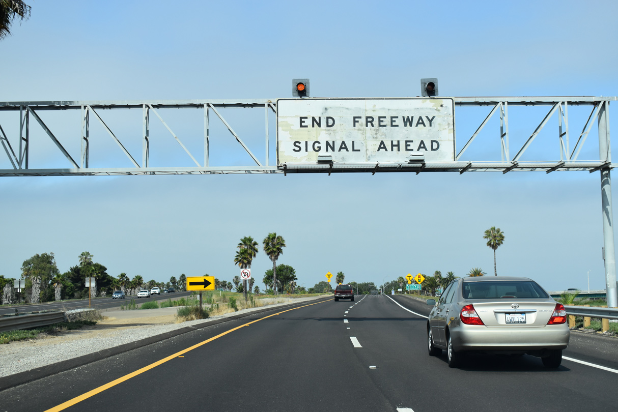
Advancing west along side the San Diego River, Interstate 8 ends in one half mile at a signalized intersection with Sunset Cliffs Boulevard south and Sea World Drive north. 07/13/18
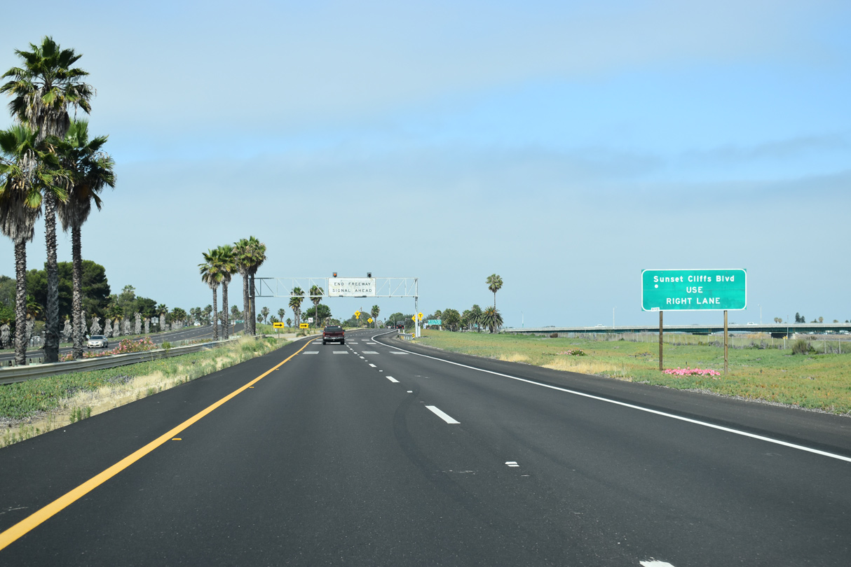
Westbound Interstate 8 ties into Sunset Cliffs Boulevard just north of the split with Nimitz Boulevard and east of Ocean Beach. 07/13/18
Plans once considered the construction of an interchange joining the west end of Interstate 8 with Sunset Cliffs Boulevard and Nimitz Boulevard south. 07/13/18

Sea World Drive crosses the San Diego River north to an interchange with West Mission Bay Drive by Sea World. Nimitz Boulevard angles south to Point Loma Heights and North Harbor Drive. 07/13/18
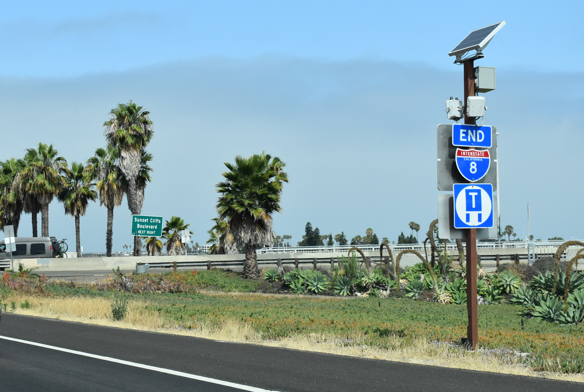
A rarity in Southern California, an end shield marks the western terminus of Interstate 8. 07/13/18
Two lanes turn south from Interstate 8 across from Robb Field Skate Park onto Sunset Cliffs Boulevard. Nimitz Boulevard branches southeast nearby. 07/13/18
Sunset Cliffs Blvd – North at ![]()
Leaving Ocean Beach, northbound Sunset Cliffs advances to the intersection with Nimitz Boulevard and Interstate 8 east. Signs along Sunset Cliffs Boulevard were placed by the city of San Diego, not Caltrans. 08/11/06
Since there is no access from eastbound I-8 to northbound I-5 north, signs recommend using Sunset Cliffs Boulevard east to Sea World Drive to Interstate 5. 08/11/06

Sunset Cliffs Boulevard crosses the San Diego River to enter the Mission Bay Interchange with Sea World Drive, Ingraham Street and W Mission Bay Drive. During hot summer afternoons, Sea World Drive can be extremely congested with beach traffic trying to make its way back to Interstate 5. 04/25/20

Traffic from Sunset Cliffs Boulevard merges with motorists from Nimitz Boulevard north as Interstate 8 (Kumeyaay Highway) begins. 04/25/20
Nimitz Blvd – North at ![]()
Nimitz Boulvard converges with Sunset Cliffs Boulevard at the eastbound beginning of Interstate 8. 07/13/18
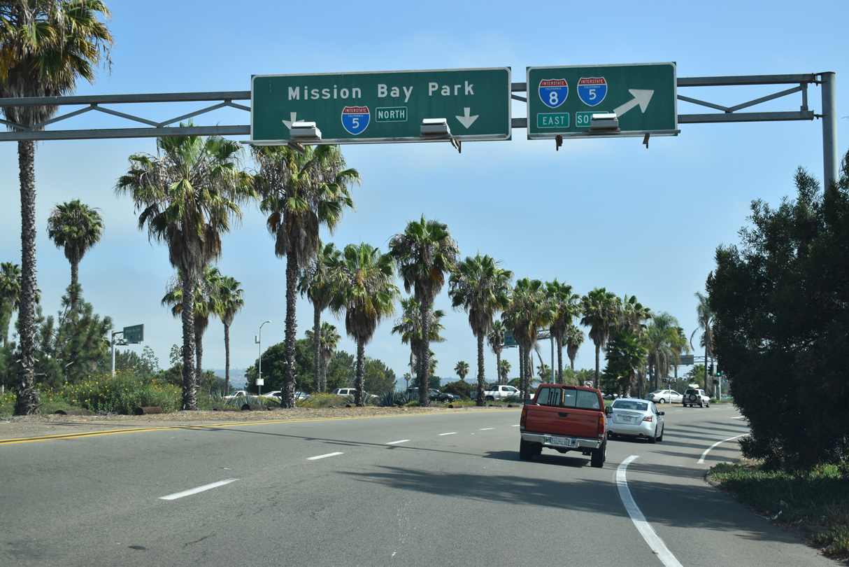
Two lanes continue north from Nimitz Boulevard toward Sea World Drive and Mission Bay Park. Sea World Drive winds east to I-5 at the exchange north of Interstate 8. 07/13/18
Traffic turns from Nimitz Boulevard directly onto Interstate 8 (Ocean Beach Freeway) east to Mission Valley. 07/13/18
![]() East
East

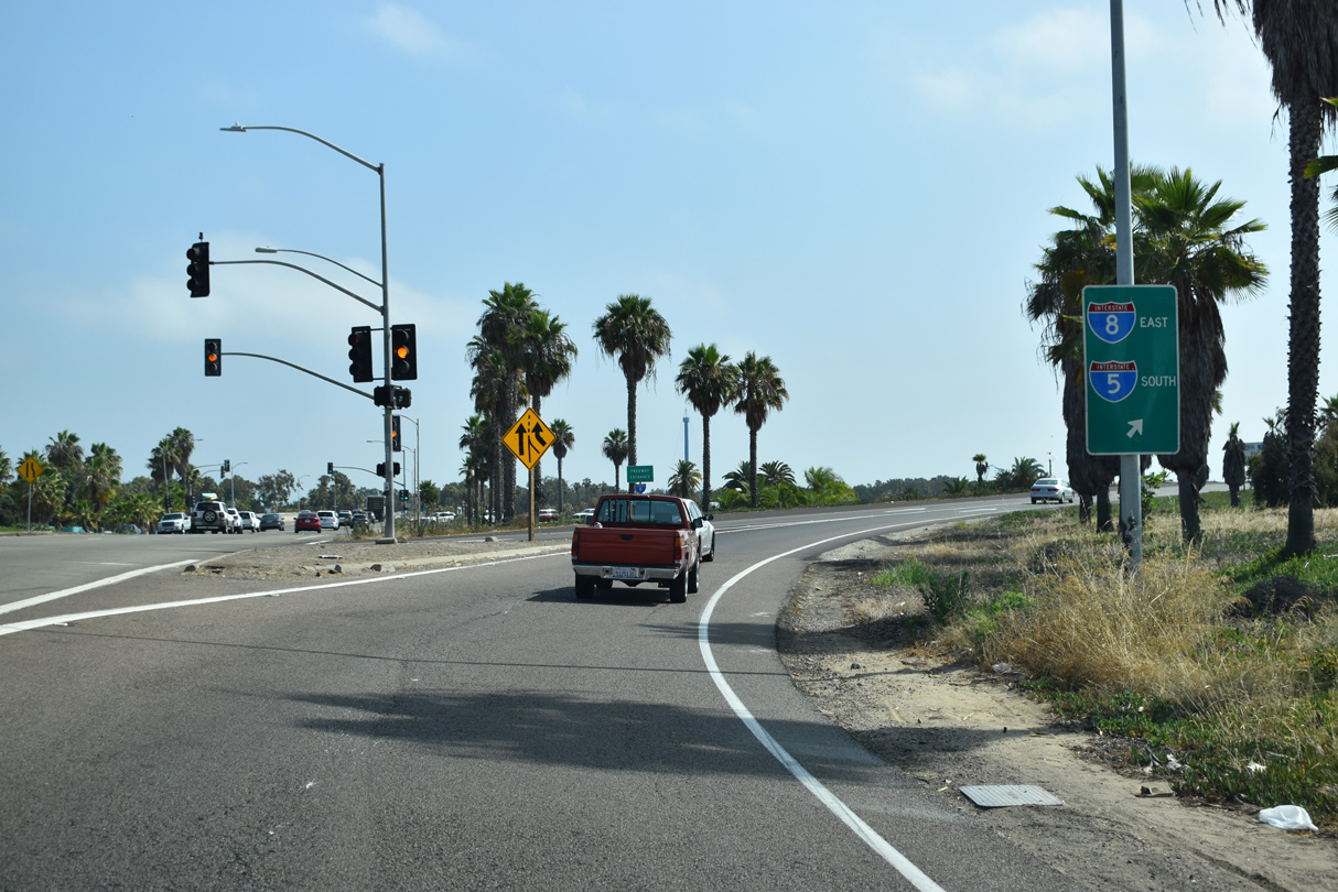
Ramps from Sunset Cliffs Boulevard and Nimitz Boulevard converge at the east freeway entrance for Interstate 8 (Kumeyaay Highway). 04/25/20
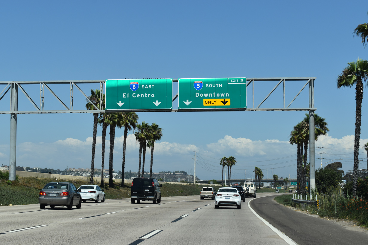
Entrance ramps from Sports Arena Boulevard and W Mission Bay Drive add two additional lanes to eastbound I-8 (Ocean Beach Freeway) leading into the systems interchange (Exit 2) with Interstate 5 south. 07/19/21
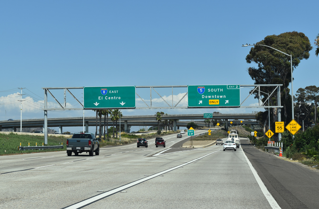
Interstate 5 (San Diego Freeway) heads south from I-8 to Downtown San Diego and Chula Vista. Interstate 8 advances east to Mission Valley, San Diego State University (SDSU) and the cities of La Mesa and El Cajon. 07/19/21
West End Throwback
This sign bridge was removed during construction for the replacement of the West Mission Bay Drive Bridge spanning the San Diego River. Work replacing the early 1950s span ran from Summer 2018 to mid 2022. 07/13/18
Guide signs at Exit 1 were replaced by April 2019. 07/13/18
Sources:
- California Celebrates 50 Years of the Interstate Highway System.
http://www.dot.ca.gov/interstate/Caltrans (California Department of Transportation). - “Both directions of I-10 now three lanes all the way between Tucson and Casa Grande.” ADOT (Arizona Department of Transportation) News. September 27, 2019.
Page updated May 17, 2022.