Interstate 5
Overview
Interstate 5 spans the West Coast, originating at San Ysidro (San Diego), California, the nation’s busiest international border crossing, and culminating at Blaine, Washington. This freeway connects all of the major population centers of the western seaboard, including San Diego, Los Angeles, Sacramento, Portland and Seattle. Via I-580 and I-505, Interstate 5 provides freeway connections to the populous San Francisco Bay Area.
Guide and Major Projects
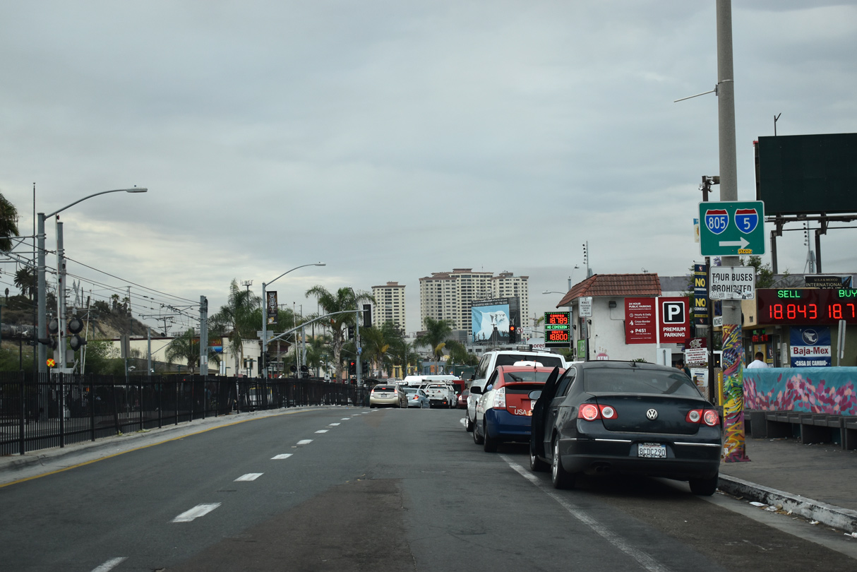
Beginning at the International Border at San Ysidro, Interstate 5 connects the metropolitan areas of Tijuana, Baja California, and San Diego, California. Due to significant traffic loads at all hours of the day and night, plans called for expansion of the northbound border inspection facility and realignment of the southbound lanes into a larger border inspection facility. A three phase, $735 million project expanded the port of entry to 62 northbound inspection booths and one dedicated bus lane among other improvements including expanded pedestrian processing facilities and connectivity to a new multi-modal transportation hub in Mexico. Initial work was completed in April 2011 when a new pedestrian bridge was completed. Phase 2, pertaining to the I-5 North and Southbound Inspection Facilities, was scheduled for completion in Summer 2018.3
Passing through the border inspection station, Interstate 5 immediately assumes the role of an urban freeway, with eight to twelve lanes for its entire length through San Diego County. The freeway replaces old U.S. 101, which used to follow surface streets between the border and Downtown San Diego. While some parts of the old road are buried (such as in National City, where it was overrun by the Mile of Cars and in La Jolla, where I-5 was routed on top of the old road), many extant sections of U.S. 101 are still around for driving enjoyment, especially between La Jolla and Oceanside via San Diego County Route S-21.
With the population explosion resonating throughout Southern California, eight lane Interstate 5 is ill-equipped to handle the needs of daily commuters, visitors, business people, international tourists, truckers and more. Plans call for expansion of I-5 in San Diego, for instance, to ten or more lanes, including the implementation of high occupancy vehicle lanes. One such project added an HOV lane per direction from Manchester Avenue to SR 78 during work between late 2015 and 2018. This work preceded the planned construction of I-5 Express Lanes, from La Jolla Village Drive in San Diego to Harbor Drive in Oceanside. These will operate similarly to the I-15 Express Lanes through San Diego County. Work proposed between 2020 and 2035 will upgrade the existing carpool lanes to Express Lanes.
Another large scale project addressing traffic congestion along I-5 was the reconstruction and expansion of the interchange with Interstate 805 through the San Diego communities of Sorrento Valley (Mira Mesa), Torrey Hills and Carmel Valley. The freeway was widened to a dual freeway configuration, which allows for trucks and local traffic to use the lanes that lead to exit ramps, while through traffic may use the express lanes. The northbound local bypass opened in early 2006, followed by the southbound local bypass in Spring 2007.
Continuing north through Orange County, Interstate 5 was reconstructed and widened substantially in the mid-2000s between SR 73 and SR 91. Parts of this section of freeway contain as many as 22 lanes, including auxiliary and carpool lanes. Even so, the interchange between I-5 and Interstate 405 can be very busy and congested during rush hour periods and on weekends.
Entering Los Angeles County, Interstate 5 reverted to its originally constructed alignment, following concrete poured in the 1960s in some areas. I-5 was generally six lanes wide. Construction expanded the freeway northwest from Buena Park to Commerce. Work started between the Coyote Creek over crossing and Marquart Avenue in January 2012. Construction continued on Segment A through December 2018. Segment B between I-605 and I-710 and Segment C at the I-710 interchange was proposed to start in Winter 2025.6
One of the biggest congestion points along Interstate 5 is at the junction with I-10, U.S. 101 and SR 60. This maze of interchanges, ramps and other maneuvers remains largely unchanged since its original construction, and so it is overwhelmed by traffic every day. Through traffic on I-5 is squeezed into two lanes at one point as well as merged with traffic from the busiest freeway in Southern California, Interstate 10 (Santa Monica Freeway). From here, I-5 generally follows old U.S. 99, which was decommissioned in 1964.
Leaving the Los Angeles Basin, Interstate 5 regains its full freeway configuration of eight to ten lanes, but the evening commute generally hits at the north end of San Fernando Valley. The interchange between I-5, I-210 and SR 14 is a choke point, even with the truck bypass. The SR 14/I-5 interchange was also the site of two devastating earthquake collapses, one in 1971’s Sylmar Earthquake and the other in 1994’s Northridge Earthquake.
Beyond San Fernando Valley, Interstate 5 ascends to one of the highest points along its course along the western coast. Crossing the Tehachapi Mountains at Tejon Pass (elevation 4,144 feet) as well as the infamous San Andreas fault, I-5 transitions from an urban to a rural freeway for the first time. In order to make the grade manageable for trucks, the northbound lanes of I-5 just north of Castaic switches sides with the southbound lanes. The result is several miles in which northbound Interstate 5 is on the left side of the freeway rather than the right side. This kind of configuration is uncommon; Interstate 8 east of Yuma, Arizona has a similar inversion of its east and westbound lanes.
Descending into the massive Central Valley via the Grapevine, Interstate 5 immediately splits into two routes: I-5 follows the Westside Highway, avoiding all major population centers between the Grapevine and Tracy. SR 99 follows the old U.S. 99 route, connecting with most major Central Valley cities, including Bakersfield, Fresno, Modesto, and Stockton. Fresno holds the dubious distinction as the largest city in the country not served by an Interstate highway. Nevertheless, Fresno still has its old standby, SR 99. Most traffic destined for the Bay Area and points northward prefer to take Interstate 5, which is shorter and avoids urban traffic.
The next several hundred miles can be peaceful or stressful depending on the day of the week and time of year. During holiday weekends, Interstate 5 can be a parking lot filled with travelers eager to reach relatives and friends in Northern or Southern California. At other times, I-5 is as free flowing as any rural freeway. However, over the past decades, more people have been using “the 5” to connect between Southern and Northern California. As this kind of usage increases, traffic delays become problematic in the Central Valley, even if the nearest city is many miles away.
Once at Interstate 580, travelers en route to the San Francisco Bay Area may exit west to their destination. I-5 remains in the Central Valley, closely following the California Aqueduct and Path 22, the flagship transmission power lines that follow the freeway through much of the state. Whenever Southern California needs power from Northern California, these power lines carry that extra power needed to satisfy their needs. The power lines also work in reverse, thus ensuring that neither part of the state is without power for a long period of time.
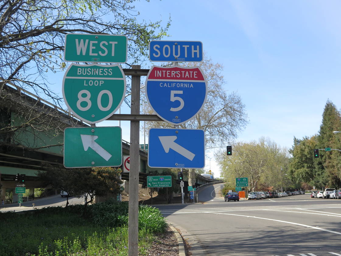
Finally I-5 passes through some cities in the Central Valley, including Tracy, Manteca, Stockton, and the capital city, Sacramento. By the time Interstate 5 reaches Sacramento, it has expanded to eight to ten lanes. Passing under Business Loop I-80, I-5 is well below grade … so low that the bottom of the nearby Sacramento River is higher than the level of the freeway as it passes by Old Town Sacramento. Occasionally, with significant amounts of rain and other variables, this section of Interstate 5 may flood.
However, there are plans to change this. Some Sacramento leaders want to see their access to the river restored, and part of that would require removing Interstate 5 from between downtown Sacramento and Old Town Sacramento. I-5 would then be re-routed to the west, connecting with Interstate 80 and Business Loop I-80 in West Sacramento at their current interchange, then continuing northeast to rejoin current I-5 at the current I-5/I-80 interchange. This ambitious plan faces many hurdles, including major cost and environmental concerns, and nothing has been finalized.
Interstate 5 leaves Sacramento almost as quickly as it arrived. Again meeting California State Route 99, I-5 serves the west edge of the northern Central Valley (via old U.S. 99W), while SR 99 and SR 70 serve the east side of the valley (via old U.S. 99E and U.S. 40 Alternate). Most of the towns passed by Interstate 5 are small, but they have seen growth through the addition of fast food restaurants, gas stations and motels. Behind the veneer of these services, old towns with a great deal of history and farming tradition — such as Williams, Arbuckle, Willows, and Orland — await.
Passing through Red Bluff, Interstate 5 enters the rolling hills that separates Red Bluff from Redding. I-5 leaves the Central Valley, and glimpses of towering Mount Shasta become common. Changing from the great valley to mountain scenery, I-5 weaves northward along old U.S. 99. This terrain remains similar as Interstate 5 passes through northern California and enters southern Oregon. By the time it reaches Eugene, the freeway has entered the narrow Willamette Valley, and it approaches Portland.
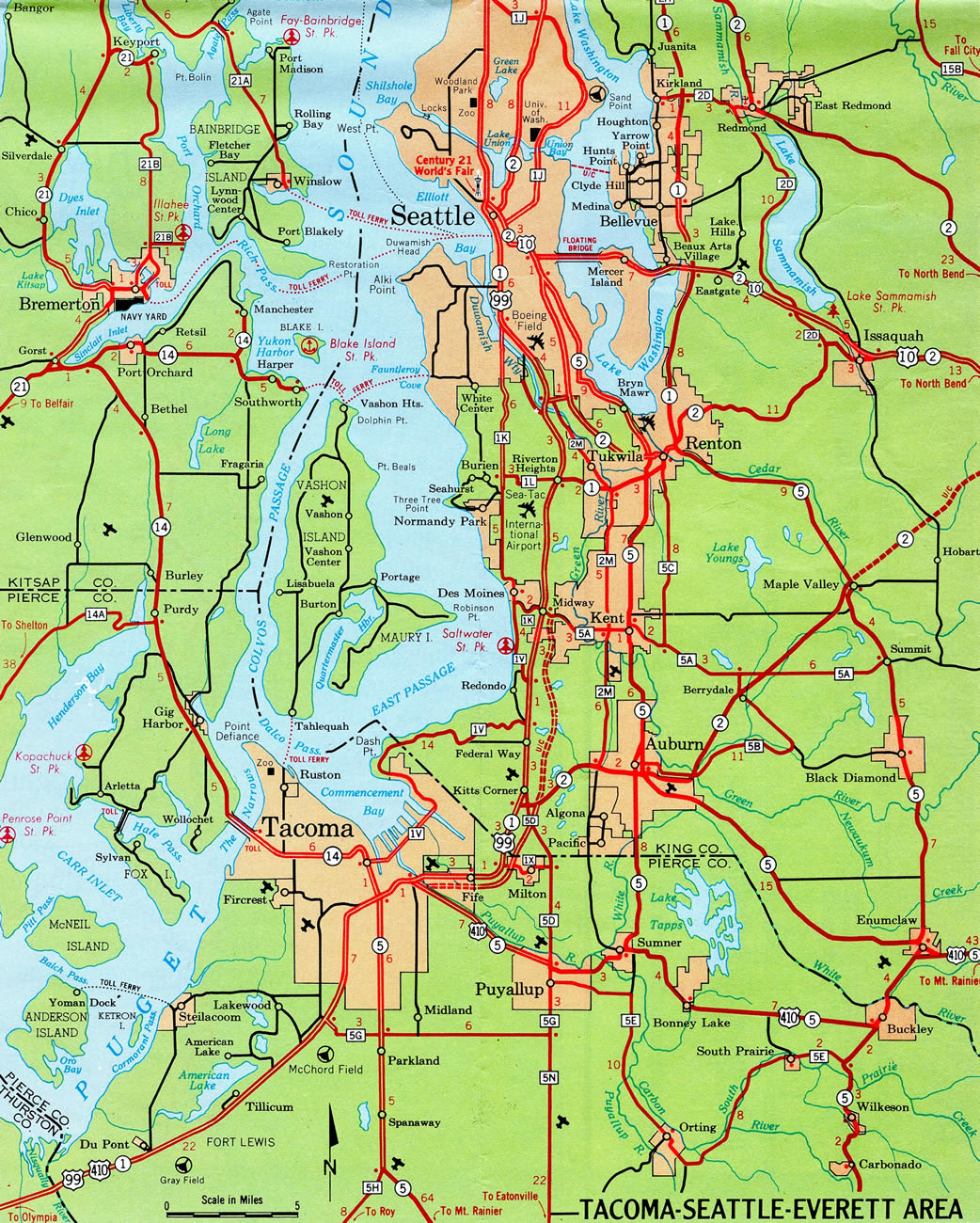
Both Portland and Seattle have several concerns with Interstate 5. In Portland, the Interstate Bridge over the Columbia River is substandard and causes traffic delays daily. In Seattle, the freeway is congested daily and cannot support the ever increasing crush of traffic.
High Priority Corridor
Interstate 5 is part of High Priority Corridor 30: Camino Real for its entire length. In the Everett-Seattle-Tacoma area, I-5 is also part of High Priority Corridor 35: FAST Corridor.
 Parallel U.S. Routes
South of San Diego, Interstate 5 replaced U.S. 101, truncating that route in Los Angeles. However, for the rest of its route northward, I-5 roughly parallels and replaces former U.S. 99, which was decommissioned in stages between 1964 and 1972. Remnants of the old route are now part of California State Route 99, Oregon Route 99, and Washington State Route 99. Although Interstate 5 runs closely to the original route of U.S. 99, large sections of the freeway avoid the old roadway and take on a new alignment, especially between Wheeler Ridge and Manteca. Old U.S. 99 instead passed through Bakersfield, Fresno, and Modesto via modern SR 99, while I-5 stays clear of urban areas until reaching Stockton. In addition, Interstate 5 replaced U.S. 99W between Woodland and Red Bluff. Today Interstate 5 only intersects a handful of U.S. routes, and only three of them are in California (U.S. 101, U.S. 50, and U.S. 97).
Route Information
Mileage
California – 796.53 miles
Cities – San Diego, Santa Ana, Los Angeles, Stockton, Sacramento, Red Bluff, Anderson, Redding, Yreka
- Junctions –


Oregon – 308.14 miles
Cities – Ashland, Medford, Grants Pass, Roseburg, Eugene, Salem, Portland
- Junctions –
Washington – 276.62 miles
Cities – Vancouver, Kelso, Chehalis, Centralia, Olympia, Tacoma, Seattle, Everett, Mt. Vernon, Bellingham
- Junctions –
Source: December 31, 2021 Interstate Route Log and Finders List
I-5 Annual Average Daily Traffic (AADT)
Source: Caltrans 2017 Traffic Volumes: Route 5-6
2018 Transportation Volume Tables (ODOT)
WSDOT Traffic GeoPortal
Ramp meters for Interstate 5 are also used in San Diego, Los Angeles, Sacramento, and Seattle.
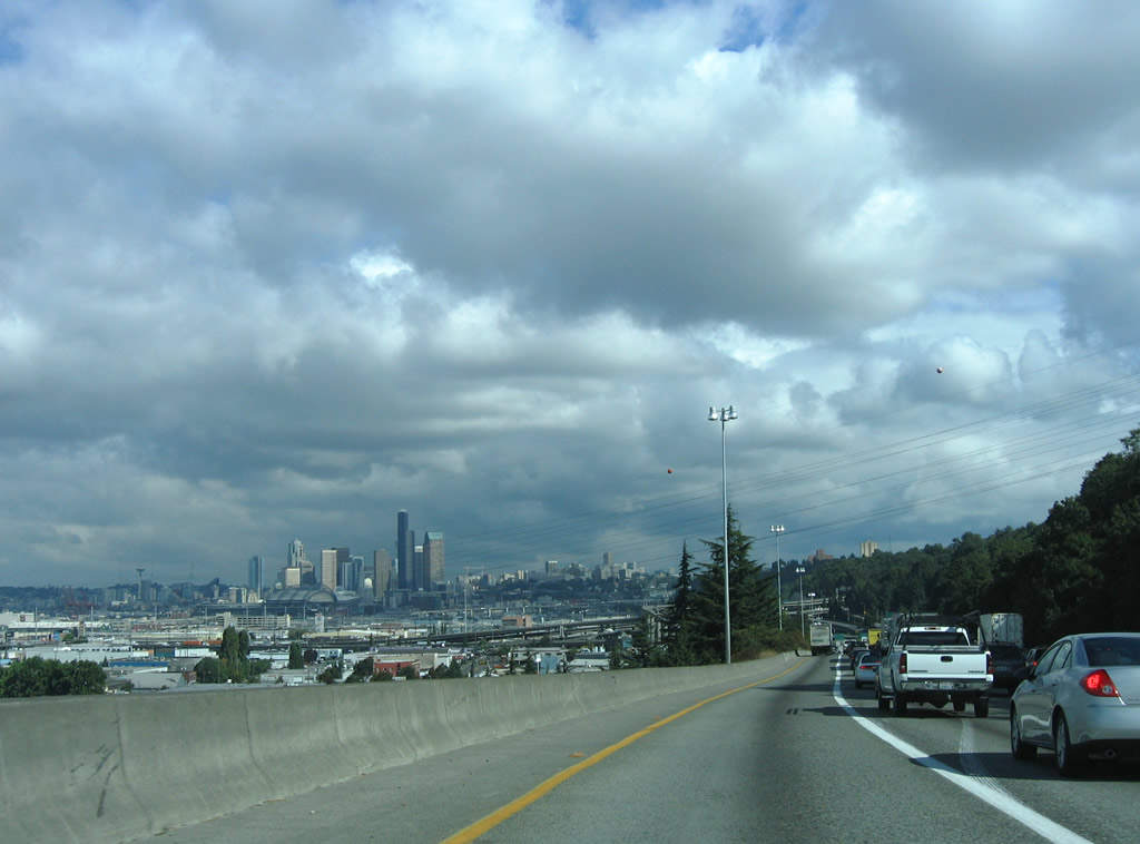
The Seattle skyline comes into view along a busy stretch of Interstate 5 northbound. 08/30/06
The initial stretch of Interstate 5 built in the Seattle-Tacoma area bypassed U.S. 99 from 54th Avenue E at Fife to Washington Route 18 near Kitts Corner.
The northern section of I-5 through Los Angeles was completed in 1963 between Lankershim Boulevard (Exit 152) and Interstate 210 (Exits 161A/B).
History
Sections of Interstate 5 in Southern California were constructed prior to the passage of the Federal Highway Act of 1956, including the Aliso Street Viaduct (built in 1948), portions of former U.S. 101/Santa Ana Freeway (south of Los Angeles) and portions of U.S. 101/Montgomery Freeway (south of San Diego). These sections were added to Interstate 5, and U.S. 101 was decommissioned on shared alignments in 1964. Much of the Ridge Route replacement between Los Angeles and the Central Valley over Tejon Pass and the Grapevine (approximately 43 miles) was completely opened by 1970; improvements included construction of separate alignments for each direction of traffic. Near Castaic, the northbound lanes cross under the southbound lanes to allow for a better uphill grade; they switch back near the Templin Highway (Old U.S. 99/Ridge Route Alternate) interchange. A major freeway corridor built with Federal Highway Act funds was the Westside Highway. Construction on this 321-mile long freeway began in 1963. The last section of Interstate 5/Westside Highway to be completed in California was located near Stockton, which opened to traffic on October 12, 1979.2
Interstate 5 in Oregon was completed and open to traffic as a four-lane highway by October 1966. Two segments were completed at that time to finish the route in the state: (1) the Marquam Bridge over the Willamette River in Portland (between the Baldock Expressway and East Bank Freeway) opened on October 18, 1966, and (2) a segment south of Canyonville near Douglas County was opened second, on October 22, 1966. The new freeway was dedicated in a ceremony held at the Cow Creek Rest Area.1
Split Routes
I-5 was originally programmed to have one split route: Interstate 5W. I-5W was to start near Vernalis, follow Interstate 580 to Oakland via Hayward, then return to I-5 via I-80 and I-505 near Vacaville. A few shields were minted and posted, but the designation was eliminated in favor of I-505 and I-580.
 Photo Guides
North End – International Border – Blaine, Washington
![]() North
North
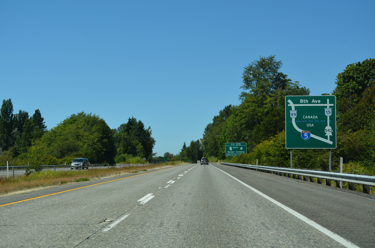
Heading northwest through Blaine, traffic destined for Highway 15 north to Cloverdale in Surrey, British Columbia is directed onto SR 543 via Exit 275. Interstate 5 leads directly to Highway 99 near White Rock, B.C. 07/19/23

A pair of freeway end signs stand next to the Hughes Avenue overpass. The final exit from Interstate 5 departs in 1.5 miles. 07/19/23
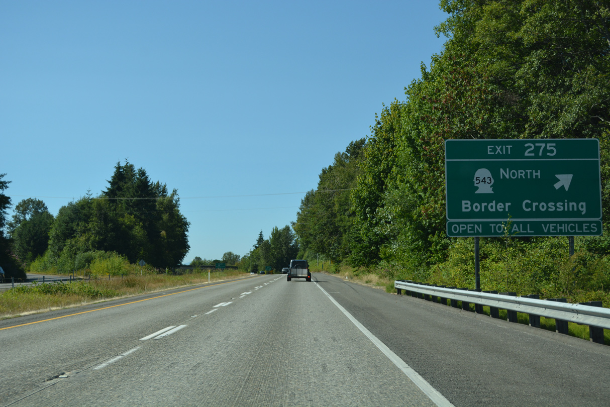
SR 543 branches north from a wye interchange (Exit 275) with Interstate 5 to H Street and the border crossing to Highway 15. All commercial vehicles and bus traffic headed into British Columbia must use the truck customs facility at the north end of SR 543. 07/19/23
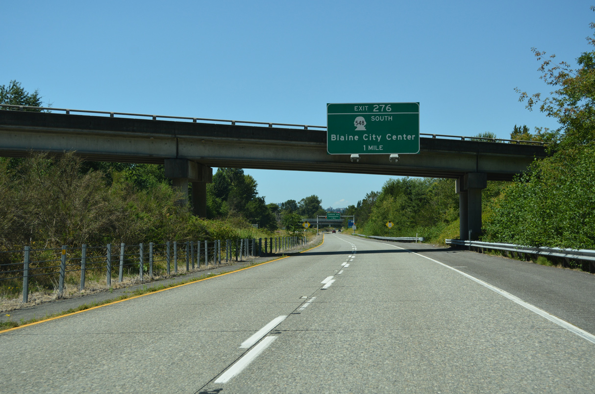
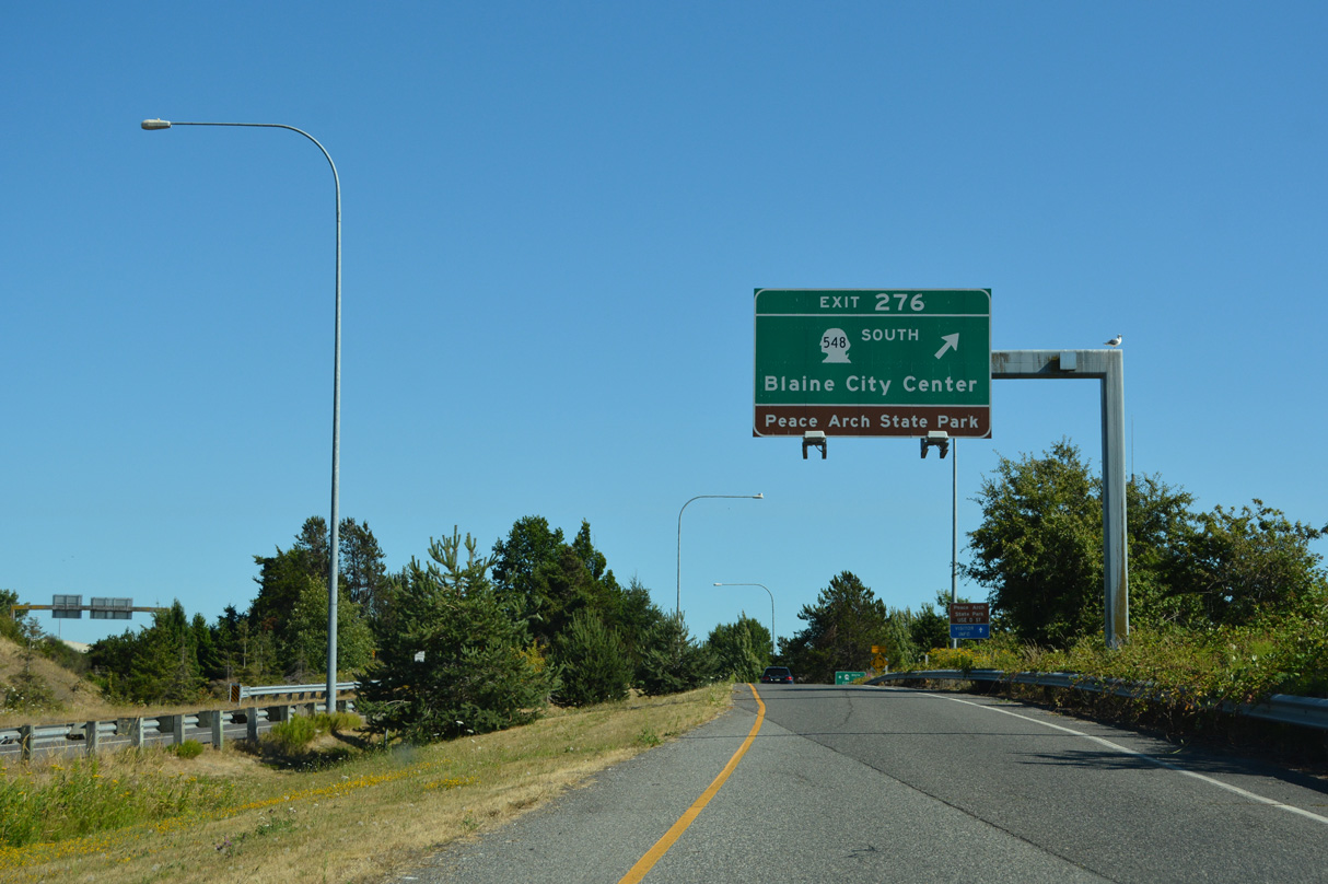
A dumbbell interchange (Exit 276) joins the north end of Interstate 5 with SR 548 (Peace Portal Drive) south to Downtown Blaine in one mile. 07/19/23
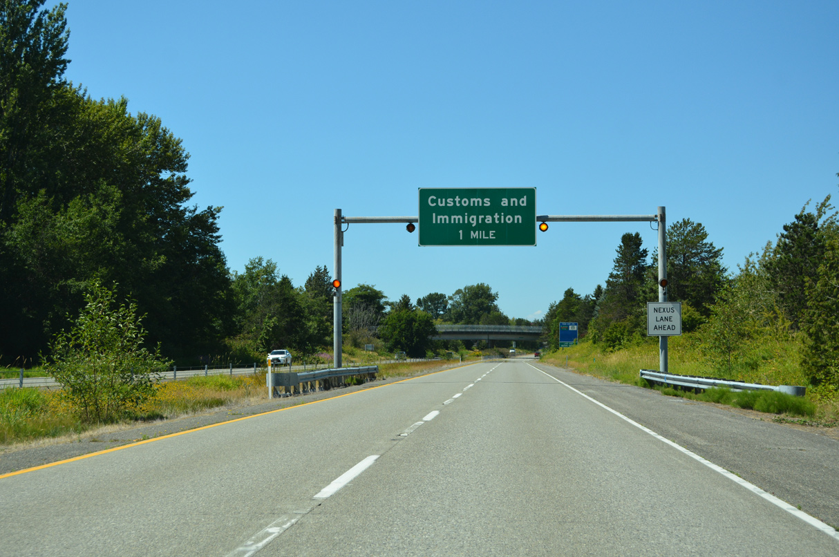
The customs and immigration station between I-5 and Highway 99 in Surrey, B.C. lies just beyond the exchange with SR 548 and D Street. 07/19/23
Unlike the south end at San Ysidro where a last U-turn is available, Exit 276 represents the final departure point from Interstate 5 north before the International Border. 07/19/23

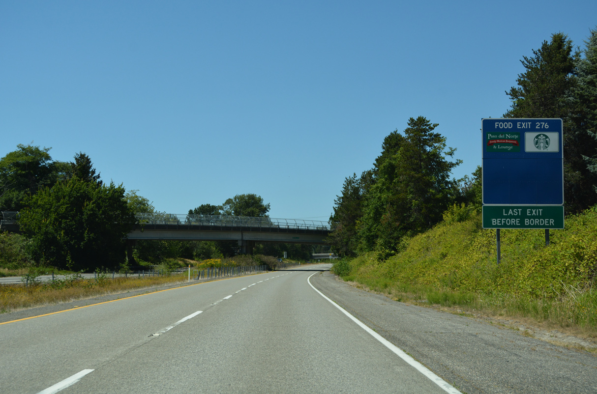
The speed limit lowers to 35 miles per hour ahead of Exit 276 to SR 548 south, D Street and Peach Arch State Park. Home of the famous Peace Arch, Peace Arch State Park marks the boundary between the United States and Canada. It is jointly maintained by the two countries. 07/19/23
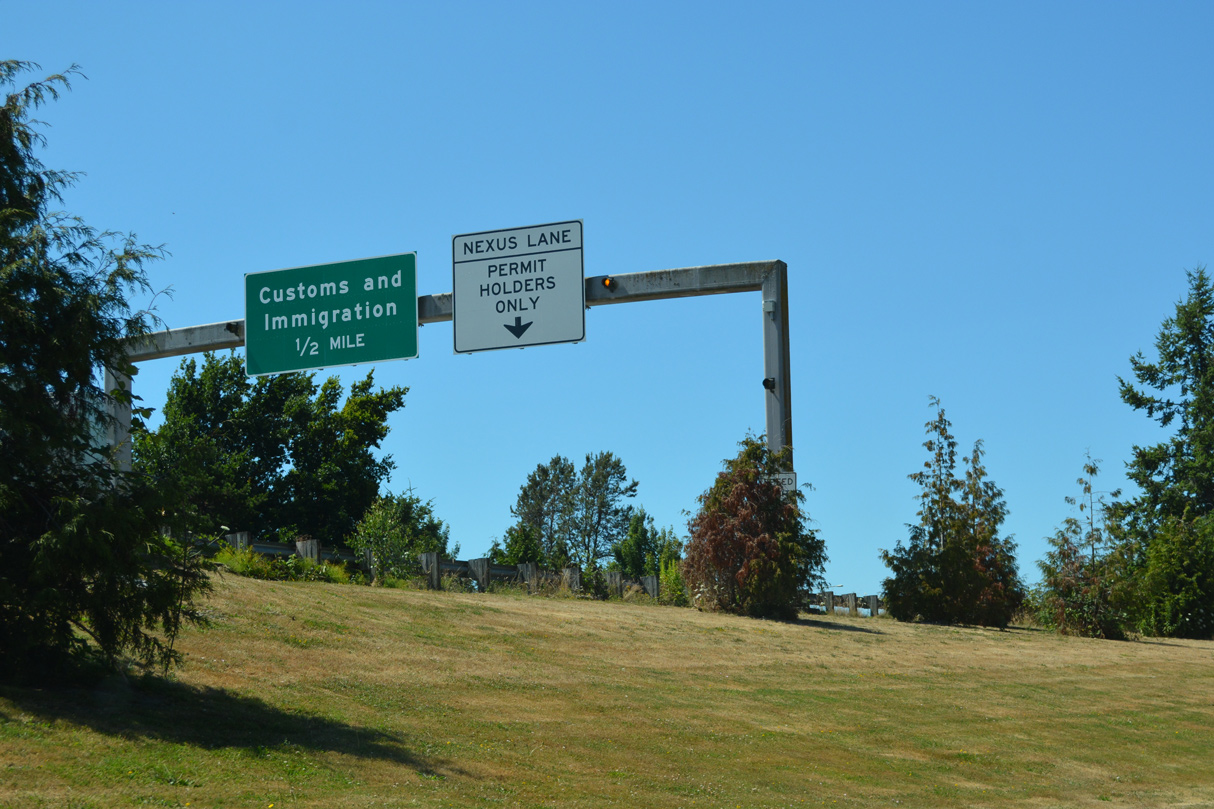
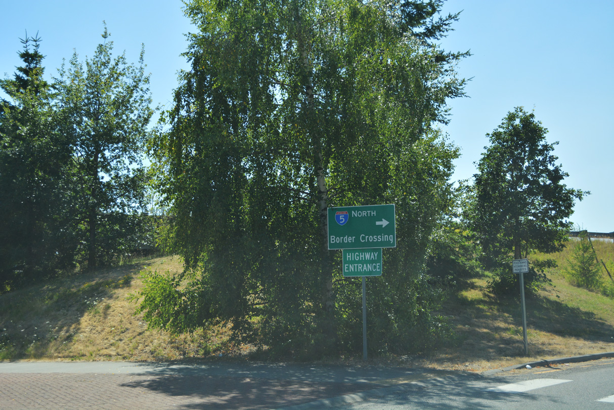
A third lane opens northbound along I-5 across SR 548 (Peace Portal Drive) for NEXUS permit holders. The Canadian port of entry lies just beyond the grounds of Peace Arch State Park. 07/19/23
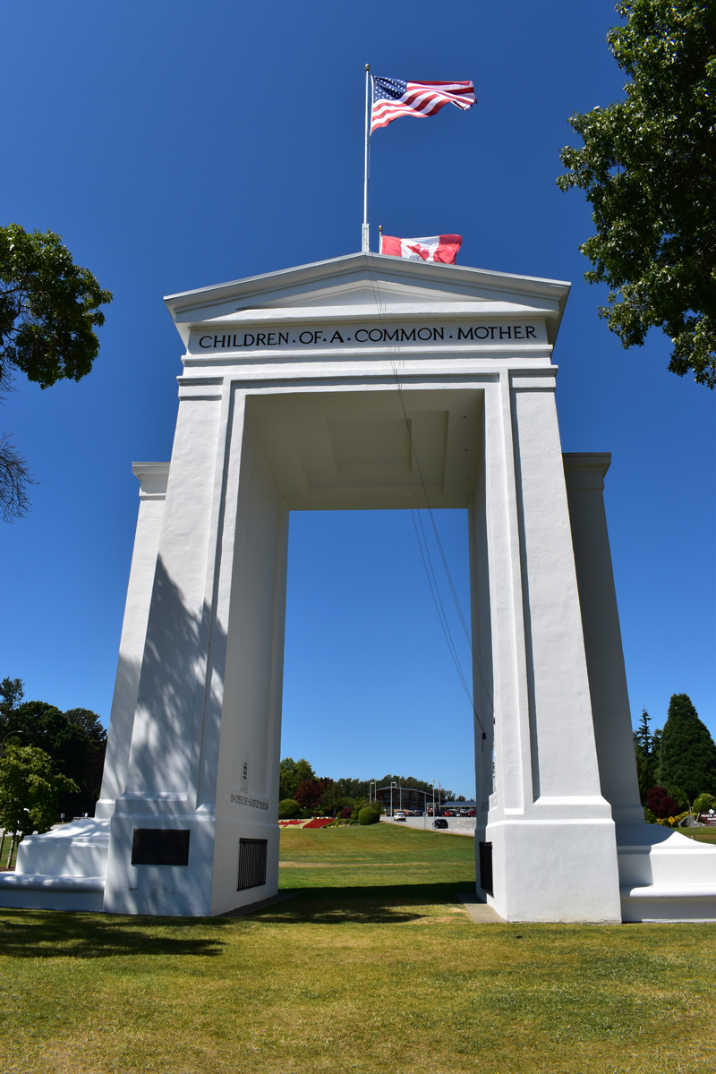
The Peace Arch acts as a large doorway connecting the United States and Canada. The phrase “Children of a Common Mother” refers to the history of both countries once belonging to the British Empire. A small inscription on the north face of the monument acknowledges the Pacific Highway, which in 1920 was constructed to pass through the arch. 07/19/23
The Peace Arch rises from a grassy area between the roadways linking I-5 and Highway 99. A pair of granite markers reference the boundary between Canada and the United States. Pedestrians are permitted to walk across the highway to view the Peace Arch, which in effect allows park visitors to visit the other country briefly. 07/19/23
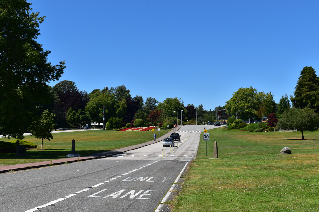
Highway 99 extends north from the International Border and Interstate 5 toward Vancouver. Highway 99 was the continuation of U.S. 99, which was replaced by I-5, and subsequently decommissioned in 1969. Photo by Steve Hanudel (05/20/06).
D Street – West at ![]()
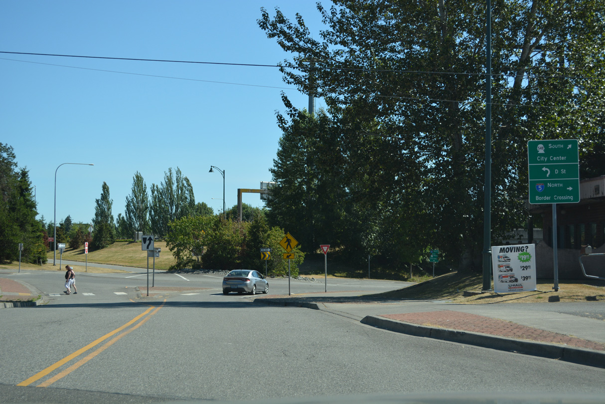
D Street west meets Interstate 5, 2nd Street north to Peach Arch State Park and SR 548 (Peace Portal Drive) south. The exchange was converted into a dumbbell interchange during a $2.77 million project underway in Spring 2010.4 07/19/23
Roundabouts replacing the signalized intersections with the Interstate 5 ramps at D Street and SR 548 (Peace Portal Drive) opened to traffic on May 19, 2010, six days ahead of schedule.5 07/19/23

The first southbound entrance ramp to Interstate 5 joins SR 548 (Peace Portal Drive) and D Street north of the Blaine business district. 07/19/23
![]() South
South
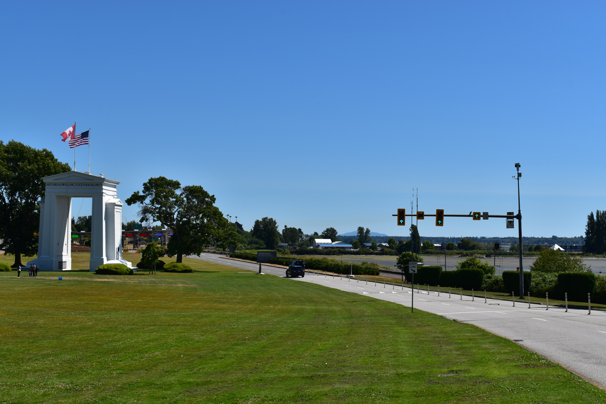
B.C. Highway 99 south from the city of Surrey becomes Interstate 5 at the international boundary in Peach Arch State Park. 07/19/23
Exit 276 departs from Interstate 5 south to SR 548 (Peace Portal Drive) and D Street in Blaine immediately after the U.S. port of entry. 07/19/23
The first confirming marker for Interstate 5 south precedes the H Street overpass east of Downtown Blaine. 07/19/23
South End – International Border – San Diego (San Ysidro), California
![]() South
South
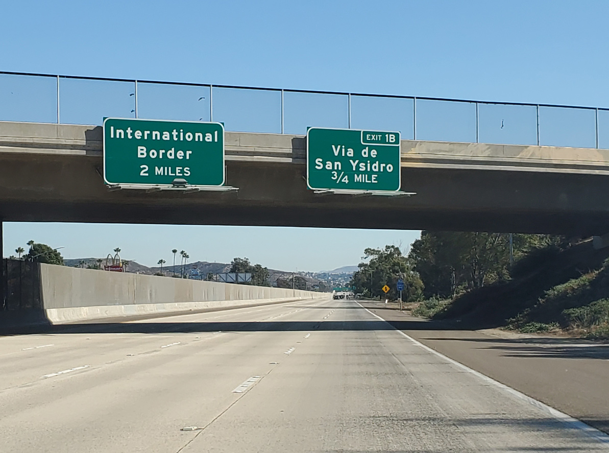
Interstate 5 converges with I-805 just ahead of the International Border with Mexico in the San Diego community of San Ysidro. The succeeding exit departs for Via de San Ysidro. 11/10/20
A diamond interchange connects I-5 with Via de San Ysidro at Exit 1B. A lengthy off-ramp (Exit 1A) follows for Camino de la Plaza. 11/10/20
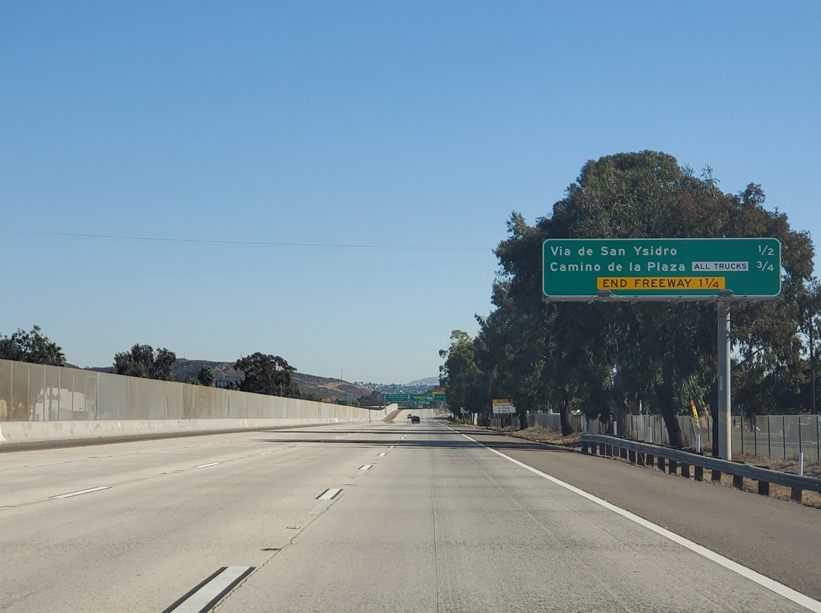
Four lanes advance southward beyond Exit 1B for Via de San Ysidro to the Mexico border crossing into Tijuana. 11/10/20
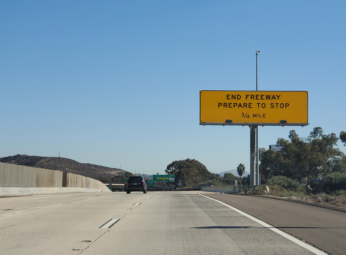
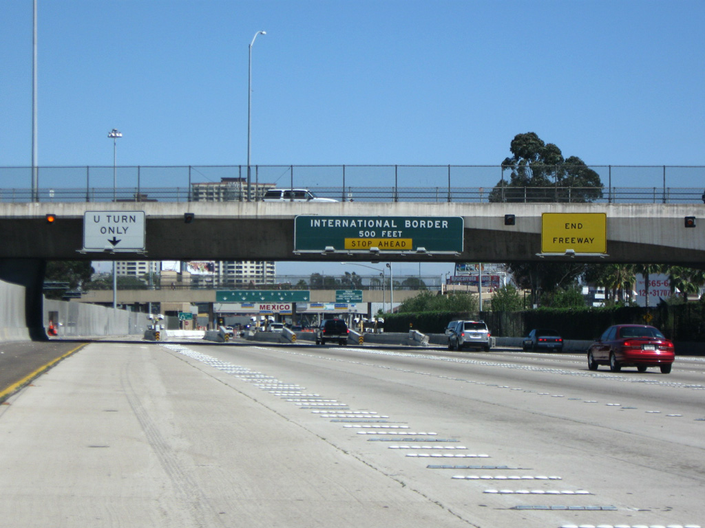
Interstate 5 ends three quarters of a mile beyond the Via De San Ysidro underpass. If Mexican officials are stopping traffic at the border, traffic congestion based delays may extended even as far north as here. 11/10/20
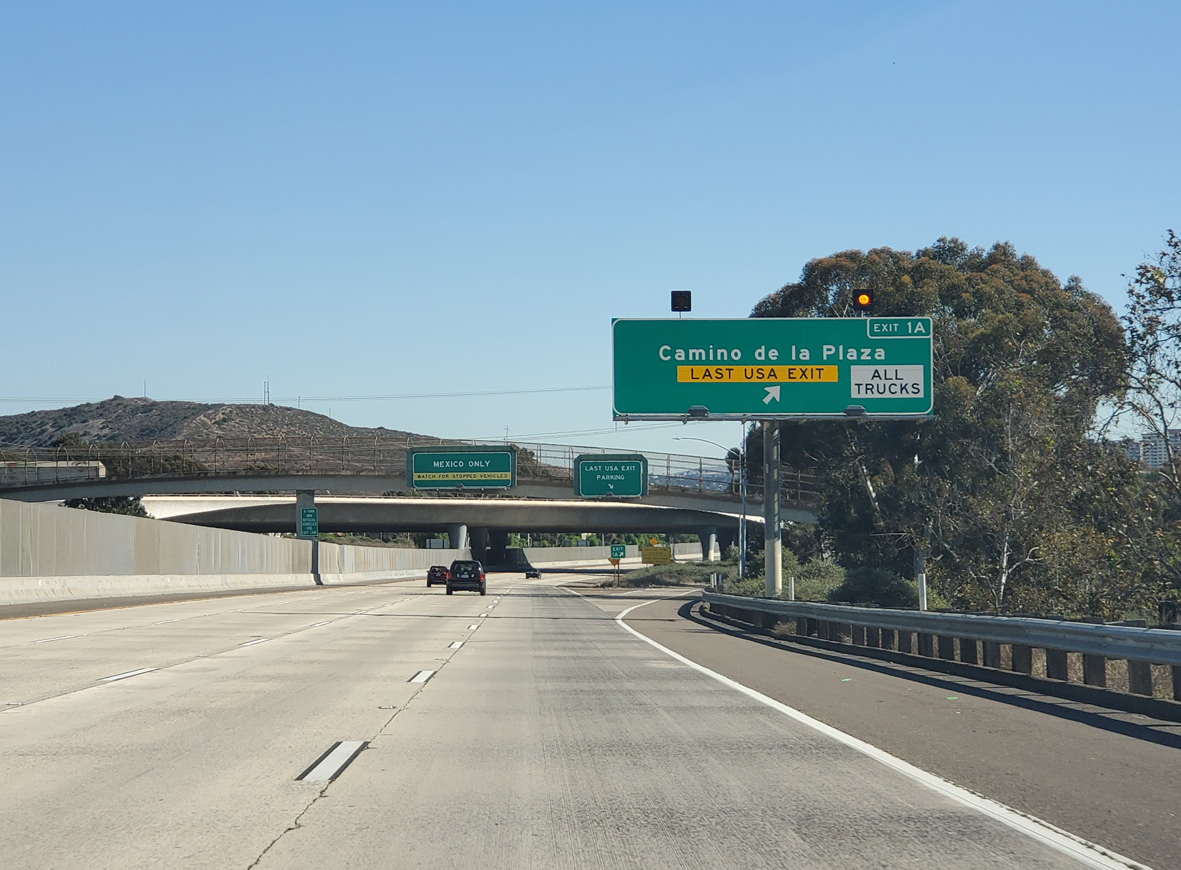
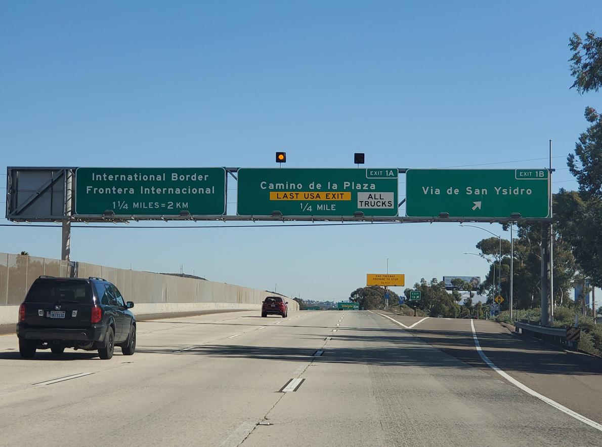
The last U.S. exit connects I-5 south with Camino de la Plaza to various outlet shops, duty free businesses, parking areas, a transit center and the pedestrian walkway into Mexico. 11/10/20
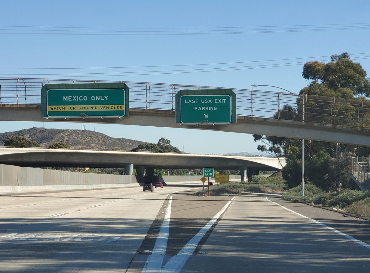
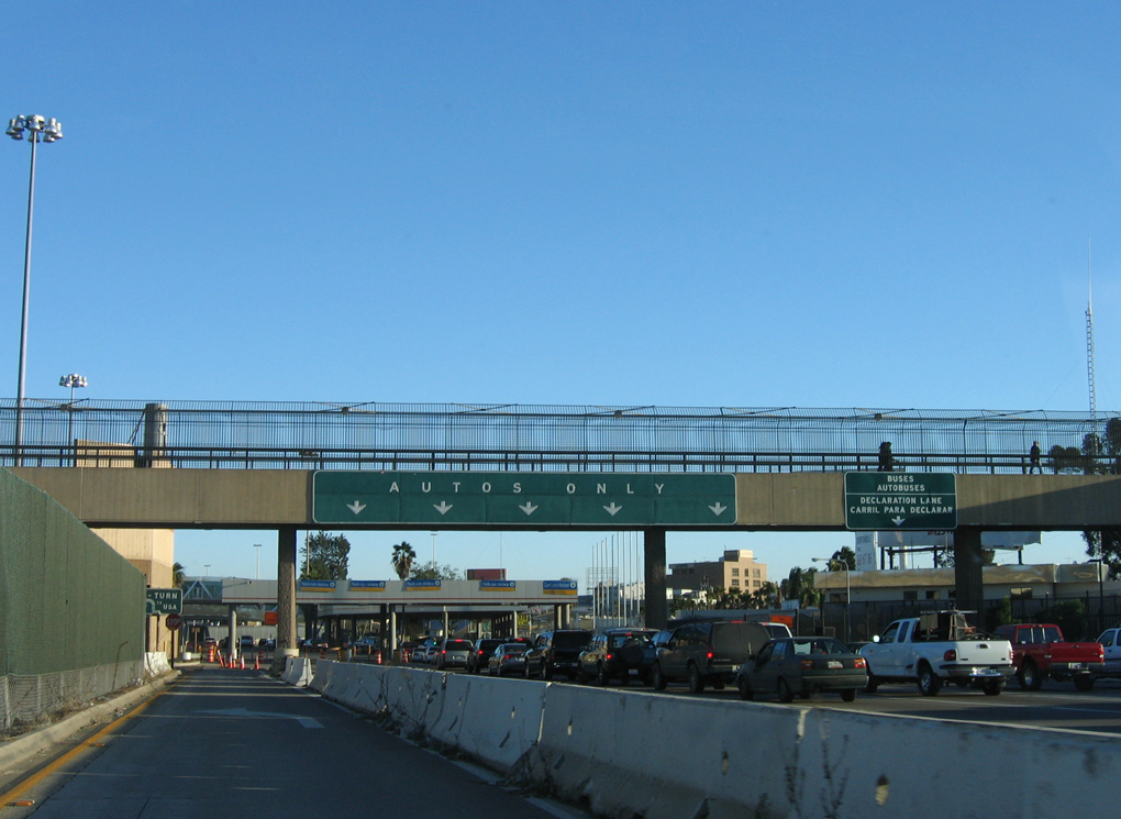
With the exception of a U-turn lane to the left, all remaining traffic along Interstate 5 south beyond Exit 1A defaults to the customs station for Mexico. 11/10/20
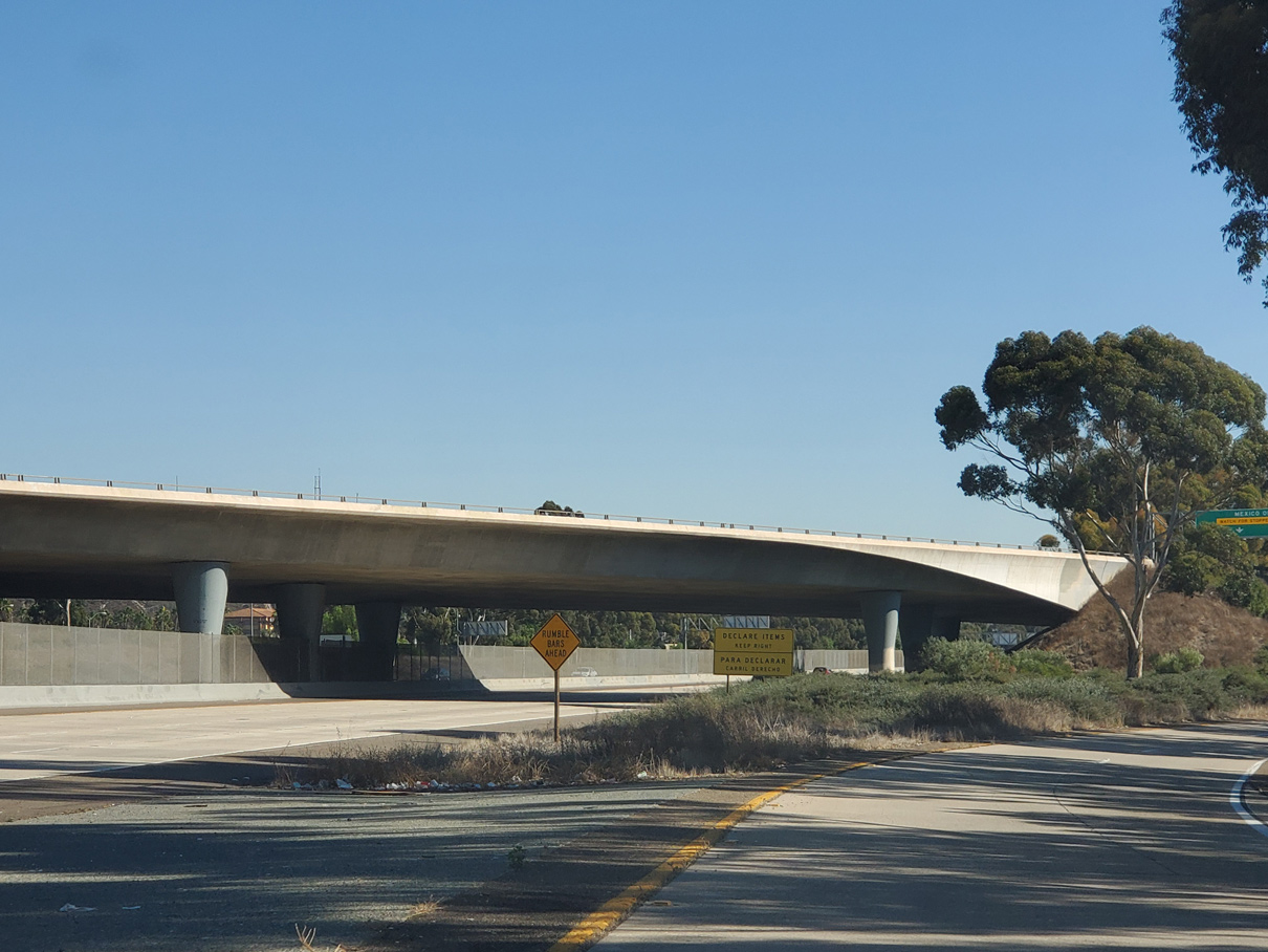
Traffic from San Ysidro Boulevard and the south end of I-805 merges onto I-5 from the ensuing overpass. Travelers headed into TiJuana, Mexico with items to declare are advised to use the right lane at the upcoming customs station. All other lanes are subject to random searches at the request of officials. 11/10/20
07/12/09
12/03/06
Leading into the San Ysidro port of entry, the left lane separates from I-5 south for the last U-turn back into the United States. The remaining four lanes continue across the International Border to Tijuana, Baja California, Mexico.
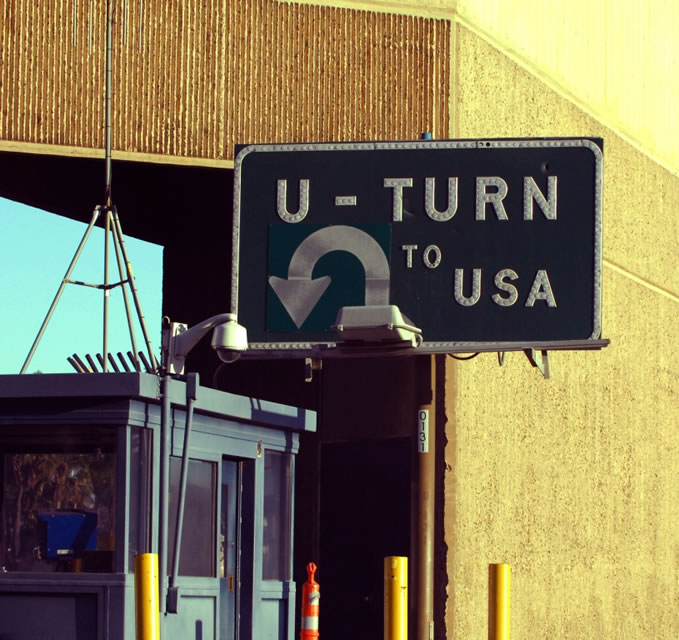
Motorists utilizing the U-turn at the San Ysidro port of entry merge onto the left lane of Interstate 5 north ahead of the split with I-805. 12/03/06
San Ysidro Boulevard – South at ![]()
San Ysidro Boulevard (historic U.S. 101) concludes at Rail Court and ramps with Interstate 5 by the U.S. Customs Station. 07/09/18
The first northbound freeway entrance for Interstate 5 is located west of San Ysidro Boulevard and Rail Court. 07/09/18
![]() North
North
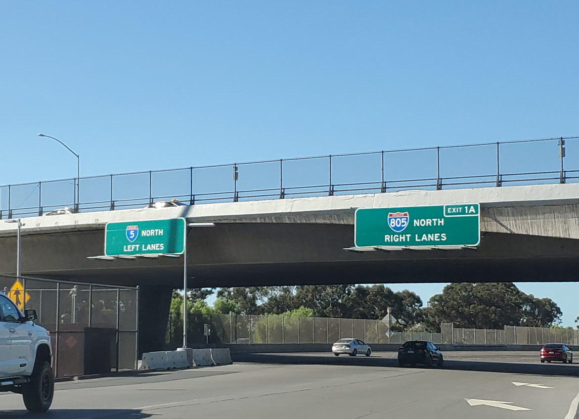
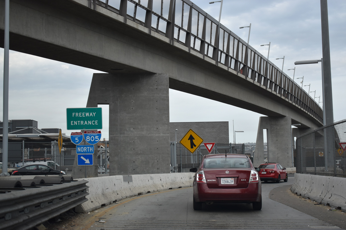
Traffic from both the port of entry/customs station at the International Border and the on-ramp from San Ysidro Boulevard combines below the Camino De La Plaza overpass. Five lanes proceed north to the I-5/805 split at Exit 1A. 11/10/20
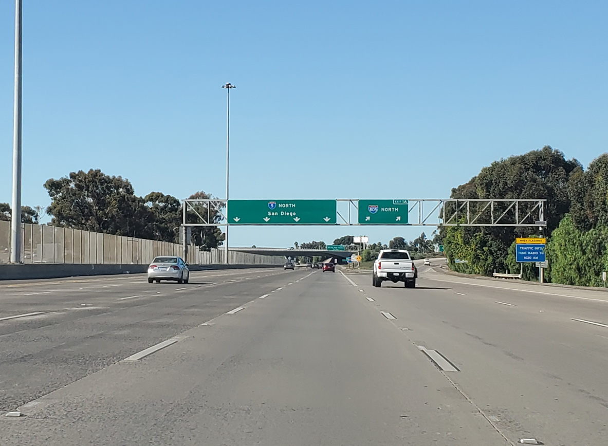
Beyond their separation, I-5 remains closer to San Diego Bay and the Pacific Coast en route to Downtown San Diego, while Interstate 805 travels through the inland communities of the San Diego metropolitan area. The two freeways rejoin in the northern San Diego neighborhood of Sorrento Valley. 11/10/20
Sources:
- Interstate 50th Anniversary: The Story of Oregon’s Interstates by the Oregon Department of Transportation, as compiled from a 2004 report entitled “The Interstate Highway System in Oregon, An Historic Overview” by George Kramer.
- California Celebrates 50 Years of the Interstate Highway System.
http://www.dot.ca.gov/interstate/Caltrans (California Department of Transportation). - San Ysidro LPOE Project Facts.
https://www.gsa.gov/about-us/regions/welcome-to-the-pacific-rim-region-9/land-ports-of-entry/san-ysidro-land-port-of-entry/san-ysidro-lpoe-project-factsU.S. General Services Administration web site. - “Bid for Blaine roundabout project 41 percent under estimate.” Bellingham Herald, The (WA), February 1, 2010.
- “Workers open Blaine traffic roundabouts six days early.” Bellingham Herald, The (WA), May 19, 2010.
http://my5la.com/
Page updated January 29, 2024.