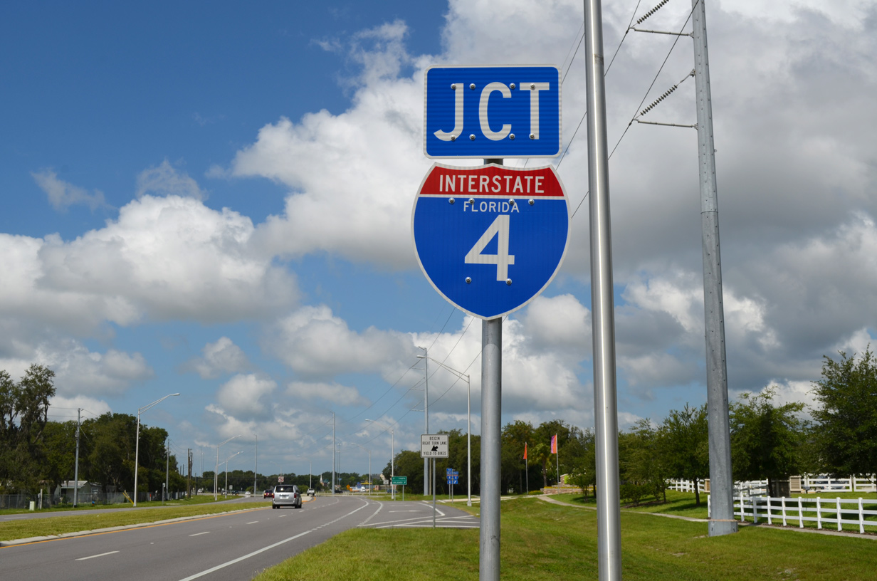
Interstate 4
Overview
Located wholly within the Sunshine State, Interstate 4 follows a route from southwest to northeast across the Florida peninsula. The heavily traveled corridor joins the Tampa Bay and Orlando metropolitan areas with the First and Space Coasts. The entire length of I-4 doubles as Florida State Road 400.
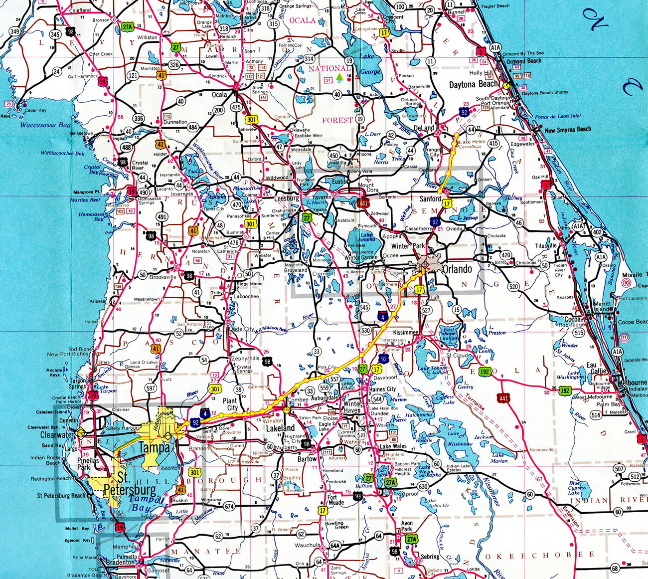
Originating at the Downtown Interchange with Interstate 275 in Tampa, I-4 leads east by Ybor City to East Lake-Orient Park and Mango in Hillsborough County. Paralleling U.S. 92 to the north, I-4 continues through semi rural areas to Plant City and Polk County. Continuing across the north side of Lakeland, numerous distribution centers line the corridor. A heavily commercialized interchange joins I-4 with U.S. 98 three miles north of Downtown.
Passing between Polk City and Auburndale, Interstate 4 advances east by Florida Polytechnic University and additional logistic centers into the Green Swamp north of Winter Haven. The rural stretch across the Green Swamp precedes the heavily developed corridor along U.S. 27 at Posner Park, where routine traffic congestion is a problem. Heavy traffic issues continue northeast along I-4 to CR 532 (Osceola Polk Line Road) at Championsgate and SR 429 (Daniel Webster Western Beltway) at Reunion.
The addition of Reunion Village Boulevard and an extension of Celebration Boulevard along the east side of Interstate 4 in 2021 spurred development, further adding traffic to the lone corridor linking Tampa and Orlando. World Drive stems north from Celebration and I-4 to the Walt Disney World resort complex. Succeeding exits with U.S. 192, Osceola Parkway (CR 522), SR 536/Epcot Center Drive and SR 535/CR 535 (S Apopka Vineland Road) join I-4 with Disney World and the adjacent Lake Buena Vista and Disney Springs areas.
Heading north to the city of Orlando, heavy development lines both sides of Interstate 4, from Dr. Phillips to the west and the International Drive (I-Drive) resort corridor to the east. The Beachline Expressway (SR 528) ties into this stretch, joining I-4 with both Orlando International Airport (MCO) and the Space Coast at Cape Canaveral.
The I-4 Express Lanes built during the Ultimate I-4 megaproject commence north from just ahead of the exchange with SR 435 (Kirkman Road) by the Universal Orlando resort. Located between the general travel lanes, the tolled I-4 Express Lanes stretch 20.5 miles north from Universal Orlando to Longwood in Seminole County. The managed lanes constitute separate two lane roadways along both directions of Interstate 4. They commenced operations on February 26, 2022.
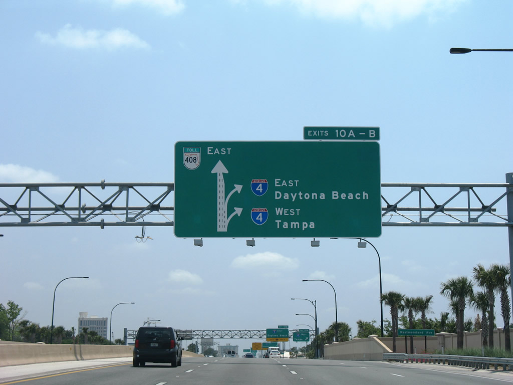
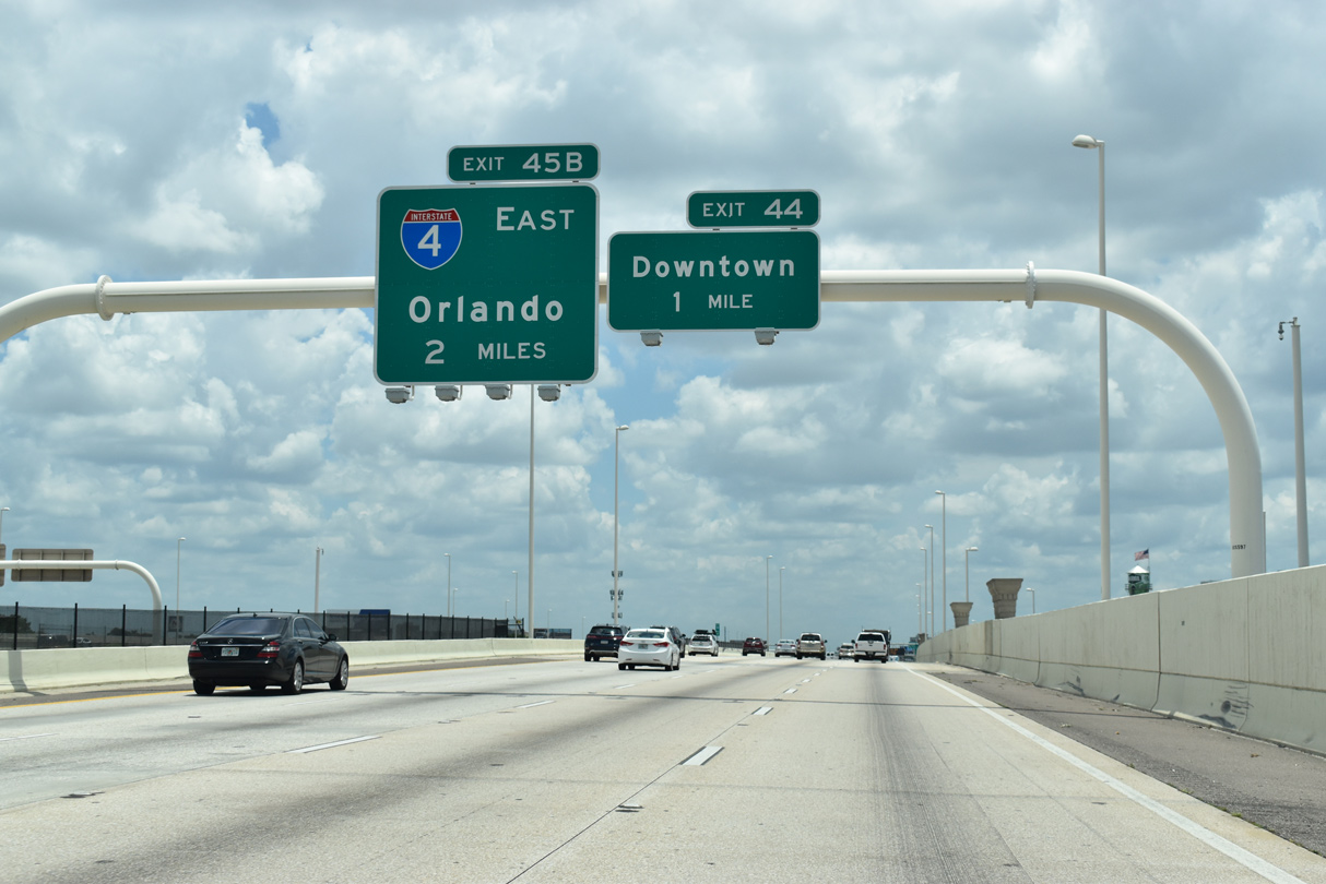
Through Orlando, Interstate 4 runs northeast from the Mall at Millenia to CR 423 (John Young Parkway) by Rio Grande Park. Curving northward by Holden Heights, I-4 converges with SR 408 (East-West Expressway) at a multi level systems interchange completed in 2021. Beyond SR 408, I-4 passes Amway Center, home of the NBA Orlando Magic, along an elevated stretch along the west side of the Orlando central business district.

Interstate 4 east at the multi level interchange with SR 408 (East-West Expressway) in Downtown Orlando. 01/08/22
Shifting east from U.S. 17/92-SR 50 (Colonial Drive) by Lake Concord, I-4 crosses Lake Ivanhoe north by the College Park neighborhood. I-4 leaves Orlando along the westward curve to SR 426 (Fairbanks Avenue) and continues along western reaches of Winter Park to unincorporated Fairview Shores. Through northern Orange County, I-4 passes through Eatonville and Maitland. Within Maitland, the freeway meets SR 414 (Maitland Boulevard), a controlled access route west to Forest Park and John Land Apopka Expressway.
Interstate 4 proceeds northward into Seminole County through Altamonte Springs, where it connects with SR 436 (Altamonte Drive) near Altamonte Mall. Bending eastward, I-4 runs along the west side of Longwood and Lake Mary to unincorporated Heathrow. The north end of SR 417 (Seminole Expressway) ties into I-4 at Sanford, where construction through 2023 expands their interchange with the final link of the tolled Wekiva Parkway, SR 429 east from Mount Dora in Lake County.
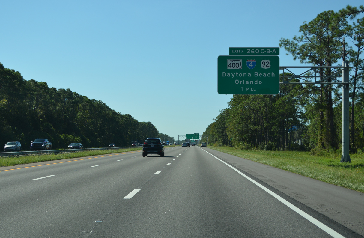
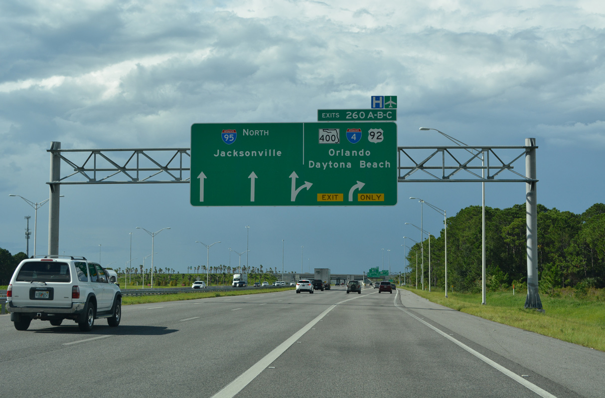
Interstate 4 angles northeast across Lake Monroe into Volusia County. The ensuing stretch travels along a suburbanized corridor between DeBary and Orange City to the west and Deltona and Cassadega to the east. I-4 meets SR 44 east of the county seat of DeLand, where it transitions into a rural freeway crossing Tomoka Wildlife Management Area. Beyond the protected area, Interstate 4 enters Daytona Beach, where it concludes at I-95 opposite SR 400 (Beville Road) from South Daytona. SR 400 extends 4.22 miles east along a four lane arterial to U.S. 1 along the Daytona Beach and South Daytona city line.
I-4 Ultimate
Through Orange and Seminole Counties along with the city of Orlando, a variety of improvements were proposed, most of which were controversial. In October 2003, the “Mobility 20/20” tax plan proposed an expanded Interstate 4 through the metropolitan area, but that was rejected by voters. One of the reasons cited for the failure of this tax was opposition to toll lanes on I-4. Nevertheless, the idea returned in March 2005.
During that time, officials proposed a managed lanes concept that is similar to the reversible and high occupancy vehicle lane concept found in Southern California, such as California State Route 91 (Riverside Freeway) and Interstate 15 (Escondido Freeway). These highways feature managed lanes in the median that can be adjusted to allow for more traffic in either direction. High occupancy vehicles use the lanes for free, while single occupancy vehicles are charged an electronic toll. Named the XPress 400 and outlined along I-4 from SR 435 (Kirkman Road) to SR 434, the toll lanes were estimated to cost over $1.5 billion to complete in 2005. Under the management of Florida’s Turnpike Enterprise (FTE), the project proposed constructing new toll lanes in the median, adding a continuous fourth lane in both directions, straightening out some sections of the freeway and redesigning interchanges. Completion was envisioned by 2013.1
The Trans4mation project resulted in some improvements to area interchanges, such as the building of a new flyover from I-4 west to John Young Parkway and completion of Phase 1 for the I-4 and SR 408 (East West Expressway) interchange upgrade. The remainder of work was folded into the I-4 Ultimate Project. The $2.3 billion initiative focused on upgrading 21 miles of Interstate 4, from a point south of SR 435 (Kirkman Road) in Orange County to north of SR 434 in Seminole County. The mega project kicked off in early 2015 and was completed in March 2022. Work rebuilt 15 interchanges, replaced 75 bridges and added two tolled Express Lane roadways in each direction within the median of I-4.
Major changes were made where Interstate 4 meets SR 408 (East-West Expressway), where a multi level systems interchange was built. SPUI’s were built at U.S. 17/92-SR 50 (Colonial Drive) and SR 436 (Semoran Boulevard). The exchange with SR 414 (Maitland Boulevard) was upgraded with free flowing ramps, eliminating signalized intersections along the limited access stretch of SR 414 leading west.
The I-4 Beyond the Ultimate project continues upgrades along Interstate 4 south from Orlando to U.S. 27 in Polk County and north to SR 472 at Deltona in Volusia County. Construction underway through the end of 2022 makes capacity improvements with the addition of auxiliary lanes between County Line Road and SR 429 (Western Beltway), coupled with the conversion of the diamond interchange at County Line Road (CR 532) into a DDI. Subsequent work scheduled includes reconfiguring the exchange at SR 482 (Sand Lake Road) into a DDI and adding a DDI at Daryl Carter Parkway.
The I-4 Beyond the Ultimate Project includes 5 segments:
- Segment 1A – 8 miles, from west of County Line Road (CR 532) to east of Osceola Parkway (CR 522). Adds direct ramps linking the I-4 Express Lanes with SR 429, World Drive and Osceola Parkway.
- Segment 1B – 5.7 miles, from east of Osceola Parkway to west of Central Florida Parkway. Adds direct ramps linking the I-4 Express Lanes with SR 536/Epcot Center Drive, elevating the general travel lanes for I-4 above SR 536 and SR 535 (S Apopka Vineland Road), and building echelon interchanges along CR 535/SR 535 at Hotel Plaza Boulevard and Vineland Avenue.
- Segment 2 – 4.6 miles, from west of Central Florida Parkway to west of SR 435 (Kirkman Road). Converts the exchange at SR 482 (Sand Lake Road) into a DDI with new access to adjacent Turkey Lake Road (CR 439). Direct ramps built linking the I-4 Express Lanes with the SR 528 (Beach Line Expressway) Thru Lanes. Expanding the half diamond interchange at Central Florida Parkway with ramps to I-4 east and from I-4 west.
- Segment 3 – 8.9 miles, from one mile east of SR 434 in Longwood to a point east of U.S. 17/92 at the Volusia County line. Converts interchanges at Lake Mary Boulevard and CR 46A (H.E. Thomas, Jr. Parkway) into DDI’s.
- Segment 4 – 10.1 miles, from east of US 17/92 at Lake Monroe to a half mile east of SR 472 at Deltona.
- Segment 5 – 4 miles, from west of U.S. 27 to west of County Line Road. Plans include adding direct ramps from the I-4 Express Lanes to U.S. 27, adding echelon interchanges where the ramps from I-4 meet U.S. 27 and adding a diamond interchange U-turn on U.S. 27 north of the grade separation with Ernie Caldwell Boulevard.
Route Information
East End – Daytona Beach, FL
West End – Tampa, FL
Branch Routes – 0
Mileage – 132.30
Cities – Tampa, Lakeland, Orlando, Daytona Beach
- Junctions –


Source: December 31, 2021 Interstate Route Log and Finders List
I-4 Annual Average Daily Traffic (AADT)
Source: 2018 AADT – Florida Traffic Online (FDOT)
SR 408 (East-West Expressway) eastbound on the approach to Interstate 4 (Exit 10) in Orlando. Ramps to I-4 opened in 2008 replaced a turnpike style trumpet-to-trumpet connection. 05/16/08
The exchange with SR 408 (East-West Expressway) at Downtown Orlando is one of the busiest along Interstate 4. Construction during the I-4 Ultimate project rebuilt the junction into a multi level systems interchange.

Replacing the western most stretch of I-4 from the Downtown Interchange in Tampa to St. Petersburg in Pinellas County, Interstate 75 was extended south to Naples in 1971. While in the transition period that year, General Drafting opted to show both routes cosigned across the Howard Frankland Bridge.
The 1963 Florida Official Highway Map showed that the bulk of Interstate 4 was already open to traffic. The freeway was completed northward to Robinson Street (SR 526) in Orlando that year. Construction of Interstate 4 overall was eventually finished in 1966.

Interstate 275 passes below ramps with I-4 at the Downtown Interchange in Tampa. 05/18/22
Often congested, construction from Summer 2023 to 2027 upgrades the exchange with increased capacity.
 Parallel U.S. Routes
Interstate 4 parallels U.S. 92 eastward from Tampa to Lakeland, with the two running close by through Mango and Plant City. Where I-4 shifts northeast, U.S. 92 stays east, leaving the freeway for Auburndale, Winter Haven and Haines City. U.S. 92 turns north at Haines City along an overlap with U.S. 17 to Kissimmee, but staying somewhat distant from I-4. U.S. 441 combines with the pair from Kissimmee through Orlando along Orange Blossom Trail, which converges with the I-4 corridor southwest of Downtown Orlando.
U.S. 441 branches northwest to Apopka at the U.S. 17/92 eastern turn onto Colonial Drive ahead of I-4. The pair extend northward to Maitland, Casselberry and Lake Mary to cross paths with I-4 again at Sanford. U.S. 17 parts ways with U.S. 92 and the I-4 vicinity at DeLand for Palatka while U.S. 92 turns east through Tomoka Wildlife Management Area. Two wye interchanges and a connector join I-4 and U.S. 92 to the west of their respective interchanges with I-95 at Daytona Beach.
History
As originally planned, Interstate 4 continued southwest from the Downtown Interchange with I-275 in Tampa across the Howard Frankland Bridge into St. Petersburg. The Howard Frankland Bridge was dedicated on January 15, 1960. Named after W. Howard Frankland, a Tampa banker and former State Turnpike and State Road Board member, the 15,872 foot long span was the third bridge between St. Petersburg and Tampa. Partitioned into three major contracts, construction of the crossing and approaches cost $16 million.2
The U.S. Department of Transportation released an official notice of approval for the extension of Interstate 75 from north of Palmetto to Miami in January 1969. This action redesignated Interstate 4 southwest from the Downtown Interchange in Tampa to Pinellas County as I-75. It also incorporated the Sunshine Skyway and three miles of U.S. 19.3
Significant milestones in the history of Interstate 4:4
- 1959 – First segment of I-4 opened from Plant City to Lakeland. I-4 under construction from Tampa to Plant City and on the Howard Frankland Bridge (which was then part of Interstate 75)
- 1960 – I-4 opened along the Howard Frankland Bridge, from East Tampa east to Lakeland and from Lake Monroe to near Lake Helen. Proposed sections that year included those in St. Petersburg, in Tampa, from Lakeland to Orlando, and from Lake Helen to Tiger Bay State Forest.
- 1961 – I-4 opened from Lakeland to Orlando and under construction from Lake Helen east to Daytona Beach. Sections still unconstructed included segments in St. Petersburg, in Tampa, and from Orlando to Sanford.
- 1963 – The only section of I-4 in Tampa that had still not yet built was between Armenia and 22nd Street.
- 1963 – In Orlando, Interstate 4 was complete north to Robinson Street and labeled as the “Orlando Expressway.”
- 1969 – Interstate 75 extended south, sharing an alignment with I-4 from Tampa southwest to St. Petersburg.
- 1971 – I-4 truncated east to the Downtown Interchange with I-75 (renumbered Interstate 275 in 1973) in Tampa. I-4 now complete from I-275 in Tampa to I-95 in Daytona Beach.
With the ever expanding population and development in the Sunshine State, Interstate 4 became a major transportation corridor that become increasingly inadequate with just four lanes. Various construction programs completed between the mid 1990s and 2008 improved the capacity of the route between Tampa and Orlando. The final six lane expansion project along I-4 was in Volusia County. It was finished in Spring 2017.
Adjacent Toll Roads
Several toll roads were constructed to provide an alternate to Interstate 4 and serve as commuter routes throughout Central Florida. These routes include Lee Roy Selmon Expressway (SR 618) at Tampa; Polk Parkway (SR 570) around Lakeland; Central Florida GreeneWay / Seminole Expressway (SR 417) around the east side of Orlando and Daniel Webster Western Beltway / Apopka Expressway (SR 429) around the west side of Orlando. Wekiva Parkway (SR 429), extending the north from John Land Apopka Expressway to I-4 at Sanford, is currently under construction.
 Photo Guides
East End – 
 – Daytona Beach, Florida
![]() East at
East at ![]()
![]()

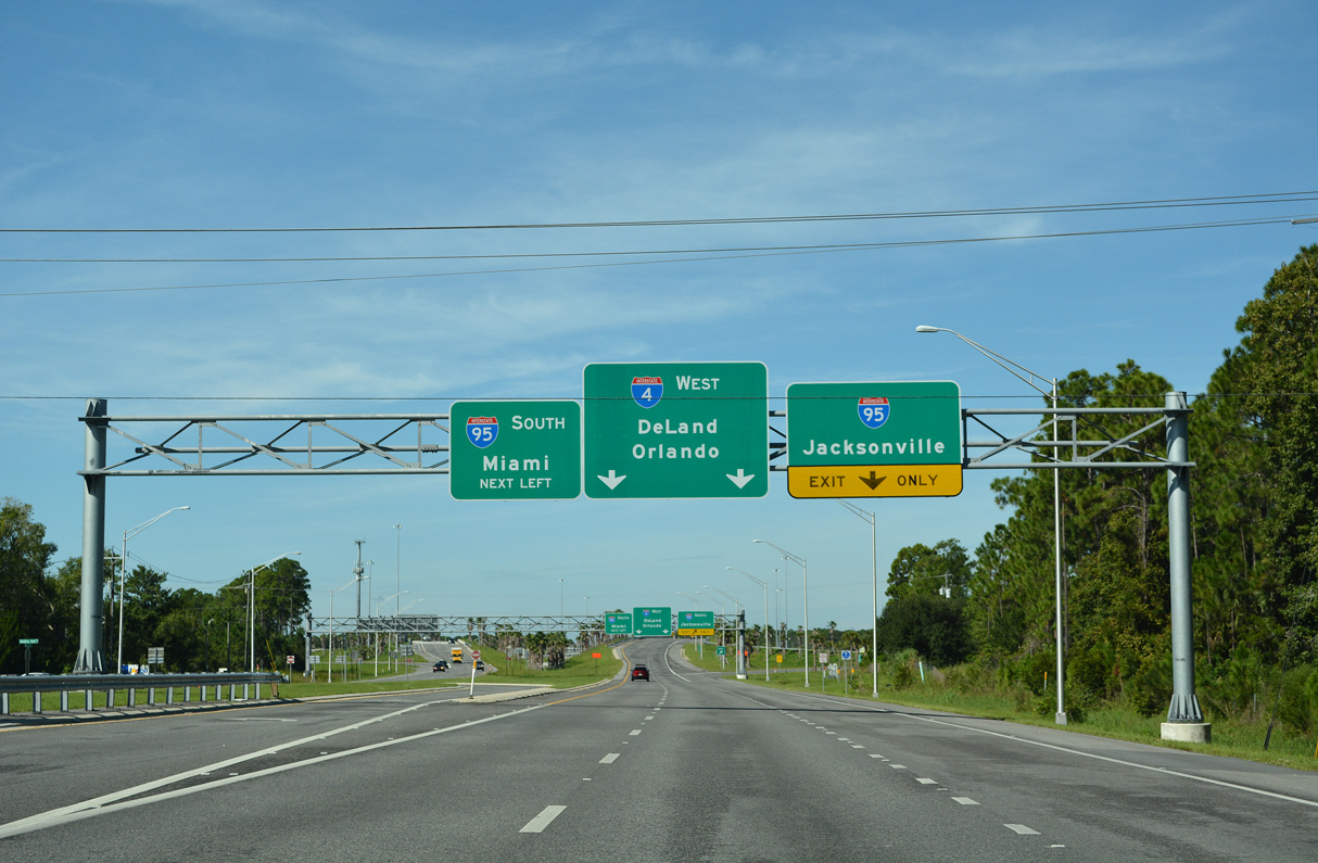
Widening of the eastern 12.34 miles of Interstate 4 from SR 44 east to I-95 was completed in Spring 2017. The $143.0 million project expanded what was the last four lane section of I-4 in the state.5 09/11/22

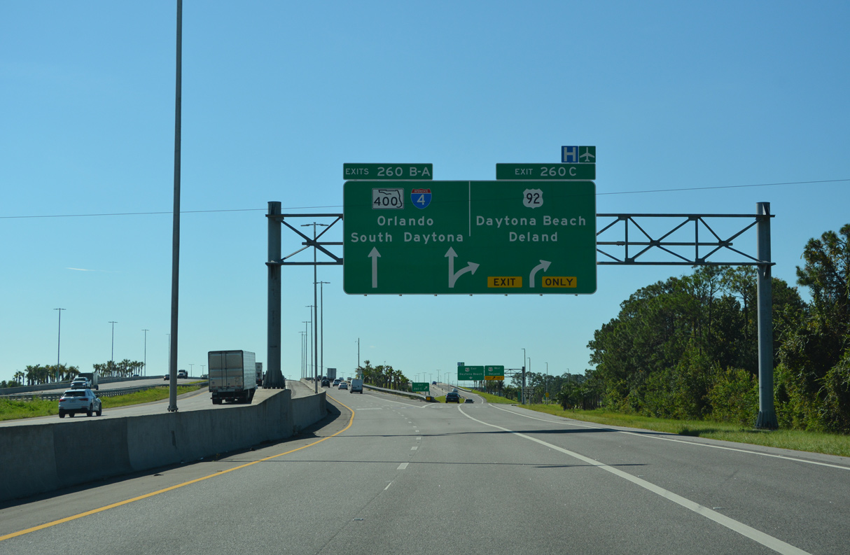
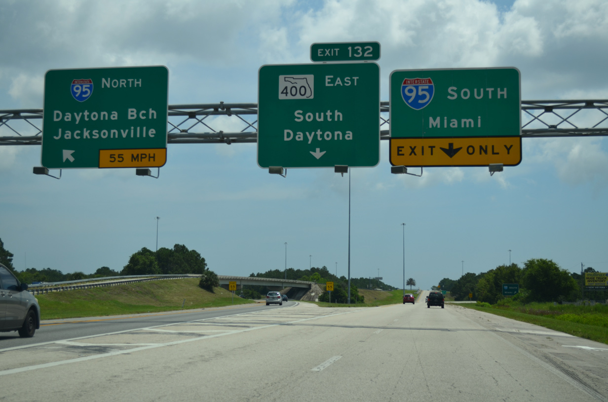
A series of arrow per lane (APL) overheads precede the separation for Exit 132 A to SR 400 east for South Daytona and Exit 132 B for the ramps to Interstate 95. 09/11/22

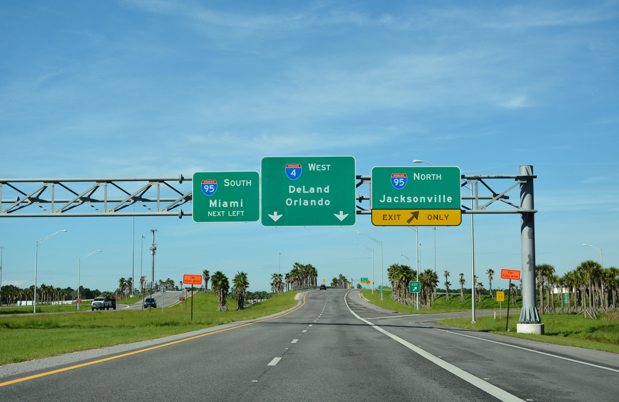
Reconstruction of the systems interchange linking I-4 east with I-95 through Spring 2020 shifted traffic for SR 400 (Beville Road) onto a separate roadway (Exit 132 A). The mainline continues with two lanes to collector distributor roadways joining I-95 with U.S. 92 (International Speedway Boulevard). 09/11/22

CR 415 (Tomoka Farms Road) spans I-4 east at the gore point for Exit 132 A to SR 400 (Beville Road). 09/11/22

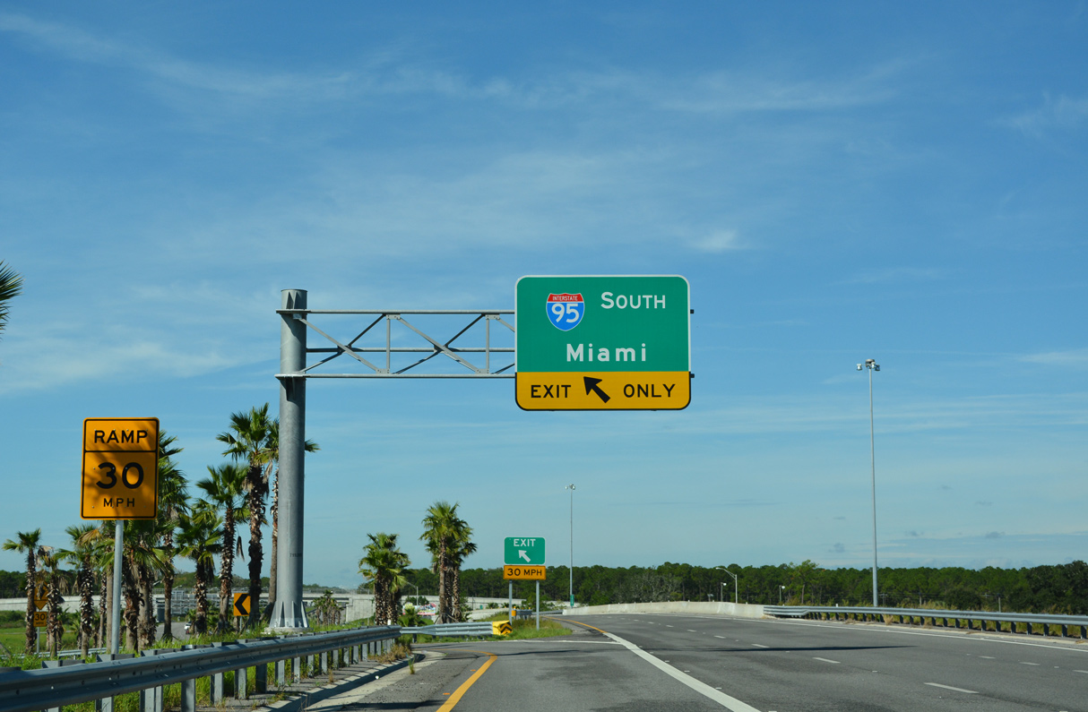
Exit 132 B departs for I-95 south below the ramp for SR 400. The interchange upgrade was part of a $205.0 million project widening 13.85 miles of Interstate 95 in Volusia County.6 03/26/20

An end shield marks the conclusion of I-4 ahead of a service station and Andros Isles Boulevard. SR 400 extends east 4.2 miles to U.S. 1 (Ridgewood Avenue) at South Daytona. Connecting roads (CR 4009 and SR 483) serve interests to Daytona International Speedway, Daytona International Airport (DAB) and Embry-Riddle Aeronautical University. 09/12/22
![]() South at
South at ![]()
![]()


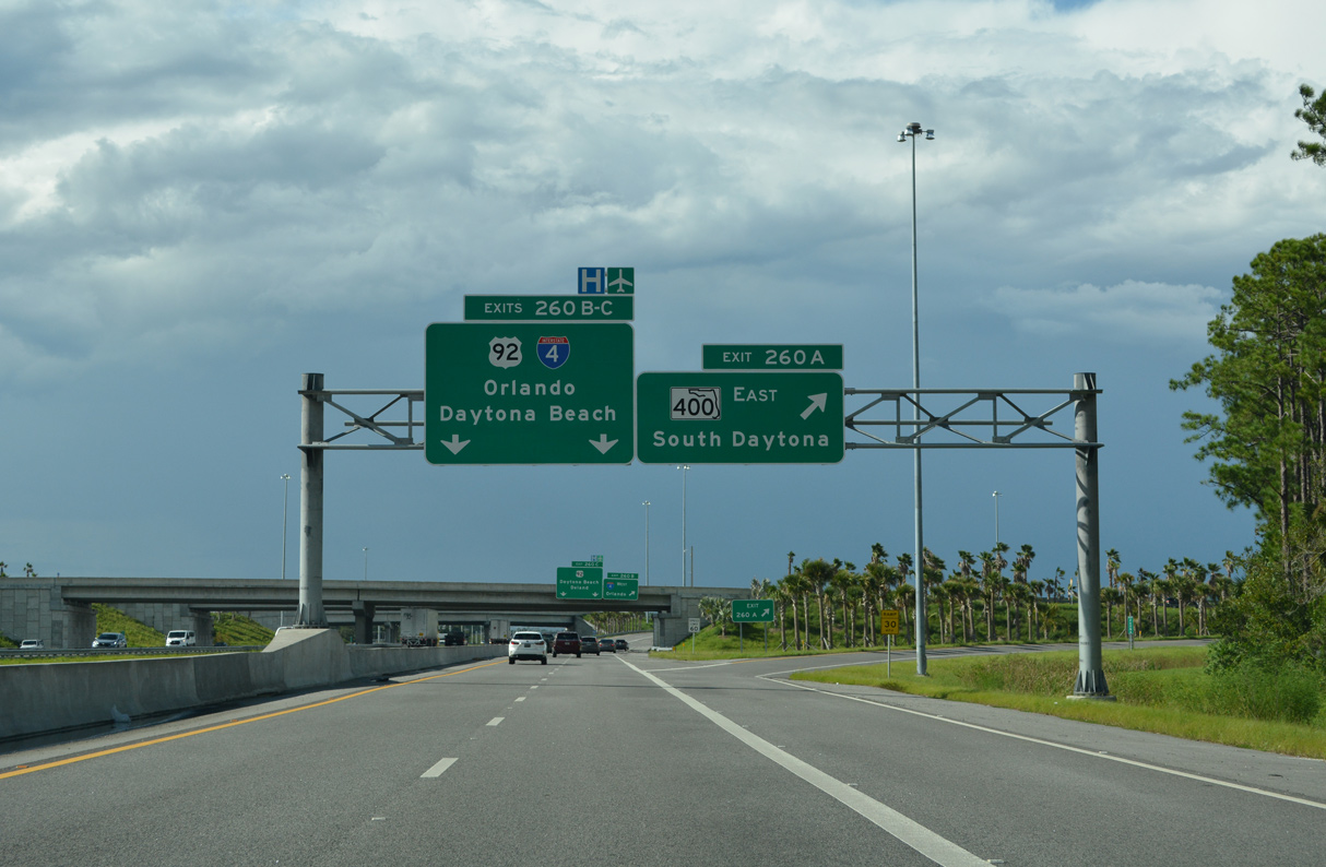
A two lane c/d roadway separates from I-95 south for all movements to Exit 260 C for U.S. 92 (International Speedway Boulevard), Exit 260 B for Interstate 4 west and Exit 260 A for SR 400 (Beville Road) east. 09/12/22

Paralleling Interstate 4 to the north, U.S. 92 (International Speedway Boulevard) heads westward from I-95 near Daytona International Speedway to DeLand. 09/12/22

The roadways for I-95 were realigned to run side by side through the rebuilt exchange with U.S. 92. Previously a left entrance ramp from U.S. 92 west joined I-95 south ahead of Interstate 4. 09/12/22

Two lanes depart from the c/d roadway at Exit 260 B for Interstate 4 southwest to Deltona, Sanford and Orlando. Exit 260 A follows onto SR 400 (Beville Road) east to U.S. 1 and South Daytona. 09/12/22
![]() North at
North at ![]()
![]()
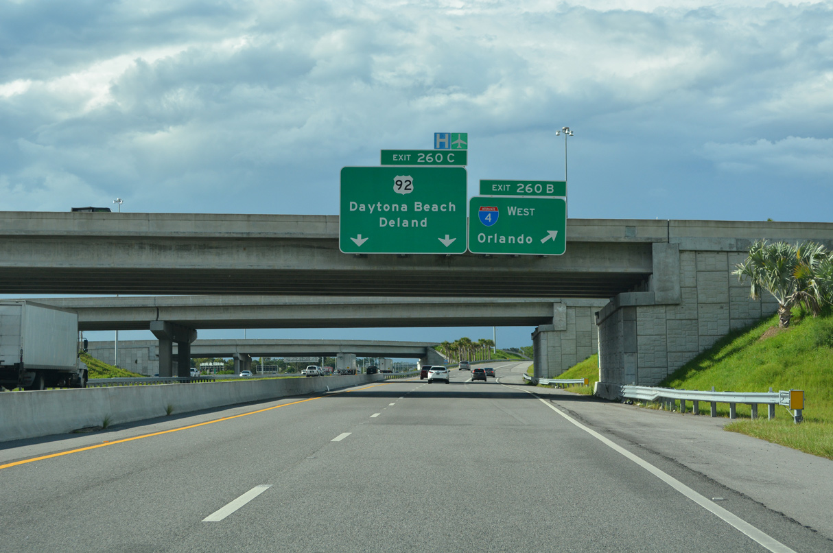
A collector distributor roadway separates from I-95 north through both interchanges with SR 400 (Beville Road) east / Interstate 4 west and U.S. 92 (International Speedway Boulevard). 09/12/22
Costing $206.22 million, the 13.85 mile long project both reconfiguring the systems interchange with I-4/SR 400 and widening I-95 ran from early 2015 to Summer 2020. 09/12/22
![]() West at
West at ![]()
![]()
SR 400 (Beville Road) constitutes an arterial route west from South Daytona to the beginning of Interstate 4 beyond CR 4009 (Williamson Boulevard). 09/12/22
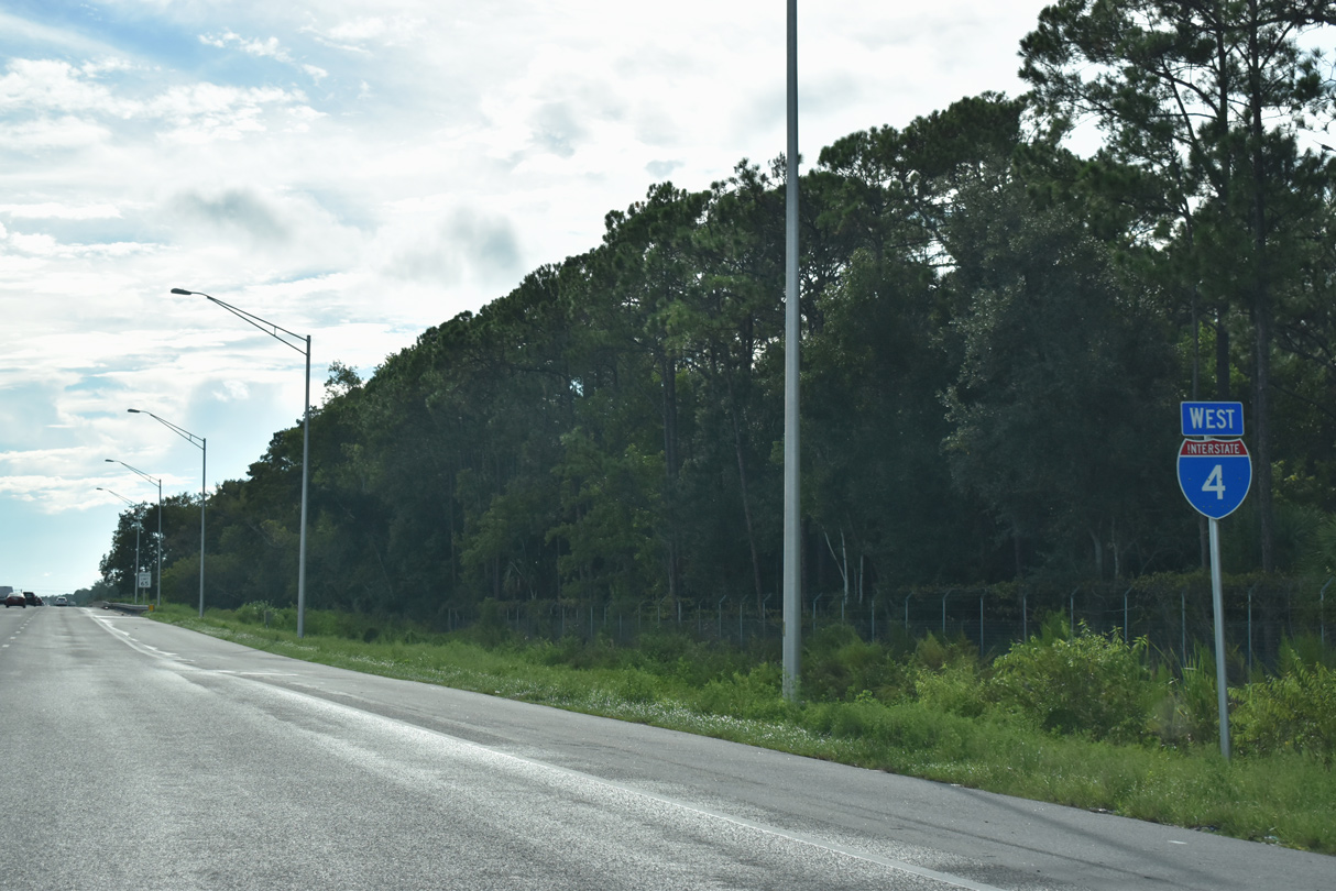
SR 400 west becomes Interstate 4 west after Andros Isles Boulevard and the exit to I-95 north for Florida’s First Coast. 09/12/22
The original exit for I-95 north to Jacksonville was replaced during 2015-20 road work by this ramp that departs further east and joins a c/d roadway ahead of U.S. 92. 09/12/22
Both roadways linking SR 400 with I-4 were rebuilt and moved to new alignments. The left side entrance ramp for I-95 south to the Space Coast replaced a loop ramp. 09/12/22
![]() West
West
The first confirming marker for Interstate 4 westbound appears beyond the exchange with I-95 in Daytona Beach. 09/13/22
East End Throwback
![]() South at
South at ![]()

I-95 south ahead the wye interchange (Exit 260B) with Interstate 4 west for Orlando before the systems interchange project. A cloverleaf interchange joined the freeway end and Beville Boulevard (SR 400) at Exit 260A. 01/03/14

I-95 south at Interstate 4 when the sequential based exit numbering system was still in use. Photo by Garrett Hayman (11/02).

Two lanes connect I-95 south with I-4 west to DeLand, Deltona, Sanford and Orlando. This ramp was relocated westward to depart from a c/d roadway built to eliminate weaving traffic between U.S. 92 and I-4. 01/03/14

An end shield for I-95 appeared along the exit ramp to I-4 west. This sign catered to tourist traffic bound for the Orlando resort area, as I-95 does not conclude for another 260 miles south in Miami. Photo by Daniel Davis (06/08/03).
![]() East at
East at ![]()

A ground level end sign was posted 1.5 miles ahead of the freeway transition to SR 400 (Beville Boulevard). This assembly was removed during widening of I-4 to six lanes. 07/27/13
A single lane left exit ramp, originally striped for two lanes, joined Interstate 95 north to St. Augustine, Jacksonville and points north. The mainline continued to I-95 south and SR 400 east. 07/27/13

Continuing east along Interstate 4, the right lane defaulted onto I-95 south to the Space Coast, Fort Lauderdale and Miami while the left lane extended east as Exit 132 to Beville Boulevard and South Daytona. 07/27/13

Four end signs for Interstate 4 were added by 2017. These were replaced in 2019 with APL signs. 05/24/17

Reconstruction of the systems interchange linking I-4/95 with SR 400 (Beville Road) east shifted all traffic bound for Interstate 95 to the left. 05/24/17

A new two lane roadway replaced the single lane separation for Exit 132B / I-95 south and SR 400 (Beville Road) east. 05/24/17

Construction for the new roadway connecting I-4 east with SR 400 took shape at the former exit ramp for Interstate 95 south to Miami. 05/24/17
![]() North at
North at ![]()

Exit 260A for the continuation of State Road 400 east from I-4 into South Daytona formerly departed from the I-95 mainline. 02/23/14
West End  – Tampa, Florida
![]() West at
West at ![]()

An end sign for Interstate 4 west was added in 2006. The freeway through Tampa and Ybor City area was completely rebuilt at that time with a larger foot print and a wide grassy median reserved for future tolled Express Lanes or light rail. 05/30/19

Traffic congestion is a routine occurrence along I-4 west at the Downtown Interchange due to the heavy merge with Interstate 275 southbound. Construction expanding both ramps to I-275 by an additional lane is anticipated to begin in 2023. 05/30/19

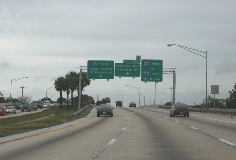
The four westbound lanes of Interstate 4 separate into three movements at the Downtown Interchange. I-275 leads through north Tampa by the University of South Florida (USF) campus to Lutz and I-75 at Wesley Chapel. 05/30/19

Exit 45A joins a distributor roadway along I-275 south to Jefferson Street and Ashley Drive into Downtown Tampa. A separate flyover was built for this ramp during 2002-06 reconstruction of the three-wye interchange. 05/30/19
![]() North at
North at ![]()

I-275 advances east from U.S. 92 (Dale Mabry Highway) 3.25 miles to the Downtown Interchange with Interstate 4. 06/11/20
Completed in 2015, reconstruction of Interstate 275 through Tampa expanded the freeway to eight overall lanes with a wide grassy median reserved for future Express Lanes or transit. 06/11/20

Continuing along the north side of Downtown Tampa from the Hillsborough River, Interstate 275 travels over a series of a viaducts east to I-4 at Exit 45B. There is no Exit 45A in this direction. 05/18/22

Curving northward beyond U.S. 41 Business (Florida Avenue), I-275 proceeds into the three-wye interchange (Exit 45B) with Interstate 4 east by YBor City in Tampa. 05/18/22

I-275 north reduces to three through lanes below the flyovers with I-4 as Exit 45B separates for Plant City, Lakeland and Orlando. 05/18/22
![]() South at
South at ![]()

I-275 heads 1.5 miles south from the exchange with U.S. 92 (Hillsborough Avenue) at Seminole Heights in Tampa to the Downtown Interchange (Exit 45B) with Interstate 4 east. 05/18/22

The flyover (Exit 46B) for Interstate 4 east departs a half mile beyond Exit 46A for Floribraska Avenue at Robles Park in Tampa. 05/18/22

Long traffic backups occur regularly along I-275 south from SR 574 (Dr. Martin Luther King, Jr. Boulevard) to the single lane ramp for I-4 east. Construction anticipated to start in 2023 expands the flyover to two lanes. 05/18/22

A distributor roadway (Exit 45A) departs I-275 south for the Tampa central business district as the mainline reduces to two through lanes at the Downtown Interchange. I-4 maintains six to eight overall lanes east from Ybor City nearby nine miles to I-75 near Mango. 05/18/22
West End Throwback
![]() West at
West at ![]()

Heading west from Historic YBor City in Tampa, Interstate 4 traveled with four lanes toward the Downtown Interchange with I-275. Photo by Carter Buchanan (12/00).

Previous overheads for I-275 referenced I-75 north to Ocala, predating the completion of Interstate 75 between I-4 and Wesley Chapel. References for I-75 North were carried over to sign replacements until 2005. Photo by Carter Buchanan (12/00).
An auxiliary lane opened west along I-4 from Ybor City to Interstate 275. I-4 maintains three westbound lanes here now, though traffic congestion remains routine. Photo by Justin Cozart (12/02).

Traffic partitioned into single lane ramps for I-275 and Exit 26 to Jefferson Street at the west end of Interstate 4. The overhead referencing I-75 North was carbon copied by December 2000. Photo by Gene Janczynskyi (10/25/00).

The Downtown Interchange was reconstructed from October 27, 2002 to December 22, 2006. Work added a separate flyover for Downtown – East from the ramp for Interstate 275 south. Photo by Carter Buchanan (12/00).
![]() North at
North at ![]()

Interstate 275 north at the Downtown Interchange with I-4 east. “To I-75 North” references were retained here as well, despite having been completed north from I-4 to Pasco County in July 1985. Photo by Carter Buchanan (12/00).
![]() South at
South at ![]()

Until 2000, guide signs for Interstate 4 east on I-275 referenced “TO I-75 South – Naples.” These were carried over from previous signs posted prior to the 1986 completion of I-75 in Hillsborough County. Photo by Gene Janczynskyi (10/25/00).

With two lanes continuing south along I-275 and a single lane flyover for I-4 east, the traffic pattern at the Downtown Interchange remains the same today. Photo by Gene Janczynskyi (10/25/00).
Sources:
- “Toll idea advances despite opposition.” Orlando Sentinel (FL), March 16, 2005.
- “Frankland Bridge Opens to Traffic.” St. Petersburg Times (FL), January 16, 1960.
- “I-4 Designated I-75 Into St. Petersburg.” St. Petersburg Times (FL), January 4, 1969.
- Florida’s Interstates: A Half-Century of Progress.
http://www.fl-interstate.comFlorida Department of Transportation (FDOT) web site. - 408464-1 I-4 Widening from SR 44 (East New York Avenue) to East of I-95.
http://www.cflroads.com/project/408464-1/I4_Widening_from_SR_44_East_New_York_Avenue_to_East_of_I-95CFLRoads, Florida Department of Transportation (DOT) project web site. - 242715-2 I-95 Widening and Systems Interchange Reconstruction Design-Build from North of SR 44 to North of US 92.
https://www.cflroads.com/project/ 242715-2/I-95_Widening_and_Systems_Interchange _Reconstruction_Design-Build_from_North_ of_SR_44_to_North_of_US_92CFLRoads, Florida Department of Transportation (DOT) project web site.
Page updated April 11, 2023.