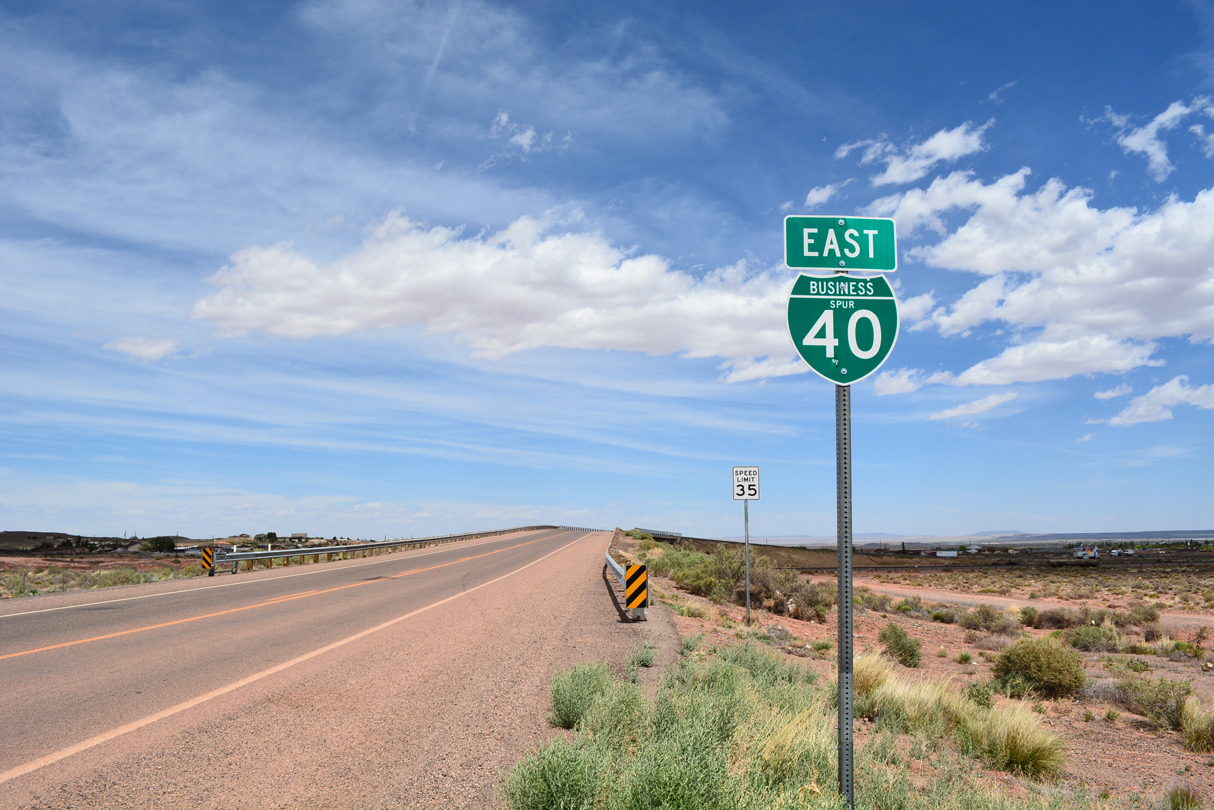
Interstate Business Route 40

Interstate 40 crosses Leroux Wash ahead of the eastbound split with U.S. 180 at Business Loop I-40 and the city of Holbrook. 07/13/08
Interstate 40 has numerous signed business routes, including the Winston-Salem business loop freeway. Several routes in Arizona and New Mexico were turned over to local control or redesignated as other state routes.
Arizona | New Mexico | Texas | Oklahoma | North Carolina
California
Needles


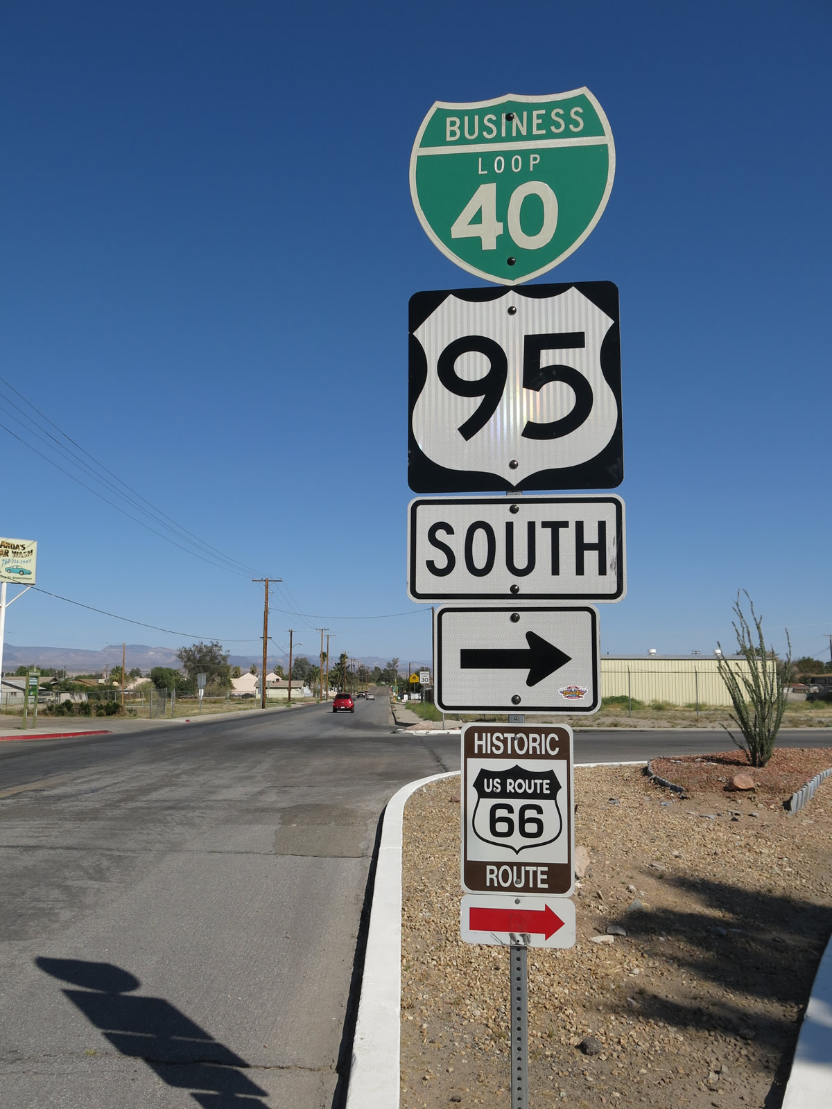
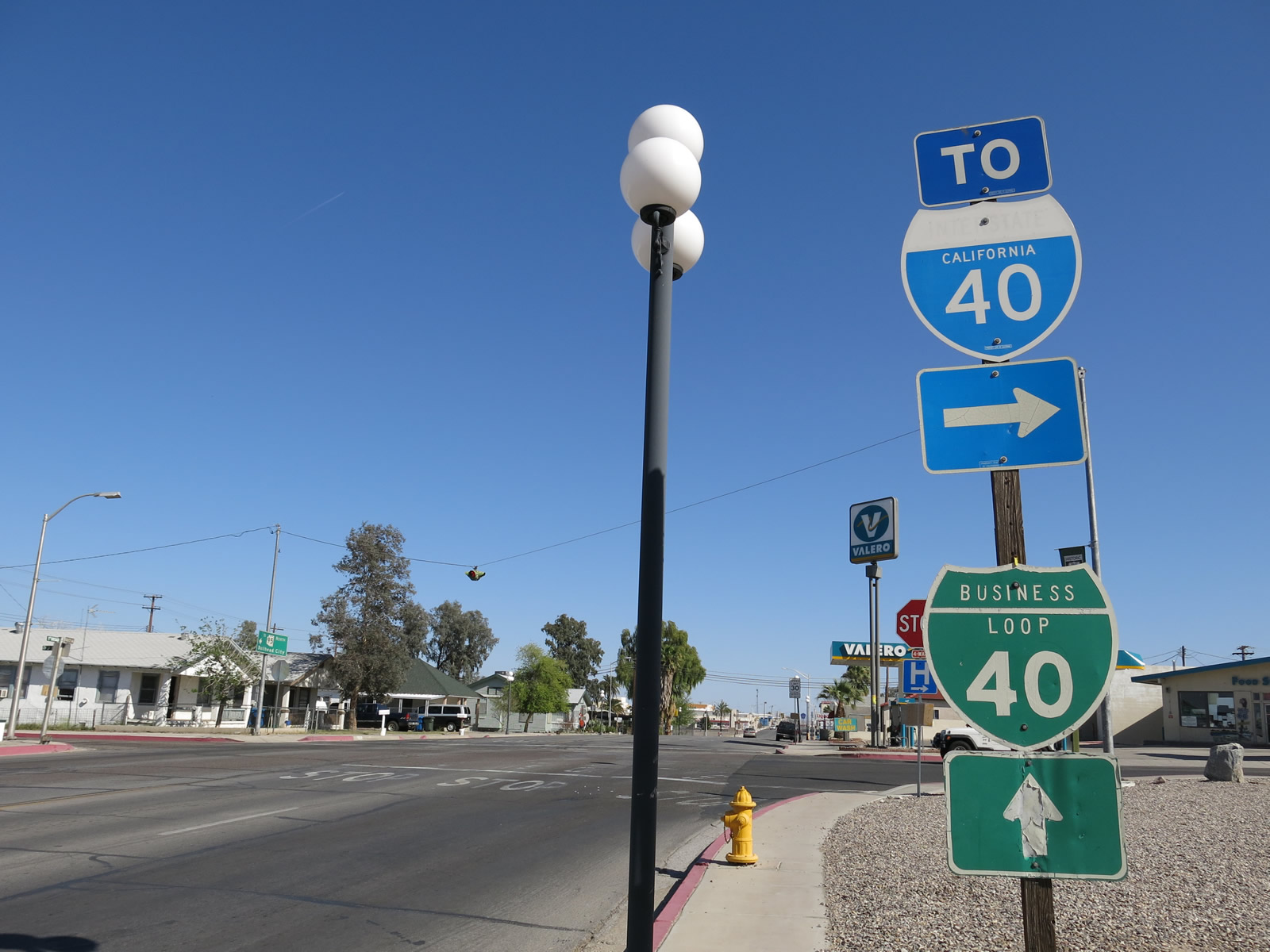
Listed in the 1991 California State Signing Log, this business route follows Old U.S. 66-95 (National Trails Highway) along a 3.4 mile course between Exits 141 and 144. Business Loop I-40 intertwines with I-40 along River Road south, Needles Highway east and Broadway Street south. The loop also provides a connection from I-40 to the north section of Arizona State Route 95 en route to Bullhead City. That stretch of SR 95 is not connected with the southern branch of the route to Lake Havasu City.
Arizona
Kingman

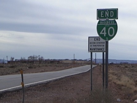
This business route used to follow Historic U.S. 66 between Exits 48 and 53 via Beale Street and Andy Devine Drive through Kingman. Business Loop I-40 was decommissioned on May 30, 2003 with approval by the American Association of State Highway and Transportation Officials (AASHTO) in order to transfer maintenance of the highway from the state to the city of Kingman. The route is now signed solely with Historic U.S. 66 markers.
Seligman
Business Loop I-40 connects Interstate 40 with the community of Seligman north from Exits 121 and 123. The 4.25 mile long route overlaps with Historic U.S. 66 east from near Seligman Airport (P23) to a point east of Lamport Street.
Ash Fork
Business Loop I-40 serves the rural community of Ash Fork along a 1.49 mile long route following Historic U.S. 66 and old U.S. 89. Lewis Avenue leads the loop east from Exit 144 to a one way couplet with Park Avenue . The business route returns to I-40 at Exit 146 opposite the north end of Arizona State Route 89 (old U.S. 89 south to Prescott).
Williams
Interstate 40 bypassed the final segment of Historic U.S. 66 when it opened on October 13, 1984 at Williams. The designation was retired the following year on June 27,1 with the former alignment between Exits 161 and 165 renumbered as Business Loop I-40. This loop is locally maintained.
Flagstaff
The second longest of the business routes in Arizona at 9.51 miles, the Flagstaff loop runs east from Exit 191 along Historic U.S. 66 and old U.S. 89 to SR 89A (Milton Road). Milton Road leads the loop north to Old Santa Fe Avenue east and Downtown.
U.S. 180 combines with Business Loop I-40 east from Humphreys Street to Country Club Drive and the south end of U.S. 89. Business Loop I-40/U.S. 180 (Country Club Drive) spans Historic U.S. 66, a BNSF Railroad and Industrial Drive south to Interstate 40 at Exit 201.
Winslow (Loop)
Business Loop I-40 was relinquished from state maintenance in 2007 but remains posted as of 2021. The route follows old U.S. 66 along 3rd Street east from Exit 252 alongside Arizona State Route 99 to a couplet with 2nd Street through Downtown Winslow. SR 87 joins the route east from Williamson Avenue to Transcon Lane, where Business Loop I-40 turns north to I-40 at Exit 255.
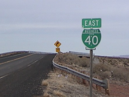
Winslow (Spur)
Business Spur I-40 extends west from the former Business Loop I-40 (Hipkoe Drive) by Exit 252. The 1.35 mile long spur follows 3rd Street and Winslow Industrial Spur to end north of Coopertown Road. Two shields are posted for the route south of the BNSF Railroad bridge built in 1975.
Business Spur I-40 was 1.44 miles in length per the ADOT 1998 State Highway System Log. It previously ended at the Coconino County line.
Joseph City
Business Loop I-40 in Joseph City joins Historic U.S. 66 along Main Street north from diamond interchanges at Exit 274 and Exit 277. The route travels 2.83 miles overall.
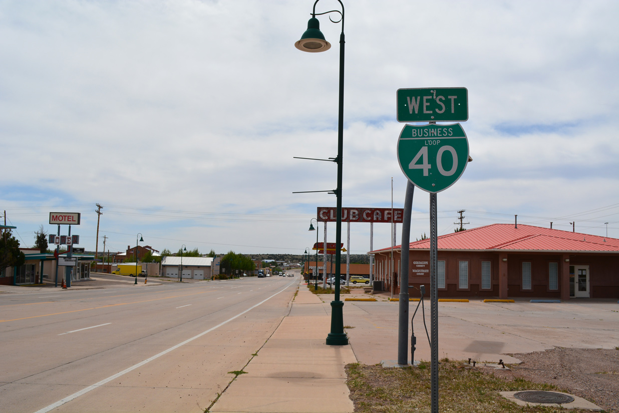
Holbrook
Interstate 40 travels across the city of Holbrook between the Downtown area and northern reaches of the city. Three interchanges serve the Navajo County seat, all with Business Loop I-40. The western portion of the route overlaps with U.S. 180 along Hopi Street (old U.S. 66) east to SR 77 in the city center. U.S. 180 combines with SR 77 south briefly before parting ways to Petrified Forest National Park and Snowflake respectively.
SR 77 joins the business route along Navajo Boulevard north to Exit 286, where the 5.09 mile long state maintained portion of Business Loop I-40 ends. The remainder of Business Loop I-40 (Navajo Boulevard) northeast to Holbrook Municipal Airport (HBK) and Exit 289 is locally maintained.
New Mexico
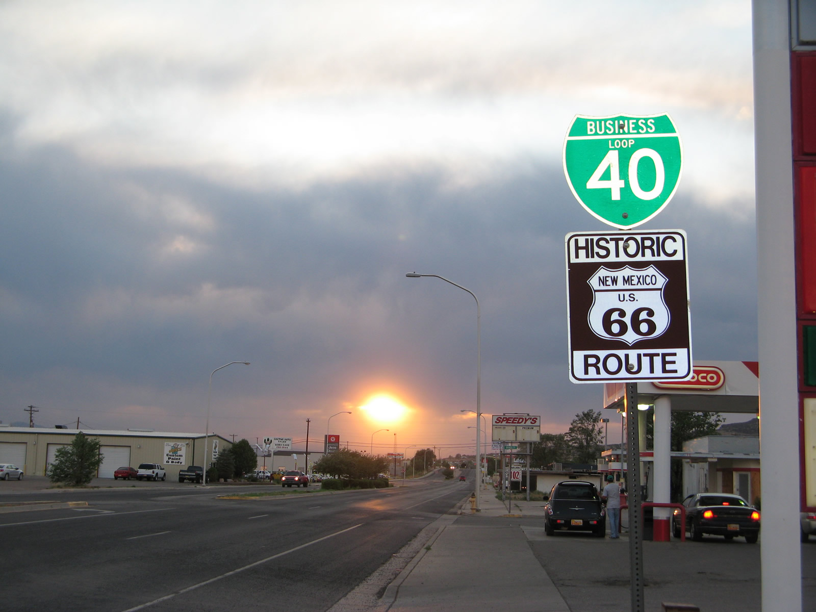
Gallup
This business route followed Historic U.S. 66 for 9.5 miles between Exits 16 and 26. The route is still acknowledged on freeway guide signs and on a few shields in Gallup as of 2016, but is inventoried otherwise as the easternmost stretch of New Mexico State Road 118. NM 118 travels 36.85 miles along old U.S. 66 from the Arizona state line to I-40 at Exit 36.
Gallup is the south end of U.S. 491. U.S. 491 was formerly designated as U.S. 666 until AASHTO approved its renumbering on May 30, 2003. Business Loop I-40 across the city was inventoried by the New Mexico Department of Transportation (NMDOT) as BL-31-P.
Grants
Inventoried by NMDOT as BL-32-P, the former business loop through Grants traveled along old U.S. 66 (Santa Fe Avenue) from Horizon Avenue at Exit 79 east to the curve of Santa Fe Avenue south to Exit 86. It was replaced by NM 615 on Horizon Avenue and NM 122 east to I-40.
Guide signs on I-40 still acknowledged the business loop in 2016.
Albuquerque
Business Loop I-40 ran in tandem with U.S. 66 across the city of Albuquerque. The designation outlasted U.S. 66, which was retired in 1985, by a period of time before it was also eliminated. The 18 mile long route joined Central Avenue (Historic U.S. 66) east from a wye interchange (Exit 149) west of Albuquerque. This exchange was removed during a 2009-11 project to add ramps with adjacent Atrisco Vista Boulevard (NM 500) nearby.
Central Avenue constitutes the main arterial across central Albuquerque. It runs directly through Downtown and by the University of New Mexico as Interstate 40 stays to the north. Historic U.S. 66 and I-40 come together again at a trumpet interchange (Exit 167) by Tijeras Canyon.
Several signs remained for Business Loop I-40 in and around the central business district as recently as April 2017.
Moriarity
Business Loop I-40 (BL-34-P) travels 2.92 miles on the south side of I-40 along Old U.S. 66 through the city of Moriarity. The business route begins at a trumpet interchange (Exit 194) with Old U.S. 66 adjacent to the east end of NM 333 (old U.S. 66 west to Albuquerque). The east end is located at Exit 197 where I-40 directly replaced U.S. 66 east to Exit 203.
Santa Rosa
The Santa Rosa business route follows a combination of Historic U.S. 66, U.S. 54 and U.S. 84 between Exits 273 and 277. BL-35-P measures 4.37 miles in length along Coronado Street, Park Avenue and Will Rogers Road. A number of traveler services line the business loop west and east of Exit 275, where it shifts sides with I-40.
Tucumcari
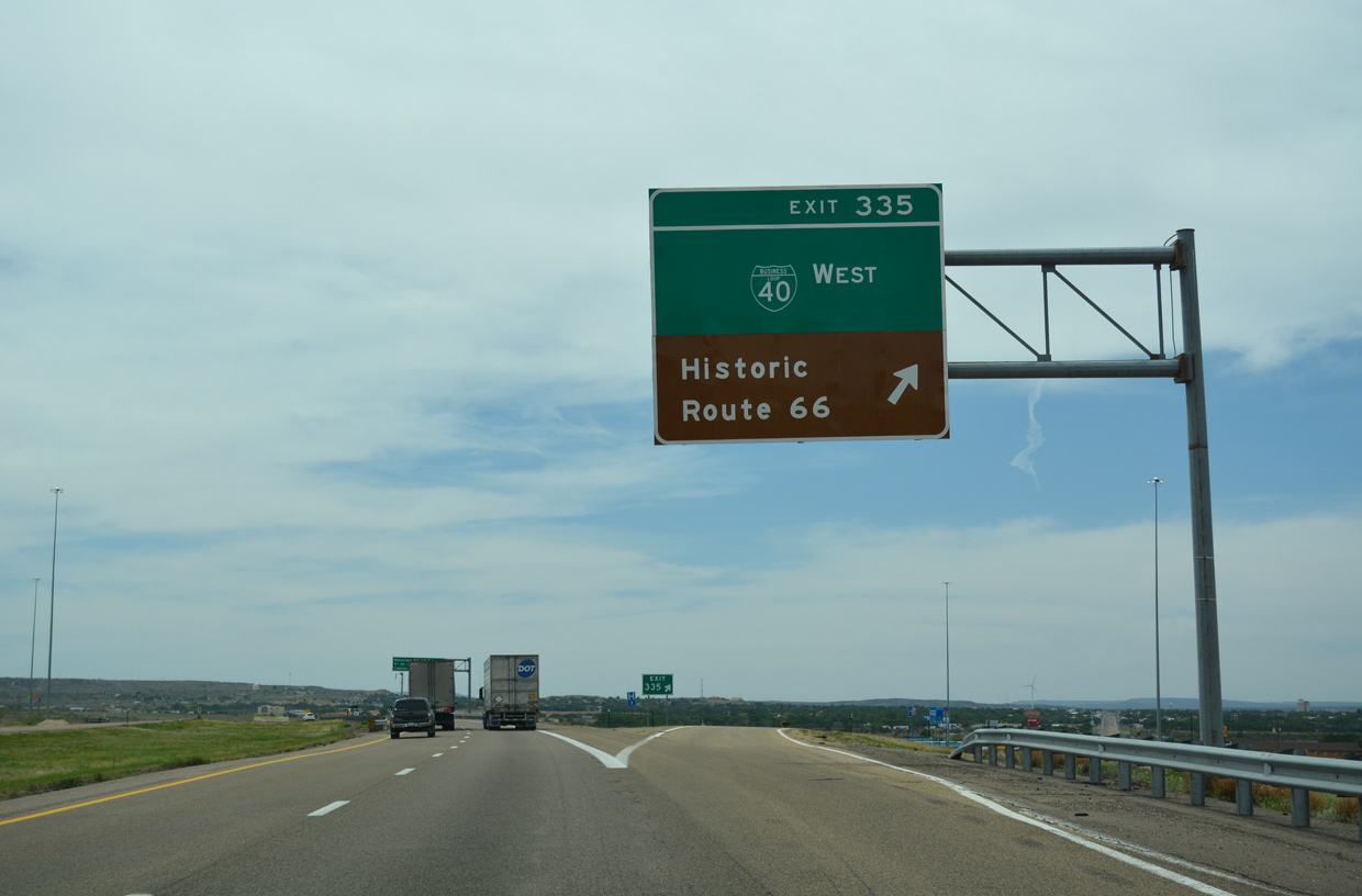
Business Loop I-40 joins Tucumcari Boulevard east from Exit 325 to Downtown and a return to I-40 at Exit 335. U.S. 54 accompanies the route from I-40 east to Railroad Avenue as well.
Inventoried by NMDOT as BL-36P, the Tucumcari business route is 7.65 miles long.
Texas
Glenrio
Business Spur I-40A connects Interstate 40 with Historic U.S. 66 leading west back into New Mexico from Exit 0. The 0.779 mile segment was designated on June 21, 1990 as a mileage transfer from State Loop 504.
Historic U.S. 66 travels west to the former settlement of Glenrio at the state line. A short distance west from there is impassable segment of U.S. 66 that turned northward across Trujillo Creek. U.S. 66 originally curved northward across the alignment of I-40 west toward Exit 369 with NM 93 south / NM 392 north.
Adrian
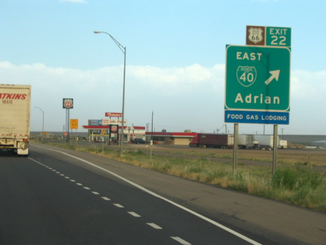
Adrian is a rural city with a population below 150. Business Loop I-40B was established on June 21, 1990 in place of State Loop 550 to serve the town from Interstate 40. The 2.37 mile long business route runs along a portion of Historic U.S. 66 between ramps at Exits 22 and 23.
Originally a split diamond interchange joined the freeway with Adrian. Three additional ramps were added later.
Vega
Interstate 40 diverges from Historic U.S. 66 to arc south of Vega between Exits 34 and 37. Lining the former U.S. 66 (Vega Boulevard) through the Oldam County seat is Business Loop I-40C. Measures 3.40 miles in length, the route replaced State Loop 551 on June 21, 1990.
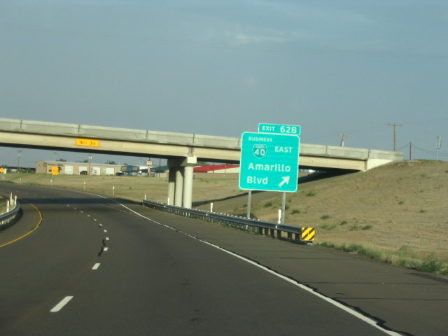
Amarillo
Business Loop I-40D branches northeasterly from Interstate 40 at Exit 62 B along a divided highway to U.S. 60, U.S. 87 and U.S. 287 in north Amarillo. U.S. 60 combines with the business route for 11 miles east from there to Folsom and a rural split near the Carson County line. Beyond their separation, U.S. 60 stays north to Panhandle while Business Loop I-40 bee lines southeast to trumpet interchange (Exit 85) with I-40.
All 24.4 miles of Business Loop I-40 follow Historic U.S. 66. The route was created on October 25, 1990 in place of State Loop 552. 14.13 miles are attributed to the business loop while the rest are inventoried as U.S. 60.
A change made at the U.S. 60 and Business Loop I-40 east split removed the high speed wye configuration and replaced it with a 90 degree angle intersection.
Groom
Interstate 40 encircles the north side of Groom while Business Loop I-40F follows Historic U.S. 66 (Front Street) through the town. The 3.53 mile long route was established between Exits 110 and 114 in place of State Loop 554 on June 21, 1990.
McLean
Business Loop I-40H arcs northward from Interstate 40 for 3.80 miles between Exits 141 and 143. Replacing State Loop 555 along Historic U.S. 66, the business route was established on June 21, 1990.
Shamrock
Business Loop I-40J branches east along Historic U.S. 66 (12th Street) from Interstate 40 at Exit 161 to Exit 164. The 2.77 mile long alignment was transferred from the mileage of State Loop 556 on March 24, 1993.
Oklahoma
Erick
Business Loop I-40 heads south from Exit 5 along West 1720 to join a four lane section of Historic U.S. 66 east to the city of Erick. The route narrows through the city center on Roger Miller Boulevard and expands again into a divided highway east and north. The 8.1 mile long route ends at a folded diamond interchange (Exit 11) with I-40 as Historic U.S. 66 shifts north en route to Sayre.
Sayre
Interstate 40 travels northerly across the North Red River by the city of Sayre between Exits 20 and 25. Business Loop I-40 combines with U.S. 283 as part of a 4.9 mile route west through the Beckham County seat. The two highways follow Historic U.S. 66 (Fourth Street) through the city center.
Elk City
Interstate 40 turns back to the east from the Sayre area to next reach Elk City. The freeway and Historic U.S. 66 separate at a wye interchange (Exit 32) well west of the city. Business Loop I-40 commences a 9.5 mile long route from there along a four lane, divided highway east to Oklahoma State Highway 6. SH 6 joins the business route east as Historic U.S. 66 transitions into a commercial arterial along 3rd Street through west Elk City.
Business Loop I-40, Historic U.S. 66/SH 6 enter Downtown Elk City and split at Main Street. SH 6 leads south to I-40 at Exit 38 while the business route turns north on Van Buren Avenue. One final turn takes Business Loop I-40 east at Country Club Boulevard and Elk City Regional Business Airport (ELK) for a divided highway leading back to Interstate 40. The freeway overtakes the old alignment of U.S. 66 east from the wye interchange (Exit 41) to Canute.
Clinton
Business Loop I-40 arcs north from Exit 65 along Gary Boulevard (Historic U.S. 66) to the Clinton city center. The business route concludes a 5.6 mile long alignment east of Turtle Creek at a wye interchange (Exit 69).
Weatherford
Decommissioned by 2016 with the relinquishment of Main Street from state maintenance, Business Loop I-40 in Weatherford followed Historic U.S. 66 for 1.47 miles. The business route branched north from a wye interchange (Exit 80 A) onto Main Street (Historic U.S. 66) east through the city center. The loop returned to Interstate 40 from Main Street at a trumpet interchange (Exit 82). The loop ramp from I-40 to Main Street west was subsequently removed by 2018.
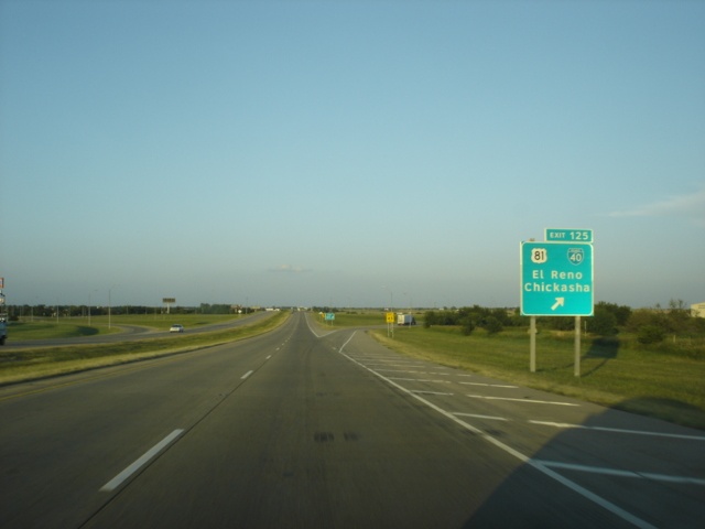
El Reno
The 8.6 mile long loop of Business I-40 through El Reno separates with I-40 at Exit 119 to overtake old U.S. 66/270 east to Sunset Drive. U.S. 81 overlaps with the business route from Choctaw Avenue, as the loop turns south one block to Wade Street and east two blocks to Rock Island Avenue.
Business Loop I-40/U.S. 81 (Rock Island Avenue) leave the El Reno street grid at Elm Avenue and curve southeast to SE 27th Street and Shepherd Avenue. There SH 66 begins east to Oklahoma City while U.S. 81 and the business route turn south to I-40 at Exit 125.
Oklahoma City

Oklahoma City Boulevard is an at-grade roadway built along the corridor of the former I-40 Crosstown route south of Downtown Oklahoma City. It branches east from Exit 148 B and returns to I-40 at the exchange with Interstate 235.
Opened to traffic in 1966, the Crosstown route was over capacity and in need of repair when a $680 million project replaced it with a new ten lane alignment of I-40 to the south.2 The relocated eastbound lanes for I-40 opened on January 5, 2012, followed by the westbound lanes on February 19, 2012. Construction followed to both tear down the old viaduct and build the new Oklahoma City Boulevard. Work continued through early 2018,3 and the boulevard was proposed to become Business Loop I-40 upon completion.4 However it appears that plans for the designation were dropped, as the route remains unposted as of 2022.
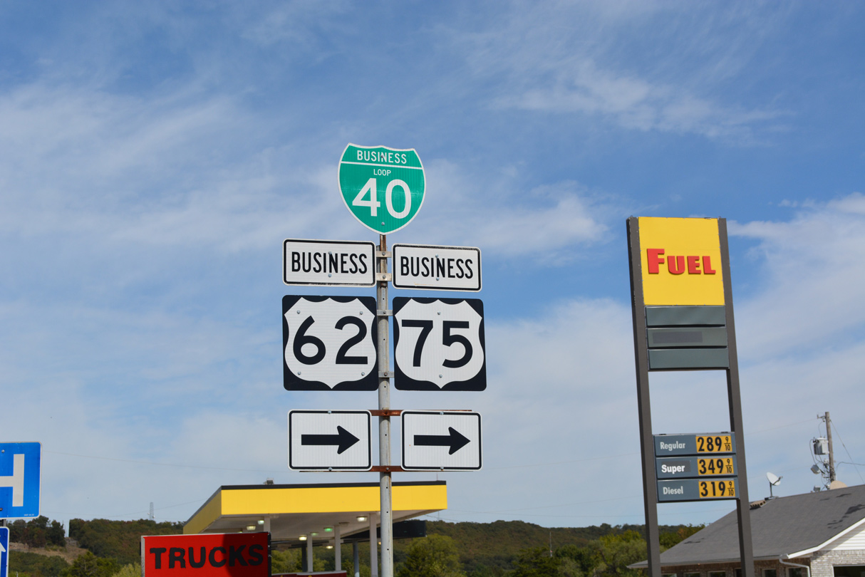
Henryetta
Business Loop I-40 overlaps with U.S. 62-75 Business east from Exit 237 to Main Street through Downtown Henryetta. The 3.5 mile long route returns to I-40 by way of U.S. 62/75 south at the cloverleaf interchange (Exit 240) with the Indian Nation Turnpike (SH 375).
Sallisaw
Interstate 40 bypasses the city of Sallisaw to the south, while Business Loop I-40 arcs 4.0 miles north from Exits 308 and 311. The west leg runs alongside U.S. 59 north to U.S. 64. The three routes overlap east along Cherokee Avenue to Downtown and Wheeler Street, where U.S. 59 turns north to Stillwell. U.S. 64 continues with Business Loop I-40 southeast along a commercial arterial to Interstate 40.
North Carolina
Winston-Salem and Kernersville
This Business Loop Freeway was approved by AASHTO on October 2, 1992 as part of the Interstate 40 relocation around Winston-Salem. The new alignment for I-40 (Corporation Parkway) across the south side of Winston-Salem and through rural areas of Forsyth County was constructed to move through traffic away from the aging expressway. It opened in 1993.
The 23 mile long route of Business Loop I-40 ran concurrent with U.S. 421 and partially alongside U.S. 158 and North Carolina Route 150. The freeway shifts north from I-40 at Exit 188 to Downtown Winston-Salem, where it converges with the U.S. 52/Future I-285. Continuing east, Business Loop I-40 continued with U.S. 421 across the town of Kernersville to a wye interchange (Exit 206) with I-40 just west of the Greensboro city limits.
The Business 40 Project by the North Carolina Department of Transportation (NCDOT) underway from Fall 2017 to February 2020 addressed some of the substandard aspects of the Business 40 freeway from west of 4th Street to east of Church Street. The $99.2 million project included modernizing entrance and exit ramps, replacing bridges and resurfacing the roadway with new concrete. An announcement made on October 21, 2016 by Governor Pat McCrory indicated that the revamped roadway will be renamed Salem Parkway with U.S. 421 as the primary designation.5
Signs for Business Loop I-40 were subsequently removed by 2020 as part of the construction project. U.S. 421 was selected as the primary route due to motorist confusion between I-40 and Business Loop I-40.5
Greensboro
Business Loop I-40 in Greensboro was a short lived designation applied to the current alignment of Interstate 40 through Greensboro. Designated on February 21, 2008, the business loop was created in an attempt to both reroute Interstate 40 through traffic around the city and remove a substandard section of old I-40/85, including the infamous “Death Valley” section, from the Interstate Highway System. Death Valley was the local nickname given to the narrow interchange where the two routes met in central Greensboro.
Business Loop I-40 traveled 15.5 miles overall and the eastern eight miles overlapped with Business Loop I-85. During this time, Interstate 40 bypassed Greensboro to the southwest along a newly opened freeway (Interstate 73 / Painter Boulevard) and joined I-85 to the southeast on a section of roadway opened in January 2004. Motorist confusion and funding changes for maintenance along the newly designated business loop resulted in a second round of renumbering at Greensboro in September 2008. I-40 was relocated back through the city, Business Loop I-40 was eliminated, and U.S. 421 was realigned to bypass the city alongside I-73.
Raleigh
The Raleigh Belt Line, east between Exits 293 and 301, was first designated as Business Loop I-40 before officials opted for a full Interstate designation. The elimination of the business loop coincided with the establishment of the 25.05 mile long route for Interstate 440. These changes were approved by AASHTO on June 9, 1991.
Later changes to I-440 would extend the route to a full beltway around Raleigh. The concurrent section with I-40 however was eventually dropped.
Sources:
- Eisenhower Interstate Highway System, Previous Facts of the Day – March 12, 2010. https://www.fhwa.dot.gov/interstate/previousfacts.cfm
- Oklahoma Department of Transportation – I-40Crosstown.
https://oklahoma.gov/odot/news/i-40crosstown.htmlproject web site. - “Update on downtown OKC boulevard project.” OKC Talk, October 27, 2016.
- “Re: I40 Crosstown Nearly Ready to Open” online posting by okroads, AARoads Forum, January 5, 2012.
- “Business 40 renamed Salem Parkway.” Winston-Salem Journal (NC), October 21, 2016.
Page updated July 12, 2022.
Business Loop I-40 follows Historic U.S. 66 (San Bernardino County Route 66) through Needles, California. The route makes several turns through the city, including this one from Needles Highway to Broadway Street. 03/24/13
Broadway Street east at J Street in Needles. Business Loop I-40 continues south to I-40 at Exit 144, while J Street connects with the adjacent freeway at Exit 142. 03/24/13
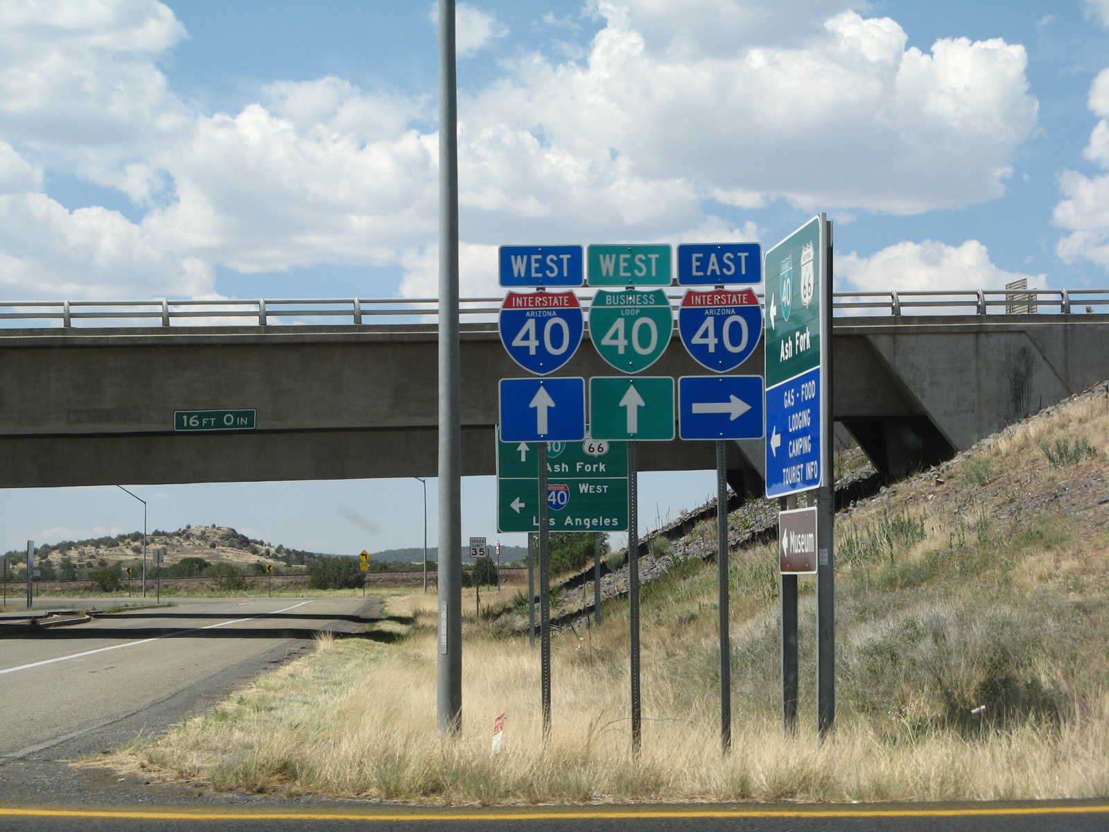
Arizona State Route 89 north transitions directly into Business Loop I-40/Historic U.S. 66 at the east Ash Fork interchange (Exit 146) along I-40. 10/24/03

Interstate 40 east at Exit 161 for the Williams business route. This loop is not inventoried in the Arizona Department of Transportation (ADOT) Route Log. 04/27/17
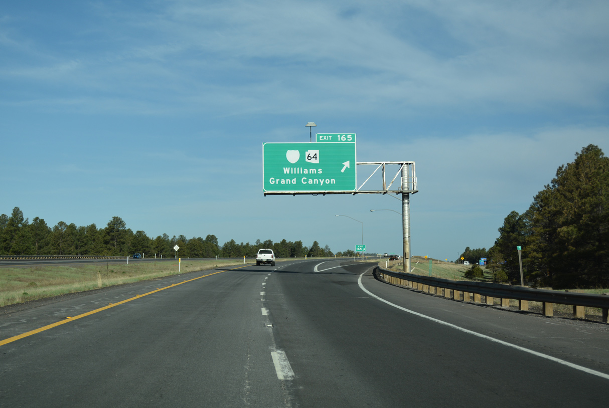
Business Loop I-40 west to Williams begins from Interstate 40 opposite SR 64 north to the Grand Canyon. 04/27/17
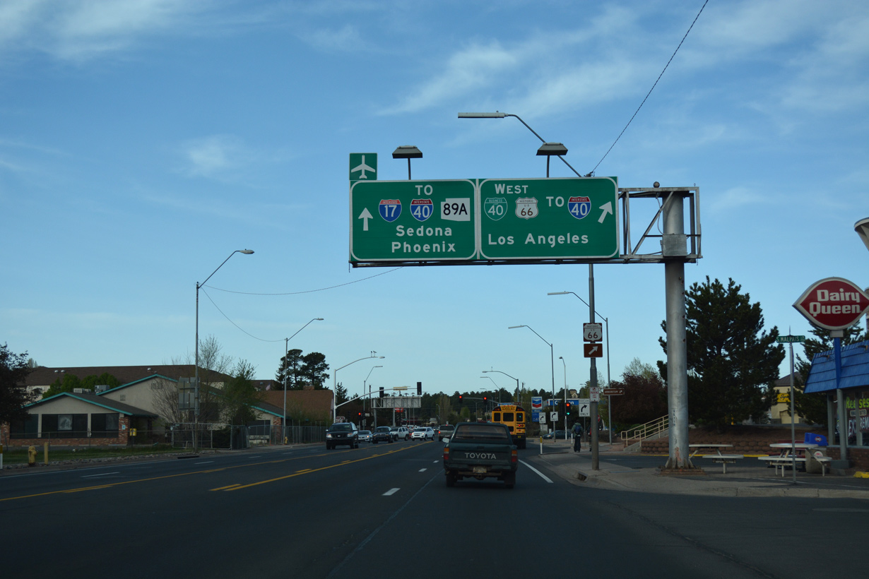
Business Loop I-40/Historic U.S. 66 turn west off of Milton Road toward west Flagstaff as SR 89A begins south toward the exchange joining I-17/40. 04/27/17
The lone shield for Business Spur I-40 east at Winslow, Arizona precedes the BNSF Railroad bridge on Winslow Industrial Spur east. Photo by Jim Mullady (02/01).
An end shield for Business Spur I-40 west appears at an unnamed road south of the BNSF Railroad bridge. Photo by Jim Mullady (02/01).
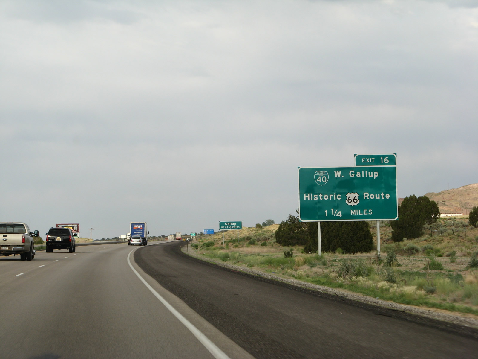
Advancing to Exit 16 with the west end of the Gallup business loop on Interstate 40 east. This route was replaced by New Mexico State Road 118. 06/28/08
A set of reassurance markers for Business Loop I-40/Historic U.S. 66 west were previously posted at Santa Fe Avenue and Bradley Street in Grants, New Mexico. 06/28/08
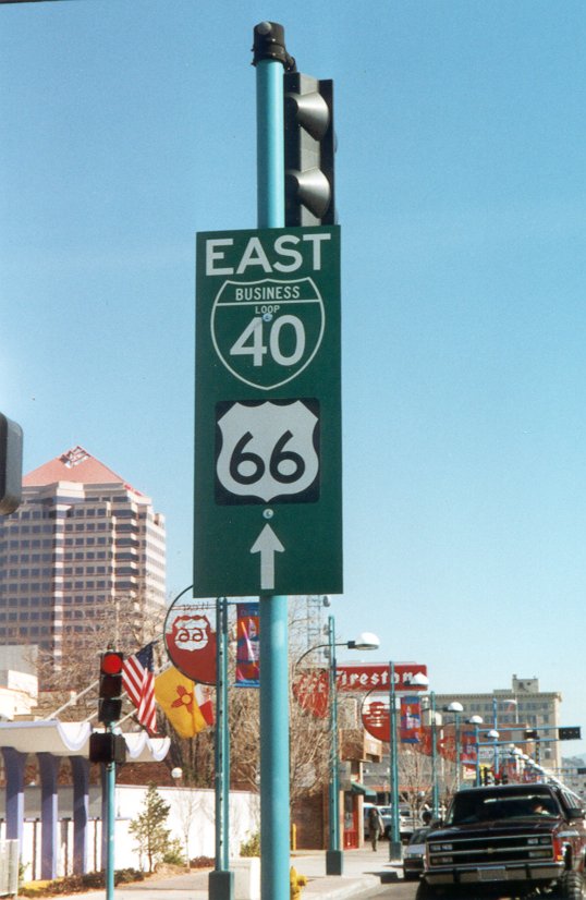
A remaining sign showing Business Loop I-40 on Central Avenue in Albuquerque, New Mexico. Photo by Casey Cooper (1998).
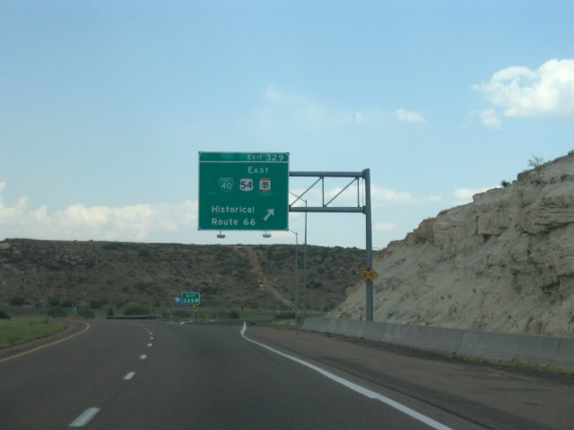
Business Loop I-40, U.S. 54/Historic U.S. 66 diverge from eastbound Interstate 40 near Tucumcari at Exit 329. This was the first of two meetings between U.S. 54/66. The second was located in Downtown Chicago prior to the retraction of U.S. 54 out of the Windy City in 1972. Photo by Robert Lee (06/17/06).
Interstate 40 westbound at Business Loop I-40 / Historic U.S. 66 in Tucumcari, New Mexico. 04/24/17
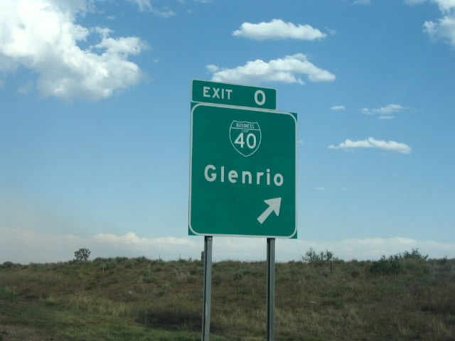
Business Spur I-40 departed from Interstate 40 east at Exit 0 for the ghost town of Glenrio. Signed here as loop instead of a spur, the design of a sign replacement made a year later retained the error. Photo by Robert Lee (06/17/06).
Interstate 40 east at the first of two exits with Business Loop I-40 at Adrian, Texas. Photo by Robert Lee (06/17/06).
Business Loop I-40 separates from I-40 east at a wye interchange (Exit 62 B) on the outskirts of Amarillo, Texas. Photo by Robert Lee (06/17/06).
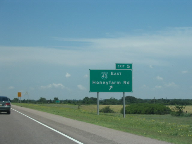
Honeyfarm Road connects I-40 with old U.S. 66 as part of the business loop for Erick, Oklahoma. Photo by Robert Lee (06/18/06).
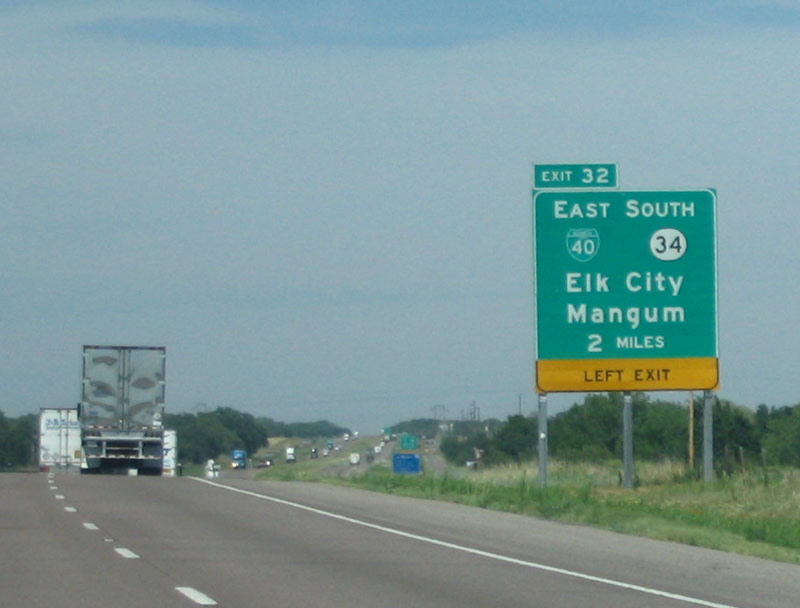
Interstate 40 turns east to pass south of Elk City as Business Loop I-40 branches northeast from Exit 32 along old U.S. 66. Photo by Robert Lee (06/18/06).
I-40/U.S. 270 east at U.S. 81 and the end of Business Loop I-40 from El Reno, Oklahoma. Photo by Eric Stuve (07/04/08).
This photo is part of Eric Stuve’s photostream on Flickr.
Business Loop I-40 overlaps with U.S. 62-75 Business east along old U.S. 62 and Main Street into the city center of Henryetta. 10/04/21