Alaska Interstates
Overview
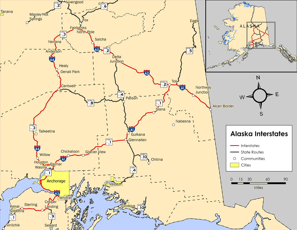
According to the Federal Highway Administration Interstate Highway (FHWA) Route Log and Finder List, Alaska has four Interstate highways that create a 1,082.22 mile system in the northernmost state. Even though these routes are designated as Interstate highways, they are generally not constructed to Interstate standards and are signed as Alaska State Routes.
| Route | Southern/Western End | Northern/Eastern End |
|---|---|---|
Interstate A-3 – Anchorage |
Canadian Border – Yukon Territory | |
Interstate A-1 – Tok Junction |
Interstate A-4 – Fairbanks |
|
Interstate A-1 – Anchorage |
||
Interstate A-1 – Palmer |
Interstate A-2 – Fairbanks |
 History
On December 31, 1981 the Federal Highway Administration approved the addition of the four Alaska Interstates between the following locations:
- A-1 from the Alaska-Canada border near Northway west to A-2 at Tok Junction, south to A-4 near Glennallen and continuing west to A-3 at Anchorage.
- A-2 from a junction with A-1 at Tok Junction west to A-4 and FAP-65 (Airport Way) in Fairbanks.
- A-3 from a junction with A-1 in Anchorage south and west to FAP-21 (Sterling Highway) and FAP-22 (Kenai Spur Highway) in Soldotna via a junction with FAP-31 (Seward Highway) in the vicinity of Moose Pass.
- A-4 from a junction with A-1 near Palmer northwest via Wasilla, Denali National Park and Preserve and Nenana to a junction with A-2 and FAP-65 (Airport Way) in Fairbanks.
The American Association of State Highway and Transportation Officials (AASHTO) then approved the numbering of the Alaska Interstates on June 28, 1982. The descriptions generally matched those outlined in the FHWA document, with the exception that the shared end point of Interstate A2 and I-A4 was located at the intersection of SR 2 (Richardson Highway) and SR 3 (Parks Highway) in Fairbanks instead of along SR 2 at Airport Way.1
For more details and other pictures, see Oscar Voss’s Alaska Roads – Interstate ends photos.
Route Information
Mileage – 408.23
Cities – Anchorage, Palmer, Tok Junction
Junctions –
 in Palmer, in Tok
State Routes –
Anchorage east to Tok; Tok east to International Border
Mileage – 202.18
Cities – Fairbanks, North Pole, Tok Junction
- Junctions – in Fairbanks, in Tok Junction
- State Routes – from Tok Junction north to Fairbanks
Mileage – 148.12
Cities – Soldotna, Anchorage
- Junctions – in Anchorage
- State Routes – from Soldotna north to Anchorage
Mileage – 323.69
Cities – Wasilla, Denali National Park, Fairbanks
- Junctions – near Palmer, in Fairbanks
State Routes –
from near Palmer north to Anchorage
Total Mileage – 1,082.22
Source: December 31, 2021 Interstate Route Log and Finders List
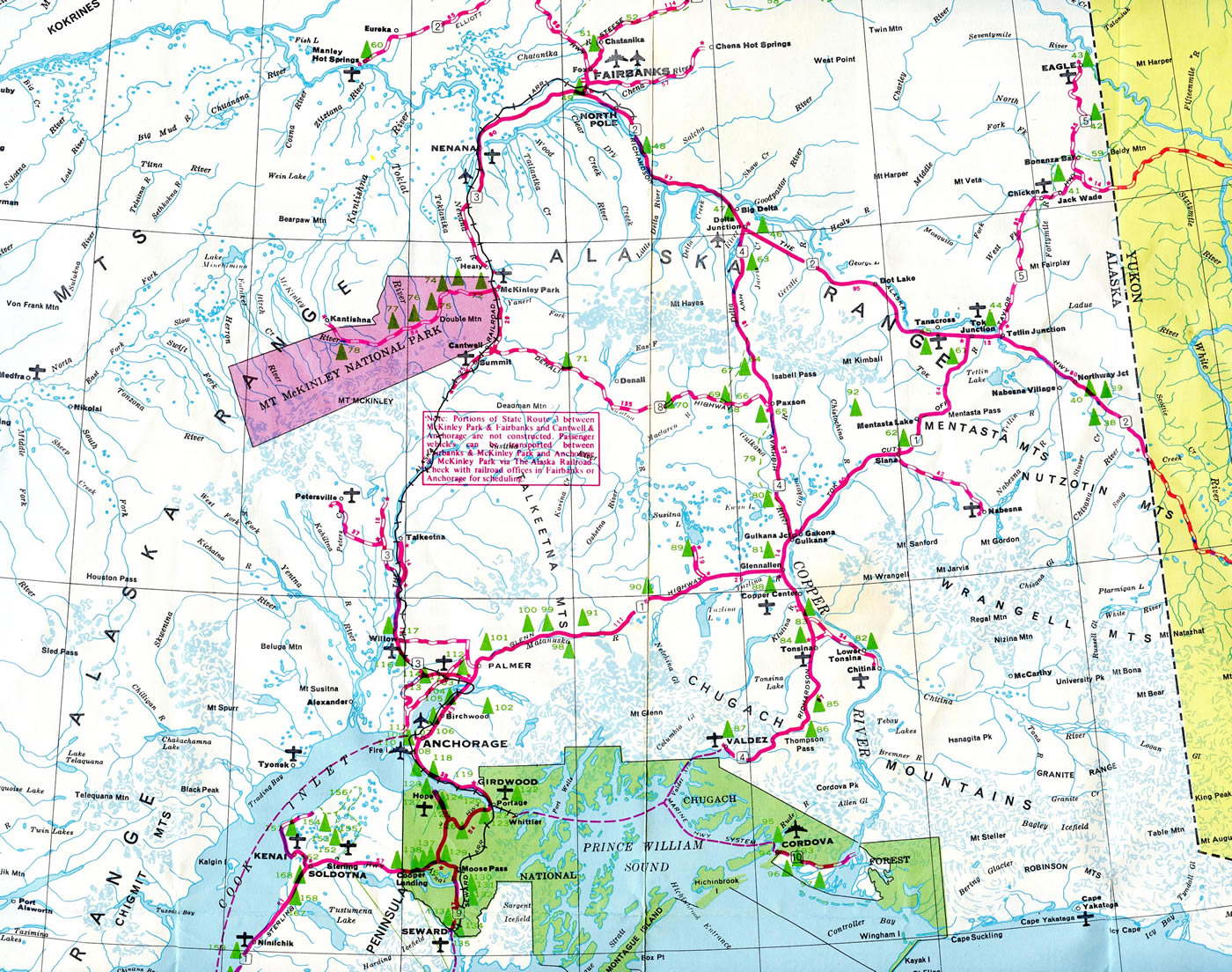
Alaska State Route 3 was the last to be built of the Interstate system within The Last Frontier. The incomplete stretch between Willow and Nenana in 1969 was augmented by the Alaska Railroad, which offered transportation for passenger vehicles.
Sources:
- AASHTO – Route Numbering Committee Agenda, dated June 28, 1982, Portsmouth, NH.
Thanks go to Oscar and Stephen Summers for assisting AARoads with information and for this page.
Page updated September 25, 2023.